Get or Give Free Stuff With Freecycle

freecycle_logo.jpg

The Freecycle Network has over 5,300 groups and 11.3 million members around the world.  It is a grassroots, nonprofit movement of people who are giving (and getting) stuff for free in their own towns and thus keeping it out of landfills.  Membership is free, and everything posted must be free, legal and appropriate for all ages.

More information is available at www.freecycle.org.  There are groups organized and moderated by volunteers in many different locations via use of Yahoo Groups.

Here are the Ventura County area groups as of July 2024:

Thousand Oaks Group (2,600 members)

Simi Valley Group (1,700 members)

Ventura Group (2,100 members)

So check it out!  Somebody may need something that you don't want!

Another source for giving and getting local free stuff is www.craigslist.com.  Here is a link to free stuff in the Ventura County Craiglist and Los Angeles County Craigslist.

Tell Me a Little Bit About the City of Westlake Village Boundary

Westlake Village is a master-planned community that is transected diagonally by the Los Angeles/Ventura County line. 

The Ventura County side of Westlake Village, which is 8,544 acres, was annexed into the City of Thousand Oaks in 1968 and 1972. The Los Angeles County side of Westlake Village is 3,456 acres and was incorporated as the City of Westlake Village in 1981. 

Westlake Village Map.JPG

Ah yes, the challenge of distinguishing between the Los Angeles and Ventura County sections of Westlake Village. It truly is a diagonal boundary that stretches from just northeast of Lindero Canyon Road, south of Blackbird Avenue on the north to South Westlake Blvd at Kirsten Lee Drive on the south.

It is impossible to drive, bike or walk the boundary line because it crosses right through the middle of Westlake Lake. Although, you could drive along the border on La Venta Drive southwest from Watergate Road.

Further north, the border cuts diagonally across Westlake Golf Course.  In fact, the driving range section of the golf course bordered on the west by Lakeview Canyon Road and on the north by the 101 is located within the City of Thousand Oaks while the rest of the course is in Westlake Village.

Costco Westlake Village and the Four Seasons Westlake Village are solely part of the City of Westlake Village, as is the Las Virgenes Reservoir.

Does it really matter what side you're on? For most, no. But there's one clear financial difference. Sales taxes. As of July 2024, sales taxes in the Thousand Oaks/Ventura County portion of Westlake Village are 7.25% as compared to 9.5% in the Los Angeles County based City of Westlake Village. The difference is 2.25% for Los Angeles County district taxes. That means if you live in the City of Westlake Village, you’ll be paying $1,125 more for a $50,000 car than those living in the Ventura County portion of Westlake Village.

Las Virgenes Reservoir, the only body of water lying completely in the City of Westlake Village.

Las Virgenes Reservoir, the only body of water lying completely in the City of Westlake Village.

Satellite Tracking Station at Laguna Peak for the Naval Satellite Operations Center Point Mugu (Now 10th Space Operations Squadron)

UPDATE: On June 6, 2022, the Naval Satellite Operations Center that previously was responsible for the Laguna Peak station was transferred from the Navy to the Space Force, specifically, the 10th Space Operations Squadron (10 SOPS). The mission of 10 SOPS, which is headquarted at Naval Base Ventura County, is to operate, manage, and maintain assigned satellites and ground systems, providing continuous and reliable satellite communications in direct support of Fleet, Joint, and Interagency operations. Learn more at THIS LINK and about 10 SOPS at www.petersonschriever.spaceforce.mil/About-Us/Fact-Sheets/Display/Article/3146952/10th-space-operations-squadron.

(Military photo of Laguna Peak.)

(Military photo of Laguna Peak.)

If you’re in the vicinity of Thornhill Broome State Beach and Sycamore Cove Beach in Point Mugu or hiking up the Chumash Trail to the La Jolla Valley in Point Mugu State Park, you’ve probably noticed some futuristic looking equipment up on a hill to the west.

That hilltop is the 1,421 foot Laguna Peak in the westernmost tip of the Santa Monica Mountains, home to the Naval Base Ventura County’s Satellite Tracking Station.

The tracking station monitors rocket launches from Vandenberg Air Force Base and other sites and is a part of a network of satellite control facilities that includes stations in Prospect Harbor, Maine, Rosemount, Minnesota and the Lincoln Laboratory in Massachusetts.

laguna peak from PCH.JPG

Hiking to the Waterfall in Pt Mugu State Park from Rancho Sierra Vista/Satwiwa

One of the most popular hikes in the Rancho Sierra Vista/Satwiwa open space in Newbury Park is to a small waterfall in the adjacent Boney Mountain Wilderness. The hike is about 3 1/2 miles round-trip from the Satwiwa Native American Indian Culture Center and is a moderate hike that can be done by all ages.

Keep in mind that in drought years, there’s sometimes not more than a trickle flowing down this waterfall, while in rainier years like 2023-2024, the waterfall is quite active. In either case, it’s a fun hike to do.

You have two primary options for where to start the hike. You can drive into the Rancho Sierra Vista park entrance on Via Goleta in Newbury Park and park in a lot that is a brief walk to the Culture Center, or you can park at the Wendy Drive and Potrero Road trailhead and add an another two miles, round trip, to your adventure.

The entrance to Rancho Sierra Vista/Satwiwa at Via Goleta, 1 mile west of Reino Road.

The entrance to Rancho Sierra Vista/Satwiwa at Via Goleta, 1 mile west of Reino Road.

The trailhead where Wendy Road ends at Potrero Road in Newbury Park

The trailhead where Wendy Road ends at Potrero Road in Newbury Park

The Satwiwa Native American Indian Culture Center is a small building open from 9am to 5pm on weekends where you can learn about native Chumash items and local wildlife.

The Satwiwa Native American Indian Culture Center is a small building open from 9am to 4pm on weekends (as of April 2024) where you can learn about native Chumash items and local wildlife.

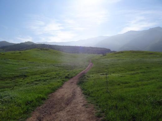
Next to the Culture Center, you'll see multiple paths, all of which can get you to your destination, but the most direct path is the Satwiwa Loop Trail seen on the left, which crosses through a meadow that can be quite green and beautiful in late Winter/early Spring and dry and brown the rest of the year. An alternate route is on the right of the picture above - the Big Sycamore Canyon Trail (paved road) to the Boney Mountain Trail, where you'll take a left.

Satwiwa Loop Trail section that takes you diagonally through the meadow. Seen here when it is nice an green.

Satwiwa Loop Trail section that takes you diagonally through the meadow. Seen here when it is nice and green.

At the end of the meadow, continue straight up a fairly steep hill, where on the right hand side you'll see the Sycamore Canyon Overlook bench shown below.

RSVW_sycoverlook.JPG

bench on sycamore canyon overlook

Hike up the moderately steep and rocky path up the hill behind the bench and you'll reach another fork in the road. If you veer left at this juncture you'll be on the Hidden Valley Overlook Trail within Rancho Sierra Vista/Satwiwa. Stay to the right and you'll be entering the Boney Mountain Wilderness area within Point Mugu State Park.

Sign that shows you the Hidden Valley Overlook Trail is on the left.

Sign that shows you the Hidden Valley Overlook Trail is on the left.

Veering right into the State of California managed Pt Mugu State Park; as you can see, dogs are not allowed in the back country area of the park.

Veering right into the State of California managed Pt Mugu State Park; as you can see, dogs are not allowed in the back country area of the park.

This trail is referred to as Danielson Road, named after the last private owner of these lands. The path down into the canyon is seen below (taken from a higher point en route to the Danielson Monument).

View of the initial section of Danielson Road trail down into the canyon; this is the path you will be taking towards the waterfall.

View of the initial section of Danielson Road trail down into the canyon; this is the path you will be taking towards the waterfall.

Danielson Road is a bit on the steep side but I see folks young and old walking up and down this section all the time. Seen here in very dry conditions.

Danielson Road is a bit on the steep side but I see folks young and old walking up and down this section all the time. Seen here in very dry conditions.

RSVW_waterfalltrailsign.JPG

THIS IS THE OLD SIGN, WHEN IT WAS CALLED DANIELSON ROAD (PRIOR TO 2024)

NEW SIGN IN 2024 SHOWING THE “OLD CABIN TRAIL” INSTEAD OF DANIELSON ROAD.

After .4 mile, you will reach the bottom of the canyon and see the sign above, the final sign indicating you are on your way to the Waterfall Trail. Then you will cross a creek bed, which can have water in it after the rains. The photo taken below in January 2015 shows minimal moisture, making it easy to cross. Some years you may have to rock hop your way a bit over the creek.

RSVW_stream.JPG

Creek bed crossing on the way to the waterfall IN 2015

Creek Crossing in April 2024.

After you cross the creek, the remainder of the trail to the waterfall is single track. Be careful not to come in contact with poison oak often seen on the sides of the trails. For this reason, I would generally not recommend strollers be taken up here.

Soon you will reach the final fork in the road. Go straight and soon you will be at the waterfall. To the right, the Old Cabin Trail (formerly Danielson Road Trail) continues upward to the Danielson Monument.

RSVWaterfallFeb17.JPG

the waterfall in april 2024.

California's Low Cost Auto Insurance Program Provides Affordable Insurance for Those Eligible

Auto insurance is a requirement if you have a valid driver's license and drive a vehicle in the state of California. The California Low Cost Auto (CLCA) Insurance program is a state-sponsored program that makes auto insurance more affordable to those meeting eligibility requirements.

To qualify, you must 1) have a valid California driver's license; 2) own a vehicle valued at $25,000 or less; 3) meet income eligibility guidelines; and 4) be at least 16 (under 18 must be legally emancipated) or older.

Maximum income requirements are based on the size of your household. As of 2024, that maximum is $37,650 for a household size of 1, increasing by $13,450 for each additional household member (e.g. household of 4 maximum income is $78,000.

Annual premiums vary by county. If you live in Ventura County, have been licensed continuously for 3 years and are not a 19-24 years of age and unmarried, your annual premium is $275 ($358 if you are an unmarried 19-24 year old).

While the premiums are great, the coverage is very limited. A basic policy includes only up to $10,000 per person and up to $20,000 per accident for bodily injury or death and up to $3,000 for property damage. Comprehensive and collision is not included in these policies (they would have to be purchased separately).

Learn more and sign up at www.mylowcostauto.com.

Ventura County Historical Landmarks at the Strathearn Historical Park in Simi Valley

Located at 137 Strathearn Place, Simi Valley, the six acre Strathearn Historical Park and Museum site contains no less than six designated Ventura County Historical Landmarks.

Originally from Scotland, the Strathearn Family purchased 15,000 acres of old Spanish Rancho from Simi Land and Water Co. around 1890.

The Simi Adobe/Strathearn House is Ventura County Historical Landmark No. 6, State Landmark No. 979 and is also listed on the National Register of Historic Places.  The Simi Adobe was originally built by Santiago Pico, original grantee of El Rancho Simi, in 1810. The Adobe was considered an important link between the San Fernando and Ventura missions.

The Strathearn House (built in 1892-3) includes the Simi Adobe (built in 1810)

After buying the property, the Strathearns built their nine-room Victorian-style farmhouse and kept two usable rooms of the adobe that were used as a dining room and kitchen. The Strathearn family occupied the house until 1968.

Built in 1930, the original Simi Library was located on Third Street near Los Angeles Avenue. Members of the community raised funds to purchase land and asked the Ventura County Library System to build this first purpose-built branch library in the county. It operated until 1962, when a new library opened on Church Street in the Community Center. The Simi Library briefly served as the first Simi Valley Museum until Strathearn Historical Park opened in 1969. The Library was designated Ventura County Historical Landmark No. 40 in May 1978. (More recently, in the Simi Valley Public Library became a separate municipal public library on July 1, 2013.)

The Haigh/Talley Colony House was designated Ventura County Historical Landmark No. 41 in May 1978 and was named to the National Register of Historic Places that same year. It is one of 12 pre-cut, partially assembled two-story homes shipped by rail in 1888 to the townsite of "Simiopolis" (this was just for six months; it was later

Read More

Highlights of a Dozen Fun Things to See and Do In and Around Camarillo

Residents voted to incorporate Camarillo as a city on September 29, 1964 (the same day that Thousand Oaks residents voted to do the same). Today Camarillo has the 5th largest population out of 10 cities in Ventura County, with about 71,000 residents.

One neat feature of Camarillo is its revitalized Old Town on Ventura Boulevard, a one mile stretch adjacent to Highway 101 between Lewis Road and Carmen Drive. There is a mixture of eateries, galleries, salons, boutiques and shopping along the pedestrian friendly thoroughfare that has transformed the area. Parking is free. More at www.facebook.com/camarillooldtown.

Here are a dozen other fun things to explore, see and do in Camarillo:

The roughly 2 mile Calleguas Creek Bike Path from Pleasant Valley Fields to the corner of Flynn and Upland Road in Camarillo is a family favorite, providing 4 miles of bicycling round-trip. The path is adjacent to Calleguas Creek with several street underpasses, keeping the path completely free of vehicular traffic.

Calleugas Creek Bike Path

Calleugas Creek Bike Path

McGrath Family Farm off the Central Avenue 101 offramp grows organic fruits, vegetables and flowers and is open 7 days a week from spring through fall. McGrath also offers farm tours, visits with the farm animals and "pick your own" produce. A quick, healthy and fun stop with the kids.

McGrathProduce9.9.12.jpg
CAF170.jpg

The Commemorative Air Force Southern California Wing Aviation Museum is open Friday through Sunday at the Camarillo Airport with hangars devoted to preserving, displaying and flying World War II aircraft. Docents are extremely knowledgeable and eager to share information.  This is a Camarillo must-see.

Also at the Camarillo Airport is the annual Wings Over Camarillo Air Show in the August time frame. This is a weekend display of restored World War II military aircraft in flight, aerobatic, vintage and experimental aircraft displays, classic cars and plenty of family fun. This is one event in Camarillo that you have to see up close at least once. Visit wingsovercamarillo.com for more information.

The Camarillo Ranch House is a 3-story, 14 room, 6,000 square foot Victorian home built by Adolfo Camarillo in 1892. The City restored the beautiful home to what it looked like during the 1914 to 1930 time frame. Today the house is a popular event venue and is open for docent-led tours several days a week. The Camarillo Ranch was added to the National Register of Historic Places in 2003.

The Camarillo Ranch House is a popular wedding and other special events destination.

The Camarillo Ranch House is a popular wedding and other special events destination.

I'm amazed at how few of the people I talk to have heard of the Western Foundation of Vertebrate Zoology, more popularly known as the Camarillo Bird Museum. The 22,000 sq ft non-descript facility in an industrial office park hosts a collection of over 250,000 sets of bird eggs representing approximately 4,000 species; 18,000 nests and 56,000 bird study skins. The Museum is open to the public for one-hour tours on Wednesdays and Fridays from 10am to 2pm.

CamBirdMuseumLR.jpg
CamPremOutlets170.jpg

The Camarillo Premium Outlets is Ventura County's premiere outlet mall, featuring over 160 shops and eateries. On the east side are the original outlets, including the Main Court and Fashion Court, while on the west is the newer The Promenade section. In between is the Edwards Camarillo Palace 12.

Harley's Camarillo Bowl is the go-to spot for most kids that I know in the Conejo Valley who throw bowling birthday parties. I know because when the kids go bowling, I make sure to join them. Harley's gets the job done with 20 lanes, a small arcade, and a bar that serves up cold beer.

There are dozens of great farmers' markets around Ventura County, including the Saturday morning Camarillo Certified Farmers Market in Old Town Camarillo from 8am to noon.

There are a number of nicely appointed parks of all shapes and sizes in Camarillo, including six larger parks. One of my favorites is the hidden away Camarillo Grove Park at the bottom of the Conejo Grade, 6968 E. Camarillo Springs Road. This 24.5 acre park offers hiking trails, a dog park, outdoor nature center and more.

A trail at Camarillo Grove Park

A trail at Camarillo Grove Park

The Pleasant Valley Historical Museum is dedicated to the preservation of local history and the adjoining Charles L. Honn Botanical Garden features plants and trees indigenous to the Pleasant Valley and the surrounding region. Both are fun, short, worthwhile visits, which is good because the Museum and Garden are only open from noon to 4:00 p.m. on Saturday and Sunday, except holidays. Admission is free. (MUSEUM IS UNDERGOING EXPANSION AND IS STILL CLOSED AS OF JUNE 2024. Check their website for updates at pvhsonline.org.