Forty-Seven Things to Do In Thousand Oaks
/
The City of Thousand Oaks was incorporated on September 29, 1964. Most of Newbury Park was annexed by the city in the 1960s/1970s. Casa Conejo, Newbury Park's first planned community built in the early 1960s and the Lynn Ranch area of Thousand Oaks are unincorporated areas of Ventura County that technically are not annexed into the City of Thousand Oaks. The City of Thousand Oaks also annexed the Ventura County portions of Westlake Village in 1968 and 1972. That said, this list also includes a few things to do in the City of Westlake Village.
Enough history for now! Let's look at the future...like tomorrow or this coming weekend. Here are 47* things to do in the City of Thousand Oaks in random order.
*It started out as 47 things to do but we've lost count since originally posting this.
Enjoy peace and serenity at Gardens of the World
AMC Dine-In Thousand Oaks 14 Movie Theater at The Oaks
Chumash Indian Museum/Oakbrook Regional Park in Thousand Oaks
Tarantula Hill in Thousand Oaks
Rancho Potrero Community Equestrian Center in Newbury Park
Moon Rabbit Pottery Studio in Newbury Park (opened July 2026)
Angel Vista Peak in Newbury Park
Rancho Potrero Open Space in Newbury Park
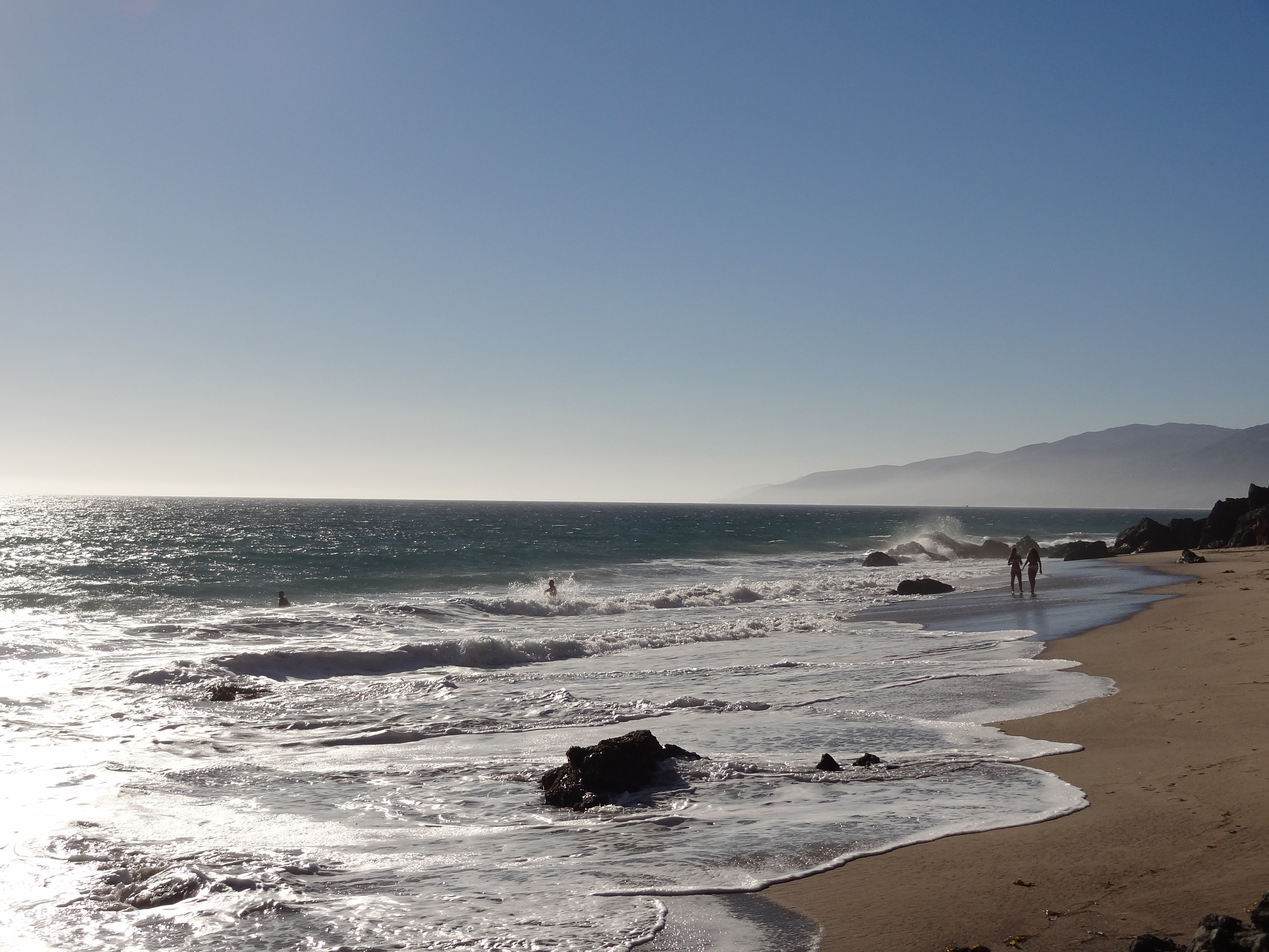
Rancho Sierra Vista/Satwiwa Recreational Area in Newbury Park

View of Boney Mountain from the Rancho Sierra Vista/Satwiwa area.
Triunfo Creek Park Open Space in Westlake Village
Hitting Zone Indoor Batting Cages in Westlake Village
Chuck E. Cheese's in Thousand Oaks
Boulderdash Indoor Rock Climbing in Thousand Oaks
Westlake Village Dog Park (technically in the City of WLV)
The Village at Dos Vientos Ranch in Newbury Park
Play Netball at Oakbrook Neighborhood Park in Thousand Oaks
Conejo Mountain Edison Road Trail in Newbury Park
Borchard Park Labyrinth and Fitness Equipment in Newbury Park
Hillcrest Open Space Preserve in Thousand Oaks
Conejo Creek Dog Park in Thousand Oaks
Rabbit Flats Disc Golf Course in Thousand Oaks
California True Colors Garden in Thousand Oaks
Pickleball courts in the Conejo Valley (and surrounding areas)
Los Robles Greens Public Golf Course and Driving Range in Thousand Oaks
For other things to do, visit Do Something, Kids' Activities and Fitness and Sports.

Older version of City of Thousand Oaks sign.