
La Jolla Canyon Loop Trail in Point Mugu State Park in Malibu
/Point Mugu State Park is at western edge of the Santa Monica Mountains National Recreation Area, stretching from Newbury Park on the north to five miles of oceanfront. The Chumash Trail is the westernmost trailhead in Point Mugu State Park which in turn gets you to the La Jolla Valley Natural Preserve area (which also can be accessed from the Ray Miller Trail, about two miles southwest of the Chumash Trail trailhead).
The Chumash Trail trailhead is accessible off of PCH, about 2 1/2 miles from where Las Posas Road connects to PCH in Camarillo, and about 10 miles from the intersection of Las Posas Road and Highway 101. It is across the street (PCH) from a Naval Base Ventura County training range. Look for the left turn into a small dirt parking area that has space for perhaps 15 or so cars.
The Chumash Trail is an initial, quite steep and technically challenging .7 mile climb, to a juncture where you either turn right to the Mugu Peak Trail (MORE AT THIS LINK). If you turn left (north), continue another half mile until you reach the La Jolla Valley Loop Trail.

Map snippet courtesy of California State Parks
The La Jolla Valley was acquired by the State of California in 1966 as part of Point Mugu State Park and was established as Natural Preserve in 1972.

One thing I find of particular visual interest on the La Jolla Canyon Loop Trail is the Naval Base Ventura County satellite tracking station situated at the top of nearby Laguna Peak.

View of the Boney Mountain Range up ahead from within the La Jolla Valley Natural Preserve. This is such a peaceful grasslands area back here. Most folks go for the ocean trails, leaving this area a bit less utilized.
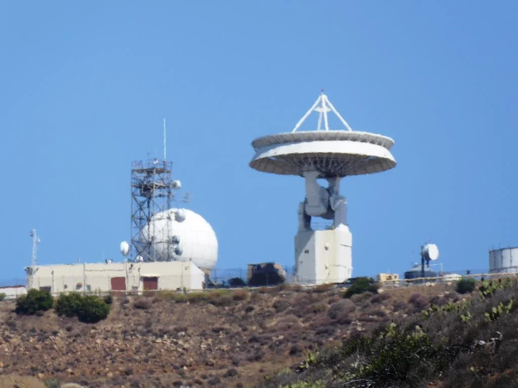
When I look up at the tracking station, The Jetsons come to mind.
Another 1 1/2 miles of hiking on the La Jolla Valley Loop Trail gets you to a small campground area with as I recall, 3 or 4 campsites accompanied by picnic tables, a vault toilet, but no water. No campfires allowed out here in the back country either. Although these appear to be rarely used, the only problem coming in from the Chumash Trail instead of the Ray Miller Trail (and La Jolla Canyon Trail) area is that you must pay for the campsite at the Ray Miller Trail area. Thus, if you do plan to stay at these back country campsites, keep that in mind and pay first.

You will pass by this sign on your way towards the campground if you want to take a shorter loop.

Here is where the La Jolla Valley Trail Campsites are, marked by the vault toilet up ahead. I don't get back here very often and when I do, I see no one. But I did notice there was TP in the room, which is good for those in need.

You're definitely in the back country back here, though in reality you are only 2.7 miles from the Pacific Ocean.
That said, the La Jolla Canyon Trail (not to be confused with the La Jolla Canyon LOOP Trail) has been closed since January 2015 because of mudslides that made that particular trail too dangerous to use. Confused? Yes, this can be confusing. Bottom line is that you pay for the camping at the La Jolla Canyon/Ray Miller Trailhead area but access the camping from either the Chumash Trail, or a longer route via the Ray Miller Trail.
So after you reach the campground area, you can either head back the way you came, or take the loop back around to the Mugu Peak Trail, where you will be treated to views, views and more views. Or hike to the top of Mugu Peak for the best views of all.
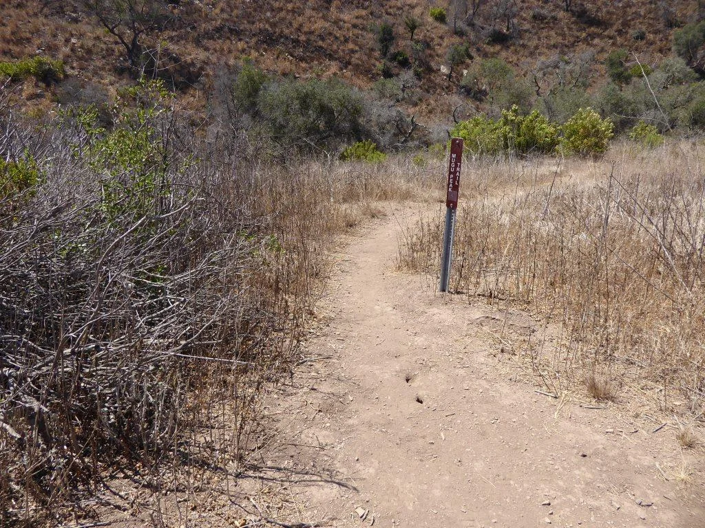
This Mugu Peak Trail sign is located near the south end of the Loop Trail.
