Sycamore to the Sea Hike, Run or Bike From Newbury Park to Sycamore Cove

Did you know that you can walk, hike, run or bike from Newbury Park to the ocean over 8 1/4 miles pretty easily, without dealing with automobiles? Park your car at the Wendy and Potrero trailhead or at the Rancho Sierra Vista/Satwiwa parking lot in Newbury Park and experience it yourself.

The entry to the Rancho Sierra Vista/Satwiwa area.

The entry to the Rancho Sierra Vista/Satwiwa area.

The Satwiwa Native American Indian Culture Center is a short walk from the parking lot.

The Satwiwa Native American Indian Culture Center is a short walk from the parking lot.

From there, take the paved road, called the Sycamore Canyon Fire Road, towards the ocean.

From there, take the paved road, called the Sycamore Canyon Fire Road, towards the ocean.

PtMuguNewburyPark.JPG

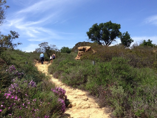
This is a nice, wide paved road with trails along the side much of the way. Generally cool in the early morning year-round as you head towards the ocean, plenty of rest/pit stop areas on the way down and nice and peaceful and beautiful, full of canyons, trees and wildlife.

Sycamore Canyon Top.JPG

The steepest descent on this course is a roughly 800 foot drop over a 3/4 of a mile into the canyon on the paved road after you see this sign. Coming back up if you do the full round-trip circuit is a bit of a challenge.

SycamoreCanyonRoad.JPG

After you drop into the canyon, it is pretty much smooth sailing. The paved road stops right around the Danielson Multi-Use area (see image below for that juncture). After that, follow the wide, dirt fire road towards the beach.

Sycamore_RangerHouse.JPG

There are numerous water spigots on the side of the road going down, which comes in quite handy on warmer days. If you use them, just make sure to turn them off.

About 3/4ths of the way down to the beach, you'll pass one of the most picturesque locations for a porta-john that I've ever seen.

About 3/4ths of the way down to the beach, you'll pass one of the most picturesque locations for a porta-john that I've ever seen.

A few miles after passing the above porta-john, you'll reach the Sycamore Canyon Campground, which has 58 campsites and is across Pacific Coast Highway from the ocean. Cross over PCH (be careful!) or find the underpass that takes you under PCH to the Sycamore Cove Beach area, with picnic tables, bathrooms, etc., and enjoy your day!

Sycamore Cove Beach in Point Mugu

Sycamore Cove Beach in Point Mugu

From there, you either head back up or call your significant other to pick you up. Or perhaps plan it out in the morning to leave one car at the beach in either the Sycamore Canyon Campground or Sycamore Cove day lots (they open at 8am) for a fee, or park on PCH where there are spots near Thornhill Broome Beach and the giant sand dune, then drive another car back (obviously you can't do this alone), park the 2nd car at Rancho Sierra Vista/Satwiwa, hike/walk/bike down the canyon to retrieve car #1.

Or do what I did once, which was drive down to Sycamore Cove via Potrero Road/Las Posas/PCH, park the car, run (or perhaps ride) up to Newbury Park, then ride down with the kids and enjoy the beach. Fun! 

For a map of the Rancho Sierra Vista/Satwiwa area with a portion of the Big Sycamore Canyon Trail, visit www.nps.gov/samo/planyourvisit/upload/Rancho-Sierra-Vista_Satwiwa_2023.pdf (National Park Service pdf brochure).

Malibu Sportfishing Pier

The Malibu Sportfishing Pier is located at 23000 Pacific Coast Highway. Just north of the pier is Surfrider Beach and Malibu Lagoon State Beach. You can go sport fishing in a 48 foot boat or you can fish off the pier. 

The pier was originally built in 1905 and first became open to the public 1934. It is currently operated by the California Department of Parks and Recreation. The pier is open daily from 7 a.m. to 9 p.m., though the restaurants close later.

Malibu Farm Cafe opened at the ocean side of the pier in 2013, serving breakfast, lunch and dinner. (This was previously Ruby’s Shake Shack that closed in 2011.)

Malibu Farm Restaurant & Bar operates at the PCH side of the pier both indoors and outdoors. Open for breakfast (weekends only), lunch and dinner as well as weekend brunch.

To fish off the pier, either bring your own fishing gear or rent it from The Ranch at the Malibu Pier. at the end of the pier. Permits are not required to fish off of the pier. The Ranch rents fishing rods and sell bait, not to mention unique items such as ceramics, clothing, cards, skateboard and more.. Call 310.456.8031 for more information. Open 8 am to 8 pm daily. Learn more about The Ranch at the Pier at onegunranch.com/pages/pier.

Learn more about the Malibu Pier at www.parks.ca.gov/?page_id=24409 and at www.malibupiersportfishing.com.

Over 150 Movie Theater Screens Around Ventura County

Here's a handy list of movie theaters with over 130 (originally it was over 150, but there’s been some closures over the years) screens throughout Ventura County and adjacent areas. Click the links for theater websites and/or showtimes.

Thousand Oaks, Westlake Village, Agoura Hills

Cinépolis Luxury Cinemas at the Promenade at Westlake, 100 Promenade Way, Westlake Village  (8 screens). Order food and drink from your seat and enjoy. cinepolisusa.com/locations/cinepolis-luxury-cinemas-westlake-village (805) 413-8838

AMC Dine-In Thousand Oaks 14, 166 West Hillcrest Drive at The Oaks Mall. Tickets at www.amctheatres.com/movie-theatres/los-angeles/amc-dine-in-thousand-oaks-14. $5 Tuesdays all day for AMC Stubs members.

Regal Janss Marketplace 9 is located at Janss Marketplace in Thousand Oaks, 255 North Moorpark Road. www.regmovies.com/theaters/regal-janss-marketplace-9/C00300689804

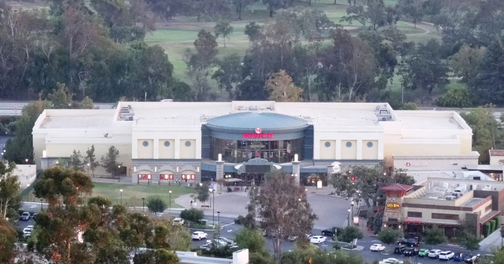
Former Muvico (now AMC Dine-In) Thousand Oaks.

Former Muvico (now AMC Dine-In) Thousand Oaks.

Century Riverpark 16 at The Collection at Riverpark

Century Riverpark 16 at The Collection at Riverpark

Edwards Camarillo Palace 12 and IMAX, 680 Ventura Boulevard, Camarillo (805.383.8879) (Located adjacent to The Promenade section of Camarillo Premium Outlets. www.regmovies.com/theaters/edwards-camarillo-palace-stadium-12-imax/C00287009669

Plaza Stadium Cinemas 14, 255 West Fifth Street, Oxnard (805.487.8380). www.santarosacinemas.com/plaza-14

dollar tuesdays.jpg

Regency Buenaventura 6, 1440 Eastman Avenue, Ventura (805.658.6544). regencymovies.com/main.php?theaterId=14 Looking for a bargain!? As of July 2022, general admission is still just $3.50. All screenings are just $1 on Tuesdays!

Roxy Stadium 11, 5001 Verdugo Way, Camarillo (805.388.0532). www.santarosacinemas.com/roxy-11

Regal Civic Center Plaza, Tapo Canyon Road, just north of the 118.

Other Local Theaters

Regency Theatres opened December 29, 2022 at the former Regal Edwards Grand Palace Stadium 6 theater at The Commons at Calabasas. regencymovies.com/main.php?theaterId=51

Regency Santa Paula 7, 550 West Main Street, Santa Paula (805.933.6707). regencymovies.com/main.php?theaterId=19 Seats just $6.50 on Sundays!

Ojai Playhouse at 145 East Ojai Avenue (805.646.1011) (1 screen) - CLOSED FOR REPAIRS SINCE 2018 at the theater that originated in 1914. Anticipated to reopen in 2013.

CLOSED

Regal Malibu Twin at 3822 Cross Creek Road, Malibu (310.456.6990) (closed in September 2017)

Simi Valley 10 Tristone Cinemas, 1457 E. Los Angeles Avenue (805.526.4329) simivalley.tristonecinemas.com (Closed 12/5/19 “due to leasing disagreements”)

Regency Paseo Camarillo Cinemas (3 theaters), 390 North Lantana Street, Camarillo (805.383.2267). regencymovies.com/main.php?theaterId=3 (“TEMPORARILY CLOSED” SINCE AUGUST 2021.)

Regency Westlake Village Twin, 4711 Lakeview Canyon Road, Westlake Village (818.889.8061) regencymovies.com/main.php?theaterId=1 Closed 1/17/22.

Edwards Grand Palace Stadium 6, 4767 Commons Way, Calabasas (818.223.0223). www.regmovies.com/theaters/edwards-calabasas-stadium-6/C00791471576 Closed 9/15/22

Lisa Smith Wengler Center for the Arts at Pepperdine University

The Lisa Smith Wengler Center for the Arts at Pepperdine University, located in the heart of the campus at 24255 Pacific Coast Highway, Malibu, showcases musicians, performers and artists from around the world at its Raitt Recital Hall (fits roughly 100 people), Smothers Theatre (500 attendees), Helen E. Lindhurst Theatre and the Frederick R. Weisman Museum of Art.

There is a wide range of great acts and artists, covering blues, country, classical, jazz, gospel, soloists, ensembles, acrobats, jugglers, classic rockers, a kids' theater series, art exhibits and numerous student productions.

For more information and to buy tickets, visit www.arts.pepperdine.edu or call 310.506.4522.

Note: Following a generous estate commitment from Pepperdine University Board member Lisa Smith Wengler, the University dedicated the Lisa Smith Wengler Center for the Arts on November 7, 2013.

Frederick R. Weisman Museum of Art at Pepperdine University in Malibu

Located on Pepperdine's main campus at 24255 Pacific Coast Highway in Malibu, the Frederick R. Weisman Museum of Art is a small art museum with rotating exhibits year-round, as well as "meet the artist" events, family art events and more.

The museum, which opened in 1992, is open Tuesday through Sunday, 11 a.m. to 5 p.m., and is closed on Mondays and major holidays. There is no admission charge. For more information, call (310) 506-4851, or visit arts.pepperdine.edu/museum.

Leo Carrillo State Park in Malibu

LeoCarilloSign.JPG

Leo Carrillo State Park consists of 1.5 miles of beach for swimming, surfing, windsurfing, surf fishing and beachcombing, as well as tide pools, coastal caves and reefs. Giant sycamores shade the main campgrounds.

Among the many great features of Leo Carrillo, the most engaging activity for me and the kids is the tide pools. They are exposed twice daily at low tide and provide hours of engagement with sea stars, sea anemones, mussels, sea slugs and more.

Nature walks and campfire programs are offered and a small visitor center has interpretive displays.

Trails include Yellow Hill Fire Trail for panoramic views of the beach and the Channel Islands, and the steeper Nicholas Flat Trail, which brings you to a pond.

There are 135 family campsites at Leo Carrillo with restrooms and token-operated showers. Visit ReserveCalifornia.com and search for “Leo Carrillo SP” to make reservations.

The park was named after Leo Carrillo (1880-1961), actor, preservationist and conservationist. Leo Carrillo served on the California Beach and Parks commission for 18 years and was instrumental in the state's acquisition of the Hearst property at San Simeon. Leo's greatest fame came from his portrayal of Pancho, the sidekick to Duncan Renaldo's Cisco Kid, an early 1950's TV series.

Leo Carrillo State Park is located at 35000 W. Pacific Coast Highway in Malibu. The park office phone is 310.457.8143. Visit www.parks.ca.gov/?page_id=616 for more information.

Parking is currently $12 in the parking lot for the day (or $3 per hour)...but free on PCH if you can find a spot. There are plenty of parking spots available in the lot. After you park, you can walk in a tunnel underneath PCH to get to the beach.

The muraled tunnel that takes you underneath PCH to Leo Carrillo Beach.

The muraled tunnel that takes you underneath PCH to Leo Carrillo Beach.

Dogs on a leash are allowed in the Park's day use areas, campground and north beach (north of lifeguard tower 3). Dogs are not allowed on backcountry trails or south beach (south of lifeguard tower 3).

DIRECTIONS

The most direct way of getting to Leo Carrillo from the Conejo Valley is via Westlake Boulevard (CA-23) (aka Decker Canyon) south, which for some is a fun 14 mile drive, but for others, not so much. It is a bit winding, hilly, steep at many junctures. I take this route during daytime hours but coming home I'm not too keen on it. After getting to PCH, turn right and drive 2 1/2 miles to get to Leo Carrillo.

Another more popular, though less direct route is via Kanan Road. Either take Kanan Road straight down to PCH, turn right (west) on PCH about 9 miles to Leo Carrillo, or take Kanan to Encinal Canyon, which is about a 3 mile drive on PCH to Leo Carrillo.

Lastly, if you are in Newbury Park, you can take Potrero Road west to Las Posas down to PCH. In about 11 miles you will reach Leo Carrillo.

Malibu Lagoon State Beach

Malibu Lagoon State Beach is where Malibu Creek meets the Pacific Ocean. To get there, park either at the state lot (corner of Pacific Coast Highway and Cross Creek Road) for a fee, along Pacific Coast Highway or across the street in spots available near Malibu Country Mart and the Malibu Civic Center.

The lagoon is serene, with a sandbar of pelicans enjoying their summer day. This beach extends southeast to Surfrider Beach and the Malibu Pier, which is just a short walk away. While you're there try to check out the Adamson House and Malibu Lagoon Museum.

More information at www.parks.ca.gov/?page_id=835. Dogs are not allowed at Malibu Lagoon State Beach and trails.

MalibuLagoon1.5.JPG
MalibuLagoon2.JPG
MalibuLagoon3.JPG
MalibuLagoon4.JPG

Beaches Spanning From Carpinteria Through Ventura County to Malibu

My kids and I love going to the beach but for many years we seemed to go to the same ones all the time. So I stopped by the Automobile Club and asked them if they had a brochure on all the local area beaches open to the public. They shrugged their shoulders and said no such guidebook existed. They handed me a fold out map, which was of no use to me as I wanted to know exactly how to get to these beaches, if they have restrooms, parking, etc.

MalibuBeach.jpg

Then I started searching around for information and found bits and pieces in various locations that were marginally useful. So I decided to consolidate this information into one place where I could find out about where to go to the beach around Ventura County on up the coast to Carpinteria and Santa Barbara and down to Malibu. So I hope you find the following links helpful in finding local area beaches in Ventura County and surrounding areas!

Carpinteria to Ventura

Oxnard to Malibu

Santa Barbara Area Beaches

This took a lot of time to compile over 60 local area beach areas, so I truly hope you benefit from these lists! So enjoy and provide feedback if you have comments and/or additional information.

MuguFisherman.jpg
At Leo Carrillo State Beach in Malibu.

At Leo Carrillo State Beach in Malibu.

Windsurfers at Surfers' Point in Ventura.

Windsurfers at Surfers' Point in Ventura.

Paradise Cove Beach in Malibu

If you’re looking for a great spot to dine at the beach, the Paradise Cove Beach Cafe in Malibu is a great choice. Located at 28128 E. Pacific Coast Highway in Malibu, it’s about a 30 minute drive from Thousand Oaks via Kanan Road. Learn more at www.paradisecovemalibu.com.

The public is welcome to access Paradise Cove Beach, including the dry stretch of beach around the pier (49 feet in width) as well as use the area of the beach below the mean high tide line for the entire shoreline length of the Paradise Cove property. You can either park on PCH and walk to the beach, or you can pay to park in the Cafe parking lot. But yes, it is expensive. It is much less expensive to park and dine at the cafe, which covers you for up to 4 hours of parking.

While some would argue that the food isn’t great and prices (including parking) is too high, my opinion is….it’s all about location, location, location.

About half a mile south on PCH is the access point to Escondido Falls, a four mile round trip hike to the tallest waterfall in the Santa Monica Mountains (over 150 feet). A fun excursion - park on PCH and do the Escondido Falls hike. Then walk down the street to the Paradise Cove Cafe. Of course don’t leave valuables in your car.

Parking fees as of June 2023.

Escondido Canyon Trail and Waterfalls in Malibu

Trailhead on Winding Way

Trailhead on Winding Way

The Edward Albert Escondido Canyon Trail and Waterfalls is located off of Winding Way in Malibu.  It also also referred to as Escondido Falls.

The most unique aspect to Escondido Falls is that it is home to the tallest waterfall in the Santa Monica Mountains at over 150 feet.

That said, in drought years, there is often no sign of waterfall, other than a sparse trickle into Escondido Canyon Creek. But even when that is the case, this is a nice, moderate hike, good for all ages. 

That said, in very wet years, like 2023, you will encounter a number of stream crossing on the trail. Just be aware, as this may not be up your alley.

To get to Escondido Falls from the Conejo Valley/101, take Kanan south to PCH and turn left. You'll be driving just under 2 miles, past Paradise Cove, to the small parking lot on Winding Way and PCH. Turn left onto Winding Way and an immediate left into the parking lot. There's a sign; you can't miss it. The lot has spaces for only around 16 vehicles; it is full, you'll have to find a spot on PCH and make you way from there...but be careful and watch for the plentiful "no parking" signs on PCH.

Parking is $12 (as of June 2023) and takes both cash and credit cards. Parking fees contribute to the ongoing maintenance of the trails, including porta potty cleanings, graffiti and trash removal and partial staffing.)

The parking area is on Winding Way and PCH. The initial section of the hike is along Winding Way is called the Winding Way Trail.

The parking area is on Winding Way and PCH. The initial section of the hike is along Winding Way is called the Winding Way Trail.

The hike is about 4 miles round trip and can be done in as fast as an hour (if you speed walk and don't hang out) or for most, a couple hours.

The first 8/10ths of a mile is along Winding Way to the trailhead. It has a moderate hill but is not that bad. Near the peak of the initial hill, you will need to cross from the left side of the street to the right side as you make your way up. There are signs that ask that you walk on the dirt trail rather than on the street, so try to abide by that. You will be treated to views of beautiful homes and ocean views along this portion of your trek.

After a short final downhill section, you'll reach the trailhead. After an initial left turn that takes you briefly west, most of the rest of the trail to Escondido Falls is a northeast to northerly direction. You'll be treated to lush oak woodlands and greenery year-round.  

Much of the trail looks like this; canopied by oaks and shrub.

Much of the trail looks like this; canopied by oaks and shrub.

Hikers, equestrians and bikers are all welcome on the trail. Dogs too, on leash of course. I have not seen bikers on this trail, however. There are no restrooms, other than a porta-john at the parking lot. No drinking fountains, so bring water. There are trash cans at the trailhead. 

The waterfall is a treat to see but the rest of the hike is quite nice too, largely shaded and not too hilly or technical. There is a net elevation gain from 150' at the trailhead to 325' at the Falls over about a mile, which is not bad.

After the rainy season, you may have to cross the creek a few times as it criss-crosses the trail. There are a couple forks in the road where you may wonder which way to go. Generally speaking, turn left on your way to the falls and that will get you there.

Believe it or not, this is the end of the trail, where the waterfall flows after the rainy season. In late August pictured here, there is a dribble of water flowing into the creek.

Believe it or not, this is the end of the trail, where the waterfall flows after the rainy season. In late August pictured here, there is a dribble of water flowing into the creek.

The parkland ends at the multi-tiered waterfall area and the trail ends. Except, there are paths that can get you to the upper falls. Technically you are not supposed to do this because you are no longer on public land, not to mention you are literally rock climbing your way up there and it can be dangerous.

This is a fun, family-friendly hike that is worth a try. Quite popular, one could argue, too popular, on weekends.

There's one side trail to the east that will give you views of the waterfall when it is flowing. The white-ish area in the upper right hand of this photo is where the waterfall resides.

There's one side trail to the east that will give you views of the waterfall when it is flowing. The white-ish area in the upper right hand of this photo is where the waterfall resides.

Why is it named after Edward Albert? Well, Edward Albert is the only son of actor Eddie Albert, well known for his role on TV sitcom "Green Acres." Edward died at age 55 in 2006. Prior to his death, he was a tireless advocate for preserving Escondido Canyon. The Santa Monica Mountains Conservancy named the area in honor of him several months prior to his death. (1)

Visit the Santa Monica Mountains Conservancy site at mrca.ca.gov/parks/park-listing/escondido-canyon-park for more information.

(1) Los Angeles Times obituary dated 9/27/06 at this link.

Escondido Falls parking as of June 2023.

County Line Beach in Solromar (Ventura County)

county line beach1.JPG

County Line Beach is located near the corner of PCH and Yerba Buena Road in Solromar, a small unincorporated community in the southwest corner of Ventura County, just northwest of the actual Ventura/Los Angeles county line.

The beach lies in between portions of the residential areas of Solromar. Solromar is the only residential community along the Malibu coast not included within Malibu city limits, yet this portion of Ventura County typically uses Malibu in its address. Neptune's Net is a well known eatery located across PCH from County Line Beach.

County Line Beach is a very popular surf spot and has about half a mile of sandy beach to enjoy. There is a dirt parking strip located off PCH that has spaces for about 15 cars; otherwise, street parking on PCH is available. There are a couple porta-johns. No lifeguards on duty here.

County Line Beach is referenced "Ventura County Line" in the 1963 Beach Boys hit, Surfin' U.S.A.

LOCAL BEACHES IN MALIBU, POINT MUGU, PORT HUENEME AND OXNARD

Malibu Creek State Park

MalibuCreekSP_sign.JPG

Malibu Creek State Park is accessible in Calabasas, at 1925 Las Virgenes Road, south of Mulholland. The park contains over 8,000 acres of rugged, beautiful hills, trails and scenery. It stretches from Agoura Hills down to Malibu, down to Malibu Lagoon State Beach, covering much of the 25 mile Malibu Creek that flows from Boney Mountain down to the Lagoon. Malibu Creek is the only stream channel that crosses through the Santa Monica Mountain range.

There are three natural preserves in the park, Liberty Canyon, Udell Gorge and Kaslow, which protect Valley Oaks, rare plants and volcanic formations.

Things to do in Malibu Creek State Park include hiking, running, biking, camping, picnicking, fishing and checking out the wildlife. There are over 35 miles of trails and fire roads throughout the park. A fun added bonus is the old M*A*S*H series set, filmed from 1972 to 1983, that resides there.

Dogs are not allowed in Malibu Creek State Park trails.

MalibuCreek2.jpg

Malibu Creek State Park contains roughly three dozen different trails, many easy, and some...extraordinarily challenging, such as the Bulldog trail, taking you to 2,500 foot peaks with panoramic views out to the ocean and surrounding peaks and valleys.

MalibuCreek1.jpg

Parking for the day at Malibu Creek State Park is currently $12, or $3 per hour. You can also park at the corner of Mulholland and Las Virgenes and make your way into the park via the Grassland Trail.

The campground at Malibu Creek State Park has 62 campsites and 4 RV sites. Visit www.parks.ca.gov/?page_id=614 for more information.

The old M*A*S*H site is about 2 1/2 miles from the parking area.

The old M*A*S*H site is about 2 1/2 miles from the parking area.

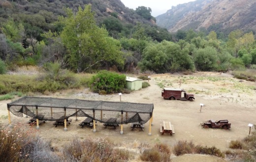
M*A*S*H site with plenty of picnic tables

M*A*S*H site with plenty of picnic tables

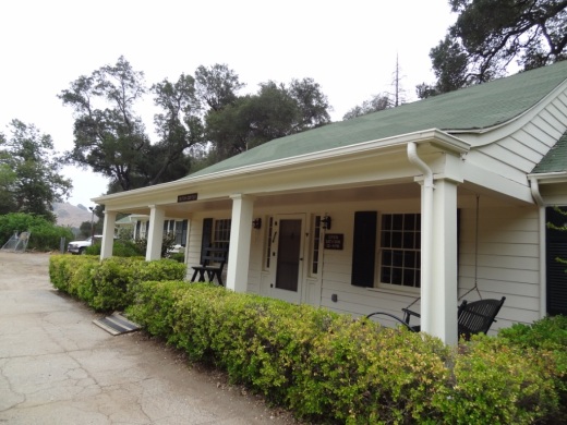
The Visitor Center is only a 10 minute walk from the parking lot and is generally open from noon to 4pm on weekends.

The Visitor Center is only a 10 minute walk from the parking lot and is generally open from noon to 4pm on weekends.

There's also an interesting visitor center about 1/2 mile from the main entrance to the park. It is open on Saturday/Sunday from noon to 4pm, subject to availability of docents. Worth a stop as there are some neat things to see in there, including wildlife and rocks/artifacts and other useful information. You can also purchase drinks in there as well as a small assortment of other items.

Hike to the Rock Pool at Malibu Creek State Park

Century Lake Hike at Malibu Creek State Park

Point Dume State Beach

On November 24, 1793, English explorer George Vancouver named the rocky promontory Point Dume after his friend, Father Francisco Dumetz. Point Dume is the western terminus of Santa Monica Bay and was named California Registered Historical Landmark No. 965.

PointDumeBeach.JPG

View in the spring of 2023

Point Dume State Beach is a 63 acre promontory that juts out into the Pacific and features headlands, cliffs, rocky coves and vast beach access for swimming, surfing and scuba diving.

To get to Point Dume State Beach, take Westward Beach Road southeast from PCH near Zuma Beach's south side to the paid parking area, or park on Westward Beach Road, which parallels Westward Beach.

To the southeast of Westward Beach is a small 300 foot or so beachfront area called Pirate's Cove Beach (which due to its seclusion was once used as a nude beach).

Pirate's Cove beach seen from the top of the promontory. You can climb down there and when the tide is moderate to low, walk around to it.

Pirate's Cove beach seen from the top of the promontory. You can climb down there and when the tide is moderate to low, walk around to it.

The 34-acre Point Dume Natural Preserve also begins from the cul-de-sac. A gradual ascending trail leads to an ancient coastal bluff sand dune with spectacular views...we've seen whales, seals and dolphins over here. A stairway from the east side of the bluff-top preserve allows access to a more isolated beach and tidepools (look but don't touch). You'll have fun exploring up here.

In the spring of 2023

This is a snippet of the pilot episode, "The Lady in the Bottle," of I Dream of Jeannie that originally aired September 18, 1965. If you skip to 1:39 in this clip, you will see the prominent rock formations on the east side of the Point Dume promontory. Below is a more recent shot of that area.

This is where Captain Anthony Nelson (Larry Hagman) made a giant S.O.S. in the sand with sticks and other items, including an old bottle that moved itself. He picks it up, dusts it off, and out pops Barbara Eden. Lucky guy!

This is where Captain Anthony Nelson (Larry Hagman) made a giant S.O.S. in the sand with sticks and other items, including an old bottle that moved itself. He picks it up, dusts it off, and out pops Barbara Eden. Lucky guy!

Location/Directions: Take Kanan south to PCH and turn right. Westward Beach Road is over the rise, at the foot of the hill. Park free on WBR or pay a fee at Westward Beach lot. No restrooms at the Preserve but some can be found on WBR. Call 310.457.8143 or visit www.parks.ca.gov/?page_id=623 for more information. Also see beaches.lacounty.gov/point-dume-beach.

Dogs are not allowed on trails in the Point Dume Natural Preserve or on the beach.

Westward Beach

Westward Beach

Springtime at the Point Dume Natural Preserve

Springtime at the Point Dume Natural Preserve