Leo Carrillo State Park in Malibu

LeoCarilloSign.JPG

Leo Carrillo State Park consists of 1.5 miles of beach for swimming, surfing, windsurfing, surf fishing and beachcombing, as well as tide pools, coastal caves and reefs. Giant sycamores shade the main campgrounds.

Among the many great features of Leo Carrillo, the most engaging activity for me and the kids is the tide pools. They are exposed twice daily at low tide and provide hours of engagement with sea stars, sea anemones, mussels, sea slugs and more.

Nature walks and campfire programs are offered and a small visitor center has interpretive displays.

Trails include Yellow Hill Fire Trail for panoramic views of the beach and the Channel Islands, and the steeper Nicholas Flat Trail, which brings you to a pond.

There are 135 family campsites at Leo Carrillo with restrooms and token-operated showers. Visit ReserveCalifornia.com and search for “Leo Carrillo SP” to make reservations.

The park was named after Leo Carrillo (1880-1961), actor, preservationist and conservationist. Leo Carrillo served on the California Beach and Parks commission for 18 years and was instrumental in the state's acquisition of the Hearst property at San Simeon. Leo's greatest fame came from his portrayal of Pancho, the sidekick to Duncan Renaldo's Cisco Kid, an early 1950's TV series.

Leo Carrillo State Park is located at 35000 W. Pacific Coast Highway in Malibu. The park office phone is 310.457.8143. Visit www.parks.ca.gov/?page_id=616 for more information.

Parking is currently $12 in the parking lot for the day (or $3 per hour)...but free on PCH if you can find a spot. There are plenty of parking spots available in the lot. After you park, you can walk in a tunnel underneath PCH to get to the beach.

The muraled tunnel that takes you underneath PCH to Leo Carrillo Beach.

The muraled tunnel that takes you underneath PCH to Leo Carrillo Beach.

Dogs on a leash are allowed in the Park's day use areas, campground and north beach (north of lifeguard tower 3). Dogs are not allowed on backcountry trails or south beach (south of lifeguard tower 3).

DIRECTIONS

The most direct way of getting to Leo Carrillo from the Conejo Valley is via Westlake Boulevard (CA-23) (aka Decker Canyon) south, which for some is a fun 14 mile drive, but for others, not so much. It is a bit winding, hilly, steep at many junctures. I take this route during daytime hours but coming home I'm not too keen on it. After getting to PCH, turn right and drive 2 1/2 miles to get to Leo Carrillo.

Another more popular, though less direct route is via Kanan Road. Either take Kanan Road straight down to PCH, turn right (west) on PCH about 9 miles to Leo Carrillo, or take Kanan to Encinal Canyon, which is about a 3 mile drive on PCH to Leo Carrillo.

Lastly, if you are in Newbury Park, you can take Potrero Road west to Las Posas down to PCH. In about 11 miles you will reach Leo Carrillo.

Lake Casitas Recreation Area in Ventura

The Lake Casitas Recreation Area is operated by the Casitas Municipal Water District, which supplied water to 70,000 people and hundreds of farms in western Ventura County, encompassing Ojai, the Ventura River Valley area, the city of Ventura to Mills Road, the Rincon and beach area to the ocean and the Santa Barbara County line.

Lake Casitas is a reservoir that was completed in 1959, with a capacity of 254,000 acre feet. The lake was used for canoeing and rowing events for the 1984 Summer Olympics. While swimming is not allowed in the lake because it is a water supply, boating, canoeing, kayaking and fishing is indeed allowed here.

There are a lot of fun things to do in the Lake Casitas Recreation Area:

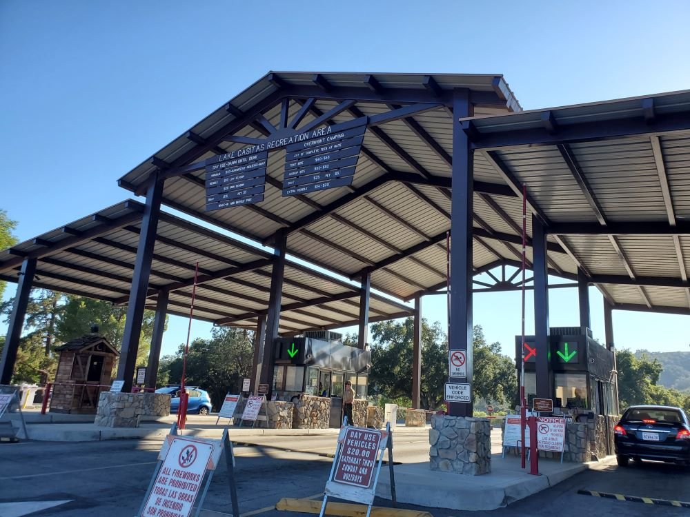
Day use hours are 6 am to 7:30 pm daily. $10 entry fee for vehicles during off season (Labor Day to Easter) and $20 on weekends during “on” season (Easter to Labor Day). Or you can be a cheapskate like me and park on Santa Ana Road and walk in. Location is 11311 Santa Ana Road, Ventura. For more information, visit www.casitaswater.org/recreation or call 805-649-2233.

Front entry to Lake Casitas Recreation Area in the summer of 2022.

Thornhill Broome Campground in Point Mugu State Park

Thornhill Broome Family Campground is located at 9000 Pacific Coast Highway in Point Mugu State Park. The beachfront campground offers 68 tent/RV spaces. There are no hookups for RVs or flush toilets; just chemical toilets and cold outside showers. However, you are camping ON THE BEACH!

Thornhill camping.JPG

Sites have picnic tables and fire rings. Pets are allowed on leash in the campground. Fees as of August 2022 are $35/night plus a $7.99 reservation fee at www.reservecalifornia.com (type in Point Mugu SP to find Thornhill Broome). Be aware that summer months in particular book up way in advance.

Keep in mind that there is no shade when you camp at the beach. So if you don't have an RV, be sure to bring a canopy and/or umbrella.

Thornhill Broome Beach is across from the gigantic sand dune that provides for a great workout and views. And due east is Sycamore Cove and Sycamore Canyon Campground (both also in Point Mugu State Park)...which of course is the most direct path...albeit by foot or bike...to Newbury Park and the Conejo Valley from the beach.

And of course the Sycamore Canyon Campground is across from Sycamore Cove, if you're looking for additional camping possibilities.

Traveling southeast on PCH from Oxnard/Camarillo; this sign tells you you're just about there.

Traveling southeast on PCH from Oxnard/Camarillo; this sign tells you you're just about there.

The cool, massive sand dune across from Thornhill Broome Beach (be careful crossing PCH!).

The cool, massive sand dune across from Thornhill Broome Beach (be careful crossing PCH!).

Point Mugu State Park

Point Mugu State Park is located in the Santa Monica Mountains, stretching from Newbury Park on the north to five miles of ocean shoreline on the south. The park includes 14,000 acres of land with over 70 miles of trails popular with hikers, cyclists and runners.  It is truly an amazing place, with rocky peaks that include the prominent Boney Mountain State Wilderness that looks over the western Conejo Valley.

The sign in Rancho Sierra Vista/Satwiwa in Newbury Park indicating you are entering State-managed Point Mugu State Park.

The sign in Rancho Sierra Vista/Satwiwa in Newbury Park indicating you are entering State-managed Point Mugu State Park.

You can actually hike, run or bike from Newbury Park, from the Rancho Sierra Vista/Satwiwa area managed by the National Park Service down to the ocean via Sycamore Canyon "Sycamore to the Sea," which is about an 8 mile trip one way. But do be aware - the initial 800 foot drop from Rancho Sierra Vista into the canyon via Big Sycamore Canyon Road is a bit more challenging coming back up.

The paved hill drops into the canyon via Sycamore Canyon Fire Road.

The paved hill drops into the canyon via Sycamore Canyon Fire Road.

There are four main canyons in Point Mugu State Park. Sycamore Canyon is perhaps the most well known, stretching practically the entire north/south length of the park, where at the bottom of the canyon you'll find the 58 space Sycamore Canyon Campground at 9000 W. Pacific Coast Highway (make reservations at ReserveCalifornia.com and search for “Point Mugu SP”).

The Sycamore Canyon Campground connects to the Sycamore Canyon Fire Road, which is your access point to a day of fun and adventure in Point Mugu State Park trails.

The Sycamore Canyon Campground connects to the Sycamore Canyon Fire Road, which is your access point to a day of fun and adventure in Point Mugu State Park trails.

The La Jolla Valley Natural Preserve is on the western side of the park, with a main access point near Thornhill Broome State Beach at the Ray Miller Trailhead to the La Jolla Canyon Trail which connects with the Loop Trail. Another access point to La Jolla Valley is the Chumash Trail trailhead, a rocky, steep trail across from Point Mugu Beach. La Jolla Valley was purchased by the State of California in 1966 and was established as a Natural Preserve in 1972.

Wood Canyon is in the northwest section of the park, where you will find the north/south running Wood Canyon Fire Road, which connects to the Guadalasca Trail, among others.

Serrano Valley is accessible from the south off the Big Sycamore Canyon Fire Road/Trail about a mile north of the beach. A beautiful, serene, area, with a connection to the Old Boney Trail that takes you to the Danielson Monument in the Boney Mountain Wilderness.

The main beach areas in Point Mugu State Park, running southeast to northwest, are Sycamore Cove, Thornhill Broome and Point Mugu. Sycamore Cove is a fun day-use park popular with families for gatherings with BBQ grills and picnic tables. Learn more about beaches in the Malibu area at this link.

This is the PCH overpass where on low tide you can walk underneath here to get from Sycamore Cove Beach to Sycamore Canyon Campgrounds and hiking in Point Mugu State Park. In higher tides, this area can be dicey, so be careful.

This is the PCH overpass where on low tide you can walk underneath here to get from Sycamore Cove Beach to Sycamore Canyon Campgrounds and hiking in Point Mugu State Park. In higher tides, this area can be dicey, so be careful.

If you are looking for beachfront camping, try Thornhill Broome Beach, with just over 60 spots available for RVs and tents. No hookups here and only porta-johns available, but can't beat the views! And across the street you can't miss the Giant Sand Dune!

Day use parking at the various sites is available for $12. There is very minimal street parking at Sycamore Cove but plenty of street parking adjacent to Thornhill Broome Beach.

Dogs on a leash are allowed in the Park's day use areas, campgrounds and beaches. Dogs are not allowed on the back country trails or dirt roads.

Keep driving northwest on PCH and you'll past the famous Mugu Rock and see Pt. Mugu Beach, which also has day use parking, with some parking on PCH. Learn more at the California State Parks website at www.parks.ca.gov/?page_id=630.

Mugu Rock up ahead, driving north on PCH from Thornhill Broome.

Mugu Rock up ahead, driving north on PCH from Thornhill Broome.

Lastly, let's cover some of the highest peaks in Point Mugu State Park. The Boney Mountain Wilderness Area, ever so prominent from the Conejo Valley, is located in the Park. But Boney Peak itself, at 2828 feet, is actually in the Circle X Ranch area managed by the National Park Service, along with Sandstone Peak, the highest spot in the Santa Monica Mountains at 3111 feet.

Boney Mountain range overlooks the western Conejo Valley.

Boney Mountain range overlooks the western Conejo Valley.

Other peaks include Tri Peaks at 3010 feet, Laguna Peak (the peak which has equipment from Naval Base Ventura County below), La Jolla Peak and Mugu Peak

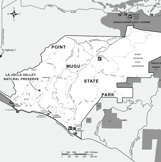
Map of Point Mugu State Park courtesy of National Park Service.

Map of Point Mugu State Park courtesy of National Park Service.

Sycamore Canyon Campground in Point Mugu State Park

Point Mugu State Park is located at 9000 W. Pacific Coast Highway, Malibu, offering a variety of beach, hiking and camping opportunities.

The Sycamore Canyon Campground is north of PCH, offering 58 tent/RV spaces along with drinking water, restrooms, showers and fire rings. There are also 4 tent spaces available for "Hike and Bike" campers. Pets are allowed on leash in the campground. Fees as of October 2019 are $35/night plus a $7.99 reservation fee at www.reservecalifornia.com (type in Point Mugu SP to find Sycamore Campground).

This campground is across the street from Sycamore Cove Beach, also part of Point Mugu State Park and just around the corner from the Thornhill Broome Campground on the beach, the giant sand dune across from Thornhill Broome, and Mugu Rock.

Sycamore Canyon has trails galore to explore, going all the way up, eight miles, to Newbury Park, if you so choose. Located just steps from the Sycamore Canyon Fire Road trailhead is the "Scenic Trail," a moderate trail with some steps that gets you to stunning views of everything mentioned above - beaches, Mugu Rock, sand dune, etc.

The Scenic Trail connects with the Overlook Fire Road, which continues on and eventually connects with the top of the Ray Miller Trail, then on towards the La Jolla Valley. It is lush and stunning when green in late winter/early spring. It gets pretty brown and dry up here towards last spring, summer and fall months. But the great views towards the Pacific never change.

Lake Piru Recreation Area

Lake Piru Recreation Area

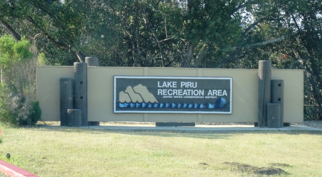
The 60 acre Lake Piru Recreation Area is located on the western shore of Lake Piru, an artificial lake in the Los Padres National Forest. Lake Piru offers 238 tree-shaded campsites, coin-operated hot showers and a store. Each site has a picnic table, fire ring and grill top.

The dam is owned and operated by the United Water Conservation District of Santa Paula and a third party operates the campsite; visit campone.com/campsites/lake-piru for more information. Boat rentals and fishing available as well as a newer children's playground area.  Make camping reservations by calling 805.521.1500.

Lake Piru in Summer 2015

Oak Park Campground in Simi Valley

OakParkCampground.jpg

Located at 901 Quimisa Drive in Simi Valley, the Oak Park Campground is a rustic 100.5 acre open space park that is surrounded by gentle, rolling hills and an abundance of coastal sage scrub brush. This natural environment supports a multitude of California native wildlife species, such as a raptors, roadrunners, sagebrush lizards, and alligator lizards. The park is ideal for group RV camping in a secluded setting.

Day use is $2 per day ($4 on weekends) (as of July 2018). Camping is $32 per day.

Plenty of things to explore in this 100 acre space! Learn more or make reservations at www.ventura.org/inland-parks/oak-park-simi-valley or call 805.654.3951.

The video shot below was on a Sunday night around 7 p.m. in July 2010. There was for the most part nobody there! What a great opportunity to camp with your kids locally! I guess my only concerns about the location would be that the park is sandwiched between the 118 freeway and the railroad tracks...though I did not encounter any noise issues in my brief drive-by.

Rose Valley Campground in the Los Padres National Forest in Ojai

Rose Valley Campground in Ojai is located at an elevation of 3,450 feet. It is open year-round. There are nine campsites located in a single loop, each with tables, BBQ grills, and/or fire rings. There is one vault toilet in the campground and another across from the lake. Drinking water is not available, so be sure to bring your own.

No reservations taken; first come, first served. An Adventure Pass is required to be displayed on car ($5/day or $30/year as of March 2017).

Half a mile hike gets you to the Rose Valley Falls. The trail begins at the southwest section of the campground.

Directions: Take Highway 33 north from Ojai 14.7 miles to mile marker 25.84.  Turn right at the Rose Valley Road turnoff and follow the paved road for 3.1 miles. Turn right again at the Rose Valley sign and drive 0.6 miles into the campground.

OTHER LOCAL CAMPING OPTIONS IN AND AROUND VENTURA COUNTY

Wheeler Gorge Visitor Center and Campground in Ojai

WheelerGorge.jpg

The Wheeler Gorge Visitor Center is located at 17017 Maricopa Highway, Ojai. To reach the Center from Ventura take Highway 33 towards Ojai at the “Y” intersection (by the Vons shopping center) turn left on Hwy 33 for about eight miles.

The Center provides information about the Los Padres National Forest and also sells maps, trail guides, forest-related books, Adventure Passes and other items. It opened in June 2001. Staff are on hand to help you plan your backcountry trip planning in the area.

The Center also serves as a hub for interpretive and educational activities and programs. These include membership functions and presentations about the resources and issues of Los Padres National Forest. One of the more popular programs is the Introduction to Backpacking course.

The Visitor Center has a kitchen, classroom, library, audiovisual equipment, large parking area, outside picnic areas, and tools/equipment storage and serves as a staging area for forest projects in the southern section of the Los Padres National Forest.

The Center is open on weekends from 9am to 3pm, except Thanksgiving and Christmas. More information at lpforest.org/wheeler or call 805.640.9060.

Across the street is the Wheeler Gorge Campground, which is open year-round and offers over 60 single-family sites for tent or RV camping. Some sites are available on a first-come, first-served basis. Visit www.recreation.gov/camping/Wheeler_Gorge/r/campgroundDetails.do?contractCode=NRSO&parkId=70392 to learn more about the Wheeler Gorge Campground.