Sunset View From Tarantula Hill on a Cold February Evening, 2-22-22

Yes, today is 2-22-22, a day that kind of reminds me of 11-11-11. It was a cold, cloudy day and while we did not see rain, we anticipate some showers tonight. In any case, enjoy these photos of tonight’s cloudy sunset from Tarantula Hill in Thousand Oaks.

Ray Miller Trail at Pt. Mugu State Park in Malibu

Views from the Ray Miller Trail at Pt. Mugu State Park.

Views from the Ray Miller Trail at Pt. Mugu State Park.

The Ray Miller Trail is located in the La Jolla Canyon section of Pt. Mugu State Park in Malibu. The trail is named after Ray Miller, "Guardian of the Canyon," who was the first official California State Park Camp Host, having volunteered from March 1, 1979 until his death on April 28, 1989.

Monument to Ray Miller on boulder in the La Jolla Canyon Day Use parking lot.

Monument to Ray Miller on boulder in the La Jolla Canyon Day Use parking lot.

On its own, the trail is 2.7 miles each direction, taking you from the base of La Jolla Canyon to an overlook of the Pacific Ocean that provides sweeping views towards Mugu Rock on the west and Sycamore Cove on the east.

La Jolla Canyon sign in need of repair in September 2015.

La Jolla Canyon sign in need of repair in September 2015.

The trail looks harder than what it really is in my opinion. The elevation gain is close to 1,000 feet over the 2.7 miles, but none of the climbs are particularly steep.  The trail zigs and zags its way up as you take in views below. You will love this trail. Many people I know say this is their favorite trail!

Ray Miller Trail Trailhead Sign
Single track trail all the way up, but the surface is pretty good overall. Can get slippery when wet, however.

Single track trail all the way up, but the surface is pretty good overall. Can get slippery when wet, however.

After you reach the overlook, you continue on until you reach the Overlook Fire Road at the end of the trail (there's a sign). At that point, you can turn back or you can continue on the fire road going either north towards the La Jolla Valley Fire Road, or south towards Sycamore Campground.

Views are in abundance most of the way up this trail. This photo was taken in September 2015, in the midst of a four-year drought. It will green up in the winter.

Views are in abundance most of the way up this trail. This photo was taken in September 2015, in the midst of a four-year drought. It will green up in the winter.

This is the sign indicating you're reached the endpoint of the Ray Miller Trail, where it intersects with the Overlook Fire Road. Explore the road going both directions if you have time (and are carrying water), as there's plenty of views in all dir…

This is the sign indicating you're reached the endpoint of the Ray Miller Trail, where it intersects with the Overlook Fire Road. Explore the road going both directions if you have time (and are carrying water), as there's plenty of views in all directions.

At the bottom of La Jolla Canyon is a group campground.  

La Jolla Canyon is located at 9000 Pacific Coast Highway in Malibu. Take PCH south/southeast from Los Posas Road in Camarillo. Takes about 30 minutes to get there from the center of Thousand Oaks via either the 101 or via Potrero Road in Newbury Park. It is located just east of Mugu Rock and near Thornhill Broome Beach.

You can park in the La Jolla Day Use Parking Lot (as of September 2015, $8 for day use; $7 for seniors), or you can park on PCH and walk in. Dogs and bikes are not allowed on this trail, though horses are. It can get pretty hot up here in the summer, so be careful and bring plenty of water and wear sunscreen. 

The La Jolla Canyon Trail, accessed adjacent to the Ray Miller Trail, has been closed since January 2015 due to mudslides and rain damage. However, you can access the beautiful La Jolla Valley from the the La Jolla Valley Fire Road.

More information about Pt. Mugu State Park

Other local hikes and trails

El Tecolote Cafe in Camarillo Captured by Local Artist in Oil Painting

El Tecolote by Linda Dark of Camarillo.

El Tecolote by Linda Dark of Camarillo.

Linda Dark has lived in Camarillo since 1978. For the last 12 years she has captured local scenes in oil paint. Here is her rendition of the historic El Tecolote, located at 333 N. Lewis Road, in the image above. El Tecolote serves up delicious, authentic Mexican food for breakfast, lunch and dinner.

According to the El Tecolote website, World War II veteran Mike Loza opened his restaurant in Moorpark in 1946. The owls occupying the trees surrounding the restaurant were the inspiration for the name El Tecolote (The Owl).

The cafe was moved to a small house in Camarillo in 1948. It was so small that a frustrated customer helped finance a move to its current location in 1952. The restaurant is now owned and managed by the Guardado family. Visit www.facebook.com/eltecoloterestaurant or call 805.482.4318 for more information. 

El Tecolate the night of Monday, September 8, 2014.

El Tecolate the night of Monday, September 8, 2014.

El Parque de la Paz "The Peace Park" in Thousand Oaks

ParqueDeLaPaz Sign.jpg

El Parque de la Paz "The Peace Park" is located at 2580 Pleasant Way in Thousand Oaks, tucked south of Thousand Oaks Boulevard behind Mouthful Eatery, Allen Motors, Harold's House of Omelettes and other businesses.

This five acre park dotted with oak trees was dedicated in 1990 by Thousand Oaks City Council.  Amenities include a Jungleland themed playground area, horseshoe pits, basketball court, picnic tables and restrooms. Learn more at www.crpd.org/park/el-parque-de-la-paz.

Jungleland themed drinking fountain.

Jungleland themed drinking fountain.

Adjacent to the park is Ventura County Historical Landmark No. 109, the Crowley House.

Who has horseshoes to use at these horseshoe pits!? Looks fun!

Who has horseshoes to use at these horseshoe pits!? Looks fun!

Parque Eleph.JPG

Two Ventura County Cities Were Born on September 29, 1964!

You wouldn't immediately know it looking at the headline of this September 30, 1964 issue of The Daily News, but the day before, residents in BOTH Camarillo and Thousand Oaks voted to incorporate their respective cities.

The article indicates that voters in Camarillo voted in favor of incorporation by a 5 to 1 margin, with 64% of the 3,745 registered voters turning in ballots. In the far right column, you'll see that with 10 of 18 precincts counted, 61% of 2,428 votes cast in Thousand Oaks were for incorporation. In Thousand Oaks they also voted on the name of the city...over 87% of votes cast said "yes" to the name Thousand Oaks.

Thanks to the Pleasant Valley Historical Society Museum in Camarillo for maintaining this and other local Ventura County history!

CamarilloTOaksIncorp2.jpg

Shakey's Pizza Parlor on Thousand Oaks Boulevard in the 1960s

Shakey's Pizza Parlor in the background at the 1966 Conejo Valley Days Parade

Shakey's Pizza Parlor in the background at the 1966 Conejo Valley Days Parade

Back in the day, there were only a few pizza places in Thousand Oaks, including this Shakey's Pizza Parlor on the north side of Thousand Oaks Boulevard, located across the street from Jungleland (where the Thousand Oaks Civic Arts Plaza now resides). 

The exact address of Shakey's was 2361 Thousand Oaks Blvd., where Toyota of Thousand Oaks resides today.

Today we have more pizza choices than ever imagined in the Conejo Valley. Over the last several years, newcomers to the Conejo Valley pizza scene include:

To name a few...not to mention Toppers Pizza, Winner’s Pizza, D’Amore’s Pizza, Butler's Pizza, California Pizza Kitchen, Pizzeria La Piccola (now closed), Tony's Pizza, Greco's Pizzeria, Parma Pizza and many others.

Shakey's Pizza was founded in Sacramento on April 30, 1954, by Sherwood "Shakey" Johnson and Ed Plummer. Johnson's nickname resulted from nerve damage following a bout of malaria suffered during World War II.  In the 1970s, there were approximately 500 Shakey's locations in the U.S. Today there are 54, the majority of which are still here in Southern California. The closest Shakey's to Thousand Oaks is 30 miles away, in Northridge.

Another scene from the 1966 Conejo Valley Days Parade. Miss Shakey's is absent! But Miss Sizzler is present!

Another scene from the 1966 Conejo Valley Days Parade. Miss Shakey's is absent! But Miss Sizzler is present!

Hike to the Danielson Monument in the Boney Mountain Wilderness

One of the more popular and challenging hikes in the local area takes you from the Rancho Sierra Vista/Satwiwa Recreation Area in Newbury Park to the Danielson Monument in the Boney Mountain Wilderness (Point Mugu State Park). 

It is about 5.5 miles round trip and has a net elevation gain of about 600 feet. The Monument is close to 1,500 feet in elevation This is a fairly challenging trail as roughly two thirds of the hike you are going up and down fairly substantial hills. That said, I've seen hundreds of folks on these trails of all fitness levels and ages doing it at their own pace.

Entrance into Rancho Sierra Vista/Satwiwa at Lynn Road and Via Goleta in Newbury Park

Entrance into Rancho Sierra Vista/Satwiwa at Lynn Road and Via Goleta in Newbury Park

Starting at the Satwiwa Native American Culture Center, make your way to the Danielson Road trail by either taking the Big Sycamore Canyon Fire Road (paved) south for roughly .3 mile and then a left on Danielson Road (trail) or take the Satwiwa Loop Trail that runs diagonally southeast until you reach a fork on the trail.

(Note: You can also park at the trailhead at Wendy and Potrero Roads and add another few miles to your trek.)

Sycamore Canyon Road southbound towards Point Mugu State Park from Satwiwa Center

Sycamore Canyon Road southbound towards Point Mugu State Park from Satwiwa Center

Veer right (south) at the juncture of the Danielson Road and Satwiwa Loop trails towards a bench that overlooks Sycamore Canyon. This is called the Upper Sycamore Canyon Overlook.

The bench at the Upper Sycamore Canyon Overlook in Rancho Sierra Vista

The bench at the Upper Sycamore Canyon Overlook in Rancho Sierra Vista

The short, rocky trail eastbound from there (behind the bench) takes you to another fork, where you can either veer left to the Hidden Valley Overlook trail (part of Rancho Sierra Vista/Satwiwa) or right into the Boney Mountain Wilderness. (Note that dogs and bikes are not allowed in the Boney Mountain Wilderness.)

Entering the Boney Mountain Wilderness

Entering the Boney Mountain Wilderness

After a steady descent of about another .4 mile, you'll see another sign. Continue towards the left. On the right is the Upper Sycamore Canyon Trail, kind of a fun, winding trail at the bottom of the canyon. Save that for another day.

In non-drought years, there is often a creek you may need to walk through as you continue on Danielson Road. It has been years since the stream was of any significance but it was back in February 2017 after recent rainstorms. But it is generally easy to get across.

After navigating the narrowest portion of trail, you will see a juncture. The unmarked "Waterfall Trail" is straight ahead (only about 120 steps to the "Waterfall" when there's not a severe drought). You can check it out as it is such a short distance. But to get to the Monument, veer sharply right, continuing up Danielson Road.

Juncture of Waterfall (straight ahead) and Danielson Road (to the right)

Juncture of Waterfall (straight ahead) and Danielson Road (to the right)

This is a long, grinding, uphill trail of about a mile until you get to a juncture where you can make a right-hand turn to the Old Boney Trail. As you make your way up, you'll be treated to great views from Sycamore Canyon to Newbury Park and beyond.

This is a bit of a dried out view from Upper Danielson Road looking down from where we came from in 2015.

This is a bit of a dried out view from Upper Danielson Road looking down from where we came from in 2015.

You're almost there once you see this Old Boney trail sign - just .3 mile to go

You're almost there once you see this Old Boney trail sign - just .3 mile to go

Continue straight on Danielson Road. There are some areas coming up that periodically get overgrown. Watch out for poison oak particularly in these areas, continuing on to the Monument. In .3 mile, you're reached your destination.

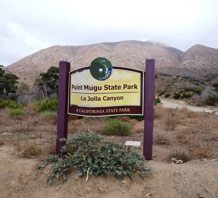
The Danielson Monument is a tribute to Richard Ely Danielson, Junior who lived on the 7,800 acre Rancho Sierra Vista after purchasing the land from the estate of Carl H. Beal in 1947 for roughly $500,000. Danielson lived on the ranch for over three decades with his family. He donated 5,585 acres of the ranch to the State of California, which became part of Point Mugu State Park, and sold 850 acres, including the horse ranch, to the National Park Service in 1980.  He passed away on December 27, 1988. 

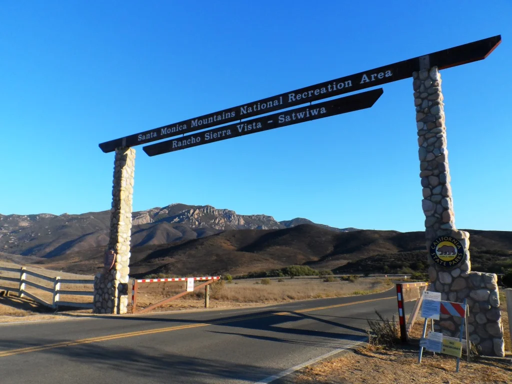
Ranching in the area dates back to the early 1800s, when Spanish soldiers were granted 48,672 acres of land, "Rancho El Conejo," which through the years was subdivided and sold to other landowners. One of these ranchers was Carl Beal, who in 1937 named the area Rancho Sierra Vista "Mountain View Ranch." 

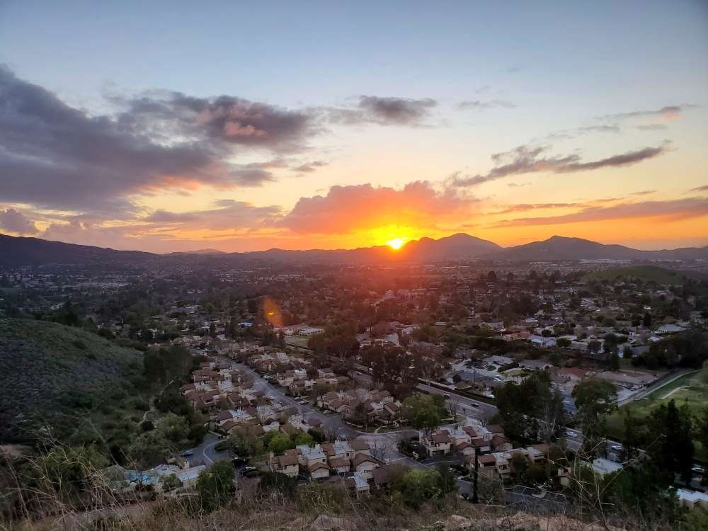
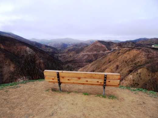
The Monument is in a peaceful setting, surrounded by trees. And it stays fairly green up here. A good place to eat lunch or sit and relax. Adjacent to the Monument is a remnant of Danielson's cabin - the chimney. If you continue up this path to the right, you can get to the top of Boney Mountain.

Remnant of Danielson's cabin adjacent to the monument - a chimney.

Remnant of Danielson's cabin adjacent to the monument - a chimney.

One thing I've never seen in my decades on this particular trail are strollers. I think strollers would be a bit of a challenge for many due to rocky and narrow sections, periodic overgrowth and poison oak on the sides of a small portion of the trail and, when we're not in a drought, a stream crossing. 

COMPILATION OF TRAILS IN AND AROUND VENTURA COUNTY