Oakbrook Regional Park Archaeological Area in Thousand Oaks is City Historical Landmark #5

Oakbrook Regional Park Archaeological Area is located at 3290 Lang Ranch Parkway in Thousand Oaks, south of the intersection of Avenida de los Arboles and Westlake Boulevard.

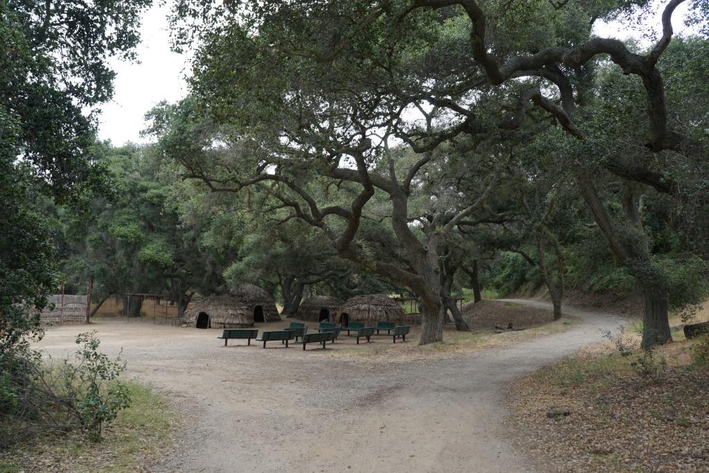
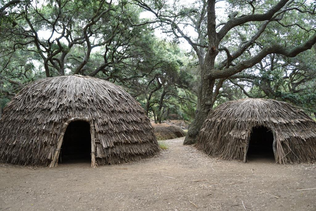
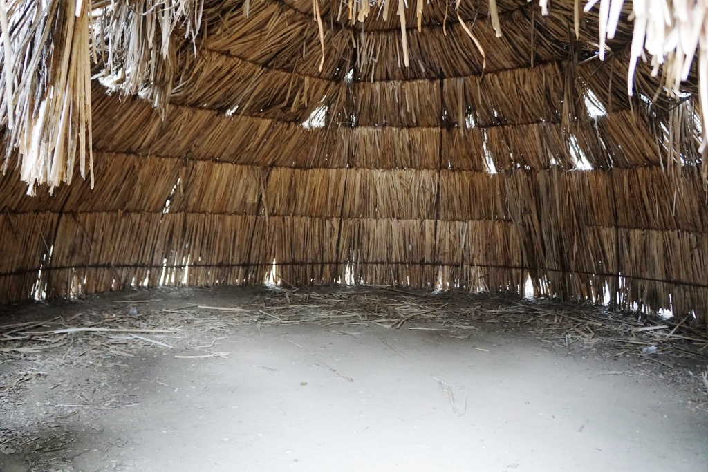
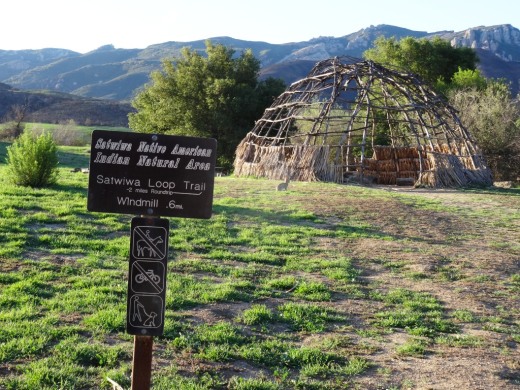
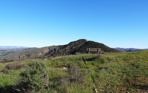
This 428 acre park is a designated historical landmark by the City of Thousand Oaks and County of Ventura. The Chumash inhabited this area going back as far as 12,000 years ago through the late 1800's. 

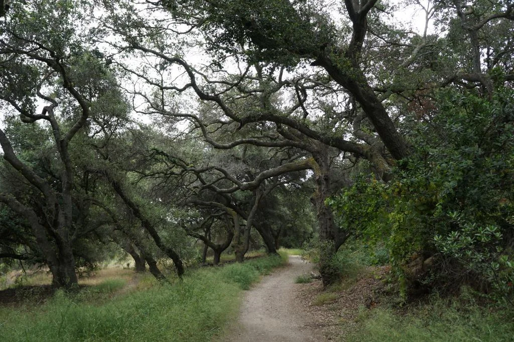
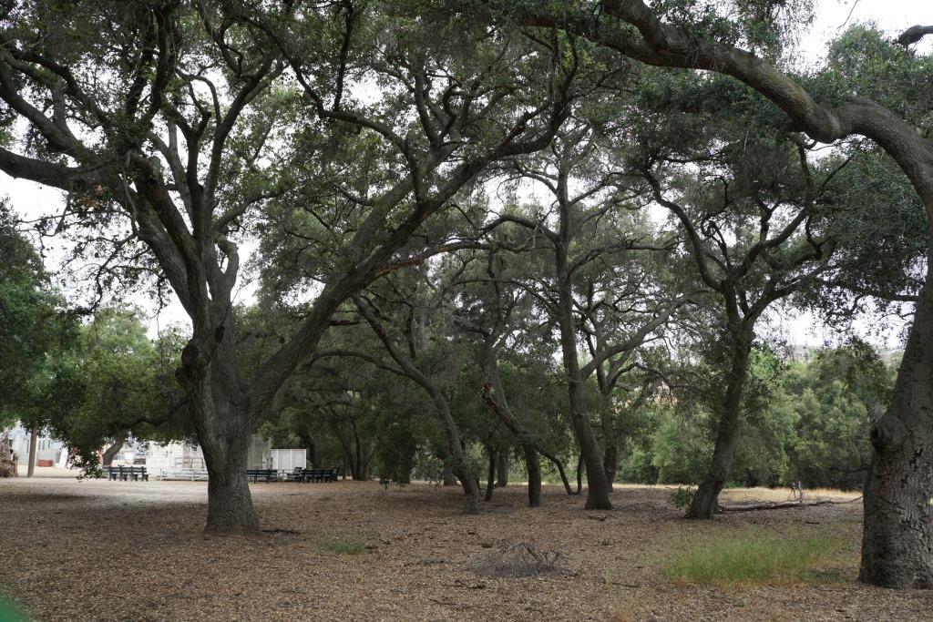
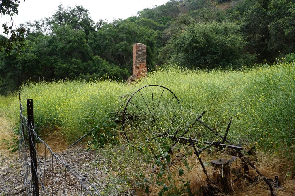
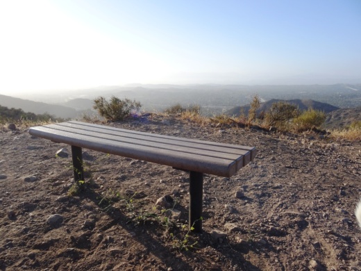
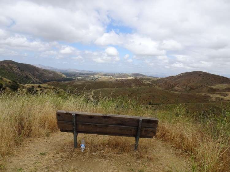
The park grounds are open to the public daily from 7 a.m. to 10 p.m.  There are flat hiking trails and a Chumash village reproduction available to explore. The oak trees provide a beautiful canopy for hikers. It is a peaceful place worth exploring. Note that dogs are prohibited from the property.

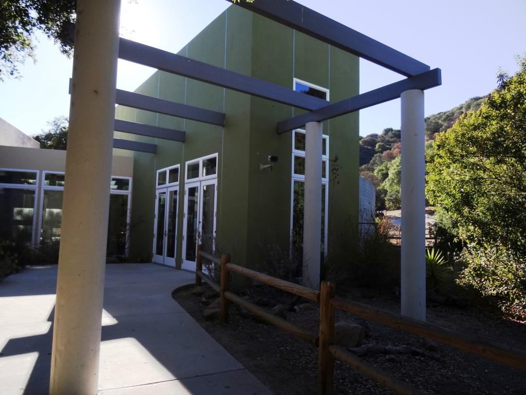
Located on the property is the Chumash Indian Museum, which contains a large collection of Chumash artifacts. The museum is open on Saturdays and Sundays from 10 a.m. to 4 p.m.

More information on Oakbrook Regional Park at www.crpd.org/park/oakbrook-regional-park.

Hiking and Exploring in Rancho Sierra Vista/Satwiwa in Newbury Park

Entrance to Rancho Sierra VistaSatwiwa at Lynn Road and Via Goleta in Newbury Park

Located on the western edge of the Santa Monica Mountains National Recreation Area, Rancho Sierra Vista/Satwiwa is accessible in Newbury Park at the intersection of Lynn Road and Via Goleta. This area spans from Potrero Road on the north and connects to Point Mugu State Park on the south.

Ranching in the area dates back to the early 1800s, when Spanish soldiers were granted 48,672 acres of land, "Rancho El Conejo," which through the years was subdivided and sold to other landowners. One of these ranchers was Carl Beal, who in 1937 named the area Rancho Sierra Vista "Mountain View Ranch." The last private landowner in the area was Richard Danielson, whose family farmed and ranched the area for 32 years. Danielson donated 5,585 acres of the ranch to the State of California, which became part of Point Mugu State Park, and sold 850 acres, including the horse ranch, to the National Park Service in 1980.

Sign at Danielson Monument accessible via Danielson Road/Old Boney Trail.

Sign at Danielson Monument accessible via Danielson Road/Old Boney Trail.

The Satwiwa Native American Indian Natural Area is a bike/horse free area within Rancho Sierra Vista/Satwiwa of roughly 60 acres. Located on the northwest corner of this area, just a short walk from visitor parking, is the Satwiwa Native American Culture Center.

The Culture Center is staffed from 9 a.m. to 4 p.m. most weekends with a park ranger or other staff. It is a small building that also hosts a variety of educational Chumash and wildlife items. NPS BROCHURE AND TRAIL MAP

Learn more about RSV at www.nps.gov/samo/planyourvisit/rsvsatwiwa.htm.

SatwiwaSign.JPG

The area is a popular destination for hikers with a variety of well maintained trails. Note, however, that bicycles and horses are not allowed in the "Satwiwa Natural Area" section (see map below).

Map excerpt courtesy of National Park Service.

Map excerpt courtesy of National Park Service.

The Satwiwa Loop Trail is an easy, 2 mile trail that starts at the Culture Center through grasslands, past the old windmill and back around, with several extensions for those looking to do a little more.

SatwiwaLoopTrail_sign.jpg

There's the Lower Loop Trail and the Upper Loop Trail that is a bit of a zig-zaggy trail with wooden footings placed by volunteers to help hikers navigate. The Upper Loop Trail runs past the "Old Windmill" pictured below.

Satwiwa Lower Loop sign at intersection of Danielson Road trail.

Satwiwa Lower Loop sign at intersection of Danielson Road trail.

The old windmill at the northeast corner of the Satwiwa Loop Trail (Upper Loop). (Windmill was knocked down by high winds in December 2016 and is still down as of MAY 2024).

You can also park at the Wendy and Potrero trailhead and walk to the Culture Center via the Wendy Trail, about a mile each way.

Wendy Trail trailhead at the intersection of Wendy and Potrero in Newbury Park

Wendy Trail trailhead at the intersection of Wendy and Potrero in Newbury Park

It is pretty dry in here most of the year but after the winter/spring rains, the green stages a comeback.

It is pretty dry in here most of the year but after the winter/spring rains, the green stages a comeback.

Another trail to explore is the 1 mile Ranch Overlook Trail that takes you from just west of the Satwiwa Native American Indian Culture Center, up a hill (where you can indeed look down toward the old ranch area, parking area and restrooms) to the main entrance and to the Palomino Trail in the Rancho Potrero Open Space.

Ranch Overlook Trail

Ranch Overlook Trail

One of my favorite trails in Rancho Sierra Vista/Satwiwa is the Hidden Valley Overlook Trail. This challenging, fairly steep trail branches off from the Satwiwa Loop Trail on the southeast, past the bench at the Upper Sycamore Canyon Overlook, via the Boney Mountain Trail/Danielson Road.

The popular bench at Upper Sycamore Canyon Overlook. Photo taken April 4, 2014, approximately 11 months after the devasting Springs Fire of 2013.

The popular bench at Upper Sycamore Canyon Overlook. Photo taken April 4, 2014, approximately 11 months after the devasting Springs Fire of 2013.

Roughly 700 feet past the Upper Sycamore Canyon bench is a juncture where you can either veer right into Point Mugu State Park and the Boney Mountain Wilderness, where you can walk down, over a stream (or a dry stream bed as the case may be), towards the popular "waterfall" (which in recent years has been not much more than a trickle) and the Danielson Monument. CLICK HERE for details.

If you veer left at the juncture, you'll see the Hidden Valley Overlook trail sign.

HiddenValleyOverlook_sign.jpg

The trail is steep and rocky and reaches an end point in about half a mile. If you are up to the challenge, you will be rewarded with sweeping views of Newbury Park, the Channel Islands, Sycamore Canyon and Boney Mountain.

Views from halfway up the Hidden Valley Overlook Trail towards the Satwiwa Native American Indian Natural Area

Views from halfway up the Hidden Valley Overlook Trail towards the Satwiwa Native American Indian Natural Area

At the end of the trail is the Hidden Valley overlook, where you will be able to peek into the not-so-hidden-anymore Hidden Valley and its peaceful ranches. As a final reward for your effort, it's all downhill the way back. Be sure to wear solid hiking shoes as the trails are a bit technical.

Peek at Hidden Valley at the end of the Hidden Valley Overlook Trail.

Peek at Hidden Valley at the end of the Hidden Valley Overlook Trail.

View of Santa Cruz Island, one of the Channel Islands, from Hidden Valley Overlook trail

View of Santa Cruz Island, one of the Channel Islands, from Hidden Valley Overlook trail

To learn more, visit the Anthony C. Beilenson Visitor Center at 26876 Mulholland Highway, Calabasas or visit www.nps.gov/samo or call 805.370.2301.

Dogs are allowed in Rancho Sierra Vista/Satwiwa as long as they are on a leash no longer than 6 feet. But please, pick up after your pet. Dogs are not allowed in the Point Mugu State Park / Boney Mountain Wilderness back country trails, though they are allowed on paved roads, such as the Big Sycamore Canyon Trail road.

Ventura County Area Listings in the National Register of Historic Places

NationalRegisterHistoricPlaces.jpg

The National Register of Historic Places is the official list of the Nation's historic places worthy of preservation. Authorized by the National Historic Preservation Act of 1966, the National Park Service's National Register of Historic Places is part of a national program to coordinate and support public and private efforts to identify, evaluate and protect America's historic and archaeological resources.

There are over 80,000 listings in the National Register in five general categories: building, structure, site, district and object.

To be considered eligible for the Register, a property must meet the National Register Criteria for Evaluation. This involves examining the property’s age (generally at least 50 years old), integrity and significance.

To learn more about the National Register of Historic Places and to search its database, visit www.nps.gov/subjects/nationalregister/index.htm.

Now let's highlight Ventura County area properties listed in the Register as of November 2024. Most of these you can visit (links provided where applicable):

Other nearby historic places:

The "Scary Dairy" at CSU Channel Islands University Park in Camarillo

CSU Channel Islands University Park is a 367 acre parcel located adjacent to CSU Channel Islands off of S. Lewis Road in Camarillo. It is a regional educational and recreation area owned and operated by California State University Channel Islands.

In 1932, the State of California purchased 1,760 acres of the Lewis Ranch and built the Camarillo State Mental Hospital, which operated from 1936 to 1997 and at one point treated as many as 7,000 patients in the mid 1950s.

Located on the parcel was a dairy farm that produced crops and housed livestock that fed the hospital community. The farm was disbanded in the 1960s and has been left in a state of disrepair, falling prey over the decades to vandals and coined "Scary Dairy."

After closure of the hospital, the land was conveyed to the County of Ventura, which had considered developing a golf course and amphitheater there but later abandoned its plans. The land was acquired by the University in 2009.

Fences and "No Trespassing" signs now surround what's left of the structures. but you can still get pretty close to check out Scary Dairy.

ScaryDairy1.JPG

CSU Channel Islands University Park is open to the public daily from sunrise to sunset. From Camarillo, take Lewis Road south to Camarillo Street and turn left (east).  Cross the bridge over Calleguas Creek and the entrance is on the left. Parking is $6 per vehicle (as of 2022). Do note that there are no facilities at this park, like restrooms and drinking fountains.

Visit www.csuci.edu/cipark for more information.

ScaryDairy4.JPG
ScaryDairy5.JPG
ScaryDairy7.jpg
ScaryDairy3.JPG

Trolley Services in Ventura County and Surrounding Areas

Trolley seen around town in Westlake Village

Trolley seen around town in Westlake Village

The term "trolley" is derived from a grooved conductive wheel attached to a pole that "trolls," or pulls along, an overhead wire to transfer electricity to a streetcar. The first large-scale trolley line in the world, the Richmond Union Passenger Railway, was a 12 mile system that opened on February 12, 1888 in Richmond, Virginia. This trolley service operated until November 25, 1949. 

You don't see many trolley buses anymore (San Francisco's historic streetcars are a well known exception), but here in Ventura County and adjacent areas we do have some electric trolleys in operation!

Camarillo: The City of Camarillo provides trolley service seven days a week, with 10 stops at various shopping centers in town in a 30 minute cycle. Fare price is $1 for adults and students, $.50 for seniors and ADA riders.

Ojai: The City of Ojai's Ojai Trolley Service has operated since 1989, providing low cost fixed route service with 45 stops over roughly five miles in Ojai, Meiners Oaks and Mira Monte.

Calabasas: Just east of us, City of Calabasas offers free trolley service on Saturdays from 10 a.m. to 3 p.m. at 24 stops at various shopping and other venues.

Santa Barbara: The Santa Barbara Trolley Company is a commercial service that provides trolley tours to some of the area's great tourist venues Thursday to Monday.

Trolleys No More:

Ventura:  The Downtown Ventura-Harbor Trolley provided year-round free service to local shopping, tourist and hotel locations over an hour-long route, Wednesday through Sunday…until it closed operations at the end of March 2019.

Westlake Village: Previously provided a free trolley service on Fr/Sat nights during certain seasonal time frames in 2019. Program has been on hiatus since then but has been under consideration. Could be reinstated at some point; visit www.wlv.org for updates.

Bench Yourself in the Conejo Valley

There are over 150 miles of public multi-use trails surrounding the Conejo Valley managed by the Conejo Open Space Conservation Agency and hundreds of miles more in the neighboring Santa Monica Mountains National Recreation Area. Learn more about these great trails here on Conejo Valley Guide.

All of this hiking, biking and running can make one tired. Not to worry...there are benches in strategic spots all throughout the area, all with great views! Here we highlight some of them. Click the images for more information about the trails that lead to these benches.

Views from Angel Vista Peak bench in Newbury Park.

Views from Angel Vista Peak bench in Newbury Park.

Bench at top of peak just east of Angel Vista Peak.

Bench at top of peak just east of Angel Vista Peak.

Bench at the top of "Space Mountain" on the Los Robles Trail West.

Bench at the top of "Space Mountain" on the Los Robles Trail West.

Bench with perfect sunset view off of the Autumn Ridge Trail in the Lang Ranch Open Space.

Bench with perfect sunset view off of the Autumn Ridge Trail in the Lang Ranch Open Space.

A bench on a hilltop overlooking the Conejo Valley on Los Robles Trail East Scenic Loop.

A bench on a hilltop overlooking the Conejo Valley on Los Robles Trail East Scenic Loop.

Bench on Los Robles Loop East Scenic Loop looking towards the south.

Bench on Los Robles Loop East Scenic Loop looking towards the south.

Benches at the top of Big Sycamore Canyon Road in Point Mugu State Park (adjacent to Rancho Sierra Vista/Satwiwa in Newbury Park).

Benches at the top of Big Sycamore Canyon Road in Point Mugu State Park (adjacent to Rancho Sierra Vista/Satwiwa in Newbury Park).

Another bench that overlooks Sycamore Canyon from the Boney Mountain Trail.

Another bench that overlooks Sycamore Canyon from the Boney Mountain Trail.

Image of the Upper Sycamore Canyon bench after the Rancho Sierra Vista area in Newbury Park was ravaged by the Springs Fire of 2013.

Image of the Upper Sycamore Canyon bench after the Rancho Sierra Vista area in Newbury Park was ravaged by the Springs Fire of 2013.

Upper Sycamore Canyon bench was subsequently replaced. Here it is in April 2014.

Upper Sycamore Canyon bench was subsequently replaced. Here it is in April 2014.

Bench on the west side of Tarantula Hill in Thousand Oaks.

Bench on the west side of Tarantula Hill in Thousand Oaks.

Another view of the Tarantula Hill bench before sundown in June 2022.

This bench is located at the juncture of the Sunrise and Meadow Vista Trails in the Lang Ranch Open Space and the Long Canyon Trail in Simi Valley. Nice view towards Simi Valley.

This bench is located at the juncture of the Sunrise and Meadow Vista Trails in the Lang Ranch Open Space and the Long Canyon Trail in Simi Valley. Nice view towards Simi Valley.

Bench on Indian Creek Trail in Wildwood Park.

Bench on Indian Creek Trail in Wildwood Park.

Bench overlooking Bard Reservoir on the Sunset Hills Loop.

Bench overlooking Bard Reservoir on the Sunset Hills Loop.

Sunset Hills Trail bench in early spring 2023.

One of two benches in the hills above CLU overlooking Thousand Oaks.

One of two benches in the hills above CLU overlooking Thousand Oaks.

Oakbrook Vista Trail bench off of Lang Ranch Parkway in Thousand Oaks

Oakbrook Vista Trail bench off of Lang Ranch Parkway in Thousand Oaks

This bench on a hill connected to the Rancho Potrero trail in Newbury Park faces the west and gets you some nice views of several of the Channel Islands on clear days.

This bench on a hill connected to the Rancho Potrero trail in Newbury Park faces the west and gets you some nice views of several of the Channel Islands on clear days.

<
Bench off the Lizard Rock Loop trail on the west side of Wildwood Park.

Bench off the Lizard Rock Loop trail on the west side of Wildwood Park.

Bench with a view of Boney Peak from the Potrero Ridge Trail in Newbury Park.

Bench with a view of Boney Peak from the Potrero Ridge Trail in Newbury Park.

There are dozens of benches facing all directions in the beautiful hilltop Conejo Valley Botanic Garden in the heart of Thousand Oaks

There are dozens of benches facing all directions in the beautiful hilltop Conejo Valley Botanic Garden in the heart of Thousand Oaks

Another bench on the west side of top of the Conejo Valley Botanic Garden.

Another bench on the west side of top of the Conejo Valley Botanic Garden.

Bench overlooking the Potrero Grade from the Vista Del Mar Trail in Newbury Park.

Bench overlooking the Potrero Grade from the Vista Del Mar Trail in Newbury Park.

This is a new bench on the Vista Del Mar Trail in Newbury Park that made its premiere in 2023.

Bench on the El Encanto Trail in the Dos Vientos section of Newbury Park. Panaromic view towards Boney Mountain while catching the sunset.

Bench on the El Encanto Trail in the Dos Vientos section of Newbury Park. Panaromic view towards Boney Mountain while catching the sunset.

Bench with panoramic views at the top of the Triunfo Canyon Trail (part of the Los Robles trail system) in Westlake Village.

Bench with panoramic views at the top of the Triunfo Canyon Trail (part of the Los Robles trail system) in Westlake Village.

Enjoy views towards Newbury Park, Wildwood Park and so on from this bench on the Lynnmere Trail in Thousand Oaks.

Enjoy views towards Newbury Park, Wildwood Park and so on from this bench on the Lynnmere Trail in Thousand Oaks.

Bench at Box Canyon Overlook in Wildwood Park.

Bench at Box Canyon Overlook in Wildwood Park.

Bench #1 on the Albertson Motorway Fire Road Trail in Thousand Oaks.

Bench #1 on the Albertson Motorway Fire Road Trail in Thousand Oaks.

Bench #2 on the Albertson Motorway Fire Road Trail in Thousand Oaks.

Bench #2 on the Albertson Motorway Fire Road Trail in Thousand Oaks.

Bench off the Western Plateau Trail in the Conejo Canyons Open Space near the Hill Canyon Trail.

Bench off the Western Plateau Trail in the Conejo Canyons Open Space near the Hill Canyon Trail.

Another bench off the Western Plateau Trail. This one is marked by a “Vista Point” sign and is across from the Outlaw Trail juncture in the Conejo Canyons Open Space.

Another bench off the Western Plateau Trail. This one is marked by a “Vista Point” sign and is across from the Outlaw Trail juncture in the Conejo Canyons Open Space.

This bench is near Elliot Peak in the Conejo Canyons Open Space.

This bench is near Elliot Peak in the Conejo Canyons Open Space.

This bench is off the Outlaw Trail in the Conejo Canyons Open Space, not far from Elliot Peak.

This bench is off the Outlaw Trail in the Conejo Canyons Open Space, not far from Elliot Peak.

Another view from the bench atop Tarantula Hill….at sunset.

Another view from the bench atop Tarantula Hill….at sunset.

Bench off of the Santa Rosa Trail in Wildwood Park, overlooking Santa Rosa Valley

Cycling Clubs and Groups In and Around Ventura County

CyclistsCam.JPG

Any given Sunday morning I come across hundreds of bicyclists on my morning runs in the Thousand Oaks area and throughout Ventura County.

Here are some local cycling groups:

CLICK HERE for some family-friendly friendly bike path options around Ventura County.

And for some local BMX track options, Freedom Park BMX Raceway in Camarillo

Bike shops in the local area:

EBike shops: