The Pedestrian Tunnel Under Avenida De Los Arboles in Thousand Oaks

There's a pedestrian tunnel that connects the Wildflower Playfield on Avenida De Los Arboles at Canna Street that goes underneath Arboles to Wildwood Neighborhood Park.

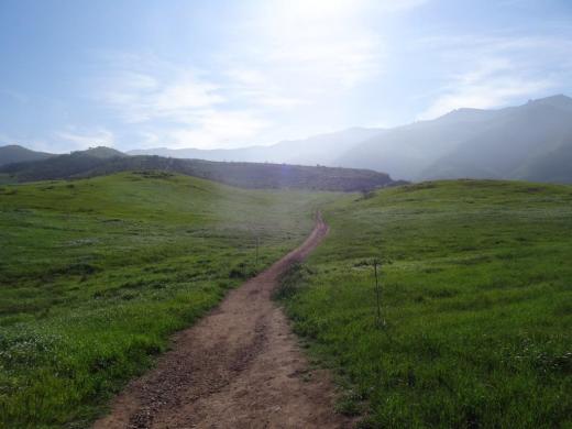
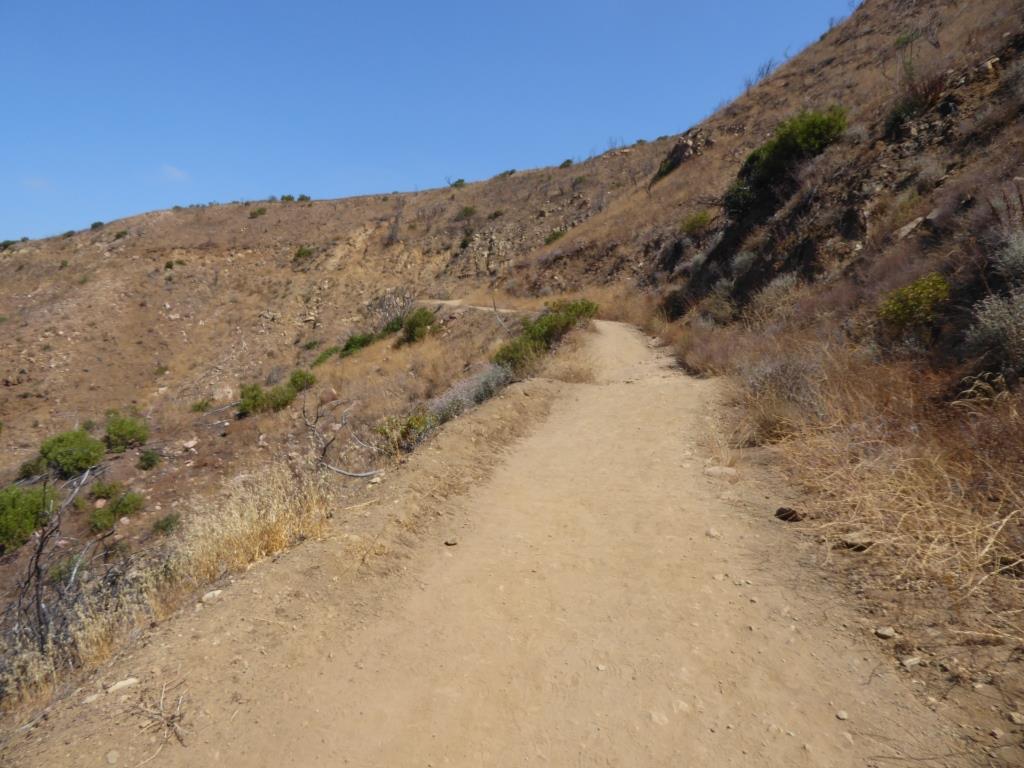
At the west end of Wildwood Neighborhood Park is a trail that will take you into Wildwood Park, and from there, you can either loop around back to the main Wildwood Park trailhead at the west end of Arboles, or turn back the way you came.

Wildwood Neighborhood Park was home to the original Wildwood Fort, built in 1967, but torn down in 2009 due to deterioration. New playground equipment was installed in 2021. There is also a playground across the street at Wildflower Playfield, along with restrooms at both parks. More info at www.crpd.org.

Playground at Wildwood Neighborhood Park

Concert Venues in Ventura County and Adjacent Venues

Looking to attend a concert in the Conejo Valley, greater Ventura County and adjacent areas? Here’s a compilation of such concert venues. For a separate listing of local area restaurant and bars where you can catch live music, visit THIS LINK.

The Bank of America Performing Arts Center (BAPAC) Thousand Oaks is one of the largest performing arts centers between Los Angeles and San Francisco at over 200,000 square feet. Managed by the City of Thousand Oaks, the BAPAC encompasses two theatres – the 1,800-seat Fred Kavli Theatre and the 394-seat Janet and Ray Scherr Forum Theatre. Located at 2100 E. Thousand Oaks Boulevardbapacthousandoaks.com

The Santa Barbara Bowl, located at 1122 N. Milpas Street, Santa Barbara, was originally built in 1936 and today with its capacity of nearly 5,000 people is the largest outdoor amphitheater in Santa Barbara County. www.sbbowl.com

The Majestic Ventura Theatre offers a 1920's Mission Style Architecture ambiance - you can see and feel close to the band from practically anywhere in the theater. All genres of music. 1200 capacity venue with multiple full bars, ballroom and occasional dinner shows. The theater is located at 26 S. Chestnut Ave., Venturawww.venturatheater.net 

Ventura Music Hall is located at 1888 E. Thompson Blvd in Ventura, hosting live music and offering craft food and drinks. www.venturamusichall.com

The Simi Valley Cultural Arts Center is a 220 seat theater at 3050 Los Angeles Avenue that hosts musicals, concerts, exhibits, children's theater and other events year-round.  The theater is a landmark Gothic structure built in the 1920s that was named as Ventura County Historical Landmark #67 in July 1981.  The building has served numerous purposes since inception and became the Cultural Arts Center in November 1995.  www.simi-arts.org

The Oceanview Pavilion located at 575 E. Surfside Drive in Port Hueneme offers concerts, theater, fairs, shows and a variety of other events for all ages.  The venue has a capacity for up to 1400 people and can be rented out for special events. www.oceanviewinfo.com

The Oxnard Performing Arts & Convention Center at 800 Hobson Way has over 1,600 seats in a theater that showcases local theater, dance, music and other programs. www.theopac.org

The High Street Arts Center at 45 E. High Street has been owned by the city of Moorpark since 2005, the theater now provides high quality theatrical performances and concerts at reasonable prices  www.highstreetarts.com

The Lisa Smith Wengler Center for the Arts at Pepperdine University, located on campus at 24255 Pacific Coast Highway, Malibu, showcases musicians, performers and artists from around the world at its Raitt Recital Hall (100 seats), Smothers Theatre (500 seats), Helen E. Lindhurst Theatre and the Frederick R. Weisman Museum of Art. www.arts.pepperdine.edu

The Canyon Club in the Whizin Market Square at 28912 Roadside Drive, Agoura Hills is a live concert venue and supper club that host all types of bands and genres, comedy, special events and more. There are tables if you’re there to enjoy dinner too. Capacity is about 600. wheremusicmeetsthesoul.com/canyon-agoura-hills

Libbey Bowl is located in the heart of Ojai near the corner of Ojai Avenue and Signal Street. It was originally built in 1957 and has been used for the annual Ojai Music Festival, Storytelling Festival, Ojai Day event, holiday celebrations and many other community events through the years. It accommodates 1,300 people. www.libbeybowl.org.

The historic Arlington Theatre is located at 1317 State Street in Santa Barbara. Built in the mission revival style, it seats over 2,000 attendees. thearlingtontheatre.com

Life's a Beach! Public Beaches Spanning From Carpinteria to the Ventura Harbor

Beach_Klotz.jpg

The beaches of Ventura County have something for everyone, be it the sand, the ocean breezes, surfing, volleyball, sunning, picnicking or just chilling out to the sound of the waves. Here we have compiled a listing of beaches just north of Ventura County in Carpinteria down the coast to the Ventura Harbor. Separately we highlight beaches stretching further down the coast through Oxnard, Channel Islands Harbor, Point Mugu and Malibu as well as up the coast in and around Santa Barbara.

The Santa Claus Lane Beach Area in Carpinteria is a south facing beach area popular with surfers, boogie boarders and sunbathers. Get there from the 101 by taking the Padaro Lane exit towards Santa Claus Lane, then taking a left on Santa Claus Lane. You can park in a small dirt area (there's room for maybe 10 cars there) on the ocean side or find street parking, which is plentiful. This is not an "official" beach to my knowledge, as in city or county-run. Just a private beach. No restrooms to my knowledge. Oh yes, you'll have to cross the railroad tracks...so be careful! Down the street is Padaro Beach Village, where you can grab a bite to eat and do a little shopping.

On a separate note, you may be wondering why it is called Santa Claus Lane. Well the old-timers among you (including me) know that a gigantic roadside Santa used to reside here that now greets us off the 101 freeway in the Nyeland Acres section of Oxnard. Learn more about the history at this link.

Surfers, boogie boarders, body surfers and frolickers at the Santa Claus Lane area beach.

Surfers, boogie boarders, body surfers and frolickers at the Santa Claus Lane area beach.

Just down the street is the quaint Padaro Beach Village, where you can grab a coffee, breakfast, lunch, do a little shopping, etc. Very relaxing little area.

Just down the street is the quaint Padaro Beach Village, where you can grab a coffee, breakfast, lunch, do a little shopping, etc. Very relaxing little area.

Carpinteria State Beach is a mile long beach for swimming, surf fishing, tidepool exploring and camping. Dogs are allowed only at the picnic area. The park originally opened in February 1932. There are four campground areas with 216 family campsites and seven group campsites available. Seals and sea lions can be seen in the area December through May, as well as an occasional gray whale. Tidepools contain starfish, sea anemones, crabs, snails, octopi and sea urchins. Exit the 101 at Casitas Pass Road, go west to Carpinteria Avenue, make a right at the signal; then turn left on Palm.  The beach is at the end of Palm Avenue near 4th Street. Call 805.968.1033 or visit www.parks.ca.gov/?page_id=599.

Note: Campfires are only allowed in the campground in fire rings provided. No fires are allowed on the beach.

CarpStateBeach_sign.JPG

Tar Pits Park in Carpinteria provides hiking and biking trails and a few benches, but no other park amenities.  Access to the park is very remote and it is suggested that you enter from the Carpinteria State Beach campgrounds or beach area.  Here you will see tar oozing out of the hills...so watch where you step! The Carpinteria Tar Pits is one of five natural asphalt lake areas in the world! Visit carpinteria.ca.us/parks-and-recreation/park-system for more information. The Carpinteria Harbor Seal Rookery can be reached by following trails east of the park.

Beach view from Tar Pits Park in Carpinteria.

Beach view from Tar Pits Park in Carpinteria.

Carpinteria Bluffs Nature Preserve is 53 acres of open space situated overlooking the Pacific Ocean is a series of walkways, trails and open space for ocean views, whale watching and fresh air. There are restrooms and I believe parking is free. This is not a beach for hanging out on the sand. Visit www.carpinteria.ca.us/parks_rec/park_system.shtml for more information. Take the 101 Freeway to Ballard Avenue and turn towards the ocean.

Rincon Beach Park is near the Ventura/Santa Barbara County line just a few miles east of Carpinteria. Just take the Bates Avenue offramp off the 101 Freeway to the ocean and on the right you'll find plenty of free parking and easy beach access, with picnic tables and restrooms. Just steps to the south of Rincon Beach Park is Rincon Point, known as one of the best surfing spots in the world.

Great photo opps here at Rincon Beach Park :)

Great photo opps here at Rincon Beach Park :)

South of Rincon Beach Park is a newer (premiered September 2014) Class I bike path that takes you through the La Conchita Beach area to Mussel Shoals. La Conchita Beach is low key, with several access points from the La Conchita Bike Path area. You can park at Rincon Point and bike or walk to one of several access points from the path. You can also drive into La Conchita, find a parking spot and take the newer undercrossing that'll get you to the beach by walking under Highway 101.  No restrooms or other facilities to my knowledge at the beach. It’s several miles of beauty, directly adjacent to the 101.

La Conchita Beach

La Conchita Beach

Mussel Shoals is a small beach community in Ventura with around 50 homes. There are about a dozen public parking spots along Old Pacific Coast Highway, paralleling the 101 near the Cliff House Inn. No restrooms. If you go there, perhaps have lunch at the Cliff House Inn and take in the peaceful views, while also checking out man-made Rincon Island.

Mussel Shoals

Mussel Shoals

The beach between Mussel Shoals on the northwest and Seacliff on the southeast is referred to Oil Piers Beach. There used to be piers here until they were taken down in 1998. You get here either via the La Conchita Bike Path or by taking the Seacliff Exit (#78) from Highway 101, then take Pacific Coast Highway northbound to Mobil Pier Road, where you will drive under the 101 to find parking (and if there's no spots available, go back to PCH and you'll find some). No facilities to my knowledge at this beach.

Oil Piers Beach Ventura

Hobson Beach Park is located north of Faria Beach Park and the Rincon Parkway, at 5210 W. Pacific Coast Highway, Ventura. It is managed by the County of Ventura. Day use parking is free but limited. Restrooms available. Limited beach space. Camping and RV spaces are available on a first come, first served basis. CLICK HERE for more info or call 805.654.3951.

Rincon Parkway is located between Faria Beach Park and Hobson Beach Park on Highway 1 off the Ventura Freeway at 5275 Pacific Coast Highway, Ventura. 127 parallel parking spaces are available for RV use only; no camping. All RV's must be fully self-contained units as there are no hookups, utilities, etc. Minimal beach, mostly rocks. Next to a train track. But nonetheless fun to stop by from time to time. No day use parking. CLICK HERE for more info.

Faria Beach Park is located south of Hobson Beach Park is another popular RV/camping spot at 4350 W. Pacific Coast Highway, Ventura. Also managed by the County of Ventura with spots available first come, first served. There are restrooms. No dogs on beach but they are allowed in camping areas. CLICK HERE for more info or call 805.654.3951.

South of Faria Park and north of Solimar Beach is an area referred to as Mondos Beach. We recently rode bikes from the Ventura Pier past this area and saw plenty of families enjoying the sand and the water. There is parallel parking available on the old highway. I believe there are also some porta-johns available.

Mondos Beach area in Ventura, south of Faria, north of Solimar.

Mondos Beach area in Ventura, south of Faria, north of Solimar.

There's a strip of beach along Old Highway 1 between Mondos Beach and Solimar Beach that has parallel parking available, with large rocks separate the street from the beach. I don't know the name of this beach, but it is there, open to the public. There's not a specific street address but it is in the proximity of 3456 Pacific Coast Highway.

Solimar Beach is a strip of beach between Faria and Emma Wood known for surfing, swimming and fishing. Park along Old Highway 1. No facilities. There are about 60 homes along this beach.

Emma Wood State Beach is popular for swimming, surfing and fishing.  The Ventura River estuary is at the mouth of the Ventura River at the southeast end of the park.  It attracts a variety of wildlife including raccoons, songbirds and great blue herons. Dolphins are occasionally seen just offshore. The park also features the crumbling ruins of a World War II coastal artillery site. Emma Wood offers family camping for self-contained vehicles only and group camping is available at Ventura River Group Camp. There are 90 campsites. There is a day use area in the park and beach access is available.  A bike path connects the park to Ventura and to the coast highway to the north. Parking is currently $10. Call 805.968.1033 or visit www.parks.ca.gov/?page_id=604. Directions at this link. Campfires not allowed on the beach.

We noticed a new sign at Emma Wood in the summer of 2015

We noticed a new sign at Emma Wood in the summer of 2015

The Downtown Ventura Promenade beachfront area stretches from Surfers' Point and Promenade Park at Figueroa Street and Shoreline Drive on the north, down the Promenade bike/walk path to the Ventura Pier. This is a popular area with lots of surfers, a cool kids' playground area just north of the pier and plenty of beach with lots of interesting looking rocks. There are several restrooms in the area. Great place to go bike riding with the family. Plenty of parking in the area on the north end. On the south side by the pier you may need to pay for parking at the Crowne Plaza on Harbor Blvd east of California Street or at San Buenaventura State Beach further east.

SurfersPointSign.JPG
VenturaPromenadeRocks.JPG

San Buenaventura State Beach stretches from the Ventura Pier down south past the homes of the Ventura Keys to Marina Park. There are two miles of sandy beach, sand dunes, picnic sites, fairly large parking lot, and the Jolly Oyster. Bike paths connect to other nearby beaches. Wheel Fun Rentals is located near the Ventura Pier if you need a bike. Campfires not allowed at this beach. Main parking lot access point is at San Pedro St and Pierpont Blvd. Additional parking in a lot off of Harbor Blvd north of Sanjon Road. Visit www.parks.ca.gov/?page_id=600 for more information.

Marina Cove Beach is a very popular family spot located at Marina Park, with a newer, small playground area, lots of parking (though weekends can get pretty packed), restrooms and a nice family-friendly beach.. Walk from Marina Park south to Soter Point for picnic areas, mermaid statue and more.

SanBuenaventuraSB.JPG
Fun stone jetty to navigate at the beach adjacent to Marina Park in Ventura.

Fun stone jetty to navigate at the beach adjacent to Marina Park in Ventura.

Harbor Cove Beach is located at the west end of Spinnaker Drive near Ventura Harbor Village and across from the Channel Islands National Park Visitor Center. It is a "still water" beach protected by jetties that is considered one of the safest family friendly beaches in the area (and also referred to as "Mother's Beach"). Restrooms and showers are available and across the street, next to the Visitor Center, is the Harbor Cove Cafe.

Harbor Cove Beach Lifeguard Station

Harbor Cove Beach Lifeguard Station

Surfer's Knoll Beach is located in Ventura adjacent from Ventura Harbor Village and as its name implies, is geared towards surfers, as well as others looking to relax and explore. Riptides are common here so be careful if you're a novice swimmer. There are restrooms and showers but no lifeguards on hand. Free parking!

And there you have it! Let's take a break for now but as mentioned above, beaches stretching further down the coast through Oxnard, Channel Islands Harbor, Point Mugu and Malibu are covered in this separate post!

But wait! Here's a compilation of beaches in the City of Santa Barbara and surrounding areas!

Then and Now: The Dairy Farm at Camarillo State Hospital

In 1932, the State of California purchased 1,760 acres of the Lewis Ranch and built the Camarillo State Mental Hospital, which operated from 1936 to 1997 and at one point treated as many as 7,000 patients in the mid 1950s.

Located on the parcel was a dairy farm that produced crops and housed livestock that fed the hospital community. The farm was disbanded in the 1960s and has been left in a state of disrepair, falling prey over the decades to vandals and coined "Scary Dairy."

Here are some "then and now" photos of the most prominent elements of the dairy farm.

The hay barn at Camarillo State Hospital in the 1940s (CSUCI John Spoor Broome Library historic photo collection)

The hay barn at Camarillo State Hospital in the 1940s (CSUCI John Spoor Broome Library historic photo collection)

The hay barn today.

The hay barn today.

The dairy at Camarillo State Hospital in the mid-1950s. (CSUCI John Spoor Broome Library historic photo collection)

The dairy at Camarillo State Hospital in the mid-1950s. (CSUCI John Spoor Broome Library historic photo collection)

The dairy building today, fenced off, covered with graffiti. 

The dairy building today, fenced off, covered with graffiti. 

Inside the hay barn - undated photo. (CSUCI John Spoor Broome Library historic photo collection)

Inside the hay barn - undated photo. (CSUCI John Spoor Broome Library historic photo collection)

Inside of hay barn - more recently.

Inside of hay barn - more recently.

Hiking to the Waterfall in Pt Mugu State Park from Rancho Sierra Vista/Satwiwa

One of the most popular hikes in the Rancho Sierra Vista/Satwiwa open space in Newbury Park is to a small waterfall in the adjacent Boney Mountain Wilderness. The hike is about 3 1/2 miles round-trip from the Satwiwa Native American Indian Culture Center and is a moderate hike that can be done by all ages.

Keep in mind that in drought years, there’s sometimes not more than a trickle flowing down this waterfall, while in rainier years like 2023-2024, the waterfall is quite active. In either case, it’s a fun hike to do.

You have two primary options for where to start the hike. You can drive into the Rancho Sierra Vista park entrance on Via Goleta in Newbury Park and park in a lot that is a brief walk to the Culture Center, or you can park at the Wendy Drive and Potrero Road trailhead and add an another two miles, round trip, to your adventure.

The entrance to Rancho Sierra Vista/Satwiwa at Via Goleta, 1 mile west of Reino Road.

The entrance to Rancho Sierra Vista/Satwiwa at Via Goleta, 1 mile west of Reino Road.

The trailhead where Wendy Road ends at Potrero Road in Newbury Park

The trailhead where Wendy Road ends at Potrero Road in Newbury Park

The Satwiwa Native American Indian Culture Center is a small building open from 9am to 5pm on weekends where you can learn about native Chumash items and local wildlife.

The Satwiwa Native American Indian Culture Center is a small building open from 9am to 4pm on weekends (as of April 2024) where you can learn about native Chumash items and local wildlife.

Next to the Culture Center, you'll see multiple paths, all of which can get you to your destination, but the most direct path is the Satwiwa Loop Trail seen on the left, which crosses through a meadow that can be quite green and beautiful in late Winter/early Spring and dry and brown the rest of the year. An alternate route is on the right of the picture above - the Big Sycamore Canyon Trail (paved road) to the Boney Mountain Trail, where you'll take a left.

Satwiwa Loop Trail section that takes you diagonally through the meadow. Seen here when it is nice an green.

Satwiwa Loop Trail section that takes you diagonally through the meadow. Seen here when it is nice and green.

At the end of the meadow, continue straight up a fairly steep hill, where on the right hand side you'll see the Sycamore Canyon Overlook bench shown below.

RSVW_sycoverlook.JPG

bench on sycamore canyon overlook

Hike up the moderately steep and rocky path up the hill behind the bench and you'll reach another fork in the road. If you veer left at this juncture you'll be on the Hidden Valley Overlook Trail within Rancho Sierra Vista/Satwiwa. Stay to the right and you'll be entering the Boney Mountain Wilderness area within Point Mugu State Park.

Sign that shows you the Hidden Valley Overlook Trail is on the left.

Sign that shows you the Hidden Valley Overlook Trail is on the left.

Veering right into the State of California managed Pt Mugu State Park; as you can see, dogs are not allowed in the back country area of the park.

Veering right into the State of California managed Pt Mugu State Park; as you can see, dogs are not allowed in the back country area of the park.

This trail is referred to as Danielson Road, named after the last private owner of these lands. The path down into the canyon is seen below (taken from a higher point en route to the Danielson Monument).

View of the initial section of Danielson Road trail down into the canyon; this is the path you will be taking towards the waterfall.

View of the initial section of Danielson Road trail down into the canyon; this is the path you will be taking towards the waterfall.

Danielson Road is a bit on the steep side but I see folks young and old walking up and down this section all the time. Seen here in very dry conditions.

Danielson Road is a bit on the steep side but I see folks young and old walking up and down this section all the time. Seen here in very dry conditions.

RSVW_waterfalltrailsign.JPG

THIS IS THE OLD SIGN, WHEN IT WAS CALLED DANIELSON ROAD (PRIOR TO 2024)

NEW SIGN IN 2024 SHOWING THE “OLD CABIN TRAIL” INSTEAD OF DANIELSON ROAD.

After .4 mile, you will reach the bottom of the canyon and see the sign above, the final sign indicating you are on your way to the Waterfall Trail. Then you will cross a creek bed, which can have water in it after the rains. The photo taken below in January 2015 shows minimal moisture, making it easy to cross. Some years you may have to rock hop your way a bit over the creek.

RSVW_stream.JPG

Creek bed crossing on the way to the waterfall IN 2015

Creek Crossing in April 2024.

After you cross the creek, the remainder of the trail to the waterfall is single track. Be careful not to come in contact with poison oak often seen on the sides of the trails. For this reason, I would generally not recommend strollers be taken up here.

Soon you will reach the final fork in the road. Go straight and soon you will be at the waterfall. To the right, the Old Cabin Trail (formerly Danielson Road Trail) continues upward to the Danielson Monument.

RSVWaterfallFeb17.JPG

the waterfall in april 2024.

Ventura County Historical Landmarks at the Strathearn Historical Park in Simi Valley

Located at 137 Strathearn Place, Simi Valley, the six acre Strathearn Historical Park and Museum site contains no less than six designated Ventura County Historical Landmarks.

Originally from Scotland, the Strathearn Family purchased 15,000 acres of old Spanish Rancho from Simi Land and Water Co. around 1890.

The Simi Adobe/Strathearn House is Ventura County Historical Landmark No. 6, State Landmark No. 979 and is also listed on the National Register of Historic Places.  The Simi Adobe was originally built by Santiago Pico, original grantee of El Rancho Simi, in 1810. The Adobe was considered an important link between the San Fernando and Ventura missions.

The Strathearn House (built in 1892-3) includes the Simi Adobe (built in 1810)

After buying the property, the Strathearns built their nine-room Victorian-style farmhouse and kept two usable rooms of the adobe that were used as a dining room and kitchen. The Strathearn family occupied the house until 1968.

Built in 1930, the original Simi Library was located on Third Street near Los Angeles Avenue. Members of the community raised funds to purchase land and asked the Ventura County Library System to build this first purpose-built branch library in the county. It operated until 1962, when a new library opened on Church Street in the Community Center. The Simi Library briefly served as the first Simi Valley Museum until Strathearn Historical Park opened in 1969. The Library was designated Ventura County Historical Landmark No. 40 in May 1978. (More recently, in the Simi Valley Public Library became a separate municipal public library on July 1, 2013.)

The Haigh/Talley Colony House was designated Ventura County Historical Landmark No. 41 in May 1978 and was named to the National Register of Historic Places that same year. It is one of 12 pre-cut, partially assembled two-story homes shipped by rail in 1888 to the townsite of "Simiopolis" (this was just for six months; it was later

Read More

Highlights of a Dozen Fun Things to See and Do In and Around Camarillo

Residents voted to incorporate Camarillo as a city on September 29, 1964 (the same day that Thousand Oaks residents voted to do the same). Today Camarillo has the 5th largest population out of 10 cities in Ventura County, with about 71,000 residents.

One neat feature of Camarillo is its revitalized Old Town on Ventura Boulevard, a one mile stretch adjacent to Highway 101 between Lewis Road and Carmen Drive. There is a mixture of eateries, galleries, salons, boutiques and shopping along the pedestrian friendly thoroughfare that has transformed the area. Parking is free. More at www.facebook.com/camarillooldtown.

Here are a dozen other fun things to explore, see and do in Camarillo:

The roughly 2 mile Calleguas Creek Bike Path from Pleasant Valley Fields to the corner of Flynn and Upland Road in Camarillo is a family favorite, providing 4 miles of bicycling round-trip. The path is adjacent to Calleguas Creek with several street underpasses, keeping the path completely free of vehicular traffic.

Calleugas Creek Bike Path

Calleugas Creek Bike Path

McGrath Family Farm off the Central Avenue 101 offramp grows organic fruits, vegetables and flowers and is open 7 days a week from spring through fall. McGrath also offers farm tours, visits with the farm animals and "pick your own" produce. A quick, healthy and fun stop with the kids.

McGrathProduce9.9.12.jpg
CAF170.jpg

The Commemorative Air Force Southern California Wing Aviation Museum is open Friday through Sunday at the Camarillo Airport with hangars devoted to preserving, displaying and flying World War II aircraft. Docents are extremely knowledgeable and eager to share information.  This is a Camarillo must-see.

Also at the Camarillo Airport is the annual Wings Over Camarillo Air Show in the August time frame. This is a weekend display of restored World War II military aircraft in flight, aerobatic, vintage and experimental aircraft displays, classic cars and plenty of family fun. This is one event in Camarillo that you have to see up close at least once. Visit wingsovercamarillo.com for more information.

The Camarillo Ranch House is a 3-story, 14 room, 6,000 square foot Victorian home built by Adolfo Camarillo in 1892. The City restored the beautiful home to what it looked like during the 1914 to 1930 time frame. Today the house is a popular event venue and is open for docent-led tours several days a week. The Camarillo Ranch was added to the National Register of Historic Places in 2003.

The Camarillo Ranch House is a popular wedding and other special events destination.

The Camarillo Ranch House is a popular wedding and other special events destination.

I'm amazed at how few of the people I talk to have heard of the Western Foundation of Vertebrate Zoology, more popularly known as the Camarillo Bird Museum. The 22,000 sq ft non-descript facility in an industrial office park hosts a collection of over 250,000 sets of bird eggs representing approximately 4,000 species; 18,000 nests and 56,000 bird study skins. The Museum is open to the public for one-hour tours on Wednesdays and Fridays from 10am to 2pm.

CamBirdMuseumLR.jpg
CamPremOutlets170.jpg

The Camarillo Premium Outlets is Ventura County's premiere outlet mall, featuring over 160 shops and eateries. On the east side are the original outlets, including the Main Court and Fashion Court, while on the west is the newer The Promenade section. In between is the Edwards Camarillo Palace 12.

Harley's Camarillo Bowl is the go-to spot for most kids that I know in the Conejo Valley who throw bowling birthday parties. I know because when the kids go bowling, I make sure to join them. Harley's gets the job done with 20 lanes, a small arcade, and a bar that serves up cold beer.

There are dozens of great farmers' markets around Ventura County, including the Saturday morning Camarillo Certified Farmers Market in Old Town Camarillo from 8am to noon.

There are a number of nicely appointed parks of all shapes and sizes in Camarillo, including six larger parks. One of my favorites is the hidden away Camarillo Grove Park at the bottom of the Conejo Grade, 6968 E. Camarillo Springs Road. This 24.5 acre park offers hiking trails, a dog park, outdoor nature center and more.

A trail at Camarillo Grove Park

A trail at Camarillo Grove Park

The Pleasant Valley Historical Museum is dedicated to the preservation of local history and the adjoining Charles L. Honn Botanical Garden features plants and trees indigenous to the Pleasant Valley and the surrounding region. Both are fun, short, worthwhile visits, which is good because the Museum and Garden are only open from noon to 4:00 p.m. on Saturday and Sunday, except holidays. Admission is free. (MUSEUM IS UNDERGOING EXPANSION AND IS STILL CLOSED AS OF JUNE 2024. Check their website for updates at pvhsonline.org.