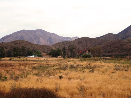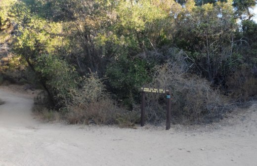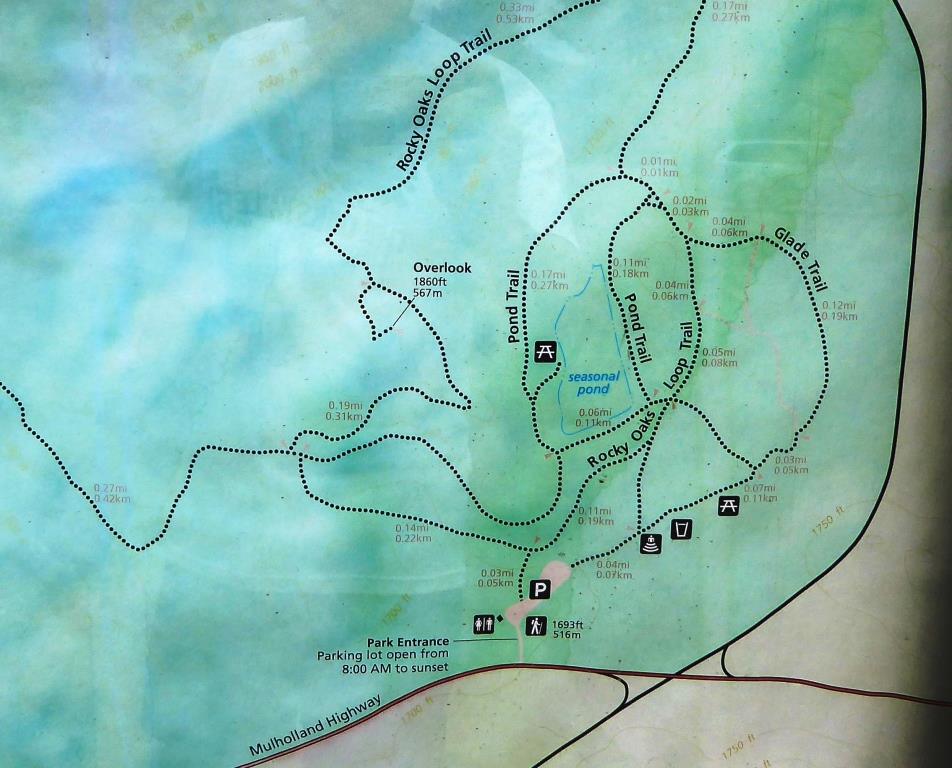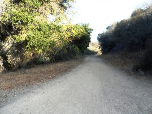
La Jolla Canyon Loop Trail in Point Mugu State Park in Malibu

Point Mugu State Park is at western edge of the Santa Monica Mountains National Recreation Area, stretching from Newbury Park on the north to five miles of oceanfront. The Chumash Trail is the westernmost trailhead in Point Mugu State Park which in turn gets you to the La Jolla Valley Natural Preserve area (which also can be accessed from the Ray Miller Trail, about two miles southwest of the Chumash Trail trailhead).

The Chumash Trail trailhead is accessible off of PCH, about 2 1/2 miles from where Las Posas Road connects to PCH in Camarillo, and about 10 miles from the intersection of Las Posas Road and Highway 101.  It is across the street (PCH) from a Naval Base Ventura County training range. Look for the left turn into a small dirt parking area that has space for perhaps 15 or so cars.

The Chumash Trail is an initial, quite steep and technically challenging .7 mile climb, to a juncture where you either turn right to the Mugu Peak Trail (MORE AT THIS LINK). If you turn left (north), continue another half mile until you reach the La Jolla Valley Loop Trail.

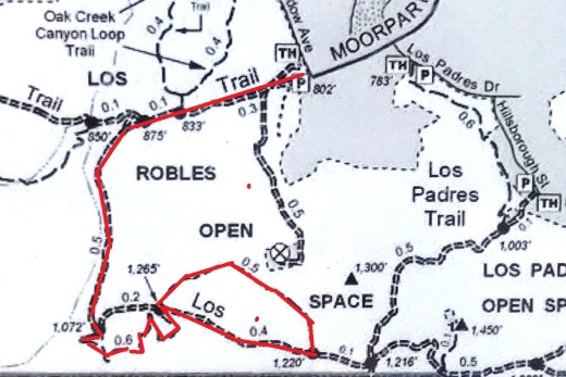
Map snippet courtesy of California State Parks

Map snippet courtesy of California State Parks

The La Jolla Valley was acquired by the State of California in 1966 as part of Point Mugu State Park and was established as Natural Preserve in 1972. 

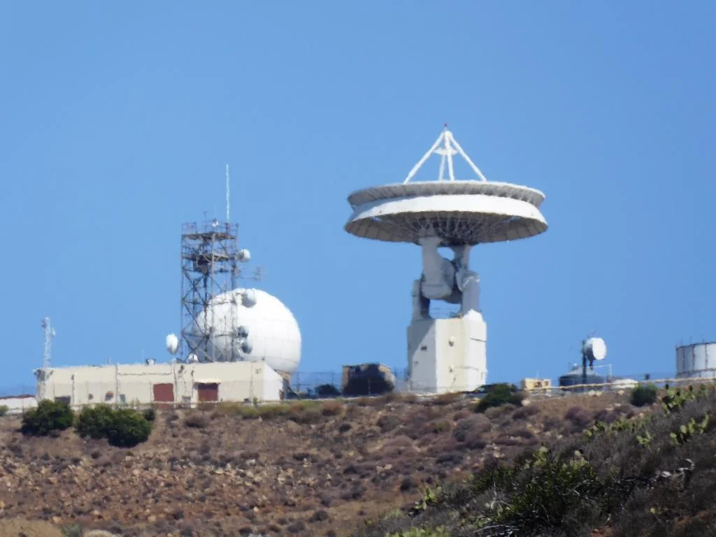
One thing I find of particular visual interest on the La Jolla Canyon Loop Trail is the Naval Base Ventura County satellite tracking station situated at the top of nearby Laguna Peak. 

One thing I find of particular visual interest on the La Jolla Canyon Loop Trail is the Naval Base Ventura County satellite tracking station situated at the top of nearby Laguna Peak. 

View of the Boney Mountain Range up ahead from within the La Jolla Valley Natural Preserve. This is such a peaceful grasslands area back here. Most folks go for the ocean trails, leaving this area a bit less utilized.
View of the Boney Mountain Range up ahead from within the La Jolla Valley Natural Preserve. This is such a peaceful grasslands area back here. Most folks go for the ocean trails, leaving this area a bit less utilized.

When I look up at the tracking station, The Jetsons come to mind.

When I look up at the tracking station, The Jetsons come to mind.

Another 1 1/2 miles of hiking on the La Jolla Valley Loop Trail gets you to a small campground area with as I recall, 3 or 4 campsites accompanied by picnic tables, a vault toilet, but no water. No campfires allowed out here in the back country either. Although these appear to be rarely used, the only problem coming in from the Chumash Trail instead of the Ray Miller Trail (and La Jolla Canyon Trail) area is that you must pay for the campsite at the Ray Miller Trail area. Thus, if you do plan to stay at these back country campsites, keep that in mind and pay first.

You will pass by this sign on your way towards the campground if you want to take a shorter loop.

You will pass by this sign on your way towards the campground if you want to take a shorter loop.

Here is where the La Jolla Valley Trail Campsites are, marked by the vault toilet up ahead. I don't get back here very often and when I do, I see no one. But I did notice there was TP in the room, which is good for those in need.

Here is where the La Jolla Valley Trail Campsites are, marked by the vault toilet up ahead. I don't get back here very often and when I do, I see no one. But I did notice there was TP in the room, which is good for those in need.

You're definitely in the back country back here, though in reality you are only 2.7 miles from the Pacific Ocean.

You're definitely in the back country back here, though in reality you are only 2.7 miles from the Pacific Ocean.

That said, the La Jolla Canyon Trail (not to be confused with the La Jolla Canyon LOOP Trail) has been closed since January 2015 because of mudslides that made that particular trail too dangerous to use. Confused? Yes, this can be confusing. Bottom line is that you pay for the camping at the La Jolla Canyon/Ray Miller Trailhead area but access the camping from either the Chumash Trail, or a longer route via the Ray Miller Trail.

So after you reach the campground area, you can either head back the way you came, or take the loop back around to the Mugu Peak Trail, where you will be treated to views, views and more views. Or hike to the top of Mugu Peak for the best views of all.
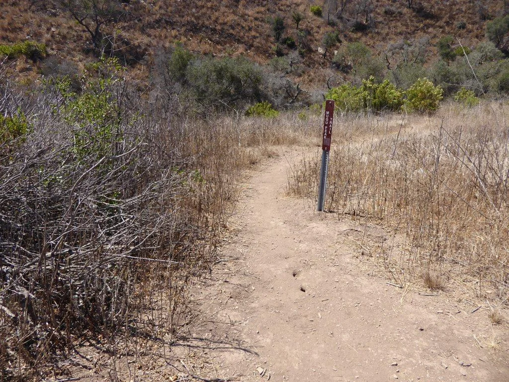
This Mugu Peak Trail sign is located near the south end of the Loop Trail.

This Mugu Peak Trail sign is located near the south end of the Loop Trail.

Gondola Paradiso at Channel Islands Harbor

GondolaParadiso.jpg

Founded in January 2014, Gondola Paradiso provides luxury Venetian-style cruises through the canals of the Channel Islands Harbor in Oxnard.

Cruises leave from Seabridge Marina, located off South Victoria Avenue at the Channel Islands Harbor, 1301 S. Victoria Avenue, Oxnard. To book a cruise, call (805) 612-4475 and for more information visit www.gondolaparadiso.com.

gondolo1.jpg

Happy Camp Canyon Regional Park in Moorpark

Happy Camp Canyon Regional Park in Moorpark is a 3,000 acre wilderness area with 12 1/2 miles of trails maintained by the Santa Monica Mountains Conservancy. I've hiked back here from time to time and rarely see anyone in these quiet canyons!

HappyCamp_GolfCourse.JPG

There are a couple entry points to Happy Camp Canyon. The one shown above is adjacent to Rustic Canyon Golf Course, 15100 Happy Camp Canyon Road, Moorpark. The other main entry point shown below is at 14105 Broadway Avenue, Moorpark. Park here and hike to the canyon entrance point.

HappyCamp_CanyonEntrance.JPG

If you're looking for relatively flat trails well suited for comfortable hiking, mountain biking and horse riding, Happy Camp Canyon is a good choice.

You can take the main Happy Camp Canyon Fire Road for quite a ways and either head back the way you came or take the more strenuous Middle Range Fire Road back and catch some great views. I veered north up a steep maintenance road to some power lines shown below.

HappyCampPowerLines.JPG

Or try the 8 mile, strenuous, South Ridge Loop (via the Middle Ridge Fire Road). Begin at the canyon gate; about 100 yards beyond, turn right and follow a dirt road up to the ridge top. Continue east along the Big Mountain Ridge to a junction, enjoying views on your right of Moorpark, Simi Valley, the Santa Monica Mountains, and all the way to the Channel Islands. At the junction, turn north and drop down into Happy Camp Canyon. When you reach an old corral (and picnic area), turn west and walk back to the entrance gate on Happy Camp Canyon Fire Road (in the canyon bottom), approximately four miles. 

There is no cost for parking here. For more information, visit mrca.ca.gov/parks/park-listing/happy-camp-canyon-regional-park.

NOTE: Because of sensitive habitat, dogs are not allowed past the entrance gate.

It greens (and purples) up quite nicely after the winter rains in Happy Camp. March/April/May are the months to check it out.

It greens (and purples) up quite nicely after the winter rains in Happy Camp. March/April/May are the months to check it out.

CSU Channel Islands University Park in Camarillo

CSU Channel Islands University Park is a 367 acre parcel located adjacent to CSU Channel Islands off of S. Lewis Road in Camarillo. It is a regional educational and recreation area owned and operated by California State University Channel Islands.

CSUCIPark_sign.JPG

The park is open to the public daily from sunrise to sunset. Do note that there are no facilities at this park, like restrooms and drinking fountains. You can walk, hike, run, bike, etc. and perhaps come across some wildlife.

Disbanded dairy farm in the distance at CSU Channel Islands University Park

Disbanded dairy farm in the distance at CSU Channel Islands University Park

One item of historical interest at the park is the "Scary Dairy," a dairy farm located on the parcel that closed in the 1960s and was disbanded and subsequently vandalized and graffittied upon over the decades.

"Scary Dairy"

"Scary Dairy"

From Camarillo, take Lewis Road south to Camarillo Street and turn left (east).  Cross the bridge over Calleguas Creek and the entrance is on the left. Parking is $6 per vehicle (as of April 2019). Visit www.csuci.edu/cipark for more information.

Bring cash to pay for parking at entrance.

Bring cash to pay for parking at entrance.

CSUCI Park Barn.JPG

California ScienCenter - Exposition Park

CalScienceCenterFront.JPG

My kids and I visit California ScienCenter in Exposition Park from time to time, roughly a 1 hour drive from Thousand Oaks. It is worth the drive. The ScienCenter is built in the location where the first State Exposition Building that opened in 1912.  The redeveloped building is modern and beautiful, with several floors of scientific exhibits of interest to all ages, including Ecosystems, Creative World, World of Life, Air and Space and Science Court. Entrance to the museum is FREE, although donations are greatly appreciated.  Parking is $12 (as of December 2017).

The "World of Life" exhibit on the third floor is a perennial favorite in our family, where we get to see everything from brains and lungs to live cockroaches, termites and animals. There's also a kids' "Discovery Room" with additional fun activities for the younger one.

CalScienceCenter_Aircraft.JPG

If you have more time and energy on your trip to Exposition Park, visit the adjacent Natural History Museum of Los Angeles County and the California African American Museum as well as the Exposition Park Rose Garden (where they have 16,000 or so rose plants).

California ScienCenter is located at 700 State Drive at the corner of S. Figueroa and 39th Street in Exposition Park.  Visit www.californiasciencenter.org or call 323.SCIENCE (724.3623) for more information.

NOTE: AS OF APRIL 2021, TIMED-ENTRY RESERVATIONS ARE REQUIRED. THERE IS A $3 SERVICE FEE. SEE californiasciencecenter.org/visit/get-reservations-tickets.

The Space Shuttle Endeavor went on a flyover trip to the West Coast atop a Boeing 747 on Friday, September 21, 2012. The Endeavor completed 25 successful space missions between its first mission on May 7, 1992 and its final mission in May 2012 to the International Space Station, now resides at the ScienCenter in the Samuel Oschin Pavilion.

SpaceShuttleEndeavor.jpg

NASA named California ScienCenter one of only three museums in the U.S. to permanently exhibit a retired space shuttle.  We have visited the Endeavor and the exhibit is extraordinarily impressive. Learn more about the Endeavor at californiasciencecenter.org/exhibits/endeavour-experience/space-shuttle-endeavour.

EndeavorCSC.JPG

Los Robles Trail West "Space Mountain"

"Space Mountain" is not the "official" name of the Los Robles Trail heading west from the South Moorpark Road and Greenmeadow Avenue in Thousand Oaks trail access point but this mostly single track trail was affectionately named after the Disneyland ride due to its switchbacks and twists and turns to the top, where you will be rewarded with outstanding views of the Conejo Valley and beyond. These trails are particularly popular with mountain bikers who enjoy the rocky, single track trails, as well as hikers and runners.

From the main trailhead, go west just under 1/2 mile and you'll see the fork in the road where you can go east or west. Go west, young man (or woman).

LosRoblesTrail_EastWestSign.JPG

After making your way up the hill to the right, you'll go down a hill to another fork in the road, where you can either veer slightly right to to the Spring Canyon Trail, which takes you about a mile to the Ventu Park area of Newbury Park. Veer to the left to continue on the Los Robles Trail West.

LosRobles_SpringCynSign.JPG

Only 4.7 miles from this juncture is the Rancho Sierra Vista/Satwiwa National Park area in Newbury Park. Some challenging miles for sure, but fun!

LosRoblesTrail_JunctureSign.JPG

This section of the Los Robles Trail is mostly single track although some sections you can walk two-wide (though you'd best not do so, as there are many mountain bikes on these trails). Good to be aware of others on the trail.

I've attempted from time to time to count the number of switchbacks on my way up to the top of Space Mountain and back down and come up with something in the neighborhood of 8 to 10 of them. This is not a stroller friendly trail as it is steep, with plenty or rocks jutting out. An easy trail to twist your ankle if you're not careful.

A photo of a section of the Los Robles Trail West up Space Mountain.

A photo of a section of the Los Robles Trail West up Space Mountain.

It is roughly 3 miles to the top, where you will find one bench directly on the trail, facing a very short path to a viewing area with another bench.

Bench on the trail at the top of "Space Mountain" on the Los Robles Trail.
Bench on the trail at the top of "Space Mountain" on the Los Robles Trail.

The viewing bench at the very top of Space Mountain.

The viewing bench at the very top of Space Mountain.

All told, this is roughly about 3.5 miles each way, or 7 miles round trip.

Los Robles Trail sign at the top of Space Mountain.

Los Robles Trail sign at the top of Space Mountain.

Views from the top of Space Mountain looking west toward the Conejo Grade.

And as mentioned above, you can continue west on the Los Robles Trail west into Newbury Park. Portions of the trail go through privately owned land, which the owner has generously made available for public trail access...so be sure to treat the trail with respect!

LosRoblesWest_PrivPropSign.JPG

And last but not least, a view of the single track trail heading towards Newbury Park, where you will eventually connect with the Angel Vista Peak trail.

Single track with awesome, continuous views as you continue west into Newbury Park.

Single track with awesome, continuous views as you continue west into Newbury Park.

Rocky Oaks Nature Reserve in the Malibu Hills

RockyOaks_sign.JPG

Rocky Oaks is a 250 acre nature reserve that is part of the Santa Monica Mountains Recreation Area, located at the 31500 block of Mulholland Highway in Malibu, west of Kanan Road. The entrance is on the north side of Mulholland Highway. The park is managed by the National Park Service.

RockyOaksLoopTrail.JPG

Rocky Oaks has various species of oak trees, some centuries old. The Overlook Trail takes you to a peak with gorgeous panoramic views while the Pond Trail (less than a mile round trip) takes you to a seasonal pond area which used to be part of a cattle ranch.

The Rocky Oaks Loop Trail is a 2.2 mile easy trail that is lined with sage. This is one of the more low key, easy to hike areas around town. It can get hot but at only 6 miles from PCH you can also feel some nice ocean breezes in these trails.

Learn more about Rocky Oaks and download a trail map at www.nps.gov/samo/planyourvisit/rockyoaks.htm.

Pond is looking quite nice in late spring of 2017.

Pond is looking quite nice in late spring of 2017.

RockyOaks_2.JPG

Los Robles Trail East in Thousand Oaks

The Los Robles Trail East in Thousand Oaks is accessible from the Los Robles Trail trailhead heading west from the corner of South Moorpark Road and Greenmeadow Avenue in Thousand Oaks.

LosRoblesTrail_SignMain.JPG

From the main trailhead, go west just under 1/2 mile and you'll see the fork in the road where you can go east or west. Head south (click here if you prefer going west) where you'll go towards the Los Robles Trail East.

A gradual uphill of about 1/2 mile on a wide fire road trail takes you to a picnic bench and then a more winding, partially shaded, narrower, eastbound section of trail.

Fire road that takes you to picnic bench.

Fire road that takes you to picnic bench.

Picnic bench at juncture of fire road and narrower, steeper Los Robles Trail East.

Picnic bench at juncture of fire road and narrower, steeper Los Robles Trail East.

LosRoblesTrail_MapEast.jpg

Another .6 mile gets you to a hill where you'll soon be treated to a reward for your hiking effort...a bench with a view of the Conejo Valley.

Los Robles Trail East near hilltop viewpoint with bench.

Los Robles Trail East near hilltop viewpoint with bench.

And the bench at the top. Nice view of the Conejo Valley, eh?

And the bench at the top. Nice view of the Conejo Valley, eh?

And the trail loops around with another bench on the other side of the trail looking south towards Hidden Valley.

Bench facing south.

Bench facing south.

The trail loops back around towards the main Los Robles Trail, where you can head back west again from where you came from, or head east towards the northern tip of the Los Padres Trail or stretch further east towards the Triunfo Canyon Trail and White Horse Canyon Trail.

Now go on, take a hike!

MB2 Raceway - Indoor Go Kart Facility in Thousand Oaks (CLOSED)

MB2 announced in February 2021 that it will no longer operate at 1475 Lawrence Drive in Newbury Park and that it will be relocating to Janss Marketplace in Thousand Oaks. It is now August 2023 and there have been no updates.

mb2raceway.jpg

MB2 Raceway opened a 60,000 square foot indoor kart racing facility at 1475 Lawrence Drive in Newbury Park in September 2008.

Established in 2006 in Sylmar, MB2 provides high performance indoor kart racing and related entertainment. MB2 fuses professionally designed ¼ mile road race circuits, high performance emissions free Italian (go) karts and a unique motor sports aesthetic theme, which together forms the successful consumer racing enterprise. MB2 regularly hosts professional drivers, leading action sports athletes, racing tournaments and private events.

The Newbury Park facility is really large and there's plenty of space to move around. Between races you can roam around, watch other racers, play pool, air hockey and arcade games or just hang out with your friends. Plenty of action and really lots of fun! Even if you're not really speedy in the karts, they are fun to try and the staff ensures that races are safe.

There are four rooms for birthday parties and corporate events. Several of the rooms are quite large.

MB2 is very popular for kids' parties. Kids need to be at least 48 inches tall to ride in the smaller kids' karts. My son had his 8th birthday party at MB2! A majority of the kids were trying it for the first time and they all had a blast.

Buy an Arrive & Drive single 14 lap race or an annual Track Pass membership that offers discounted race specials, free birthday racing and more.

For more information visit www.mb2raceway.com or call 805.214.9999. Open 7 days a week. Information specific to the Thousand Oaks/Newbury Park location at mb2raceway.com/locations/thousand-oaks.

MB2PreRace.jpg
MB2Kids.JPG
MB2Arcade.JPG
MB2Room.JPG

Los Padres Trail in Thousand Oaks

LosPadresTrail_trailhead.JPG

The Los Padres Trail is a short, 1 mile, neat little trail accessed on Los Padres Drive, near the corner of Fox Hills Drive in Thousand Oaks. Take Moorpark Road south of the 101 freeway and turn left on Los Padres Drive. The trailhead is clearly marked on the right hand side, The trail is maintained by the Conejo Open Space Foundation.

Surrounded by trees in the first section of the Los Padres Trail.

Surrounded by trees in the first section of the Los Padres Trail.

Short but sweet, the trail is.canopied by trees, several bridges, mostly single track trail and a bit of a climb (750 feet) as you make your way up to the Los Robles Trail junction. That's about a mile, so you can turn around there for a 2 mile round trip hike.

Where the Los Padres Trail meets the Los Robles Trail.

Where the Los Padres Trail meets the Los Robles Trail.

Or...you can turn right (west) and head your way up the wide, fire road sized section of the Los Robles Trail east. This is a bit of a climb, but pretty moderate and gradual. Crest the hill and you'll see a gate.

The Los Padres Trail is winding, uphill and wide in this section.

The Los Padres Trail is winding, uphill and wide in this section.

Before the gate, you can turn left (east) and in 3 miles you're at Triunfo Park in the Los Padres Open Space via the Triunfo Canyon Trail. Or turn right (west) and you're off into the Los Robles Open Space. If you go straight ahead, you’ll reach a gate to Hidden Valley private property.

LosRoblesTrail_Triunfo.JPG
Gate at top of trail. Private property in Hidden Valley ahead.

Gate at top of trail. Private property in Hidden Valley ahead.

Marview Drive Trail in Thousand Oaks

Marview Drive Trail Trailhead in Thousand Oaks

Marview Drive Trail Trailhead in Thousand Oaks

If you're looking for a short, steep and sweet trail to hike up and down in Thousand Oaks, check out the trail on Marview Drive, just east of the entrance to Old Meadows Park at 1600 Marview Drive. Take Erbes Road and go west on Marview. After passing the residential section of the road, up ahead is Old Meadows Park and on the right is plenty of street parking across from the trailhead.

MarviewTrail_steep.jpg

Short it definitely is. Only about a quarter of a mile to the top of the hill, but it will take you a bit longer than your typical hike because it is so steep, at least the first section.

MarviewTrail.JPG

Then toward the top it starts to flatten out, where you will discover panoramic views of the Conejo Valley. There's also quite a clear view of the 23 Freeway from up here!

Marview_23fwy.JPG

At the top of the trail is a large, enclosed square fenced in with No Trespassing signs all over the place. This is a water tank. But you can walk around the area to the other side, where there's actually a trail and walkway that goes down to the St. Patrick’s Episcopal Church.

So there you have it! A short, steep, but sweet little trail in the heart of Thousand Oaks!

Color Me Mine Thousand Oaks (CLOSED)

CLOSED IN APRIL 2022

ColorMeMine.jpg

Color Me Mine is a ceramic painting studio where you drop by anytime and select from over 400 ceramic pieces to design and paint. . For the price of a studio fee and the item you choose to paint, you can paint all day using 60+ colors and supplies! They glaze and fire your work in a kiln and your work of art will be available in 5 to 7 days.

The Thousand Oaks Color Me Mine location is at the Paseo Market Square in Thousand Oaks at 3707 E. Thousand Oaks Boulevard, near The Melting Pot.

More information at thousandoaks.colormemine.com.

Creative Castle in Newbury Park (CLOSED IN SEPTEMBER 2021)

CREATIVE CASTLE CLOSED ITS STORE IN SEPTEMBER 2021, AFTER 32 YEARS IN BUSINESS.

Located at 2323 Michael Drive in Newbury Park, Creative Castle is a full service retail bead store with a full line of beads and beading products. Classes, private sessions and special events like trunk shows also offered. Currently (March 2021) open Tuesday and Sundays from 11am to 4pm. Visit www.creativecastle.com or call 805.499.1377 for more information.

I stopped by on a Saturday morning to check out the shop. My jaw dropped when I saw how many different types of beads and decorative items packed the store. There was a large room in the back completely full of folks beading together. Looked like a lot of fun.

Not being a "beader" myself, I asked if I could bring the kids in and create something for mom, getting help as we go. The answer was, of course we can. There were several nice employees ready to help us out.