Seven Flat, Stroller and Family Friendly Hikes in the Conejo Valley

There is a ring of about 15,000 acres of open space with 140 miles of trails for public use surrounding the Conejo Valley. All too often on the Conejo Valley Guide Facebook Page we hear requests for which trails are "stroller friendly" and/or suitable for young children. Here is a sampling of some of the more popular ones in the area.

Wildwood Park to many is the single greatest spot for family hikes and stroller-friendly trails. With 14 trails covering 17 miles, including the popular hike to Paradise Falls and the teepee as well as some wide, relatively flat sections along the Mesa Trail towards Lizard Rock.

It takes a bit of driving via the Norwegian Grade and Santa Rosa Road to get there, but the Conejo Canyons Open Space in the Western Plateau section of the Conejo Open Space leads to several miles of nice, flat, well-maintained family-friendly trails leading to tree-canopied picnic areas. The Hill Canyon Trail and Hawk Canyon Trail are very easy to navigate.

Shaded picnic area off the Hawk Canyon Trail from the Conejo Canyons Bridge.

Shaded picnic area off the Hawk Canyon Trail from the Conejo Canyons Bridge.

The one mile Spring Canyon Trail is a mostly flat trail that runs from Lynn Oaks Park, 359 Capitan Street, Newbury Park to the Los Robles Trail.  There are some moderate hills but with the park nearby, this makes for a fun little excursion with the little ones. (No restrooms, however.)

The main access point to the Los Robles Trail at the southern endpoint of Moorpark Road at Greenmeadow Ave starts out with a reasonably flat section that is a nice, easy family stroll.

Speaking of the Los Robles Trail, another great little hike to take with the kids is the Oak Creek Canyon Loop Trail. The first 4/10th of a mile of the trail, accessible off of Greenmeadow Avenue in Thousand Oaks, is the Oak Creek Canyon Whole Access Interpretive Trail. This is a nice, shady, flat trail with benches and picnic benches along the path. The remainder of the loop is not quite as stroller friendly, with a couple moderately steep sections that can be navigated on foot.

Picnic trails and shade abound at the Oak Creek Canyon Interpretative Trail.

Picnic trails and shade abound at the Oak Creek Canyon Interpretative Trail.

The Rancho Sierra Vista/Satwiwa area managed by the National Park Service in Newbury Park has several miles of trails to explore, most of which are flat and stroller-friendly. The Satwiwa Loop Trail takes you around the area and the Satwiwa Native American Indian Culture Center makes for a fun stop with the family when open on weekends.

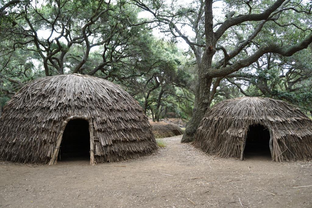
The Chumash home, or “‘Ap,” in the background. The one pictured has since been replaced.

The Chumash home, or “‘Ap,” in the background. The one pictured has since been replaced.

Cheeseboro/Palo Comado Canyons offer great family hiking opportunities. While there's definitely hills surrounding these canyons, try the Cheeseboro Canyon Trail, the 4 to 5 mile main artery into the park. Flat and kid/stroller friendly it is. Also try the Doubletree Trailhead connector to the Palo Comado Trail. Flat, fun and scenic.

The Los Padres Trail in Thousand Oaks is a short trail, half of which is pretty flat and tree lined, if you’re looking for a short excursion with a toddler. A seasonal creek makes it even more interesting as you may hear froggies in the spring.

PaloComadoSign.JPG

Although the trails in the Lang Ranch/Woodridge Open Space in Thousand Oaks are NOT FLAT and indeed quite HILLY, they are worth checking out with the kids because they wide and have some interesting sandstone rock formations. If you are really strong, strollers are possible here, but do know that you will encounter some hills like the hill shown in the image below.
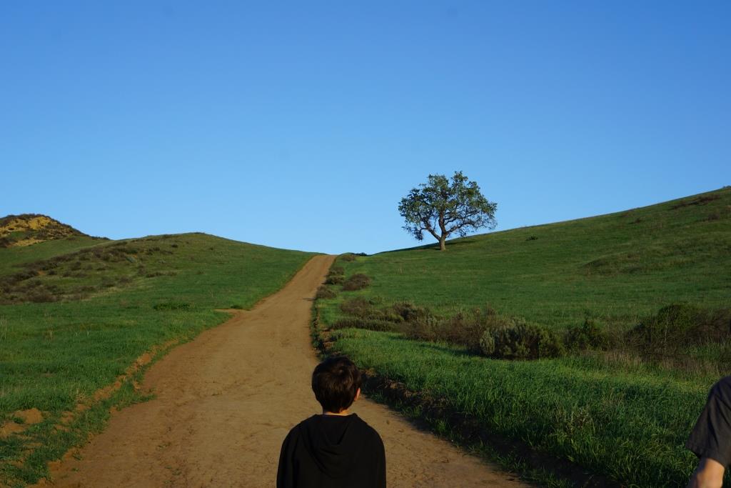
This hill in the Lang Ranch/Woodridge Open Space at the Autumn Ridge Trail is a bit daunting but worth the climb.

This hill in the Lang Ranch/Woodridge Open Space at the Autumn Ridge Trail is a bit daunting but worth the climb.

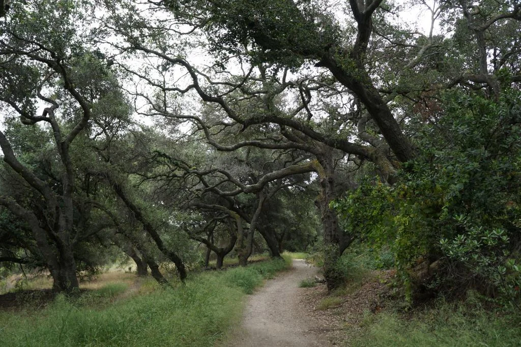
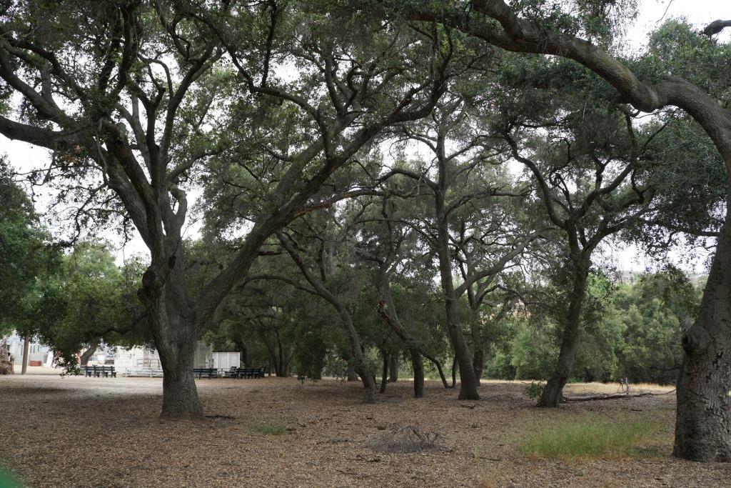
We're going to throw a bonus trail into the mix. The several miles of hiking trails in the Oakbrook Regional Park Archaeological Area in Thousand Oaks is an outstanding place for a flat, picturesque and oak-tree canopied place for a short hike with the kids.

For a more comprehensive compilation of trails in the Conejo Valley and throughout Ventura County, visit THIS LINK.
Hike to the Teepee, Paradise Falls and Little Cave at Wildwood Park in Thousand Oaks

One hiking experience that everyone in the Conejo Valley and neighboring areas has to experience is Wildwood Park. With 14 trails covering 17 miles in the nearly 1,800 acre park managed by the Conejo Open Space Conservation Agency, there is plenty to see and do in Wildwood Park.
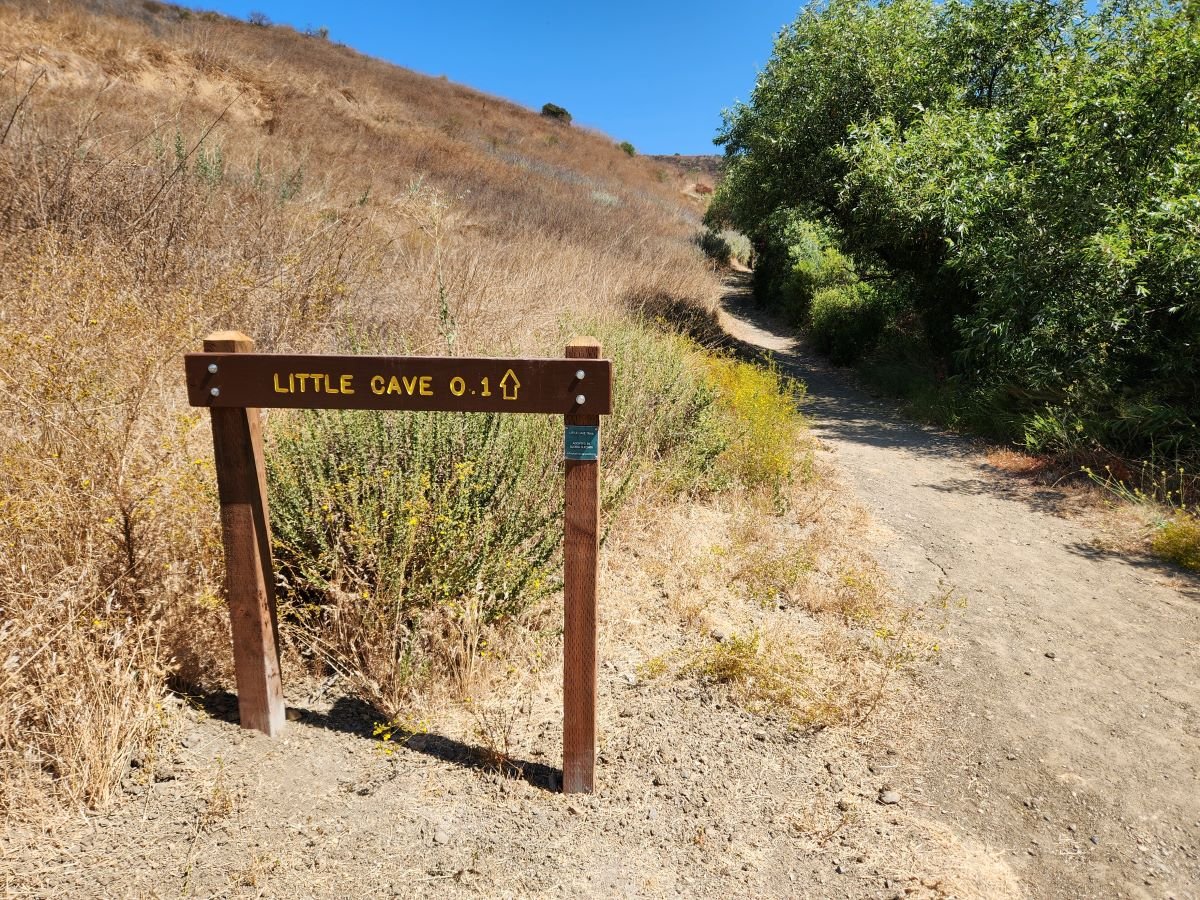
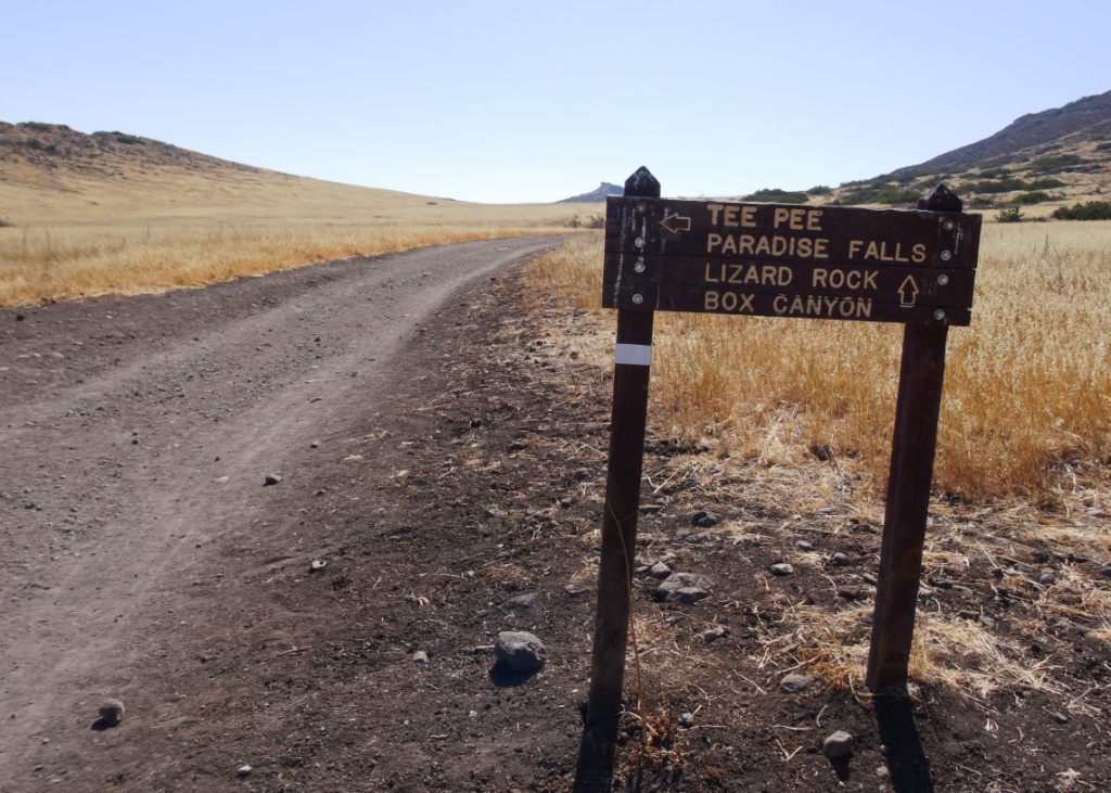
One particularly fun and fairly easy family hike at Wildwood takes you from the main parking lot at the west end of Avenida de los Arboles to the Teepee, Paradise Falls and Little Cave (formerly Indian Cave**). Take the Mesa Trail about a 3rd of a mile until you see the sign below, then take a left.

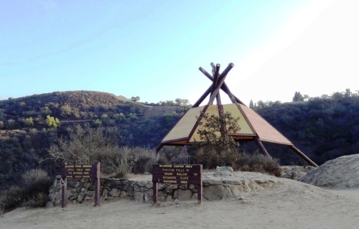
Another third of a mile and you're at the teepee, where you'll find another clearly marked sign pointing you in the direction of Paradise Falls.

Another third of a mile and you're at the teepee, where you'll find another clearly marked sign pointing you in the direction of Paradise Falls.

WildwoodTeepee3.JPG

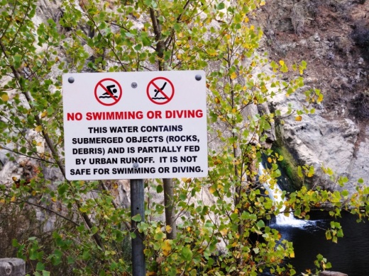
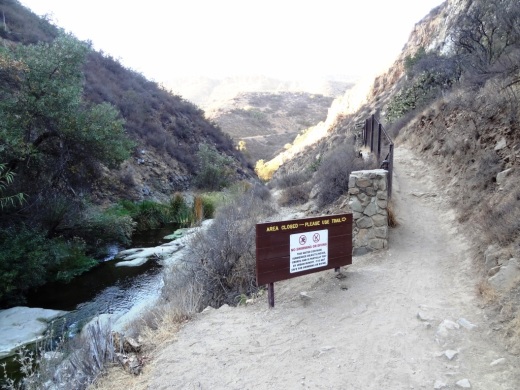
Hike down some switchbacks and stairs and you'll see be at the beautiful Paradise Falls. Always a fun place to take the kids, though we're warned not to go into the water, which is largely urban runoff.

ParadiseFalls2.JPG
ParadiseFalls4.jpg

But it is sure popular and enjoyable to sit back and enjoy this year-round waterfall that is so nicely hidden yet so close to hustle and bustle of suburban Thousand Oaks.

ParadiseFalls11.3.13.JPG

The Little Cave is roughly half a mile east of Paradise Falls and can be accessed from the trail directly above the falls or by hiking back up to the teepee and going the other direction.

Trail adjacent to Paradise Falls that takes you towards the Indian Cave.

Trail adjacent to Paradise Falls that takes you towards little Cave.

A quarter of a mile or so and you'll see the sign below.

Little Cave (Formerly Indian Cave) sign

Here's the sign indicating you are near the Indian Cave in Wildwood Park.

Formerly called indian cave

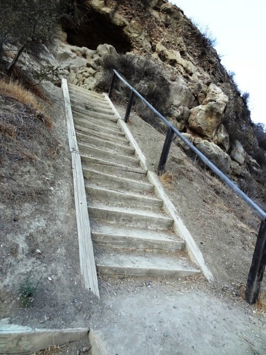
Another 100 yards or so and you've reached the staircase that will take you up to the Cave.

Large enough to actually hang out in, though the last time we walked in there were signs of rodents.

Large enough to actually hang out in, though the last time we walked in there were signs of rodents.

IndianCave5.JPG

You can literally climb through the cave to an exit at the top and hike your way up to a connector trail that will lead you back towards the parking lot. My kids love this and so do I!

** The change in name was approved by the Conejo Open Space Conservation Agency (COSCA) in May 2022. COSCA received a request to change the Indian Creek Trail name earlier that year. On its own, the work "Indian" refers to individuals from India, rather than Native Americans, and thus did not accurately reflect the origin of the people to whom it refers.

The Indian Cave and Indian Cave Trail were renamed Little Cave as it was unclear if the cave was naturally formed and/or historically used by Native Americans.

The Indian Creek Trail in Wildwood Park was renamed Two Springs Trail as two natural springs contribute to the stream flow in this portion of the channel.

Tell Me a Little Bit About Newbury Park

Newbury Park is a community located in the western portion of Thousand Oaks. Most of Newbury Park became part of Thousand Oaks by community vote sometime in the 1960s and 1970s. Thousand Oaks became a city in October 1964.

A view of Newbury Park from Boney Peak in October 2021. (Feet Model: Conejo Joe)

Egbert Starr Newbury (Photo Courtesy Conejo Valley Historical Society)

Egbert Starr Newbury (Photo Courtesy Conejo Valley Historical Society)

Newbury Park is named after Egbert Starr Newbury, who owned thousands of acres of land in the Conejo Valley after moving to California from Michigan for health reasons in 1871.  Newbury was one of the three largest Conejo Valley landowners of his time. He and his wife Fannie became the first postmasters in the Conejo Valley in 1875.  The post office was located in a small compound near their house, which was located at the current location of the Thousand Oaks Civic Arts Plaza

The other major landowners at that time were John Edwards, who owned much of the current Newbury Park/Thousand Oaks area north of the 101, and Howard Mills, who owned much of what today is Westlake Village and Hidden Valley.

Edwards sold 10,000 acres of what is now central Thousand Oaks to Edwin and Harold Janss in 1893.  The Janss Corporation also bought thousands of acres of land in Newbury Park (Friedrich, Running Springs and Borchard Ranches) in 1962. 

There were efforts to incorporate Newbury Park in 1961 and 1963 that failed due to a lack of sufficient votes.

Over a 30 month period beginning in the Fall of 1876, only 6 inches of rain fell in the Conejo Valley.  This drought brought devastation to landowners, most of whom lost their crops and livestock and had to sell at a loss or went bankrupt.  The Newburys were no exception; they moved back to the midwest in 1877.  Egbert fell ill to pneumonia in 1880 and passed away at the young age of 36.

The Newburys lived here only six years, so why is it still called Newbury Park? Because the name of the Newburys' post office never changed! The Newbury Park Post Office has changed locations a number of times (including 1602 Newbury Road from May 1968 until it moved to its current location at 3401 Grande Vista Drive in 2013). So the Newbury name and legacy live on here in the Conejo Valley.

Horse tied to a sign indicating the Newbury Park Post Office, in 1909. The location was near modern-day Lynn Ranch. (Courtesy of the Thousand Oaks Library Local History Photo Collection).

Horse tied to a sign indicating the Newbury Park Post Office, in 1909. The location was near modern-day Lynn Ranch. (Courtesy of the Thousand Oaks Library Local History Photo Collection).

Sources: "The Conejo Valley - Old and New Frontiers" by Carol A. Bidwell and "The Newburys of Newbury Park" by Miriam Sprankling

But wait...there's more to Newbury Park! Casa Conejo is also part of the Newbury Park community but is not an incorporated part of Thousand Oaks. It is considered a census-designated place in Ventura County, with its own Municipal Advisory Council. Casa Conejo is the first planned community in Newbury Park and was built in the early 1960s. It has an area of .5 square mile and is bound by Borchard to the south, Old Conejo Road to the north, Jenny Drive (east of Newbury Park High School) to the west and Sequoia Middle School to the east.

TELL ME ABOUT THE HISTORY OF THE STREET NAMES IN THE CASA CONEJO NEIGHBORHOOD

Interested in historical pictures of the area going back to the 1950s?  Click here to read about the work of prolific Conejo Valley photographer, Ed Lawrence. 

Click here for a history of Thousand Oaks. Thousand Oaks is over 56 square miles and Newbury Park represents about 40% of that square footage. Thousand Oaks was incorporated as a city on October 7, 1964.

Three dozen or so things to do in Newbury Park

Another three dozen or so kids' activities in Newbury Park

Yet another three dozen or so sports and fitness activities in Newbury Park

Century Lake at Malibu Creek State Park

According to the Malibu Creek Docents, around 1903, the Crags Country Club constructed a 50 foot tall dam on its 2,000 acre property on what is now Malibu Creek State Park. The dam created a seven acre lake that club members used for fishing and duck hunting.

The Club closed in 1936, and 10 years later, 20th Century Fox Studios purchased the property to film movies and TV shows on what was renamed Century Ranch. The 1968 "Planet of the Apes" featured many prominent scenes shot here.

This is an awesome video showing Planet of the Apes (1968) film scenes at Malibu Creek State Park and local area beaches then and today.

As for the lake, it is now referred to as Century Lake, a hiking destination in Malibu Creek State Park. Only 1 1/2 miles from the parking area, Century Lake is in a secluded area, where you can eat your lunch at the picnic table and enjoy serenity (usually, depending on who else is there). I believe it is fine to wade in the water and even kayak in there if desired. although I've never seen anyone do so.

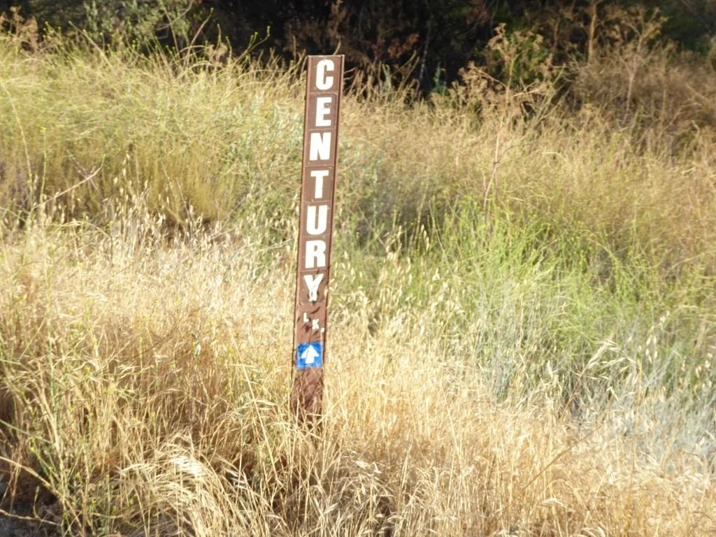
Century Lake is a left hand turn from the main Crags Road trail, after cresting the only significant hill going down the other side. The only indicator is this narrow sign.

Century Lake is a left hand turn from the main Crags Road trail, after cresting the only significant hill going down the other side. The only indicator is this narrow sign.

The hike has a moderately steep hill in it, but otherwise is quite flat and easy to do with kids and/or a stroller.

Malibu Creek State Park has something for everyone...camping, a visitor center, the "Rock Pool," the M*A*S*H set, the old Reagan Ranch, Century Lake, over 35 miles of trails, rock climbing (near the Rock Pool) and more.

The Century Dam is shown in this image. You don't wanna fall down that dam. Off limits.

The Century Dam is shown in this image. You don't wanna fall down that dam. Off limits.

Ventura County Area Car Shows, Car Clubs and Car Museums

CarShow.jpeg

Looking for automotive fun around Ventura County?  Here are some options.

Monthly and Annual Car Shows:

County Line Cars and Coffee meets the 2nd Saturday of the month from 8-10AM at The Promenade at Westlake. www.facebook.com/countylinecarsandcoffee

Conejo Valley Cars and Coffee meets the 1st and 3rd Saturday of each month from 7-10AM at Firestone Tire at The Oaks mall, 598 W. Hillcrest Drive, Thousand Oaks. www.cvcarsandcoffee.com

Firebill Tim Wheels & Waves monthly car show is currently at the Channel Islands Maritime Museum at the 3900 Bluefin Circle, Oxnard the first Sunday of the month from 8-10AM. Free to the public, featuring classic cars, coffee, art, donuts, and more. www.cimmvc.org/events-activities

Ventura Raceway offers racing events for dwarf cars, hobby stocks, motorcycles and more. Pricing varies. Visit venturaraceway.com for more information.

The Annual Touch-a-Truck Event in Thousand Oaks for kids and their families takes place on Father’s Day weekend each year.

The Thousand Oaks Rotary Annual Street Fair in October always has a fantastic vintage and eclectic auto show worth stopping by for. www.tostreetfair.com

Father’s Day Car Show at Channel Islands Harbor every June www.channelislandsfathersdaycarshow.com

The annual Thousand Oaks Chili Cook-Off, Car Show and Craft Brew Fest takes place usually the first Sunday of May each year at Conejo Creek Park North.

Sespe Creek Car Show in Fillmore every 4th of July sespecreekevents.org

Simi Valley Knights of Columbus Chili Cook-Off & Car Show every June chilikc.com

Tri-County Mustang Club Ponies by the Sea Car Show at Channel Islands Harbor is every October www.tricountymustangclub.com/car-show

Central Coast British Car Club Car Show is in the Sept/Oct time frame each year at the Channel Islands Harbor centralcoastbritishcarclub.com/car-show

Camarillo Old Town Friday Night Car Cruise takes place every 4th Friday in April through October. www.camarillooldtown.org/car-cruise

Ventura Nationals every Labor Day weekend in Ventura venturanationals.com

Annual shows usually pop up in the CVG Events Calendar.


The Nethercutt Museum in Sylmar (free admission; open Tuesday to Saturday).

Looking for local car clubs? Check the Social/Hobby Clubs section of CVG. Or here's a list of car and motorcycle clubs.

And also check the Events Calendar and Event Listings for additional events that you will enjoy!

Have something to add to this list? CONTACT US

CLOSED OR STATUS ON HIATUS OR UNCLEAR

Malibu Cars and Coffee on hiatus (still on hiatus as of December 2023).. www.malibucarsandcoffee.com

Muscles & Mojo Cars and Coffee took place every 3rd Sunday at the Murphy Auto Museum in Oxnard, but it’s finale was June 16, 2024 as the museum is closing on July 7th.

The Mullin Auto Museum in Oxnard closed its doors on Feb 10, 2024.

The Murphy Auto Museum in Oxnard closes its doors on July 7, 2024.

ClassicCarYello.JPG
ClassicCar1.JPG

Oakbrook Regional Park Archaeological Area in Thousand Oaks is City Historical Landmark #5

Oakbrook Regional Park Archaeological Area is located at 3290 Lang Ranch Parkway in Thousand Oaks, south of the intersection of Avenida de los Arboles and Westlake Boulevard.

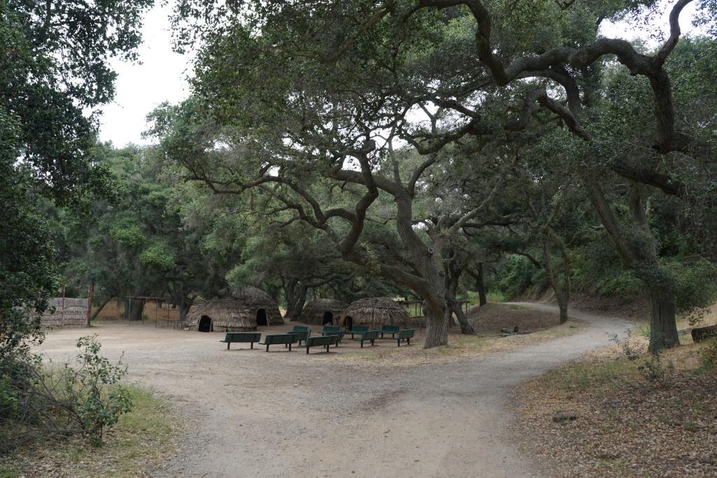
This 428 acre park is a designated historical landmark by the City of Thousand Oaks and County of Ventura. The Chumash inhabited this area going back as far as 12,000 years ago through the late 1800's. 

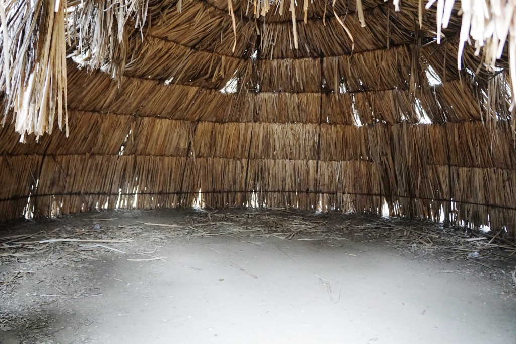
The park grounds are open to the public daily from 7 a.m. to 10 p.m.  There are flat hiking trails and a Chumash village reproduction available to explore. The oak trees provide a beautiful canopy for hikers. It is a peaceful place worth exploring. Note that dogs are prohibited from the property.

Located on the property is the Chumash Indian Museum, which contains a large collection of Chumash artifacts. The museum is open on Saturdays and Sundays from 10 a.m. to 4 p.m.

More information on Oakbrook Regional Park at www.crpd.org/park/oakbrook-regional-park.

Hiking and Exploring in Rancho Sierra Vista/Satwiwa in Newbury Park

Entrance to Rancho Sierra VistaSatwiwa at Lynn Road and Via Goleta in Newbury Park

Located on the western edge of the Santa Monica Mountains National Recreation Area, Rancho Sierra Vista/Satwiwa is accessible in Newbury Park at the intersection of Lynn Road and Via Goleta. This area spans from Potrero Road on the north and connects to Point Mugu State Park on the south.

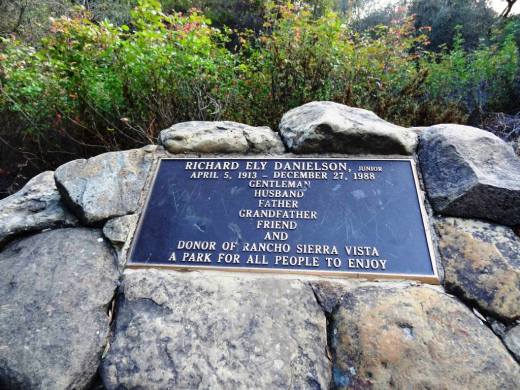
Ranching in the area dates back to the early 1800s, when Spanish soldiers were granted 48,672 acres of land, "Rancho El Conejo," which through the years was subdivided and sold to other landowners. One of these ranchers was Carl Beal, who in 1937 named the area Rancho Sierra Vista "Mountain View Ranch." The last private landowner in the area was Richard Danielson, whose family farmed and ranched the area for 32 years. Danielson donated 5,585 acres of the ranch to the State of California, which became part of Point Mugu State Park, and sold 850 acres, including the horse ranch, to the National Park Service in 1980.

Sign at Danielson Monument accessible via Danielson Road/Old Boney Trail.

Sign at Danielson Monument accessible via Danielson Road/Old Boney Trail.

The Satwiwa Native American Indian Natural Area is a bike/horse free area within Rancho Sierra Vista/Satwiwa of roughly 60 acres. Located on the northwest corner of this area, just a short walk from visitor parking, is the Satwiwa Native American Culture Center.

The Culture Center is staffed from 9 a.m. to 4 p.m. most weekends with a park ranger or other staff. It is a small building that also hosts a variety of educational Chumash and wildlife items. NPS BROCHURE AND TRAIL MAP

Learn more about RSV at www.nps.gov/samo/planyourvisit/rsvsatwiwa.htm.

SatwiwaSign.JPG

The area is a popular destination for hikers with a variety of well maintained trails. Note, however, that bicycles and horses are not allowed in the "Satwiwa Natural Area" section (see map below).

Map excerpt courtesy of National Park Service.

Map excerpt courtesy of National Park Service.

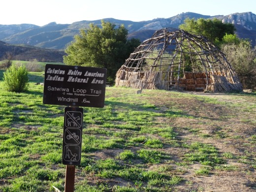
The Satwiwa Loop Trail is an easy, 2 mile trail that starts at the Culture Center through grasslands, past the old windmill and back around, with several extensions for those looking to do a little more.

SatwiwaLoopTrail_sign.jpg

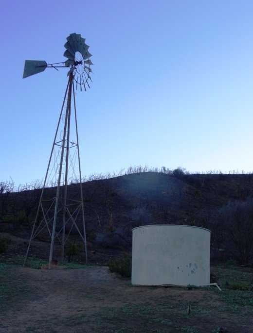
There's the Lower Loop Trail and the Upper Loop Trail that is a bit of a zig-zaggy trail with wooden footings placed by volunteers to help hikers navigate. The Upper Loop Trail runs past the "Old Windmill" pictured below.

Satwiwa Lower Loop sign at intersection of Danielson Road trail.

Satwiwa Lower Loop sign at intersection of Danielson Road trail.

The old windmill at the northeast corner of the Satwiwa Loop Trail (Upper Loop). (Windmill was knocked down by high winds in December 2016 and is still down as of MAY 2024).

You can also park at the Wendy and Potrero trailhead and walk to the Culture Center via the Wendy Trail, about a mile each way.

Wendy Trail trailhead at the intersection of Wendy and Potrero in Newbury Park

Wendy Trail trailhead at the intersection of Wendy and Potrero in Newbury Park

It is pretty dry in here most of the year but after the winter/spring rains, the green stages a comeback.

It is pretty dry in here most of the year but after the winter/spring rains, the green stages a comeback.

Another trail to explore is the 1 mile Ranch Overlook Trail that takes you from just west of the Satwiwa Native American Indian Culture Center, up a hill (where you can indeed look down toward the old ranch area, parking area and restrooms) to the main entrance and to the Palomino Trail in the Rancho Potrero Open Space.

Ranch Overlook Trail

Ranch Overlook Trail

One of my favorite trails in Rancho Sierra Vista/Satwiwa is the Hidden Valley Overlook Trail. This challenging, fairly steep trail branches off from the Satwiwa Loop Trail on the southeast, past the bench at the Upper Sycamore Canyon Overlook, via the Boney Mountain Trail/Danielson Road.

The popular bench at Upper Sycamore Canyon Overlook. Photo taken April 4, 2014, approximately 11 months after the devasting Springs Fire of 2013.

The popular bench at Upper Sycamore Canyon Overlook. Photo taken April 4, 2014, approximately 11 months after the devasting Springs Fire of 2013.

Roughly 700 feet past the Upper Sycamore Canyon bench is a juncture where you can either veer right into Point Mugu State Park and the Boney Mountain Wilderness, where you can walk down, over a stream (or a dry stream bed as the case may be), towards the popular "waterfall" (which in recent years has been not much more than a trickle) and the Danielson Monument. CLICK HERE for details.

If you veer left at the juncture, you'll see the Hidden Valley Overlook trail sign.

HiddenValleyOverlook_sign.jpg

The trail is steep and rocky and reaches an end point in about half a mile. If you are up to the challenge, you will be rewarded with sweeping views of Newbury Park, the Channel Islands, Sycamore Canyon and Boney Mountain.

Views from halfway up the Hidden Valley Overlook Trail towards the Satwiwa Native American Indian Natural Area

Views from halfway up the Hidden Valley Overlook Trail towards the Satwiwa Native American Indian Natural Area

At the end of the trail is the Hidden Valley overlook, where you will be able to peek into the not-so-hidden-anymore Hidden Valley and its peaceful ranches. As a final reward for your effort, it's all downhill the way back. Be sure to wear solid hiking shoes as the trails are a bit technical.

Peek at Hidden Valley at the end of the Hidden Valley Overlook Trail.

Peek at Hidden Valley at the end of the Hidden Valley Overlook Trail.

View of Santa Cruz Island, one of the Channel Islands, from Hidden Valley Overlook trail

View of Santa Cruz Island, one of the Channel Islands, from Hidden Valley Overlook trail

To learn more, visit the Anthony C. Beilenson Visitor Center at 26876 Mulholland Highway, Calabasas or visit www.nps.gov/samo or call 805.370.2301.

Dogs are allowed in Rancho Sierra Vista/Satwiwa as long as they are on a leash no longer than 6 feet. But please, pick up after your pet. Dogs are not allowed in the Point Mugu State Park / Boney Mountain Wilderness back country trails, though they are allowed on paved roads, such as the Big Sycamore Canyon Trail road.