Where to Play Pickleball in Ventura County
/
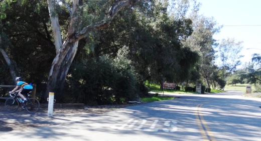
Pickleball court at Del Prado Playgrounds in Newbury Park.
According to www.whatispickleball.com, pickleball is oversized ping pong played on a badminton sized court with a tennis sized net. Pickleball originated in Bainsbridge Island, Washington in 1965 when congressman Joel Pritchard and his friend Bill Bell created the game for their families to play.
Pickleball is played with a perforated plastic ball similar to a wiffle ball that weighs about an ounce and composite or wooden paddles about twice the size of ping pong paddles. Pickleball is an indoor/outdoor sport that is easy to learn and, like tennis and ping pong, can be played singles or doubles. Learn more about pickleball at www.usapa.org.
Today, the sport of pickleball is governed in the U.S. by the USA Pickleball Association. which was founded in 2005 to promote the sport. There are over 8.9 million pickleball players in the United States over the age of six and over 44,000 pickleball courts across the country.
Pickleball continues to grow in popularity here in the Ventura County area. Here is a list of pickleball courts in and around Ventura County as well as adjacent areas:
Thousand Oaks:
Two pickleball courts at Del Prado Playfield in the Dos Vientos section of Newbury Park. Lighted from sunset to 10pm.
Six courts at Rancho Conejo Playfield in Newbury Park
Three indoor courts at the Thousand Oaks Community Center
Two courts (bring your own net) at Estella Park.
The Pickleball Athletic Club is opening soon (est March 2025) at 2000-B Anchor Court, Thousand Oaks. The facility will have 9 indoor, temperature-controlled acrylic courts. Operating hours will be 6am to 11pm daily. There are monthly membership fees, but guests will also be able to reserve courts. Learn more at playatpac.com.
Westlake Village:
The City of Westlake Village constructed four pickleball courts for public use at Westlake Village Community Park, 31107 Thousand Oaks Boulevard. The courts are located in the northeast corner of the existing parking lot, east of the Yarrow Family YMCA and south of the skate park. Courts are open from sunrise to 9pm and have lights. www.wlv.org/pickleball.
There are 8 dedicated pickleball courts at the Westlake Athletic Club available to its members. wac.caclubs.com/pickleball
Simi Valley:
Pickleball courts at Rancho Tapo Community Park, 3700 Avenida Simi offers 4 dedicated courts and 2 shared courts available daily from 7am to 10pm.
Pickleball courts at Rancho Simi Community Park, 1765 Royal Avenue offers 6 dedicated courts daily from 7am to 10pm.
There are 12 pickleball courts available at Sinaloa Middle School, 601 Royal Avenue, on weekdays when school is in session from 4:30pm to dusk and on weekends, school holidays and summer break from 7am to dusk. www.rsrpd.org/recreation/sports___field_conditions/sv_tennis_pickleball/index.php
Oak Park:
There are four new (as of June 2025) pickleball courts at Deerhill Park, 6700 Doubletree Road. www.rsrpd.org/business_detail_T9_R26.php
Port Hueneme:
Pickleball is available at Walter B. Moranda Park, 200 Moranda Parkway, Port Hueneme. There are 10 courts; 5 of them are reservable. www.ci.port-hueneme.ca.us/1169/Moranda-Park
Moorpark:
Pickleball courts at Tierra Rejada Park, 11900 Mountain Trail Street open 8am to sunset and dual tennis/pickleball courts at Miller Park, 4530 Miller Parkway open 7am to 10pm.
Camarillo:
Six pickleball courts (4 permanent, 2 dual use courts) at Bob Kildee Community Park, 1030 Temple Avenue.
Two dual use courts with lights and rollaway nets at Springville Park, 81 Via Zamora. as well as at Pitts Ranch Park, 1400 Flynn Road.
Dual-use court at Springville Park, 801 Via Zamora. www.pvrpd.org/springville-park-pickleball
There are four indoor pickleball courts at Camarillo Athletics that can be reserved for a fee. Located at 487 Dawson Drive #3S. camarilloathletics.com
Ventura www.cityofventura.ca.gov/pickleball
Harry A. Lyon Park, 150 De Anza Drive, Ventura on Tuesdays from 3:30pm to dusk and Saturdays from 9am to noon.
Juanamaria Park, Kimball Road and Loma Vista Road on Thursdays from 3:30pm to dusk and 2pm to dusk.
There are three pickleball courts at the Lake Casitas Recreation Area that are open daily during regular park hours. They are available with a park entry fee or annual pass. Located at Picnic 1 Area. www.casitaswater.org/pickleball
Ojai
The City of Ojai has 4 pickleball courts on City Hall Grounds at 401 S. Ventura Street, Ojai. Visit ojairec.com/389/Pickleball-Courts for hours and other information.
Pickleball court are under construction at Soule Park, 1301 Soule Park Road, through July 2024. www.ventura.org/parks-department/inland-parks/soule-park-ojai
Calabasas
The privately-owned Calabasas Pickleball Club opened on June 1, 2024, with 16 courts at 5155 Old Scandia Lane. It is a members only club. Visit calabasaspb.com for more information.
Pickleball is offered at the Calabasas Tennis & Swim Center www.cityofcalabasas.com/government/community-services-parks-recreation/tennis-swim-center/tennis-pickleball

Clubs:
Ventura County Pickleball Club venturacountypickleballclub.com
Ojai Valley Pickleball www.ojaivalleypickleball.com
Ventura County Pickleball League camarilloathletics.com/ventura-county-pickleball-league
Visit camarillopickleball.fun to connect with other pickleball players.