Red Brick Art Gallery and School in Ventura

Red Brick Art is a fine art gallery located at 4601 Telephone Rd #112, Ventura with a strong focus on art classes as well as free events and cultural outreach.

Exhibits change change bi-monthly and feature the work of talented artists who host workshops at the studio. Artists of all mediums are represented including a wide variety of glass art (fused, blown, cracked and mosaic), clay, stone, metal, mixed media, wood, photography and all forms of painting. 

Classes for adults and youth are offered each weekend for beginning and intermediate students. Adult classes include photography, Photoshop, watercolor painting, pastel, acryllic painting and mosaics.

Additionally, painting parties are offered both at the Red Brick Studio (these classes do not include wine) as well as at local tasting rooms "Paint and Sip" events like Four Brix Winery, Sunland Vintage Winery and Aldabella Custom Crush.

Learn more at redbrickart.com.

Mt. McCoy Trail in Simi Valley

The Mt. McCoy Trail is located on the west side of Simi Valley with a trailhead at the corner of Washburn Street and Los Amigos Avenue (off the west end of Royal Avenue).

The trailhead at the corner of Washburn St and Los Amigos Avenue

The trailhead at the corner of Washburn St and Los Amigos Avenue

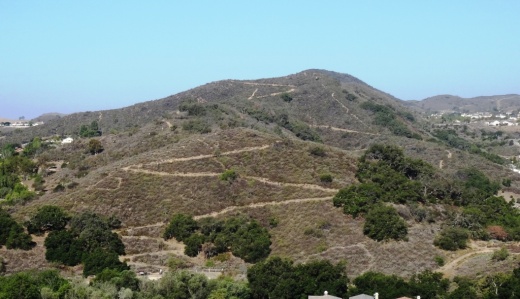
The Mt. McCoy trail is distinctive as there is a large white cross at the top of the mountain, which is about a 600 or so foot climb. From the trailhead, go straight and then take the switchbacks up the mountain.

At this first juncture, keep going straight (south) to the switchbacks. Turn right and you'll be going straight up the steep hill, like we did the first time.

At this first juncture, keep going straight (south) to the switchbacks. Turn right and you'll be going straight up the steep hill, like we did the first time.

Actually, after just a few hundred feet from the Washburn/Los Amigos trailhead, you'll reach a juncture where you either go straight (which is correct) or take a trail to the right, which is much steeper, but a much more direct path to the top. We made the mistake of taking that path the first time and it got us right up to the cross, but it is pretty steep.

The trails here are all really nicely groomed, thanks to the Rancho Simi Trailblazers and RSRPD. There are dozens of "shortcuts" along the trail but try to stick to the main path. Taking the correct path, with its switchbacks and twists and turns, is a bit over a mile to the top of Mt. McCoy, where you will be treated to panoramic views of the entire Simi Valley and the other direction towards the Reagan Library.  In fact, there are paths from the top that take you in other directions, including  a fire road that intersects with Presidential Drive to the Reagan Library.

View of the cross from about halfway up

View of the cross from about halfway up

A couple benches at the top of the hill to take in the beautiful views

A couple benches at the top of the hill to take in the beautiful views

McCoyTrail_cross2.JPG

The Rancho Simi Recreation and Park District owns 200 acres surrounding Mt. McCoy and the Rancho Simi Trailblazers helped construct the nicely maintained trail. Learn more at www.rsrpd.org/business_detail_T9_R17.php/

McCoyTrail_topview.JPG
Looking down from the cross to the south, where the benches and trailhead are.

Looking down from the cross to the south, where the benches and trailhead are.

Ojai Valley Trail

OjaiValleyTrail_Sign.jpg

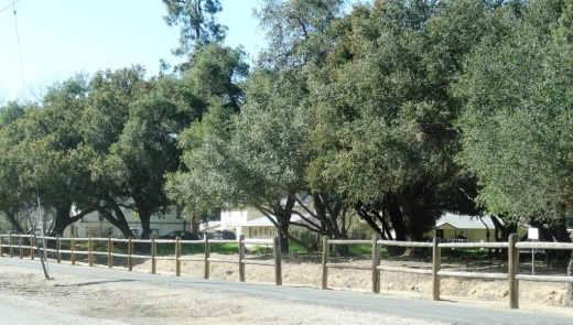
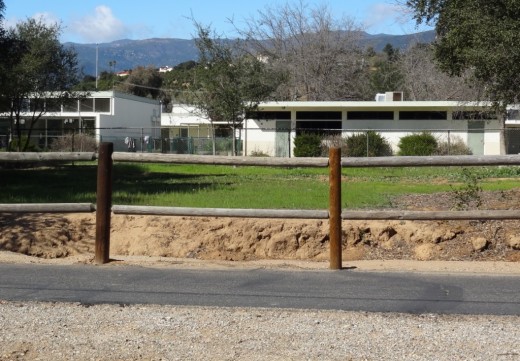
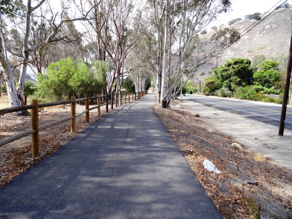
The Ojai Valley Trail is a 9 mile trail that parallels Highway 33 from Foster Park on the outskirts of west Ventura, to Soule Park in Ojai. One side of the trail is paved for bicyclists, walkers, joggers and people exercising their pets. Post-and-rail wood fence separates the paved path from a dirt bridle path for horseback riders. Sections wind through wooded areas and past riverbeds. While most of the path is offset from Highway 33 (the main thoroughfare in Ojai), it does have a number of street crossings. If staying in Ojai and you run or bike, you will no doubt cross paths with this path!

At Foster Park, the Ojai Valley Trail connects with the 6.3 mile Ventura River Trail, which in turn extends to the Omer Rains Trail along the Ventura beachfront.

OjaiTrail1.JPG
OjaiTrail2.JPG
OjaiTrail3.JPG
Ojai Valley Trail near Foster Park

Ojai Valley Trail near Foster Park

Golf N' Stuff Ventura

For hours of amusement check out Golf N' Stuff off of Highway 101 in eastern Ventura. Golf N' Stuff features two 18-hole miniature golf courses, Indy style race cars (go-karts), bumper boats, bumper cars and a large arcade. You must be 4' 8" tall to drive the go-karts and at least 4' tall to drive the bumper boats and bumper cars.

Birthday parties at Golf N’ Stuff include pizza, cake, golf, rides, etc. The arcade is one of the largest around town.

Pricing (as of December 2024) is $18 per person for miniature golf (or $22 for 2 hours of unlimited play), $14 for go-kart rides, $12 for bumper boats and $12 for bumper cars (for the driver; $7 for passengers).

Golf N' Stuff is open 365 days a year. They usually open at 10am. Closing time varies by day from 8pm to 11pm. located at 5555 Walker Street, Ventura. Exit the 101 off Victoria, head North to Moon Drive, which turns into Walker, and turn left. The park is on the right hand side. More information at www.golfnstuff.com or call 805.644.7131.

GolfNStuffSign.jpg
GolfNStuffCtr.jpg
GolfNStuffCtr2.jpg
GolfNStuffC2H10.jpg

Camarillo Ranch House

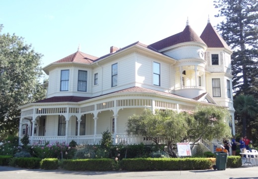
The Camarillo Ranch House is a 3-story, 14 room, 6,000 square foot Victorian home built by Adolfo Camarillo in 1892.  Adolfo is the son of Juan Camarillo, who purchased the land in 1866.  Adolfo operated the ranch from the time of Juan's death in 1880 until 1948.  Adolfo's name proliferates in Camarillo and the local high school was named after him after he gave 50 acres of land for that use.

The 4.5 acre ranch was given to the City of Camarillo by the Centex Company in 1997.  Today the property includes the house, a historic red barn and a stable.  In 2001, the City of Camarillo completed a $1.5 million restoration of the beautiful home to exhibit what it looked like during the 1914 to 1930 time frame. The Camarillo Ranch was added to the National Register of Historic Places in 2003.

The Camarillo Ranch is open to the public 7 days a week, 9am-5pm, unless there is holiday or special event. There is no charge to visit the property and walk the grounds during normal hours. The gardens have interpretive signs and there are also picnic benches available for use at lunchtime.

Docent-led tours of the house are currently (as of December 2024) offered on Saturdays and Sundays from 11 a.m. to 2 p.m. (last tour starts at 1:30 p.m.). House tour fees are $5 per person (cash only). Children 12 and under are free.

The property is used for many special events and can be reserved for private events like weddings and receptions.

The Camarillo Ranch House is located at 201 Camarillo Ranch Road.  Visit camarilloranchfoundation.com or call 805.389.8182 for more information.

CamRanchHousePic.JPG
Morton Bay Fig Tree

Morton Bay Fig Tree

Long Canyon Trail in Simi Valley

The Long Canyon Trail is an easy to moderate hike in the Wood Ranch section of Simi Valley, located at the corner of Wood Ranch Parkway and Long Canyon Road (take Wood Ranch Parkway south until it ends, and turn right into the parking lot).

About a .7 mile hike to the top of the canyon connects you with the Lang Ranch / Woodridge Open Space in Thousand Oaks. Great views from the top towards Simi Valley,  Thousand Oaks and beyond, towards the Channel Islands on clear days.

More information at www.rsrpd.org/business_detail_T9_R16.php.

LongCanyon0.jpg
Technically I believe this bench is in the Lang Ranch/Woodridge Open Space in Thousand Oaks, which connects with the Long Canyon Trail. Nice view here towards Simi Valley.

Technically I believe this bench is in the Lang Ranch/Woodridge Open Space in Thousand Oaks, which connects with the Long Canyon Trail. Nice view here towards Simi Valley.

Lizard Rock Hike in Wildwood Park, Thousand Oaks

Lizard Rock is just over a mile from the main entrance to Wildwood Park at the west end of Avenida de los Arboles. Walk/run/hike the Mesa Trail towards Lizard Rock and you will be treated to beautiful views of the surrounding spaces where shows like Gunsmoke and The Rifleman were filmed.

The entrance area and dirt parking lot at the Wildwood Park main trailhead.

The entrance area and dirt parking lot at the Wildwood Park main trailhead.

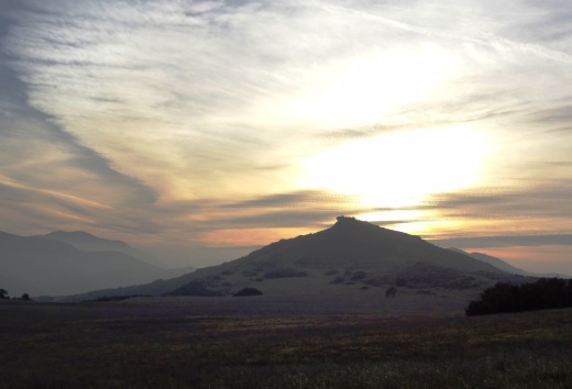
LizardRockInDistance.JPG
Lizard Rock in the distance

Lizard Rock in the distance

View from on top of the lizard

View from on top of the lizard

Trail sign south of Lizard Rock indicating Lizard Rock Trail to Wildwood Canyon Trail

Trail sign south of Lizard Rock indicating Lizard Rock Trail to Wildwood Canyon Trail

You can make this hike a 4 1/2 mile loop past Paradise Falls and the Indian Creek Trail by reviewing the map on the Conejo Open Space Foundation website at cosf.org/trails/wildwood/wildwood-park-easy-hike-indian-creek.

Sycamore Canyon Campground in Point Mugu State Park

Point Mugu State Park is located at 9000 W. Pacific Coast Highway, Malibu, offering a variety of beach, hiking and camping opportunities.

The Sycamore Canyon Campground is north of PCH, offering 58 tent/RV spaces along with drinking water, restrooms, showers and fire rings. There are also 4 tent spaces available for "Hike and Bike" campers. Pets are allowed on leash in the campground. Fees as of October 2024 are $35/night plus a $7.99 reservation fee at www.reservecalifornia.com (type in Point Mugu SP to find Sycamore Campground).

This campground is across the street from Sycamore Cove Beach, also part of Point Mugu State Park and just around the corner from the Thornhill Broome Campground on the beach, the giant sand dune across from Thornhill Broome, and Mugu Rock.

Sycamore Canyon has trails galore to explore, going all the way up, eight miles, to Newbury Park, if you so choose. Located just steps from the Sycamore Canyon Fire Road trailhead is the "Scenic Trail," a moderate trail with some steps that gets you to stunning views of everything mentioned above - beaches, Mugu Rock, sand dune, etc.

The Scenic Trail connects with the Overlook Fire Road, which continues on and eventually connects with the top of the Ray Miller Trail, then on towards the La Jolla Valley. It is lush and stunning when green in late winter/early spring. It gets pretty brown and dry up here towards last spring, summer and fall months. But the great views towards the Pacific never change.

Gardens of the World - Thousand Oaks

Gardens of the World at 2001 Thousand Oaks Boulevard is a 4 1/2 acre garden across from the Civic Arts Plaza in Thousand Oaks.  It is free and open to the public Tuesday through Saturday from 9 a.m. to 5 p.m. (last admittance is 4:30 p.m.)  Closed Sunday and Monday and most national holidays. Gardens of the World is a gift from the Hogan Family Foundation.

GOTW_front2.JPG

Gardens of the World is an oasis of beauty in the middle of Thousand Oaks. There is a large bandstand in the center of the Gardens that is a perfect venue for outdoor music.  And the array of plants, flowers, waterfalls (including a stunning fountain that looks out toward the Civic Arts Plaza) and a serene koi pond next to an authentic Japanese Pagoda.

GOTW_WaterFountain.JPG

There is a Japanese garden, a French garden and waterfall (shown above), a Mission Courtyard, an English perennial and rose garden and an Italian garden.  A beautiful place to visit and relax for a bit, right in the heart of Thousand Oaks.  Also a great place for a picnic lunch, with plenty of tables, benches and grassy areas. More information at www.gardensoftheworld.info or 805.557.1135.

I never promised you a rose garden...but here's a beautiful one to check out!

I never promised you a rose garden...but here's a beautiful one to check out!

Koi pond in the Japanese Garden

Koi pond in the Japanese Garden

Shaded picnic area

Shaded picnic area

Since 2003, Gardens of the World has hosted a great Jazz Series on Sunday afternoons in August in this traditional American Bandstand area.

Since 2003, Gardens of the World has hosted a great Jazz Series on Sunday afternoons in August in this traditional American Bandstand area.

Potrero Ridge Trail in Newbury Park

The Potrero Ridge Trail in Newbury Park is an interesting ridgeline trail that runs west/east in three sections over approximately 2 1/2 miles one way. You can access the trail from a number of locations and neighborhood feeder trails, but the main sections are as follows (west to east):

Via Las Brisas in the Dos Vientos tract, just north of Paseo Santa Rosa to Reino Road, just north of Paseo de Leon and Lynn Road, is a little over a mile. This is one of my favorite trails in the area, providing panoramic views of the southern portion of Newbury Park, Boney Mountain and Dos Vientos. There are some switchbacks on the west end near Reino Road but they are not overly strenuous.

Potrero Ridge Trailhead on Via Las Brisas, just north of Paseo Santa Rosa.

Potrero Ridge Trailhead on Via Las Brisas, just north of Paseo Santa Rosa.

potreroridgeview.JPG
Potrero Ridge Trail trailhead (and parking area) off of Reino Road

Potrero Ridge Trail trailhead (and parking area) off of Reino Road

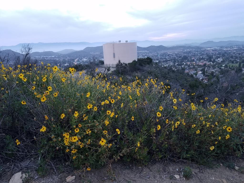
The middle section of the Potrero Ridge Trail runs from Woodland Oak Place off of Reino Road to Wendy Drive between Felton and Peppermint, where there's a convenient dirt parking lot.  Only about a half mile to the top of the trail, where you'll see a water tank. The primary trail is a wide fire road to the water tank from Wendy Drive. There's a secondary single track trail that mostly runs parallel (south) to the main fire road that is accessible from several points. This trail treats you to wonderful, panoramic views of the area.

Potrero Ridge Trail trailhead off of Wendy Drive.

Potrero Ridge Trail trailhead off of Wendy Drive.

Views towards the water tank at top of Potrero Ridge Trail (middle section)

Views towards the water tank at top of Potrero Ridge Trail (middle section)

The east section of the trail runs from across the parking lot on Wendy Drive to another peak, then down towards Silas Lane near Grace Bible Church, about half a mile in total. There is no parking available for this section of trail, though you can park in the Wendy lot and find a crosswalk to cross over to the trailhead.

View from east section of Potrero Ridge Trail.

View from east section of Potrero Ridge Trail.

So basically these 3 segments are split between Via las Brisas and Reino Road, Reino Road and Wendy Drive and Wendy Drive and Silas Lane.

If you'e like to extend your trail trekking on the west side, cross over Via las Brisas and take the Sierra Vista Trail west another mile to Rancho Dos Vientos.

This trail is maintained by the Conejo Open Space Foundation.

Here's a view of the initial section of the western section of the Potrero Ridge Trail from the Wendy Water Tank section of the trail across Reino Road.

Here's a view of the initial section of the western section of the Potrero Ridge Trail from the Wendy Water Tank section of the trail across Reino Road.

Views into the Dos Vientos section of Newbury Park

Views into the Dos Vientos section of Newbury Park

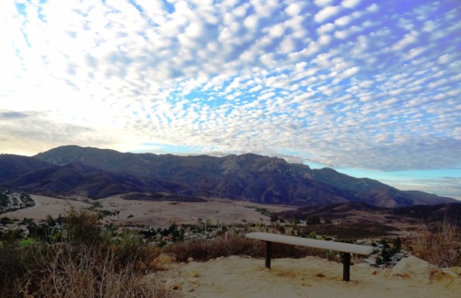
Potrero Ridge Trail bench provide extensive views

Potrero Ridge Trail bench provide extensive views

Views from the same bench on a cloudy late October day in 2013

Views from the same bench on a cloudy late October day in 2013

Adamson House Tour and Malibu Lagoon Museum

AdamsonHouseSign.JPG

The Adamson House at 23200 Pacific Coast Highway in Malibu is a National Historic Site and a registered California landmark. The house and grounds share one of the most beautiful beach locations in Southern California, with a view of the Malibu Lagoon, Malibu Beach and the Malibu Pier. In addition to its world-famous Malibu Tile, the house contains hand-carved teakwood doors, hand-painted murals, molded ceilings, hand-wrought ironwork and lead-framed bottle glass windows.

CLICK HERE FOR MORE PHOTOS AND INFO ABOUT THE ADAMSON HOUSE

The Adamson House Tour is a guided tour through the house which contains its original furnishings and is decorated with the renowned Malibu Potteries tile. Trained volunteer docents relate the history of the house, details of its architecture and furnishings, and the history of the family that lived in and created this distinctive home.

Admission (as of September 2024) is $7 for adults and $2 ages 6 to 17. Five and under is free. Cash only.

Open 8am to sunset, 7 days a week. Docent-led tours are available Wed-Sat from 11am to 2pm

No on-site parking. Park at Surfrider Beach, Malibu Lagoon State Beach or on PCH.

The Malibu Lagoon Museum adjoins the Adamson House and contains a collection of artifacts, rare photographs and documents depicting the colorful history of Malibu. The museum tour takes the visitor from the early Chumash Indian era through the Spanish California culture. Here is an excellent opportunity to relive the genteel and romantic ranching days of the famed Rindge and Adamson families. Learn about dramatic episodes in Malibu's rich history: the Malibu Railroad; the 50-room Castle on the Hill; the 17-year legal battle over a Malibu highway; the Malibu movie colony; the Malibu Dam, and much more. Admission to the museum is free.

Adamson House.jpg

The Adamson House Garden Tour is a docent-led walking tour of the landmark gardens, beautifully preserved in their 1930s appearance. It is offered every Friday of the month, 10:00 a.m. The Adamson House Tour admission fee includes a house garden tour; no reservation is required. Reservations are necessary only for groups of 10 or more at 310-456-8432. Group tours are Tuesdays at 10:00 a.m.

More information at www.adamsonhouse.org or call 310.456.8432.