Arroyo Simi Bike Path in Simi Valley

The Arroyo Simi Bike Path is a two lane bike path in Simi Valley that runs from Madera Road, just south of Easy Street on the west, ending at Cochran Avenue between Fig Street and Ralston Street on the east (more recently, the path has been extended east to Tapo Street).

Over seven miles in total. It is also referred to as the Arroyo Simi Greenway.

The Arroyo Simi is a waterway that begins at Corriganville Park in east Simi Valley and extends west all the way through Simi Valley until into merges into Arroyo Las Posas and Conejo Creek into Calleguas Creek. It is managed by the County of Ventura but the Rancho Simi Recreation and Park District has access to the pathway for recreational use.

While this path is nowhere near as visually appealing as bike paths along Ventura Beach and such, the Arroyo Simi Bike Path is almost entirely flat and allows passageway along much of Simi Valley from east to west. You can really do a lot of exploration from this artery. We like to park at the East Street entry point and bike to Rancho Simi Community Park (2.2 miles one way), Rancho Santa Susana Park (6 miles one way) and various other areas.

Because this path is so long and flat (and not crowded), it is a nice destination for learning to ride. However, do be aware that there are a number of street crossings where you are asked to walk your bike across. They are protected by lights and signs, however.

Arroyo Simi bike path entry point at Easy Street and Madera.

Arroyo Simi bike path entry point at Easy Street and Madera.

Arroyo Simi Bike path may not be the most picturesque path but is nicely flat and goes a long way!

Arroyo Simi Bike path may not be the most picturesque path but is nicely flat and goes a long way!

There are numerous entry points to the path, which largely parallels Los Angeles Avenue; this one is just east of Ralston off of Los Angeles Avenue.

There are numerous entry points to the path, which largely parallels Los Angeles Avenue; this one is just east of Ralston off of Los Angeles Avenue.

Conejo Creek Bike Path in Thousand Oaks

Conejo Creek Bike Path (Courtesy City of Thousand Oaks)

Conejo Creek Bike Path (Courtesy City of Thousand Oaks)

The Conejo Creek Bike Path is a 1.2 mile path in Thousand Oaks that connects Gainsborough Road on the south to Conejo Creek Park South. From there, you can cross Janss Road to get to the Thousand Oaks Library Conejo Creek Park North and the Thousand Oaks Teen Center

This path opened to the public in Spring 2011, providing a nice, flat alternative to city streets as it goes under State Route 23.

The paved path on Paige Lane ends at Janss Road across the street from the Thousand Oaks Library, but you can take the crosswalk at Janss Road at the crosswalk and from there get to a wide, fairly flat horse trail that takes you up to Avenida De Los Flores.

The east end of Gainsborough Road has an access point to the Conejo Creek Bike Path

The east end of Gainsborough Road has an access point to the Conejo Creek Bike Path

Nice flat path adjacent to city streets and neighborhoods

Nice flat path adjacent to city streets and neighborhoods

The path takes you under the 23 Freeway

The path takes you under the 23 Freeway

The path ends at Janss Road, across from the Thousand Oaks Library Conejo Creek Park North.

The path ends at Janss Road, across from the Thousand Oaks Library Conejo Creek Park North.

The City of Thousand Oaks maintains approximately 80 miles of bikeways, including about 3 miles of bike paths, roughly 54 miles of bike lanes and another 20 miles or so of bike routes.

Medea Creek Natural Park in Oak Park

MedeaCreekNP_sign.JPG

Medea Creek Natural Park has hiking, biking and fitness trails that stretch from Calle Rio Vista and Oaks Hills Drive in Oak Park on the north, then south past Medea Creek Lane and Conifer Street to a cul de sac entrance to the park at the west terminus of Tamarind Street.

Nicely paved Medea Creek Trail north towards Kanan/Oak Park Library

Nicely paved Medea Creek Trail north towards Kanan/Oak Park Library

The paved Medea Creek Trail, great for walks as well as casual bicycling, has a northern entry point at Kanan Road across from Deerhill Road (adjacent to the Oak Park Library). It crosses Sunnycrest Drive, where there is street parking, so you do need to be careful with kids when you cross.

Medea Creek runs through suburbia via this wash, where you will see some neat bird activity.

Medea Creek runs through suburbia via this wash, where you will see some neat bird activity.

The nature loop trail is about 1.5 miles. You will likely see ducks and perhaps other birds enjoying the creek as you choose between the paved and dirt paths. There's also a fitness circuit. It is kind of interesting as you'll see multiple layers of trails; some dirt, some paved, some grassy, some in the creek.

Multiple paths and areas to explore at Medea Creek.

Multiple paths and areas to explore at Medea Creek.

Medea Creek Natural Park is managed by the Rancho Simi Recreation and Park District www.rsrpd.org/business_detail_T9_R29.php

MedeaCreekPark_sign.JPG
Sign at east end terminus of Tamarind StreetFitness course signs along 1.5 mile path.

Sign at east end terminus of Tamarind StreetFitness course signs along 1.5 mile path.

Bike Path in Oxnard at Oxnard Beach Park to Channel Islands Harbor

There's a bike path that starts at the ocean side of Oxnard Beach Park at Mandalay Beach Road at Beach Way and takes you south all the way to Hollywood Beach and Channel Islands Harbor. Alternatively you can just park at the Oxnard Beach Park and go from there. It is roughly 3/4 of a mile one way to Harbor Boulevard.

Cross Harbor Boulevard and make your way into Channel Islands Harbor, where you can ride all the way to the south end of the harbor.

Entrance to bike path at Mandalay Beach Road and Beach Way

Entrance to bike path at Mandalay Beach Road and Beach Way

There's a loop you can do around Oxnard Beach Park

There's a loop you can do around Oxnard Beach Park

The bike path continues south and goes around the Embassy Suites Mandalay Beach Hotel

The bike path continues south and goes around the Embassy Suites Mandalay Beach Hotel

Soon after passing the hotel, the path swing east towards Harbor Boulevard

Soon after passing the hotel, the path swing east towards Harbor Boulevard

At Harbor Boulevard, you can cross over to Channel Islands Harbor or veer right (west) on West Channel Islands Boulevard towards Hollywood Beach. 

At Harbor Boulevard, you can cross over to Channel Islands Harbor or veer right (west) on West Channel Islands Boulevard towards Hollywood Beach. 

plenty of sand at Hollywood Beach. There's a restroom facility here. You can bike along Ocean Drive, which parallels the beach, to an entry point. do note that you are no longer on a bike path. you can continue south on Ocean Drive until i…

plenty of sand at Hollywood Beach. There's a restroom facility here. You can bike along Ocean Drive, which parallels the beach, to an entry point. do note that you are no longer on a bike path. you can continue south on Ocean Drive until its endpoint, where you turn left on South Harbor Boulevard past Channel View Park, where you will soon reach Channel Islands Harbor. 

On S. Harbor Boulevard going north now, you will be able to take a right (east) turn on Albacore Way to get to the nice pedestrian/bike path along Channel Islands Harbor. It will take you past the Channel Islands Maritime Museum and marina, where th…

On S. Harbor Boulevard going north now, you will be able to take a right (east) turn on Albacore Way to get to the nice pedestrian/bike path along Channel Islands Harbor. It will take you past the Channel Islands Maritime Museum and marina, where there are restaurants and other things to do.

Pretty cool place to ride bikes at the harbor...and rarely crowded in my experience.

Pretty cool place to ride bikes at the harbor...and rarely crowded in my experience.

If you and the kids are up to it and want a longer ride, after reaching the north side of the Harbor, you can take Harbor Boulevard back over to W. Channel Islands Boulevard over the bridge to the middle of the Harbor. There's a popular Toppers…

If you and the kids are up to it and want a longer ride, after reaching the north side of the Harbor, you can take Harbor Boulevard back over to W. Channel Islands Boulevard over the bridge to the middle of the Harbor. There's a popular Toppers Pizza over there. Or go the east side of the Harbor. 

Other options of course include parking at the Channel Islands Harbor somewhere and cycling your way up to the Oxnard Beach Park. And you can also pedal your way over to S. Victoria Avenue and take the bike lane all the way down to Silverstrand Beach (or even park at Silverstrand and ride your way up from there...though do take not that this is not a bike path). Have fun!

Wheel Fun Rentals - Bike Rentals - Ventura

With a number of locations in Ventura and Santa Barbara, Wheel Fun Rentals provides an assortment of bicycles, quads, coupes, surreys, tag-alongs and other two to four wheel human powered vehicles for rides along the beach. They also offer a wide assortment of water vehicles...boats, surfboards, boogie boards, etc.

Santa Barbara is my favorite nearby daytime destination with the kids as there are so many things to do that we all enjoy, one of them being riding bikes along the ocean.

Nearby locations as of September 2022 are:

Oxnard- Zachari Dunes on Mandalay Beach, 2101 Mandalay Beach Road (805.984.1994)

Oxnard - Channel Islands Marine Emporium Landing, 3600 S. Harbor Blvd (805.910.7257)

Oxnard - Residence Inn Oxnard River Ridge, 2101 W. Vineyard Avenue (805.278.2200)

Port Hueneme - Holiday Inn Express, 350 E. Port Hueneme Road (805.986.5353)

Ventura - Crowne Plaza, 450 E. Harbor Blvd (805.648.2100)

Ventura Pier 850 Harbor Blvd., Ventura (805.765.5795)

Ventura State Beach Picnic Area 901 San Pedro, Ventura (805.650.7770)

Santa Barbara - Hilton Beachfront Resort 633 East Cabrillo Blvd., Santa Barbara (805.966.2282)

Santa Barbara - Near Stearns Wharf 24 E. Mason Street (805.966.2282)

Santa Barbara Train Station 215 State Street (805.966.2282)

For more information visit www.wheelfunrentals.com or call 805.650.7770.

Camarillo Bike Path Next to Calleguas Creek

Looking to take the kids on a nice, flat bike path unimpeded by cars? A great choice is the roughly 2 mile Calleguas Creek bike path from Pleasant Valley Fields at 100 Village at the Park Drive in Camarillo off the Dawson 101 exit up to the corner of Flynn and Upland Roads in Camarillo.

Look at how nice and flat this bike path adjacent to Calleguas Creek is!

Look at how nice and flat this bike path adjacent to Calleguas Creek is!

This is a nice, smooth and flat bike path that goes under several bridges, including the 101 freeway, so that you don't have to worry about cars! You can park your car at Pleasant Valley Fields and ride up and back down the path. This is a comfortable path to learn on as well as just enjoy.

At the north end of the path, you can detour off the path to Pitts Ranch Park at 1400 Flynn Road, just a short block northwest of the path, and enjoy lunch.

CamBikePathCC2.JPG
Calleguas Creek

Calleguas Creek

Sapwi Bike Park in Thousand Oaks

Beginners’ pump track at Sapwi Trails Community Park.

Beginners’ pump track at Sapwi Trails Community Park.

The Sapwi Bike Park project is a partnership between the Concerned Off-Road Bicyclists Association (CORBA) and Conejo Recreation and Park District (CRPD). The park is a free, public recreational bicycle skills park facility located in the heart of beautiful Sapwi Trails Community Park in Thousand Oaks.

The park also features several miles of multi-use trails, natural habitat preservation, and other activities such as disc golf, cross-country running, and a non-motorized glider flying area.

The Sapwi Trails Bike Park offers a wide range of trails and features to challenge all ages and skill levels. In addition to a pump track, the park features progressive drop and jump lines – varying in difficulty from beginner to advanced. Outside of the dedicated bike park area, there are several trail side feature areas and a hard-surface beginner level pump track.

This 145 acre Sapwi Trails Community Park is located in the open space between Erbes Road (at Scenicpark Street) on the west and Westlake Boulevard east, with Avenida de los Arboles on the north. There are three parking lots off of Erbes, Arboles and Westlake Boulevard.

Learn more about the Sapwi Bike Park at sapwibikepark.com.

sapwi sign.JPG

Westlake Lake in Westlake Village

Westlake Lake is a 125 acre lake with 8 miles of shoreline in Westlake Village. Over 1,300 homes are located on the lake or are within access of it. It is a man-made lake that was completed in 1969 at a cost of $3.5 million.  A number of homes are located on an island in the lake that is connected by La Venta Drive.

View of Westlake Lake from southwest side on Triunfo Canyon Road. The Landing is on the left side.

View of Westlake Lake from southwest side on Triunfo Canyon Road. The Landing is on the left side.

While Westlake Lake is a private lake maintained for Westlake Village residents by the Westlake Lake Management Association, you can still enjoy its beauty in many ways. Running, cycling and walking around the lake via Triunfo Canyon and other adjacent streets is quite popular. Or visit The Landing (32129 Lindero Canyon) on the southwest side of the lake to enjoy a meal at one of several lakefront restaurants such as Boccacio's, Zin Bistro Americana and The Landing Grill and Sushi Bar, all with indoor/outdoor dining. Or just stroll around, taking in the sweeping views and serenity.

View from the southwest side of the Lake while cycling on Lindero Canyon Road.

The lake is stocked with bass but fishing and boating is restricted to Westlake Village residents with guests and permits. So if you don't live there, start making some Westlake Village friends!

Pedego 101 Electric Bikes in Westlake Village

Pedego 101 Electric Bikes, located in the Westlake Village Industrial Park at 31332 Via Colinas #107, Westlake Village, offers rentals, sales and service of electric bicycles.

Pedego also offers guided tours once a month and a weekly group ride for anyone with an e-bike to join. I know folks who thoroughly enjoy their Pedego bikes and ride them quite regularly!

Learn more at www.pedegoelectricbikes.com/dealers/westlake-village or call 805.379.9245.

Ventura Beach Bike Path

There's a bike path that takes you the entire length of San Buenaventura State Beach. Officially it is called the Omer Rains Trail, named after California State Senator Omer Rains, who served the Ventura County area from 1974 to 1983.

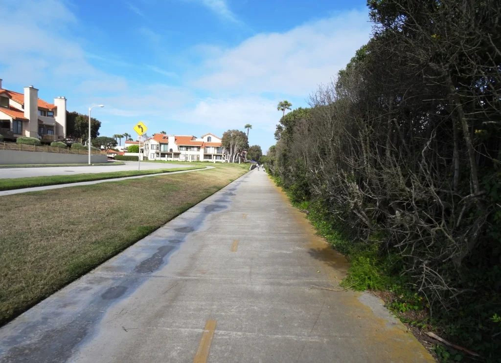
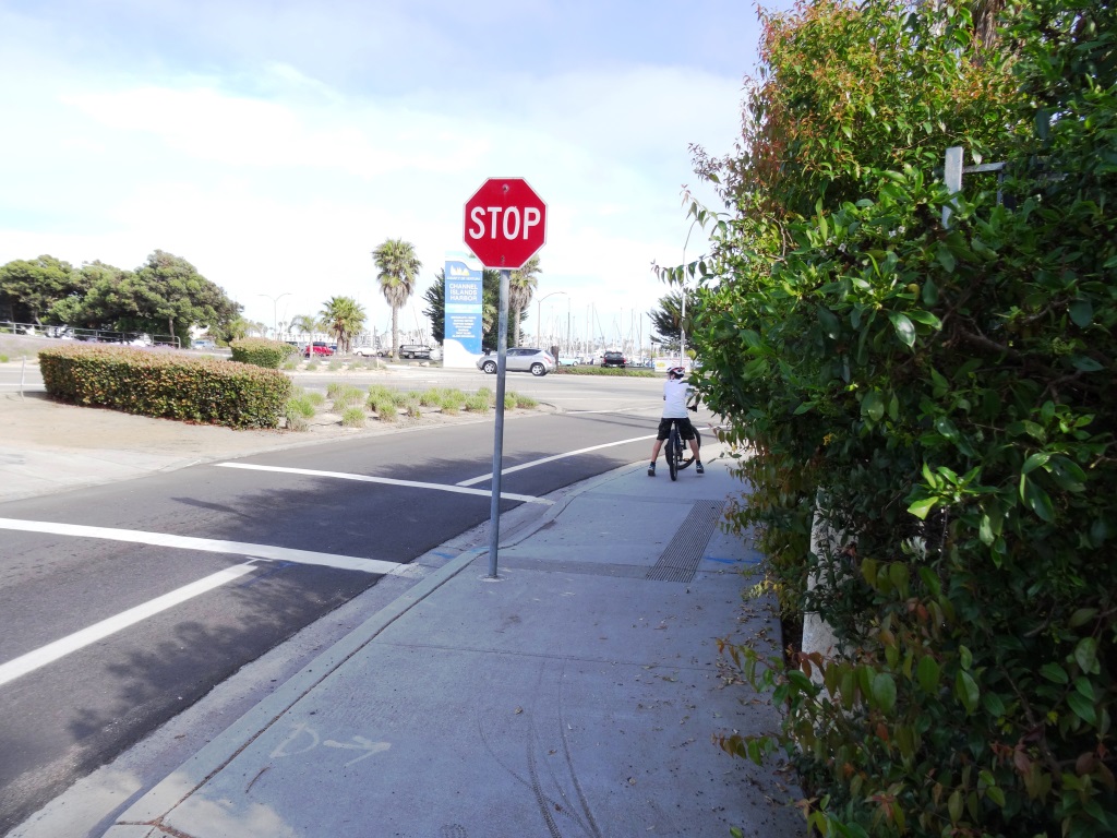
While I don't have the specific start-end points of the Omer Rains Trail, I do know that it's a lot of fun taking the bikes to Marina Park at the south end of San Buenaventura State Beach and taking the bike lane on Pierpont Blvd about a mile to where the beachfront bike path starts at the corner of Pierpont and San Pedro St.

OmerRainsBikePath.JPG

Great bike path along the beach in Ventura! Nice and flat with cool ocean breezes, with several restrooms available.

Speaking of restrooms, I've always been a bit puzzled by these odd shaped ones at San Buenaventura State Beach.

Speaking of restrooms, I've always been a bit puzzled by these odd shaped ones at San Buenaventura State Beach.

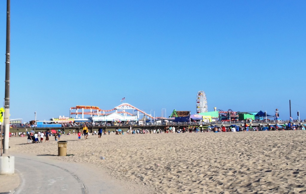
From there, the two-lane bike meanders along the beach to the Ventura Pier and up the Ventura Promenade to Surfers' Point. On weekends it can get a little crowded around here with pedestrians, other cyclists and beachgoers, so do be careful.

The bike path goes under the Ventura Pier.

The bike path goes under the Ventura Pier.

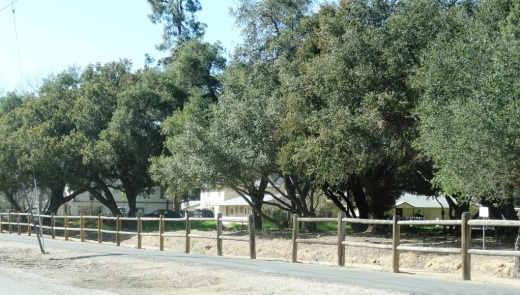
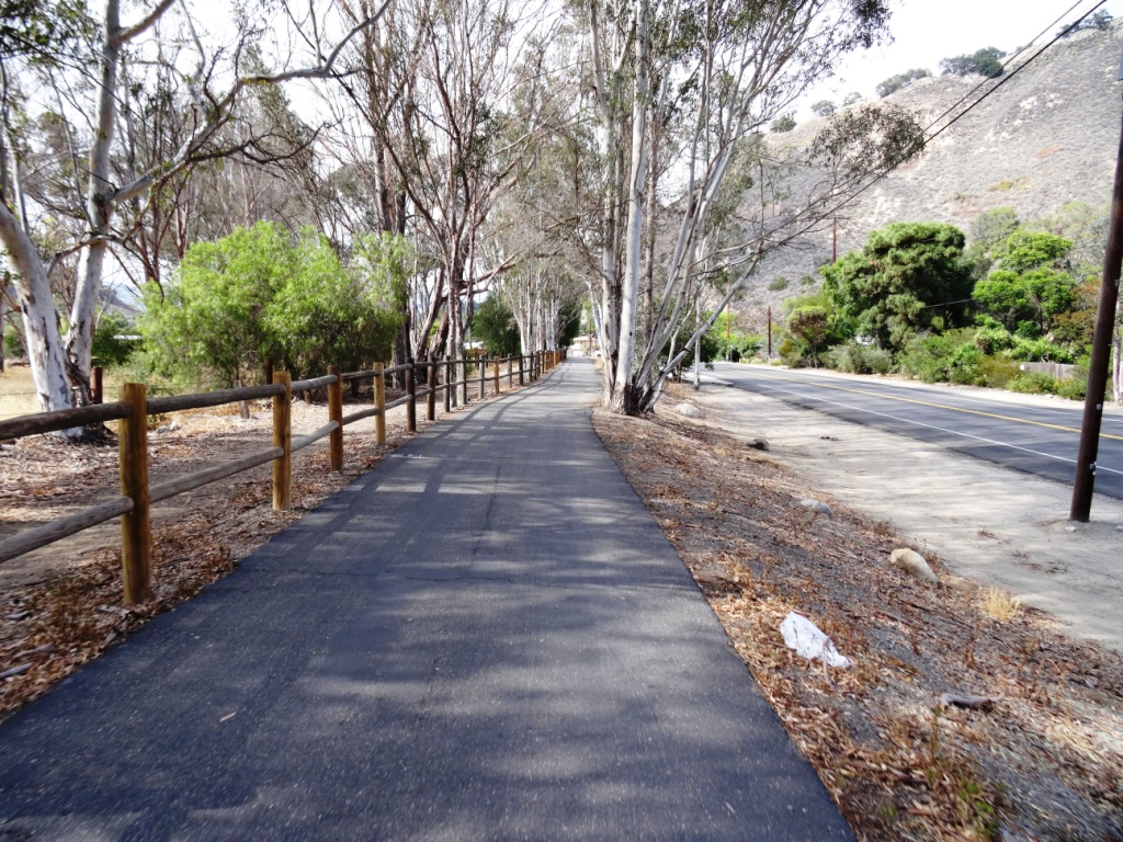
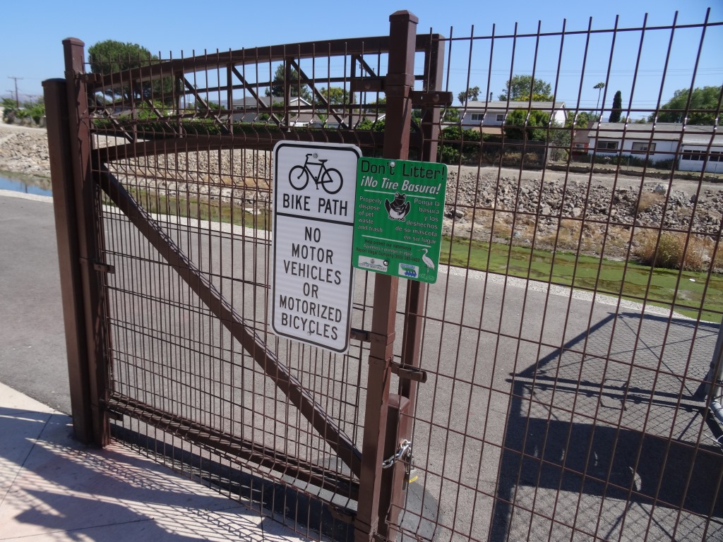
From Surfers' Point, you can continue taking the bike path north/northwest to Emma Wood State Beach, cycling around the Ventura Beach RV Resort, past the City of Ventura's Seaside Wilderness Park, then on up the coast. Or if you want, veer right on Main Street and make your way over to the Ventura River Trail that takes you up to Ojai.

Northwest portion of Omer Rains Trail (Map courtesy of City of San Buenaventura)

Northwest portion of Omer Rains Trail (Map courtesy of City of San Buenaventura)

Or just turn back and enjoy the views, perhaps stopping and having lunch on a bench overlooking the ocean. Or make your way up to Downtown Ventura and grab a bite to eat. 

VenturaBeachBenches.JPG
Ventura bike path headed south from Emma Wood State Beach towards Ventura Beach

Ventura bike path headed south from Emma Wood State Beach towards Ventura Beach

Marvin Braude Coastal Bike Path - Pacific Palisades to Torrance

We love driving down to Will Rogers State Beach from time to time, bring the bikes and enjoy the Marvin Braude Coastal Bicycle Path along the Pacific Ocean. 

This fun 22 mile path takes you from Pacific Palisades as far as Torrance.  Depending on how far you want to go and if you have kids with you, there are so many spots to stop along the way. 

To get to Will Rogers State Beach from the Conejo Valley, take the 101 to Las Virgenes/Malibu Canyon Road south to PCH, then about 9 miles down PCH to Will Rogers (17000 PCH), just east of Gladstones and Sunset Boulevard. Parking at Will Rogers varies based on when you go; I last recall paying $10.

The path doesn't actually start at Will Rogers Beach as it is a walking path only at this point. Ride the bike through the parking lot to the start of the bike path at Temescal Canyon Road. And, you're off!

From the start of the path, here are some approximate distances to destinations:

  • Santa Monica Pier - 3.2 miles
  • Venice Pier - 5.8 miles
  • Marina del Rey - 8.7 miles
  • Playa del Rey - 9.9 miles
  • Dockweiler Beach - 12.5 miles
  • Manhattan Beach Pier - 16.5 miles
  • Hermosa Beach Pier - 18.2 miles
  • Redondo Beach Pier - 20.4 miles
  • Torrance Beach - 22.3 miles (endpoint)

With younger kids, the Santa Monica Pier makes a perfect 6 1/2 mile round trip destination as you can stop, eat lunch and have some fun at Pacific Park, then ride back. Or kick it a few notches and ride to/through Venice Beach for all the action. 

Pacific Park up ahead

Pacific Park up ahead

There are plenty of restrooms water stops and of course non-stop BEACH to enjoy here, making this one of my favorite destination for bicycling with the family. And of course, you don't have to park at Will Rogers...you can park anywhere on PCH in and around the bike path to enjoy it.

Of course you do have to be careful of sand on the path, pedestrians/beach goers crossing and walking on the path, other cyclists, runners, roller bladers and crowds.  

Detailed map at file.lacounty.gov/SDSInter/dbh/docs/189949_2013-BIKEMAP85x11Web-Ready(highres).pdf

CLICK HERE FOR DOZENS OF FAMILY-FRIENDLY BIKE PATHS BACK UP IN THE VENTURA COUNTY AREA!

Ventura River Trail

VenturaRiverTrail.jpg

The Ventura River Trail is a 6.3 mile asphalt pedestrian and bike path that follows the old Southern Pacific Railroad right-of-way from Main Street in Ventura to Foster Park inland towards Ojai. The path, originally opened in 1999, connects the Ojai Valley Trail to the Omer Rains Trail along the beachfront for 17 miles of great bicycling. The trail is open dawn to dusk.

Much of the Ventura River Trail parallels Ojai Freeway 33 and as such is also referred to as the Ojai Valley Trail Extension. Here are the various access points from south to north:

OK, so now for some commentary. This is not exactly the most exciting bike path in the world. You are paralleling Highway 33 and are kind of off the beaten path in an industrial area, but it is a peaceful path. Also, there are several stops you need to make as you cross streets, so your kids (and you) do need to be aware of that. You won't find an ocean view on this path.  But...it is never crowded, quite flat and a great way to get out on the bikes away, for the most part, from automobiles.

One of the more interesting, albeit somewhat creepy scenes along the path is this dormant USA Petroleum Refinery that was closed in 1984 after operating less than 10 years.  A bit of an eyesore this 96 acre, barbed wire fence enclosed section on the north end of the trail is. In the past there have been homeless encampments in the vicinity, but I've never seen them.

USAPetrol_view1.JPG
USAPetrol2.JPG
USAPetrol4.JPG

What I like to do is park in the free city parking lot near the Omer Rains Trail at the corner of W. Main St and Peking St, then take Main St a block east to N. Olive St, turn left (north) to Rex St. Take a left on Rex to the bike path entrance.

VenturaTrailEntry.JPG
VenturaTrailHwy33.JPG

Ojai Valley Trail

OjaiValleyTrail_Sign.jpg

The Ojai Valley Trail is a 9 to 10 mile trail that parallels Highway 33 from Foster Park on the outskirts of west Ventura, to Soule Park in Ojai. One side of the trail is paved for bicyclists, walkers, joggers and people exercising their pets. Post-and-rail wood fence separates the paved path from a dirt bridle path for horseback riders. Sections wind through wooded areas and past riverbeds. While most of the path is offset from Highway 33 (the main thoroughfare in Ojai), it does have a number of street crossings. If staying in Ojai and you run or bike, you will no doubt cross paths with this path!

At Foster Park, the Ojai Valley Trail connects with the 6.3 mile Ventura River Trail, which in turn extends to the Omer Rains Trail along the Ventura beachfront.

OjaiTrail1.JPG
OjaiTrail2.JPG
OjaiTrail3.JPG
Ojai Valley Trail near Foster Park

Ojai Valley Trail near Foster Park