Conejo Players Theatre in Thousand Oaks

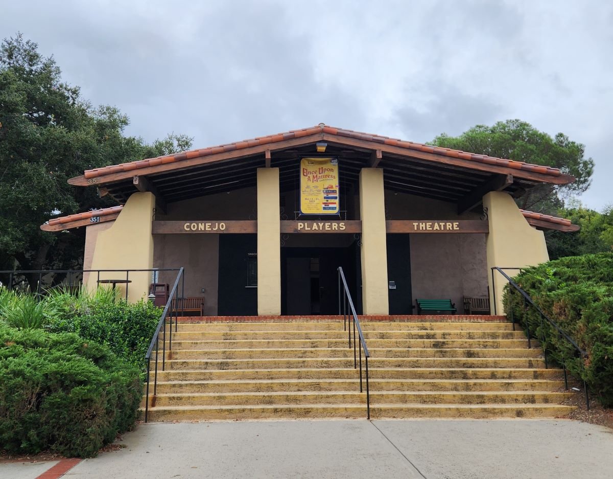
The Conejo Players is a community based theatre arts group that has entertained local residents since 1958.  It is a volunteer based non-profit organization that hosts six productions each year, as well as several productions geared towards kids.

The 185 seat Conejo Players Theatre is located at 351 South Moorpark Road in Thousand Oaks, just south of the 101 near the Los Robles Greens entrance.  Phone is 805.495.3715.  www.conejoplayers.org

Bank of America Performing Arts Center Thousand Oaks

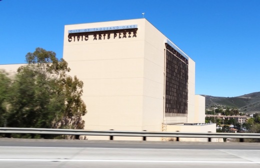
The Bank of America Performing Arts Center (BAPAC) Thousand Oaks (formerly the Thousand Oaks Civic Arts Plaza) is one of the largest performing arts centers between Los Angeles and San Francisco at over 200,000 square feet.

CivicArtsPlaza.JPG

The City of Thousand Oaks Cultural Affairs Department oversees theatre productions for the BAPAC, which encompasses two theatres – the 1,800-seat Fred Kavli Theatre and the 394-seat Janet and Ray Scherr Forum Theatre.

The performing arts center combines outstanding arts and entertainment with state-of-the-art technology and acoustics. Over 300,000 patrons and 50,000 children attend more than 400 performances annually. The BAPAC Thousand Oaks is funded through a unique public/private partnership between the City of Thousand Oaks and the Alliance for the Arts. It opened in 1994.

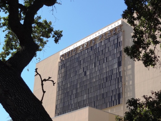
Thousand Oaks Civic Arts Plaza

Thousand Oaks Civic Arts Plaza

There is something for everyone at this venue....musicals, cabaret, Broadway musicals, dance, concerts, big bands, the New West Symphony, ballet, plays, well known speakers and events for the kids. In front of the plaza is the Mary and Richard Carpenter plaza park.

Next door to the Plaza is The Lakes of Thousand Oaks, a great place to grab a bite to eat, do some shopping and enjoy the lakes and playground on the property.

Between 1926 and 1968 this location housed the 170 acre Goebel's Lion Farm (later called Jungleland), where many of the famous wild animals in Hollywood pictures lived.  There were elephants, lions, tigers, hippos, you name it.  Leo, the MGM lion, Mr. Ed the Talking Horse, and Getta, Tarzan's chimpanzee all lived there at some point.  Jungleland was a major draw in its day that played a large role in making Thousand Oaks what it is today.

A photo of Jungleland after it closed in 1969 (Image courtesy of Conejo Through the Lens, Thousand Oaks Library).

A photo of Jungleland after it closed in 1969 (Image courtesy of Conejo Through the Lens, Thousand Oaks Library).

The BAPAC is located at 2100 E. Thousand Oaks Boulevard (take the 101 East, left on Rancho exit, right on T.O. Blvd, and turn right into parking structure at Dallas Drive).  Visit bapacthousandoaks.com for more information or call 805.449.2787.

It takes good luck and timing for a novice photographer like me to capture the Thousand Oaks Civic Arts Plaza while driving south on the 101 freeway.

It takes good luck and timing for a novice photographer like me to capture the Thousand Oaks Civic Arts Plaza while driving south on the 101 freeway.

TOCivicArtsPlaza_wall.JPG

Color Me Mine Paint Your Own Ceramics Studio in Oxnard

ColorMeMine_logo.jpg

Are you looking for a creative way to spend quality time with the ones you love? Paint ceramics with your friends and family at Color Me Mine Paint Your Own Ceramics Studio located at The Collection at Riverpark, at 2710 Portico Way, Oxnard!

Color Me Mine is a ceramic painting studio where you drop by anytime and paint a pre-made bisque pieces. For the price of a studio fee and the item you choose to paint, you can paint all day using 60+ colors and supplies! They then glaze and fire your work in a kiln and your work of art will be available in 5 to 7 days.

In addition to a vast array of tableware, painters can select from a variety of vases, frames, jewelry boxes, figurines, and more!

More information at www.oxnard.colormemine.com or call 805.981.8631.

Two Springs Trail and Wildwood Canyon Trails in Wildwood Park, Thousand Oaks

Sign on the west side of the Wildwood Park parking lot after walking down some steps

Sign on the west side of the Wildwood Park parking lot after walking down some steps. (Indian Creek Trail was renamed Two Springs Trail in May 2022.**)

If you enjoy the sound of running water, the Two Springs Trail (formerly Indian Creek Trail) and Wildwood Canyon Trail at Wildwood Park in Thousand Oaks are for you.

The Two Springs Trail can be accessed from the main Wildwood Canyon trailhead area parking lot at the east end of Avenida de los Arboles as well as at a separate trailhead on Arboles, slightly west of the parking lot.

Indian Creek Trail entry point from Avenida de los Arboles

Two Springs Trail (formerly Indian Creek Trail) entry point from Avenida de los Arboles

There are shady sections hidden among the trees and sections in the sun. Most of the trail runs along a creek that flows into Paradise Falls. This is not a completely easy hike as there are some hilly sections, a number of steps, and a stream crossing. That said, there's enough variety to make this a fun and interesting hike with the kids.

Visit the Conejo Open Space Foundation website at cosf.org/trails/wildwood/wildwood-park-easy-hike-moonridge-trail/ for a handy map of these trails.

About half a mile or so into the hike, you'll come across a fairly significant waterfall down below, way below, in the creek. Not as large as Paradise Falls, but definitely prominent. Adjacent to that area is a bench. And from there you have some steps and a stream crossing to make it down to the flatter section of the trail.

The waterfall seen from the Indian Creek Trail. Be careful!

The waterfall seen from the Two Springs Trail (formerly Indian Creek Trail). Be careful!

The bench on the Indian Creek Trail in Wildwood Park

The bench on the Two Springs Trail (formerly Indian Creek Trail) in Wildwood Park

Eventually you get to a bridge. If instead of crossing the bridge, you veer left (southwest), you'll be on the Wildwood Canyon Trail along the creek. This is a wide path that can take you on another little sidetrack loop up the Castillo Trail to Castillo Circle (street). A bit of a steep, roughly 3/8ths of a mile trail to Castillo Circle, where you can walk back to a separate trailhead via Velarde Drive north to San Miguel Circle to the San Miguel Trail. You'll end up back at the bridge area.

The Wildwood Canyon Trail is pretty cool. Fairly flat, wide and runs along a creek. The water they say is mostly urban runoff but fun to check out up close with the kids.

The Wildwood Canyon Trail is pretty cool. Fairly flat, wide and runs along a creek. The water they say is mostly urban runoff but fun to check out up close with the kids.

The Meadows Center next to the bridge has restrooms and a drinking fountain. The Conejo Rec & Park District leads many hikes here for s'mores and fun activities.

The Meadows Center next to the bridge has restrooms and a drinking fountain. The Conejo Rec & Park District leads many hikes here for s'mores and fun activities.

The bridge that intersects the Indian Creek Trail and Wildwood Canyon Trail. Lots of options!

The bridge that intersects the tWO sPRINGS (FORMERLY iNDIAN cREEK) Trail and Wildwood Canyon Trail. Lots of options!

Or, veer right (west) over the bridge, continuing on perhaps the Wildwood Canyon Trail southeast towards the top end entry into the Paradise Falls area (pretty cool to go this way). You can also sidetrack a bit by crossing the bridge and making a sharp right (north) to the short Little Cave Trail** and check out the Little Cave **.

The Indian Cave is really easy to get to. Wear good hiking shoes though as it can get slippery. I slipped several times recently because the sole of my sneakers was so worn down.

The Little Cave (formerly Indian Cave**) is really easy to get to. Wear good hiking shoes though as it can get slippery. I slipped several times recently because the sole of my sneakers was so worn down.

You can return to the parking area by either backtracking up the Two Springs Trail or by taking the trail directly across from the bridge (basically go straight) up the steep, moderately winding path to a public access road (there is overflow parking available here) to the main Mesa Trail. From there, go right (east) back to the parking lot.

I could go on but there are so many different options in Wildwood Park that we'll stop here for now. Here are links to some other options:

THE TEEPEE, LITTLE CAVE AND PARADISE FALLS

LIZARD ROCK

SANTA ROSA LOOP

SANTA ROSA TRAIL AND LOWER BUTTE TRAIL FROM WILDWOOD PARK TO CLU

** The change in name was approved by the Conejo Open Space Conservation Agency (COSCA) in May 2022. COSCA received a request to change the Indian Creek Trail name earlier that year. On its own, the work "Indian" refers to individuals from India, rather than Native Americans, and thus did not accurately reflect the origin of the people to whom it refers.

The Indian Cave and Indian Cave Trail were renamed Little Cave as it was unclear if the cave was naturally formed and/or historically used by Native Americans.

The Indian Creek Trail in Wildwood Park was renamed Two Springs Trail as two natural springs contribute to the stream flow in this portion of the channel.

CReATE STUDIO Mobile Art Studio

CReATE STUDIO originally opened at a venue in Westlake Village in 2009 but is now a mobile art studio geared towards creative exploration using a varied array of recycled, artistic and crafty materials. All ages can create treasured masterpieces using many interesting and everyday household materials to build, tape, glue, paint and invent!

To learn more, visit www.createstudiofun.com.

As You Wish Pottery Painting Place in Simi Valley

As You Wish Pottery Painting Place is located at the Simi Valley Town Center. This is a large, nicely appointed ceramics/painting studio where you select a piece of pottery off the shelves, paint it and a few days later pick up your beautiful, glazed work of art!

Great place for birthday parties, team building, family nights, fundraising and more. Visit www.asyouwishpottery.com or call 805.520.9500 for more information. Open seven days a week.

Golf N' Stuff Ventura

For hours of amusement check out Golf N' Stuff off of Highway 101 in eastern Ventura. Golf N' Stuff features two 18-hole miniature golf courses, Indy style race cars (go-karts), bumper boats, bumper cars and a large arcade. You must be 4' 8" tall to drive the go-karts and at least 4' tall to drive the bumper boats and bumper cars.

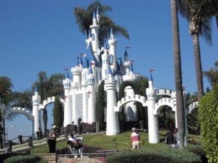
The famous Golf N' Stuff Castle seen from Highway 101 in Ventura.

The famous Golf N' Stuff Castle seen from Highway 101 in Ventura.

Wow, talk about a fun venue for a kid's birthday party! Parties include pizza, cake, golf, rides, etc. Lots of things to do for everyone at Golf N' Stuff. The arcade is one of the largest around town.

Pricing (as of August 2023) is $16 per person for miniature golf ($20 for 2 hours of unlimited play), $12 for go-kart rides, $12 for bumper boats and $10 for bumper cars (for the driver; $5 for passengers).

Golf N' Stuff is open 365 days a year. They usually open at 10am. Closing time varies by day from 8pm to 10pm. located at 5555 Walker Street, Ventura. Exit the 101 off Victoria, head North to Moon Drive, which turns into Walker, and turn left. The park is on the right hand side. More information at www.golfnstuff.com or call 805.644.7131.

GolfNStuffSign.jpg
GolfNStuffCtr.jpg
GolfNStuffCtr2.jpg
GolfNStuffC2H10.jpg

Malibu Lagoon State Beach

Malibu Lagoon State Beach is where Malibu Creek meets the Pacific Ocean. To get there, park either at the state lot (corner of Pacific Coast Highway and Cross Creek Road) for a fee, along Pacific Coast Highway or across the street in spots available near Malibu Country Mart and the Malibu Civic Center.

The lagoon is serene, with a sandbar of pelicans enjoying their summer day. This beach extends southeast to Surfrider Beach and the Malibu Pier, which is just a short walk away. While you're there try to check out the Adamson House and Malibu Lagoon Museum.

More information at www.parks.ca.gov/?page_id=835. Dogs are not allowed at Malibu Lagoon State Beach and trails.

MalibuLagoon1.5.JPG
MalibuLagoon2.JPG
MalibuLagoon3.JPG
MalibuLagoon4.JPG

Beaches Spanning From Carpinteria Through Ventura County to Malibu

My kids and I love going to the beach but for many years we seemed to go to the same ones all the time. So I stopped by the Automobile Club and asked them if they had a brochure on all the local area beaches open to the public. They shrugged their shoulders and said no such guidebook existed. They handed me a fold out map, which was of no use to me as I wanted to know exactly how to get to these beaches, if they have restrooms, parking, etc.

MalibuBeach.jpg

Then I started searching around for information and found bits and pieces in various locations that were marginally useful. So I decided to consolidate this information into one place where I could find out about where to go to the beach around Ventura County on up the coast to Carpinteria and Santa Barbara and down to Malibu. So I hope you find the following links helpful in finding local area beaches in Ventura County and surrounding areas!

Carpinteria to Ventura

Oxnard to Malibu

Santa Barbara Area Beaches

This took a lot of time to compile over 60 local area beach areas, so I truly hope you benefit from these lists! So enjoy and provide feedback if you have comments and/or additional information.

MuguFisherman.jpg
At Leo Carrillo State Beach in Malibu.

At Leo Carrillo State Beach in Malibu.

Windsurfers at Surfers' Point in Ventura.

Windsurfers at Surfers' Point in Ventura.

Rancho Sierra Vista / Satwiwa in Newbury Park

RanchoSierraVistaEntry.jpg

We are fortunate to have such great trails and views of Boney Peak from in Newbury Park. At Wendy and Potrero is the Western edge of the Santa Monica Mountains where Sycamore Canyon cuts through Rancho Sierra Vista/Satwiwa and Point Mugu State Park.

SatwiwaSign.JPG
Satwiwa.jpg

Roughly a mile easy hike from Wendy/Potrero gets you to the Satwiwa Native American Indian Culture Center where you can explore some native Chumash items and educational information and chat with rangers. This is a nice little hike to take the kids on. There are restrooms and water at the center, which is open from 9 to 5 on weekends.

Learn more about hiking in Rancho Sierra Vista/Satwiwa at THIS LINK.

You can get easier access to the center by parking in the adjacent National Park Service parking lot via Lynn Road to the access road at Via Goleta in Newbury Park.

Another mile and a half of hiking gets you to a small waterfall, which is fun to check out with the kids but somewhat more strenuous of a hike. Note that in recent years (2012-2015), the waterfall has barely flowed due to low rainfall.

Here is more information about the Boney Mountain Trail, leading up to Hidden Valley Overlook, the waterfall and Danielson Monument.

SatwiwaCircle.JPG

Visit www.nps.gov/samo/planyourvisit/rsvsatwiwa.htm for a map and site information on the National Park Service website.

BoneyViewsSatwiwa.jpg
SatwiwaTrails.JPG
WendyPotreroTrailhead.JPG

Trailhead at the corner of Wendy Drive and Potrero Road in Newbury Park. Park on the dirt on the south side of Potrero or on the street on Wendy.

Escondido Canyon Trail and Waterfalls in Malibu

Trailhead on Winding Way

Trailhead on Winding Way

The Edward Albert Escondido Canyon Trail and Waterfalls is located off of Winding Way in Malibu.  It also also referred to as Escondido Falls.

The most unique aspect to Escondido Falls is that it is home to the tallest waterfall in the Santa Monica Mountains at over 150 feet.

That said, in drought years, there is often no sign of waterfall, other than a sparse trickle into Escondido Canyon Creek. But even when that is the case, this is a nice, moderate hike, good for all ages. 

That said, in very wet years, like 2023, you will encounter a number of stream crossing on the trail. Just be aware, as this may not be up your alley.

To get to Escondido Falls from the Conejo Valley/101, take Kanan south to PCH and turn left. You'll be driving just under 2 miles, past Paradise Cove, to the small parking lot on Winding Way and PCH. Turn left onto Winding Way and an immediate left into the parking lot. There's a sign; you can't miss it. The lot has spaces for only around 16 vehicles; it is full, you'll have to find a spot on PCH and make you way from there...but be careful and watch for the plentiful "no parking" signs on PCH.

Parking is $12 (as of June 2023) and takes both cash and credit cards. Parking fees contribute to the ongoing maintenance of the trails, including porta potty cleanings, graffiti and trash removal and partial staffing.)

The parking area is on Winding Way and PCH. The initial section of the hike is along Winding Way is called the Winding Way Trail.

The parking area is on Winding Way and PCH. The initial section of the hike is along Winding Way is called the Winding Way Trail.

The hike is about 4 miles round trip and can be done in as fast as an hour (if you speed walk and don't hang out) or for most, a couple hours.

The first 8/10ths of a mile is along Winding Way to the trailhead. It has a moderate hill but is not that bad. Near the peak of the initial hill, you will need to cross from the left side of the street to the right side as you make your way up. There are signs that ask that you walk on the dirt trail rather than on the street, so try to abide by that. You will be treated to views of beautiful homes and ocean views along this portion of your trek.

After a short final downhill section, you'll reach the trailhead. After an initial left turn that takes you briefly west, most of the rest of the trail to Escondido Falls is a northeast to northerly direction. You'll be treated to lush oak woodlands and greenery year-round.  

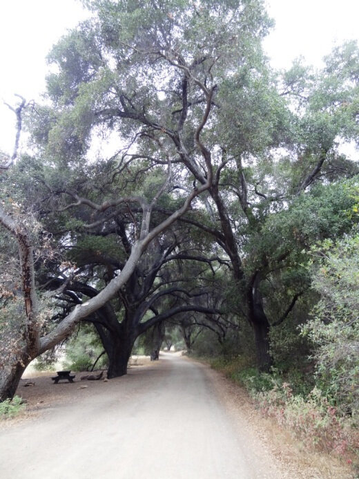
Much of the trail looks like this; canopied by oaks and shrub.

Much of the trail looks like this; canopied by oaks and shrub.

Hikers, equestrians and bikers are all welcome on the trail. Dogs too, on leash of course. I have not seen bikers on this trail, however. There are no restrooms, other than a porta-john at the parking lot. No drinking fountains, so bring water. There are trash cans at the trailhead. 

The waterfall is a treat to see but the rest of the hike is quite nice too, largely shaded and not too hilly or technical. There is a net elevation gain from 150' at the trailhead to 325' at the Falls over about a mile, which is not bad.

After the rainy season, you may have to cross the creek a few times as it criss-crosses the trail. There are a couple forks in the road where you may wonder which way to go. Generally speaking, turn left on your way to the falls and that will get you there.

Believe it or not, this is the end of the trail, where the waterfall flows after the rainy season. In late August pictured here, there is a dribble of water flowing into the creek.

Believe it or not, this is the end of the trail, where the waterfall flows after the rainy season. In late August pictured here, there is a dribble of water flowing into the creek.

The parkland ends at the multi-tiered waterfall area and the trail ends. Except, there are paths that can get you to the upper falls. Technically you are not supposed to do this because you are no longer on public land, not to mention you are literally rock climbing your way up there and it can be dangerous.

This is a fun, family-friendly hike that is worth a try. Quite popular, one could argue, too popular, on weekends.

There's one side trail to the east that will give you views of the waterfall when it is flowing. The white-ish area in the upper right hand of this photo is where the waterfall resides.

There's one side trail to the east that will give you views of the waterfall when it is flowing. The white-ish area in the upper right hand of this photo is where the waterfall resides.

Why is it named after Edward Albert? Well, Edward Albert is the only son of actor Eddie Albert, well known for his role on TV sitcom "Green Acres." Edward died at age 55 in 2006. Prior to his death, he was a tireless advocate for preserving Escondido Canyon. The Santa Monica Mountains Conservancy named the area in honor of him several months prior to his death. (1)

Visit the Santa Monica Mountains Conservancy site at mrca.ca.gov/parks/park-listing/escondido-canyon-park for more information.

(1) Los Angeles Times obituary dated 9/27/06 at this link.

Escondido Falls parking as of June 2023.

Stearns Wharf in Santa Barbara

Dolphins greet you at the entrance to Stearns Wharf.

Dolphins greet you at the entrance to Stearns Wharf.

StearnsWharf.gif

Stearns Wharf is located at the juncture of W. Cabrillo Road and State Street in Santa Barbara. Originally constructed in 1872 by lumberman John P. Stearns as the longest deep-water pier between Los Angeles and San Francisco, it is now one of the most visible and visited tourist destinations in Santa Barbara. In 1980-81, the City of Santa Barbara restored the wharf, constructed new buildings on it and assumed operation of the facility.

Our family particularly enjoys visiting the Museum of Santa Barbara Sea Center located on the wharf, followed by a stop at Mother Stearns Candy Company or the Great Pacific Ice Cream Company. Of course, The Harbor Restaurant and Longboard’s Grill are crowd favorites. There's also wine tasting at Deep Sea Wine Tasting Room, Moby Dick Restaurant, fish and chips, souvenir shops and other places.

View from the end of Stearns Wharf back toward the mainland.

View from the end of Stearns Wharf back toward the mainland.

View from Stearns Wharf

View from Stearns Wharf

You can get onto the wharf in a number of ways. There is limited parking on the wharf. Cost (as of May 2023) is $3/hour, but the first 90 minutes are free. Or you can park along Cabrillo Road or in a local beach parking lot and walk onto the wharf. Or do what we enjoy...park at the Santa Barbara Harbor and ride bikes onto the wharf. The wood planks are a bit bumpy but you'll survive!

Learn more about Stearns Wharf at www.stearnswharf.org.

Beautiful views of the harbor area as you'll see below from the pier. If you walk onto the wharf, you may encounter some locals that "live off the land" with sand sculptures and other monuments on the sand for your viewing pleasure (and perhaps some spare change). They are part of the carnival atmosphere. And of course on Sundays you'll be treated to the Santa Barbara Arts & Crafts Show that has been running since 1965.

Malibu Creek State Park

MalibuCreekSP_sign.JPG

Malibu Creek State Park is accessible in Calabasas, at 1925 Las Virgenes Road, south of Mulholland. The park contains over 8,000 acres of rugged, beautiful hills, trails and scenery. It stretches from Agoura Hills down to Malibu, down to Malibu Lagoon State Beach, covering much of the 25 mile Malibu Creek that flows from Boney Mountain down to the Lagoon. Malibu Creek is the only stream channel that crosses through the Santa Monica Mountain range.

There are three natural preserves in the park, Liberty Canyon, Udell Gorge and Kaslow, which protect Valley Oaks, rare plants and volcanic formations.

Things to do in Malibu Creek State Park include hiking, running, biking, camping, picnicking, fishing and checking out the wildlife. There are over 35 miles of trails and fire roads throughout the park. A fun added bonus is the old M*A*S*H series set, filmed from 1972 to 1983, that resides there.

Dogs are not allowed in Malibu Creek State Park trails.

MalibuCreek2.jpg

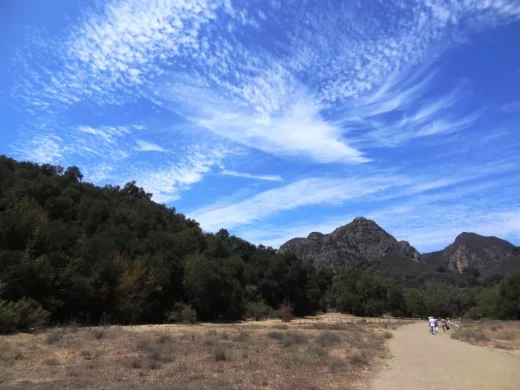
Malibu Creek State Park contains roughly three dozen different trails, many easy, and some...extraordinarily challenging, such as the Bulldog trail, taking you to 2,500 foot peaks with panoramic views out to the ocean and surrounding peaks and valleys.

MalibuCreek1.jpg

Parking for the day at Malibu Creek State Park is currently $12, or $3 per hour. You can also park at the corner of Mulholland and Las Virgenes and make your way into the park via the Grassland Trail.

The campground at Malibu Creek State Park has 62 campsites and 4 RV sites. Visit www.parks.ca.gov/?page_id=614 for more information.

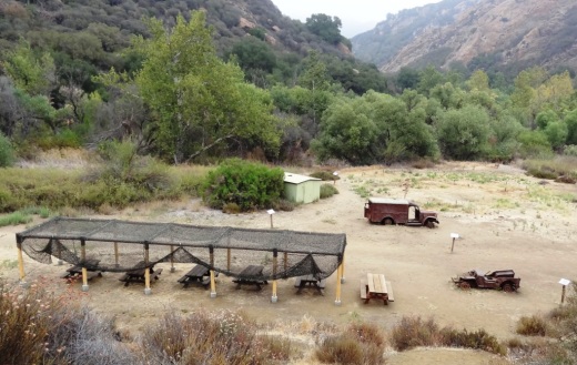
The old M*A*S*H site is about 2 1/2 miles from the parking area.

The old M*A*S*H site is about 2 1/2 miles from the parking area.

M*A*S*H site with plenty of picnic tables

M*A*S*H site with plenty of picnic tables

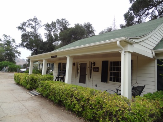
The Visitor Center is only a 10 minute walk from the parking lot and is generally open from noon to 4pm on weekends.

The Visitor Center is only a 10 minute walk from the parking lot and is generally open from noon to 4pm on weekends.

There's also an interesting visitor center about 1/2 mile from the main entrance to the park. It is open on Saturday/Sunday from noon to 4pm, subject to availability of docents. Worth a stop as there are some neat things to see in there, including wildlife and rocks/artifacts and other useful information. You can also purchase drinks in there as well as a small assortment of other items.

Hike to the Rock Pool at Malibu Creek State Park

Century Lake Hike at Malibu Creek State Park