Rocky Oaks Nature Reserve in the Malibu Hills

RockyOaks_sign.JPG

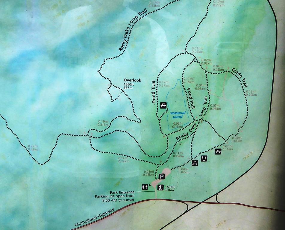
Rocky Oaks is a 250 acre nature reserve that is part of the Santa Monica Mountains Recreation Area, located at the 31500 block of Mulholland Highway in Malibu, west of Kanan Road. The entrance is on the north side of Mulholland Highway. The park is managed by the National Park Service.

RockyOaksLoopTrail.JPG

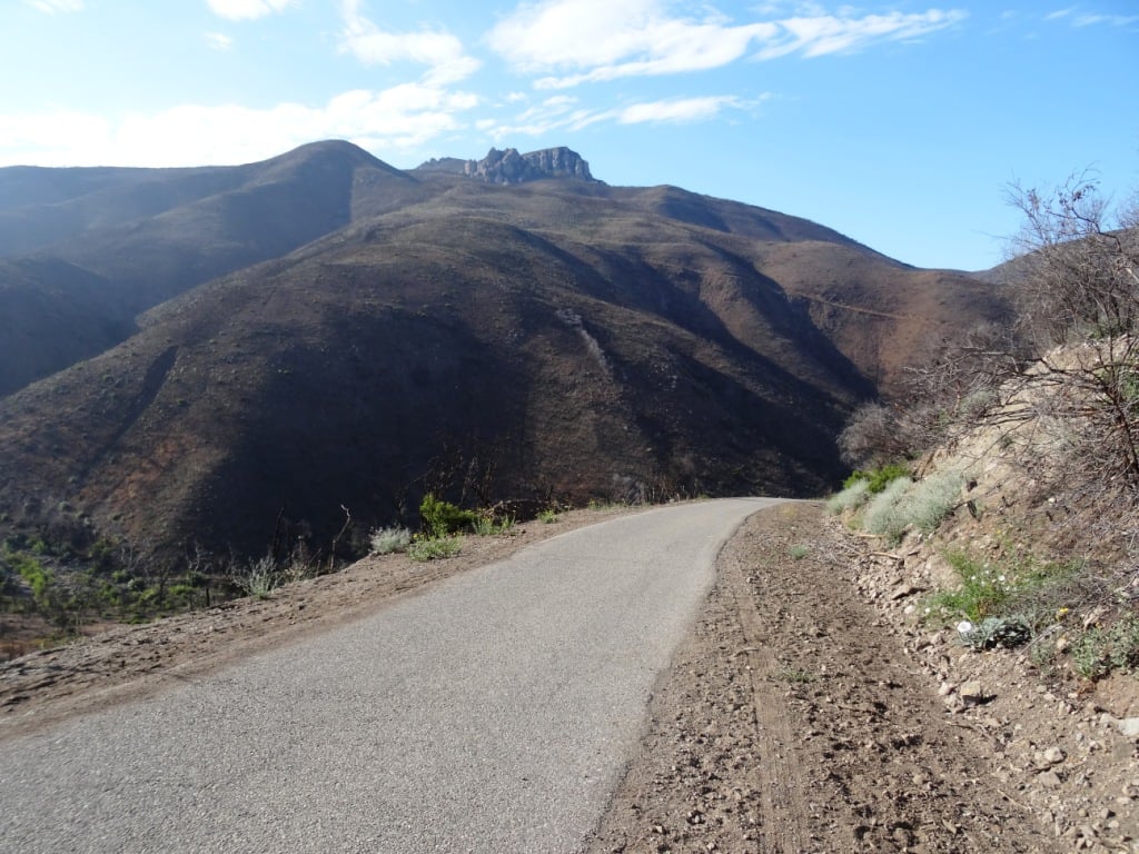
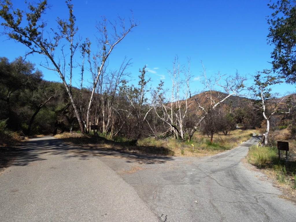
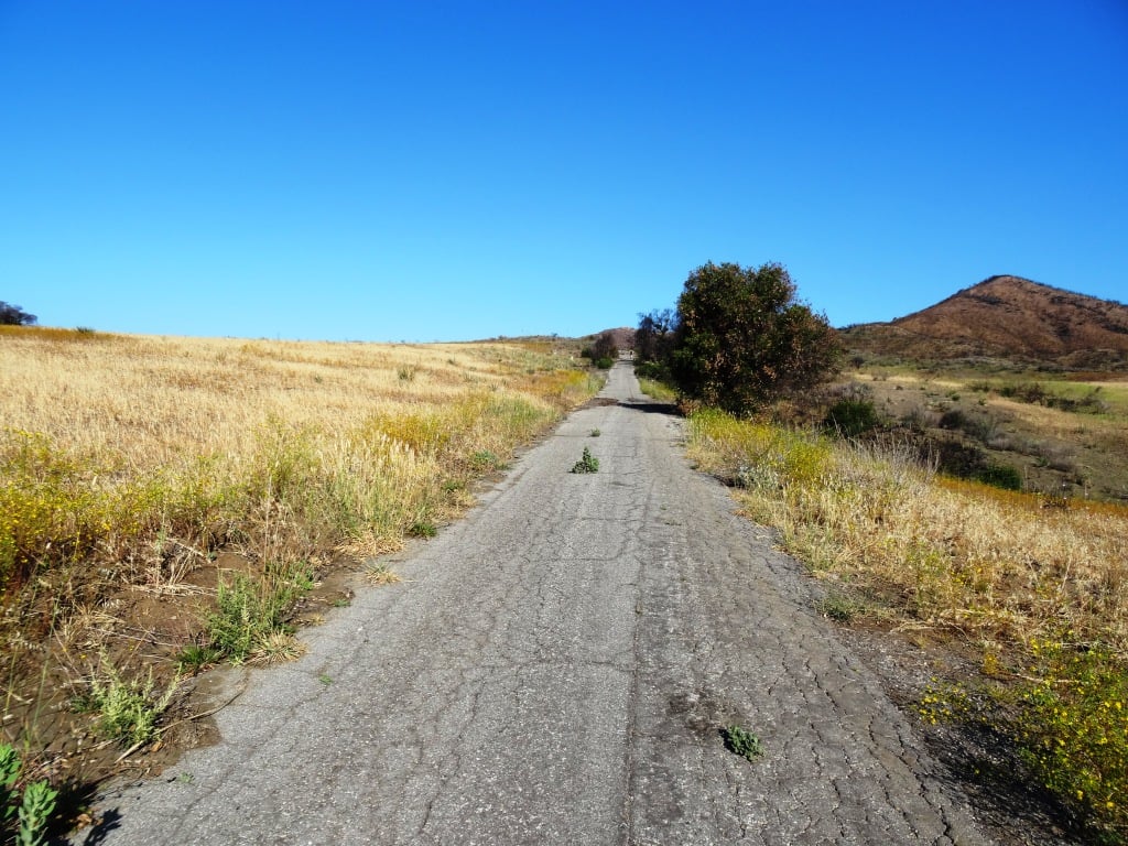
Rocky Oaks has various species of oak trees, some centuries old. The Overlook Trail takes you to a peak with gorgeous panoramic views while the Pond Trail (less than a mile round trip) takes you to a seasonal pond area which used to be part of a cattle ranch.

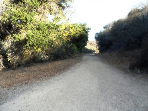
The Rocky Oaks Loop Trail is a 2.2 mile easy trail that is lined with sage. This is one of the more low key, easy to hike areas around town. It can get hot but at only 6 miles from PCH you can also feel some nice ocean breezes in these trails.

Learn more about Rocky Oaks and download a trail map at www.nps.gov/samo/planyourvisit/rockyoaks.htm.

Pond is looking quite nice in late spring of 2017.

Pond is looking quite nice in late spring of 2017.

RockyOaks_2.JPG

Los Robles Trail East in Thousand Oaks

The Los Robles Trail East in Thousand Oaks is accessible from the Los Robles Trail trailhead heading west from the corner of South Moorpark Road and Greenmeadow Avenue in Thousand Oaks.

LosRoblesTrail_SignMain.JPG

From the main trailhead, go west just under 1/2 mile and you'll see the fork in the road where you can go east or west. Head south (click here if you prefer going west) where you'll go towards the Los Robles Trail East.

A gradual uphill of about 1/2 mile on a wide fire road trail takes you to a picnic bench and then a more winding, partially shaded, narrower, eastbound section of trail.

Fire road that takes you to picnic bench.

Fire road that takes you to picnic bench.

Picnic bench at juncture of fire road and narrower, steeper Los Robles Trail East.

Picnic bench at juncture of fire road and narrower, steeper Los Robles Trail East.

LosRoblesTrail_MapEast.jpg

Another .6 mile gets you to a hill where you'll soon be treated to a reward for your hiking effort...a bench with a view of the Conejo Valley.

Los Robles Trail East near hilltop viewpoint with bench.

Los Robles Trail East near hilltop viewpoint with bench.

And the bench at the top. Nice view of the Conejo Valley, eh?

And the bench at the top. Nice view of the Conejo Valley, eh?

And the trail loops around with another bench on the other side of the trail looking south towards Hidden Valley.

Bench facing south.

Bench facing south.

The trail loops back around towards the main Los Robles Trail, where you can head back west again from where you came from, or head east towards the northern tip of the Los Padres Trail or stretch further east towards the Triunfo Canyon Trail and White Horse Canyon Trail.

Now go on, take a hike!

MB2 Raceway - Indoor Go Kart Facility in Thousand Oaks (CLOSED)

MB2 announced in February 2021 that it will no longer operate at 1475 Lawrence Drive in Newbury Park and that it will be relocating to Janss Marketplace in Thousand Oaks. It is now August 2023 and there have been no updates.

mb2raceway.jpg

MB2 Raceway opened a 60,000 square foot indoor kart racing facility at 1475 Lawrence Drive in Newbury Park in September 2008.

Established in 2006 in Sylmar, MB2 provides high performance indoor kart racing and related entertainment. MB2 fuses professionally designed ¼ mile road race circuits, high performance emissions free Italian (go) karts and a unique motor sports aesthetic theme, which together forms the successful consumer racing enterprise. MB2 regularly hosts professional drivers, leading action sports athletes, racing tournaments and private events.

The Newbury Park facility is really large and there's plenty of space to move around. Between races you can roam around, watch other racers, play pool, air hockey and arcade games or just hang out with your friends. Plenty of action and really lots of fun! Even if you're not really speedy in the karts, they are fun to try and the staff ensures that races are safe.

There are four rooms for birthday parties and corporate events. Several of the rooms are quite large.

MB2 is very popular for kids' parties. Kids need to be at least 48 inches tall to ride in the smaller kids' karts. My son had his 8th birthday party at MB2! A majority of the kids were trying it for the first time and they all had a blast.

Buy an Arrive & Drive single 14 lap race or an annual Track Pass membership that offers discounted race specials, free birthday racing and more.

For more information visit www.mb2raceway.com or call 805.214.9999. Open 7 days a week. Information specific to the Thousand Oaks/Newbury Park location at mb2raceway.com/locations/thousand-oaks.

MB2PreRace.jpg
MB2Kids.JPG
MB2Arcade.JPG
MB2Room.JPG

Los Padres Trail in Thousand Oaks

LosPadresTrail_trailhead.JPG

The Los Padres Trail is a short, 1 mile, neat little trail accessed on Los Padres Drive, near the corner of Fox Hills Drive in Thousand Oaks. Take Moorpark Road south of the 101 freeway and turn left on Los Padres Drive. The trailhead is clearly marked on the right hand side, The trail is maintained by the Conejo Open Space Foundation.

Surrounded by trees in the first section of the Los Padres Trail.

Surrounded by trees in the first section of the Los Padres Trail.

Short but sweet, the trail is.canopied by trees, several bridges, mostly single track trail and a bit of a climb (750 feet) as you make your way up to the Los Robles Trail junction. That's about a mile, so you can turn around there for a 2 mile round trip hike.

Where the Los Padres Trail meets the Los Robles Trail.

Where the Los Padres Trail meets the Los Robles Trail.

Or...you can turn right (west) and head your way up the wide, fire road sized section of the Los Robles Trail east. This is a bit of a climb, but pretty moderate and gradual. Crest the hill and you'll see a gate. Before the gate, on the left, is a picnic bench.

The Los Padres Trail is winding, uphill and wide in this section.

The Los Padres Trail is winding, uphill and wide in this section.

After you pass the sign below, there's a picnic bench on the left. You've climbed a couple miles. Time for a break before heading back down. Or turn left (east) and in 3 miles you're at Triunfo Park in the Los Padres Open Space via the Triunfo Canyon Trail. Or turn right (west) and you're off into the Los Robles Open Space. If you go straight ahead, you’ll reach a gate to Hidden Valley private property.

LosRoblesTrail_Triunfo.JPG
Gate at top of trail. Private property in Hidden Valley ahead.

Gate at top of trail. Private property in Hidden Valley ahead.

Casa de la Guerra in Santa Barbara

CasaDeLaGuerra.jpg

Casa de la Guerra is one of the most important remnants of Santa Barbara's Spanish-Mexican heritage, along with El Presidio de Santa Bárbara (1782) and Mission Santa Barbara (1786). This adobe residence was constructed between 1818 and 1828 by Josè de la Guerra, the fifth comandante of the Presidio. In addition to his military post, de la Guerra ran an active commercial trade enterprise and served as a patriarch for the community.

His home was the social, political, and cultural center of Santa Barbara during the Mexican period. Descendants of Josè continued to occupy the building until 1943, when the Casa was fully incorporated into the El Paseo complex. In the 1990s, the Santa Barbara Trust for Historic Preservation restored the building to its appearance between 1828 and 1858.

The adobe is now a museum, containing exhibits on the history of the de la Guerra family and the building, furnished period rooms, and rotating exhibits on Santa Barbara and Early California history.

Casa de la Guerra is a City Landmark, a California Landmark, and is listed on the National Register of Historic Places.

Museum hours are Saturday/Sunday noon to 4 p.m. Located at 13-15 East De la Guerra Street, Santa Barbara (just half a block off of State Street. Admission is Adult: $5, Senior (62+): $4, Children (under 16): Free (Note: Free admission to SB Presidio with purchase of admission to Casa de la Guerra).

Visit www.sbthp.org or call 805.965.0093 for more information.

El Presidio de Santa Barbara State Historic Park (123 East Canon Perdido Street, Santa Barbara)

El Presidio de Santa Barbara State Historic Park (123 East Canon Perdido Street, Santa Barbara)

Marview Drive Trail in Thousand Oaks

Marview Drive Trail Trailhead in Thousand Oaks

Marview Drive Trail Trailhead in Thousand Oaks

If you're looking for a short, steep and sweet trail to hike up and down in Thousand Oaks, check out the trail on Marview Drive, just east of the entrance to Old Meadows Park at 1600 Marview Drive. Take Erbes Road and go west on Marview. After passing the residential section of the road, up ahead is Old Meadows Park and on the right is plenty of street parking across from the trailhead.

MarviewTrail_steep.jpg

Short it definitely is. Only about a quarter of a mile to the top of the hill, but it will take you a bit longer than your typical hike because it is so steep, at least the first section.

MarviewTrail.JPG

Then toward the top it starts to flatten out, where you will discover panoramic views of the Conejo Valley. There's also quite a clear view of the 23 Freeway from up here!

Marview_23fwy.JPG

At the top of the trail is a large, enclosed square fenced in with No Trespassing signs all over the place. This is a water tank. But you can walk around the area to the other side, where there's actually a trail and walkway that goes down to the St. Patrick’s Episcopal Church.

So there you have it! A short, steep, but sweet little trail in the heart of Thousand Oaks!

Color Me Mine Thousand Oaks (CLOSED)

CLOSED IN APRIL 2022

ColorMeMine.jpg

Color Me Mine is a ceramic painting studio where you drop by anytime and select from over 400 ceramic pieces to design and paint. . For the price of a studio fee and the item you choose to paint, you can paint all day using 60+ colors and supplies! They glaze and fire your work in a kiln and your work of art will be available in 5 to 7 days.

The Thousand Oaks Color Me Mine location is at the Paseo Market Square in Thousand Oaks at 3707 E. Thousand Oaks Boulevard, near The Melting Pot.

More information at thousandoaks.colormemine.com.

Creative Castle in Newbury Park (CLOSED IN SEPTEMBER 2021)

CREATIVE CASTLE CLOSED ITS STORE IN SEPTEMBER 2021, AFTER 32 YEARS IN BUSINESS.

Located at 2323 Michael Drive in Newbury Park, Creative Castle is a full service retail bead store with a full line of beads and beading products. Classes, private sessions and special events like trunk shows also offered. Currently (March 2021) open Tuesday and Sundays from 11am to 4pm. Visit www.creativecastle.com or call 805.499.1377 for more information.

I stopped by on a Saturday morning to check out the shop. My jaw dropped when I saw how many different types of beads and decorative items packed the store. There was a large room in the back completely full of folks beading together. Looked like a lot of fun.

Not being a "beader" myself, I asked if I could bring the kids in and create something for mom, getting help as we go. The answer was, of course we can. There were several nice employees ready to help us out.

The Promenade at Westlake

thepromenade_logo.gif

Located at the southeast corner of Westlake Boulevard and Thousand Oaks Boulevard, The Promenade at Westlake is an architecturally appealing outdoor mall that has an assortment of things to do, including two large fountains, a koi pond and the Cinepolis movie theater.

One of two fountains at The Promenade at Westlake.

One of two fountains at The Promenade at Westlake.

Eateries include The Grill on the Alley, Marmalade Cafe, Farfalla Trattoria, Kreation Organic, Fresh Brothers, Lemonade, Paul Martin's American Grill and Soom Soom Fresh Mediterranean (opened in September 2018) and Shake Shack (opened in October 2018).

Other stores include Cost Plus World Market, See's Candies, Sprinkles Cupcakes and Ice Cream and a variety of clothing and specialty stores, including Restoration Hardware, Brandy Glanville, Intermix, Lululemon Athletica, Sephora, Sharon Segal / Nina Segal the closet, Chico's and more.

Lots of outdoor seating around the fountain area outside of Barnes and Noble.  There is usually live music on Friday/Saturday nights during the summer months.

ThePromenadeWLV_FrontFountain.jpg

The Promenade at Westlake is the sister mall of the similarly appointed The Commons at Calabasas

The Promenade is located at 100 Promenade Way, Westlake Village (southeast corner of Westlake and Thousand Oaks Boulevards).  Visit www.ShopPromenade.com or call 805.497.9861 for more information.

Previously at The Promenade:

Ranch Center Road, Wood Canyon Fire Road and Other Trails in Northern Point Mugu State Park

Northern Point Mugu State Park map image courtesy National Park Service

Northern Point Mugu State Park map image courtesy National Park Service

Point Mugu State Park in the Santa Monica Mountains stretches from Newbury Park to the ocean, over 14,000 acres of land and 70 miles of trails. Visit this link for more information.

If you ever get the time and energy, consider exploring the trails in the northernmost section of Point Mugu State Park. To access these trails, you can start at Rancho Sierra Vista/Satwiwa in Newbury Park and make your way up Big Sycamore Canyon Road, then, down, down, down the big paved hill into the canyons of Point Mugu State Park.

The descent down into the canyon on Big Sycamore Canyon Road is pretty steep. Watch for cyclists. Boney Mountain is seen in the distance.

The descent down into the canyon on Big Sycamore Canyon Road is pretty steep. Watch for cyclists. Boney Mountain is seen in the distance.

The descent into the canyon is about 3/4 mile. From there, you'll go another mile or so until you see a fork in the road. If you go straight (veering slightly left), you'll continue down Big Sycamore Canyon Road towards PCH. But if you turn right, you're on Ranch Center Road, a gradual, steady climb up an old, paved hill.

Juncture of Big Sycamore Canyon Road (left) and Ranch Center Road (right).

Juncture of Big Sycamore Canyon Road (left) and Ranch Center Road (right).

This is one section of Ranch Center Road. As you can see, this is a pretty old road that was used by the ranchers who lived here before the land was acquired by California State Parks.

This is one section of Ranch Center Road. As you can see, this is a pretty old road that was used by the ranchers who lived here before the land was acquired by California State Parks.

You are highly unlikely to see a lot of people down here. You might see a couple cyclists from time to time, but hikers/runners in these quiet areas are, from my experience, pretty rare in appearance. It feels like you're going to the middle of nowhere.

You will also notice that there are several trails that connect with the road, including, from east to west, the Sin Nombre Trail, Sage Trail, Ranch Center Fire Trail, Coyote Trail and, finally, the Wood Canyon Fire Road trail. All of these trails will either take you back to Big Sycamore Canyon Road or other trails that will allow you to do a loop back up to Rancho Sierra Vista. You can add another 4 miles to your adventure by checking out the Guadalasca Trail that connects to the Wood Canyon Fire Road. See detailed map here.

Old water tank seen at the juncture of Ranch Center Road (paved) and Ranch Center Fire Road (trail).

Old water tank seen at the juncture of Ranch Center Road (paved) and Ranch Center Fire Road (trail).

After you pass the water tank seen above, you continue downhill towards the remains of some old ranch houses. Pretty much everything has been demolished but you'll see some vintage items still on hand, along with signs warning you to stay outta there.

You've reached what used to be the Ranch Center.

You've reached what used to be the Ranch Center.

Not sure if this would sell on Craigslist.

Not sure if this would sell on Craigslist.

The old ranch house area is at the juncture of Ranch Center Road and Wood Canyon Fire Road. I particularly enjoying running down Wood Canyon Fire Road as it is so quiet and there is nice tree coverage.

More Wood Canyon Fire Road

More Wood Canyon Fire Road

Wood Canyon Fire Road runs south until it connects with the "Loop Trail" (west) or continues east back towards the Two Foxes Trail (parallels Big Sycamore Canyon Road) and then Big Sycamore Canyon Road, where you can veer back up north towards Newbury Park. 

DOZENS AND DOZENS OF TRAILS IN AND AROUND VENTURA COUNTY

Heritage Park Native Plant Demonstration Garden in Thousand Oaks

The Heritage Park Native Plant Demonstration Garden is located at the corner of Thousand Oaks Boulevard and Long Court in Thousand Oaks (next to the still vacant Corrigan's Steak House and across from Pacific Breeze Salon). The garden was designed by the Conejo Valley Audubon Society in collaboration with the City of Thousand Oaks. The drought-resistant California native plants seen in the garden attract birds, butterflies, pollinators by providing food and shelter while eliminating the need for fertilizer and pesticides.

More information at wp.conejovalleyaudubon.org/wp-content/uploads/2020/07/HeritagePark_Palette_FINAL-amended11-24-16.pdf.

Ventura Beach Bike Path

There's a bike path that takes you the entire length of San Buenaventura State Beach. Officially it is called the Omer Rains Trail, named after California State Senator Omer Rains, who served the Ventura County area from 1974 to 1983.

While I don't have the specific start-end points of the Omer Rains Trail, I do know that it's a lot of fun taking the bikes to Marina Park at the south end of San Buenaventura State Beach and taking the bike lane on Pierpont Blvd about a mile to where the beachfront bike path starts at the corner of Pierpont and San Pedro St.

OmerRainsBikePath.JPG

Great bike path along the beach in Ventura! Nice and flat with cool ocean breezes, with several restrooms available.

Speaking of restrooms, I've always been a bit puzzled by these odd shaped ones at San Buenaventura State Beach.

Speaking of restrooms, I've always been a bit puzzled by these odd shaped ones at San Buenaventura State Beach.

From there, the two-lane bike meanders along the beach to the Ventura Pier and up the Ventura Promenade to Surfers' Point. On weekends it can get a little crowded around here with pedestrians, other cyclists and beachgoers, so do be careful.

The bike path goes under the Ventura Pier.

The bike path goes under the Ventura Pier.

From Surfers' Point, you can continue taking the bike path north/northwest to Emma Wood State Beach, cycling around the Ventura Beach RV Resort, past the City of Ventura's Seaside Wilderness Park, then on up the coast. Or if you want, veer right on Main Street and make your way over to the Ventura River Trail that takes you up to Ojai.

Northwest portion of Omer Rains Trail (Map courtesy of City of San Buenaventura)

Northwest portion of Omer Rains Trail (Map courtesy of City of San Buenaventura)

Or just turn back and enjoy the views, perhaps stopping and having lunch on a bench overlooking the ocean. Or make your way up to Downtown Ventura and grab a bite to eat. 

VenturaBeachBenches.JPG
Ventura bike path headed south from Emma Wood State Beach towards Ventura Beach

Ventura bike path headed south from Emma Wood State Beach towards Ventura Beach