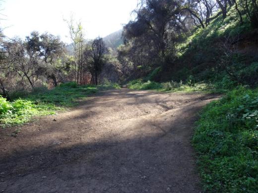
Hike to the Danielson Monument in the Boney Mountain Wilderness

One of the more popular and challenging hikes in the local area takes you from the Rancho Sierra Vista/Satwiwa Recreation Area in Newbury Park to the Danielson Monument in the Boney Mountain Wilderness (Point Mugu State Park). 

It is about 5.5 miles round trip and has a net elevation gain of about 600 feet. The Monument is close to 1,500 feet in elevation This is a fairly challenging trail as roughly two thirds of the hike you are going up and down fairly substantial hills. That said, I've seen hundreds of folks on these trails of all fitness levels and ages doing it at their own pace.

Entrance into Rancho Sierra Vista/Satwiwa at Lynn Road and Via Goleta in Newbury Park

Entrance into Rancho Sierra Vista/Satwiwa at Lynn Road and Via Goleta in Newbury Park

Starting at the Satwiwa Native American Culture Center, make your way to the Danielson Road trail by either taking the Big Sycamore Canyon Fire Road (paved) south for roughly .3 mile and then a left on Danielson Road (trail) or take the Satwiwa Loop Trail that runs diagonally southeast until you reach a fork on the trail.

(Note: You can also park at the trailhead at Wendy and Potrero Roads and add another few miles to your trek.)

Sycamore Canyon Road southbound towards Point Mugu State Park from Satwiwa Center

Sycamore Canyon Road southbound towards Point Mugu State Park from Satwiwa Center

Veer right (south) at the juncture of the Danielson Road and Satwiwa Loop trails towards a bench that overlooks Sycamore Canyon. This is called the Upper Sycamore Canyon Overlook.

The bench at the Upper Sycamore Canyon Overlook in Rancho Sierra Vista

The bench at the Upper Sycamore Canyon Overlook in Rancho Sierra Vista

The short, rocky trail eastbound from there (behind the bench) takes you to another fork, where you can either veer left to the Hidden Valley Overlook trail (part of Rancho Sierra Vista/Satwiwa) or right into the Boney Mountain Wilderness. (Note that dogs and bikes are not allowed in the Boney Mountain Wilderness.)

Entering the Boney Mountain Wilderness

Entering the Boney Mountain Wilderness

After a steady descent of about another .4 mile, you'll see another sign. Continue towards the left. On the right is the Upper Sycamore Canyon Trail, kind of a fun, winding trail at the bottom of the canyon. Save that for another day.

In non-drought years, there is often a creek you may need to walk through as you continue on Danielson Road. It has been years since the stream was of any significance but it was back in February 2017 after recent rainstorms. But it is generally easy to get across.

After navigating the narrowest portion of trail, you will see a juncture. The unmarked "Waterfall Trail" is straight ahead (only about 120 steps to the "Waterfall" when there's not a severe drought). You can check it out as it is such a short distance. But to get to the Monument, veer sharply right, continuing up Danielson Road.

Juncture of Waterfall (straight ahead) and Danielson Road (to the right)

Juncture of Waterfall (straight ahead) and Danielson Road (to the right)

This is a long, grinding, uphill trail of about a mile until you get to a juncture where you can make a right-hand turn to the Old Boney Trail. As you make your way up, you'll be treated to great views from Sycamore Canyon to Newbury Park and beyond.

This is a bit of a dried out view from Upper Danielson Road looking down from where we came from in 2015.

This is a bit of a dried out view from Upper Danielson Road looking down from where we came from in 2015.

You're almost there once you see this Old Boney trail sign - just .3 mile to go

You're almost there once you see this Old Boney trail sign - just .3 mile to go

Continue straight on Danielson Road. There are some areas coming up that periodically get overgrown. Watch out for poison oak particularly in these areas, continuing on to the Monument. In .3 mile, you're reached your destination.

The Danielson Monument is a tribute to Richard Ely Danielson, Junior who lived on the 7,800 acre Rancho Sierra Vista after purchasing the land from the estate of Carl H. Beal in 1947 for roughly $500,000. Danielson lived on the ranch for over three decades with his family. He donated 5,585 acres of the ranch to the State of California, which became part of Point Mugu State Park, and sold 850 acres, including the horse ranch, to the National Park Service in 1980.  He passed away on December 27, 1988. 

Ranching in the area dates back to the early 1800s, when Spanish soldiers were granted 48,672 acres of land, "Rancho El Conejo," which through the years was subdivided and sold to other landowners. One of these ranchers was Carl Beal, who in 1937 named the area Rancho Sierra Vista "Mountain View Ranch." 

The Monument is in a peaceful setting, surrounded by trees. And it stays fairly green up here. A good place to eat lunch or sit and relax. Adjacent to the Monument is a remnant of Danielson's cabin - the chimney. If you continue up this path to the right, you can get to the top of Boney Mountain.

Remnant of Danielson's cabin adjacent to the monument - a chimney.

Remnant of Danielson's cabin adjacent to the monument - a chimney.

One thing I've never seen in my decades on this particular trail are strollers. I think strollers would be a bit of a challenge for many due to rocky and narrow sections, periodic overgrowth and poison oak on the sides of a small portion of the trail and, when we're not in a drought, a stream crossing. 

COMPILATION OF TRAILS IN AND AROUND VENTURA COUNTY

All About the Advance Child Tax Credits That Commenced Today, July 15, 2021

Today, the IRS started sending out “Advance Child Tax Credits” to eligible taxpayers for 2021 that were voted into law as part of the American Rescue Plan Act in March.

The law did a number of things for the 2021 tax year only:

  • It increased the amount of the Child Tax Credit from $2,000 for dependents under age 17 to $3,600 for ages 5 and under and $3,000 for ages 17 and under.

    • Dependents age 18 and up continue to generate a $500 tax credit, with no advance credit.

    • Note that in prior years, the credit dropped from $2,000 to $500 at age 17, not age 18. So effectively the Child Tax Credit for dependents age 17 increased from $500 to $3,000 for year 2021, which is quite substantial.

    • The ages are determined as of 12/31/21.

  • The law allows for Advance Child Tax Credit payments to taxpayers over a 6 month period beginning July 15 through December 15, 2021. The advance payments are as follows:

    • Up to $1,800 of the $3,600 tax credit for ages 5 and under at a rate of $300 per month, beginning July 15th.

    • Up to $1,500 of the $3,000 tax credit for ages 6 to 17 at a rate of $250 per month, beginning July 15th.

    • The remaining 50% of the tax credit will be applied as usual when you file your 2021 tax return in 2022.

  • However, there is a “first phaseout” of the increased Child Tax Credit in 2021 once your 2021 modified Adjusted Gross Income (AGI) reaches $150,000 for married filing joint, $112,500 for head of household and $75,000 for single filers.

    • This first phaseout begins to reduce the Child Tax Credit from $3,000 or $3,600 down to $2,000.

    • The reduction is $50 of tax credit for each $1,000 in AGI in excess of the limits shown above. That means the Child Tax Credit drops to $2,000 if your income is $30,000 (ages 6 to 17) or $36,000 (ages 5 and under) greater than the limits.

  • There’s also a “second phaseout” if your income reaches $400,000 married filing joint or $200,000 for other filing statuses as there has been in prior years.

Isn’t this great how uncomplicated the rules are? <sarcasm>

How do they determine if you will be receiving the Advance Child Tax Credit? Based on your 2020, or if not filed yet, your 2019 tax return.

The IRS will be sending out “Letter 6419” next January to show the total amount of Advance Child Tax Credits paid. They will need to be included in your 2021 tax returns to derive any remaining Child Tax Credit.

The Advance Child Tax Credits are not taxable income. HOWEVER, if your tax situation changes significantly in 2021 and as a result you are not eligible for the full Child Tax Credit, but you receive the Advance Child Tax Credits, you may have to pay back some of the money when you file the return. For example:

  • Your income increased in 2021 and you are no longer eligible for the increased tax credit.

  • You no longer claim the dependent for whatever reason.

If you think you are in this situation, you can OPT OUT of receiving the Advance Child Tax Credits at https://www.irs.gov/credits-deductions/advance-child-tax-credit-payments-in-2021.

  • You cannot opt out of payments already received, but you can opt out of future payments.

Inversely, your tax situation may have changed in 2021 that would allow you to receive more Advance Child Tax Credits:

  • You had a baby in 2021 or otherwise have additional dependents under age 18.

  • Your AGI dropped in 2021 and as a result you are now eligible for Child Tax Credits based on your reduced income.

  • Your tax filing status changed in 2021 (single to married, or vice versa) and that changes your eligibility for Child Tax Credits.

Goldstein Weiss, CPAs www.goldsteinweiss.com 818-876-8380

Goldstein Weiss, CPAs www.goldsteinweiss.com 818-876-8380

Go to the link above to update your information with the IRS to start receiving Advance Child Tax Credits.

Neptune's Net and County Line Beach in Malibu are Local-Area "Must Do's"

NeptunesNetJune2016.jpg

Neptune's Net is a Malibu icon, located across from County Line Beach in Malibu at 42505 Pacific Coast Highway. Everyone who lives in the local area just has to experience this favorite eatery overlooking the Pacific. 

Originally built in 1956, the location of the fryer and grill have not changed. However, it was originally a gas station, real estate office and restaurant called "Panorama Pacific at Solimar" but locals called it Jake's Diner (after Eastman "Jake" Jacobs, its owner). In 1974 it was sold and the new owners renamed it Neptune's Net. The current owners purchased it in 1991.

Some of our favorites at Neptune's Net are everything fried (fish & chips, shrimp, scallops, clam strips and calamari), fresh seafood (lobster, crab, shrimp and oysters), burgers and more. Quite a popular biker hangout but at the same time, family friendly.

If you're newbie, check out the menu and then find the back of the ordering line, which often stretches back to the refrigerated drinks area. Grab your drink first as you wait in line. Order. Grab a seat, either in the front patio overlooking PCH, the side patio adjacent to the parking lot or the indoor seating area. Learn more at neptunesnet.com.

After (or before) you've dined, park or re-park (it's nice to clear your spot at Neptune's Net for other folks) your car across the street at County Line Beach, a casual, perhaps 1/3 mile stretch of beach surrounded by residences on each side.

There are no facilities at this beach other than three porta-johns in the parking area. No parking fees. 

County Line Beach is popular with surfers and folks generally hanging out and jumping into the water. There are some rocks to explore on the west side of the beach too. And well-behaved dogs can often be seen at this beach.

Rocks about on the west side of the beach, which stretches around to residences.

Rocks about on the west side of the beach, which stretches around to residences.

Leaf Blower Guidelines in the City of Westlake Village

Yes, the City of Westlake Village has "recommended guidelines" for the operation of leaf blowers that was approved by the Westlake Village City Council on June 27, 2012.

The detailed Guidelines are available on the City's website at www.wlv.org but here are the highlights:

  1. Leaf blowers are only to be used between 7am and 4pm on weekdays and 8am to 4pm on Saturdays. Sundays and legal holidays are banned from use of gas powered leaf blowers.

  2. One must use leaf blowers at the lowest speed possible...if a higher speed is ABSOLUTELY needed, one must do so for no longer than two minutes.

  3. Mufflers and air filters must be used and serviced/cleaned periodically.

  4. One must observe wind direction when operating the blower...and must blow in the same direction of the wind (except of course if the wind is blowing into your neighbor's property, city streets/gutters or the lake, in which case you might want to stop blowing).

  5. Actually, one must NOT use leaf blowers when there are excessive winds or when any doors or windows are open.

Bottom line: When the area to be cleaned is small, grab a broom or rake and have at it. The guidelines state that failure to abide by the guidelines "could result in legal prohibitions against the use of leaf blowers."

The neighboring City of Thousand Oaks has no such guideline. The general Noise Ordinance in Chapter Five of the City's Municipal Code indicates that no powered equipment such as "backpack blower" (not to mention lawn mowers, edgers, etc.) shall be used between 9pm and 7am. That should explain why you never hear your neighbor mowing their lawn at midnight.

www.wlv.org/DocumentCenter/View/207/Leaf-Blower-Guidelines---2012-revised?bidId=

Hillside Letters "SP" on South Mountain in Santa Paula

Santa Paula SP 1.JPG

When driving southbound in Santa Paula, look up towards the mountain south of the city (aptly named South Mountain) and you’ll see the letters SP boldly emblazoned high up on the hill that overlooks the Santa Paula Airport.

According to the Santa Paula Times, the letters are 125 feet long and 25 feet wide and originated in the 1922 time frame when a group of high schoolers made the trek up the mountain to carve the letters.

The brush was cleared annually over the years until the 1970s; for decades thereafter, the brush overgrew the letters and made them difficult to see.

Then, as part of the city’s centennial celebration in 2002, the Times noted that Limoneira Co. and other volunteers and donors worked to clean up the letters for all to see.

Santa Paula SP 2.JPG

Santa Paula is not alone in its mountain monogram. Other local area cities with monograms include Agoura Hills (there’s a letter A in the hill north of Agoura High School), the letters CLU emblazoned on the hill overlooking Cal Lutheran University, the letter F in the hills east of Fillmore, the letter V in the hills above Ventura High School and the letters VC in the hills above Ventura College.

Of course, the most prominent icon landscaped into a hill in Ventura County is Happy Face Hill seen by westbound drivers on the 118 near Kuehner Drive.

Happy Face Hill in Simi Valley - sure to bring a smile to your face.

Happy Face Hill in Simi Valley - sure to bring a smile to your face.

Restaurants That Opened and Restaurants That Closed in the Conejo Valley During the Pandemic

The World Health Organization labeled COVID-19 as a pandemic on March 11, 2020, when there were 118,000 reported cases in 114 countries, leading to 4,291 deaths. The state of California was placed on “Stay at Home” orders, effective March 19, 2020. The rest is history.

Meanwhile, we’ve been tracking eateries in the Conejo Valley, including Thousand Oaks, Westlake Village, Newbury Park, Oak Park, Agoura Hills and portions of Calabasas that opened and closed since the pandemic began.

Eateries That Opened Since the Pandemic Began

Wingstop at Janss Marketplace Thousand Oaks (Opened Mid-April)

Nick the Greek Souvlaki & Gyro House at North Ranch Mall in Westlake Village (May 2021)

Cork Dork Wine Bar in Westlake Village (May 20. 2021)

Fierce Ave Korean BBQ in Newbury Park (2021)

Saffron Mediterranean Kitchen in Agoura Hills (January 2021)

O’t Bistro Asian Comfort Food at Janss Marketplace (March 2021)

Bagelicious Cafe at Whizin Market Square in Agoura Hills (December 2020)

Agoura Wine & Beer Co at Whizin Market Square in Agoura Hills

Drive-Thru Starbucks at Janss Marketplace (January 2021)

E+MON Sushi and Ramen at the Westlake Commons (December 2020)

Siblings Bakery in Thousand Oaks (January 2021)

Chef Danny’s Naru Bento at Janss Marketplace (November 2020)

Leone’s Original Italian Ices in Thousand Oaks (November 2020)

Porta Via at The Commons at Calabasas (September 2020)

Limena Peruvian Eatery in Thousand Oaks (July 2020)

Urban Vejjie at The Shoppes at Westlake (June 23, 2020; but closed in 2021)

Sage Plant Based Bistro & Brewery in Agoura Hills (May 2020)

Peebee & Jay’s Newbury Park (May 2020)

La Esquina Mexican Grill in Thousand Oaks (June 2020)

Armando’s Tacos Thousand Oaks (Fall 2020)

Pedals & Pints Brewing Company Thousand Oaks (March 17, 2020)

Eateries That Announced They are Opening Soon

The Waffle Experience in Newbury Park (Coming Soon)

Valentino’s Take & Bake Pizza in Thousand Oaks (Coming Soon)

Wild Fork Foods - Meat & Seafood Market in Thousand Oaks (Coming Soon)

Azuki Tea at North Ranch Shopping Center in Westlake Village (Coming Soon)

Viet Kitchen at The Village at Newbury Park (Opening Soon)

Amy’s Drive Thru Organic Fast Food in Thousand Oaks (Early 2022)

Barney’s Gourmet Hamburgers at The Commons at Calabasas (Summer 2021)

The Waffle Experience in Newbury Park (Coming Soon)

Furn Saj Lebanese Bakery at The Summit at Calabasas (Now Open - Late May)

Everbowl at the North Ranch Mall in Westlake Village (Coming Soon)

Salsa & Beer Mexican Food in Calabasas (Coming Soon)

Parma Pizzeria to open Agoura Hills Location (Coming Soon)

Caribbean Haven in Thousand Oaks (Coming Soon)

Chakaa Tea Cafe in Newbury Park (Coming Soon)

sweetgreen at The Promenade at Westlake (Coming Soon)

Eateries That Closed Permanently

Flame Broiler in Newbury Park

Lemonade Restaurant at The Promenade at Westlake (Feb 21, 2021)

Mimi’s Cafe Thousand Oaks (February 2021)

Currying Flavors in Agoura Hills (Late 2020)

Roma Italian Deli in Newbury Park (November 2020)

Currying Flavors in Agoura Hills (Fall 2020)

Champagne French Bakery at The Promenade at Westlake (Summer 2020)

Jack’s Donuts Thousand Oaks (August 2020)

Champagne French Bakery at The Promenade at Westlake (Summer 2020)

Taco Bell Westlake Village (July 2020)

Pizza Rev at The Oaks mall (Summer 2020)

Edelweiss German Bierhaus in Newbury Park (June 2020)

Coffee Bean & Tea Leaf on Moorpark Road in Thousand Oaks (May 2020)

Peet’s Coffee in Westlake Village

Freddy’s Frozen Custard and Steakburgers in Westlake Village (March 2020)

Starbucks on Moorpark Road (closed, but re-opened up the street as a drive-thru)

E.T. Donuts in Thousand Oaks

Flatiron Bagel in Thousand Oaks

Eateries That Closed Temporarily, Possibly Permanently (TBD)

Stacked at The Oaks mall

Red Robin at The Oaks mall

Pitfire Pizza in Westlake Village

Hot Dog on a Stick at The Oaks mall

Mishe Mokwa Trail to Split Rock and Balanced Rock at Circle X Ranch in Malibu

One of my favorite hikes with the kids is Mishe Mokwa Trail to Split Rock at Circle X Ranch in the Santa Monica Mountains above Malibu. 

The first challenge to this excursion is getting there. We are spoiled in the Conejo Valley, with trailheads into the Conejo Open Space pretty much within a mile of anywhere you live. Getting to Circle X Ranch is a bit more time consuming, taking upwards of 30 minutes for the 12 to 13 mile drive from Thousand Oaks via Decker Canyon. But we love it.

The Mishe Mokwa trailhead is the first parking lot off of Yerba Buena Road/Little Sycamore Canyon Road from Mulholland Drive, roughly five miles of twisty, turny roads. There are dirt lots on both sides of Yerba Buena.

(If you drive another .6 miles west/southwest on Yerba Buena Drive, you'll get to the Sandstone Peak trailhead parking area...another must do hike in the Santa Monica Mountains.)

Park and head to the clearly marked trailhead and start your 3 1/2 mile round trip journey to Split Rock. The trail itself is fairly moderate but wear good hiking shoes as there's plenty of rocks you'll be stopping on and over on this hike.

Springtime is my favorite time to hike this trail, when it is still on the cooler side and there's plenty of green surrounding you on the trails. 

About .4 mile into the hike, you'll come to this sign. Continue towards Split Rock. Or you can take this short trail to the Backbone Trail and the more direct path to Sandstone Peak.

About .4 mile into the hike, you'll come to this sign. Continue towards Split Rock. Or you can take this short trail to the Backbone Trail and the more direct path to Sandstone Peak.

You will soon start seeing the Echo Cliffs area and Balanced Rock. The closer you get to Split Rock, the better the view.  Shout out and you will see how Echo Cliffs got its name. And there's no question as to how Balanced Rock received its moniker.

Echo Cliffs and the well known Balance Rock as you head west on the Mishe Mokwa trail.

Echo Cliffs and the well known Balance Rock as you head west on the Mishe Mokwa trail.

There are a few areas where you have to do some low-key rock climbing as you get closer to Split Rock, but they are generally of moderate difficulty.

Split Rock you will clearly see is named after a very large rock that is split in several places, including one crack that is large enough to walk through. There is a picnic table at this shady area and a nearby creek for a peaceful area to take a break.

Split Rock

Split Rock

You can head back at Split Rock or continue onward towards the Backbone Trail and Sandstone Peak for a full six mile hike. For something a bit more daring, you can side track back to Balanced Rock via a trail that is not maintained by the National Park Service.

BalancedRockSign.JPG

We took this trail roughly about a third of a mile to Balance Rock and it does get a bit challenging, between dealing with overgrown areas and finding the right trail (there seems to be multiple trails) and some challenging sections. Not for everyone but certainly do-able. And once you get to this wonderful geologically unusual formation, any frustration with the trail seems worth it.

Balanced Rock is amazing to see from all angles, from both far away and up close.

Balanced Rock is amazing to see from all angles, from both far away and up close.

Once you reach Balanced Rock, you'll be amazed not only by its size but by the amount of shade it renders. We also discovered a "sign in" box in a crevice below the rock.

BalancedRock.JPG

Learn more about Circle X Ranch at www.nps.gov/samo/planyourvisit/circlexranch.htm.