Compilation of Public Beaches Spanning From Oxnard to Hueneme to Malibu

In a separate post, we highlighted beaches ranging from Carpinteria down south to the beaches at the Ventura Harbor. This is the 2nd installment of local area beaches that stretch from McGrath State Beach on down to the beaches gracing Malibu. We hope these compilations prove useful in guiding you to all the oceanfront fun Ventura County and adjacent areas have to offer!

Additionally, here's a compilation of beaches in the Santa Barbara area (excluding Carpinteria).

McGrath State Beach has been closed due to flooding issues since 2019. Visit parks.ca.gov/?page_id=607 or call 805.968.1033 for more information.  McGrath has 2 1/2 miles of beach available. Swimming, surfing, and water sports are discouraged because of rip currents. McGrath is 5 miles south of Ventura off the 101 freeway via Harbor Boulevard.

Mandalay State Beach is 94 acres of undeveloped beachfront land located south of Reliant Energy's Mandalay Generating Station. The natural sand dunes and the wetlands ecosystem are recognized for their important natural value and houses several threatened bird species. This is a passive, natural open space park with no support facilities. The sandy ocean beach and adjacent coastal dunes are available for public day use only. The beach is managed by the County of Ventura on behalf of the California State Parks Department. Located at the corner of Harbor Boulevard and 5th Street in Oxnard. Visit www.parks.ca.gov/?page_id=609. No dogs allowed.

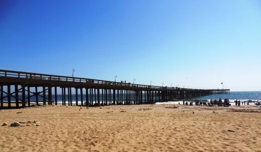
‘ololkoy Beach Park (formerly Oxnard Beach Park) has one of the best kids play areas around town, restrooms, lots of grass, and easy access to miles and miles of beach. The park is located at 1601 S. Harbor Boulevard. visitoxnard.com/directory/oxnard-beach-park

Oxnard Beach Park looking towards the beach.

Oxnard Beach Park looking towards the beach.

Hollywood Beach is a great spot for swimming, sunning and viewing the Channel Islands. Free public beach volleyball courts, public restrooms on the north end of the beach, on-street parking and lifeguards on duty between Memorial Day and Labor Day. Located right next to Channel Islands Harbor off of Harbor Boulevard. Dogs are allowed at Hollywood Beach on leash before 9am and after 5pm. West-facing beach means it’s great for catching the sunset!

Hollywood Beach

Hollywood Beach

Silver Strand Beach is a 1 mile long beach near Channel Islands Harbor, about 150 yards in width. It is capped by north and south jetties, both of which have small parking lots; one next to San Nicholas Avenue (at Ocean Drive), the other next to Sawtelle Avenue. Free parking from sunrise to sunset with limited restroom facilities. This is a sandy bottom beach break which may have rip tides and an undertow, so be careful. Dogs on leash allowed before 9am and after 5pm. Lifeguards on duty daily during summer months. Accessed via S. Victoria Avenue. Visit visitoxnard.com/things-to-do/beaches/silver-strand-beach for more information.

There's a Kiddie Beach Park off of S. Victoria Avenue at Sunset Drive with available parking, restrooms and benches. It is a small sliver of sand that fronts the south end of Channel Islands Harbor and thus does not face ocean waves.

Hueneme Beach Park is a 50 acre area with picnic tables, barbecue pits, walking paths, a fishing pier, sand volleyball courts, Surfside Seafood snack bar, lifeguards and restrooms. Beach parking lots and Surfside Drive parking available for a fee. No dogs allowed. Visit www.ci.port-hueneme.ca.us/index.aspx?NID=926 for more information. Located at 550 E. Surfside Drive, Port Hueneme

Ormond Beach is a 1,500 acre area composed of agriculture, industry and wetlands. A two mile long beach extends from Port Hueneme on the north to Naval Base Ventura County on the south. This is one of the few areas in southern California with an intact dune transition zone marsh system, hosting over 200 migratory bird species. The California Coastal Conservancy is restoring these wetlands. A bit off the beaten path, it is probably more geared towards bird watchers and hikers. Get there via Hueneme Road, going south on either Perkins Road on the north and Arnold Road on the south.

Naval Base Ventura County occupies roughly 6 miles of oceanfront space between Ormond Beach on the north and Point Mugu State Park on the south. This space is not accessible by the general public. However, there are periodic opportunities for civilians to catch a glimpse of the Pacific Ocean from NBVC during organized events open to the public.

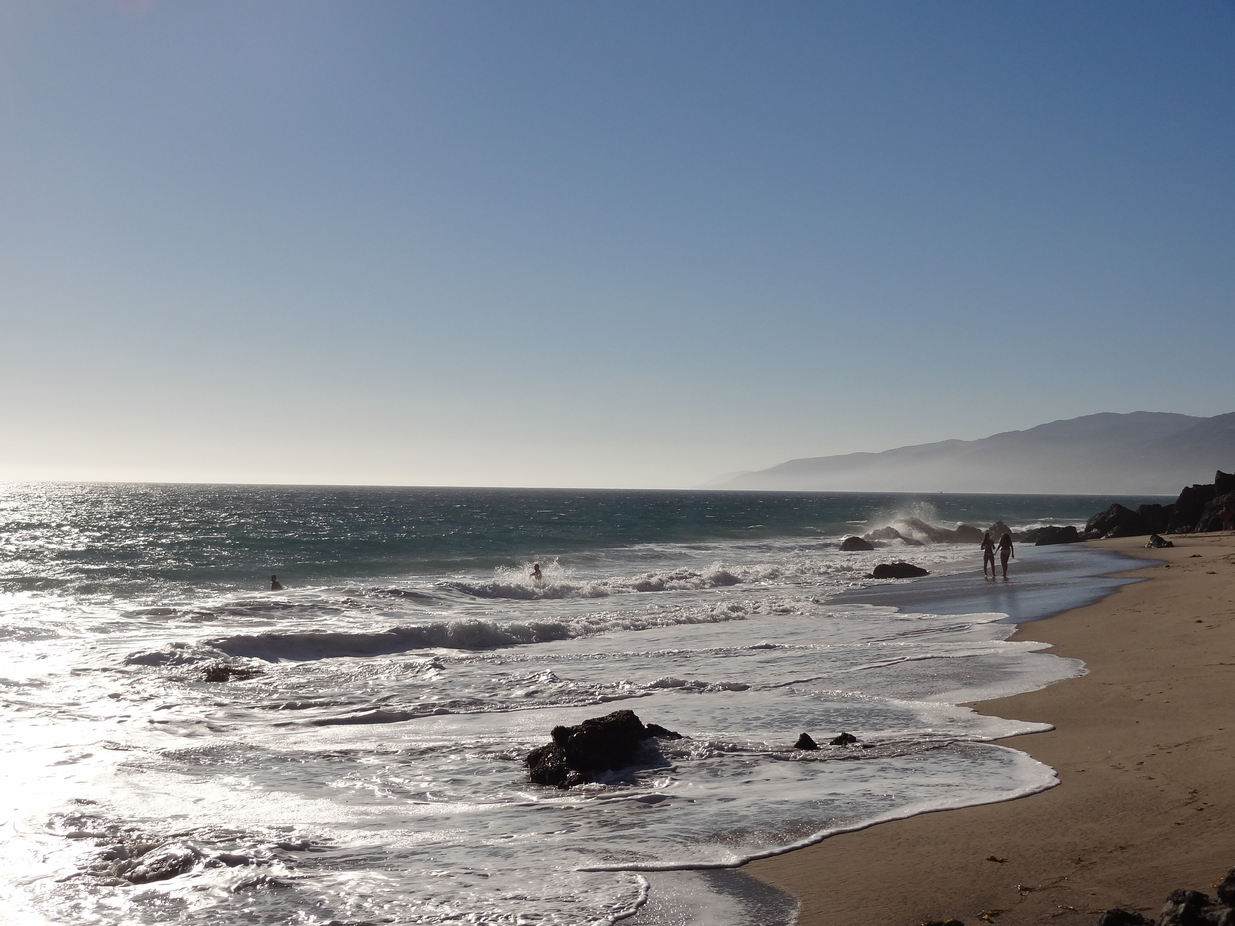
Mugu Beach is the first publicly accessible beach area south of Naval Base Ventura County off of PCH, located adjacent to the prominent Mugu Rock. For the most part this is the most quickly accessible beach to Camarillo and Conejo Valley residents. There is paid parking ($12 last time I was there) as well as parking available on PCH. Popular with fisherman. One thing to be aware of here is that there is a significant undertow. If you bring the little ones, best to stay out of the water or just be extra careful.

South of Mugu Rock there is also some beach that is accessible with plenty of parking on PCH. No facilities and not a lot of beach, but beautiful views and a quick place to explore.

ThornhillBroome.JPG

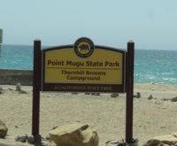
Thornhill Broome Campground and Beach is also part of Point Mugu State Park, located a mile or two south of Mugu Beach. This is a campground right on the beach with a capacity for about 60 or so RVs. But of course you can visit for the day for a parking fee. Plenty of parking also available on PCH. Porta-potties available. Dogs are allowed around here as long as they are on a leash (and paleeeze...pick up after them).

Across the street on PCH is a gigantic, steep sand dune that I've always found to be interesting. Learn more about that sand dune here.

Unusually large sand dune on the east side of PCH across from Thornhill Broome Campground

Unusually large sand dune on the east side of PCH across from Thornhill Broome Campground

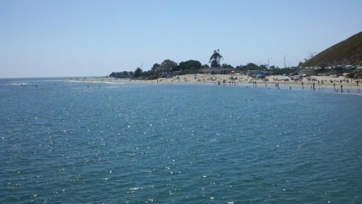
Sycamore Cove is at the southernmost beachfront portion of Point Mugu State Park. Point Mugu State Park features 3.6 miles of ocean shoreline (Sycamore Cove to Mugu Beach), with rocky bluffs, beaches, sand dunes, rugged hills and uplands, two major river canyons and wide grassy valleys dotted native trees.

Sycamore Canyon Campground across PCH from Sycamore Cove has 58 campsites. For a challenge, ride or hike down through Sycamore Canyon from Rancho Sierra Vista/Satwiwa in Newbury Park. You'll most likely have to pay to park here (most recently $12 for day use) as there are not many spots on PCH available on the south side...watch out...there are no parking signs all over the place.

SycamoreCove_sign.JPG

Sycamore Cove Beach has a number of picnic benches shaded by trees and is thus a popular spot on summer weekends for the BBQ crowd as well as with the campers from the campground on the other side of PCH. Located at 9000 Pacific Coast Highway. Visit www.parks.ca.gov/?page_id=630.

Trees shade the picnic tables at Sycamore Cove Beach

Trees shade the picnic tables at Sycamore Cove Beach

In the 3.3 mile stretch of PCH between Sycamore Cove Beach and County Line Beach (below) there are three or four places where you can park on PCH and access the beach.

One of these beaches I refer to as Call Box 1-35 Beach, about a mile southeast of Sycamore Cove Beach. This is not the official name of this beach in the unincorporated section of Ventura County northwest of Malibu city limits. But since the dilapidated staircase leading down to the beach is next to this call box, it seems appropriate. The address is approximately 9649 Pacific Coast Highway, Malibu (yes, technically not Malibu, yet in Google maps the address says Malibu).

About half a mile southeast of Call Box 1-35 is Call Box 1-27 Beach, which I also refer to as 26 Steps Beach. 26 Steps Beach is approximately 1.9 miles northeast of County Line Beach (see below) and 1.5 miles southwest of Sycamore Cove Beach (see above), at approximately 9999 PCH, just west of Deer Creek Road. I made up the name 26 Steps Beach because there is a well-worn, tagged up staircase that leads you from your parked car on PCH near the 1-27 Call Box sign to the beach. This is not a bad little section of beach that rarely has many people. No restrooms. Parking is free on PCH.

County Line Beach is located across the street from the iconic Neptune's Net, 3 miles south of Sycamore Cove at 42505 Pacific Coast Highway, Malibu. Lots of surfers and places to explore. Park on PCH. Watch out for bikers...there can be hundreds of them hanging out here on many a weekend. There are outer reefs for scuba diving that have an abundance of sea life. Activities include diving, surfing, and tide pools. No lifeguards on duty. There are a few porta-johns here. Technically, County Line Beach is located in Solromar, an unincorporated community in Ventura County - but they use the Malibu zip code so hey, it’s ok to say it is in Malibu.

NeptunesNet.JPG

Before the main Leo Carrillo State Beach area while heading south on PCH is the Leo Carrillo State Park Staircase Beach area. There’s a California State Parks parking lot at 40000 Pacific Coast Highway, Malibu. Parking is available for approximately 50 cars. There’s a moderately narrow trail that takes you down to the beach, which is also a fairly narrow beach with lots of rocks. You can also walk to this beach from the main Leo Carrillo Beach. Dogs allowed on leash.

Leo Carrillo State Park Staircase Beach parking lot.

Leo Carrillo State Park Staircase Beach parking lot.

Leo Carrillo State Park consists of 1 1/2 miles of beach for swimming, surfing, windsurfing, surf fishing and beach combing; one of our favorites for exploring sea caves, rocks and tidepools. Located at 35000 West Pacific Coast Highway, Malibu, Leo Carrillo is about 1 1/2 miles south of County Line Beach. On the north side of PCH, there are 135 campsites in over 2,500 acres. Visit www.parks.ca.gov/?page_id=616 or call 805.488.1827. Dogs on a leash are allowed in day use areas, campground and north beach (north of lifeguard tower 3). Dogs are not allowed on back country trails or south beach (south of lifeguard tower 3). Park on PCH or in the state lot ($12) and take the tunnel under PCH to the beach. More details on how to get to Leo Carrillo from the 101 freeway at this link.

NicholasCanyon.JPG

Nicholas Canyon County Beach is one mile east of Leo Carrillo at 33850 Pacific Coast Highway. Great beach where you can hang out, fish, picnic, surf and more. About 150 parking spaces available. Generally $10 to park on summer weekends, or park on PCH. More info at beaches.lacounty.gov/nicholas-canyon-beach. Restrooms available.

A view of Nicholas Canyon County Beach, just a mile east of Leo Carrillo.

A view of Nicholas Canyon County Beach, just a mile east of Leo Carrillo.

Located between Leo Carrillo and Point Dume State Beaches, Robert H. Meyer Memorial State Beach is made up of a number of cove or cliff-foot strands known as "pocket beaches" along the west end of Malibu, including El Pescador, La Piedra and El Matadorwww.parks.ca.gov/?page_id=633 Dogs are not allowed on state beaches.

El Pescador State Beach is 1.4 miles east of Nicholas Canyon at 32900 Pacific Coast Highway, Malibu. Steep, uneven stairs lead to about 10 acres of narrow, sandy beach. It is just east of Decker Canyon, the curvy, steep road that takes you up to Hidden Valley/Westlake Village. Dogs are not allowed on state beaches. Limited parking is available (fees vary) or park on PCH. Small, secluded beach. When the tide is not too high, you can trek you way east towards La Piedra Beach and back.

Porta-potty available. www.parks.ca.gov/?page_id=633.

Sign on PCH east of Decker Canyon Road, prior to El Pescador State Beach to the west of it.

Sign on PCH east of Decker Canyon Road, prior to El Pescador State Beach to the west of it.

La Piedra State Beach is .3 miles east of El Pescador at 32700 Pacific Coast Highway. A fairly long hiking path (may be a bit challenging for those lugging a lot of stuff) leads to 9 acres of narrow, sandy beach. Dogs are not allowed on state beaches. Limited parking available for a fee (which vary) or park on PCH. Porta potty available. www.parks.ca.gov/?page_id=633.

El Matador State Beach is .3 miles east of La Piedra at 32350 Pacific Coast Highway, just east of where Encinal Canyon Road intersects with PCH. A dirt path, then dozens of stairs, leads to 18 acres of narrow, sandy beach with stunning, rock formations and caves.

Dogs are not allowed on state beaches.  There is a parking lot with room for 25 or so cars where you can pay $3/hour or $10 for all day (as of June 2025).  You can also park on PCH, but on the north side...for whatever reason parking is prohibited on the south side of PCH. This means you have to cross PCH, which can be a challenge. There are porta-potties available. www.parks.ca.gov/?page_id=633

Stunning rock formations at El Matador State Beach.

Stunning rock formations at El Matador State Beach.

Lechuza Beach in Malibu, a mile east of El Matador State Beach, is maintained by the Mountains Recreation and Conservation Authority. It is a small, sandy beach with beautiful rock formations and views up the coast. Accessible via the northeast end of Broad Beach Road.  More information and specific access points at mrca.ca.gov/parks/park-listing/lechuza-beach. Dogs not allowed on the beach.

Zuma Beach is located at 30000 Pacific Coast Highway about 3.5 miles east of El Matador. With 1.8 miles of beach, Zuma is one of the largest and most popular beaches in Los Angeles County, Zuma is known for its long, wide sands and excellent surf. Plenty of facilities, including several food stands, restrooms, showers, volleyball, etc. Plenty of street parking on PCH and over 2,000 parking spaces (currently $8 weekdays and $15 weekends). Visit beaches.lacounty.gov/zuma-beach for more information. Zuma is known for riptides, so do be careful out there.

NOTE: Fires, including BBQs, are not allowed on any beach in Malibu; the exception is that fires may be allowed in designated spots at some state beaches. Dogs not allowed on the beach also.

Zuma Beach

Zuma Beach

Point Dume State Beach is a 63 acre promontory that juts out into the Pacific and features headlands, cliffs, rocky coves and vast beach access for swimming, surfing, scuba diving and fishing. Westward Beach borders Zuma Beach at Zuma's south side. There is plenty of parking on Westward Beach Road, which parallels Westward Beach. To the southeast of Westward Beach is a small 300 foot or so beachfront area called Pirate's Cove Beach (which due to its seclusion was once used as a nude beach).

PointDumeSign.jpg

At the end of Westward Beach Road (WBR), access to the protected 34-acre Point Dume Natural Preserve begins from the cul-de-sac. A gradual ascending trail leads to an ancient coastal bluff sand dune with spectacular views...we've seen whales, seals and dolphins over here. A stairway from the east side of the bluff-top preserve allows access to a more isolated beach and tidepools (look but don't touch). Location/Directions: Take Kanan south to PCH and turn right. WBR is over the rise, at the foot of the hill. Park free on WBR or pay a fee at Westward Beach lot. No restrooms at the Preserve but some can be found on WBR. Call 310.457.8143 or visit www.parks.ca.gov/?page_id=623 for more information.

NOTE: Dogs are not allowed on trails in the Point Dume Natural Preserve or on the beach.

Looking down on the beach at Point Dume

Looking down on the beach at Point Dume

Paradise Cove Beach is located at 28128 Pacific Coast Highway, accessed via Paradise Cove Road. Parking (as of June 2026) is $10 weekdays ($15 weekends/holidays) for if you spend up to 4 hours at the Paradise Cove Beach Cafe (and spend at least $30 there) or $45/$65/day (weekdays/weekends) if you park there just for the beach. Or, you can park on PCH and walk there. There are restrooms, cabanas, lounge chairs and chairs for rent, and a small pier. Visit www.paradisecovemalibu.com.

Escondido Beach is a short, narrow strip of beach accessible just west of Geoffrey's Malibu via a long stairway at 27420 PCH or near the corner of Escondido Beach Road and Malibu Cove Colony Drive. Look for access signs. No dogs allowed. No facilities.

Dan Blocker Beach is located at 26000 Pacific Coast Highway (between Solstice Canyon and Corral Canyon Roads. A sandy, narrow beach that draws surfers and scuba divers. Limited free roadside parking. Restrooms are available. Corral Canyon (trail map HERE) is located across the street at 25623 PCH. The trailhead is on the north side of PCH next to Malibu Seafood restaurant. The beach can be accessed via a seasonal trail under PCH. 310.305.9546

On June 14, 2016, a new beach stairway access was completed at 24038 Malibu Road. Very little parking available there and no facilities at the beach.

Malibu Beach is a 167 acre beach at 23050 and 23200 Pacific Coast Highway that includes Malibu Lagoon, Malibu Lagoon Museum and the Malibu Pier. Malibu Surfrider Beach next to the pier is quite popular with local surfers. Parking available for a fee, or park on streets surrounding Malibu Country Mart and walk across PCH at the signaled crosswalk at Cross Creek Road.

Malibu Surfrider Beach viewed from the Malibu Sportfishing Pier

Malibu Surfrider Beach viewed from the Malibu Sportfishing Pier

Perhaps the most expensive strip of beach in the world is Carbon Beach, which stretches about a mile and a half between the Malibu Pier and just east of Carbon Canyon Road. This wide beach is a beautiful strip of sand, but public access points can be challenging to find and parking can be a challenge. Learn specifics at THIS LINK but specifically, the public accessway points are at 22670 PCH, 22466 PCH and 22126 PCH. No restrooms and no dogs allowed at this beach.

Las Tunas Beach is located at 19444 Pacific Coast Highway, about 4 1/2 miles east of the Malibu Pier. It is a narrow beach beneath the bluffs that holds a special attraction to surf casters. Free parking lot. Located between Tuna Canyon and Las Flores Canyon Roads.

CoastalAccess2.JPG

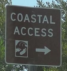
And there's more...the California Coastal Commission Shoreline Public Access Program helps maximize public access to the beach along the California coast. When you see one of those "Coastal Access" signs, that means you can get to the beach. More on the program at www.coastal.ca.gov/access/accndx.html. The L.A. County Dept of Beaches and Harbors has published Malibu beach accessways at file.lacounty.gov/dbh/cms1_151453.jpg, including 11 accessways on PCH, Malibu Road and Broad Beach Road. But if you do check them out, be mindful of those who live there!

Eleven of My Favorite Things to Do In and Around the City of Ventura

HistoricVenturaSign.jpg

Incorporated in 1866, the City of Ventura is the county seat of Ventura County. The official name of Ventura is the city of San Buenaventura. Mission San Buenaventura was founded by Franciscan priest Junipero Serra on March 31, 1782 and was named after Saint Bonaventure. Enough with the history lesson...here are some of my favorite things to do in this beautiful city!

You can't miss the 1,600 foot long Ventura Pier, with its panoramic views, fishing and ocean breezes. There's a cool little playground area in the sand just west of the pier, bicycle rentals nearby, miles of beachfront bike path and Surfers' Point. San Buenaventura State Beach stretches from the Ventura Pier down south past the homes of the Ventura Keys. Eateries on the pier include Eric Ericsson’s Fish Co., MadeWest Brewing Company Taproom and Beach House Tacos.

VenturaPierBeach.JPG

Ventura Harbor Village is home to 33 acres of harborside activities, shopping and restaurants. There's an arcade with an antique carousel, boat rides, kayaking and sailing and quick access to family-friendly Harbor Cove Beach and Surfer's Knoll Beach. Also within a short walking distance is the Robert J. Lagomarsino Visitor Center, an inspirational and interactive source of information about the Channel Islands National Park. Bring the kids!

Ventura Harbor Village is a popular destination for tourists and locals alike.

Ventura Harbor Village is a popular destination for tourists and locals alike.

For some of the most spectacular views of Ventura, stop by Grant Park / Serra Cross Park. You can drive up there, or park above the historic Ventura City Hall building and walk to Grant Park via the Ventura Botanical Gardens trail. This nice one mile trail will give you a nice little workout, with views along the way.

A view from the Ventura Botanical Gardens Trail near Grant Park

Golf N' Stuff is a family favorite, especially when it's really hot in the Conejo Valley and you're looking for an outdoor alternative to the beach.  The kids never tire of the two 18-hole mini golf courses, bumper boats, large, nicely appointed arcade, go karts and bumper cars.

Mini golf fun at Golf N' Stuff Ventura.

Mini golf fun at Golf N' Stuff Ventura.

Another popular family choice is oceanfront Marina Park in the Ventura Keys, a decent sized park with plenty of grassy area, a newer playground and path to adjacent picnic and viewing area Soter Point. We enjoy riding bikes from the park to the Ventura Beach Path.

Marina Park Beach

Marina Park Beach

In Downtown Ventura, the Museum of Ventura County hosts a collection of over 30,000 pieces of fine art and historical items and a changing lineup of exhibits displaying items of local relevance. The Museum's Research Library houses over 150,000 resources related to the history of Ventura County. And the Museum regularly hosts public events geared towards all ages as well as free admission the first Sunday of each month.

The city closed off five blocks of Main Street in Downtown Ventura to create “Main Street Moves.” in 2020. This allowed many businesses to thrive with outdoor dining during the pandemic, but it also caught on as a great opportunity to roam the streets of Downtown Ventura in a leisurely way, without automobile traffic. City Council voted to extend Main Street Moves on a year-round basis in November 2024. Updates at www.cityofventura.ca.gov/2165/Main-Street-Moves.

It doesn’t feel like it is in Ventura, but Lake Casitas Recreation Area, technically in Ventura (though it feels more like it is in Oak View), is a wonderland of outdoor fun - boating/kayaking on the lake (no swimming though…it is a water source), camping, disc golf, picnicking, bicycling, exploring and more.

Kayaking at Lake Casitas.

Moby’s on Main opened at 369 E. Main Street in Ventura, in late May 2024. Moby’s is Ventura’s first family-friendly arcade and bar, offering a collection of vintage arcade games, pinball machines, classic Thrifty ice cream, snacks and more. www.mobysonmain.com

Guide to Finding Family Friendly Bike Paths In and Around Ventura County

As a casual cyclist with young kids I usually steer clear of riding on busy streets, particularly those that don't have any type of bike lane on them. Thankfully there are nearly 80 miles of bikeways in Thousand Oaks, including 3 miles of bike paths, 20 miles of bike lanes and 54 miles of marked bike routes.  

Bike routes are shared with vehicles

Bike routes are shared with vehicles

Class I Bike Paths are separate from auto traffic and thus are great for family friendly cycling. Class II Bike Lanes are striped, painted and shared lanes adjacent to automobile lanes. Class III Bike Routes are marked by green signs that signify sharing with autos.

We also love taking our bikes to other places in and around Ventura County to enjoy other sights and surroundings. So how about if we highlight Class I Bike Paths throughout Ventura County, stretching from Thousand Oaks to Ventura.

Conejo Valley

The Conejo Creek Bike Path is a 1.2 mile path in the heart of Thousand Oaks that connects Gainsborough Road on the south to Conejo Creek Park and the Thousand Oaks Library. This is a nice, flat path, good for kids.

Another access point to the Conejo Creek Bike Path on La Granada Drive.

Another access point to the Conejo Creek Bike Path on La Granada Drive.

There is another Thousand Oaks bike path, the .5 mile Greenmeadow Drive connector bike path accessible on the west at Greenmeadow and Yellowstone, on the south side of Los Robles Greens. This is not a particularly interesting path but it does enable cyclists and walkers a path around the golf course to the Los Robles trailhead and Moorpark Road from Newbury Park. A bit hilly, too.

Entrance to Greenmeadow Avenue connector bike path in Thousand Oaks

Entrance to Greenmeadow Avenue connector bike path in Thousand Oaks

There is also the .8 mile bike path on the north side of The Oaks mall as well as the .5 mile Read Road Connector path accessible off of Olsen Road just east of the 23 freeway.

Sign at the Read Road connector path on Olsen Road east of 23 Freeway.

Sign at the Read Road connector path on Olsen Road east of 23 Freeway.

Medea Creek Natural Park has hiking, biking and fitness trails that stretch from Calle Rio Vista and Oaks Hills Drive in Oak Park on the north, then south past Medea Creek Lane and Conifer Street to a cul de sac entrance to the park at the west terminus of Tamarind Street. About a mile to mile and a half of paths, including paved and dirt paths.

Nicely paved path at Medea Creek Natural Park in Oak Park

Nicely paved path at Medea Creek Natural Park in Oak Park

Ventura

My personal favorite bike path in Ventura County is the Omer Rains Trail that runs the entire length of San Buenaventura State Beach.

Senator Omer Rains Ventura Oceanfront Bikeway Sign on Main Street next to Ventura Beach RV Resort

Senator Omer Rains Ventura Oceanfront Bikeway Sign on Main Street next to Ventura Beach RV Resort

We park the car at Marina Park in Ventura and ride a short distance north on Pierpont Blvd to the bike path entrance. This oceanfront path takes you past the Ventura Pier, through the Promenade area, adjacent to the Ventura County Fairgrounds, Emma Wood State Beach and beyond. Or you can get to the path from anywhere along the Ventura Promenade area.

Bike path along San Buenaventura State Beach.

Bike path along San Buenaventura State Beach.

Omer Rains Bike Path near Ventura Beach RV Resort on Main St.

Omer Rains Bike Path near Ventura Beach RV Resort on Main St.

Nice, newer paved section of Ventura beachfront bike path near Surfers Point.

Nice, newer paved section of Ventura beachfront bike path near Surfers Point.

The Ventura River Trail is a 6.3 mile asphalt pedestrian and bike path that follows the old Southern Pacific Railroad right-of-way from Main Street in Ventura to Foster Park inland towards Ojai. You can easily connect from the Omer Rains Trail to the Ventura River Trail up to the Ojai Valley Trail for quite a long, nearly automobile-free ride.

The Ventura Harbor Bike Path takes you 1.2 miles from Market St and Arundell Ave in midtown Ventura southwest through farmland to E. Harbor Boulevard and Schooner Drive, near Four Points by Sheraton.

Bike path from midtown Ventura to the Harbor is not the most exciting path but it is a convenient way to ride to Ventura Harbor, Marina Park and adjacent areas.

Bike path from midtown Ventura to the Harbor is not the most exciting path but it is a convenient way to ride to Ventura Harbor, Marina Park and adjacent areas.

The La Conchita Bike Path between Rincon Point at the Ventura/Santa Barbara County Line adjacent to Highway 101 past La Conchita to Mobil Pier Road in Ventura was completed in September 2014. This path has leapfrogged into my own personal favorite in Ventura County because of its spectacular beach views. This is about 4 miles of bike path in the Oil Piers Beach to Mussel Shoals to La Conchita Beach to Rincon Point beach areas.

Bike paths rarely get better than this stretch along the southbound 101 and the Pacific Ocean in Ventura.

Bike paths rarely get better than this stretch along the southbound 101 and the Pacific Ocean in Ventura.

There's another short stretch of bike path at the east end of Navigator Drive that goes west, then south, around the Ventura West Marina.

Entrance to short bike path adjacent to Ventura West Marina.

Entrance to short bike path adjacent to Ventura West Marina.

There is a two mile biking and hiking on the east side of the lake at the Lake Casitas Recreation Area, 11311 Santa Ana Road, Ventura. The path starts at picnic area #1 and follows the east shoreline of the lake for a four mile round trip ride. The path is paved in the recreational area and becomes a dirt road outside of that. More information at www.casitaswater.org/hiking-and-biking-trail.

Ojai

The Ojai Valley Trail is a 9 to 10 mile trail that parallels Highway 33 from Foster Park on the outskirts of west Ventura, to Soule Park in Ojai. It connects to the Ventura River Trail.

The Ojai Trail runs parallel to Ventura Ave/Ojai Ave.

The Ojai Trail runs parallel to Ventura Ave/Ojai Ave.

Simi Valley

The Arroyo Simi Bike Path is a two lane bike path in Simi Valley that runs from Madera Road, just south of Easy Street on the west, ending at Tapo Street on the east. Over seven miles.

Arroyo Simi Bike Path/Trail in Simi Valley.

Arroyo Simi Bike Path/Trail in Simi Valley.

Camarillo

We enjoy the newer, flat roughly 2 mile Calleguas Creek bike path from Pleasant Valley Fields up to the corner of Flynn and Upland Roads in Camarillo. Quick access from the Conejo Valley and a nice, relatively easy path good for all ages.

Look at how nice and flat this bike path adjacent to Calleguas Creek is!

Look at how nice and flat this bike path adjacent to Calleguas Creek is!

Other Areas

There's an online bike map available on the Ventura County Transportation Commission website at www.goventura.org where you can find other Class I, II and II bike paths around the county. Here are some of them.

The Santa Paula Bike Trail takes you roughly 3 miles on the east near W. Main St and Peck Rd to (roughly) Dike Road on the west

The Fillmore Bike Path runs from south of Highway 126 (Telegraph Road) up past Shiell Park.

In Moorpark there's a .5 mile path at Country Trail Park, around the neighborhood to the west, back to Mountain Trail Street.

There's a bike path that starts at the ocean side of'olołkoy Beach Park and takes you south all the way to Hollywood Beach and Channel Islands Harbor. Cross Harbor Boulevard and make your way into Channel Islands Harbor, where you can ride all the way to the south end of the harbor.

Bike path near Oxnard Beach Park and Channel Islands Harbor.

Bike path near Oxnard Beach Park and Channel Islands Harbor.

In Port Hueneme there's a bike path that starts off of Bard Rd, west of South J St, through Richard Bard Running Springs Park and takes you southwest all the way to Hueneme Beach.

If you're willing to venture a bit further away from Ventura County, the Marvin Braude Coastal Bike Path stretches over 20 miles, from Will Rogers State Park in Pacific Palisades to Torrance. Flat, adjacent to the ocean, and so many things to do along the way!

Marvin Braude Coastal Bike Path in Pacific Palisades

Marvin Braude Coastal Bike Path in Pacific Palisades

That should be enough to get you started! Looking for local cycling clubs? Find some of them at this link.

Seven Flat, Stroller and Family Friendly Hikes in the Conejo Valley

There is a ring of about 15,000 acres of open space with 140 miles of trails for public use surrounding the Conejo Valley. All too often on the Conejo Valley Guide Facebook Page we hear requests for which trails are "stroller friendly" and/or suitable for young children. Here is a sampling of some of the more popular ones in the area.

Wildwood Park to many is the single greatest spot for family hikes and stroller-friendly trails. With 14 trails covering 17 miles, including the popular hike to Paradise Falls and the teepee as well as some wide, relatively flat sections along the Mesa Trail towards Lizard Rock.

It takes a bit of driving via the Norwegian Grade and Santa Rosa Road to get there, but the Conejo Canyons Open Space in the Western Plateau section of the Conejo Open Space leads to several miles of nice, flat, well-maintained family-friendly trails leading to tree-canopied picnic areas. The Hill Canyon Trail and Hawk Canyon Trail are very easy to navigate.

Shaded picnic area off the Hawk Canyon Trail from the Conejo Canyons Bridge.

Shaded picnic area off the Hawk Canyon Trail from the Conejo Canyons Bridge.

The one mile Spring Canyon Trail is a mostly flat trail that runs from Lynn Oaks Park, 359 Capitan Street, Newbury Park to the Los Robles Trail.  There are some moderate hills but with the park nearby, this makes for a fun little excursion with the little ones. (No restrooms, however.)

The main access point to the Los Robles Trail at the southern endpoint of Moorpark Road at Greenmeadow Ave starts out with a reasonably flat section that is a nice, easy family stroll.

Speaking of the Los Robles Trail, another great little hike to take with the kids is the Oak Creek Canyon Loop Trail. The first 4/10th of a mile of the trail, accessible off of Greenmeadow Avenue in Thousand Oaks, is the Oak Creek Canyon Whole Access Interpretive Trail. This is a nice, shady, flat trail with benches and picnic benches along the path. The remainder of the loop is not quite as stroller friendly, with a couple moderately steep sections that can be navigated on foot.

Picnic trails and shade abound at the Oak Creek Canyon Interpretative Trail.

Picnic trails and shade abound at the Oak Creek Canyon Interpretative Trail.

The Rancho Sierra Vista/Satwiwa area managed by the National Park Service in Newbury Park has several miles of trails to explore, most of which are flat and stroller-friendly. The Satwiwa Loop Trail takes you around the area and the Satwiwa Native American Indian Culture Center makes for a fun stop with the family when open on weekends.

The Chumash home, or “‘Ap,” in the background. The one pictured has since been replaced.

The Chumash home, or “‘Ap,” in the background. It is no longer there as of 2025.

Cheeseboro/Palo Comado Canyons offer great family hiking opportunities. While there's definitely hills surrounding these canyons, try the Cheeseboro Canyon Trail, the 4 to 5 mile main artery into the park. Flat and kid/stroller friendly it is. Also try the Doubletree Trailhead connector to the Palo Comado Trail. Flat, fun and scenic.

The Los Padres Trail in Thousand Oaks is a short trail, half of which is pretty flat and tree lined, if you’re looking for a short excursion with a toddler. A seasonal creek makes it even more interesting as you may hear froggies in the spring.

PaloComadoSign.JPG

Although the trails in the Lang Ranch/Woodridge Open Space in Thousand Oaks are NOT FLAT and indeed quite HILLY, they are worth checking out with the kids because they wide and have some interesting sandstone rock formations. If you are really strong, strollers are possible here, but do know that you will encounter some hills like the hill shown in the image below.

This hill in the Lang Ranch/Woodridge Open Space at the Autumn Ridge Trail is a bit daunting but worth the climb.

This hill in the Lang Ranch/Woodridge Open Space at the Autumn Ridge Trail is a bit daunting but worth the climb.

We're going to throw a bonus trail into the mix. The several miles of hiking trails in the Oakbrook Regional Park Archaeological Area in Thousand Oaks is an outstanding place for a flat, picturesque and oak-tree canopied place for a short hike with the kids.

For a more comprehensive compilation of trails in the Conejo Valley and throughout Ventura County, visit THIS LINK.

Live Music and Other Nightlife Options In and Around Ventura County

Guitar Player

Are you a night owl looking for something to do around town? Here's a list of places in and around Ventura County that have things to do during nighttime hours, including live music, concerts, dancing, darts, comedy, trivia and other activities scheduled on a regular basis.

This compilation includes restaurants as well as some bars. TVs are great, but don't count as "something to do" for the purposes of this compilation.

Are we missing something? Let us know!

For other nighttime fun, check out these compilations of Ventura County area movie theaters, comedy shows and entertainment venues. Or bowling. Perhaps wine tasting.

Local area craft breweries with taprooms!

(Information is subject to change, so contact the business to confirm.)

Conejo Valley (Thousand Oaks, Newbury Park, Westlake Village)

Azar's Sports Bar at 2215 Michael Drive, Newbury Park has Tuesday and Friday night karaoke and live music on Saturday nights. 805.498.2365 azarsportsbar.com

Breakers Sports Bar & Grill in the Best Buy Plaza at 398 N. Moorpark Road, Thousand Oaks hosts comedy night on Thursdays (8-9:30pm), live music on Fridays (9pm-close) and live band/karaoke on Saturdays (8:30-11:30pm). www.instagram.com/breakerssportsbarandgrill (805) 494-8454

Cajun Crab Shack at 1074 E. Avenida De Los Arboles, Thousand Oaks premiered its new sports bar in June 2026. www.cajuncrabshackto.com 805-241-3600

Crown and Anchor at 2891 E. Thousand Oaks Boulevard in Thousand Oaks is a British restaurant and pub, offering authentic British dishes along with American fare. Live music on the patio Fri/Sat nights and Sun afternoons. 805.497.0070 crownnanchor.com

14 Cannons Brewery at 31125 Via Colinas, Suite 907 in Westlake Village offers trivia nights, open mic nights and comedy nights 818.652.6971 www.14cannons.com

Mikey’s Restaurant at 579 N. Ventu Park Road in Newbury Park offers karaoke, live music and comedy on select nights. Contact them for more information. mikeysrestaurants.com

NABU Wines at 2649 Townsgate Road, Suite 200, Westlake Village offers live music on select Fri/Sat nights and Thursday Trivia Night 7-10PM. Visit nabuwines.com or call 805.778.1100.

Naughty Pine Brewing Co. at 766 Lakefield Dr., Ste A in Westake Villlage offers live music and trivia nights most nights as well as food trucks. 808.269.7975 www.naughtypinebrewingco.com

Pedals & Pints Brewing Company is located at The Oaks mall east parking lot, offering freshly brewed beer, artisan pizzas, baked tater tots, wings and other small plates…and live music every Saturday night, trivia nights at 7pm on Wednesday nights, and periodic special events on Friday nights. 805-551-0547 www.pedalsandpintsbrewing.com

PJ’s Sports Pub at 417 E. Avenida De Los Arboles in Thousand Oaks offers pool tables, darts, karaoke nights and live music. 805-590-6210 pjs-sports-pub.res-menu.com

Sunland Vintage Winery Tasting Room at 1321 E. Thousand Oaks Boulevard #108 hosts live music on Thursday and Friday nights as well as other events. 805-379-2250 www.sunlandvintagewinery.com/events

Sunset Terrace Restaurant and Lounge at Janss Marketplace has live music, dancing, three pool tables, shuffleboard, four lanes of bowling and more. 805.497.4847 www.sunsetterracerestaurant.com

Tarantula Hill Brewing Company at 244 Thousand Oaks Boulevard offers live music and other events - check their events calendar at www.tarantulahillbrewingco.com for details.

The Mighty Axe at Janss Marketplace in Thousand Oaks offers the ultimate in nighttime excitement…axe throwing and beer! And you can order food from eateries at Janss. themightyaxe.com

The Original Pizza Cookery at 75 West Thousand Oaks Blvd offers live music most Friday/Saturday nights. See www.pizzacookery.com/entertainment for details.

The Tipsy Goat at 159 E. Thousand Oaks Boulevard, Thousand Oaks has karaoke, pool tables, a dartboard, ping pong, shuffleboard, video games, trivia and more. Also DJ/dancing on Saturday nights, tipsygoat.com 805-494-9996

Louie’s at the Westlake Village Inn at 32001 Agoura Road, Westlake Village is a bar/nightclub open Wednesday through Saturday nights. 818.889.2394 www.clublouies.com/calendar

Agoura Hills, Calabasas, Malibu

The Canyon club at Whizin Market Square in Agoura Hills is a hot spot for live music of all types, from original rock bands to cover bands, tribute bands, comedy and more. 888.645.5006 wheremusicmeetsthesoul.com

Sagebrush Cantina at 23527 Calabasas Road hosts karaoke on Thursday nights, live music and dancing on Fri/Sat nights and music on Sun afternoons. 818.222.6062 sagebrushcantina.com

Ventura

Bombay Bar & Grill, located at 143 S. California Street in Ventura has a DJ and dancing on weekends. 805.643.4404 bombayventura.com

Margarita Villa Mexican Restaurant at Ventura Harbor Village, 1567 Spinnaker Drive, Ventura hosts live music Friday through Sunday - check for times and schedule at margaritavillaventura.com/music.html 805-654-7906

The Garage is a dive bar located at 1091 Scandia Avenue, Ventura with live music on Fri/Sat nights. 805.814.2234 www.facebook.com/TheGarageBarVTA

Gibson’s Neighborhood Bar (formerly The Twist on Main) at 454 E. Main Street in Ventura offers live music, open mic, karaoke and DJs. 805.641.0053 www.facebook.com/profile.php?id=61574570391205

The Greek at the Harbor at Ventura Harbor Village offers belly dancing starting at 6:30pm on Fri/Sat nights and 6pm on Sundays. Greek dance shows Fri/Sat at 7pm. 805.650.5350 www.thegreekventura.com

Keynote Lounge at 10245 Telephone Road in Ventura is a bar with live music on Fri/Sat nights. 805.647.9390 www.keynotelounge.com

Leashless Brewing at 585 East Thompson Blvd., Ventura is a tasting room that hosts live music most Thursdays through Sundays. Check their events calendar at www.leashlessbrewing.com/event-calendar. 805.628.9474

O'Leary's Tavern at 6555 Telephone Road, Suite 7 in Ventura has a pool table, shuffleboard, air hockey, dartboard machine, karaoke and live music. 805.644.4619 www.facebook.com/olearysventura

Paddy's Bar & Lounge at 2 W. Main St, Ventura is a LGBT owned/operated nightclub bar offering pool, darts, karaoke on Wed nights and more. 805.652.1071 paddysventura.com

Prime Steakhouse at 2009 E. Thompson Blvd, Ventura offers "Frank Sinatra" Tuesdays and other music nights. 805.652.1055 www.primesteakhouseventura.com

The Saloon at 456 E. Main St in Ventura has live music. 805.667.8550 www.thesaloonvta.com

The Grape House of Jazz & Spirits is a winery and jazz club with a full menu at 2351 E. Main Street in Ventura, offering live jazz Tues through Sun nights. Ages 21+ only. 805.643.7300 thegrapeventura.com

Ventura Music Hall is located at 1888 E. Thompson Boulevard in Ventura. Live music from local talent and touring musicians, along with food from local eateries and drinks at several bars throughout the venue. Learn more at www.venturamusichall.com.

Victoria Pub & Grill at 1413 Victoria Avenue, Suite F, Ventura has pool tables and darts. 805.650.0060 www.victoriapubandgrill.com

Winchester’s Grill & Saloon hosts live music Saturdays and Sundays from 2-5pm and other events. www.winchestersgrill.com 805-653-7446

Simi Valley/Moorpark/Heritage Valley (Fillmore, Santa Paula)

Arena Sports Grill at the Grand Vista Hotel, 999 Enchanted Way, Simi Valley has live music, dancing, pool tables, dartboards, video games, 20 TVs and more. 805.583.2000 arenasimi.com

Chuy's Mesquite Broiler Simi West at 1397 E. Los Angeles Avenue hosts live music various nights 805.582.4897 chuysbajagrill.com/events

Enzo's Italian Restaurant at the historic Glen Tavern Inn at 134 N. Mill St, Santa Paula offers live entertainment on weekends. 805.933.5550 www.glentavern.com/dining.aspx

The Golden Nugget Pub and Tavern at 4435 Cochran St, Simi Valley is the oldest bar in Simi, established in 1964. Trivia on Monday and Wednesday nights. 805.583.9715 www.goldennuggetpub.com

Lucas Sellers Winery at 330 Zachary Street in Moorpark (at The Alley in Moorpark) hosts live music most Saturday nights from 6-9pm. www.facebook.com/LucasSellersWine

Lucky Fool's Pub at 75 E. High Street in Moorpark offers Sunday night trivia games, a pool table and dart board, not to mention live music several nights a week. 805.532.1500 www.luckyfoolspub.com

Rock & Roll Pizza at Harley’s Valley Bowl, 5255 Cochran Street, Simi Valley, offers live music on Friday/Saturday, Reggae on Sundays, Karaoke Night 9-12 on Tuesdays and Live Comedy on many Wed nights. Details at www.harleysbowl.com/rocknrollpizzabar 805-584-2695

Other West Ventura County (Camarillo, Oxnard, Port Hueneme, Ojai)

Copper Blues Rock Pub & Kitchen at The Collection at RiverPark in Oxnard opened in September 2016, with live music on Saturday nights and more. 805.457.5551 www.copperblueslive.com/oxnard

Corner Pocket Billiards on 7th & A Street in Oxnard is a billiards, arcade, lounge, restaurant and sports bar for the whole family. 805.844.7266 www.facebook.com/cornerpocketoxnard

The El Rey Cantina at 2302 Ventura Blvd, Camarillo has occasional live music. 805.484.4433 www.instagram.com/elreycantinacam

Four Brix Winery at 2290 Eastman Ave, Ste 109, Ventura offers live music every Saturday and Sunday from 1-3:30pm. www.fourbrixwine.com

Harley’s Camarillo Bowl offers live music most Saturday nights and select other nights. Check their events calendar at www.harleysbowl.com/camarillo-events 805-482-0747

The Lamplighter is dive bar at 1936 Ventura Blvd, Camarillo that has three pool tables, foosball and darts for your nighttime activities. www.facebook.com/profile.php?id=100064177201671 805-484-2113

The Lookout Bar & Grill at Channel Islands Harbor (2800 Harbor Blvd, Oxnard) offers Tuesday night trivia and live music on designated days. Open mic night on Mon nights. 805.985.9300 www.facebook.com/TheLookoutBar

The Manhattan of Camarillo at 5800 Santa Rosa Road, Suite 140 offers live music and dancing Thursday through Sunday nights. Also Trivia Night on Thursday nights. 805.388.5550 www.themanhattanofcamarillo.com

The Ojai Deer Lodge at 2261 Maricopa Highway showcases live local entertainers up to 5 nights a week. 805.646.4256 deerlodgeojai.com

The Ojai Pub at 914 E. Ojai Avenue hosts Open Mic Night on Sunday nights, Karaoke Tuesdays, Trivia Thursdays, and live music. 805.669-7729 www.ojaipub.com

Q Club Oxnard at 2362 N. Oxnard Blvd is a sports lounge with 25 TVs and 15 pool tables, karaoke, games, DJ and more 805.278.1231 www.facebook.com/qcluboxnard

Onyx Bistro at 2390 Las Posas Road (at Arneill) offers live music from 5;30-8:30pm on Friday/Saturday nights. 805.991.7356 onyxbistrocamarillo.com

Ric's Restaurant at 2500 Las Posas Road, Camarillo offers live music on Sunday afternoons and other time frames. www.ricsrestaurant.com/entertainment 805.389.9919

The Shores Restaurant at 1031 S. Harbor Blvd in Oxnard has karaoke on Thursdays and live music on weekends. 805.984.5533 www.facebook.com/theshoresoxnard

Sam’s Place at 308 E. Ojai Avenue offers live music Wednesday thru Sunday from 8-10 PM www.facebook.com/The-Vine-1471139523136821 805.646.1555

Beerly departed:

Wedding Reception Venues In Ventura County and Surrounding Areas

iStock_wedding.jpg

Conejo Valley Guide focuses primarily on events, activities and things to do in the Conejo Valley, Ventura County and surrounding areas.

Since we're out and about so much, we thought it might be helpful to have a comprehensive list of over 170 local wedding, wedding reception and meeting venues within an hour radius of the Conejo Valley.

(Contact us for additions/edits to this list.)

Simi Valley Wedding Reception Venues

Moorpark, Somis Wedding Reception Venues

Ojai, Santa Paula, Fillmore, Piru Wedding Reception Venues

Santa Barbara, Carpinteria, Goleta

Ten Things To Do in the City of Moorpark

MoorparkSign.JPG

The City of Moorpark has the distinction of being the youngest city in Ventura County,  incorporating July 1, 1983.

According to the Moorpark Historical Society, the city originated when land investor Robert W. Poindexter of Los Angeles and his wife Madeline purchased the plot of land that is now Moorpark after Southern Pacific Railroad announced plans to relocate its tracks Los Angeles to San Francisco route from the coast to Chatsworth.

For many years, Moorpark was mostly farmland, with dry land crops including apricots, hay and lima beans, then later, walnuts and citrus when irrigation systems were improved. Moorpark became known as the "apricot capital of the world" and held an annual apricot festival by the late 1920s

So where did the name Moorpark come from? Apparently, Poindexter named the community after the Moorpark Apricot. Simple as that. Heck, he could have named it Poindexter!

So in any case, Moorpark is now a full-fledged city of 12.8 square miles with a population of approximately 35,000. Here is a selection of over a dozen things to do in the City of Moorpark.

For more things to do in Moorpark, visit the Do Something, Kid Fun and Fitness & Sports sections of the site. And of course the Events Calendar highlights daily goings on around the county.

A DOZEN FUN THINGS TO DO IN SIMI VALLEY