Guide to Finding Family Friendly Bike Paths In and Around Ventura County
/
As a casual cyclist with young kids I usually steer clear of riding on busy streets, particularly those that don't have any type of bike lane on them. Thankfully there are nearly 80 miles of bikeways in Thousand Oaks, including 3 miles of bike paths, 20 miles of bike lanes and 54 miles of marked bike routes.

Bike routes are shared with vehicles
Class I Bike Paths are separate from auto traffic and thus are great for family friendly cycling. Class II Bike Lanes are striped, painted and shared lanes adjacent to automobile lanes. Class III Bike Routes are marked by green signs that signify sharing with autos.
We also love taking our bikes to other places in and around Ventura County to enjoy other sights and surroundings. So how about if we highlight Class I Bike Paths throughout Ventura County, stretching from Thousand Oaks to Ventura.
Conejo Valley
The Conejo Creek Bike Path is a 1.2 mile path in the heart of Thousand Oaks that connects Gainsborough Road on the south to Conejo Creek Park and the Thousand Oaks Library. This is a nice, flat path, good for kids.
Another access point to the Conejo Creek Bike Path on La Granada Drive.
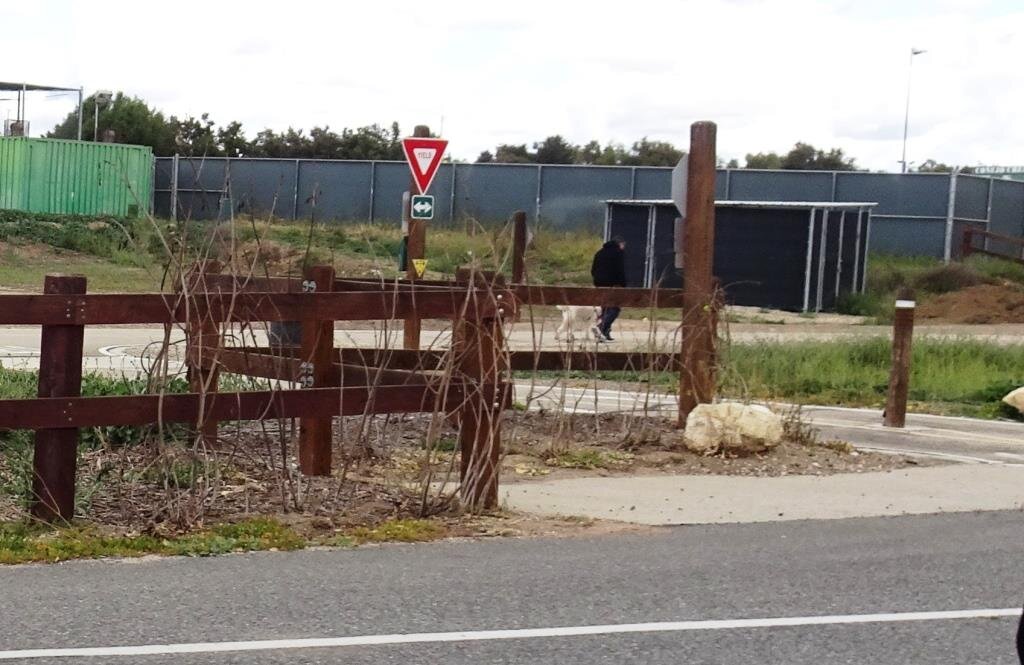
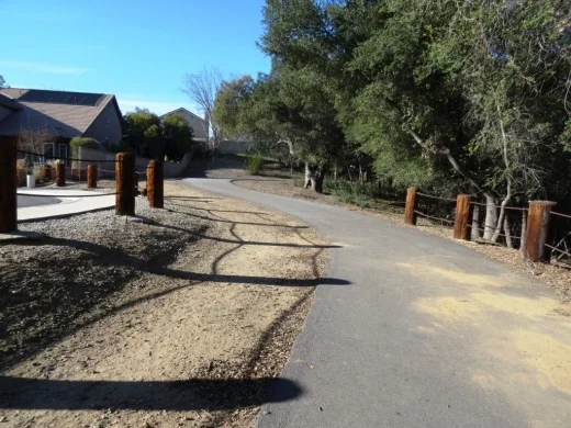
There is another Thousand Oaks bike path, the .5 mile Greenmeadow Drive connector bike path accessible on the west at Greenmeadow and Yellowstone, on the south side of Los Robles Greens. This is not a particularly interesting path but it does enable cyclists and walkers a path around the golf course to the Los Robles trailhead and Moorpark Road from Newbury Park. A bit hilly, too.

Entrance to Greenmeadow Avenue connector bike path in Thousand Oaks
There is also the .8 mile bike path on the north side of The Oaks mall as well as the .5 mile Read Road Connector path accessible off of Olsen Road just east of the 23 freeway.

Sign at the Read Road connector path on Olsen Road east of 23 Freeway.
Medea Creek Natural Park has hiking, biking and fitness trails that stretch from Calle Rio Vista and Oaks Hills Drive in Oak Park on the north, then south past Medea Creek Lane and Conifer Street to a cul de sac entrance to the park at the west terminus of Tamarind Street. About a mile to mile and a half of paths, including paved and dirt paths.
Nicely paved path at Medea Creek Natural Park in Oak Park
Ventura
My personal favorite bike path in Ventura County is the Omer Rains Trail that runs the entire length of San Buenaventura State Beach.

Senator Omer Rains Ventura Oceanfront Bikeway Sign on Main Street next to Ventura Beach RV Resort
We park the car at Marina Park in Ventura and ride a short distance north on Pierpont Blvd to the bike path entrance. This oceanfront path takes you past the Ventura Pier, through the Promenade area, adjacent to the Ventura County Fairgrounds, Emma Wood State Beach and beyond. Or you can get to the path from anywhere along the Ventura Promenade area.

Bike path along San Buenaventura State Beach.

Omer Rains Bike Path near Ventura Beach RV Resort on Main St.

Nice, newer paved section of Ventura beachfront bike path near Surfers Point.
The Ventura River Trail is a 6.3 mile asphalt pedestrian and bike path that follows the old Southern Pacific Railroad right-of-way from Main Street in Ventura to Foster Park inland towards Ojai. You can easily connect from the Omer Rains Trail to the Ventura River Trail up to the Ojai Valley Trail for quite a long, nearly automobile-free ride.
The Ventura Harbor Bike Path takes you 1.2 miles from Market St and Arundell Ave in midtown Ventura southwest through farmland to E. Harbor Boulevard and Schooner Drive, near Four Points by Sheraton.
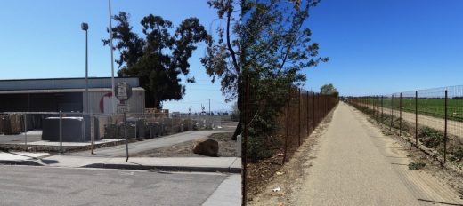
Bike path from midtown Ventura to the Harbor is not the most exciting path but it is a convenient way to ride to Ventura Harbor, Marina Park and adjacent areas.
The La Conchita Bike Path between Rincon Point at the Ventura/Santa Barbara County Line adjacent to Highway 101 past La Conchita to Mobil Pier Road in Ventura was completed in September 2014. This path has leapfrogged into my own personal favorite in Ventura County because of its spectacular beach views. This is about 4 miles of bike path in the Oil Piers Beach to Mussel Shoals to La Conchita Beach to Rincon Point beach areas.

Bike paths rarely get better than this stretch along the southbound 101 and the Pacific Ocean in Ventura.
There's another short stretch of bike path at the east end of Navigator Drive that goes west, then south, around the Ventura West Marina.

Entrance to short bike path adjacent to Ventura West Marina.
There is a two mile biking and hiking on the east side of the lake at the Lake Casitas Recreation Area, 11311 Santa Ana Road, Ventura. The path starts at picnic area #1 and follows the east shoreline of the lake for a four mile round trip ride. The path is paved in the recreational area and becomes a dirt road outside of that. More information at www.casitaswater.org/hiking-and-biking-trail.
Ojai
The Ojai Valley Trail is a 9 to 10 mile trail that parallels Highway 33 from Foster Park on the outskirts of west Ventura, to Soule Park in Ojai. It connects to the Ventura River Trail.
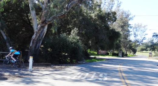
The Ojai Trail runs parallel to Ventura Ave/Ojai Ave.
Simi Valley
The Arroyo Simi Bike Path is a two lane bike path in Simi Valley that runs from Madera Road, just south of Easy Street on the west, ending at Tapo Street on the east. Over seven miles.

Arroyo Simi Bike Path/Trail in Simi Valley.
Camarillo
We enjoy the newer, flat roughly 2 mile Calleguas Creek bike path from Pleasant Valley Fields up to the corner of Flynn and Upland Roads in Camarillo. Quick access from the Conejo Valley and a nice, relatively easy path good for all ages.

Look at how nice and flat this bike path adjacent to Calleguas Creek is!
Other Areas
There's an online bike map available on the Ventura County Transportation Commission website at www.goventura.org where you can find other Class I, II and II bike paths around the county. Here are some of them.
The Santa Paula Bike Trail takes you roughly 3 miles on the east near W. Main St and Peck Rd to (roughly) Dike Road on the west.
The Fillmore Bike Path runs from south of Highway 126 (Telegraph Road) up past Shiell Park.
In Moorpark there's a .5 mile path at Country Trail Park, around the neighborhood to the west, back to Mountain Trail Street.
There's a bike path that starts at the ocean side of'olołkoy Beach Park and takes you south all the way to Hollywood Beach and Channel Islands Harbor. Cross Harbor Boulevard and make your way into Channel Islands Harbor, where you can ride all the way to the south end of the harbor.

Bike path near Oxnard Beach Park and Channel Islands Harbor.
In Port Hueneme there's a bike path that starts off of Bard Rd, west of South J St, through Richard Bard Running Springs Park and takes you southwest all the way to Hueneme Beach.
If you're willing to venture a bit further away from Ventura County, the Marvin Braude Coastal Bike Path stretches over 20 miles, from Will Rogers State Park in Pacific Palisades to Torrance. Flat, adjacent to the ocean, and so many things to do along the way!

Marvin Braude Coastal Bike Path in Pacific Palisades
That should be enough to get you started! Looking for local cycling clubs? Find some of them at this link.


![fire_island_kids_eat_free[1].jpg](https://images.squarespace-cdn.com/content/v1/5581d2d3e4b02b620931f85b/1565855045853-RO5ENM4QDW535X2UNH6E/fire_island_kids_eat_free%5B1%5D.jpg)