Rancho Sierra Vista / Satwiwa in Newbury Park

RanchoSierraVistaEntry.jpg

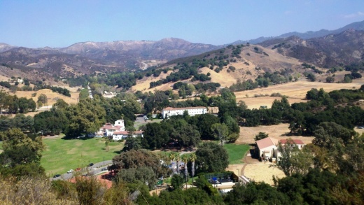
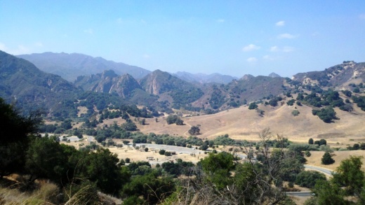
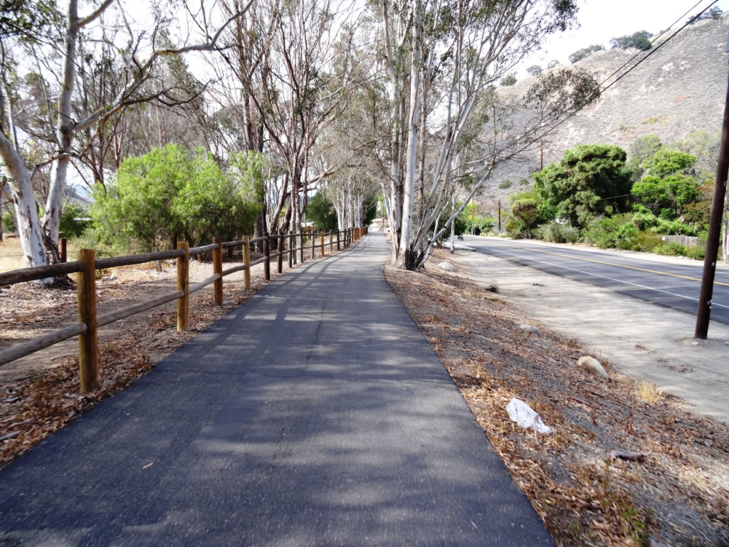
We are fortunate to have such great trails and views of Boney Peak from in Newbury Park. At Wendy and Potrero is the Western edge of the Santa Monica Mountains where Sycamore Canyon cuts through Rancho Sierra Vista/Satwiwa and Point Mugu State Park.

SatwiwaSign.JPG
Satwiwa.jpg

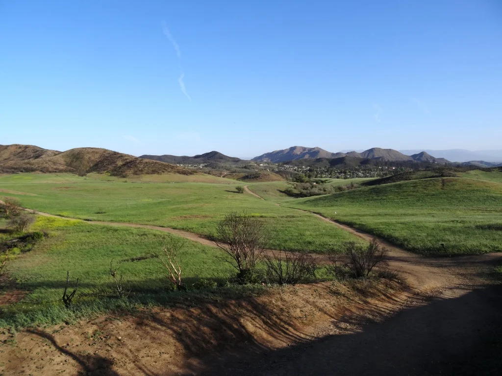
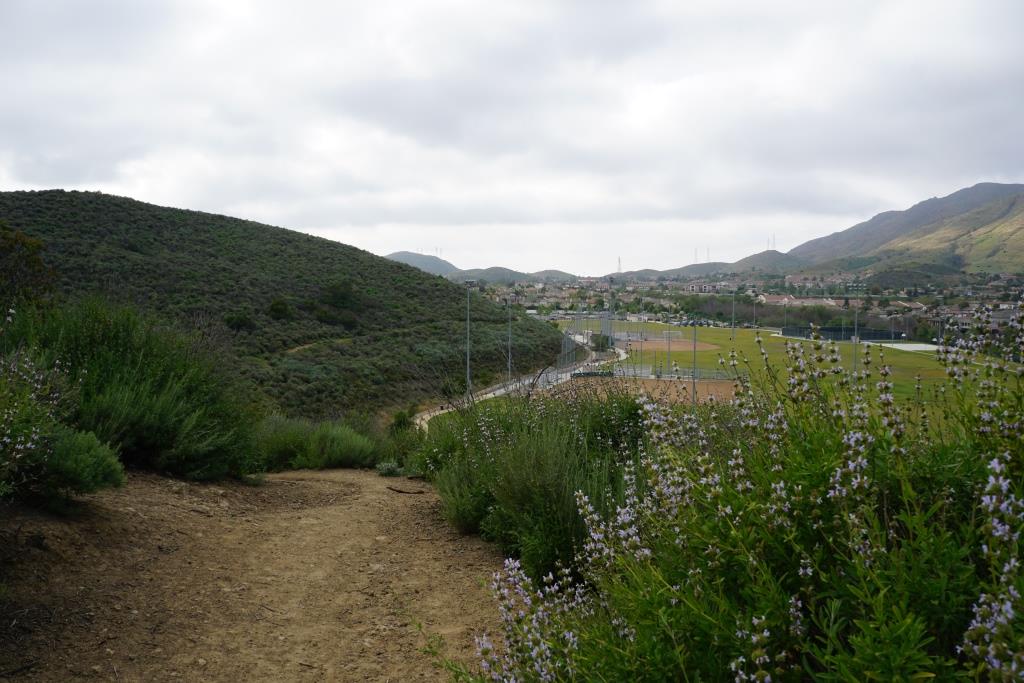
Roughly a mile easy hike from Wendy/Potrero gets you to the Satwiwa Native American Indian Culture Center where you can explore some native Chumash items and educational information and chat with rangers. This is a nice little hike to take the kids on. There are restrooms and water at the center, which is open from 9am to 4pm on weekends.

Learn more about hiking in Rancho Sierra Vista/Satwiwa at THIS LINK.

You can get easier access to the center by parking in the adjacent National Park Service parking lot via Lynn Road to the access road at Via Goleta in Newbury Park.

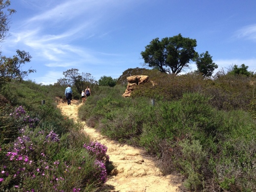
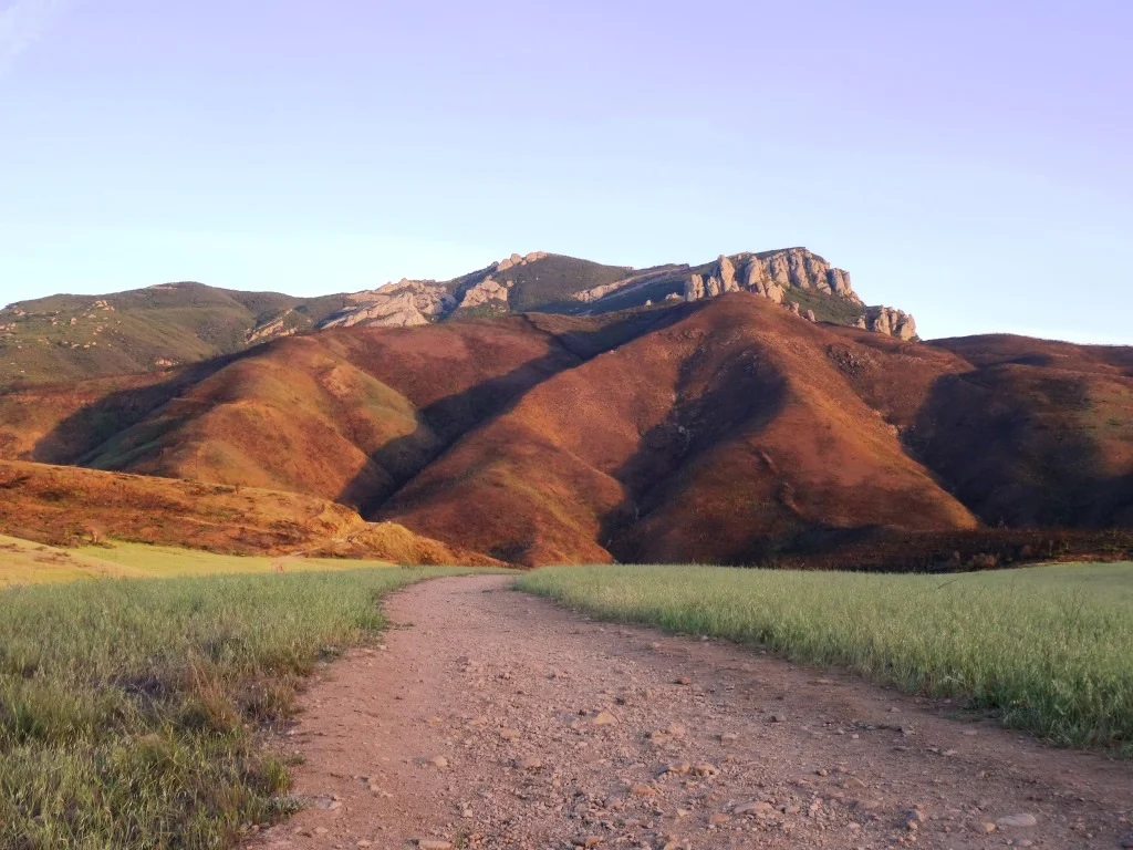
Another mile and a half of hiking gets you to a small waterfall, which is fun to check out with the kids but somewhat more strenuous of a hike. Note that in recent years (2012-2015), the waterfall has barely flowed due to low rainfall.

Here is more information about the Boney Mountain Trail, leading up to Hidden Valley Overlook, the waterfall and Danielson Monument.

SatwiwaCircle.JPG

Visit www.nps.gov/samo/planyourvisit/rsvsatwiwa.htm for a map and site information on the National Park Service website.

BoneyViewsSatwiwa.jpg
SatwiwaTrails.JPG
WendyPotreroTrailhead.JPG

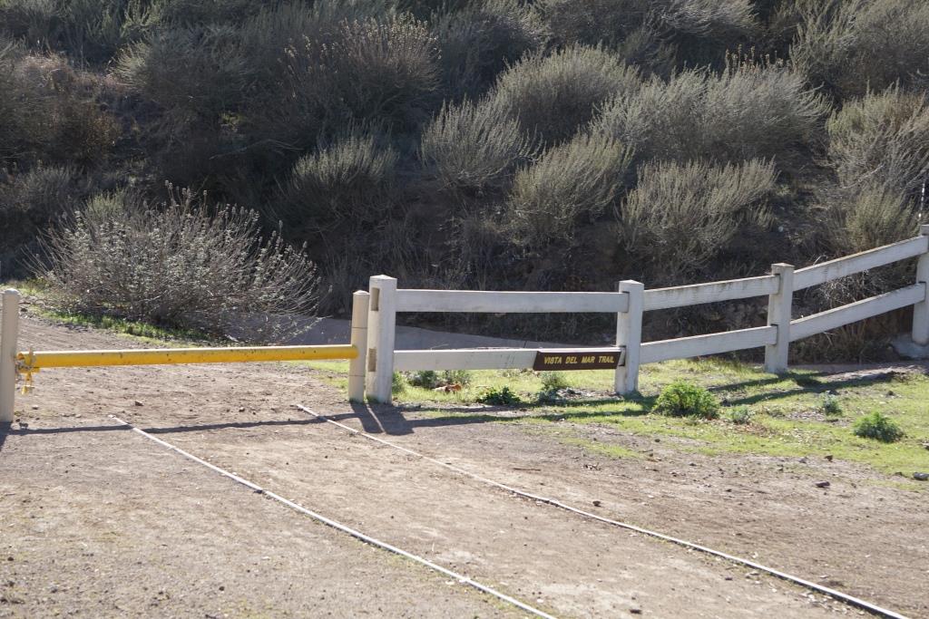
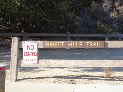
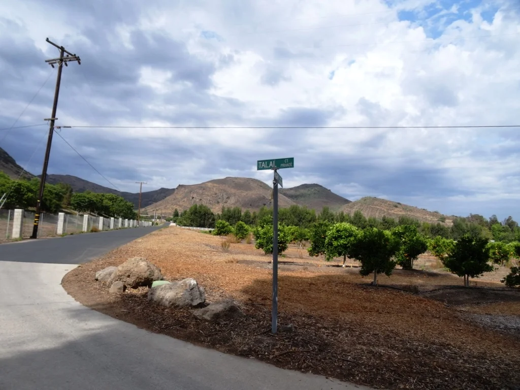
Trailhead at the corner of Wendy Drive and Potrero Road in Newbury Park. Park on the dirt on the south side of Potrero or on the street on Wendy.

Vista Del Mar Trail in Newbury Park

Trail access off of Via Ricardo in Newbury Park (Dos Vientos section).

Trail access off of Via Ricardo in Newbury Park (Dos Vientos section).

Other end of trailhead off of Via Ricardo.

Other end of trailhead off of Via Ricardo.

The Vista Del Mar Trail is a 2 1/2 mile long trail along the west side of the Dos Vientos residential development in Newbury Park. The trail is maintained by the Conejo Open Space Conservancy Agency.

The trail can be accessed near the corner of Via Ricardo and Via Rincon (parking on Via Ricardo). The other end of the trail is near the corner of Rancho Dos Vientos and Via El Cerro (where there is no parking on Rancho Dos Vientos).

"Vista Del Mar" is Spanish for "View of the Sea" and while the overcast early morning photos below do not show it, on a clear day you will indeed be able to see down the Potrero Grade to the Pacific Ocean and Channel Islands. The Vista Del Mar trail also provides views to Camarillo and the Oxnard Plain.

The trail is nice and wide, good for walkers, runners and cyclists.

The trail is nice and wide, good for walkers, runners and cyclists.

The north section of the trail before intersecting with the Edison Fire Road Trail is where the "Twin Ponds" are. The image below of one of the ponds was taken after the Springs Fire of May 2013 ravaged the area. More on the Twin Ponds Conservation Area at this link.

DosVientos5.5.13_12.JPG

The Twin Ponds are more easily accessed via the northeast Vista Del Mar trailhead near the corner of Via Ricardo and Via Rincon. About a mile.

VistaDelMar_priprsign.JPG
VistaDelMarTrail_priprpsign2.JPG

About 1/4 mile into the trailhead from Via Ricardo, you'll reach this junction. Veer right to the single track public access trail, as the trail to the left is on private property.

Lone bench on the Vista Del Mol trail that has views to the Channel Islands on a clear day

Lone bench on the Vista Del Mol trail that has views to the Channel Islands on a clear day

The Vista Del Mar trail connects on the southeast to the Sierra Vista Trail, which in turn connects to the Potrero Ridge trail, with an endpoint on Reino Road.

Views from the Vista Del Mar Trail on a clear morning.

Views from the Vista Del Mar Trail on a clear morning.

Map courtesy of the Conejo Open Space Foundation

Map courtesy of the Conejo Open Space Foundation

Sunset Hills Trail in Thousand Oaks

SunsetHillsTrail_sign.JPG

The Sunset Hills Trail is easily accessible off of Erbes Road in Thousand Oaks, just 7/10ths of a mile north of Sunset Hills Boulevard, just past Fernleaf Court.

There's a triangular dirt parking lot on the east.

There's a triangular dirt parking lot on the east.

This is a pretty easy mile or so trail that takes you past the Bard Lake Reservoir. The reservoir is of course is fenced in but you'll be treated to its beauty as you make your way up. Lake Bard is owned by the Calleguas Water District for storage of up to 10,000 acre-feet (3.3 billion gallons) of water used to meet peak summer demand and emergency requirements.

SunsetHillsTrail2.JPG

In fact, most all the way up this fairly gentle, hilly slope, you'll get some great panoramic views of the entire area, including the Conejo Valley, Simi Hills and looking west towards Camarillo/Oxnard. Continue east and you will reach the Woodridge Open Space in Thousand Oaks.

SunsetHillsTrail1.JPG
SunsetHillsTrail4.JPG

The Sunset Hills Trail is maintained by the Conejo Open Space Conservation Agency. More information at cosf.org/trails/other-trails/easy-hike-sunset-hills-trail.

SunsetHillsTrail5.JPG

An additional, and perhaps more popular hike provides even better view of the Bard Reservoir. Take the additional loop in the shape of Maine (kind of) either clockwise or from the first juncture or counterclockwise after cresting the hill. If you go to the top of the hill take the trail on the left and continue onwards. You will see some steps and a bench to take in the views along the way.

(Map courtesy of the conejo Open Space Foundation) Green highlighted section is a nice loop to hike - good family hike.

After cresting the first hill from Erbes Road, find the loop trail on the left.

After cresting the first hill from Erbes Road, find the loop trail on the left.

A short walk to this bench that overlooks Bard Reservoir.

A short walk to this bench that overlooks Bard Reservoir.

Continue on the trail until it loops around and goes south., parallel to Highway 23

Continue on the trail until it loops around and goes south., parallel to Highway 23

Soon you will be back at the main trail, passing through this tree-tunneled section.

Soon you will be back at the main trail, passing through this tree-tunneled section.

King Gillette Ranch in Calabasas

KingGilletteSign.JPG

The 588-acre King Gillette Ranch (26800 West Mulholland Highway, Calabasas) is situated adjacent to Malibu Creek State Park. This scenic parkland at the lower end of the Las Virgenes Valley is a haven for larger mammals of the Santa Monica Mountains and offers a rare unspoiled view of California’s rich archaeological, cultural, and historic resources, including a Chumash settlement, and nationally significant structures designed for razor magnate King C. Gillette in the 1920’s by Wallace Neff, architect of California’s Golden Age.

View of King Gillette Ranch from Inspiration Point, south of the Gillette Mansion

View of King Gillette Ranch from Inspiration Point, south of the Gillette Mansion

A short, somewhat steep roughly 1 mile hike from the parking area south of the Gillette Mansion leads to a knoll with 360-degree views—including the famous rock formations of Malibu Creek State Park. This is referred to as Inspiration Point. You will love the spectacular views from up there.

View from Inspiration Point west towards Malibu Creek State Park.

View from Inspiration Point west towards Malibu Creek State Park.

Other activities include strolling, bicycling, photography, and picnicking. King Gillette Ranch is owned and managed by the Mountains Recreation and Conservation Authority in cooperation with the Santa Monica Mountains National Recreation Area unit of the National Park Service, the Santa Monica Mountains Conservancy, and California State Parks

Parking is $7. More information at mrca.ca.gov/parks/park-listing/king-gillette-ranch/ or call the Anthony C. Beilenson Interagency Visitor Center at 805.370.2301.

Directions from the Conejo Valley: Take Hwy 101 (Ventura Freeway) to the Las Virgenes/Malibu Canyon exit. Head south on Las Virgenes Road and continue to Mulholland Hwy, about two miles. Turn left onto Mulholland Highway and immediately look for the King Gillette Ranch entrance on the right.

Rocky Peak Park in Simi Valley

RockyPeakPark_trailhead.JPG

The 4,800 acre Rocky Peak Park is located in the Santa Susana Mountains, adjacent to the 118 freeway between Yosemite Avenue and Rocky Peak Road in Simi Valley. It is visually stunning to see as you drive up the 118 grade east towards the San Fernando Valley.

View of Rocky Peak Park from Highway 118 driving eastbound

View of Rocky Peak Park from Highway 118 driving eastbound

There are large sandstone structures, unusually balanced rocks, caves and other interesting formations throughout Rocky Peak Park. Plenty to explore and views abound!

The main entrance to the park is the Rocky Peak Trail, which runs north/south over about five miles of fire roads. It is moderately strenuous, with lots of hard, rocky surfaces, so make sure to wear solid shoes for this trail. Be prepared for panoramic views of Simi Valley and the San Fernando Valley as the trail is nearly on the Ventura/Los Angeles County line.

To get there from the west, take the 118 east to Rocky Peak Road. The trailhead is across (north of) the freeway, but parking is very limited, so plan to park on Santa Susana Pass Road, where plenty of street parking is available - just turn right at the end of the offramp and you’re there.

Lots of rocky surfaces on the Rocky Peak Trail as you can see

Lots of rocky surfaces on the Rocky Peak Trail as you can see

Trails that intersect the Rocky Peak Trail going east/west include the Hummingbird Creek Trail, Chumash Trail and Las Llajas Canyon Trail. Not far into Rocky Peak Trail you'll see a sign that indicates the Hummingbird Creek Trail.

No doubt about it...you'll have some really nice views of Simi Valley from up here!

No doubt about it...you'll have some really nice views of Simi Valley from up here!

After reaching the 2,715 foot Rocky Peak and taking in the views, if you're up to it you can continue north where you will pass by the Chumash Trail and Las Llajas Canyon Trail.

The Rocky Peak Trail terminates north of Blind Canyon in Las Llajas Canyon. You must then double back to return to the trailhead, or take the three mile Chumash Trail down to the westernmost boundary of the property at the end of Flanagan Drive in Simi Valley.

Chumash Trail is about 3 miles of steady climb from Flanagan Drive. To get to the Chumash Trail trailhead, take the 118 to Yosemite, go north, turn right on Flanagan to the end. Park on the street.

The Hummingbird Trail was built by the Rancho Simi Recreation and Park District, starting near Kuehner Drive and the 118 Freeway. The trail leads up to the main Rocky Peak Trail. During and just after the rainy season, the trail passes cascades flowing down the sandstone boulders and cliffs. It is about 2 miles or so each way. Take the 118 to Kuehner, go north to the parking area about a quarter of a mile away.

Clearly marked sign on Rocky Peak Trail showing the Hummingbird Trail turnoff

Clearly marked sign on Rocky Peak Trail showing the Hummingbird Trail turnoff

Rocky Peak Park is maintained by the Santa Monica Mountains Conservancy. Learn more at mrca.ca.gov/parks/park-listing/rocky-peak-park. Dogs are allowed on these trails on leash.

Peering down upon the northwest San Fernando Valley from Rocky Peak.

Peering down upon the northwest San Fernando Valley from Rocky Peak.

Lake Eleanor Open Space Hike in Westlake Village

For a nice, fairly moderate hike in Westlake Village, take Triunfo Canyon Road south to Highgate Road and head up to the southeast endpoint of Highgate, past Hillsbury Road, to the end of the road, where you'll see a trailhead sign. Park on the street.

It doesn't actually say "Lake Eleanor Open Space Hike" but this is indeed the way to get to this trail maintained by the Conejo Open Space Foundation (COSF).  Walk past the fence on the pavement, and in about 60 steps, the trailhead is on the right. There's no sign. In fact, I've never seen any signs indicating which way to go on this trail. But once you reach this path, for the most part the trail is pretty obvious.

COSF has some helpful images and a trail map at cosf.org/trails/other-trails/easy-lake-eleanor-open-space-hike.

There are some brief, slightly challenging hilly sections on this hike, along with some rocky sections, but for the most part, this trail is perfectly fine for all ages. I generally wouldn't recommend strollers on this trail though because of these sections, but if you have a solid off-road stroller, it is possible.

LakeEleanorTrail.JPG
After record rainfalls in January/February 2017, this place is looking quite green.

After record rainfalls in January/February 2017, this place is looking quite green.

On the left you'll see the beautiful Las Virgenes Reservoir for most of the 1 1/2 mile hike.

You can't go swimming in the Las Virgenes Reservoir but it sure makes for gorgeous views.

You can't go swimming in the Las Virgenes Reservoir but it sure makes for gorgeous views.

Towards the endpoint (Denver Springs Drive), on the right you can look down towards Westlake Boulevard/Decker Canyon and see the eight acre Lake Eleanor. Pretty cool to see from above as it is not accessible to the public.

There is also a trailhead and some parking on Hillsbury Road.

The main trail is on the left; veer right however for best views of Lake Eleanor.

The main trail is on the left; veer right however for best views of Lake Eleanor.

Lake Eleanor along with the Lake Eleanor Dam (also called Banning Dam) and surrounding 529 acres of open space has been named City of Thousand Oaks Historical Landmark #9. 

Lake Eleanor, which is fenced off to protect the wildlife, is clearly visible from the trail.

Lake Eleanor, which is fenced off to protect the wildlife, is clearly visible from the trail.

I love this little hike. It is quiet and peaceful and the views are just wonderful up here. And you are just minutes from civilization.

CLICK HERE FOR DOZENS OF OTHER GREAT HIKING TRAILS AROUND VENTURA COUNTY

Ojai Valley Trail

OjaiValleyTrail_Sign.jpg

The Ojai Valley Trail is a 9 mile trail that parallels Highway 33 from Foster Park on the outskirts of west Ventura, to Soule Park in Ojai. One side of the trail is paved for bicyclists, walkers, joggers and people exercising their pets. Post-and-rail wood fence separates the paved path from a dirt bridle path for horseback riders. Sections wind through wooded areas and past riverbeds. While most of the path is offset from Highway 33 (the main thoroughfare in Ojai), it does have a number of street crossings. If staying in Ojai and you run or bike, you will no doubt cross paths with this path!

At Foster Park, the Ojai Valley Trail connects with the 6.3 mile Ventura River Trail, which in turn extends to the Omer Rains Trail along the Ventura beachfront.

More information at parks.venturacounty.gov/county-parks/ojai-valley-trail.

OjaiTrail1.JPG
OjaiTrail2.JPG
OjaiTrail3.JPG
Ojai Valley Trail near Foster Park

Ojai Valley Trail near Foster Park

Prickly Pear Trail in Newbury Park

The Prickly Pear Trail is located in the Dos Vientos section of Newbury Park. The entry point is at Del Prado Playfields, 402 Calle Del Prado, Newbury Park.

This is a short, roughly one mile in total, family-friendly hike at the east end of the Dos Vientos community. 

The entry point is on the south side of the parking lot in front of the park. It is quite clearly marked, as shown below. The first straightaway is about 1/4 mile, at which point you have the decision of which direction you'd like to take the loop. If you go left (clockwise loop), at the first fork in the trail, continue the remainder of the loop veering right until you're back at the straightway you came from.

This is a convenient little family hike as there is plenty of parking, restrooms, a newer playground for the kids, pickleball and tennis courts at the park.

About 1/4 mile into the hike, looking back towards Del Prado Playfields.

About 1/4 mile into the hike, looking back towards Del Prado Playfields.

Views toward the protected pond behind Cypress Elementary, along Via Rio.

Views toward the protected pond behind Cypress Elementary, along Via Rio.

Santa Rosa Trail and Lower Butte Trail in Thousand Oaks

SantaRosaTrail.JPG

The Santa Rosa Trail connects Wildwood Park to the hills above Cal Lutheran University in Thousand Oaks, about a 3 mile hike one way along the Mount Clef Ridge. Enjoy beautiful views of the Conejo Valley and Santa Rosa Valley, then loop around the hills behind CLU.

SRTrail_toWildwood.JPG

From Wildwood Park, you can take the Mesa Trail west and turn right onto the Santa Rosa Trail. Or start from the other direction...park at CLU near the Samuelson Community Pool and hike towards Wildwood.

Juncture of Santa Rosa Trail and Lower Butte Trail.

Juncture of Santa Rosa Trail and Lower Butte Trail.

Or take an alternate route with the Lower Butte Trail. The Conejo Open Space Foundation website has a map of the Santa Rosa/Lower Butte Trail loop hike that is about 6 miles in length from Wildwood Park at cosf.org/trails/wildwood/wildwood-park-moderate-hike-santa-rosa-lower-butte-loop.

Two benches and a cross abpve CLU, east of the CLU sign, with panoramic views of the Conejo and Santa Rosa Valleys.

Two benches and a cross abpve CLU, east of the CLU sign, with panoramic views of the Conejo and Santa Rosa Valleys.

SRTrail_SRViews.JPG

The Calabasas Stairs

The Calabasas Stairs is a set of 375 stairs located in the Santa Monica Mountains, leading up to a residential area above a locked gate.

To get there, take Calabasas Road west to its endpoint, then turn around and park near the Anza Loop Trail trailhead, which is a paved area. (There’s a different trailhead at the very end of Calabasas Road that will take you elsewhere.)

Take the Anza Loop Trail about half a mile until you can see the stairs. Veer right to the New Millenium Loop Trail when you see that sign. At some point you’ll reach another fork in the trail which is unmarked. Veer left to hike into canyon, where you’ll eventually reach the path to the bottom of the staircase.

This is the unmarkeded split where you veer left down into the ravine to get to the stairs

Charmlee Wilderness Park in Malibu

CharmleeSign.JPG

Charmlee Wilderness Park is a 532 acre park located at 2577 Encinal Canyon Road in Malibu, just 10 miles from the Conejo Valley. It is located within the Santa Monica Mountains. There are over eight miles of hiking trails, a nature center (currently closed), picnic areas and more. Park hours are 8 a.m. to sunset. Parking is free of charge.

Visit www.malibucity.org/561/Charmlee-Wilderness-Park for more information.

To get there from the Conejo Valley, take the 23 (Westlake Boulevard/Decker Canyon Road) toward the ocean and turn left on Lechusa Road. Continue on Encinal Canyon Road and look for the sign on the right.

Photos below courtesy of Suzy Demeter Photography.

Charmlee1.jpg
Charmlee3.jpg
Charmlee5.jpg
Charmlee6.jpg

Santa Rosa Loop Hike in Wildwood Park

The Santa Rosa Loop Hike at Wildwood Park in Thousand Oaks is a 6 1/2 mile trek with moderately challenging uphills and downhills. You’ll be rewarded with beautiful views of the Conejo Valley and Santa Rosa Valley.

Start at the main Wildwood trailhead at the west end of Avenida de Los Arboles. Take the main Mesa Trail towards Lizard Rock. You'll soon reach the Santa Rosa Trail sign, which points you north.

Box Canyon Loop Trail
As you crest the hill, follow the arrows toward the Lower Santa Rosa Trail.

As you crest the hill, follow the arrows toward the Lower Santa Rosa Trail.

Views of Santa Rosa Valley

So you're heading east and almost feeling like maybe you're getting lost, but this indeed is the Santa Rosa Trail. Just stay towards the left. It is single track much of the way over here. Then, you'll see the following sign as you get closer to the bottom of the Santa Rosa Valley.

So now you are zig zagging down the Shooting Star Trail, which eventually merges into the Lower Santa Rosa Trail.

(That said, you can continue east from the above juncture and make your way to Cal Lutheran.)

Now you're going to turn left (west) on Lower Santa Rosa Trail for some gentle slopes alongside private residences and farms in the Santa Rosa Valley for about a mile or so.

Some old farming equipment on the side of the Lower Santa Rosa Trail.

Some old farming equipment on the side of the Lower Santa Rosa Trail.

Then soon you come to the end of the trail and there's a sign that tells you to get back into Wildwood Park via the Box Canyon Trail, take the road up ahead 4/10ths of a mile. You're actually in Camarillo now on Rocky High Road.

The trail ends at the juncture of Talal Ct (private) and Rocky High Road.

The trail ends at the juncture of Talal Ct (private) and Rocky High Road.

At the end of the short stretch of road is the trailhead back into Wildwood Park.

And soon you'll see the Box Canyon Trail sign. Veer left (although I think if you go right it loops around to the main trail also).

Box Canyon Trail Sign

It's about a 300 foot climb over less than half a mile up the Box Canyon Trail that gets you back to the main Mesa Trail artery in Wildwood Park. Take your time...you're almost there!

Box Canyon Lizard Rock Sign Wildwood Park

Then you'll see the Lizard Rock / Box Canyon sign that signifies you are back at the Mesa Trail to head about half a mile back to the parking lot. Or turn right to check out the views from Lizard Rock before you go.

To see a map of this hike, visit www.cosf.org/website/html/santa-rosa-loop.html.

OK, so if you're looking to take a break and sit back and enjoy the view near the juncture of the Mesa Trail and Box Canyon Trail?  Then head back (west) from the "Lizard Rock/Box Canyon" trail sign above toward Box Canyon and take the trail on the left to the Box Canyon Overlook, where you will find the following place to park your rear end. Not a bad view, eh?

Bench at Box Canyon Overlook.

Bench at Box Canyon Overlook.

Conejo Valley Botanic Garden - Thousand Oaks

CVBG_logo3.gif

The Conejo Valley Botanic Garden is a 33 acre retreat of hiking trails and natural habitat adjacent to Conejo Community Park off of Lynn Road and Gainsborough. 

CVBG now offers plant sales (weather permitting) every Sunday from 11:00 a.m. to 2:30 p.m. featuring California native and drought tolerant plants. Reasonable prices! Enter at the Kids' Adventure Garden entrance (400 W. Gainsborough Road).

This is really a special place to bring the kids for low key hike.  There are numerous trails and a short walk/hike to the top of the mountain rewards you with sweeping views of the entire Conejo Valley, from Westlake Village to Thousand Oaks to Newbury Park.

CVBotanicGarden.jpg
CVBotanic_Sign.jpg

Here is what you'll find at the CVBG:

  • The Nature Trail is 3/4 of a mile long and meanders above the creek through oaks and willows. This is a moderate trail.

  • The Little Loop Trail leads you above the creek, through chaparral and around a meadow.

  • The Native Plant Section and Lower Meadow feature southern and northern California plants.

  • Lillian's Meadow showcases perennials, shrubs and trees that thrive with minimal water.

  • The Salvia Garden delights hummingbirds and butterflies.

  • The Butterfly Garden is a safe haven that provides nectar and food sources for butterflies and caterpillars.

  • The Nursery houses workspace for the plant propagation team and hosts plant sales.

  • The Herb Garden exhibits an extensive and unusual collection of medicinal, kitchen and aromatic herbs.

  • The Bird Habitat has a fresh water source and is planted with native plants that provide year-round food source for birds.

  • The Australian Section features collection of plants from down under.

  • The Desert Garden hilltop landscape features cacti, succulents and desert trees and provides a panoramic view of the Conejo Valley.

  • The Rare Fruit Orchard holds an extensive collection of trees.

  • The Tranquility Garden is planted in the Japanese style featuring California native plants.

  • The Oak Tree Grove has many species of North American and other oak trees.

  • The Trail of Trees exhibits 50 trees with a variety of genera.

If you have small kids, they will love the Kids' Adventure Garden and treehouse, open on Sundays from 11 a.m. to 3 p.m.  They'll enjoy hiking through the trails and exploring the streams and bridges.

Conejo Valley Botanic Garden is located at 400 West Gainsborough Road, Thousand Oaks.  For more information visit www.conejogarden.org.

Desert Garden at the top of the hill, featuring cacti, succulents, etc.

Desert Garden at the top of the hill, featuring cacti, succulents, etc.

Japanese style Tranquility Garden featuring native California plants

Japanese style Tranquility Garden featuring native California plants

CVBG_bench.JPG
CVBG_cactus.JPG