Meditation Mount in Ojai

Meditation Mount is a meditation center located on a 32 acre site at 10340 Reeves Road in Ojai that opened in 1970. The grounds include a winding path through the International Garden of Peace, which winds around the property with a view of the Ojai Valley.

Meditation Mount is offering visitations on a pre-registered basis with two-hour self-guided sessions for $12 per person as of January 2025. They also offer other events, including guided meditations, yoga, performances and more.

Visit meditationmount.org for more information and to register for a session.

Mt. McCoy Trail in Simi Valley

The Mt. McCoy Trail is located on the west side of Simi Valley with a trailhead at the corner of Washburn Street and Los Amigos Avenue (off the west end of Royal Avenue).

The trailhead at the corner of Washburn St and Los Amigos Avenue

The trailhead at the corner of Washburn St and Los Amigos Avenue

The Mt. McCoy trail is distinctive as there is a large white cross at the top of the mountain, which is about a 600 or so foot climb. From the trailhead, go straight and then take the switchbacks up the mountain.

At this first juncture, keep going straight (south) to the switchbacks. Turn right and you'll be going straight up the steep hill, like we did the first time.

At this first juncture, keep going straight (south) to the switchbacks. Turn right and you'll be going straight up the steep hill, like we did the first time.

Actually, after just a few hundred feet from the Washburn/Los Amigos trailhead, you'll reach a juncture where you either go straight (which is correct) or take a trail to the right, which is much steeper, but a much more direct path to the top. We made the mistake of taking that path the first time and it got us right up to the cross, but it is pretty steep.

The trails here are all really nicely groomed, thanks to the Rancho Simi Trailblazers and RSRPD. There are dozens of "shortcuts" along the trail but try to stick to the main path. Taking the correct path, with its switchbacks and twists and turns, is a bit over a mile to the top of Mt. McCoy, where you will be treated to panoramic views of the entire Simi Valley and the other direction towards the Reagan Library.  In fact, there are paths from the top that take you in other directions, including  a fire road that intersects with Presidential Drive to the Reagan Library.

View of the cross from about halfway up

View of the cross from about halfway up

A couple benches at the top of the hill to take in the beautiful views

A couple benches at the top of the hill to take in the beautiful views

McCoyTrail_cross2.JPG

The Rancho Simi Recreation and Park District owns 200 acres surrounding Mt. McCoy and the Rancho Simi Trailblazers helped construct the nicely maintained trail. Learn more at www.rsrpd.org/business_detail_T9_R17.php/

McCoyTrail_topview.JPG
Looking down from the cross to the south, where the benches and trailhead are.

Looking down from the cross to the south, where the benches and trailhead are.

Ojai Valley Trail

OjaiValleyTrail_Sign.jpg

The Ojai Valley Trail is a 9 mile trail that parallels Highway 33 from Foster Park on the outskirts of west Ventura, to Soule Park in Ojai. One side of the trail is paved for bicyclists, walkers, joggers and people exercising their pets. Post-and-rail wood fence separates the paved path from a dirt bridle path for horseback riders. Sections wind through wooded areas and past riverbeds. While most of the path is offset from Highway 33 (the main thoroughfare in Ojai), it does have a number of street crossings. If staying in Ojai and you run or bike, you will no doubt cross paths with this path!

At Foster Park, the Ojai Valley Trail connects with the 6.3 mile Ventura River Trail, which in turn extends to the Omer Rains Trail along the Ventura beachfront.

OjaiTrail1.JPG
OjaiTrail2.JPG
OjaiTrail3.JPG
Ojai Valley Trail near Foster Park

Ojai Valley Trail near Foster Park

Long Canyon Trail in Simi Valley

The Long Canyon Trail is an easy to moderate hike in the Wood Ranch section of Simi Valley, located at the corner of Wood Ranch Parkway and Long Canyon Road (take Wood Ranch Parkway south until it ends, and turn right into the parking lot).

About a .7 mile hike to the top of the canyon connects you with the Lang Ranch / Woodridge Open Space in Thousand Oaks. Great views from the top towards Simi Valley,  Thousand Oaks and beyond, towards the Channel Islands on clear days.

More information at www.rsrpd.org/business_detail_T9_R16.php.

LongCanyon0.jpg
Technically I believe this bench is in the Lang Ranch/Woodridge Open Space in Thousand Oaks, which connects with the Long Canyon Trail. Nice view here towards Simi Valley.

Technically I believe this bench is in the Lang Ranch/Woodridge Open Space in Thousand Oaks, which connects with the Long Canyon Trail. Nice view here towards Simi Valley.

Lizard Rock Hike in Wildwood Park, Thousand Oaks

Lizard Rock is just over a mile from the main entrance to Wildwood Park at the west end of Avenida de los Arboles. Walk/run/hike the Mesa Trail towards Lizard Rock and you will be treated to beautiful views of the surrounding spaces where shows like Gunsmoke and The Rifleman were filmed.

The entrance area and dirt parking lot at the Wildwood Park main trailhead.

The entrance area and dirt parking lot at the Wildwood Park main trailhead.

LizardRockInDistance.JPG
Lizard Rock in the distance

Lizard Rock in the distance

View from on top of the lizard

View from on top of the lizard

Trail sign south of Lizard Rock indicating Lizard Rock Trail to Wildwood Canyon Trail

Trail sign south of Lizard Rock indicating Lizard Rock Trail to Wildwood Canyon Trail

You can make this hike a 4 1/2 mile loop past Paradise Falls and the Indian Creek Trail by reviewing the map on the Conejo Open Space Foundation website at cosf.org/trails/wildwood/wildwood-park-easy-hike-indian-creek.

Sycamore Canyon Campground in Point Mugu State Park

Point Mugu State Park is located at 9000 W. Pacific Coast Highway, Malibu, offering a variety of beach, hiking and camping opportunities.

The Sycamore Canyon Campground is north of PCH, offering 58 tent/RV spaces along with drinking water, restrooms, showers and fire rings. There are also 4 tent spaces available for "Hike and Bike" campers. Pets are allowed on leash in the campground. Fees as of October 2024 are $35/night plus a $7.99 reservation fee at www.reservecalifornia.com (type in Point Mugu SP to find Sycamore Campground).

This campground is across the street from Sycamore Cove Beach, also part of Point Mugu State Park and just around the corner from the Thornhill Broome Campground on the beach, the giant sand dune across from Thornhill Broome, and Mugu Rock.

Sycamore Canyon has trails galore to explore, going all the way up, eight miles, to Newbury Park, if you so choose. Located just steps from the Sycamore Canyon Fire Road trailhead is the "Scenic Trail," a moderate trail with some steps that gets you to stunning views of everything mentioned above - beaches, Mugu Rock, sand dune, etc.

The Scenic Trail connects with the Overlook Fire Road, which continues on and eventually connects with the top of the Ray Miller Trail, then on towards the La Jolla Valley. It is lush and stunning when green in late winter/early spring. It gets pretty brown and dry up here towards last spring, summer and fall months. But the great views towards the Pacific never change.

Gardens of the World - Thousand Oaks

Gardens of the World at 2001 Thousand Oaks Boulevard is a 4 1/2 acre garden across from the Civic Arts Plaza in Thousand Oaks.  It is free and open to the public Tuesday through Saturday from 9 a.m. to 5 p.m. (last admittance is 4:30 p.m.)  Closed Sunday and Monday and most national holidays. Gardens of the World is a gift from the Hogan Family Foundation.

GOTW_front2.JPG

Gardens of the World is an oasis of beauty in the middle of Thousand Oaks. There is a large bandstand in the center of the Gardens that is a perfect venue for outdoor music.  And the array of plants, flowers, waterfalls (including a stunning fountain that looks out toward the Civic Arts Plaza) and a serene koi pond next to an authentic Japanese Pagoda.

GOTW_WaterFountain.JPG

There is a Japanese garden, a French garden and waterfall (shown above), a Mission Courtyard, an English perennial and rose garden and an Italian garden.  A beautiful place to visit and relax for a bit, right in the heart of Thousand Oaks.  Also a great place for a picnic lunch, with plenty of tables, benches and grassy areas. More information at www.gardensoftheworld.info or 805.557.1135.

I never promised you a rose garden...but here's a beautiful one to check out!

I never promised you a rose garden...but here's a beautiful one to check out!

Koi pond in the Japanese Garden

Koi pond in the Japanese Garden

Shaded picnic area

Shaded picnic area

Since 2003, Gardens of the World has hosted a great Jazz Series on Sunday afternoons in August in this traditional American Bandstand area.

Since 2003, Gardens of the World has hosted a great Jazz Series on Sunday afternoons in August in this traditional American Bandstand area.

Potrero Ridge Trail in Newbury Park

The Potrero Ridge Trail in Newbury Park is an interesting ridgeline trail that runs west/east in three sections over approximately 2 1/2 miles one way. You can access the trail from a number of locations and neighborhood feeder trails, but the main sections are as follows (west to east):

Via Las Brisas in the Dos Vientos tract, just north of Paseo Santa Rosa to Reino Road, just north of Paseo de Leon and Lynn Road, is a little over a mile. This is one of my favorite trails in the area, providing panoramic views of the southern portion of Newbury Park, Boney Mountain and Dos Vientos. There are some switchbacks on the west end near Reino Road but they are not overly strenuous.

Potrero Ridge Trailhead on Via Las Brisas, just north of Paseo Santa Rosa.

Potrero Ridge Trailhead on Via Las Brisas, just north of Paseo Santa Rosa.

potreroridgeview.JPG
Potrero Ridge Trail trailhead (and parking area) off of Reino Road

Potrero Ridge Trail trailhead (and parking area) off of Reino Road

The middle section of the Potrero Ridge Trail runs from Woodland Oak Place off of Reino Road to Wendy Drive between Felton and Peppermint, where there's a convenient dirt parking lot.  Only about a half mile to the top of the trail, where you'll see a water tank. The primary trail is a wide fire road to the water tank from Wendy Drive. There's a secondary single track trail that mostly runs parallel (south) to the main fire road that is accessible from several points. This trail treats you to wonderful, panoramic views of the area.

Potrero Ridge Trail trailhead off of Wendy Drive.

Potrero Ridge Trail trailhead off of Wendy Drive.

Views towards the water tank at top of Potrero Ridge Trail (middle section)

Views towards the water tank at top of Potrero Ridge Trail (middle section)

The east section of the trail runs from across the parking lot on Wendy Drive to another peak, then down towards Silas Lane near Grace Bible Church, about half a mile in total. There is no parking available for this section of trail, though you can park in the Wendy lot and find a crosswalk to cross over to the trailhead.

View from east section of Potrero Ridge Trail.

View from east section of Potrero Ridge Trail.

So basically these 3 segments are split between Via las Brisas and Reino Road, Reino Road and Wendy Drive and Wendy Drive and Silas Lane.

If you'e like to extend your trail trekking on the west side, cross over Via las Brisas and take the Sierra Vista Trail west another mile to Rancho Dos Vientos.

This trail is maintained by the Conejo Open Space Foundation.

Here's a view of the initial section of the western section of the Potrero Ridge Trail from the Wendy Water Tank section of the trail across Reino Road.

Here's a view of the initial section of the western section of the Potrero Ridge Trail from the Wendy Water Tank section of the trail across Reino Road.

Views into the Dos Vientos section of Newbury Park

Views into the Dos Vientos section of Newbury Park

Potrero Ridge Trail bench provide extensive views

Potrero Ridge Trail bench provide extensive views

Views from the same bench on a cloudy late October day in 2013

Views from the same bench on a cloudy late October day in 2013

Escondido Canyon Trail and Waterfalls in Malibu

Trailhead on Winding Way

Trailhead on Winding Way

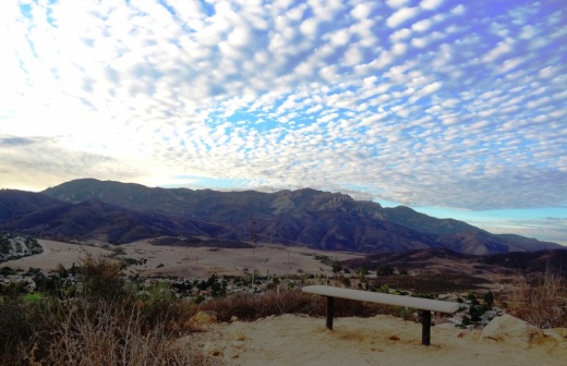
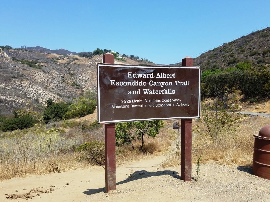
The Edward Albert Escondido Canyon Trail and Waterfalls is located off of Winding Way in Malibu.  It also also referred to as Escondido Falls.

The most unique aspect to Escondido Falls is that it is home to the tallest waterfall in the Santa Monica Mountains at over 150 feet.

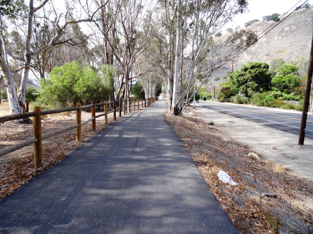
That said, in drought years, there is often no sign of waterfall, other than a sparse trickle into Escondido Canyon Creek. But even when that is the case, this is a nice, moderate hike, good for all ages. 

That said, in very wet years, like 2023, you will encounter a number of stream crossing on the trail. Just be aware, as this may not be up your alley.

To get to Escondido Falls from the Conejo Valley/101, take Kanan south to PCH and turn left. You'll be driving just under 2 miles, past Paradise Cove, to the small parking lot on Winding Way and PCH. Turn left onto Winding Way and an immediate left into the parking lot. There's a sign; you can't miss it. The lot has spaces for only around 16 vehicles; it is full, you'll have to find a spot on PCH and make you way from there...but be careful and watch for the plentiful "no parking" signs on PCH.

Parking is $12 (as of June 2023) and takes both cash and credit cards. Parking fees contribute to the ongoing maintenance of the trails, including porta potty cleanings, graffiti and trash removal and partial staffing.)

The parking area is on Winding Way and PCH. The initial section of the hike is along Winding Way is called the Winding Way Trail.

The parking area is on Winding Way and PCH. The initial section of the hike is along Winding Way is called the Winding Way Trail.

The hike is about 4 miles round trip and can be done in as fast as an hour (if you speed walk and don't hang out) or for most, a couple hours.

The first 8/10ths of a mile is along Winding Way to the trailhead. It has a moderate hill but is not that bad. Near the peak of the initial hill, you will need to cross from the left side of the street to the right side as you make your way up. There are signs that ask that you walk on the dirt trail rather than on the street, so try to abide by that. You will be treated to views of beautiful homes and ocean views along this portion of your trek.

After a short final downhill section, you'll reach the trailhead. After an initial left turn that takes you briefly west, most of the rest of the trail to Escondido Falls is a northeast to northerly direction. You'll be treated to lush oak woodlands and greenery year-round.  

Much of the trail looks like this; canopied by oaks and shrub.

Much of the trail looks like this; canopied by oaks and shrub.

Hikers, equestrians and bikers are all welcome on the trail. Dogs too, on leash of course. I have not seen bikers on this trail, however. There are no restrooms, other than a porta-john at the parking lot. No drinking fountains, so bring water. There are trash cans at the trailhead. 

The waterfall is a treat to see but the rest of the hike is quite nice too, largely shaded and not too hilly or technical. There is a net elevation gain from 150' at the trailhead to 325' at the Falls over about a mile, which is not bad.

After the rainy season, you may have to cross the creek a few times as it criss-crosses the trail. There are a couple forks in the road where you may wonder which way to go. Generally speaking, turn left on your way to the falls and that will get you there.

Believe it or not, this is the end of the trail, where the waterfall flows after the rainy season. In late August pictured here, there is a dribble of water flowing into the creek.

Believe it or not, this is the end of the trail, where the waterfall flows after the rainy season. In late August pictured here, there is a dribble of water flowing into the creek.

The parkland ends at the multi-tiered waterfall area and the trail ends. Except, there are paths that can get you to the upper falls. Technically you are not supposed to do this because you are no longer on public land, not to mention you are literally rock climbing your way up there and it can be dangerous.

This is a fun, family-friendly hike that is worth a try. Quite popular, one could argue, too popular, on weekends.

There's one side trail to the east that will give you views of the waterfall when it is flowing. The white-ish area in the upper right hand of this photo is where the waterfall resides.

There's one side trail to the east that will give you views of the waterfall when it is flowing. The white-ish area in the upper right hand of this photo is where the waterfall resides.

Why is it named after Edward Albert? Well, Edward Albert is the only son of actor Eddie Albert, well known for his role on TV sitcom "Green Acres." Edward died at age 55 in 2006. Prior to his death, he was a tireless advocate for preserving Escondido Canyon. The Santa Monica Mountains Conservancy named the area in honor of him several months prior to his death. (1)

Visit the Santa Monica Mountains Conservancy site at mrca.ca.gov/parks/park-listing/escondido-canyon-park for more information.

(1) Los Angeles Times obituary dated 9/27/06 at this link.

Escondido Falls parking as of June 2023.

SOAR Over Ventura Zip Lines and Adventure Course at Ventura Ranch KOA in Santa Paula

SOAR Over Ventura is an adventure park located at the Ventura Ranch KOA Campground, 7400 Pine Grove Road, Santa Paula. SOAR Over Ventura offers state-of-the-art zip line and ropes course facilities. Zip through the treetops on two courses.

The Family Adventure Course features 8 zip lines and a 12-section ropes course, soaring over the resort pool and through tree canopies in a scenic valley near Topa Topa Mountain.

The Eagles Nest Zip Line Course features higher and faster zip lines, soaring through trees and over a BMX track and a mining sluice.

Admission as of August 2024 is $59 per course, or both for $78. Admission includes a 4-hour pass to the Ventura Ranch KOA, featuring a 2,000 sq ft jumping pillow, one of the world’s largest boulder labyrinths, resort pool and more.

Learn more at soaroverventura.com.

State Fish Hatchery in Fillmore

The California Department of Fish and Game maintains a Fish Hatchery in Fillmore, off Highway 126, just east of downtown Fillmore. Watch for the sign - you make a quick right on Fish Hatchery Road, not more than a mile or so from downtown Fillmore. (The given address is 612 E. Telegraph Road, but Fish Hatchery Road is just east of there.)

Fish species raised at the Fillmore Hatchery include rainbow trout and brown trout. The hatchery is located in a former citrus grove bordering the Santa Clara River. It was originally constructed in 1942 with 30 earthen ponds that were supplied by spring and well water. Major renovations were made in 1968 and 1972 that included the construction of 40 concrete ponds, with water temperatures averaging 60 degrees. Fish are raised for one year before release for recreational angling. An average of 700,000 trout are released annually into lakes and streams primarily in Southern California.

The hatchery is open 365 days a year, from 8 a.m. to 2 p.m. Bring dimes to purchase fish food and learn about fish and their role in California. This is a self-guided tour. More information at www.wildlife.ca.gov/Fishing/Hatcheries/Fillmore.

Ventura Pier

VenturaPier_1.jpg

The Ventura Pier was originally constructed in 1872 and is a favorite spot for local fishermen. The Pier is 1,600 feet long and underwent a $2.2 million renovation in 2000 that added an 80 foot octagon shaped extension, benches and more. The Pier can be accessed off of East Harbor Boulevard, close to the Crowne Plaza hotel off of California Street.

Eateries on the pier include Eric Ericsson’s Fish Co., MadeWest Brewing Company Taproom and Beach House Tacos.

VenturaPierSign.JPG

On the west side of the pier is a playground area with some unique play equipment. My kids always enjoy it here because of the great combination of the beach, pier, playground, quick access to bike rentals and food.

The Ventura Wharf (Pier) was designated City of Ventura Historic Landmark #20 on March 29, 1976.

The former Eric Ericsson's (now Beach House Fish) next to the playground on the pier.

The former Eric Ericsson's (now Beach House Fish) next to the playground on the pier.

VenturaPier_Underside.jpg
VenturaPierView.JPG

Malibu Creek State Park

MalibuCreekSP_sign.JPG

Malibu Creek State Park is accessible in Calabasas, at 1925 Las Virgenes Road, south of Mulholland. The park contains over 8,000 acres of rugged, beautiful hills, trails and scenery. It stretches from Agoura Hills down to Malibu, down to Malibu Lagoon State Beach, covering much of the 25 mile Malibu Creek that flows from Boney Mountain down to the Lagoon. Malibu Creek is the only stream channel that crosses through the Santa Monica Mountain range.

There are three natural preserves in the park, Liberty Canyon, Udell Gorge and Kaslow, which protect Valley Oaks, rare plants and volcanic formations.

Things to do in Malibu Creek State Park include hiking, running, biking, camping, picnicking, fishing and checking out the wildlife. There are over 35 miles of trails and fire roads throughout the park. A fun added bonus is the old M*A*S*H series set, filmed from 1972 to 1983, that resides there.

Dogs are not allowed in Malibu Creek State Park trails.

Malibu Creek State Park contains roughly three dozen different trails, many easy, and some...extraordinarily challenging, such as the Bulldog trail, taking you to 2,500 foot peaks with panoramic views out to the ocean and surrounding peaks and valleys.

Parking for the day at Malibu Creek State Park is currently $12, or $3 per hour. You can also park at the corner of Mulholland and Las Virgenes and make your way into the park via the Grassland Trail.

The campground at Malibu Creek State Park has 62 campsites and 4 RV sites. Visit www.parks.ca.gov/?page_id=614 for more information.

The old M*A*S*H site is 2.7 miles from the parking area.

M*A*S*H site with plenty of picnic tables

M*A*S*H site with plenty of picnic tables

The Visitor Center is only a 10 minute walk from the parking lot and is generally open from noon to 4pm on weekends.

The Visitor Center is only a 10 minute walk from the parking lot and is generally open from noon to 4pm on weekends.

There's also an interesting visitor center about 1/2 mile from the main entrance to the park. It is open on Saturday/Sunday from noon to 4pm, subject to availability of docents. Worth a stop as there are some neat things to see in there, including wildlife and rocks/artifacts and other useful information. You can also purchase drinks in there as well as a small assortment of other items.

Hike to the Rock Pool at Malibu Creek State Park

Century Lake Hike at Malibu Creek State Park