Boney Mountain Peak Hike From Newbury Park

At an elevation of 2,825 feet, the presence of Boney Peak (also known at Mount Boney), is felt throughout the Conejo Valley and surrounding areas. Want to climb it?

BoneyPeakHikers.JPG

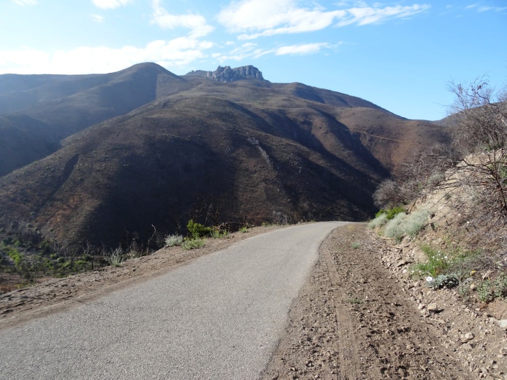
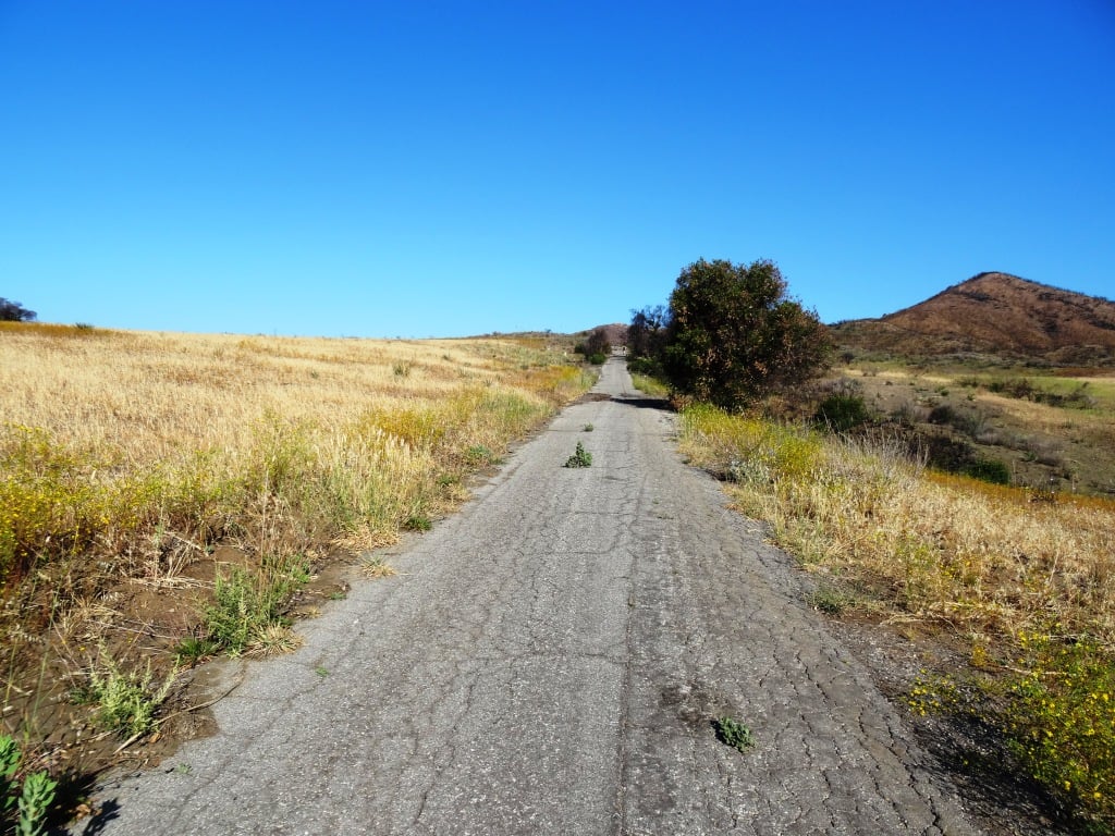
Well you can! It is challenging, but possible. Boney Mountain is located in the Santa Monica Mountains. One way to get to Boney Peak is via the Upper Canyon Trail from the Danielson Monument.

Danielson Monument

Danielson Monument

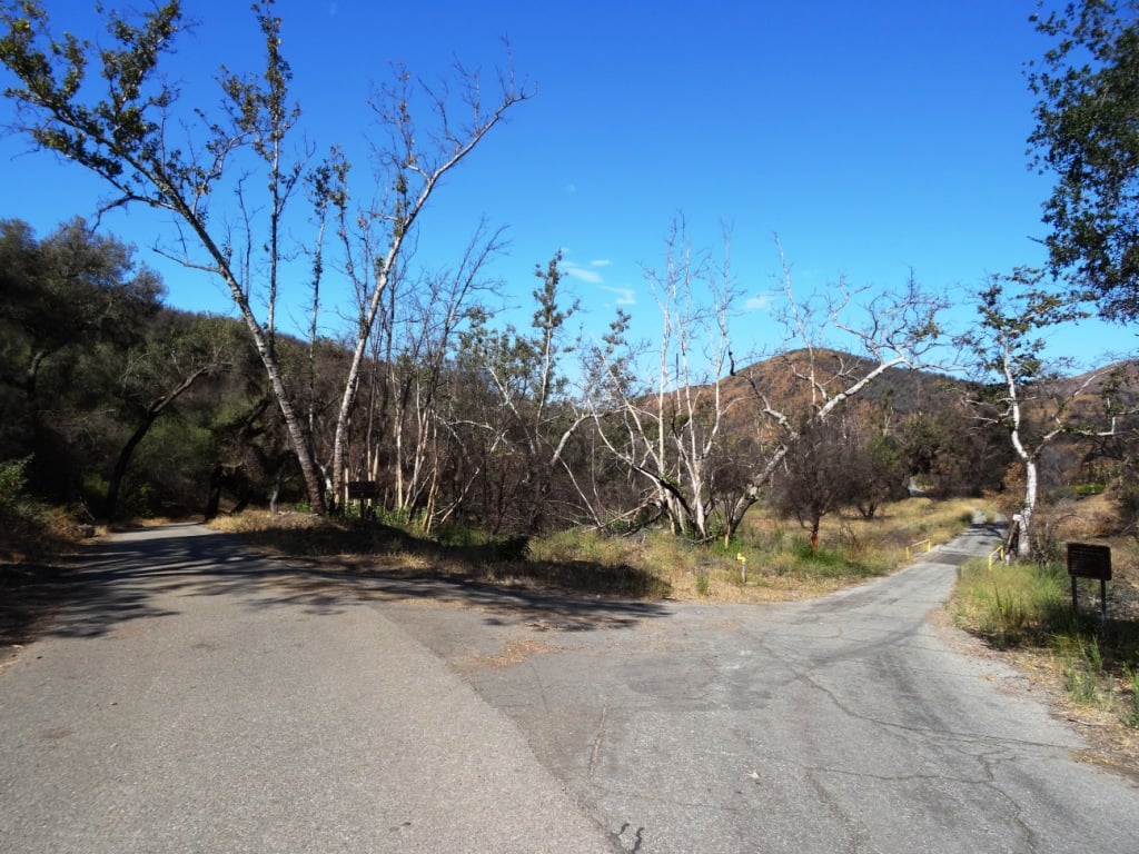
First off, hike your way up to the Danielson Monument, click this link for details. The monument is next to the remains of a burned down cabin shown below.

There is a trail that veers left next to the chimney. This is where you want to go. You're looking at a challenging 2 mile climb to Boney Peak. Most of the trail is narrow single track. There are some really steep, rocky sections, some with deep crevices, that may freak you out. You may have to duck your head from time to time. The trail is definitely challenging, both going up and coming back down. Definitely not for everyone.

The trail gets tight at times.

The trail gets tight at times.

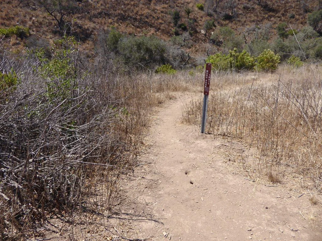
The trail is not "officially" maintained by the National Park Service and thus there are NO SIGNS that say, hey, go this way to get to Boney Peak.  But I've seen plenty of people make it up there just fine as the path is fairly obvious. Just stay on the main trail.

After twists, turns, rocks, crevices and hills, the trail flattens out a bit near the top.

After twists, turns, rocks, crevices and hills, the trail flattens out a bit near the top.

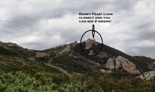
One thing to note when you think you've reached the top. Look at the picture at the top of this post. To the left of the circled area is a large boulder. This is not the peak. There's a trail to the left behind it that you'll have to go up to get to the actual peak. Again, there are no signs. But you should be able to see the path pretty easily. You will be climbing some sheer rock face to get there. Can be slippery. And standing on the top of Boney can be both exhilarating and scary as hell! So be careful!

The final ascent to the top on sheer rock path.

The final ascent to the top on sheer rock path.

How long does it take to get from the trailhead at Wendy and Potrero and back? I'd allow for 4 to 5 hours if you are hiking. If you are a strong runner you can get up to it in as little as an hour (I'm talking top notch runner) to hour and a half, but you will only be able to "run" about half of the trail above the Danielson Monument. The rest is more of a technical hike in and around the rocks, boulders and crevices.

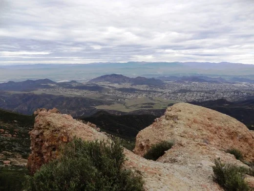
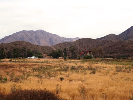
Here are some views you'll be treated to at the top.

BoneyPeakView3.3.13.JPG
BoneyPeak3.3.13_MoreViews.JPG
BoneyPeak3.3.13_Islands.JPG
BoneyPeak3.3.13_Top.JPG
BoneyPeak3.3.13HidVal.JPG
BoneyAnotherView.JPG

La Jolla Canyon Loop Trail in Point Mugu State Park in Malibu

Point Mugu State Park is at western edge of the Santa Monica Mountains National Recreation Area, stretching from Newbury Park on the north to five miles of oceanfront. The Chumash Trail is the westernmost trailhead in Point Mugu State Park which in turn gets you to the La Jolla Valley Natural Preserve area (which also can be accessed from the Ray Miller Trail, about two miles southwest of the Chumash Trail trailhead).

The Chumash Trail trailhead is accessible off of PCH, about 2 1/2 miles from where Las Posas Road connects to PCH in Camarillo, and about 10 miles from the intersection of Las Posas Road and Highway 101.  It is across the street (PCH) from a Naval Base Ventura County training range. Look for the left turn into a small dirt parking area that has space for perhaps 15 or so cars.

The Chumash Trail is an initial, quite steep and technically challenging .7 mile climb, to a juncture where you either turn right to the Mugu Peak Trail (MORE AT THIS LINK). If you turn left (north), continue another half mile until you reach the La Jolla Valley Loop Trail.

Map snippet courtesy of California State Parks

Map snippet courtesy of California State Parks

The La Jolla Valley was acquired by the State of California in 1966 as part of Point Mugu State Park and was established as Natural Preserve in 1972. 

One thing I find of particular visual interest on the La Jolla Canyon Loop Trail is the Naval Base Ventura County satellite tracking station situated at the top of nearby Laguna Peak. 

One thing I find of particular visual interest on the La Jolla Canyon Loop Trail is the Naval Base Ventura County satellite tracking station situated at the top of nearby Laguna Peak. 

View of the Boney Mountain Range up ahead from within the La Jolla Valley Natural Preserve. This is such a peaceful grasslands area back here. Most folks go for the ocean trails, leaving this area a bit less utilized.

View of the Boney Mountain Range up ahead from within the La Jolla Valley Natural Preserve. This is such a peaceful grasslands area back here. Most folks go for the ocean trails, leaving this area a bit less utilized.

When I look up at the tracking station, The Jetsons come to mind.

When I look up at the tracking station, The Jetsons come to mind.

Another 1 1/2 miles of hiking on the La Jolla Valley Loop Trail gets you to a small campground area with as I recall, 3 or 4 campsites accompanied by picnic tables, a vault toilet, but no water. No campfires allowed out here in the back country either. Although these appear to be rarely used, the only problem coming in from the Chumash Trail instead of the Ray Miller Trail (and La Jolla Canyon Trail) area is that you must pay for the campsite at the Ray Miller Trail area. Thus, if you do plan to stay at these back country campsites, keep that in mind and pay first.

You will pass by this sign on your way towards the campground if you want to take a shorter loop.

You will pass by this sign on your way towards the campground if you want to take a shorter loop.

Here is where the La Jolla Valley Trail Campsites are, marked by the vault toilet up ahead. I don't get back here very often and when I do, I see no one. But I did notice there was TP in the room, which is good for those in need.

Here is where the La Jolla Valley Trail Campsites are, marked by the vault toilet up ahead. I don't get back here very often and when I do, I see no one. But I did notice there was TP in the room, which is good for those in need.

You're definitely in the back country back here, though in reality you are only 2.7 miles from the Pacific Ocean.

You're definitely in the back country back here, though in reality you are only 2.7 miles from the Pacific Ocean.

That said, the La Jolla Canyon Trail (not to be confused with the La Jolla Canyon LOOP Trail) has been closed since January 2015 because of mudslides that made that particular trail too dangerous to use. Confused? Yes, this can be confusing. Bottom line is that you pay for the camping at the La Jolla Canyon/Ray Miller Trailhead area but access the camping from either the Chumash Trail, or a longer route via the Ray Miller Trail.

So after you reach the campground area, you can either head back the way you came, or take the loop back around to the Mugu Peak Trail, where you will be treated to views, views and more views. Or hike to the top of Mugu Peak for the best views of all.

This Mugu Peak Trail sign is located near the south end of the Loop Trail.

This Mugu Peak Trail sign is located near the south end of the Loop Trail.

Angel Vista Peak in Newbury Park

AngelVistaBench_June2013_2.JPG

The 1,530' elevation Angel Vista Peak in Newbury Park may well have the most spectacular views of the Conejo Valley. You can see the entire Conejo Valley, stretching from the Conejo Grade to central Thousand Oaks, Agoura Hills, Hidden Valley, Boney Mountain and beyond from here!

Angel Vista can most easily be accessed via the Rosewood Trail at the southern terminus of Regal Oak Ct, off of Lynn Road) Or for a much longer hike, take the Los Robles Trail (either the Thousand Oaks side accessible at South Moorpark Road and Greenmeadow Ave or Newbury Park side off of Potrero Road). The Conejo Open Space Foundation provides a useful map at www.cosf.org/website/html/los-robles-angel-vista.html. There's a bench as well as a picnic table up there with wonderful views.

The hike is about 3 1/2 miles round trip.

You'll eventually see this sign if you make the trek up the Rosewood Trail.

You'll eventually see this sign if you make the trek up the Rosewood Trail.

The bench is in sight!

The bench is in sight!

AngelVista4 - Copy.JPG
AngelVista5 - Copy.JPG
Fun to see at least a portion of Hidden Valley from up here.

Fun to see at least a portion of Hidden Valley from up here.

Happy Camp Canyon Regional Park in Moorpark

Happy Camp Canyon Regional Park in Moorpark is a 3,000 acre wilderness area with 12 1/2 miles of trails maintained by the Santa Monica Mountains Conservancy. I've hiked back here from time to time and rarely see anyone in these quiet canyons!

HappyCamp_GolfCourse.JPG

There are a couple entry points to Happy Camp Canyon. The one shown above is adjacent to Rustic Canyon Golf Course, 15100 Happy Camp Canyon Road, Moorpark. The other main entry point shown below is at 14105 Broadway Avenue, Moorpark. Park here and hike to the canyon entrance point.

HappyCamp_CanyonEntrance.JPG

If you're looking for relatively flat trails well suited for comfortable hiking, mountain biking and horse riding, Happy Camp Canyon is a good choice.

You can take the main Happy Camp Canyon Fire Road for quite a ways and either head back the way you came or take the more strenuous Middle Range Fire Road back and catch some great views. I veered north up a steep maintenance road to some power lines shown below.

HappyCampPowerLines.JPG

Or try the 8 mile, strenuous, South Ridge Loop (via the Middle Ridge Fire Road). Begin at the canyon gate; about 100 yards beyond, turn right and follow a dirt road up to the ridge top. Continue east along the Big Mountain Ridge to a junction, enjoying views on your right of Moorpark, Simi Valley, the Santa Monica Mountains, and all the way to the Channel Islands. At the junction, turn north and drop down into Happy Camp Canyon. When you reach an old corral (and picnic area), turn west and walk back to the entrance gate on Happy Camp Canyon Fire Road (in the canyon bottom), approximately four miles. 

There is no cost for parking here. For more information, visit mrca.ca.gov/parks/park-listing/happy-camp-canyon-regional-park.

NOTE: Because of sensitive habitat, dogs are not allowed past the entrance gate.

It greens (and purples) up quite nicely after the winter rains in Happy Camp. March/April/May are the months to check it out.

It greens (and purples) up quite nicely after the winter rains in Happy Camp. March/April/May are the months to check it out.

CSU Channel Islands University Park in Camarillo

CSU Channel Islands University Park is a 367 acre parcel located adjacent to CSU Channel Islands off of S. Lewis Road in Camarillo. It is a regional educational and recreation area owned and operated by California State University Channel Islands.

CSUCIPark_sign.JPG

The park is open to the public daily from sunrise to sunset. Do note that there are no facilities at this park, like restrooms and drinking fountains. You can walk, hike, run, bike, etc. and perhaps come across some wildlife.

Disbanded dairy farm in the distance at CSU Channel Islands University Park

Disbanded dairy farm in the distance at CSU Channel Islands University Park

One item of historical interest at the park is the "Scary Dairy," a dairy farm located on the parcel that closed in the 1960s and was disbanded and subsequently vandalized and graffittied upon over the decades.

"Scary Dairy"

"Scary Dairy"

From Camarillo, take Lewis Road south to Camarillo Street and turn left (east).  Cross the bridge over Calleguas Creek and the entrance is on the left. Parking is $6 per vehicle (as of April 2019). Visit www.csuci.edu/cipark for more information.

Bring cash to pay for parking at entrance.

Bring cash to pay for parking at entrance.

CSUCI Park Barn.JPG

Harmon Canyon Preserve in Ventura

Look for this address sign on Foothill Road to access the trailhead.

Look for this address sign on Foothill Road to access the trailhead.

Established in 2020, the Harmon Canyon Preserve is owned and managed by the Ventura Land Trust. The 2,100 acre preserve located at 7511 Foothill Road, Ventura (just west of Kimball Road) contains about 6 1/2 miles of well-maintained trails in the canyons and hills.

Open to hikers, bikers and runners. Dogs on leash allowed.

Free parking is available at the preserve trailhead off of McVittie Place. You can park on the west side of Kimball, or park a few blocks down Kimball and Loma Vista Road at Juanamaria Park, and walk a few blocks to the trailhead.

More details and trail map at www.venturalandtrust.org/harmoncanyon.

Trailhead

Trailhead

Old Jeep on the trail

Old Jeep on the trail

Harmon Canyon 3.JPG

Los Robles Trail West "Space Mountain"

"Space Mountain" is not the "official" name of the Los Robles Trail heading west from the South Moorpark Road and Greenmeadow Avenue in Thousand Oaks trail access point but this mostly single track trail was affectionately named after the Disneyland ride due to its switchbacks and twists and turns to the top, where you will be rewarded with outstanding views of the Conejo Valley and beyond. These trails are particularly popular with mountain bikers who enjoy the rocky, single track trails, as well as hikers and runners.

From the main trailhead, go west just under 1/2 mile and you'll see the fork in the road where you can go east or west. Go west, young man (or woman).

LosRoblesTrail_EastWestSign.JPG

After making your way up the hill to the right, you'll go down a hill to another fork in the road, where you can either veer slightly right to to the Spring Canyon Trail, which takes you about a mile to the Ventu Park area of Newbury Park. Veer to the left to continue on the Los Robles Trail West.

LosRobles_SpringCynSign.JPG

Only 4.7 miles from this juncture is the Rancho Sierra Vista/Satwiwa National Park area in Newbury Park. Some challenging miles for sure, but fun!

LosRoblesTrail_JunctureSign.JPG

This section of the Los Robles Trail is mostly single track although some sections you can walk two-wide (though you'd best not do so, as there are many mountain bikes on these trails). Good to be aware of others on the trail.

I've attempted from time to time to count the number of switchbacks on my way up to the top of Space Mountain and back down and come up with something in the neighborhood of 8 to 10 of them. This is not a stroller friendly trail as it is steep, with plenty or rocks jutting out. An easy trail to twist your ankle if you're not careful.

A photo of a section of the Los Robles Trail West up Space Mountain.

A photo of a section of the Los Robles Trail West up Space Mountain.

It is roughly 3 miles to the top, where you will find one bench directly on the trail, facing a very short path to a viewing area with another bench.

Bench on the trail at the top of "Space Mountain" on the Los Robles Trail.

Bench on the trail at the top of "Space Mountain" on the Los Robles Trail.

The viewing bench at the very top of Space Mountain.

The viewing bench at the very top of Space Mountain.

All told, this is roughly about 3.5 miles each way, or 7 miles round trip.

Los Robles Trail sign at the top of Space Mountain.

Los Robles Trail sign at the top of Space Mountain.

Views from the top of Space Mountain looking west toward the Conejo Grade.

And as mentioned above, you can continue west on the Los Robles Trail west into Newbury Park. Portions of the trail go through privately owned land, which the owner has generously made available for public trail access...so be sure to treat the trail with respect!

LosRoblesWest_PrivPropSign.JPG

And last but not least, a view of the single track trail heading towards Newbury Park, where you will eventually connect with the Angel Vista Peak trail.

Single track with awesome, continuous views as you continue west into Newbury Park.

Single track with awesome, continuous views as you continue west into Newbury Park.

Rocky Oaks Nature Reserve in the Malibu Hills

RockyOaks_sign.JPG

Rocky Oaks is a 250 acre nature reserve that is part of the Santa Monica Mountains Recreation Area, located at the 31500 block of Mulholland Highway in Malibu, west of Kanan Road. The entrance is on the north side of Mulholland Highway. The park is managed by the National Park Service.

RockyOaksLoopTrail.JPG

Rocky Oaks has various species of oak trees, some centuries old. The Overlook Trail takes you to a peak with gorgeous panoramic views while the Pond Trail (less than a mile round trip) takes you to a seasonal pond area which used to be part of a cattle ranch.

The Rocky Oaks Loop Trail is a 2.2 mile easy trail that is lined with sage. This is one of the more low key, easy to hike areas around town. It can get hot but at only 6 miles from PCH you can also feel some nice ocean breezes in these trails.

Learn more about Rocky Oaks and download a trail map at www.nps.gov/samo/planyourvisit/rockyoaks.htm.

Pond is looking quite nice in late spring of 2017.

Pond is looking quite nice in late spring of 2017.

RockyOaks_2.JPG

Los Robles Trail East in Thousand Oaks

The Los Robles Trail East in Thousand Oaks is accessible from the Los Robles Trail trailhead heading west from the corner of South Moorpark Road and Greenmeadow Avenue in Thousand Oaks.

LosRoblesTrail_SignMain.JPG

From the main trailhead, go west just under 1/2 mile and you'll see the fork in the road where you can go east or west. Head south (click here if you prefer going west) where you'll go towards the Los Robles Trail East.

A gradual uphill of about 1/2 mile on a wide fire road trail takes you to a picnic bench and then a more winding, partially shaded, narrower, eastbound section of trail.

Fire road that takes you to picnic bench.

Fire road that takes you to picnic bench.

Picnic bench at juncture of fire road and narrower, steeper Los Robles Trail East.

Picnic bench at juncture of fire road and narrower, steeper Los Robles Trail East.

LosRoblesTrail_MapEast.jpg

Another .6 mile gets you to a hill where you'll soon be treated to a reward for your hiking effort...a bench with a view of the Conejo Valley.

Los Robles Trail East near hilltop viewpoint with bench.

Los Robles Trail East near hilltop viewpoint with bench.

And the bench at the top. Nice view of the Conejo Valley, eh?

And the bench at the top. Nice view of the Conejo Valley, eh?

And the trail loops around with another bench on the other side of the trail looking south towards Hidden Valley.

Bench facing south.

Bench facing south.

The trail loops back around towards the main Los Robles Trail, where you can head back west again from where you came from, or head east towards the northern tip of the Los Padres Trail or stretch further east towards the Triunfo Canyon Trail and White Horse Canyon Trail.

Now go on, take a hike!

Los Padres Trail in Thousand Oaks

LosPadresTrail_trailhead.JPG

The Los Padres Trail is a short, 1 mile, neat little trail accessed on Los Padres Drive, near the corner of Fox Hills Drive in Thousand Oaks. Take Moorpark Road south of the 101 freeway and turn left on Los Padres Drive. The trailhead is clearly marked on the right hand side, The trail is maintained by the Conejo Open Space Foundation.

Surrounded by trees in the first section of the Los Padres Trail.

Surrounded by trees in the first section of the Los Padres Trail.

Short but sweet, the trail is.canopied by trees, several bridges, mostly single track trail and a bit of a climb (750 feet) as you make your way up to the Los Robles Trail junction. That's about a mile, so you can turn around there for a 2 mile round trip hike.

Where the Los Padres Trail meets the Los Robles Trail.

Where the Los Padres Trail meets the Los Robles Trail.

Or...you can turn right (west) and head your way up the wide, fire road sized section of the Los Robles Trail east. This is a bit of a climb, but pretty moderate and gradual. Crest the hill and you'll see a gate. Before the gate, on the left, is a picnic bench.

The Los Padres Trail is winding, uphill and wide in this section.

The Los Padres Trail is winding, uphill and wide in this section.

After you pass the sign below, there's a picnic bench on the left. You've climbed a couple miles. Time for a break before heading back down. Or turn left (east) and in 3 miles you're at Triunfo Park in the Los Padres Open Space via the Triunfo Canyon Trail. Or turn right (west) and you're off into the Los Robles Open Space. If you go straight ahead, you’ll reach a gate to Hidden Valley private property.

LosRoblesTrail_Triunfo.JPG
Gate at top of trail. Private property in Hidden Valley ahead.

Gate at top of trail. Private property in Hidden Valley ahead.

Marview Drive Trail in Thousand Oaks

Marview Drive Trail Trailhead in Thousand Oaks

Marview Drive Trail Trailhead in Thousand Oaks

If you're looking for a short, steep and sweet trail to hike up and down in Thousand Oaks, check out the trail on Marview Drive, just east of the entrance to Old Meadows Park at 1600 Marview Drive. Take Erbes Road and go west on Marview. After passing the residential section of the road, up ahead is Old Meadows Park and on the right is plenty of street parking across from the trailhead.

MarviewTrail_steep.jpg

Short it definitely is. Only about a quarter of a mile to the top of the hill, but it will take you a bit longer than your typical hike because it is so steep, at least the first section.

MarviewTrail.JPG

Then toward the top it starts to flatten out, where you will discover panoramic views of the Conejo Valley. There's also quite a clear view of the 23 Freeway from up here!

Marview_23fwy.JPG

At the top of the trail is a large, enclosed square fenced in with No Trespassing signs all over the place. This is a water tank. But you can walk around the area to the other side, where there's actually a trail and walkway that goes down to the St. Patrick’s Episcopal Church.

So there you have it! A short, steep, but sweet little trail in the heart of Thousand Oaks!

Santa Rosa Trail and Lower Butte Trail in Thousand Oaks

SantaRosaTrail.JPG

The Santa Rosa Trail connects Wildwood Park to the hills above Cal Lutheran University in Thousand Oaks, about a 3 mile hike one way along the Mount Clef Ridge. Enjoy beautiful views of the Conejo Valley and Santa Rosa Valley, then loop around the hills behind CLU.

SRTrail_toWildwood.JPG

From Wildwood Park, you can take the Mesa Trail west and turn right onto the Santa Rosa Trail. Or start from the other direction...park at CLU near the Samuelson Community Pool and hike towards Wildwood.

Juncture of Santa Rosa Trail and Lower Butte Trail.

Juncture of Santa Rosa Trail and Lower Butte Trail.

Or take an alternate route with the Lower Butte Trail. The Conejo Open Space Foundation website has a map of the Santa Rosa/Lower Butte Trail loop hike that is about 6 miles in length from Wildwood Park at cosf.org/trails/wildwood/wildwood-park-moderate-hike-santa-rosa-lower-butte-loop.

Two benches and a cross abpve CLU, east of the CLU sign, with panoramic views of the Conejo and Santa Rosa Valleys.

Two benches and a cross abpve CLU, east of the CLU sign, with panoramic views of the Conejo and Santa Rosa Valleys.

SRTrail_SRViews.JPG

Ranch Center Road, Wood Canyon Fire Road and Other Trails in Northern Point Mugu State Park

Northern Point Mugu State Park map image courtesy National Park Service

Northern Point Mugu State Park map image courtesy National Park Service

Point Mugu State Park in the Santa Monica Mountains stretches from Newbury Park to the ocean, over 14,000 acres of land and 70 miles of trails. Visit this link for more information.

If you ever get the time and energy, consider exploring the trails in the northernmost section of Point Mugu State Park. To access these trails, you can start at Rancho Sierra Vista/Satwiwa in Newbury Park and make your way up Big Sycamore Canyon Road, then, down, down, down the big paved hill into the canyons of Point Mugu State Park.

The descent down into the canyon on Big Sycamore Canyon Road is pretty steep. Watch for cyclists. Boney Mountain is seen in the distance.

The descent down into the canyon on Big Sycamore Canyon Road is pretty steep. Watch for cyclists. Boney Mountain is seen in the distance.

The descent into the canyon is about 3/4 mile. From there, you'll go another mile or so until you see a fork in the road. If you go straight (veering slightly left), you'll continue down Big Sycamore Canyon Road towards PCH. But if you turn right, you're on Ranch Center Road, a gradual, steady climb up an old, paved hill.

Juncture of Big Sycamore Canyon Road (left) and Ranch Center Road (right).

Juncture of Big Sycamore Canyon Road (left) and Ranch Center Road (right).

This is one section of Ranch Center Road. As you can see, this is a pretty old road that was used by the ranchers who lived here before the land was acquired by California State Parks.

This is one section of Ranch Center Road. As you can see, this is a pretty old road that was used by the ranchers who lived here before the land was acquired by California State Parks.

You are highly unlikely to see a lot of people down here. You might see a couple cyclists from time to time, but hikers/runners in these quiet areas are, from my experience, pretty rare in appearance. It feels like you're going to the middle of nowhere.

You will also notice that there are several trails that connect with the road, including, from east to west, the Sin Nombre Trail, Sage Trail, Ranch Center Fire Trail, Coyote Trail and, finally, the Wood Canyon Fire Road trail. All of these trails will either take you back to Big Sycamore Canyon Road or other trails that will allow you to do a loop back up to Rancho Sierra Vista. You can add another 4 miles to your adventure by checking out the Guadalasca Trail that connects to the Wood Canyon Fire Road. See detailed map here.

Old water tank seen at the juncture of Ranch Center Road (paved) and Ranch Center Fire Road (trail).

Old water tank seen at the juncture of Ranch Center Road (paved) and Ranch Center Fire Road (trail).

After you pass the water tank seen above, you continue downhill towards the remains of some old ranch houses. Pretty much everything has been demolished but you'll see some vintage items still on hand, along with signs warning you to stay outta there.

You've reached what used to be the Ranch Center.

You've reached what used to be the Ranch Center.

Not sure if this would sell on Craigslist.

Not sure if this would sell on Craigslist.

The old ranch house area is at the juncture of Ranch Center Road and Wood Canyon Fire Road. I particularly enjoying running down Wood Canyon Fire Road as it is so quiet and there is nice tree coverage.

More Wood Canyon Fire Road

More Wood Canyon Fire Road

Wood Canyon Fire Road runs south until it connects with the "Loop Trail" (west) or continues east back towards the Two Foxes Trail (parallels Big Sycamore Canyon Road) and then Big Sycamore Canyon Road, where you can veer back up north towards Newbury Park. 

DOZENS AND DOZENS OF TRAILS IN AND AROUND VENTURA COUNTY