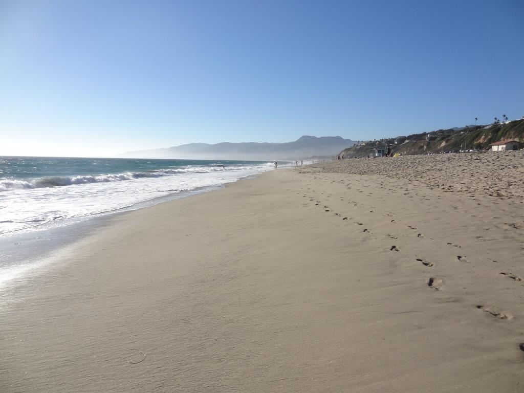
Paradise Cove Beach in Malibu

If you’re looking for a great spot to dine at the beach, the Paradise Cove Beach Cafe in Malibu is a great choice. Located at 28128 E. Pacific Coast Highway in Malibu, it’s about a 30 minute drive from Thousand Oaks via Kanan Road. Learn more at www.paradisecovemalibu.com.

The public is welcome to access Paradise Cove Beach, including the dry stretch of beach around the pier (49 feet in width) as well as use the area of the beach below the mean high tide line for the entire shoreline length of the Paradise Cove property. You can either park on PCH and walk to the beach, or you can pay to park in the Cafe parking lot. But yes, it is expensive. It is much less expensive to park and dine at the cafe, which covers you for up to 4 hours of parking.

While some would argue that the food isn’t great and prices (including parking) is too high, my opinion is….it’s all about location, location, location.

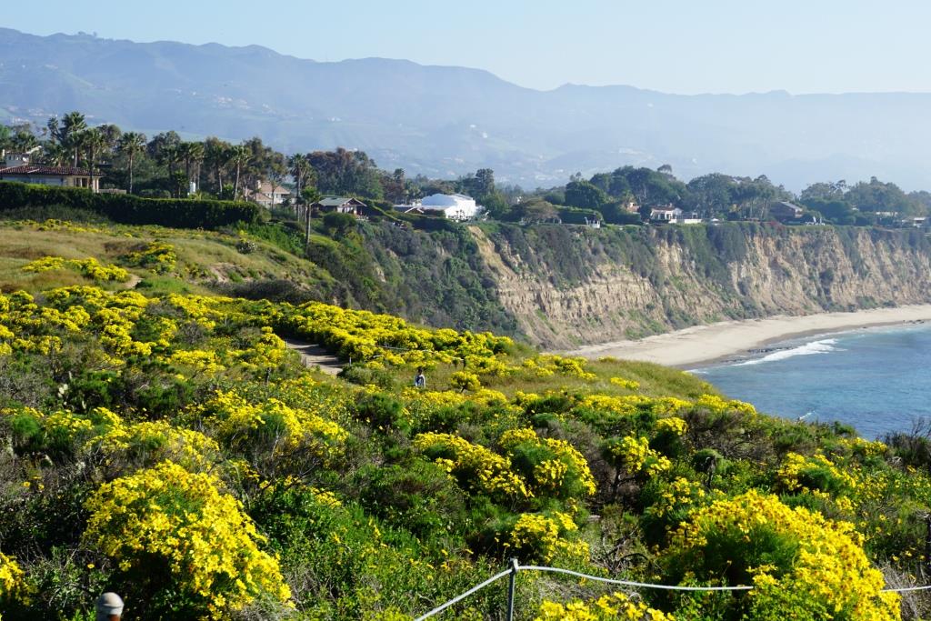
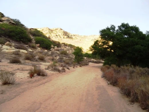
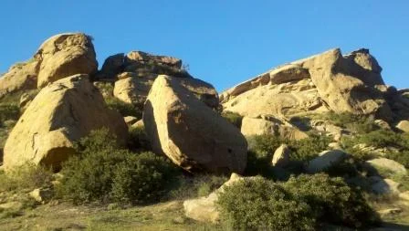
About half a mile south on PCH is the access point to Escondido Falls, a four mile round trip hike to the tallest waterfall in the Santa Monica Mountains (over 150 feet). A fun excursion - park on PCH and do the Escondido Falls hike. Then walk down the street to the Paradise Cove Cafe. Of course don’t leave valuables in your car.

Parking fees as of June 2023.

Rancho Sierra Vista / Satwiwa in Newbury Park

RanchoSierraVistaEntry.jpg

We are fortunate to have such great trails and views of Boney Peak from in Newbury Park. At Wendy and Potrero is the Western edge of the Santa Monica Mountains where Sycamore Canyon cuts through Rancho Sierra Vista/Satwiwa and Point Mugu State Park.

SatwiwaSign.JPG
Satwiwa.jpg

Roughly a mile easy hike from Wendy/Potrero gets you to the Satwiwa Native American Indian Culture Center where you can explore some native Chumash items and educational information and chat with rangers. This is a nice little hike to take the kids on. There are restrooms and water at the center, which is open from 9 to 5 on weekends.

Learn more about hiking in Rancho Sierra Vista/Satwiwa at THIS LINK.

You can get easier access to the center by parking in the adjacent National Park Service parking lot via Lynn Road to the access road at Via Goleta in Newbury Park.

Another mile and a half of hiking gets you to a small waterfall, which is fun to check out with the kids but somewhat more strenuous of a hike. Note that in recent years (2012-2015), the waterfall has barely flowed due to low rainfall.

Here is more information about the Boney Mountain Trail, leading up to Hidden Valley Overlook, the waterfall and Danielson Monument.

SatwiwaCircle.JPG

Visit www.nps.gov/samo/planyourvisit/rsvsatwiwa.htm for a map and site information on the National Park Service website.

BoneyViewsSatwiwa.jpg
SatwiwaTrails.JPG
WendyPotreroTrailhead.JPG

Trailhead at the corner of Wendy Drive and Potrero Road in Newbury Park. Park on the dirt on the south side of Potrero or on the street on Wendy.

Lizard Rock Trail From Lizard Rock to Wildwood Canyon at Wildwood Park Thousand Oaks

This is one in a series of posts about trails in the 1,765 acre Wildwood Park in Thousand Oaks.

Lizard Rock at Wildwood Park

Lizard Rock at Wildwood Park

Lizard Rock is a popular 2 mile round trip destination for hikers from the main parking area in Wildwood Park, mostly on the Mesa Trail. It is a moderate hike with an elevation gain of about 300 feet to its peak at 931 feet.

Sign just south of Lizard Rock indication direction of Lizard Rock Trail towards Wildwood Canyon

Sign just south of Lizard Rock indication direction of Lizard Rock Trail towards Wildwood Canyon

After reaching Lizard Rock, some folks (hikers and bikers) venture further south on the Lizard Rock Trail about .8 mile of downhill that takes you past the City of Thousand Oaks Hill Canyon Water Treatment Facility to the Wildwood Canyon area, a drop of about 600 feet in elevation.

View of Hill Canyon Waste Treatment Plan from near Lizard Rock

View of Hill Canyon Waste Treatment Plan from near Lizard Rock

The descent down the Lizard Rock Trail provides nice views into the Santa Rosa Valley as it zigs and zags towards the bottom. You can see Hill Canyon from Lizard Rock but as you move down the hill you will get a much clearer view of this high tech facility that converts wastewater into a reusable water source. You will indeed catch some whiffs of smells that aren't particularly pleasing down there but having been down there myself a number of times, it ain't that bad.

The descent down Lizard Rock Trail

The descent down Lizard Rock Trail

Before you reach the bottom, there are several overlook benches available to take a break as you look towards the Arroyo Conejo, Santa Rosa Valley and beyond.

The first of two overlook benches facing west on the Lizard Rock Trail

The first of two overlook benches facing west on the Lizard Rock Trail

A view of the same bench looking back up (north) towards Lizard Rock (yes, that's the lizard head poking out of the hill on the right).

A view of the same bench looking back up (north) towards Lizard Rock (yes, that's the lizard head poking out of the hill on the right).

And here's the 2nd bench, further down the Lizard Rock Trail. Is that actual green I see up ahead in late September!? Yes it is. Must be drought-tolerant native shrubs!

And here's the 2nd bench, further down the Lizard Rock Trail. Is that actual green I see up ahead in late September!? Yes it is. Must be drought-tolerant native shrubs!

Hill Canyon comes into closer view

Hill Canyon comes into closer view

As you can see, the Lizard Rock Trail starts heading back east as it traverses the Hill Canyon Treatment Plant. Amazing facility. I wouldn't want to go swimming in the green liquid however.

As you can see, the Lizard Rock Trail starts heading back east as it traverses the Hill Canyon Treatment Plant. Amazing facility. I wouldn't want to go swimming in the green liquid however.

At the very bottom of the trail, after you have completely passed the water treatment plant, you see this sign that indicates you are on your way towards Lower Wildwood Canyon.

At the very bottom of the trail, after you have completely passed the water treatment plant, you see this sign that indicates you are on your way towards Lower Wildwood Canyon.

So you've reached the bottom of Wildwood Canyon and other than heading back up that steep Lizard Rock Trail to where you just came from, you can take the more interesting loop route following the Wildwood Canyon Trail to Wildwood Canyon. There are restrooms, drinking fountain and picnic tables in there.

From Wildwood Canyon, either continue onward up the Wildwood Canyon Trail about a third of a mile to Paradise Falls, or the Tepee Trail (yes, this is what it is called on the map), which largely parallels the Wildwood Canyon Trail, up towards, yes, the Tee Pee. Then follow the signs back

There is a great map that covers this Lizard Rock to Paradise Falls to Two Springs (formerly Indian Creek) Trail loop, about 4 1/2 miles in total, on the Conejo Open Space Foundation website at www.cosf.org/website/html/lizard-waterfall-creek.html.

Since we're down at the bottom of the canyon, you will see a sign for "Skunk Hollow." This is a tree-lined area adjacent to the creek with a picnic bench. Kind of nice little area, just around the corner from the waste treatment plant, albeit not within view of the plant. 

And in that area, you will see a sign indicating Eagle Point Trail. Eagle Point Trail is a hilly little 1/3 of a mile alternate route that gets you into Wildwood Canyon. The first section has dozens of steps. The remainder has a few steep sections. Just a small side attraction to check out. 

Eagle Point Trail Wildwood Park

El Rincon, El Cerro and Las Brisas Trails in Dos Vientos Section of Newbury Park

In the heart of Dos Vientos (Spanish for Two Winds), there are three trails that are accessible from multiple spots by walkers, hikers, runners and bikers. These are the El Rincon, El Cerro and Las Brisas trails. These trails are all nicely maintained, single track and provide great views of the surrounding areas. Other trails surrounding Dos Vientos include the Vista Del Mar Trail, Sierra Vista Trail, Sumac Trail (kind of parallels Sierra Vista Trail), El Encanto Trail and Powerline (Edison Road) Trail, as well as the Potrero Ridge Trail.

ElRincon_trailhead.JPG

Access to the El Rincon Trail is near the corner of Via Rincon and Rancho Dos Vientos. The trail is about 4/10ths of a mile and connects with the El Cerro and Las Brisas trails.

ElRinconTrail1.JPG
ElRinconTrail2.JPG

Access to El Cerro and Las Brisas trails is at the juncture of Via Las Brisas and Calle Del Prado and several other points. Visit https://cosf.org/files/maps/dos_vientos_trail_map.pdf for a trail map on the Conejo Open Space Foundation website.

ElCerroLasBrisas_sign.JPG

Conejo Valley Art Museum

Founded in 1978, the Conejo Valley Art Museum is a non-profit organization that supports local arts in the Conejo Valley. Over the years it has resided in several locations in Thousand Oaks while the Museum's Board of Trustees work towards obtaining additional funds to acquire a permanent home.

Since 2011, Janss Marketplace was its home from 2011 to the 2024 time frame. It is currently (as of May 2025) looking for a new home.

For more information about CVAM, visit www.conejovalleyartmuseum.org.

Brief tour of space at the Janss Marketplace as of mid-July 2012 is shown below.

Point Dume State Beach

On November 24, 1793, English explorer George Vancouver named the rocky promontory Point Dume after his friend, Father Francisco Dumetz. Point Dume is the western terminus of Santa Monica Bay and was named California Registered Historical Landmark No. 965.

PointDumeBeach.JPG

View in the spring of 2023

Point Dume State Beach is a 63 acre promontory that juts out into the Pacific and features headlands, cliffs, rocky coves and vast beach access for swimming, surfing and scuba diving.

To get to Point Dume State Beach, take Westward Beach Road southeast from PCH near Zuma Beach's south side to the paid parking area, or park on Westward Beach Road, which parallels Westward Beach.

To the southeast of Westward Beach is a small 300 foot or so beachfront area called Pirate's Cove Beach (which due to its seclusion was once used as a nude beach).

Pirate's Cove beach seen from the top of the promontory. You can climb down there and when the tide is moderate to low, walk around to it.

Pirate's Cove beach seen from the top of the promontory. You can climb down there and when the tide is moderate to low, walk around to it.

The 34-acre Point Dume Natural Preserve also begins from the cul-de-sac. A gradual ascending trail leads to an ancient coastal bluff sand dune with spectacular views...we've seen whales, seals and dolphins over here. A stairway from the east side of the bluff-top preserve allows access to a more isolated beach and tidepools (look but don't touch). You'll have fun exploring up here.

In the spring of 2023

This is a snippet of the pilot episode, "The Lady in the Bottle," of I Dream of Jeannie that originally aired September 18, 1965. If you skip to 1:39 in this clip, you will see the prominent rock formations on the east side of the Point Dume promontory. Below is a more recent shot of that area.

This is where Captain Anthony Nelson (Larry Hagman) made a giant S.O.S. in the sand with sticks and other items, including an old bottle that moved itself. He picks it up, dusts it off, and out pops Barbara Eden. Lucky guy!

This is where Captain Anthony Nelson (Larry Hagman) made a giant S.O.S. in the sand with sticks and other items, including an old bottle that moved itself. He picks it up, dusts it off, and out pops Barbara Eden. Lucky guy!

Location/Directions: Take Kanan south to PCH and turn right. Westward Beach Road is over the rise, at the foot of the hill. Park free on WBR or pay a fee at Westward Beach lot. No restrooms at the Preserve but some can be found on WBR. Call 310.457.8143 or visit www.parks.ca.gov/?page_id=623 for more information. Also see beaches.lacounty.gov/point-dume-beach.

Dogs are not allowed on trails in the Point Dume Natural Preserve or on the beach.

Westward Beach

Westward Beach

Springtime at the Point Dume Natural Preserve

Springtime at the Point Dume Natural Preserve

Satwiwa Native American Indian Culture Center in Newbury Park

The Satwiwa Native American Indian Culture Center is located at Rancho Sierra Vista / Satwiwa in Newbury Park. Sycamore Canyon, which cuts through Rancho Sierra Vista/Satwiwa and Point Mugu State Park, was part of a Chumash trade route. Satwiwa, which means "the bluffs," was the name of a nearby Chumash village.

View of the Satwiwa area with the Center on the right and an Indian village area on the left.

View of the Satwiwa area with the Center on the right and an Indian village area on the left.

In the Center is a variety of native Chumash items. Native American workshops, programs and art shows occur throughout the year. The Center is open 9 am to 4 pm on weekends, with rangers on hand to answer questions. There's a small gift shop in the Center too, as well as restrooms and a water fountain.

There is a Chumash house, or 'ap, on the grounds of the Center. It is made with willow trees and tule.

There is a Chumash house, or 'ap, on the grounds of the Center. It is made with willow trees and tule.

Inside the Culture Center. The table contains items that children are encourage to touch.

Inside the Culture Center. The table contains items that children are encourage to touch.

Small but nicely appointment gift shop in the Center has something for everyone.

Small but nicely appointment gift shop in the Center has something for everyone.

Park in the adjacent National Park Service parking lot via Lynn Road to the access road at Via Goleta in Newbury Park.

Visit www.nps.gov/samo/planyourvisit/satwiwa-native-american-indian-culture-center.htm for more information.

Access point to the Rancho Sierra Vista / Satwiwa area in the Santa Monica Mountains National Recreation Area off of Lynn Road in Newbury Park.

Access point to the Rancho Sierra Vista / Satwiwa area in the Santa Monica Mountains National Recreation Area off of Lynn Road in Newbury Park.

Wishbone Trail in the North Ranch Open Space

The Wishbone Trail is a two mile round trip, moderately steep trail that takes you from the west end of Westlake Village Community Park through the North Ranch Open Space to the Bowfield Trail. There are two entry points - one directly behind the baseball fields and the other at the far west end of the parking lot.

This is one of the newest trails in the Conejo Open space, constructed in 2018. If you’re looking for views, you will get them on this trail. Clear views of Ladyface Mountain on the south, the Boney Mountain Range and other local scenes. And this is the best place to catch California poppies in the spring, in most years. There are several view benches along the west trail as well as a bench at the top, near the juncture with the Bowfield Trail.

More information on the Conejo Open Space Foundation website at cosf.org/files/routes/Wishbone%20Trail.pdf. Westlake Village Community Park is located at 31107 Thousand Oaks Boulevard.

View from the east Wishbone Trial looking west towards the west Wishbone Trail. It is definitely not a flat trail - it is a moderately steep trail.

This access point to the east fork of the Wishbone Trail is directly behind the baseball fields on the west side of Westlake Village Community Park. The other entry point is past the baseball fields at the far west end of the parking lot.

There are some patches of poppies visible off of the Wishbone Trail in the spring but the biggest patches seem to be off of the connecting Bowfield Trail. the wetter the winter, the bigger the poppy display.

Corriganville Park in Simi Valley

Corriganville3.JPG

Corriganville Park is a historical 206 acre park located at 7001 Smith Road in Simi Valley that is owned and operated by the Rancho Simi Recreation and Park District. The park has over four miles of hiking, biking and equestrian trails, sandstone cliffs, an oak forest, seasonal stream, shaded picnic areas, Camp Rotary Youth Campground, picnic shelter and more.

The park is named after Ray "Crash" Corrigan, a stuntman/actor who owned the park from 1937 to 1965, when over 3,500 movies, TV shows and commercials were filmed there. In 1949, the Corrigan Movie Ranch opened as a Western-style amusement park with a train ride and stagecoach ride that in the late 1950s had greater weekend attendance than Disneyland and Knott's Berry Farm.

Corriganville4.JPG

Bob Hope bought the property in 1965 and renamed it Hopetown, but filming stopped after a year. The ranch burned down in the 1970s and all that is left are the cement slabs and exterior rock walls of the barn. You've got to visit the Santa Susana Depot Museum around the corner from Corriganville and see the model of what Corriganville looked like in 1960, then visit the park to see the slabs and imagine what it was like back then.

There is an interpretative trail at Corriganville with 20 markers that provide information about the vegetation and surroundings as well as some of the history. Visit www.rsrpd.org/business_detail_T9_R53.php for a link to pdf brochures with information about the history and trails of the park. Or call 805.584.4400.

Corriganville1.jpg
Corriganville2.jpg

New Millennium Trail in Calabasas

new millennium trail.jpg

The New Millennium Trail is a loop that is accessible from the Bark Park Trail in Calabasas. In total the loop is about 12 miles.

The Calabasas Bark Park is located at 4232 Las Virgenes Road. Park there and you’ll see the Bark Park Trailhead on the north side of the dog park. Take it about 1.2 miles until you reach the following fork in the trail.

The New Millennium Trail is a challenging series of switchbacks and hills on mostly single track trails. This is a popular trail with mountain bikers. If you’re a runner or hiker, to be aware that you may encounter bikers and have to your best make room for the cyclists to pass by.

The trail itself is usually quite well maintained, but be careful because the single track can be tight in sections as you make your way up the hills.

Learn more about the trail on the LA County Department of Parks and Recreation website at trails.lacounty.gov/Trail/1754/new-millenium-trail.

new millennium sign1.JPG
new millen 2.JPG
new millen 0.JPG

Medea Creek Natural Park in Oak Park

MedeaCreekNP_sign.JPG

Medea Creek Natural Park has hiking, biking and fitness trails that stretch from Calle Rio Vista and Oaks Hills Drive in Oak Park on the north, then south past Medea Creek Lane and Conifer Street to a cul de sac entrance to the park at the west terminus of Tamarind Street.

Nicely paved Medea Creek Trail north towards Kanan/Oak Park Library

Nicely paved Medea Creek Trail north towards Kanan/Oak Park Library

The paved Medea Creek Trail, great for walks as well as casual bicycling, has a northern entry point at Kanan Road across from Deerhill Road (adjacent to the Oak Park Library). It crosses Sunnycrest Drive, where there is street parking, so you do need to be careful with kids when you cross.

Medea Creek runs through suburbia via this wash, where you will see some neat bird activity.

Medea Creek runs through suburbia via this wash, where you will see some neat bird activity.

The nature loop trail is about 1.5 miles. You will likely see ducks and perhaps other birds enjoying the creek as you choose between the paved and dirt paths. There's also a fitness circuit. It is kind of interesting as you'll see multiple layers of trails; some dirt, some paved, some grassy, some in the creek.

Multiple paths and areas to explore at Medea Creek.

Multiple paths and areas to explore at Medea Creek.

Medea Creek Natural Park is managed by the Rancho Simi Recreation and Park District www.rsrpd.org/business_detail_T9_R29.php

MedeaCreekPark_sign.JPG
Sign at east end terminus of Tamarind StreetFitness course signs along 1.5 mile path.

Sign at east end terminus of Tamarind StreetFitness course signs along 1.5 mile path.

Camarillo Bike Path Next to Calleguas Creek

Looking to take the kids on a nice, flat bike path unimpeded by cars? A great choice is the roughly 2 mile Calleguas Creek bike path from Pleasant Valley Fields at 100 Village at the Park Drive in Camarillo off the Dawson 101 exit up to the corner of Flynn and Upland Roads in Camarillo.

Look at how nice and flat this bike path adjacent to Calleguas Creek is!

Look at how nice and flat this bike path adjacent to Calleguas Creek is!

This is a nice, smooth and flat bike path that goes under several bridges, including the 101 freeway, so that you don't have to worry about cars! You can park your car at Pleasant Valley Fields and ride up and back down the path. This is a comfortable path to learn on as well as just enjoy.

At the north end of the path, you can detour off the path to Pitts Ranch Park at 1400 Flynn Road, just a short block northwest of the path, and enjoy lunch.

CamBikePathCC2.JPG
Calleguas Creek

Calleguas Creek