New West Symphony - Thousand Oaks

The New West Symphony performs at the 1,800-seat Kavli Theatre at the Thousand Oaks Civic Arts Plaza, and the 695-seat Rancho Campana Performing Arts Center in Camarillo.

The New West Symphony is a 501(c)3 non-profit governed by a 50-member board of directors. The annual concert program features the great symphonic repertoire of the 19th through 21st centuries.

For more information, visit www.newwestsymphony.org.

Bank of America Performing Arts Center Thousand Oaks

The Bank of America Performing Arts Center (BAPAC) Thousand Oaks (formerly the Thousand Oaks Civic Arts Plaza) is one of the largest performing arts centers between Los Angeles and San Francisco at over 200,000 square feet.

CivicArtsPlaza.JPG

The City of Thousand Oaks Cultural Affairs Department oversees theatre productions for the BAPAC, which encompasses two theatres – the 1,800-seat Fred Kavli Theatre and the 394-seat Janet and Ray Scherr Forum Theatre.

The performing arts center combines outstanding arts and entertainment with state-of-the-art technology and acoustics. Over 300,000 patrons and 50,000 children attend more than 400 performances annually. The BAPAC Thousand Oaks is funded through a unique public/private partnership between the City of Thousand Oaks and the Alliance for the Arts. It opened in 1994.

Thousand Oaks Civic Arts Plaza

Thousand Oaks Civic Arts Plaza

There is something for everyone at this venue....musicals, cabaret, Broadway musicals, dance, concerts, big bands, the New West Symphony, ballet, plays, well known speakers and events for the kids. In front of the plaza is the Mary and Richard Carpenter plaza park.

Next door to the Plaza is The Lakes of Thousand Oaks, a great place to grab a bite to eat, do some shopping and enjoy the lakes and playground on the property.

Between 1926 and 1968 this location housed the 170 acre Goebel's Lion Farm (later called Jungleland), where many of the famous wild animals in Hollywood pictures lived.  There were elephants, lions, tigers, hippos, you name it.  Leo, the MGM lion, Mr. Ed the Talking Horse, and Getta, Tarzan's chimpanzee all lived there at some point.  Jungleland was a major draw in its day that played a large role in making Thousand Oaks what it is today.

A photo of Jungleland after it closed in 1969 (Image courtesy of Conejo Through the Lens, Thousand Oaks Library).

A photo of Jungleland after it closed in 1969 (Image courtesy of Conejo Through the Lens, Thousand Oaks Library).

The BAPAC is located at 2100 E. Thousand Oaks Boulevard (take the 101 East, left on Rancho exit, right on T.O. Blvd, and turn right into parking structure at Dallas Drive).  Visit bapacthousandoaks.com for more information or call 805.449.2787.

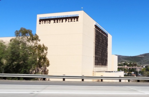
It takes good luck and timing for a novice photographer like me to capture the Thousand Oaks Civic Arts Plaza while driving south on the 101 freeway.

It takes good luck and timing for a novice photographer like me to capture the Thousand Oaks Civic Arts Plaza while driving south on the 101 freeway.

TOCivicArtsPlaza_wall.JPG

Ventura Boat Rentals at Ventura Harbor Village

Sailboat.JPG

Ventura Boat Rentals, located at Ventura Harbor Village at 1575 Spinnaker Drive, Ventura rents out electric boats, paddle boats, kayaks, power boats, surf bikes. jet skis and sail boats to the general public.  They also offer narrated harbor tours on weekends and select holidays, public dinner cruises, sunset cocktail cruises, private charters, private parties and public holiday tours. 

Visit www.venturaboatrentals.com or call 805.642.7753 for more information.

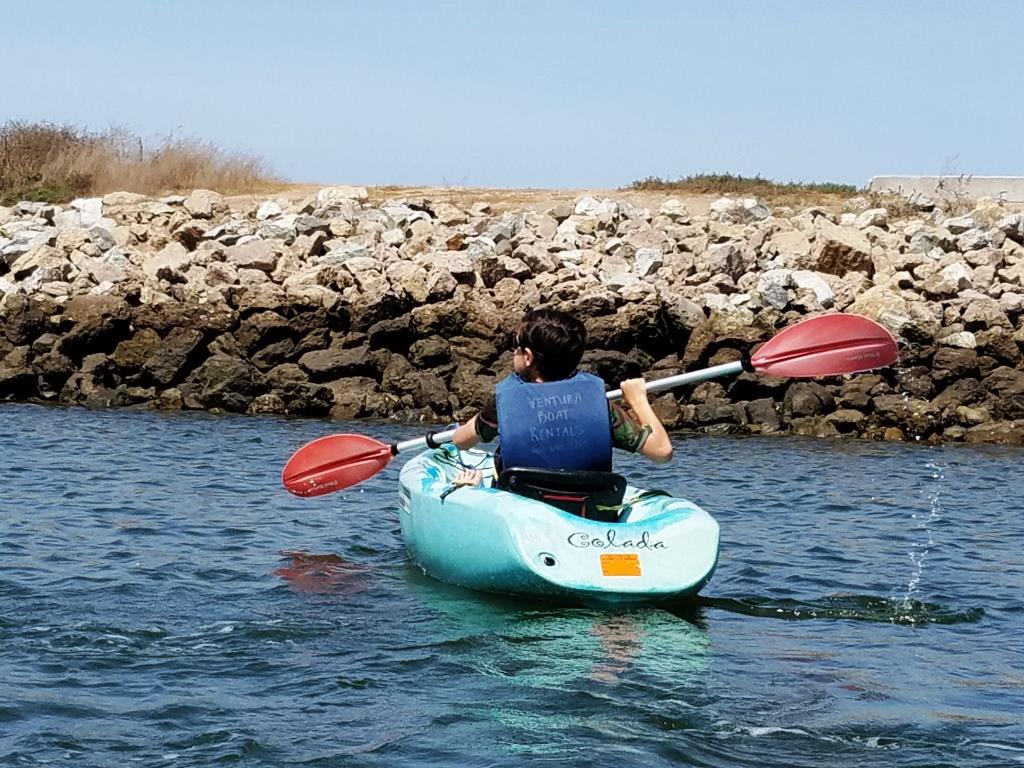
We enjoy exploring the Ventura Harbor, thanks to Ventura Boat Rentals.  Lots of small crabs hang out in these rocks.

We enjoy exploring the Ventura Harbor, thanks to Ventura Boat Rentals.  Lots of small crabs hang out in these rocks.

Bark Park Trail in Calabasas

BarkPark_sign.JPG

The Calabasas "Bark Park" is located at 4232 Las Virgenes Road. To get there from the 101, take Las Virgenes Road south just under a mile. The entrance is on the left (east). If you're going fast, it is easy to miss it. It's a nice, local dog park open sunrise to 9pm with plenty of space for the doggies as well as a separate gated kids' play area and plenty of parking.

BarkPark_trailhead.JPG

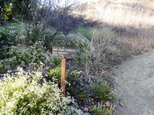
On the north side of the park is the trailhead to the Bark Park Trail, a 1.2 mile climb that links you up with the New Millenium Loop Trail. Round trip you're talking about a 2 1/2 mile hike.

BarkPark_trail.JPG

It is a nicely maintained trail with a steady, uphill climb. I would call it a moderate climb for the most part. A good walk to take the kids on. But it can get a bit hot up here, so bring water and sunscreen on summer days.

Trail sign at the junction of Bark Park Trail and New Millennium Loop Trail.

Trail sign at the junction of Bark Park Trail and New Millennium Loop Trail.

As you can see from the sign, there's a lot more exploring you can do on these nicely maintained trails in Calabasas.

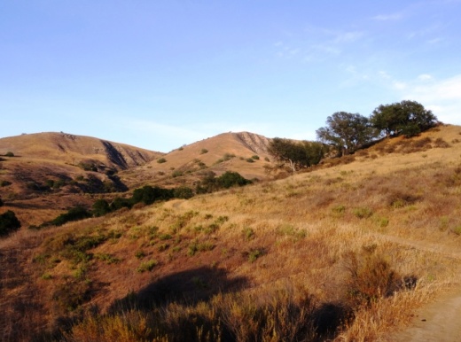
A view of the Bark Park from the trail above.

A view of the Bark Park from the trail above.

Wildwood Park in Thousand Oaks

The main entrance into the 1,765 acre Wildwood Park is at the corner of Avenida de los Arboles and Big Sky Drive in Thousand Oaks. The Chumash Indians lived in Wildwood Park for nearly 8,000 years, until the early 19th century, when the Spanish colonized California. Eventually the park became owned by the Janss Corporation, which sold it to the Conejo Recreation and Park District in 1967.

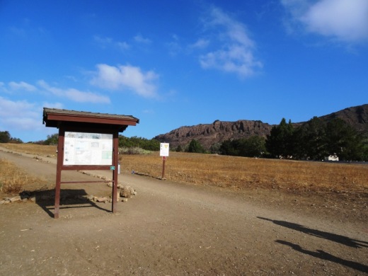
Main trailhead accessible from the parking lot at Ave de los Arboles and Big Sky.

Main trailhead accessible from the parking lot at Ave de los Arboles and Big Sky.

Wildwood Park is an extremely popular hiking and cycling spot and CRPD frequently hosts nature hikes there. The park has 14 trails covering 17 miles, including two year-round waterfalls, Paradise Falls and Little Falls.  Wildwood is known for its spring wildflower displays from January to June.

The park hosted a number of movie/TV productions in the 1930s to the 1960s, including Spartacus, Wuthering Heights, Wagon Train, The Rifleman and Gunsmoke.

Call the CRPD at 805.495.2163 for more information about the park. But for lots of detailed information about Wildwood Park, including trail maps and pictures, visit the Conejo Open Space Foundation website at cosf.org/trails/wildwood.

As far as facilities in the park, there are drinking fountains at the main parking lot as well as at the Teepee, at Paradise Falls and the two restroom areas in the park. One of the restrooms are located at Meadows Center, a small building located across the bridge that is adjacent to the short trail to Little Cave. CRPD often hosts short hikes from the main parking lot to Meadows Center for fun, games and s'mores.

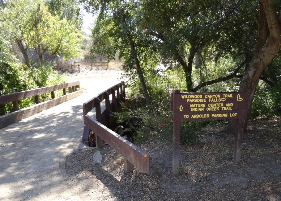
Bridge over creek that connects Wildwood Canyon Trail to Meadows Center, which has restrooms and a drinking fountain.

Bridge over creek that connects Wildwood Canyon Trail to Meadows Center, which has restrooms and a drinking fountain.

The other restrooms are at the bottom of Wildwood Canyon. You can get there by taking the Tepee Trail roughly 1/2 mile to the bottom of the canyon, or alternatively from Paradise Falls about 1/4 mile down the Wildwood Canyon Trail. The Arroyo Conejo Creek runs down from Paradise Falls to here and is fun to explore (keeping in mind still that this is partially urban runoff and thus you don't want to play around in it too much).

Additional restrooms at the bottom of Wildwood Canyon.

Additional restrooms at the bottom of Wildwood Canyon.

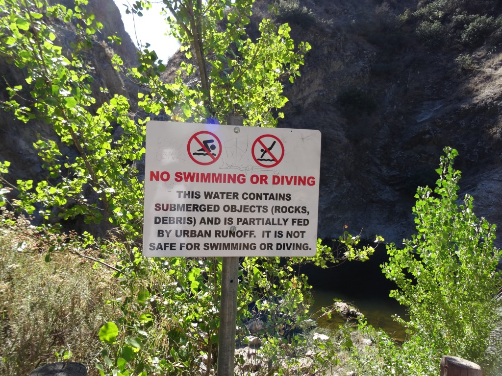
Sign at Paradise Falls indicating this particular water is partially urban runoff and best not to swim in.

Sign at Paradise Falls indicating this particular water is partially urban runoff and best not to swim in.

Wildwood2.JPG
Wildwood4_sign.JPG
Tepee Wildwood.JPG

Glass Arts Collective in Westlake Village

Glass Arts Collective opened its doors on February 5, 2020 at 31139 Via Colinas, # 201 in Westlake Village. Glass Arts Collective offers classes and workshops in fused glass, mosaic and stained glass. They are equipped to cut glass, shape it, melt it, glue it, solder it and make beautiful objects from it.

Glass is a friendly material-- everyone can learn to use it to create beautiful decorative and functional works of art. Whatever your level, from beginner to advanced, our fully equipped glass studio and enthusiastic instructors welcome you to explore and play.

You can also book team events at the studio, purchase glass supplies and tools and explore the gift shop.

Learn more at www.glassartscollective.com or call 818.318.1462.

Malibu Lagoon State Beach

Malibu Lagoon State Beach is where Malibu Creek meets the Pacific Ocean. To get there, park either at the state lot (corner of Pacific Coast Highway and Cross Creek Road) for a fee, along Pacific Coast Highway or across the street in spots available near Malibu Country Mart and the Malibu Civic Center.

The lagoon is serene, with a sandbar of pelicans enjoying their summer day. This beach extends southeast to Surfrider Beach and the Malibu Pier, which is just a short walk away. While you're there try to check out the Adamson House and Malibu Lagoon Museum.

More information at www.parks.ca.gov/?page_id=835. Dogs are not allowed at Malibu Lagoon State Beach and trails.

MalibuLagoon1.5.JPG
MalibuLagoon2.JPG
MalibuLagoon3.JPG
MalibuLagoon4.JPG

Seaside Sunday Flea Market at the Ventura County Fairgrounds

There’s a new monthly flea market at the Ventura County Fairgrounds on designated dates. The Seaside Sunday Flea Market will be open from 9am to 2pm for $5 admission (ages 13 and under free) with early bird admission 5am to 9am for $10. Fairgrounds parking $10.

Current planned dates are: June 25, July 9, Sept 3 and Nov 12.

https://www.facebook.com/photo/?fbid=987743032504597&set=pb.100038067289863.-2207520000.

Since this is a new flea market, we suggest you check the organizer’s Facebook page at www.facebook.com/VenturaWednesdayFleaMarket805 before going.

Paradise Cove Beach in Malibu

If you’re looking for a great spot to dine at the beach, the Paradise Cove Beach Cafe in Malibu is a great choice. Located at 28128 E. Pacific Coast Highway in Malibu, it’s about a 30 minute drive from Thousand Oaks via Kanan Road. Learn more at www.paradisecovemalibu.com.

The public is welcome to access Paradise Cove Beach, including the dry stretch of beach around the pier (49 feet in width) as well as use the area of the beach below the mean high tide line for the entire shoreline length of the Paradise Cove property. You can either park on PCH and walk to the beach, or you can pay to park in the Cafe parking lot. But yes, it is expensive. It is much less expensive to park and dine at the cafe, which covers you for up to 4 hours of parking.

While some would argue that the food isn’t great and prices (including parking) is too high, my opinion is….it’s all about location, location, location.

About half a mile south on PCH is the access point to Escondido Falls, a four mile round trip hike to the tallest waterfall in the Santa Monica Mountains (over 150 feet). A fun excursion - park on PCH and do the Escondido Falls hike. Then walk down the street to the Paradise Cove Cafe. Of course don’t leave valuables in your car.

Parking fees as of June 2023.

Lizard Rock Trail From Lizard Rock to Wildwood Canyon at Wildwood Park Thousand Oaks

This is one in a series of posts about trails in the 1,765 acre Wildwood Park in Thousand Oaks.

Lizard Rock at Wildwood Park

Lizard Rock at Wildwood Park

Lizard Rock is a popular 2 mile round trip destination for hikers from the main parking area in Wildwood Park, mostly on the Mesa Trail. It is a moderate hike with an elevation gain of about 300 feet to its peak at 931 feet.

Sign just south of Lizard Rock indication direction of Lizard Rock Trail towards Wildwood Canyon

Sign just south of Lizard Rock indication direction of Lizard Rock Trail towards Wildwood Canyon

After reaching Lizard Rock, some folks (hikers and bikers) venture further south on the Lizard Rock Trail about .8 mile of downhill that takes you past the City of Thousand Oaks Hill Canyon Water Treatment Facility to the Wildwood Canyon area, a drop of about 600 feet in elevation.

View of Hill Canyon Waste Treatment Plan from near Lizard Rock

View of Hill Canyon Waste Treatment Plan from near Lizard Rock

The descent down the Lizard Rock Trail provides nice views into the Santa Rosa Valley as it zigs and zags towards the bottom. You can see Hill Canyon from Lizard Rock but as you move down the hill you will get a much clearer view of this high tech facility that converts wastewater into a reusable water source. You will indeed catch some whiffs of smells that aren't particularly pleasing down there but having been down there myself a number of times, it ain't that bad.

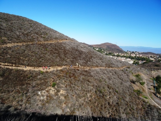
The descent down Lizard Rock Trail

The descent down Lizard Rock Trail

Before you reach the bottom, there are several overlook benches available to take a break as you look towards the Arroyo Conejo, Santa Rosa Valley and beyond.

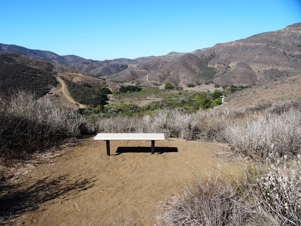
The first of two overlook benches facing west on the Lizard Rock Trail

The first of two overlook benches facing west on the Lizard Rock Trail

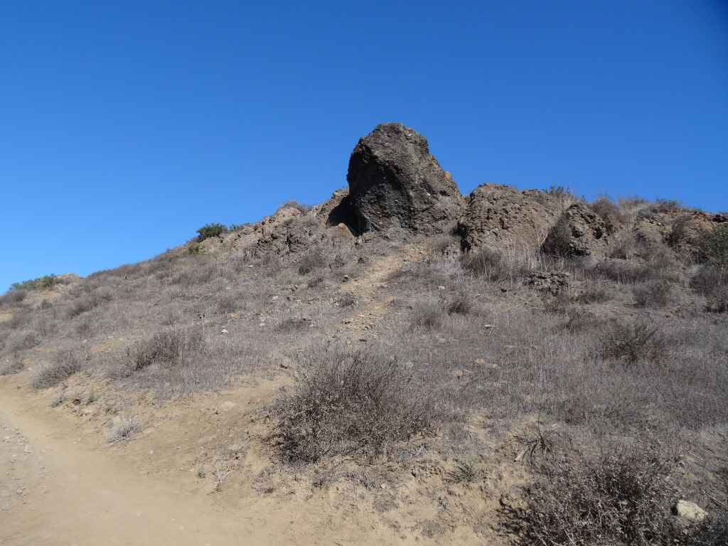
A view of the same bench looking back up (north) towards Lizard Rock (yes, that's the lizard head poking out of the hill on the right).

A view of the same bench looking back up (north) towards Lizard Rock (yes, that's the lizard head poking out of the hill on the right).

And here's the 2nd bench, further down the Lizard Rock Trail. Is that actual green I see up ahead in late September!? Yes it is. Must be drought-tolerant native shrubs!

And here's the 2nd bench, further down the Lizard Rock Trail. Is that actual green I see up ahead in late September!? Yes it is. Must be drought-tolerant native shrubs!

Hill Canyon comes into closer view

Hill Canyon comes into closer view

As you can see, the Lizard Rock Trail starts heading back east as it traverses the Hill Canyon Treatment Plant. Amazing facility. I wouldn't want to go swimming in the green liquid however.

As you can see, the Lizard Rock Trail starts heading back east as it traverses the Hill Canyon Treatment Plant. Amazing facility. I wouldn't want to go swimming in the green liquid however.

At the very bottom of the trail, after you have completely passed the water treatment plant, you see this sign that indicates you are on your way towards Lower Wildwood Canyon.

At the very bottom of the trail, after you have completely passed the water treatment plant, you see this sign that indicates you are on your way towards Lower Wildwood Canyon.

So you've reached the bottom of Wildwood Canyon and other than heading back up that steep Lizard Rock Trail to where you just came from, you can take the more interesting loop route following the Wildwood Canyon Trail to Wildwood Canyon. There are restrooms, drinking fountain and picnic tables in there.

From Wildwood Canyon, either continue onward up the Wildwood Canyon Trail about a third of a mile to Paradise Falls, or the Tepee Trail (yes, this is what it is called on the map), which largely parallels the Wildwood Canyon Trail, up towards, yes, the Tee Pee. Then follow the signs back

There is a great map that covers this Lizard Rock to Paradise Falls to Two Springs (formerly Indian Creek) Trail loop, about 4 1/2 miles in total, on the Conejo Open Space Foundation website at www.cosf.org/website/html/lizard-waterfall-creek.html.

Since we're down at the bottom of the canyon, you will see a sign for "Skunk Hollow." This is a tree-lined area adjacent to the creek with a picnic bench. Kind of nice little area, just around the corner from the waste treatment plant, albeit not within view of the plant. 

And in that area, you will see a sign indicating Eagle Point Trail. Eagle Point Trail is a hilly little 1/3 of a mile alternate route that gets you into Wildwood Canyon. The first section has dozens of steps. The remainder has a few steep sections. Just a small side attraction to check out. 

Eagle Point Trail Wildwood Park

El Rincon, El Cerro and Las Brisas Trails in Dos Vientos Section of Newbury Park

In the heart of Dos Vientos (Spanish for Two Winds), there are three trails that are accessible from multiple spots by walkers, hikers, runners and bikers. These are the El Rincon, El Cerro and Las Brisas trails. These trails are all nicely maintained, single track and provide great views of the surrounding areas. Other trails surrounding Dos Vientos include the Vista Del Mar Trail, Sierra Vista Trail, Sumac Trail (kind of parallels Sierra Vista Trail), El Encanto Trail and Powerline (Edison Road) Trail, as well as the Potrero Ridge Trail.

ElRincon_trailhead.JPG

Access to the El Rincon Trail is near the corner of Via Rincon and Rancho Dos Vientos. The trail is about 4/10ths of a mile and connects with the El Cerro and Las Brisas trails.

ElRinconTrail1.JPG
ElRinconTrail2.JPG

Access to El Cerro and Las Brisas trails is at the juncture of Via Las Brisas and Calle Del Prado and several other points. Visit https://cosf.org/files/maps/dos_vientos_trail_map.pdf for a trail map on the Conejo Open Space Foundation website.

ElCerroLasBrisas_sign.JPG