King Gillette Ranch in Calabasas
/
The 588-acre King Gillette Ranch (26800 West Mulholland Highway, Calabasas) is situated adjacent to Malibu Creek State Park. This scenic parkland at the lower end of the Las Virgenes Valley is a haven for larger mammals of the Santa Monica Mountains and offers a rare unspoiled view of California’s rich archaeological, cultural, and historic resources, including a Chumash settlement, and nationally significant structures designed for razor magnate King C. Gillette in the 1920’s by Wallace Neff, architect of California’s Golden Age.
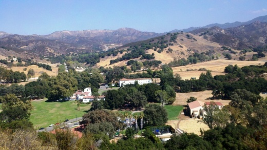
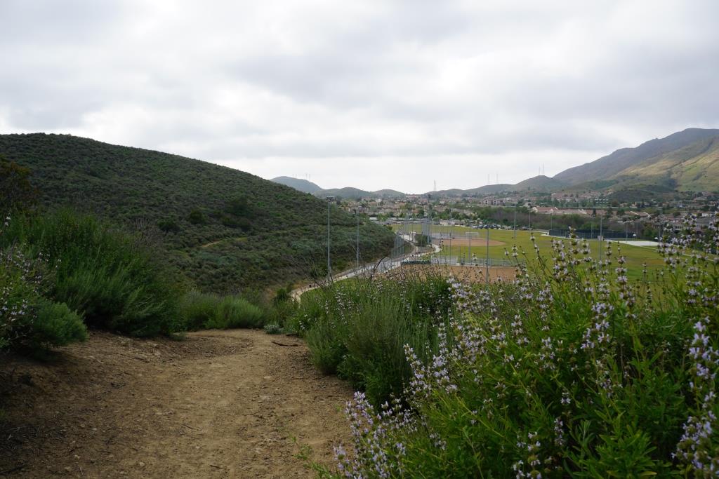
View of King Gillette Ranch from Inspiration Point, south of the Gillette Mansion
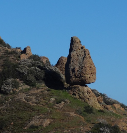
A short, somewhat steep roughly 1 mile hike from the parking area south of the Gillette Mansion leads to a knoll with 360-degree views—including the famous rock formations of Malibu Creek State Park. This is referred to as Inspiration Point. You will love the spectacular views from up there.
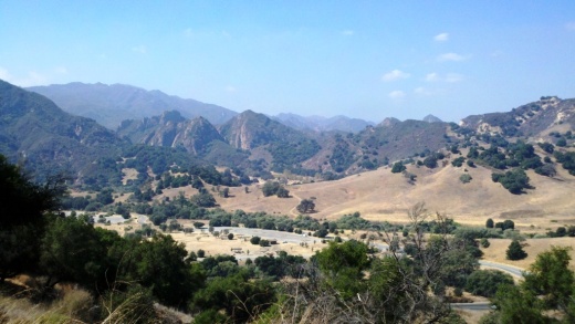
View from Inspiration Point west towards Malibu Creek State Park.
Other activities include strolling, bicycling, photography, and picnicking. King Gillette Ranch is owned and managed by the Mountains Recreation and Conservation Authority in cooperation with the Santa Monica Mountains National Recreation Area unit of the National Park Service, the Santa Monica Mountains Conservancy, and California State Parks. More information at lamountains.com/parks.asp?parkid=670 or call the Anthony C. Beilenson Interagency Visitor Center at 805.370.2301.
Directions from the Conejo Valley: Take Hwy 101 (Ventura Freeway) to the Las Virgenes/Malibu Canyon exit. Head south on Las Virgenes Road and continue to Mulholland Hwy, about two miles. Turn left onto Mulholland Highway and immediately look for the King Gillette Ranch entrance on the right.