Peter Strauss Ranch in Agoura Hills

NOTE: PETER STRAUSS RANCH SUSTAINED MAJOR DAMAGE IN THE WOOLSEY FIRE OF NOVEMBER 2018 AND WILL BE CLOSED UNTIL FURTHER NOTICE. CHECK THEIR WEBSITE FOR UPDATES.

Peter Strauss Ranch sign on Kanan Road southbound before Troutdale.

Peter Strauss Ranch sign on Kanan Road southbound before Troutdale.

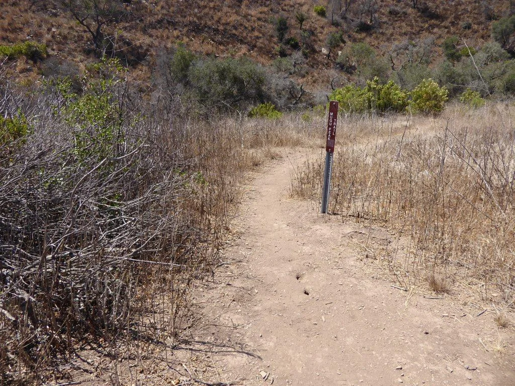
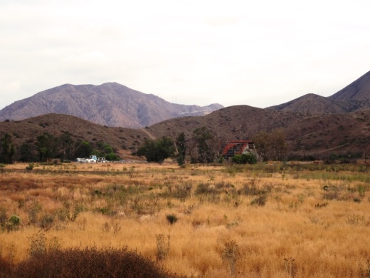
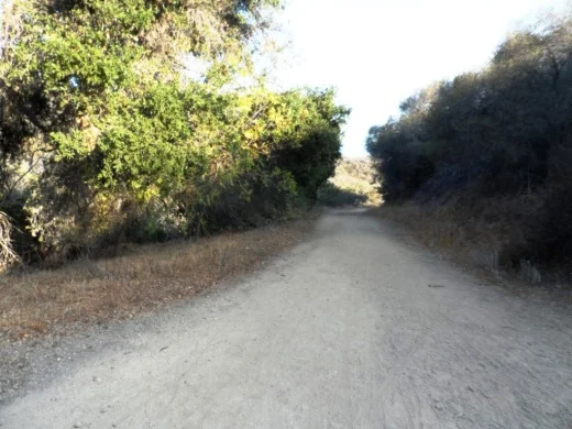
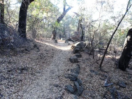
The 64 acre Peter Strauss Ranch is located at the juncture of Troutdale Drive and Mulholland Highway in Agoura Hills. The property is managed by the National Park Service (NPS) and is part of the Santa Monica Mountains National Recreation Area. It features a ranch house, .6 mile hiking trail, restrooms and an amphitheater area.

Parking lot access off of Mulholland Highway on northeast side of ranch.

Parking lot access off of Mulholland Highway on northeast side of ranch.

The Ranch has quite a history. According to the NPS, auto manufacturer Harry Miller bought the ranch at the turn of the 20th century as his weekend retreat. He built many of the structures on the site in the 1920s, including the stone ranch house, lookout tower and aviary.  He lost the ranch in the Depression.

Warren Shobert and Arthur Edeson purchased the ranch in the 1930s and created “Shoson”—a fairyland of charm and a paradise for children and adults. Later, a dam was constructed on Triunfo Creek, creating a small lake. The resort was renamed “Lake Enchanto.” Competition from other, larger amusement parks and resorts led to the decline of “Lake Enchanto.” It fell into disrepair and closed around 1960.

PeterStraussRanch_sign.JPG

Actor Peter Strauss purchased the property in 1976, restored the site, lived there until 1983, and later sold it to the Santa Monica Mountains Conservancy.  The NPS purchased the ranch in 1987 and the site will be preserved as part of our local natural and cultural history.

PeterStraussTrail_sign.JPG
PeterStraussRanch_trail1.JPG
PeterStrauss_Terrazo.JPG

Here is the ruins of the 650,000 gallon Lake Enchanto pool on the Peter Strauss Ranch site. The circular pool was 125 feet in diameter, ranging in depth from 2 to 9 1/2 feet. The pool was said to be the largest filtered, fresh-water swimming pool in California.

PeterStrauss_pool.JPG

More on the history of the Peter Strauss Ranch at peterstrauss.net/storyofranch.html.

Visit the NPS Peter Strauss Ranch page at www.nps.gov/samo/planyourvisit/straussranch.htm.

Lake Enchanto ad from the early 1940s.

Boney Mountain Peak Hike From Newbury Park

At an elevation of 2,825 feet, the presence of Boney Peak (also known at Mount Boney), is felt throughout the Conejo Valley and surrounding areas. Want to climb it?

BoneyPeakHikers.JPG

Well you can! It is challenging, but possible. Boney Mountain is located in the Santa Monica Mountains. One way to get to Boney Peak is via the Upper Canyon Trail from the Danielson Monument.

Danielson Monument

Danielson Monument

First off, hike your way up to the Danielson Monument, click this link for details. The monument is next to the remains of a burned down cabin shown below.

There is a trail that veers left next to the chimney. This is where you want to go. You're looking at a challenging 2 mile climb to Boney Peak. Most of the trail is narrow single track. There are some really steep, rocky sections, some with deep crevices, that may freak you out. You may have to duck your head from time to time. The trail is definitely challenging, both going up and coming back down. Definitely not for everyone.

The trail gets tight at times.

The trail gets tight at times.

The trail is not "officially" maintained by the National Park Service and thus there are NO SIGNS that say, hey, go this way to get to Boney Peak.  But I've seen plenty of people make it up there just fine as the path is fairly obvious. Just stay on the main trail.

After twists, turns, rocks, crevices and hills, the trail flattens out a bit near the top.

After twists, turns, rocks, crevices and hills, the trail flattens out a bit near the top.

One thing to note when you think you've reached the top. Look at the picture at the top of this post. To the left of the circled area is a large boulder. This is not the peak. There's a trail to the left behind it that you'll have to go up to get to the actual peak. Again, there are no signs. But you should be able to see the path pretty easily. You will be climbing some sheer rock face to get there. Can be slippery. And standing on the top of Boney can be both exhilarating and scary as hell! So be careful!

The final ascent to the top on sheer rock path.

The final ascent to the top on sheer rock path.

How long does it take to get from the trailhead at Wendy and Potrero and back? I'd allow for 4 to 5 hours if you are hiking. If you are a strong runner you can get up to it in as little as an hour (I'm talking top notch runner) to hour and a half, but you will only be able to "run" about half of the trail above the Danielson Monument. The rest is more of a technical hike in and around the rocks, boulders and crevices.

Here are some views you'll be treated to at the top.

BoneyPeakView3.3.13.JPG
BoneyPeak3.3.13_MoreViews.JPG
BoneyPeak3.3.13_Islands.JPG
BoneyPeak3.3.13_Top.JPG
BoneyPeak3.3.13HidVal.JPG
BoneyAnotherView.JPG

Zuma Beach in Malibu

zuma sign.JPG

Zuma Beach is located at 30000 Pacific Coast Highway At 4 miles long, Zuma is one of the largest and most popular beaches in Los Angeles County,

Zuma is known for its long, wide sands and excellent surf. Plenty of facilities, including several food stands, restrooms, showers, volleyball, etc. Plenty of street parking on PCH and over 2,000 parking spaces (currently $8 weekdays and $10 weekends).

Visit beaches.lacounty.gov/zuma-beach for more information. Zuma is known for riptides, so do be careful out there.

zuma beach.JPG

Underwood Family Farms - Moorpark

For a great time and for fresh produce, visit Underwood Family Farms in Moorpark.  My family loves the annual Fall Harvest Festival in October.  There are rides and activities for the kids, music and entertainment, tractor rides, special events, tasty food, farm animals galore and lots and lots of pumpkins, squash, gourds and other Fall goodies.

This is also a great place for kids' birthday parties.  There are animal shows, tractor rides, pony rides, mini train ride, play area, hay stack, animal feeding and other really fun activities for the kids.  We love feeding carrots to the goats, donkeys, alpacas, emus and horses.  Feeding the chickens, birds, rabbits and other animals is also great fun.

There are other great events at Underwood.  From the day after Thanksgiving to a week before Christmas the farm is festively decorated and there are cool tractor rides with Santa and other goings on.  There's also usually a large Easter event geared towards the kids each year.  The Moorpark location is generally closed from late December through February during the winter season.

Underwood Farms Goat Area

Underwood Family Farm is located at 3370 Sunset Valley Road, Moorpark (805.529.3690). 

Hours are: 9:00 am - 6:00 pm (daylight savings time), 9:00 am - 6:00 pm, weather and farm conditions permitting. Admission is $6.00 per person Monday-Friday and $9.00 per person weekends and major holidays. Children under 2 are free. Visit www.underwoodfamilyfarms.com for more information. 

Underwood also has a location at 5696 Los Angeles Avenue, Somis (805.386.4660), which includes a farm market, animal center and pick your own berries.  The farm center in Somis is open every day, year round. Animals on hand at the Somis location include sheep, alpacas, chickens and pygmy goats. Stop by and picnic with them! There is no admission charge at this much smaller location.

Alpacas at the Somis Animal Center

Alpacas at the Somis Animal Center

Soter Point at Marina Park in Ventura

SoterPoint1.JPG

Dedicated in 2011, Soter Point at Marina Park in Ventura consists of a shaded picnic area, benches, attractive landscaping and a 15 foot mermaid statue. Soter Point is the result of a private/public partnership between local Ventura residents and the City of Ventura.

The inscription on a plaque on the Mermaid of Soter Point tells the story:

This stunning landmark overlooking the Ventura Harbor represents a trailblazing cooperative effort to beautify our community through private citizens working with public agencies. Andy Soter developed and landscaped the area in memory of his daughter Andrea, a successful and much admired investment manager. The mermaid sculpture and its foundation were donated by Russian emigrants Alec and Tatyana Benke, as an expression of love for their new country, America. Samuel Povar created the first collaboration of this nature in 2007 as a tribute to his late wife Orianna and worked tirelessly to make this Marina Park project a reality. And, the Ventura City Council and the Coastal Commission gave their enthusiastic blessing. Now Povar, Soter, and Benke, all Ventura residents, hope to inspire others to use private capital along with public cooperation and support…to envision something beautiful and make it happen.

Soter Point is located at the southernmost point of Marina Park, a short walk from the main playground area of the park. With beautiful views looking out toward Ventura Harbor and picnic area cooled by sea breezes, Soter Point does not Disa-Point.

Bench faces south toward Ventura Harbor Village

Bench faces south toward Ventura Harbor Village

SoterPoint3.JPG
SoterPoint4.JPG
SoterPoint6.JPG

La Jolla Canyon Loop Trail in Point Mugu State Park in Malibu

Point Mugu State Park is at western edge of the Santa Monica Mountains National Recreation Area, stretching from Newbury Park on the north to five miles of oceanfront. The Chumash Trail is the westernmost trailhead in Point Mugu State Park which in turn gets you to the La Jolla Valley Natural Preserve area (which also can be accessed from the Ray Miller Trail, about two miles southwest of the Chumash Trail trailhead).

The Chumash Trail trailhead is accessible off of PCH, about 2 1/2 miles from where Las Posas Road connects to PCH in Camarillo, and about 10 miles from the intersection of Las Posas Road and Highway 101.  It is across the street (PCH) from a Naval Base Ventura County training range. Look for the left turn into a small dirt parking area that has space for perhaps 15 or so cars.

The Chumash Trail is an initial, quite steep and technically challenging .7 mile climb, to a juncture where you either turn right to the Mugu Peak Trail (MORE AT THIS LINK). If you turn left (north), continue another half mile until you reach the La Jolla Valley Loop Trail.

Map snippet courtesy of California State Parks

Map snippet courtesy of California State Parks

The La Jolla Valley was acquired by the State of California in 1966 as part of Point Mugu State Park and was established as Natural Preserve in 1972. 

One thing I find of particular visual interest on the La Jolla Canyon Loop Trail is the Naval Base Ventura County satellite tracking station situated at the top of nearby Laguna Peak. 

One thing I find of particular visual interest on the La Jolla Canyon Loop Trail is the Naval Base Ventura County satellite tracking station situated at the top of nearby Laguna Peak. 

View of the Boney Mountain Range up ahead from within the La Jolla Valley Natural Preserve. This is such a peaceful grasslands area back here. Most folks go for the ocean trails, leaving this area a bit less utilized.

View of the Boney Mountain Range up ahead from within the La Jolla Valley Natural Preserve. This is such a peaceful grasslands area back here. Most folks go for the ocean trails, leaving this area a bit less utilized.

When I look up at the tracking station, The Jetsons come to mind.

When I look up at the tracking station, The Jetsons come to mind.

Another 1 1/2 miles of hiking on the La Jolla Valley Loop Trail gets you to a small campground area with as I recall, 3 or 4 campsites accompanied by picnic tables, a vault toilet, but no water. No campfires allowed out here in the back country either. Although these appear to be rarely used, the only problem coming in from the Chumash Trail instead of the Ray Miller Trail (and La Jolla Canyon Trail) area is that you must pay for the campsite at the Ray Miller Trail area. Thus, if you do plan to stay at these back country campsites, keep that in mind and pay first.

You will pass by this sign on your way towards the campground if you want to take a shorter loop.

You will pass by this sign on your way towards the campground if you want to take a shorter loop.

Here is where the La Jolla Valley Trail Campsites are, marked by the vault toilet up ahead. I don't get back here very often and when I do, I see no one. But I did notice there was TP in the room, which is good for those in need.

Here is where the La Jolla Valley Trail Campsites are, marked by the vault toilet up ahead. I don't get back here very often and when I do, I see no one. But I did notice there was TP in the room, which is good for those in need.

You're definitely in the back country back here, though in reality you are only 2.7 miles from the Pacific Ocean.

You're definitely in the back country back here, though in reality you are only 2.7 miles from the Pacific Ocean.

That said, the La Jolla Canyon Trail (not to be confused with the La Jolla Canyon LOOP Trail) has been closed since January 2015 because of mudslides that made that particular trail too dangerous to use. Confused? Yes, this can be confusing. Bottom line is that you pay for the camping at the La Jolla Canyon/Ray Miller Trailhead area but access the camping from either the Chumash Trail, or a longer route via the Ray Miller Trail.

So after you reach the campground area, you can either head back the way you came, or take the loop back around to the Mugu Peak Trail, where you will be treated to views, views and more views. Or hike to the top of Mugu Peak for the best views of all.

This Mugu Peak Trail sign is located near the south end of the Loop Trail.

This Mugu Peak Trail sign is located near the south end of the Loop Trail.

Happy Camp Canyon Regional Park in Moorpark

Happy Camp Canyon Regional Park in Moorpark is a 3,000 acre wilderness area with 12 1/2 miles of trails maintained by the Santa Monica Mountains Conservancy. I've hiked back here from time to time and rarely see anyone in these quiet canyons!

HappyCamp_GolfCourse.JPG

There are a couple entry points to Happy Camp Canyon. The one shown above is adjacent to Rustic Canyon Golf Course, 15100 Happy Camp Canyon Road, Moorpark. The other main entry point shown below is at 14105 Broadway Avenue, Moorpark. Park here and hike to the canyon entrance point.

HappyCamp_CanyonEntrance.JPG

If you're looking for relatively flat trails well suited for comfortable hiking, mountain biking and horse riding, Happy Camp Canyon is a good choice.

You can take the main Happy Camp Canyon Fire Road for quite a ways and either head back the way you came or take the more strenuous Middle Range Fire Road back and catch some great views. I veered north up a steep maintenance road to some power lines shown below.

HappyCampPowerLines.JPG

Or try the 8 mile, strenuous, South Ridge Loop (via the Middle Ridge Fire Road). Begin at the canyon gate; about 100 yards beyond, turn right and follow a dirt road up to the ridge top. Continue east along the Big Mountain Ridge to a junction, enjoying views on your right of Moorpark, Simi Valley, the Santa Monica Mountains, and all the way to the Channel Islands. At the junction, turn north and drop down into Happy Camp Canyon. When you reach an old corral (and picnic area), turn west and walk back to the entrance gate on Happy Camp Canyon Fire Road (in the canyon bottom), approximately four miles. 

There is no cost for parking here. For more information, visit mrca.ca.gov/parks/park-listing/happy-camp-canyon-regional-park.

NOTE: Because of sensitive habitat, dogs are not allowed past the entrance gate.

It greens (and purples) up quite nicely after the winter rains in Happy Camp. March/April/May are the months to check it out.

It greens (and purples) up quite nicely after the winter rains in Happy Camp. March/April/May are the months to check it out.

CSU Channel Islands University Park in Camarillo

CSU Channel Islands University Park is a 367 acre parcel located adjacent to CSU Channel Islands off of S. Lewis Road in Camarillo. It is a regional educational and recreation area owned and operated by California State University Channel Islands.

CSUCIPark_sign.JPG

The park is open to the public daily from sunrise to sunset. Do note that there are no facilities at this park, like restrooms and drinking fountains. You can walk, hike, run, bike, etc. and perhaps come across some wildlife.

Disbanded dairy farm in the distance at CSU Channel Islands University Park

Disbanded dairy farm in the distance at CSU Channel Islands University Park

One item of historical interest at the park is the "Scary Dairy," a dairy farm located on the parcel that closed in the 1960s and was disbanded and subsequently vandalized and graffittied upon over the decades.

"Scary Dairy"

"Scary Dairy"

From Camarillo, take Lewis Road south to Camarillo Street and turn left (east).  Cross the bridge over Calleguas Creek and the entrance is on the left. Parking is $6 per vehicle (as of April 2019). Visit www.csuci.edu/cipark for more information.

Bring cash to pay for parking at entrance.

Bring cash to pay for parking at entrance.

CSUCI Park Barn.JPG

Santa Barbara Zoo

sbzlogo.gif

The 30 acre Santa Barbara Zoo is a great family outing, with beautiful landscape, low key, clean environment and cool breezes from the nearby Pacific Ocean.

SBZooGiraffeSmall.jpg

There are over 500 animals at the Santa Barbara Zoo and my family's favorites include the giraffes and the penguins.  One of the most unique features is feeding the giraffes. For a fee of $8 (for an adult; $4 for kids) you are situated face to face with these friendly Masai giraffes as you give them a snack. Open weekdays from 11:30am to 1:30pm and weekends 11:30am to 12:45pm and 1:30-2:45pm.

The penguin exhibit is mesmerizing as you are treated to happy go lucky penguins frolicking in the water.

There are plenty of other animals, exhibits and places in the park to just hang out and have a picnic lunch.  And the train ride is always fun.

So drive the 45 miles up the coast, take the kids to the zoo, grab a bite, feel the sand, do some shopping and you've got yourself a nice day out.  Better yet, buy a tax-deductible zoo membership and visit the zoo several times per year with the kids.

Speaking of membership, if you have a membership at the Los Angeles Zoo, your card will get you 50% off admission at the Santa Barbara Zoo. Conversely, a membership at the Santa Barbara Zoo will get you 50% off at the Los Angeles Zoo. Nice!

The Santa Barbara Zoo is located at 500 Niños Drive, Santa Barbara.  For more information, visit www.sbzoo.org or call 805.962.5339 or 805.962.6310.

Open 9:30 a.m. - 5:00 p.m. Monday to Thursday, 9:30 a.m. to 7 p.m. Friday to Sunday, except 10:00 a.m. - 3:30 p.m. on Thanksgiving, Christmas Eve, and Christmas.

Ticket Prices (as of April 2021) are Adults 13-64: $19.95, Children 2-12 $11.95, Seniors 65+: $18.95 and Children under 2: Free. Parking: $11 (free with SB Zoo Membership)

Harmon Canyon Preserve in Ventura

Look for this address sign on Foothill Road to access the trailhead.

Look for this address sign on Foothill Road to access the trailhead.

Established in 2020, the Harmon Canyon Preserve is owned and managed by the Ventura Land Trust. The 2,100 acre preserve located at 7511 Foothill Road, Ventura (just west of Kimball Road) contains about 6 1/2 miles of well-maintained trails in the canyons and hills.

Open to hikers, bikers and runners. Dogs on leash allowed.

Free parking is available at the preserve trailhead off of McVittie Place. You can park on the west side of Kimball, or park a few blocks down Kimball and Loma Vista Road at Juanamaria Park, and walk a few blocks to the trailhead.

More details and trail map at www.venturalandtrust.org/harmoncanyon.

Trailhead

Trailhead

Old Jeep on the trail

Old Jeep on the trail

Harmon Canyon 3.JPG

Rocky Oaks Nature Reserve in the Malibu Hills

RockyOaks_sign.JPG

Rocky Oaks is a 250 acre nature reserve that is part of the Santa Monica Mountains Recreation Area, located at the 31500 block of Mulholland Highway in Malibu, west of Kanan Road. The entrance is on the north side of Mulholland Highway. The park is managed by the National Park Service.

RockyOaksLoopTrail.JPG

Rocky Oaks has various species of oak trees, some centuries old. The Overlook Trail takes you to a peak with gorgeous panoramic views while the Pond Trail (less than a mile round trip) takes you to a seasonal pond area which used to be part of a cattle ranch.

The Rocky Oaks Loop Trail is a 2.2 mile easy trail that is lined with sage. This is one of the more low key, easy to hike areas around town. It can get hot but at only 6 miles from PCH you can also feel some nice ocean breezes in these trails.

Learn more about Rocky Oaks and download a trail map at www.nps.gov/samo/planyourvisit/rockyoaks.htm.

Pond is looking quite nice in late spring of 2017.

Pond is looking quite nice in late spring of 2017.

RockyOaks_2.JPG

Los Robles Trail East in Thousand Oaks

The Los Robles Trail East in Thousand Oaks is accessible from the Los Robles Trail trailhead heading west from the corner of South Moorpark Road and Greenmeadow Avenue in Thousand Oaks.

LosRoblesTrail_SignMain.JPG

From the main trailhead, go west just under 1/2 mile and you'll see the fork in the road where you can go east or west. Head south (click here if you prefer going west) where you'll go towards the Los Robles Trail East.

A gradual uphill of about 1/2 mile on a wide fire road trail takes you to a picnic bench and then a more winding, partially shaded, narrower, eastbound section of trail.

Fire road that takes you to picnic bench.

Fire road that takes you to picnic bench.

Picnic bench at juncture of fire road and narrower, steeper Los Robles Trail East.

Picnic bench at juncture of fire road and narrower, steeper Los Robles Trail East.

LosRoblesTrail_MapEast.jpg

Another .6 mile gets you to a hill where you'll soon be treated to a reward for your hiking effort...a bench with a view of the Conejo Valley.

Los Robles Trail East near hilltop viewpoint with bench.

Los Robles Trail East near hilltop viewpoint with bench.

And the bench at the top. Nice view of the Conejo Valley, eh?

And the bench at the top. Nice view of the Conejo Valley, eh?

And the trail loops around with another bench on the other side of the trail looking south towards Hidden Valley.

Bench facing south.

Bench facing south.

The trail loops back around towards the main Los Robles Trail, where you can head back west again from where you came from, or head east towards the northern tip of the Los Padres Trail or stretch further east towards the Triunfo Canyon Trail and White Horse Canyon Trail.

Now go on, take a hike!

Los Padres Trail in Thousand Oaks

LosPadresTrail_trailhead.JPG

The Los Padres Trail is a short, 1 mile, neat little trail accessed on Los Padres Drive, near the corner of Fox Hills Drive in Thousand Oaks. Take Moorpark Road south of the 101 freeway and turn left on Los Padres Drive. The trailhead is clearly marked on the right hand side, The trail is maintained by the Conejo Open Space Foundation.

Surrounded by trees in the first section of the Los Padres Trail.

Surrounded by trees in the first section of the Los Padres Trail.

Short but sweet, the trail is.canopied by trees, several bridges, mostly single track trail and a bit of a climb (750 feet) as you make your way up to the Los Robles Trail junction. That's about a mile, so you can turn around there for a 2 mile round trip hike.

Where the Los Padres Trail meets the Los Robles Trail.

Where the Los Padres Trail meets the Los Robles Trail.

Or...you can turn right (west) and head your way up the wide, fire road sized section of the Los Robles Trail east. This is a bit of a climb, but pretty moderate and gradual. Crest the hill and you'll see a gate. Before the gate, on the left, is a picnic bench.

The Los Padres Trail is winding, uphill and wide in this section.

The Los Padres Trail is winding, uphill and wide in this section.

After you pass the sign below, there's a picnic bench on the left. You've climbed a couple miles. Time for a break before heading back down. Or turn left (east) and in 3 miles you're at Triunfo Park in the Los Padres Open Space via the Triunfo Canyon Trail. Or turn right (west) and you're off into the Los Robles Open Space. If you go straight ahead, you’ll reach a gate to Hidden Valley private property.

LosRoblesTrail_Triunfo.JPG
Gate at top of trail. Private property in Hidden Valley ahead.

Gate at top of trail. Private property in Hidden Valley ahead.