Marview Drive Trail in Thousand Oaks

Marview Drive Trail Trailhead in Thousand Oaks

Marview Drive Trail Trailhead in Thousand Oaks

If you're looking for a short, steep and sweet trail to hike up and down in Thousand Oaks, check out the trail on Marview Drive, just east of the entrance to Old Meadows Park at 1600 Marview Drive. Take Erbes Road and go west on Marview. After passing the residential section of the road, up ahead is Old Meadows Park and on the right is plenty of street parking across from the trailhead.

MarviewTrail_steep.jpg

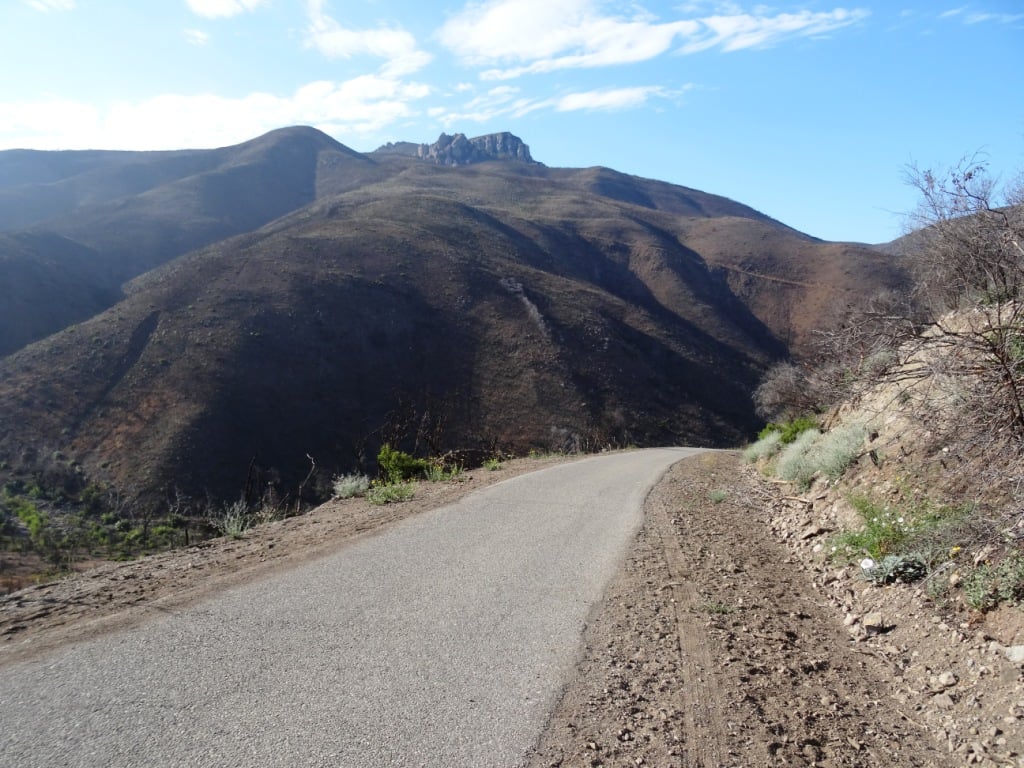
Short it definitely is. Only about a quarter of a mile to the top of the hill, but it will take you a bit longer than your typical hike because it is so steep, at least the first section.

MarviewTrail.JPG

Then toward the top it starts to flatten out, where you will discover panoramic views of the Conejo Valley. There's also quite a clear view of the 23 Freeway from up here!

Marview_23fwy.JPG

At the top of the trail is a large, enclosed square fenced in with No Trespassing signs all over the place. This is a water tank. But you can walk around the area to the other side, where there's actually a trail and walkway that goes down to the St. Patrick’s Episcopal Church.

So there you have it! A short, steep, but sweet little trail in the heart of Thousand Oaks!

Santa Rosa Trail and Lower Butte Trail in Thousand Oaks

SantaRosaTrail.JPG

The Santa Rosa Trail connects Wildwood Park to the hills above Cal Lutheran University in Thousand Oaks, about a 3 mile hike one way along the Mount Clef Ridge. Enjoy beautiful views of the Conejo Valley and Santa Rosa Valley, then loop around the hills behind CLU.

SRTrail_toWildwood.JPG

From Wildwood Park, you can take the Mesa Trail west and turn right onto the Santa Rosa Trail. Or start from the other direction...park at CLU near the Samuelson Community Pool and hike towards Wildwood.

Juncture of Santa Rosa Trail and Lower Butte Trail.

Juncture of Santa Rosa Trail and Lower Butte Trail.

Or take an alternate route with the Lower Butte Trail. The Conejo Open Space Foundation website has a map of the Santa Rosa/Lower Butte Trail loop hike that is about 6 miles in length from Wildwood Park at cosf.org/trails/wildwood/wildwood-park-moderate-hike-santa-rosa-lower-butte-loop.

Two benches and a cross abpve CLU, east of the CLU sign, with panoramic views of the Conejo and Santa Rosa Valleys.

Two benches and a cross abpve CLU, east of the CLU sign, with panoramic views of the Conejo and Santa Rosa Valleys.

SRTrail_SRViews.JPG

Ranch Center Road, Wood Canyon Fire Road and Other Trails in Northern Point Mugu State Park

Northern Point Mugu State Park map image courtesy National Park Service

Northern Point Mugu State Park map image courtesy National Park Service

Point Mugu State Park in the Santa Monica Mountains stretches from Newbury Park to the ocean, over 14,000 acres of land and 70 miles of trails. Visit this link for more information.

If you ever get the time and energy, consider exploring the trails in the northernmost section of Point Mugu State Park. To access these trails, you can start at Rancho Sierra Vista/Satwiwa in Newbury Park and make your way up Big Sycamore Canyon Road, then, down, down, down the big paved hill into the canyons of Point Mugu State Park.

The descent down into the canyon on Big Sycamore Canyon Road is pretty steep. Watch for cyclists. Boney Mountain is seen in the distance.

The descent down into the canyon on Big Sycamore Canyon Road is pretty steep. Watch for cyclists. Boney Mountain is seen in the distance.

The descent into the canyon is about 3/4 mile. From there, you'll go another mile or so until you see a fork in the road. If you go straight (veering slightly left), you'll continue down Big Sycamore Canyon Road towards PCH. But if you turn right, you're on Ranch Center Road, a gradual, steady climb up an old, paved hill.

Juncture of Big Sycamore Canyon Road (left) and Ranch Center Road (right).

Juncture of Big Sycamore Canyon Road (left) and Ranch Center Road (right).

This is one section of Ranch Center Road. As you can see, this is a pretty old road that was used by the ranchers who lived here before the land was acquired by California State Parks.

This is one section of Ranch Center Road. As you can see, this is a pretty old road that was used by the ranchers who lived here before the land was acquired by California State Parks.

You are highly unlikely to see a lot of people down here. You might see a couple cyclists from time to time, but hikers/runners in these quiet areas are, from my experience, pretty rare in appearance. It feels like you're going to the middle of nowhere.

You will also notice that there are several trails that connect with the road, including, from east to west, the Sin Nombre Trail, Sage Trail, Ranch Center Fire Trail, Coyote Trail and, finally, the Wood Canyon Fire Road trail. All of these trails will either take you back to Big Sycamore Canyon Road or other trails that will allow you to do a loop back up to Rancho Sierra Vista. You can add another 4 miles to your adventure by checking out the Guadalasca Trail that connects to the Wood Canyon Fire Road. See detailed map here.

Old water tank seen at the juncture of Ranch Center Road (paved) and Ranch Center Fire Road (trail).

Old water tank seen at the juncture of Ranch Center Road (paved) and Ranch Center Fire Road (trail).

After you pass the water tank seen above, you continue downhill towards the remains of some old ranch houses. Pretty much everything has been demolished but you'll see some vintage items still on hand, along with signs warning you to stay outta there.

You've reached what used to be the Ranch Center.

You've reached what used to be the Ranch Center.

Not sure if this would sell on Craigslist.

Not sure if this would sell on Craigslist.

The old ranch house area is at the juncture of Ranch Center Road and Wood Canyon Fire Road. I particularly enjoying running down Wood Canyon Fire Road as it is so quiet and there is nice tree coverage.

More Wood Canyon Fire Road

More Wood Canyon Fire Road

Wood Canyon Fire Road runs south until it connects with the "Loop Trail" (west) or continues east back towards the Two Foxes Trail (parallels Big Sycamore Canyon Road) and then Big Sycamore Canyon Road, where you can veer back up north towards Newbury Park. 

DOZENS AND DOZENS OF TRAILS IN AND AROUND VENTURA COUNTY

Heritage Park Native Plant Demonstration Garden in Thousand Oaks

The Heritage Park Native Plant Demonstration Garden is located at the corner of Thousand Oaks Boulevard and Long Court in Thousand Oaks (next to the still vacant Corrigan's Steak House and across from Pacific Breeze Salon). The garden was designed by the Conejo Valley Audubon Society in collaboration with the City of Thousand Oaks. The drought-resistant California native plants seen in the garden attract birds, butterflies, pollinators by providing food and shelter while eliminating the need for fertilizer and pesticides.

More information at wp.conejovalleyaudubon.org/wp-content/uploads/2020/07/HeritagePark_Palette_FINAL-amended11-24-16.pdf.

Malibu Lagoon Field Trips Hosted by Santa Monica Bay Audubon Society

The Santa Monica Bay Audubon Society (SMBAS) hosts Malibu Lagoon Field Trips the 4th Sunday of every month.

Adult Walk starts at 8:30 a.m. for 2-3 hrs. The group meets at the metal-shaded viewing area next to parking lot. SMBAS makes a special effort to make these monthly Malibu Lagoon walks attractive to first-time and beginner birdwatchers. Brings binoculars and cameras.

Metal shaded viewing area next to parking lot.

Metal shaded viewing area next to parking lot.

Children & Parents Walk starts at 10:00 a.m. for a 1 hr session. Meet at metal-shaded viewing area next to parking lot. SMBAS leaders are experienced with kids so by all means bring them down to the beach to enjoy nature. Binoculars will be provided.

Upcoming dates: 9/27/20. (SUBJECT TO CHANGE DUE TO COVID - PRIOR MONTHS HAVE BEEN CANCELLED)

If you have a Scout troop or other group 7 or larger, please call Lu at 310.395.6235 to make sure SMBAS has enough binoculars and docents on hand.

Visit smbasblog.com to learn more.

Directions: Malibu Lagoon is located at the intersection of Pacific Coast Highway and Cross Creek Road in Malibu. Bring water and sun protection; look around for people wearing binoculars and hats.

Parking: Self-serve parking machine in lot, $3/hr, $12 day ($11 seniors); credit cards accepted. Annual passes accepted. You may also park (read all signs carefully) on PCH west of Cross Creek Road, on Cross Creek Road, or on Civic Center.Way north (inland) of the shopping center. Lagoon parking in shopping center lots is not permitted.

Channel Islands Harbor in Oxnard

ChannelIslandsHarborSign.JPG

Channel Islands Harbor is located in Oxnard; take the 101 Freeway to Ventura. Exit Victoria Avenue. Turn south onto Victoria Avenue. Continue on Victoria for approximately 5 miles until you reach Channel Islands Harbor.

Channel Islands Harbor offers a variety of activities for the entire family. Throughout the year various events are held including the Celebration of the Whales, visits by Tall Ships, Concerts by the Sea, Fireworks by the Sea on July 4th, the Ventura County Boat Show, Ventura Vintage Rods Harbor Run Classic Car Show, and the annual Parade of Lights.

Harbor restaurants include The Waterside Restaurant and Wine Bar, H.C. Seafood & Co., Fisherman's House, The Lookout Bar & Grill, Moqueca Brazilian Cuisine, Mrs. Olson’s Coffee Hut, Honey Cup Coffee Bar, Toppers Pizza Place, The Masala Twist, Ventura BBQ Co., Spudnuts and Sea Fresh Channel Islands.

Visitors may rent boats at Hopper Boat Rentals, or Channel Islands Kayak Center, visit the Channel Islands Maritime Museum or just enjoy a beautiful day at one of the local beaches. Weekends offer live musical entertainment. Fresh fruits and vegetables plus arts and crafts may be found at the Harbor's Farmers' Market held at the Marine Emporium Landing from 10:00 a.m. - 2:00 p.m. every Sunday, rain or shine! Or just ride bikes!

For more information, visit www.channelislandsharbor.org or call 805.985.4852.

We stop by the harbor as often as possible for various events and to walk around, as well as to walk a few blocks over to the beach!  Quite a nice opportunity to beat the Conejo Valley heat...and only 15 to 20 minutes away!

Grant Park / Serra Cross Park in Ventura

SerraCrossPark1.JPG

For some of the most spectacular views of Ventura you can ask for, stop by Grant Park / Serra Cross Park off of Ferro Drive in Ventura. Grant Park is a 107 acre park of mostly open space. Serra Cross Park is located at Grant Park. It is a one acre parcel that contains the wooden cross shown below.

The land and cross were sold to San Buenaventura Heritage, Inc. in 2003 in order to maintain the historic cross, which was placed on this spot in 1941 to replace the previous cross that was erected in 1912.

Visit www.serracrosspark.org to learn more about Serra Cross Park.

Get there via Brakey Road to the left side of Ventura City Hall or Ferro Drive off of Cedar Street. There are no restrooms, playground, drinking fountains, etc. at this park.

SerraCrossPark2.JPG
SerraCrossPark3.JPG
SerraCrossPark4.JPG
SerraCrossPark5.JPG
SerraCrossPark8.JPG

Oakbrook Vista Trail in Thousand Oaks

The Oakbrook Vista Trail is a relatively easy out and back climb that provides nice panoramic views of the Lang Ranch area of Thousand Oaks. Access to the trail is on the south side of Lang Ranch Parkway, just east of Westlake Boulevard. See access point below.

OakbrookVista1.JPG

The first portion is a narrow trail that zig zags its way to a bench, where you can rest and enjoy the views. But I'd estimate this is only 1/4 of a mile, so keep going if you're game!

OakbrookVista2.5.JPG

After the bench, the trail opens up and continues up and up and up and if you reach the top, roughly a mile or so up the hill, you'll be enjoying 360 degree views towards Boney Mountain on the west, Lang Ranch/Woodridge trails on the north and more.

OakbrookVista4.JPG
OakBrookVista3.jpg
Same view as above, in May 2020.www.cosf.org/website/html/oakbrook-vista-trail.html

Same view as above, in May 2020.www.cosf.org/website/html/oakbrook-vista-trail.html

For a trail map and additional information, visit the Conejo Open Space Foundation website at cosf.org/trails/lang-ranch/lang-ranch-woodridge-easy-hike-oakbrook-vista-trail.

Vista Del Mar Trail in Newbury Park

Trail access off of Via Ricardo in Newbury Park (Dos Vientos section).

Trail access off of Via Ricardo in Newbury Park (Dos Vientos section).

Other end of trailhead off of Via Ricardo.

Other end of trailhead off of Via Ricardo.

The Vista Del Mar Trail is a 1 to 1 1/2 mile long trail along the west side of the Dos Vientos residential development in Newbury Park. The trail is maintained by the Conejo Open Space Foundation.

The trail can be accessed near the corner of Via Ricardo and Via Rincon (parking on Via Ricardo). The other end of the trail is near the corner of Rancho Dos Vientos and Via El Cerro (where there is no parking on Rancho Dos Vientos).

"Vista Del Mar" is Spanish for "View of the Sea" and while the overcast early morning photos below do not show it, on a clear day you will indeed be able to see down the Potrero Grade to the Pacific Ocean and Channel Islands. The Vista Del Mar trail also provides views to Camarillo and the Oxnard Plain.

The trail is nice and wide, good for walkers, runners and cyclists.

The trail is nice and wide, good for walkers, runners and cyclists.

The north section of the trail before intersecting with the Edison Fire Road Trail is where the "Twin Ponds" are. The image below of one of the ponds was taken after the Springs Fire of May 2013 ravaged the area. More on the Twin Ponds Conservation Area at this link.

DosVientos5.5.13_12.JPG

The Twin Ponds are more easily accessed via the northeast Vista Del Mar trailhead near the corner of Via Ricardo and Via Rincon. About a mile.

VistaDelMar_priprsign.JPG
VistaDelMarTrail_priprpsign2.JPG

About 1/4 mile into the trailhead from Via Ricardo, you'll reach this junction. Veer right to the single track public access trail, as the trail to the left is on private property.

Lone bench on the Vista Del Mol trail that has views to the Channel Islands on a clear day

Lone bench on the Vista Del Mol trail that has views to the Channel Islands on a clear day

The Vista Del Mar trail connects on the southeast to the Sierra Vista Trail, which in turn connects to the Potrero Ridge trail, with an endpoint on Reino Road.

Views from the Vista Del Mar Trail on a clear morning.

Views from the Vista Del Mar Trail on a clear morning.

Map courtesy of the Conejo Open Space Foundation

Map courtesy of the Conejo Open Space Foundation

Disc Golf in Ventura County

DiscGolf.jpg

Looking for disc golf options in Ventura County? You’ve come to the right place. These are all available to the public, free of charge.

The newest disc golf option is at Sapwi Trails Community Park in Thousand Oaks. The course has 19 holes. Hole #1 is located off the parking lot on Avenida de los Arboles at Kensington Drive. The park and course opened in March 2019. and is managed by the Conejo Recreation and Park District (CRPD).

Rabbit Flats Disc Golf Course is located on the west end of Thousand Oaks Community Park, 2525 N. Moorpark Road (next to Thousand Oaks High School). This course opened to the public in May 2010. Park managed by CRPD.

Coyote Point Disc Golf Course is an 18 hole course located at Lake Casitas, 11311 Santa Ana Road, Ventura.

Chaparral Park, located at 217 N. Medea Creek Lane in Oak Park, has a newer 10 hole course. Course map at THIS LINK (that link also provides detailed instructions on how to play!). Park is managed by the Rancho Simi Recreation and Park District (RSRPD).

Also managed by RSRPD is a 12 hole disc Sycamore Park Disc Golf Course at Sycamore Park, 855 N. Planetree Avenue, Simi Valley. Detailed map and instructions at THIS LINK.

There is yet another disc golf course located at Sequoia Park, 2150 Tracy Avenue, Simi Valley. Also managed by RSRPD, this is a 9-hole course. Course map and instructions at THIS LINK.

Finally, there is a 9-hole disc golf course located at Lake Piru Recreation Area, 4780 Piru Canyon Road, Piru.

Scarlett Belle Riverboat Cruises

ScarlettBelle.jpg

The Scarlett Belle is a modern riverboat located in the scenic Channel Islands Harbor. The boat can accommodate from 40 to 150 passengers and is a fun, luxurious venue for weddings, parties, corporate events, anniversaries and more...casino nights, graduation parties, public holiday cruises, etc.

For more information, visit www.scarlettbelle.com or call 805.204.0977.

Located at A&M Boat Charters & Cruises at the Marine Emporium Landing at Channel Islands Harbor, 3600 S. Harbor Blvd., #219, Oxnard.

Exit the 101 freeway at Victoria, proceed south on Victoria, at West Channel Islands Blvd, turn right. Go to the second stop light and turn left onto Harbor/ W. Channel Islands Blvd. Go to Cabezone Circle make a left. Into the Marine Emporium. Walk to the back of the three buildings facing the street to the dock where you will see the Scarlett Belle and Sunfish. Free parking.

Santa Rosa Valley Regional Park in Camarillo

Located at 10241 Hill Canyon Road in Camarillo, Santa Rosa Valley Regional Park is a 50 acre county park with hiking, trails and equestrian riding areas. Open 7:30 am - 5:00 pm - (January, February, November, December), until 6:00 pm (March, October), 7:30 pm (April, May, September) and 8:00 pm - (June, July, August). There is no playground area here...this park is mostly geared towards hiking, exploring and horseback riding. Parking is $2 on weekdays and $4 weekends.

SantaRosaValleyRegPark.JPG

This park is located at the entry point to the Conejo Canyons bridge, where you can access trails in the Western Plateau area of Thousand Oaks, maintained by the Conejo Open Space Foundation.

From Thousand Oaks, take Moorpark Road down the Norwegian Grade through Santa Rosa Valley until you see the sign shown below.

More information at www.ventura.org/parks-department/inland-parks/santa-rosa-valley-park-camarillo.

SantaRosaCountyPark_sign.JPG

Call Box 1-35 Beach in Unincorporated Ventura County

Call Box 1-35.JPG

Call Box 1-35 is not the official name of this beach in the unincorporated section of Ventura County northwest of Malibu city limits. But since the dilapidated staircase leading down to the beach is next to this Call Box, it seems appropriate. The address is approximately 9649 Pacific Coast Highway, Malibu (yes, technically not Malibu, yet in Google maps the address says Malibu). Plenty of street parking on PCH. No facilities. This and other pocket beaches along PCH are fun to explore.

Call Box 1-35 Stairs.JPG