Disc Golf in Ventura County

Looking for disc golf options in Ventura County? You’ve come to the right place. These are all available to the public, free of charge.

The newest disc golf option is at Sapwi Trails Community Park in Thousand Oaks. The course has 19 holes. Hole #1 is located off the parking lot on Avenida de los Arboles at Kensington Drive. The park and course opened in March 2019. and is managed by the Conejo Recreation and Park District (CRPD).

Rabbit Flats Disc Golf Course is located on the west end of Thousand Oaks Community Park, 2525 N. Moorpark Road (next to Thousand Oaks High School). This course opened to the public in May 2010. Park managed by CRPD.

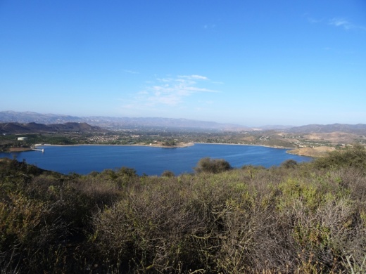
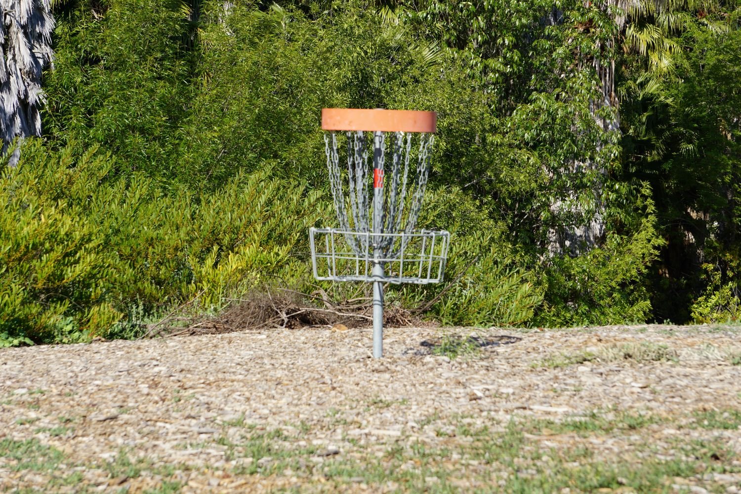
Coyote Point Disc Golf Course is an 18 hole course located at Lake Casitas, 11311 Santa Ana Road, Ventura.

Chaparral Park, located at 217 N. Medea Creek Lane in Oak Park, has a newer 10 hole course. Course map at THIS LINK (that link also provides detailed instructions on how to play!). Park is managed by the Rancho Simi Recreation and Park District (RSRPD). Learn more at www.rsrpd.org/business_detail_T9_R25.php.

Also managed by RSRPD is a 12 hole disc Sycamore Park Disc Golf Course at Sycamore Park, 855 N. Planetree Avenue, Simi Valley. Detailed map and instructions at THIS LINK.

There is yet another disc golf course located at Sequoia Park, 2150 Tracy Avenue, Simi Valley. Also managed by RSRPD, this is a 9-hole course. Course map and instructions at THIS LINK.

Finally, there is a 9-hole disc golf course located at Lake Piru Recreation Area, 4780 Piru Canyon Road, Piru.

Frederick R. Weisman Museum of Art at Pepperdine University in Malibu

Located on Pepperdine's main campus at 24255 Pacific Coast Highway in Malibu, the Frederick R. Weisman Museum of Art is a small art museum with rotating exhibits year-round, as well as "meet the artist" events, family art events and more.

The museum, which opened in 1992, is open Tuesday through Sunday, 11 a.m. to 5 p.m., and is closed on major holidays. There is no admission charge.

For more information, call (310) 506-4851, or visit arts.pepperdine.edu/museum.

Satwiwa Native American Indian Culture Center in Newbury Park

The Satwiwa Native American Indian Culture Center is located at Rancho Sierra Vista / Satwiwa in Newbury Park. Sycamore Canyon, which cuts through Rancho Sierra Vista/Satwiwa and Point Mugu State Park, was part of a Chumash trade route. Satwiwa, which means "the bluffs," was the name of a nearby Chumash village.

View of the Satwiwa area with the Center on the right and an Indian village area on the left.

View of the Satwiwa area with the Center on the right and an Indian village area on the left.

In the Center is a variety of native Chumash items. Native American workshops, programs and art shows occur throughout the year. The Center is open 9 am to 4 pm on weekends, with rangers on hand to answer questions. There's a small gift shop in the Center too, as well as restrooms and a water fountain.

There is a Chumash house, or 'ap, on the grounds of the Center. It is made with willow trees and tule.

There is a Chumash house, or 'ap, on the grounds of the Center. It is made with willow trees and tule.

Inside the Culture Center. The table contains items that children are encourage to touch.

Inside the Culture Center. The table contains items that children are encourage to touch.

Small but nicely appointment gift shop in the Center has something for everyone.

Small but nicely appointment gift shop in the Center has something for everyone.

Park in the adjacent National Park Service parking lot via Lynn Road to the access road at Via Goleta in Newbury Park.

Visit www.nps.gov/samo/planyourvisit/satwiwa-native-american-indian-culture-center.htm for more information.

Access point to the Rancho Sierra Vista / Satwiwa area in the Santa Monica Mountains National Recreation Area off of Lynn Road in Newbury Park.

Access point to the Rancho Sierra Vista / Satwiwa area in the Santa Monica Mountains National Recreation Area off of Lynn Road in Newbury Park.

Rancho Sierra Vista / Satwiwa in Newbury Park

RanchoSierraVistaEntry.jpg

We are fortunate to have such great trails and views of Boney Peak from in Newbury Park. At Wendy and Potrero is the Western edge of the Santa Monica Mountains where Sycamore Canyon cuts through Rancho Sierra Vista/Satwiwa and Point Mugu State Park.

SatwiwaSign.JPG
Satwiwa.jpg

Roughly a mile easy hike from Wendy/Potrero gets you to the Satwiwa Native American Indian Culture Center where you can explore some native Chumash items and educational information and chat with rangers. This is a nice little hike to take the kids on. There are restrooms and water at the center, which is open from 9am to 4pm on weekends.

Learn more about hiking in Rancho Sierra Vista/Satwiwa at THIS LINK.

You can get easier access to the center by parking in the adjacent National Park Service parking lot via Lynn Road to the access road at Via Goleta in Newbury Park.

Another mile and a half of hiking gets you to a small waterfall, which is fun to check out with the kids but somewhat more strenuous of a hike. Note that in recent years (2012-2015), the waterfall has barely flowed due to low rainfall.

Here is more information about the Boney Mountain Trail, leading up to Hidden Valley Overlook, the waterfall and Danielson Monument.

SatwiwaCircle.JPG

Visit www.nps.gov/samo/planyourvisit/rsvsatwiwa.htm for a map and site information on the National Park Service website.

BoneyViewsSatwiwa.jpg
SatwiwaTrails.JPG
WendyPotreroTrailhead.JPG

Trailhead at the corner of Wendy Drive and Potrero Road in Newbury Park. Park on the dirt on the south side of Potrero or on the street on Wendy.

Conejo Canyons Open Space in Thousand Oaks

Pedestrian bridge that provides access into the conejo canyons Open Space

The Conejo Canyons Open Space in the Western Plateau area of Thousand Oaks is a 1,430 acre area with over 10 miles of trails to explore. It also ties in to Wildwood Park. Visit cosf.org/conejo-canyons for trail maps.

The main entrance to the Conejo Canyons Open Space is via a pedestrian bridge accessed off of Santa Rosa Road. Coming from Thousand Oaks, take Moorpark Road north down the Norwegian Grade, where it intersects with Santa Rosa Road. Continue about 3.7 miles on Santa Rosa Road and make a left on Hill Canyon Road. Drive down Hill Canyon Road and you will see a large, flat dirt parking area on the right, adjacent to Santa Rosa Valley Regional Park.

Sign on Santa Rosa Road at Hill Canyon (coming from Camarillo)

Sign on Santa Rosa Road at Hill Canyon (coming from Camarillo)

Parking area on Hill Canyon Road, as seen from the Canyon Overlook Trail leading to Lizard Rock.

Parking area on Hill Canyon Road, as seen from the Canyon Overlook Trail leading to Lizard Rock.

Park and you'll see the bridge just south, which takes you to the Hill Canyon Trail, a flat path that after a mile takes you to an intersection. At the intersection, you can turn around, go straight ahead to the Hawk Canyon Trail, take a right turn to the hilly Western Plateau Trail or veer left to make your way to the Arroyo Conejo Trail that ultimately takes you about 2 1/2 miles to the Rancho Conejo Playfields in Newbury Park.

Hill Canyon Trail - one of the flatest trails in the Conejo Valley

Fork in the Hill Canyon Trail - Straight ahead to the hawk Canyon Trail or right to the hilly Western Plateau Trail

Or go west to the steep Canyon Overlook Trail, a zig zagging hill that takes you to Lizard Rock in Wildwood Park. The hill is a fun challenge with the kids and you'll be rewarded with great panoramic views towards Boney Mountain, Camarillo, Ojai and Simi.

In May 2024, the Conejo Open Space Conservation Agency premiered the new Conejo Canyons Bridge in this area, connecting Hill Canyon to the Western Plateau.

The Conejo Canyons Bridge was completed in May 2024, providing a connection between Hill CAnyon and the Western Plateau.

Sierra Vista Trail in Newbury Park

The Sierra Vista Trail in the Dos Vientos section of Newbury Park is a roughly one mile long trail that connects the Vista Del Mar Trail on the west to the Potrero Ridge Trail on the east. The entry point on the west side is off of Rancho Dos Vientos just south of Via El Cerro and on the east side is on Via Las Brisas near Paseo Santa Rosa. As with most trails in this area, you will be treated with some great views of the surrounding mountains and neighborhoods. This trail is maintained by the Conejo Open Space Foundation.

SierraVistaTrail_1.JPG
SierraVistaTrail_2.JPG
SierraVistaTrail_3.JPG
SVistaBoney.JPG

Skateboarding Hall of Fame and Museum in Simi Valley

The Skateboarding Hall of Fame and Museum opened at the Simi Valley Town Center in December 2018. It is located directly across from the Vans store in the mall in a space of over 10,000 square feet.

The International Skateboarding Hall of Fame is a 501(c)(3) non-profit founded by Todd Huber. It was created to honor the passion, dedication and contributions to skateboarding history and culture by skateboarders and cultural icons through the decades.

The museum displays hundreds of skateboards and other skating artifacts spanning decades. There is also an art gallery, gift shop, theater/library (over 600 skating videos as well as skating magazines) and skate shop.

Also on site is s skate park with a fun wall ride available to local youth. Cost is $15 (as of January 2026).

Admission to the museum is free. Donations to the non-profit are always welcome.

Visit www.skateboardinghalloffame.org for more information. Hours as of January 2026 are Wed-Fri 2-8pm, Sat 11am-8pm and Sun noon-5pm.

Vista Del Mar Trail in Newbury Park

Trail access off of Via Ricardo in Newbury Park (Dos Vientos section).

Trail access off of Via Ricardo in Newbury Park (Dos Vientos section).

Other end of trailhead off of Via Ricardo.

Other end of trailhead off of Via Ricardo.

The Vista Del Mar Trail is a 2 1/2 mile long trail along the west side of the Dos Vientos residential development in Newbury Park. The trail is maintained by the Conejo Open Space Conservancy Agency.

The trail can be accessed near the corner of Via Ricardo and Via Rincon (parking on Via Ricardo). The other end of the trail is near the corner of Rancho Dos Vientos and Via El Cerro (where there is no parking on Rancho Dos Vientos).

"Vista Del Mar" is Spanish for "View of the Sea" and while the overcast early morning photos below do not show it, on a clear day you will indeed be able to see down the Potrero Grade to the Pacific Ocean and Channel Islands. The Vista Del Mar trail also provides views to Camarillo and the Oxnard Plain.

The trail is nice and wide, good for walkers, runners and cyclists.

The trail is nice and wide, good for walkers, runners and cyclists.

The north section of the trail before intersecting with the Edison Fire Road Trail is where the "Twin Ponds" are. The image below of one of the ponds was taken after the Springs Fire of May 2013 ravaged the area. More on the Twin Ponds Conservation Area at this link.

DosVientos5.5.13_12.JPG

The Twin Ponds are more easily accessed via the northeast Vista Del Mar trailhead near the corner of Via Ricardo and Via Rincon. About a mile.

VistaDelMar_priprsign.JPG
VistaDelMarTrail_priprpsign2.JPG

About 1/4 mile into the trailhead from Via Ricardo, you'll reach this junction. Veer right to the single track public access trail, as the trail to the left is on private property.

Lone bench on the Vista Del Mol trail that has views to the Channel Islands on a clear day

Lone bench on the Vista Del Mol trail that has views to the Channel Islands on a clear day

The Vista Del Mar trail connects on the southeast to the Sierra Vista Trail, which in turn connects to the Potrero Ridge trail, with an endpoint on Reino Road.

Views from the Vista Del Mar Trail on a clear morning.

Views from the Vista Del Mar Trail on a clear morning.

Map courtesy of the Conejo Open Space Foundation

Map courtesy of the Conejo Open Space Foundation

Sunset Hills Trail in Thousand Oaks

SunsetHillsTrail_sign.JPG

The Sunset Hills Trail is easily accessible off of Erbes Road in Thousand Oaks, just 7/10ths of a mile north of Sunset Hills Boulevard, just past Fernleaf Court.

There's a triangular dirt parking lot on the east.

There's a triangular dirt parking lot on the east.

This is a pretty easy mile or so trail that takes you past the Bard Lake Reservoir. The reservoir is of course is fenced in but you'll be treated to its beauty as you make your way up. Lake Bard is owned by the Calleguas Water District for storage of up to 10,000 acre-feet (3.3 billion gallons) of water used to meet peak summer demand and emergency requirements.

SunsetHillsTrail2.JPG

In fact, most all the way up this fairly gentle, hilly slope, you'll get some great panoramic views of the entire area, including the Conejo Valley, Simi Hills and looking west towards Camarillo/Oxnard. Continue east and you will reach the Woodridge Open Space in Thousand Oaks.

SunsetHillsTrail1.JPG
SunsetHillsTrail4.JPG

The Sunset Hills Trail is maintained by the Conejo Open Space Conservation Agency. More information at cosf.org/trails/other-trails/easy-hike-sunset-hills-trail.

SunsetHillsTrail5.JPG

An additional, and perhaps more popular hike provides even better view of the Bard Reservoir. Take the additional loop in the shape of Maine (kind of) either clockwise or from the first juncture or counterclockwise after cresting the hill. If you go to the top of the hill take the trail on the left and continue onwards. You will see some steps and a bench to take in the views along the way.

(Map courtesy of the conejo Open Space Foundation) Green highlighted section is a nice loop to hike - good family hike.

After cresting the first hill from Erbes Road, find the loop trail on the left.

After cresting the first hill from Erbes Road, find the loop trail on the left.

A short walk to this bench that overlooks Bard Reservoir.

A short walk to this bench that overlooks Bard Reservoir.

Continue on the trail until it loops around and goes south., parallel to Highway 23

Continue on the trail until it loops around and goes south., parallel to Highway 23

Soon you will be back at the main trail, passing through this tree-tunneled section.

Soon you will be back at the main trail, passing through this tree-tunneled section.

Angel Vista Peak in Newbury Park

AngelVistaBench_June2013_2.JPG

The 1,530' elevation Angel Vista Peak in Newbury Park may well have the most spectacular views of the Conejo Valley. You can see the entire Conejo Valley, stretching from the Conejo Grade to central Thousand Oaks, Agoura Hills, Hidden Valley, Boney Mountain and beyond!

Angel Vista can most easily be accessed via the Rosewood Trail at the southern terminus of Regal Oak Ct, off of Lynn Road). The trail is approximately 3 miles round trip to the top and back. There is a picnic table and nearby bench at the peak.

Or for a much longer hike, take the Los Robles Trail (either the Thousand Oaks side accessible at South Moorpark Road and Greenmeadow Ave or Newbury Park side off of Potrero Road).

The Conejo Open Space Foundation provides a useful map at cosf.org/trails/los-robles.

You'll eventually see this sign if you make the trek up the Rosewood Trail.

You'll eventually see this sign if you make the trek up the Rosewood Trail.

The bench is in sight!

The bench is in sight!

AngelVista4 - Copy.JPG
AngelVista5 - Copy.JPG
Fun to see at least a portion of Hidden Valley from up here.

Fun to see at least a portion of Hidden Valley from up here.

Rocky Peak Park in Simi Valley

RockyPeakPark_trailhead.JPG

The 4,800 acre Rocky Peak Park is located in the Santa Susana Mountains, adjacent to the 118 freeway between Yosemite Avenue and Rocky Peak Road in Simi Valley. It is visually stunning to see as you drive up the 118 grade east towards the San Fernando Valley.

View of Rocky Peak Park from Highway 118 driving eastbound

View of Rocky Peak Park from Highway 118 driving eastbound

There are large sandstone structures, unusually balanced rocks, caves and other interesting formations throughout Rocky Peak Park. Plenty to explore and views abound!

The main entrance to the park is the Rocky Peak Trail, which runs north/south over about five miles of fire roads. It is moderately strenuous, with lots of hard, rocky surfaces, so make sure to wear solid shoes for this trail. Be prepared for panoramic views of Simi Valley and the San Fernando Valley as the trail is nearly on the Ventura/Los Angeles County line.

To get there from the west, take the 118 east to Rocky Peak Road. The trailhead is across (north of) the freeway, but parking is very limited, so plan to park on Santa Susana Pass Road, where plenty of street parking is available - just turn right at the end of the offramp and you’re there.

Lots of rocky surfaces on the Rocky Peak Trail as you can see

Lots of rocky surfaces on the Rocky Peak Trail as you can see

Trails that intersect the Rocky Peak Trail going east/west include the Hummingbird Creek Trail, Chumash Trail and Las Llajas Canyon Trail. Not far into Rocky Peak Trail you'll see a sign that indicates the Hummingbird Creek Trail.

No doubt about it...you'll have some really nice views of Simi Valley from up here!

No doubt about it...you'll have some really nice views of Simi Valley from up here!

After reaching the 2,715 foot Rocky Peak and taking in the views, if you're up to it you can continue north where you will pass by the Chumash Trail and Las Llajas Canyon Trail.

The Rocky Peak Trail terminates north of Blind Canyon in Las Llajas Canyon. You must then double back to return to the trailhead, or take the three mile Chumash Trail down to the westernmost boundary of the property at the end of Flanagan Drive in Simi Valley.

Chumash Trail is about 3 miles of steady climb from Flanagan Drive. To get to the Chumash Trail trailhead, take the 118 to Yosemite, go north, turn right on Flanagan to the end. Park on the street.

The Hummingbird Trail was built by the Rancho Simi Recreation and Park District, starting near Kuehner Drive and the 118 Freeway. The trail leads up to the main Rocky Peak Trail. During and just after the rainy season, the trail passes cascades flowing down the sandstone boulders and cliffs. It is about 2 miles or so each way. Take the 118 to Kuehner, go north to the parking area about a quarter of a mile away.

Clearly marked sign on Rocky Peak Trail showing the Hummingbird Trail turnoff

Clearly marked sign on Rocky Peak Trail showing the Hummingbird Trail turnoff

Rocky Peak Park is maintained by the Santa Monica Mountains Conservancy. Learn more at mrca.ca.gov/parks/park-listing/rocky-peak-park. Dogs are allowed on these trails on leash.

Peering down upon the northwest San Fernando Valley from Rocky Peak.

Peering down upon the northwest San Fernando Valley from Rocky Peak.

Lake Eleanor Open Space Hike in Westlake Village

For a nice, fairly moderate hike in Westlake Village, take Triunfo Canyon Road south to Highgate Road and head up to the southeast endpoint of Highgate, past Hillsbury Road, to the end of the road, where you'll see a trailhead sign. Park on the street.

It doesn't actually say "Lake Eleanor Open Space Hike" but this is indeed the way to get to this trail maintained by the Conejo Open Space Foundation (COSF).  Walk past the fence on the pavement, and in about 60 steps, the trailhead is on the right. There's no sign. In fact, I've never seen any signs indicating which way to go on this trail. But once you reach this path, for the most part the trail is pretty obvious.

COSF has some helpful images and a trail map at cosf.org/trails/other-trails/easy-lake-eleanor-open-space-hike.

There are some brief, slightly challenging hilly sections on this hike, along with some rocky sections, but for the most part, this trail is perfectly fine for all ages. I generally wouldn't recommend strollers on this trail though because of these sections, but if you have a solid off-road stroller, it is possible.

LakeEleanorTrail.JPG
After record rainfalls in January/February 2017, this place is looking quite green.

After record rainfalls in January/February 2017, this place is looking quite green.

On the left you'll see the beautiful Las Virgenes Reservoir for most of the 1 1/2 mile hike.

You can't go swimming in the Las Virgenes Reservoir but it sure makes for gorgeous views.

You can't go swimming in the Las Virgenes Reservoir but it sure makes for gorgeous views.

Towards the endpoint (Denver Springs Drive), on the right you can look down towards Westlake Boulevard/Decker Canyon and see the eight acre Lake Eleanor. Pretty cool to see from above as it is not accessible to the public.

There is also a trailhead and some parking on Hillsbury Road.

The main trail is on the left; veer right however for best views of Lake Eleanor.

The main trail is on the left; veer right however for best views of Lake Eleanor.

Lake Eleanor along with the Lake Eleanor Dam (also called Banning Dam) and surrounding 529 acres of open space has been named City of Thousand Oaks Historical Landmark #9. 

Lake Eleanor, which is fenced off to protect the wildlife, is clearly visible from the trail.

Lake Eleanor, which is fenced off to protect the wildlife, is clearly visible from the trail.

I love this little hike. It is quiet and peaceful and the views are just wonderful up here. And you are just minutes from civilization.

CLICK HERE FOR DOZENS OF OTHER GREAT HIKING TRAILS AROUND VENTURA COUNTY

Chumash Trail in Simi Valley

The Chumash Trail in Simi Valley is a roughly 2.7 mile trail that takes you from near Chumash Park to the trailhead at the north end of Flanagan Drive to the Rocky Peak Trail. It is a moderate, uphill trail with plenty of views of Simi Valley. No trees and thus no shade. Dogs allowed on leash.

To get to the Chumash Trail trailhead, take the 118 to Yosemite, go north, turn right on Flanagan to the end. Park on the street. More information at www.rsrpd.org/business_detail_T9_R11.php.

Sandstone formations appear on the upper portion of the trail.

Sandstone formations appear on the upper portion of the trail.