The Twin Ponds Conservation Area in the Conejo Open Space is Protected Land

The Twin Ponds Conservation Area in Dos Vientos is part of the open space lands of the Conejo Open Space Conservation Agency and is protected by a conservation easement to the California Department of Fish and Game.
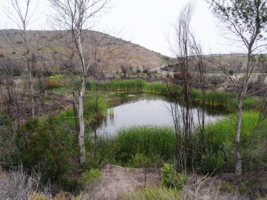
July 2014

July 2014

January 2015

January 2015

May 2016

May 2016

The ponds were originally constructed in the 1920s as part of the irrigation system for agricultural and cattle ranching operations at Dos Vientos Ranch. Today they serve as important habitat for Two Striped Garter Snakes and larger animals such as deer, bobcat, coyote and mountain lions that depend on a reliable source of water. Migrating waterfowl are occasionally abundant, especially in winter.

TwinPondsDV1.JPG

COSCA and Fish & Game ask that we enjoy this scenic area but protect the ponds for the future and ask that we do not enter the water or allow dogs/horses to enter the water, disturb or remove any animal or plant or place any plants or animals, including fish, into the ponds.

To explore the ponds, take the Vista Del Mar Trail from one of several access points in the Dos Vientos area, including the corner of Via Ricardo and Via Rincon and the corner of Rancho Dos Vientos and Via El Cerro. This is a fun little hike to take the kids on and the ponds are only about a mile from the Via Ricardo/Via Rincon trailhead.

Twin Ponds? What ponds? The ponds are completely dried up as of August/September 2016.

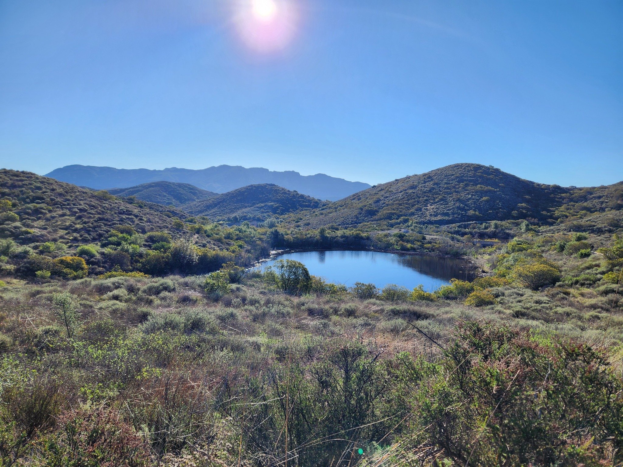
Twin Ponds? What ponds? The ponds are completely dried up as of August/September 2016.

January 2024

Late March 2024 - looking great!
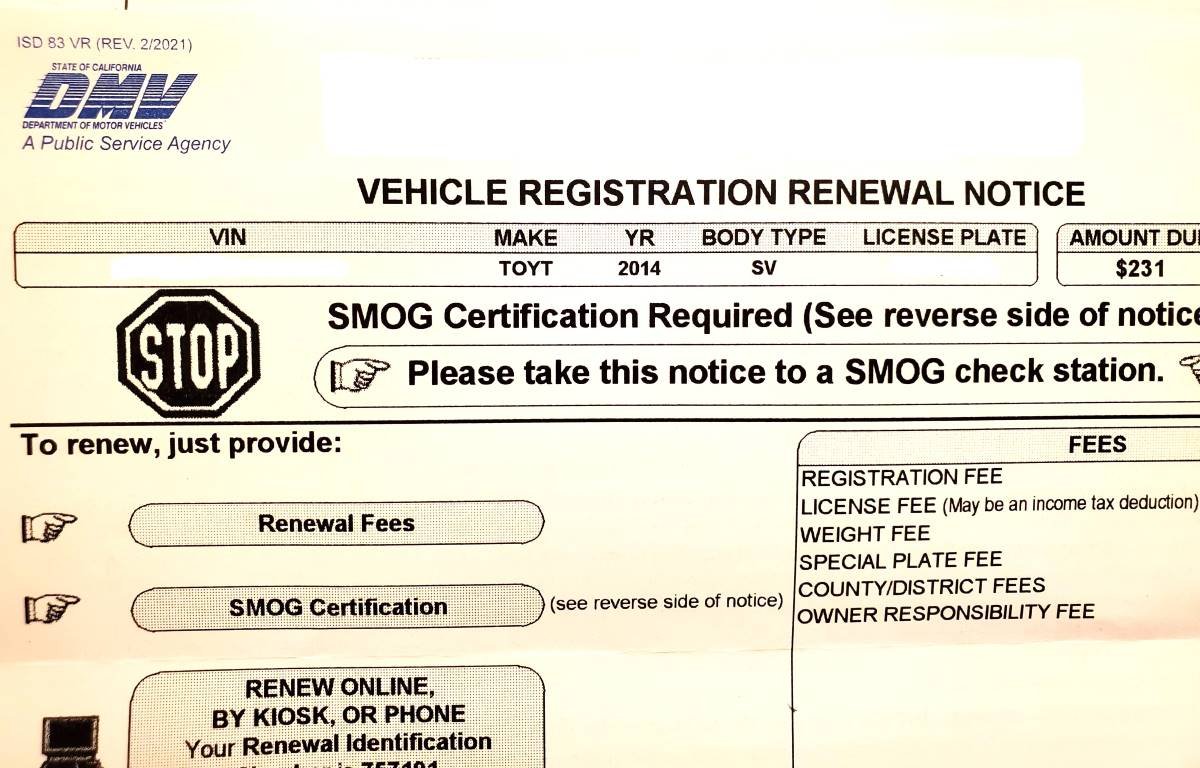
State of California Smog Check Program Requirements

I was about to renew my auto registration online as I’ve done mindlessly for many years, until I looked more carefully at the notice and I read the dreaded “STOP: SMOG Certification Required” imprinted near the top of the notice. I’ve owned the minivan for eight years and wondered, why NOW!?

The California Smog Check Program has been in place since 1984 and is administered by the Bureau of Automotive Repair, or BAR. BAR licenses independently owned smog check stations throughout the state.

THE BASICS

The BAR indicates a smog check is required EVERY OTHER YEAR as part of the vehicle registration process. It is also required when a vehicle changes ownership or when it is registered for the first time in California.

Every other year? That can’t be, because this was the first time I’ve been asked to do a smog check in the eight years since I owned the car, right?

The BAR goes on to explain that gasoline-powered vehicles, hybrid vehicles and alternative-fuel vehicles that are model year 1976 and newer require a smog check, with the following exceptions:

  • Eight model years and newer do not require a biennial smog check.

  • Four model years and newer do not require a change-of-ownership check.

In English, this means you need to add 8 to the model year of your vehicle to determine when you need to start doing biennial, or every other year, smog checks. For example, my 2014 minivan needed a smog test starting in 2022. And if I purchase a used 2018 vehicle in 2022, it would be subject to a smog check.

SMOG CHECKS ARE NOT REQUIRED FOR:

  • 1975 or older vehicles

  • Eight model years or newer vehicles

  • Four model years or newer vehicles changing ownership

  • Electric vehicles

  • Motorcycles

  • Tricycles (OK, I decided to throw this in to make sure you were paying attention.)

  • Diesel vehicles model year 1997 and older

  • Diesel vehicles with a gross weight of over 14,000 pounds

OTHER

Wait a second, my 2014 minivan is eight years old. Why this year, not next year, for the first smog check? Because the state assumes that model years are released in the calendar year prior to a vehicle’s model year. So regardless whether I purchased my brand new 2014 minivan in 2013 or 2014, it is assumed to be one model year old in 2014. That means, it is theoretically turning nine model years old in 2022. Hence, the need for a smog check for the first time in 2022.

If your smog check passes, hurray! The smog “certificate” is electronically submitted to the DMV and you are on your way to renew your vehicle registration. If it fails the test, you need to get it fixed, or you can visit a “smog check referee” for a second opinion.

“But I don’t want to get a smog check!” Well, then buy an electric car or a model 1975 or older car. Or buy a new car before your car turns eight model years old. Or move to a state like Alabama that doesn’t require emissions testing.

State Route 23 Between the 101 and 118 is Dedicated to Japanese American World War II Soldiers

Moorpark Freeway section of SR 23 taken from Marview Trail in Thousand Oaks.

Moorpark Freeway section of SR 23 taken from Marview Trail in Thousand Oaks.

State Route 23 stretches from Malibu to Fillmore in three sections. The south section is the winding, hilly Decker Canyon Road that connects Pacific Coast Highway to Westlake Village and Hidden Valley. This section is approximately 10 miles from PCH to the Potrero Road intersection, but generally takes 20 to 25 minutes to drive.

SR 23 continues as Westlake Boulevard to the Ventura Freeway (U.S. Route 101), where it runs concurrent with the 101 north a couple miles until you reach the Moorpark Freeway overpass. This is another 4 to 4 1/2 miles.

The most visible section of SR 23 in Thousand Oaks is the Moorpark Freeway, which stretches from the 101 to the Los Angeles Avenue exit in Moorpark; about 8 miles. This middle section of the 23 was named the Military Intelligence Service Memorial Highway in 1994 by the California State Assembly. The renaming was made in honor of Nisei, or Japanese American, Soldiers of World War II who served in units of the U.S. Armed Forces comprising the 100/442/MIS triad (Military Intelligence Service, 100th Infantry Battalion and 442nd Regimental Combat Team). **

Military Intelligence Service Memorial Highway sign

Military Intelligence Service Memorial Highway sign

The northern section of SR 23 begins at Los Angeles Avenue (SR 118) in Moorpark and goes north as Grimes Canyon Road, ending at SR 126 in Fillmore. This is about a 12 mile stretch includes some eye opening, hilly twists and turns in the Grimes Canyon Road area.

The total length of SR 23 is about 32 miles.

** Some additional clarification from the 1994 legislation: Segments of State Highway Routes 23 and 99 are officially designated as follows: (a) State Highway Route 23, from Highway 101 to Highway 118, as the Military Intelligence Service Memorial Highway. (b) State Highway Route 99, between the Cities of Fresno and Madera, as the 100th Infantry Battalion Memorial Highway. (c) State Highway Route 99, between the Cities of Salida and Manteca, as the 442nd Regimental Combat Team Memorial Highway. Each of the signs to also include "A unit of the 100/422/MIS triad.

Fireworks Hill in Thousand Oaks Has Hosted the City's Fireworks Show for Decades

So called "Fireworks Hill" is located in the center of Thousand Oaks, enveloped by McCloud Avenue on the northwest, St. Charles Drive on the northeast, Wilbur Road on the east, Marin Street on the south and Hillcrest Drive on the southeast.

The hill is passed by tens of thousands of commuters each day as it can clearly be seen from the 101. 

For decades, the annual City of Thousand Oaks 4th of July Fireworks have been launched from this hill, a 27 acre parcel that was acquired by the City of Thousand Oaks in 1994. According to an April 7, 1994 Los Angeles Times article, the top of the hill was graded three decades prior.

According to minutes from the April 5, 1994 City Council meeting, city council voted by a 3 to 2 vote to acquire the property from the Robert A. Franklyn Estate for $540,000, plus $5,000 in estimated escrow closing costs.

The fireworks launched from this site can be seen from quite a large radius in the surrounding area. Here's to a great Independence Day!

Independence Day events and activities throughout Ventura County

Fireworks Hill shown here in early January 2016, when three were snow capped peaks in the background.

Fireworks Hill shown here in early January 2016, when three were snow capped peaks in the background.

Mugu Rock at Point Mugu

Point Mugu is an unincorporated part of Ventura County that is derived from the Chumash word Muwu, or beach. Other than the Naval Base, probably the most well known fixture in Point Mugu is the Mugu Rock. Mugu Rock is a large rock formation that was formed when Pacific Coast Highway was built and cut through the mountain that now resides on the other side of PCH. Before PCH was built, a road went around the rock, where a chain link fence has been placed to keep people away from this hazardous area adjacent to the Pacific Ocean.  PCH was cut through Point Mugu from October 1937 to February 1940, according to this interesting KCET article.

MuguRock_pch.JPG

Mugu Rock is located just a few miles near the northwest tip of PCH before it veers north towards Oxnard. It is about a 10 mile drive from the Camarillo Premium Outlets and about 20 miles from the heart of Thousand Oaks taking either the 101/Lewis Road route or the slightly slower, curvy and interesting Potrero Road route.

Professional landscape and wildlife photographer Greg Clure of Newbury Park has shared a couple neat images facing Mugu Rock from the south. Visit Greg's website at www.gregclurephotography.com for more of his outstanding work.

ClureMuguRock2.jpg
ClureMuguRock1.jpg

And here is some not so professional video footage of Mugu Rock from the north.

Hike to the Teepee, Paradise Falls and Little Cave at Wildwood Park in Thousand Oaks

One hiking experience that everyone in the Conejo Valley and neighboring areas has to experience is Wildwood Park. With 14 trails covering 17 miles in the nearly 1,800 acre park managed by the Conejo Open Space Conservation Agency, there is plenty to see and do in Wildwood Park.

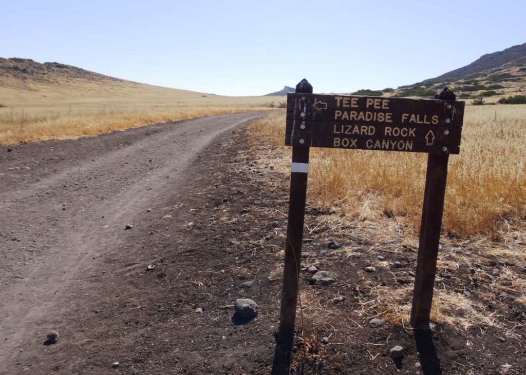
One particularly fun and fairly easy family hike at Wildwood takes you from the main parking lot at the west end of Avenida de los Arboles to the Teepee, Paradise Falls and Little Cave (formerly Indian Cave**). Take the Mesa Trail about a 3rd of a mile until you see the sign below, then take a left.

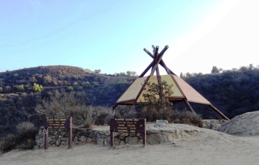
Another third of a mile and you're at the teepee, where you'll find another clearly marked sign pointing you in the direction of Paradise Falls.

Another third of a mile and you're at the teepee, where you'll find another clearly marked sign pointing you in the direction of Paradise Falls.

WildwoodTeepee3.JPG

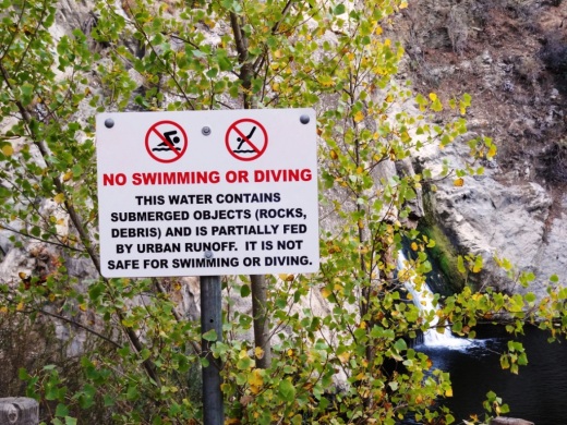
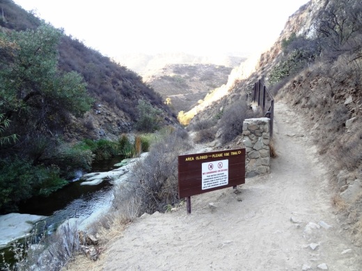
Hike down some switchbacks and stairs and you'll see be at the beautiful Paradise Falls. Always a fun place to take the kids, though we're warned not to go into the water, which is largely urban runoff.

ParadiseFalls2.JPG
ParadiseFalls4.jpg

But it is sure popular and enjoyable to sit back and enjoy this year-round waterfall that is so nicely hidden yet so close to hustle and bustle of suburban Thousand Oaks.

ParadiseFalls11.3.13.JPG

The Little Cave is roughly half a mile east of Paradise Falls and can be accessed from the trail directly above the falls or by hiking back up to the teepee and going the other direction.

Trail adjacent to Paradise Falls that takes you towards the Indian Cave.

Trail adjacent to Paradise Falls that takes you towards little Cave.

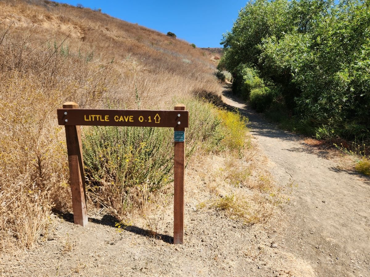
A quarter of a mile or so and you'll see the sign below.

Little Cave (Formerly Indian Cave) sign

Here's the sign indicating you are near the Indian Cave in Wildwood Park.

Formerly called indian cave

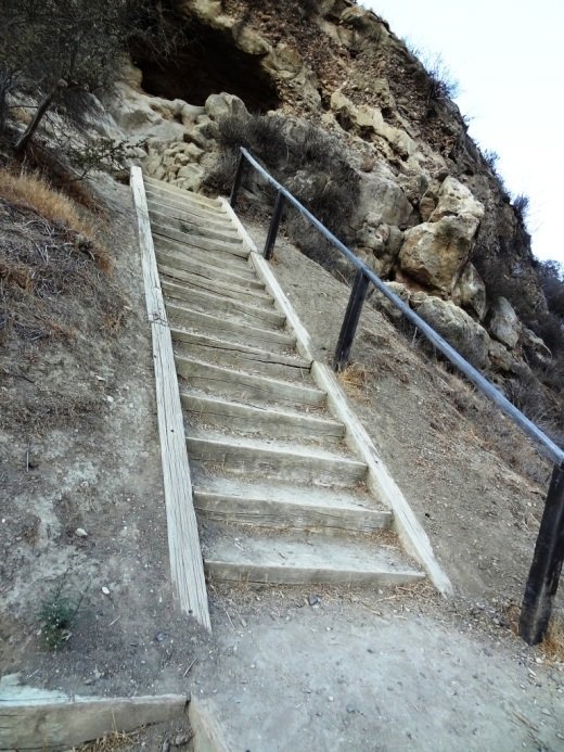
Another 100 yards or so and you've reached the staircase that will take you up to the Cave.

Large enough to actually hang out in, though the last time we walked in there were signs of rodents.

Large enough to actually hang out in, though the last time we walked in there were signs of rodents.

IndianCave5.JPG

You can literally climb through the cave to an exit at the top and hike your way up to a connector trail that will lead you back towards the parking lot. My kids love this and so do I!

** The change in name was approved by the Conejo Open Space Conservation Agency (COSCA) in May 2022. COSCA received a request to change the Indian Creek Trail name earlier that year. On its own, the work "Indian" refers to individuals from India, rather than Native Americans, and thus did not accurately reflect the origin of the people to whom it refers.

The Indian Cave and Indian Cave Trail were renamed Little Cave as it was unclear if the cave was naturally formed and/or historically used by Native Americans.

The Indian Creek Trail in Wildwood Park was renamed Two Springs Trail as two natural springs contribute to the stream flow in this portion of the channel.

A Bit of History Behind the Origination of the Conejo Valley Unified School District

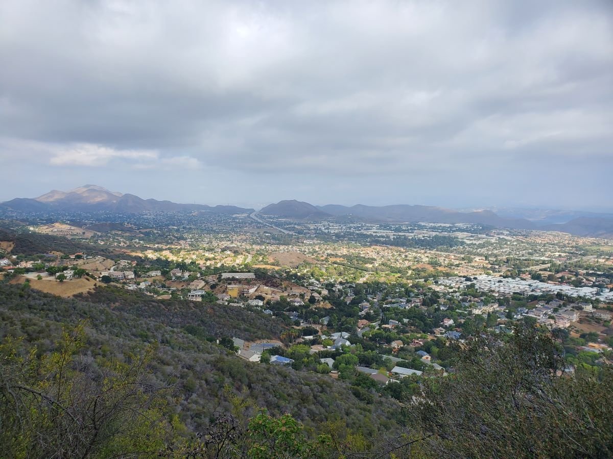
View of the Conejo Valley from the Los Robles Trail in Thousand Oaks

The Conejo Valley spans southeastern Ventura County and northwestern Los Angeles County. Communities in the Conejo Valley include Thousand Oaks, Newbury Park, Westlake Village, Oak Park, Agoura Hills, Lake Sherwood and a portion of Calabasas,

The Conejo Valley Unified School District was created July 1, 1974, unifying the following previous school districts:

  • Timber School District (founded in 1888)

  • Valley Oaks Union School District (founded in 1960 and formerly Conejo School District, founded 1877 and Santa Rosa School District, founded 1912).

  • Newbury Park and Thousand Oaks High Schools (formerly part of Oxnard Union High School District, founded in 1901).

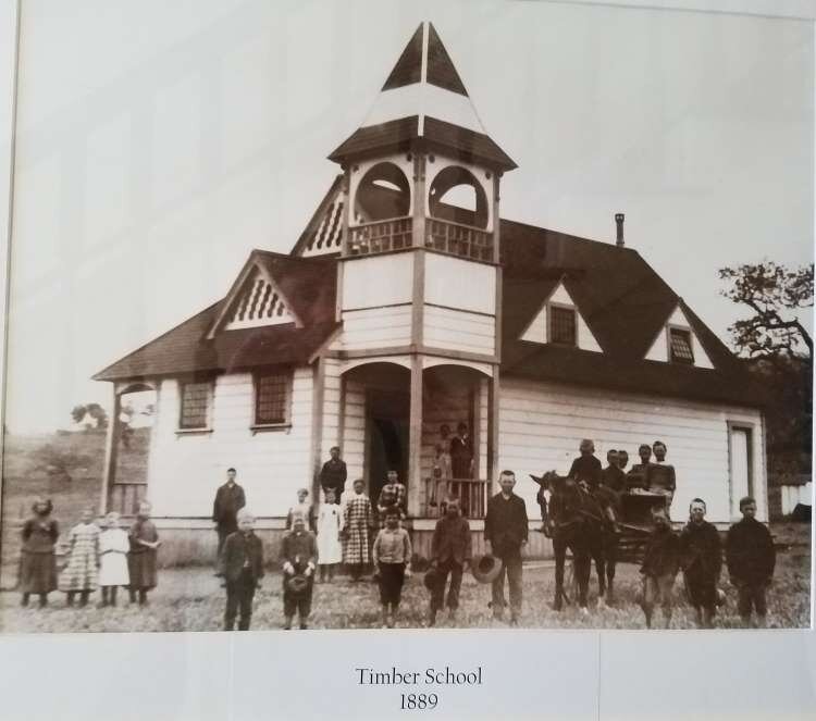
The Timber School was established as the first school in Newbury Park in 1889. The original school was constructed at the intersection of what is now Newbury and Kelley Roads in Newbury Park. The original Timber School was a one room schoolhouse that was demolished to make way for the new, larger Timber School House erected in front of the original school in 1924. The Timber School Auditorium was built in 1948.

The Timber School House and Auditorium buildings at 1872 Newbury Road, Newbury Park represent City of Thousand Oaks Landmark No. 12 and Ventura County Historical Landmark No. 166.

A replica of the original Timber School House was built at the Stagecoach Inn Museum complex in 1995 by students of Newbury Park High School under direction of teacher, Randy Porter.

Replica of the original Timber School at the Stagecoach Inn Museum.

Replica of the original Timber School at the Stagecoach Inn Museum.

Photo of the original Timber School in 1889.

Photo of the original Timber School in 1889.

Formed in 1877, the Conejo School District predates the Timber School District. It was created at a time when there were 126 residents in the Conejo Valley, including 54 children under age 17. After operating for 4 months in a shanty on the ranch of Howard Mills, parents voted to assess $750 for a building that was constructed on two acres of land donated by Mills. The structure was called “Conejo School” and was located near what is now the northwest corner of Westlake Boulevard and Townsgate Road.

As a result of the terrible drought in late 1870s to early 1880s, many ranchers had to leave the area. The Mills property was sold to the Russell family. Abigail Russell, wife of Andrew Russell, struggled to keep the Conejo School open. Eventually, a new Conejo School was built and opened in 1929 at the current location of Conejo Elementary School at 280 N. Conejo School Road in Thousand Oaks. The original school built in 1929 was demolished in 1957 due to unsafe earthquake standards.

Learn more about the Timber School and Conejo School districts on the Stagecoach Inn Museum website at stagecoachinnmuseum.com/timber-school.

Students at Conejo School in 1941 (Photo donated by Gerald Olsen to the Conejo Through the Lens collection, Grant R. Brimhall Library, Thousand Oaks).

Students at Conejo School in 1941 (Photo donated by Gerald Olsen to the Conejo Through the Lens collection, Grant R. Brimhall Library, Thousand Oaks).

Today, the Conejo Valley Unified School District in Ventura County serves Thousand Oaks and its communities of Newbury Park and the Ventura County portion of Westlake Village. As of spring 2025, the district is comprised of the following schools:

  • Four preschool/early child care schools: CVUSD Preschool - Early Childhood Program, Wonder Preschool, Horizon Hills Parenting Program, Be Me Preschool Program (play-based and language enriched program for ages 3 to 5 eligible for special education)

  • Eighteen elementary (K-5) schools: Acacia Magnet School for Enriched Learning, Aspen, Banyan, Conejo Academy of Leadership and Language Immersion, Cypress, EARThS Magnet, Glenwood, Ladera STARS Academy, Lang Ranch, Madroña Academy of the Arts and Sciences, Maple, SHINE Homeschool, Sycamore Canyon, Walnut, Weathersfield, Westlake, Westlake Hills, Wildwood

  • Eight middle schools: Century Academy, Colina, Los Cerritos, Outdoor School, Redwood, Sequoia, SHINE Homeschool, Sycamore Canyon

  • Six high schools: Newbury Park, Thousand Oaks, Westlake, Conejo Valley, Century Academy, SHINE homeschool

  • Homeschool and Hybrid Learning: SHINE: Homeschool Program (TK-12), Century Academy (grades 6-12)

  • Two Adult and Post-Secondary Programs: The Conejo Valley Adult Education, Conejo Oaks Academy (post-secondary program)

The Conejo Valley USD website is www.conejousd.org.