State Route 23 Between the 101 and 118 is Dedicated to Japanese American World War II Soldiers
/
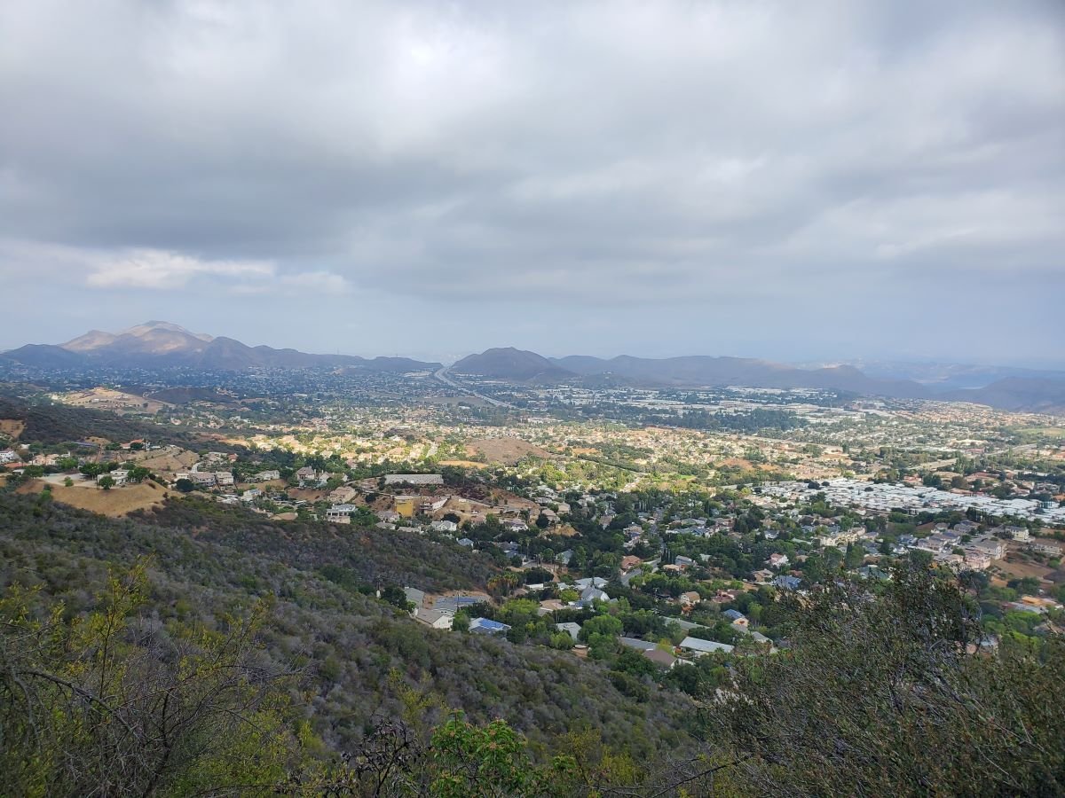
Moorpark Freeway section of SR 23 taken from Marview Trail in Thousand Oaks.
State Route 23 stretches from Malibu to Fillmore in three sections. The south section is the winding, hilly Decker Canyon Road that connects Pacific Coast Highway to Westlake Village and Hidden Valley. This section is approximately 10 miles from PCH to the Potrero Road intersection, but generally takes 20 to 25 minutes to drive.
SR 23 continues as Westlake Boulevard to the Ventura Freeway (U.S. Route 101), where it runs concurrent with the 101 north a couple miles until you reach the Moorpark Freeway overpass. This is another 4 to 4 1/2 miles.
The most visible section of SR 23 in Thousand Oaks is the Moorpark Freeway, which stretches from the 101 to the Los Angeles Avenue exit in Moorpark; about 8 miles. This middle section of the 23 was named the Military Intelligence Service Memorial Highway in 1994 by the California State Assembly. The renaming was made in honor of Nisei, or Japanese American, Soldiers of World War II who served in units of the U.S. Armed Forces comprising the 100/442/MIS triad (Military Intelligence Service, 100th Infantry Battalion and 442nd Regimental Combat Team). **
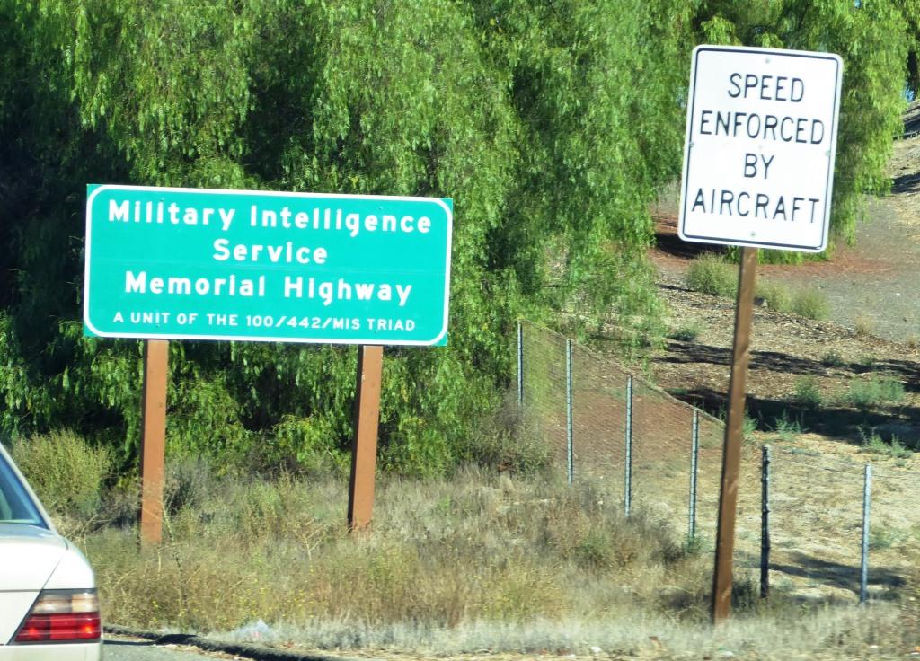
Military Intelligence Service Memorial Highway sign
The northern section of SR 23 begins at Los Angeles Avenue (SR 118) in Moorpark and goes north as Grimes Canyon Road, ending at SR 126 in Fillmore. This is about a 12 mile stretch includes some eye opening, hilly twists and turns in the Grimes Canyon Road area.
The total length of SR 23 is about 32 miles.
** Some additional clarification from the 1994 legislation: Segments of State Highway Routes 23 and 99 are officially designated as follows: (a) State Highway Route 23, from Highway 101 to Highway 118, as the Military Intelligence Service Memorial Highway. (b) State Highway Route 99, between the Cities of Fresno and Madera, as the 100th Infantry Battalion Memorial Highway. (c) State Highway Route 99, between the Cities of Salida and Manteca, as the 442nd Regimental Combat Team Memorial Highway. Each of the signs to also include "A unit of the 100/422/MIS triad.