Reagan Ranch Center Exhibit Galleries in Santa Barbara

ReaganRanchCenterGalleries.jpg

President Reagan’s home for 25 years and the Western White House during the height of the Cold War, the Reagan Ranch embodies the life and ideas of Ronald Reagan. In the spring of 1998, Young America’s Foundation stepped forward to save the Reagan Ranch; eight years later, in June 2006, the Reagan Ranch Center in downtown Santa Barbara opened its doors. 

The Reagan Ranch Center in downtown Santa Barbara is open to the general public for tours and visitation Thursdays and Fridays from 11:00 am to 4:00 pm. Admission is free.

These galleries feature original Reagan Ranch artifacts matched with state-of-the-art, interactive, multimedia exhibits that highlight the history of Ronald Reagan’s quarter-century at Rancho del Cielo and the accomplishments of his presidency.

ReaganRanchCenter1.jpg

Over six hours of dynamic multimedia exhibits provide access to exclusive speeches, interviews, radio addresses, and original video presentations. The centerpiece of the gallery is a 28-foot-long interactive “timeline” that gives users the ability to explore the “Western White House” during the 1980s.

The galleries also feature several unique collections on display, including the Lorraine Wagner Letter Collection, a nearly 300-piece collection of letters written by Ronald Reagan over a 50-year period and the Russell D. Sibert Collection, featuring rare Reagan-related memorabilia such as campaign buttons, posters and commemorative items.

A massive 5,000 pound section of the Berlin Wall greets visitors as they arrive at the Reagan Ranch Center, reminding the world of Ronald Reagan’s role in eliminating this assault on human dignity and freedom. The president’s famous blue Jeep Scrambler, complete with “Gipper” license plate, sits in the center of the gallery, flanked by a selection of his favorite books, an original saddle and chainsaw owned and used by President Reagan.

ReaganRanchGallery2.jpg

The Reagan Ranch Center is designed to engage visitors of all ages; younger children can even earn their “Junior Secret Service Clearance” by completing a fun and educational scavenger hunt.

The Reagan Ranch Center is located at 217 State Street next to the train station.

Hike to the Cross in the Hills Above Cal Lutheran University in Thousand Oaks

Views of Santa Rosa Valley from the hills above CLU.

Views of Santa Rosa Valley from the hills above CLU.

For a quick local hike and a calorie burner, try hiking to the cross in the hills above Cal Lutheran University in Thousand Oaks.

You can park in the CLU lot near the community pool at 100 Overton Court, Thousand Oaks. Then head in the direction of the adjacent baseball fields. Take the path just west of the fields towards the hills. After crossing the bridge, I veer right on the trail.

The hike itself is not particularly picturesque until you get to the top of the hill. On the east end of the hilltop is the prominent cross, along with several benches for enjoying the fruits of your uphill labor. Views extend towards the Santa Rosa Valley on the north and Thousand Oaks on the south.

You can continue your way west up the hill if you’d like. In total, the hike is about a mile to a mile and a half round-trip.

The trails are usually well maintained, though you can slip on the dirt if you don’t have decent traction on your shoes. Couldn’t hurt to bring a walking stick for the steeper, slippery parts of the hill towards the top.

So if you’re really feeling energetic, there’s a trail that takes you to Wildwood Park from these trails. See THIS LINK.

clu cross lr.JPG
As you make your way towards the hill after passing by the baseball fields, you’ll see this sign.

As you make your way towards the hill after passing by the baseball fields, you’ll see this sign.

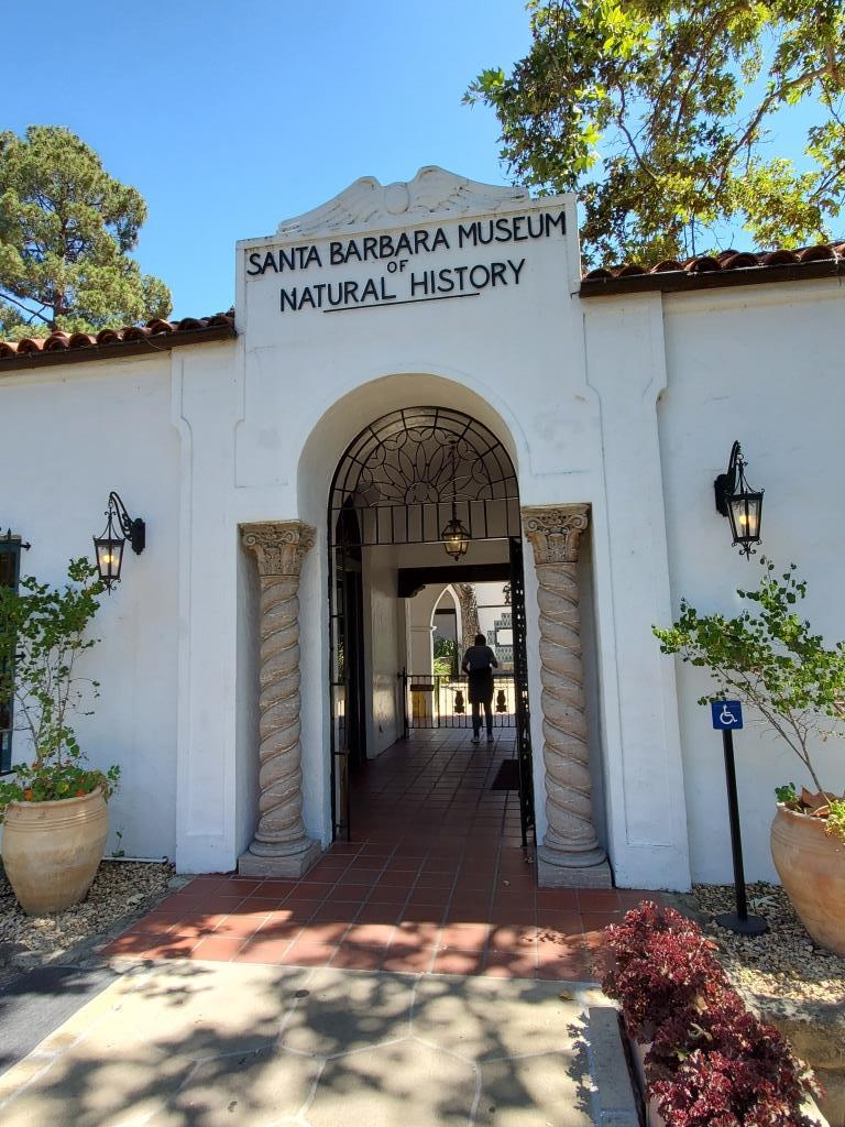
Santa Barbara Museum of Natural History

sbnhm.jpg

Founded in 1916, the Santa Barbara Museum of Natural History makes for a great excursion to Santa Barbara with the kids.  There are eight exhibit halls with permanent exhibits featuring birds, mammals, insects, ocean life, a planetarium and more. Many of the exhibits are "hands on" with buttons and interactive features that kids particularly enjoy. There are an additional two halls for changing exhibits.

You and your kids can roam the nature paths and visit the well stocked gift shop, full of educational items. I can vouch for the fascination kids (and adults) have at this Museum. It is a very comfortable museum that in my experience is rarely is crowded. The "Museum Backyard" area and gardens has a picnic area, stream and other enjoyable features. The pond and stream often have tadpoles that captivate the kids.

The museum is open 7 days a week from 10am to 5pm and is closed certain holidays. As of May 2025, admission is $19 for adults, $17 for 65+ seniors and teens (13-17) and $14 for children 2 to 12 years of age. Become a Museum member and you don't have to pay for admission. Tax-deductible family memberships are currently start at $109 per year.

Santa Barbara Museum of Natural History is located at 2559 Puesta del Sol Road, Santa Barbara. More information at www.sbnature.org or 805.682.4711.

Lang Ranch/Woodridge Open Space Trails in Thousand Oaks

Looking for some spectacular trail hiking and panoramic views stretching from the Conejo Valley to the Simi Hills? Then take a look at the open space trails in the Lang Ranch/Woodridge system in the northeast portion of Thousand Oaks in the Lang Ranch area (where Avenida de los Arboles meets Westlake Boulevard).

The 1,025 acre area is maintained by the Conejo Open Space Conservation Agency (COSCA) and connects with another 8,000 acres of open space that is part of the Santa Monica Mountains. There are 10 miles of well-maintained trails that are outstanding for hiking, running and biking. The views are spectacular and you can actually hike from Thousand Oaks to Simi Valley (via the Long Canyon Trail) and Agoura Hills (Woodridge to Cheeseboro/Palo Comado).

More information about the various trails in the Lang Ranch/Woodridge Open Space on the Conejo Open Space Foundation website at cosf.org/trails/lang-ranch.

The specific trails seen below can be accessed from the Autumn Ridge trailhead at Westlake Boulevard and Autumn Ridge Drive in Thousand Oaks.

Access to this trail is at the corner of Westlake Bd and Autumn Ridge Dr

Access to this trail is at the corner of Westlake Bd and Autumn Ridge Dr

You can get a clear view of Bard Lake (Calleguas Water District Reservoir) from the Sunrise Trail, which parallels to the north of a portion of the Autumn Ridge Trail.

LangRanchTrail4.jpg
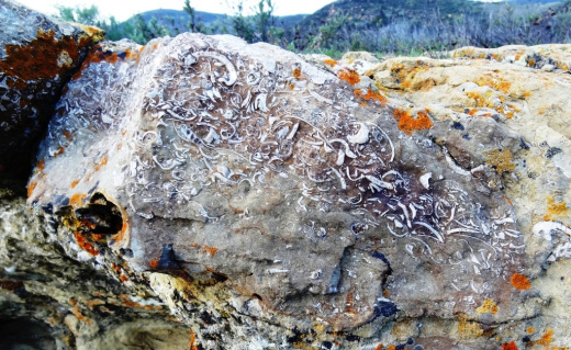
Checking out fossils on display in the open space. Pretty fun to see with the kids. The approximate spot of these fossil rocks is at THIS LINK.

Checking out fossils on display in the open space. Pretty fun to see with the kids. The approximate spot of these fossil rocks is at THIS LINK.

This bench is located at the juncture of the Sunrise and Meadow Vista Trails in the Lang Ranch Open Space and Long Canyon Trail, which is accessible via the Wood Ranch section of Simi Valley. Not a bad view, eh?

This bench is located at the juncture of the Sunrise and Meadow Vista Trails in the Lang Ranch Open Space and Long Canyon Trail, which is accessible via the Wood Ranch section of Simi Valley. Not a bad view, eh?

Trailhead at east end of Lang Ranch Parkway, to Albertson Fire Road trail.

Trailhead at east end of Lang Ranch Parkway, to Albertson Fire Road trail.

There’s another fun path I like to take in the Lang Ranch Open space. Take the Autumn Ridge Trail about half a mile and veer left at the Woodbridge Connector Trail, looping up and around to Wood Ranch in Simi Valley to the Long Canyon Trail trailhead, then back up to Lang Ranch. It’s only about 4 or 5 miles. See the map at cosf.org/files/maps/lang_ranch_trail_map.pdf for details.

Hunt Olive Tree - Historical Landmark in Thousand Oaks

When Richard Orville Hunt and his wife Mary Jane Hunt planted trees in their orchard on the Salto Ranch (currently Lynn Ranch) over 130 years ago, they probably never contemplated that one of their trees would be thriving next to the Sprouts Farmers Market (previously Circuit City) parking lot. 

Well, that's where this beautiful old timer is.  I'm not exactly sure why the Hunt Olive Tree was moved here from its prior home in 1993, but she looks like she is doing o.k.  This tree at 600 West Hillcrest was designated a Ventura County Historical Landmark #64 on January 25, 1982. It is also Historical Landmark #4 in the City of Thousand Oaks.

Richard Hunt served as postmaster of the Newbury Park Post Office (which at the time was located at his ranch) for 18 years, beginning in 1891.

So go pay homage to this lovely link to our local history en route to buying some fresh fruits, veggies and other health foods at Sprouts!

HuntOliveTree2.jpg
HuntOliveTree1.jpg

McGrath Family Farm in Camarillo

McGrathFarmhouse.jpg

McGrath Family Farm at 1012 West Ventura Blvd, Camarillo (take the Central Avenue offramp from the 101...McGrath is just south of the freeway) is a sustainable farm that grows organic fruits, vegetables and flowers for the local community.

The Farm Market is open Wednesday through Saturday, 10am to 4pm and Sunday 11am to 4pm.

We've been here numerous times over the years and I just love the fresh fruit and veggies available most of the year. You can find some nice locally grown gems here like heirloom tomatoes, strawberries, avocados and so much more.

Or pick your own for $10, plus the cost of the produce. Picking season generally starts around April 15th each year.

For more information, visit www.storeatmcgrath.com or call 805.983.0333.

McGrathProduce9.9.12.jpg
McGrath Farm Tours (as of September 2012)

McGrath Farm Tours (as of September 2012)

Feeding the animals at McGrath Family Farm.

Feeding the animals at McGrath Family Farm.

Triunfo Creek Park in Westlake Village

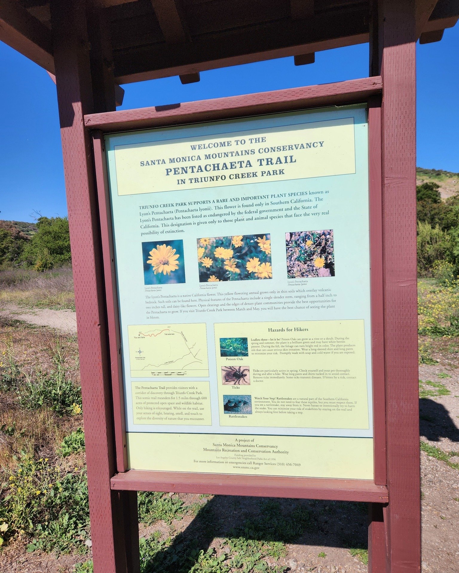
Owned and maintained by the Santa Monica Mountains Conservancy, the 600-acre Triunfo Creek Park in Westlake Village/Agoura contains deep oak woodland, native grasslands and blankets of wildflowers in the springtime. The main feature of the park, the Pentachaeta Trail, is named after the Pentachaeta lyonii, a federally-listed endangered flower found in the park. The yellow, daisy-like flower is found only in Southern California, and blooms between April and June.

PentachaetaTrail.JPG

An informational kiosk at the trailhead interprets the Pentachaeta lyonii, as well as other unusual wildflowers found on the site such as the Chocolate Lily, and the White Globe Lily. The site also provides access to hiking trails on the Westlake Vista parcel, also owned and managed by the Conservancy.

PentachaetaTrail1.JPG
Pentachaeta Trail to the east. Westlake Vista Trail towards the Las Virgenes Reservoir on the west.

Pentachaeta Trail to the east. Westlake Vista Trail towards the Las Virgenes Reservoir on the west.

Pretty flowers off the Pentachaeta Trail in March 2016.

Pretty flowers off the Pentachaeta Trail in March 2016.

pentachaeta1.JPG
Views from Westlake Vista Trail towards, well, but of course, Westlake Village

Views from Westlake Vista Trail towards, well, but of course, Westlake Village

Las Virgenes Reservoir in close proximity to Westlake Vista Trail.

Las Virgenes Reservoir in close proximity to Westlake Vista Trail.

The Westlake Vista Trail takes you to a fence that encloses the Las Virgenes Reservoir, where you may be treated to sounds of birds and other wildlife. Find the trail that parallels the fence up the mountain and you will be treated to gorgeous views of the area down to Westlake Lake and beyond and the Santa Monica Mountains to the south.

Views towards Westlake Lake from the Westlake Vista Trail.

Views towards Westlake Lake from the Westlake Vista Trail.

Directions: The main trailhead with kiosk is on Triunfo Canyon Road east of the southern terminus of Lindero Canyon Road. There are a small number of off-pavement parking spots there. The other end of the trail is at the west end of Triunfo Canyon Road about 1.5 miles west of Kanan Road.

Directions: From the 101 Freeway in Westlake Village exit Lindero Canyon Road. Take Lindero south to Triunfo Canyon Road. Turn left. The trailhead is located opposite Oak Forest Mobile Homes.

Visit mrca.ca.gov/parks/park-listing/triunfo-creek-park for more information.

Map courtesy of Santa Monica Mountains Conservancy at THIS LINK. (Note that Truinfo is a typo on map; actual spelling is Triunfo. But at least is was consistently misspelled not once, not twice, but seven times lol.)

Map courtesy of Santa Monica Mountains Conservancy at THIS LINK. (Note that Truinfo is a typo on map; actual spelling is Triunfo. But at least is was consistently misspelled not once, not twice, but seven times lol.)

Demolished car sitting near Westlake Vista Trail.

Demolished car sitting near Westlake Vista Trail.

Hillcrest Open Space Preserve in Thousand Oaks

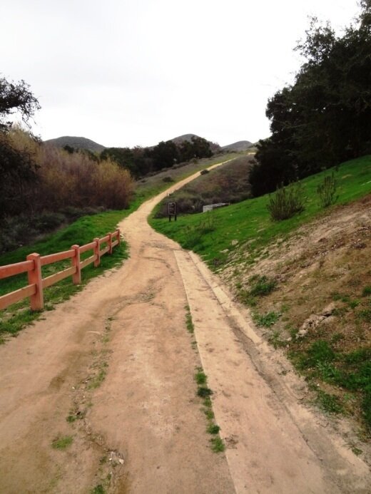
The Hillcrest Open Space Preserve is an area bound on the south by Hillcrest Drive, on the east by Westlake Boulevard and on the west by La Granada Drive. I don't know the exact boundary on the north side. The kids and I usually enter the Hillcrest Open Space at the White Sage Trail trailhead off of Hillcrest Drive, just west of Blue Mesa Street, about half a mile west of Westlake Boulevard.

There is no parking to be found on that stretch of Hillcrest Drive and the nearest crosswalks from the other side of Hillcrest Drive, where you can find parking on residential streets, is at Westlake Boulevard (1/2 mile east) and Duesenberg Drive (1/3 mile west). I've parked on Blue Mesa Street and run across Hillcrest but would not recommend that as the cars speed along on that busy boulevard.

In any case, this is a fun little excursion, particularly if you enjoy a steep hill to climb and beautiful panoramic views of the area.

Hillcrest 2.17.19_1.JPG

Another access point to the Hillcrest Open Space is the southeast endpoint of La Granada Drive (at Crown View Ct), east of Erbes Road in Thousand Oaks.  This 4 1/2 mile, hilly loop is a great way to view the local scenery, from the Conejo Grade to the Civic Arts Plaza and most everything else.

More detailed information on the Hillcrest Open Space Loop trail can be found on the Conejo Open Space Foundation website at cosf.org/trails/other-trails/moderate-hike-hillcrest-open-space-loop.

Trailhead access point at the end of La Granada Drive.

Trailhead access point at the end of La Granada Drive.

In greener times.

Spring Canyon Trail Hike in Thousand Oaks

The Spring Canyon Trail is a short, fairly easy hike in the Newbury Park/Thousand Oaks section of the Los Robles Trail system that is great family fun.

Although a good portion of the Spring Canyon Trail is flat like this, there definitely are some moderately hilly sections.

Although a good portion of the Spring Canyon Trail is flat like this, there definitely are some moderately hilly sections.

This one mile trail runs east from the vicinity of Lynn Oaks Park, 359 Capitan Street, Newbury Park as well from the eastern terminus of Hemlock Lane, at Heavenly Valley Road in Newbury Park (in the Ventu Park community) to a juncture where you can either continue straight ahead for about a half a mile towards the Los Robles Trail access point at South Moorpark Road and Greenmeadow Avenue in Thousand Oaks or veer up "Space Mountain" on the right. (The views at the top of Space Mountain are awesome but this is a bit of a climb and is very popular with mountain bikers...probably not the best direction with little ones).

The path that takes you from Lynn Oaks Park to the Spring Canyon Trail.

The path that takes you from Lynn Oaks Park to the Spring Canyon Trail.

Sign above Lynn Oaks Park that tells you that to the left is Los Robles Trail and to the right is the Hemlock Lane gate in Ventu Park.

Sign above Lynn Oaks Park that tells you that to the left is Los Robles Trail and to the right is the Hemlock Lane gate in Ventu Park.

Out and back you can make this a 2 to 3 mile moderate hike or more if you add in the Oak Creek Canyon Loop or Los Robles Nature Walk.

Sign at the east terminus of Spring Canyon Trail indicating Moorpark Road is half a mile away. Behind me is the trail toward "Space Mountain" and Los Robles Trail going east towards Newbury Park.

Sign at the east terminus of Spring Canyon Trail indicating Moorpark Road is half a mile away. Behind me is the trail toward "Space Mountain" and Los Robles Trail going east towards Newbury Park.

You can also park your car at the Moorpark Road/Greenmeadow trailhead and make your way west towards the Spring Canyon Trail and perhaps eat lunch or snack at Lynn Oaks Park (which by the way also has a nice playground area, basketball court and more...but no restroom however).

Lake Casitas Recreation Area in Ventura

The Lake Casitas Recreation Area is operated by the Casitas Municipal Water District, which supplies water to 70,000 people and hundreds of farms in western Ventura County, encompassing Ojai, the Ventura River Valley area, the city of Ventura to Mills Road, the Rincon and beach area to the ocean and the Santa Barbara County line.

Lake Casitas is a reservoir that was completed in 1959, with a capacity of 254,000 acre feet. The lake was used for canoeing and rowing events for the 1984 Summer Olympics. While swimming is not allowed in the lake because it is a water supply, boating, canoeing, kayaking and fishing is indeed allowed here.

There are a lot of fun things to do in the Lake Casitas Recreation Area:

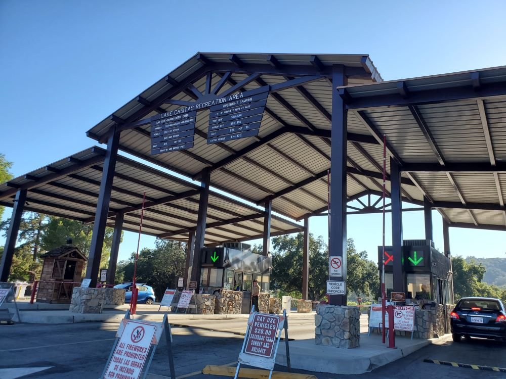
Day use hours are 6 am to 7:30 pm daily. $10 entry fee for vehicles during off season (Labor Day to Easter) and $20 on weekends during “on” season (Easter to Labor Day). Or you can be a cheapskate like me and park on Santa Ana Road and walk in. Location is 11311 Santa Ana Road, Ventura. For more information, visit www.casitaswater.org/recreation or call 805-649-2233.

Front entry to Lake Casitas Recreation Area in the summer of 2022.

Cheeseboro/Palo Comado Canyons in Agoura Hills

CheeseboroPic1.JPG

Cheeseboro and Palo Comado Canyons cover 4,000 acres in the northernmost section of the Santa Monica Mountains National Recreation Area, in the Simi Hills. Stroll to Sulphur Springs or hike to the top of Simi Peak for panoramic views of Oak Park, Agoura Hills and Simi Valley. The Chumash lived in these canyons for thousands of years. Many trails within the canyons may have originated with the Chumash and then were expanded by the ranchers who followed.

Cheeseboro Canyon has some of the best cycling and running trails in the area. The lower trailhead is accessed from Chesebro Road and there is plenty of parking.

On a side note, why is Chesebro Road spelled differently than Cheeseboro Canyon? CLICK HERE

Cheeseboro Canyon Trail (CCT) is a 4.6 mile, fairly easygoing main artery into the park, whereas the 4.4 mile Palo Comado Canyon Trail, which largely parallels the CCT, is much more challenging. The Cheeseboro Ridge Trail also parallels the CCT and seems to be favored by cyclists with its long, rolling hills, though distance runners also will enjoy this trail.  Take CCT up through Sulphur Springs and you'll be running through a small (usually) stream bed and a brief rotten egg smell. Then soon the trail becomes more desert-like as you make your way up to the Sheep Corral Trail and the Shepherds' Flat area. It is really beautiful up there though it can get pretty hot, so carry some water!

While there are plenty of steep hills in this area, this is also a great place for strollers, as many of the trails are quite wide and flat.

The only bathroom that I'm aware of in these trails is at the Chesebro Road trailhead.

Visit www.nps.gov/samo/planyourvisit/cheeseboropalocomado.htm to learn more. The trailhead is located at 5792 Chesebro Road. Contact the visitor center at 805.370.2301. Dogs are allowed but must be on a leash at all times.

Excerpt of Cheeseboro/Palo Comado Canyon Map (Courtesy National Park Service)

Excerpt of Cheeseboro/Palo Comado Canyon Map (Courtesy National Park Service)

CheeseboroPic1.5.JPG
CheeseboroPic2.JPG
CheeseboroPic3.JPG
The Morrison Ranch House in Cheeseboro Canyon was destroyed in the Woolsey Fire of November 2018. Rancher John Morrison and his family occupied this house in 1904 and lived and worked in the home for nearly 60 years. This original ranch house, modif…

The Morrison Ranch House in Cheeseboro Canyon was destroyed in the Woolsey Fire of November 2018. Rancher John Morrison and his family occupied this house in 1904 and lived and worked in the home for nearly 60 years. This original ranch house, modified over the years, dated back to the late 1800s.

The sign survived the Woolsey Fire but the house did not, except for a lone bathtub (hidden by the sign).

The sign survived the Woolsey Fire but the house did not, except for a lone bathtub (hidden by the sign).

Western Plateau Trail Loop Hike From Newbury Park

If you're looking for a trail a bit off the beaten path, check out the Western Plateau Loop from Conejo Center Drive in Newbury Park.

The trailhead for this hike is adjacent to the City of Thousand Oaks Household Hazardous Waste Facility at 2010 Conejo Center Drive, Newbury Park. You can park in the dirt lot next to the trailhead and head on your way.

The trailhead on Conejo Center Drive.

The trailhead on Conejo Center Drive.

It is mostly downhill over the first half mile or so of this 5 mile round-trip hike until you get to the Hawk Canyon Trail turnoff.

It is mostly downhill over the first half mile or so of this 5 mile round-trip hike until you get to the Hawk Canyon Trail turnoff.

You can either go straight from here and do a clockwise loop via the Western Plateau Trail or you can turn right on Hawk Canyon, which is a direct route to the Conejo Canyons Bridge.

Hawk Canyon Trail is a fairly narrow, mostly single-track trail.

Hawk Canyon Trail is a fairly narrow, mostly single-track trail.

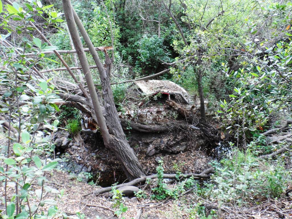
The Hawk Canyon Trail is a fun, narrow trail surrounding by trees and other vegetation, like you're in the middle of nowhere. There's an old car in a crevice as you approach the Conejo Canyons towards Santa Rosa Valley.

Odd to see this old car out in the middle of nowhere. steep embankment makes it somewhat challenging reaching it.

Odd to see this old car out in the middle of nowhere. steep embankment makes it somewhat challenging reaching it.

Bring a snack and sit at a picnic table in the middle of what feels to be nowhere. Then either head back the way you came or find your way to the Western Plateau Trail and loop back counter-clockwise back towards where you parked.

See the Conejo Open Space Foundation's map of this trail at cosf.org/trails/conejo-canyons/conejo-canyons-moderate-hike-western-plateau-loop-from-conejo-center-dr

It can get a bit overgrown in the spring as seen here on the Hawk Canyon Trail but quite beautiful nonetheless!

It can get a bit overgrown in the spring as seen here on the Hawk Canyon Trail but quite beautiful nonetheless!

Lisa Smith Wengler Center for the Arts at Pepperdine University

The Lisa Smith Wengler Center for the Arts at Pepperdine University, located in the heart of the campus at 24255 Pacific Coast Highway, Malibu, showcases musicians, performers and artists from around the world at its Raitt Recital Hall (fits roughly 100 people), Smothers Theatre (500 attendees), Helen E. Lindhurst Theatre and the Frederick R. Weisman Museum of Art.

There is a wide range of great acts and artists, covering blues, country, classical, jazz, gospel, soloists, ensembles, acrobats, jugglers, classic rockers, a kids' theater series, art exhibits and numerous student productions.

For more information and to buy tickets, visit www.arts.pepperdine.edu or call 310.506.4522.

Note: Following a generous estate commitment from Pepperdine University Board member Lisa Smith Wengler, the University dedicated the Lisa Smith Wengler Center for the Arts on November 7, 2013.