Stearns Wharf in Santa Barbara

Dolphins greet you at the entrance to Stearns Wharf.

Dolphins greet you at the entrance to Stearns Wharf.

StearnsWharf.gif

Stearns Wharf is located at the juncture of W. Cabrillo Road and State Street in Santa Barbara. Originally constructed in 1872 by lumberman John P. Stearns as the longest deep-water pier between Los Angeles and San Francisco, it is now one of the most visible and visited tourist destinations in Santa Barbara. In 1980-81, the City of Santa Barbara restored the wharf, constructed new buildings on it and assumed operation of the facility.

Our family particularly enjoys visiting the Museum of Santa Barbara Sea Center located on the wharf, followed by a stop at Mother Stearns Candy Company or the Great Pacific Ice Cream Company. Of course, The Harbor Restaurant and Longboard’s Grill are crowd favorites. There's also wine tasting at Deep Sea Wine Tasting Room, Moby Dick Restaurant, fish and chips, souvenir shops and other places.

View from the end of Stearns Wharf back toward the mainland.

View from the end of Stearns Wharf back toward the mainland.

View from Stearns Wharf

View from Stearns Wharf

You can get onto the wharf in a number of ways. There is limited parking on the wharf. Cost (as of May 2023) is $3/hour, but the first 90 minutes are free. Or you can park along Cabrillo Road or in a local beach parking lot and walk onto the wharf. Or do what we enjoy...park at the Santa Barbara Harbor and ride bikes onto the wharf. The wood planks are a bit bumpy but you'll survive!

Learn more about Stearns Wharf at www.stearnswharf.org.

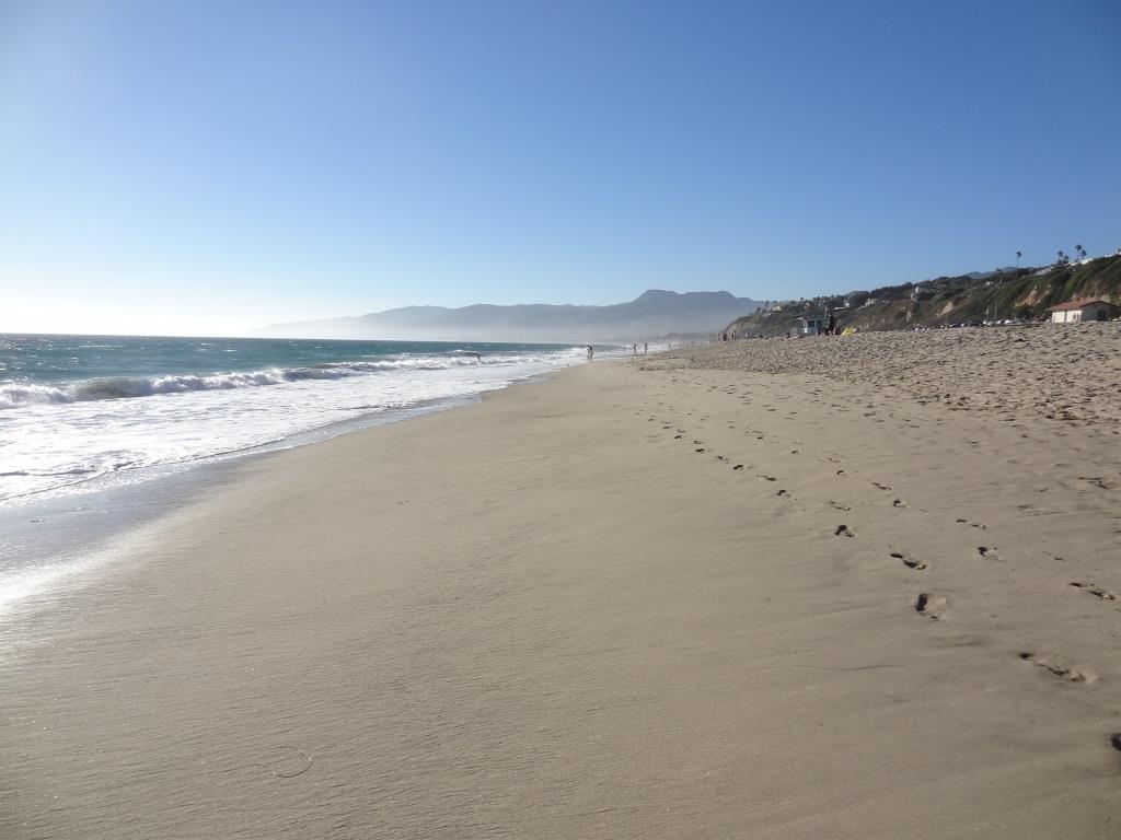
Beautiful views of the harbor area as you'll see below from the pier. If you walk onto the wharf, you may encounter some locals that "live off the land" with sand sculptures and other monuments on the sand for your viewing pleasure (and perhaps some spare change). They are part of the carnival atmosphere. And of course on Sundays you'll be treated to the Santa Barbara Arts & Crafts Show that has been running since 1965.

El Rincon, El Cerro and Las Brisas Trails in Dos Vientos Section of Newbury Park

In the heart of Dos Vientos (Spanish for Two Winds), there are three trails that are accessible from multiple spots by walkers, hikers, runners and bikers. These are the El Rincon, El Cerro and Las Brisas trails. These trails are all nicely maintained, single track and provide great views of the surrounding areas. Other trails surrounding Dos Vientos include the Vista Del Mar Trail, Sierra Vista Trail, Sumac Trail (kind of parallels Sierra Vista Trail), El Encanto Trail and Powerline (Edison Road) Trail, as well as the Potrero Ridge Trail.

ElRincon_trailhead.JPG

Access to the El Rincon Trail is near the corner of Via Rincon and Rancho Dos Vientos. The trail is about 4/10ths of a mile and connects with the El Cerro and Las Brisas trails.

ElRinconTrail1.JPG
ElRinconTrail2.JPG

Access to El Cerro and Las Brisas trails is at the juncture of Via Las Brisas and Calle Del Prado and several other points. Visit https://cosf.org/files/maps/dos_vientos_trail_map.pdf for a trail map on the Conejo Open Space Foundation website.

ElCerroLasBrisas_sign.JPG

Malibu Creek State Park

MalibuCreekSP_sign.JPG

Malibu Creek State Park is accessible in Calabasas, at 1925 Las Virgenes Road, south of Mulholland. The park contains over 8,000 acres of rugged, beautiful hills, trails and scenery. It stretches from Agoura Hills down to Malibu, down to Malibu Lagoon State Beach, covering much of the 25 mile Malibu Creek that flows from Boney Mountain down to the Lagoon. Malibu Creek is the only stream channel that crosses through the Santa Monica Mountain range.

There are three natural preserves in the park, Liberty Canyon, Udell Gorge and Kaslow, which protect Valley Oaks, rare plants and volcanic formations.

Things to do in Malibu Creek State Park include hiking, running, biking, camping, picnicking, fishing and checking out the wildlife. There are over 35 miles of trails and fire roads throughout the park. A fun added bonus is the old M*A*S*H series set, filmed from 1972 to 1983, that resides there.

Dogs are not allowed in Malibu Creek State Park trails.

MalibuCreek2.jpg

Malibu Creek State Park contains roughly three dozen different trails, many easy, and some...extraordinarily challenging, such as the Bulldog trail, taking you to 2,500 foot peaks with panoramic views out to the ocean and surrounding peaks and valleys.

MalibuCreek1.jpg

Parking for the day at Malibu Creek State Park is currently $12, or $3 per hour. You can also park at the corner of Mulholland and Las Virgenes and make your way into the park via the Grassland Trail.

The campground at Malibu Creek State Park has 62 campsites and 4 RV sites. Visit www.parks.ca.gov/?page_id=614 for more information.

The old M*A*S*H site is about 2 1/2 miles from the parking area.

The old M*A*S*H site is about 2 1/2 miles from the parking area.

M*A*S*H site with plenty of picnic tables

M*A*S*H site with plenty of picnic tables

The Visitor Center is only a 10 minute walk from the parking lot and is generally open from noon to 4pm on weekends.

The Visitor Center is only a 10 minute walk from the parking lot and is generally open from noon to 4pm on weekends.

There's also an interesting visitor center about 1/2 mile from the main entrance to the park. It is open on Saturday/Sunday from noon to 4pm, subject to availability of docents. Worth a stop as there are some neat things to see in there, including wildlife and rocks/artifacts and other useful information. You can also purchase drinks in there as well as a small assortment of other items.

Hike to the Rock Pool at Malibu Creek State Park

Century Lake Hike at Malibu Creek State Park

Point Dume State Beach

On November 24, 1793, English explorer George Vancouver named the rocky promontory Point Dume after his friend, Father Francisco Dumetz. Point Dume is the western terminus of Santa Monica Bay and was named California Registered Historical Landmark No. 965.

PointDumeBeach.JPG

View in the spring of 2023

Point Dume State Beach is a 63 acre promontory that juts out into the Pacific and features headlands, cliffs, rocky coves and vast beach access for swimming, surfing and scuba diving.

To get to Point Dume State Beach, take Westward Beach Road southeast from PCH near Zuma Beach's south side to the paid parking area, or park on Westward Beach Road, which parallels Westward Beach.

To the southeast of Westward Beach is a small 300 foot or so beachfront area called Pirate's Cove Beach (which due to its seclusion was once used as a nude beach).

Pirate's Cove beach seen from the top of the promontory. You can climb down there and when the tide is moderate to low, walk around to it.

Pirate's Cove beach seen from the top of the promontory. You can climb down there and when the tide is moderate to low, walk around to it.

The 34-acre Point Dume Natural Preserve also begins from the cul-de-sac. A gradual ascending trail leads to an ancient coastal bluff sand dune with spectacular views...we've seen whales, seals and dolphins over here. A stairway from the east side of the bluff-top preserve allows access to a more isolated beach and tidepools (look but don't touch). You'll have fun exploring up here.

In the spring of 2023

This is a snippet of the pilot episode, "The Lady in the Bottle," of I Dream of Jeannie that originally aired September 18, 1965. If you skip to 1:39 in this clip, you will see the prominent rock formations on the east side of the Point Dume promontory. Below is a more recent shot of that area.

This is where Captain Anthony Nelson (Larry Hagman) made a giant S.O.S. in the sand with sticks and other items, including an old bottle that moved itself. He picks it up, dusts it off, and out pops Barbara Eden. Lucky guy!

This is where Captain Anthony Nelson (Larry Hagman) made a giant S.O.S. in the sand with sticks and other items, including an old bottle that moved itself. He picks it up, dusts it off, and out pops Barbara Eden. Lucky guy!

Location/Directions: Take Kanan south to PCH and turn right. Westward Beach Road is over the rise, at the foot of the hill. Park free on WBR or pay a fee at Westward Beach lot. No restrooms at the Preserve but some can be found on WBR. Call 310.457.8143 or visit www.parks.ca.gov/?page_id=623 for more information. Also see beaches.lacounty.gov/point-dume-beach.

Dogs are not allowed on trails in the Point Dume Natural Preserve or on the beach.

Westward Beach

Westward Beach

Springtime at the Point Dume Natural Preserve

Springtime at the Point Dume Natural Preserve

Satwiwa Native American Indian Culture Center in Newbury Park

The Satwiwa Native American Indian Culture Center is located at Rancho Sierra Vista / Satwiwa in Newbury Park. Sycamore Canyon, which cuts through Rancho Sierra Vista/Satwiwa and Point Mugu State Park, was part of a Chumash trade route. Satwiwa, which means "the bluffs," was the name of a nearby Chumash village.

View of the Satwiwa area with the Center on the right and an Indian village area on the left.

View of the Satwiwa area with the Center on the right and an Indian village area on the left.

In the Center is a variety of native Chumash items. Native American workshops, programs and art shows occur throughout the year. The Center is open 9 am to 4 pm on weekends, with rangers on hand to answer questions. There's a small gift shop in the Center too, as well as restrooms and a water fountain.

There is a Chumash house, or 'ap, on the grounds of the Center. It is made with willow trees and tule.

There is a Chumash house, or 'ap, on the grounds of the Center. It is made with willow trees and tule.

Inside the Culture Center. The table contains items that children are encourage to touch.

Inside the Culture Center. The table contains items that children are encourage to touch.

Small but nicely appointment gift shop in the Center has something for everyone.

Small but nicely appointment gift shop in the Center has something for everyone.

Park in the adjacent National Park Service parking lot via Lynn Road to the access road at Via Goleta in Newbury Park.

Visit www.nps.gov/samo/planyourvisit/satwiwa-native-american-indian-culture-center.htm for more information.

Access point to the Rancho Sierra Vista / Satwiwa area in the Santa Monica Mountains National Recreation Area off of Lynn Road in Newbury Park.

Access point to the Rancho Sierra Vista / Satwiwa area in the Santa Monica Mountains National Recreation Area off of Lynn Road in Newbury Park.

Chumash Indian Museum / Oakbrook Regional Park

ChumashMuseum_front.JPG

Located in Lang Ranch at the top of Westlake Boulevard near Avenida de los Arboles at 3290 Lang Ranch Parkway, Thousand Oaks, the Chumash Interpretative Center / Chumash Indian Museum contains Chumash artifacts and historical items, nature walks and tours of the beautiful local Oakbrook Regional Park area.  The museum is open Saturdays 10 am to 4 pm and Sundays from noon to 4 pm. Admission is $7 for adults, $5 for seniors 65+ and $5 for children under 12 (as of March 2023).

There is no charge to walk the trails in the park, which is open from sunrise to sunset daily. No dogs, except service animals, are allowed on museum grounds or trails.

OakbrookRegionalPark_sign.JPG

The Chumash Indian Museum is located on a historical Chumash village site and contains a large collection of Chumash artifacts.

ChumashIntCtr.jpg

Stroll around the 436 acre Oakbrook Regional Park, a Ventura County historical landmark #90 (designated in 1983). More on Oakbrook Regional Park at www.crpd.org/park/oakbrook-regional-park.

Contact the Center for more information about these and other events, field trips, weddings and birthday parties at www.chumashmuseum.org or 805.492.8076.

To protect the wildlife, dogs are not allowed here.

Examples of the Chumash Home - called an ‘ap (not to be confused with app). more on ‘aps at THIS LINK.

Beautiful canopied oak tree configuration at Oakbrook Regional Park, behind the Chumash Indian Museum.

Hunt Olive Tree - Historical Landmark in Thousand Oaks

When Richard Orville Hunt and his wife Mary Jane Hunt planted trees in their orchard on the Salto Ranch (currently Lynn Ranch) over 130 years ago, they probably never contemplated that one of their trees would be thriving next to the Sprouts Farmers Market (previously Circuit City) parking lot. 

Well, that's where this beautiful old timer is.  I'm not exactly sure why the Hunt Olive Tree was moved here from its prior home in 1993, but she looks like she is doing o.k.  This tree at 600 West Hillcrest was designated a Ventura County Historical Landmark #64 on January 25, 1982. It is also Historical Landmark #4 in the City of Thousand Oaks.

Richard Hunt served as postmaster of the Newbury Park Post Office (which at the time was located at his ranch) for 18 years, beginning in 1891.

So go pay homage to this lovely link to our local history en route to buying some fresh fruits, veggies and other health foods at Sprouts!

HuntOliveTree2.jpg
HuntOliveTree1.jpg

McGrath Family Farm in Camarillo

McGrathFarmhouse.jpg

McGrath Family Farm at 1012 West Ventura Blvd, Camarillo (take the Central Avenue offramp from the 101...McGrath is just south of the freeway) is a sustainable farm that grows organic fruits, vegetables and flowers for the local community.

The Store at McGrath Family Farm is open Tuesday through Sunday

We've been here numerous times over the years and I just love the fresh fruit and veggies available most of the year. You can find some nice locally grown gems here like heirloom tomatoes, strawberries, avocados and so much more.

And the kids always love visiting with the animals. For only $3 per person for a 15 minute visit, a McGrath staff lead you and the kids into the farm animal area behind the farm store. With some healthful treats for the goats, ducks, pigeons, geese and rabbit on hand, you'll have a lot of fun with these very friendly farm animals.

For more information, visit www.storeatmcgrath.com or call 805.983.0333.

McGrathProduce9.9.12.jpg
McGrath Farm Tours (as of September 2012)

McGrath Farm Tours (as of September 2012)

Feeding the animals at McGrath Family Farm.

Feeding the animals at McGrath Family Farm.

Charmlee Wilderness Park in Malibu

CharmleeSign.JPG

Charmlee Wilderness Park is a 532 acre park located at 2577 Encinal Canyon Road in Malibu, just 15 miles from the Conejo Valley. It is located within the Santa Monica Mountains. There are over eight miles of hiking trails, a nature center, picnic areas and more. Park hours are 8 a.m. to sunset and the nature center is open on weekends from 8 a.m. to 5 p.m. (or dark, whichever comes first). Parking is now free of charge.

Visit www.malibucity.org/561/Charmlee-Wilderness-Park for more information.

To get there from the Conejo Valley, take the 23 (Westlake Boulevard/Decker Canyon Road) toward the ocean and turn left on Lechusa Road. Continue on Encinal Canyon Road and look for the sign on the right.

Photos below courtesy of Suzy Demeter Photography.

Charmlee1.jpg
Charmlee3.jpg
Charmlee5.jpg
Charmlee6.jpg

Conejo Valley Botanic Garden - Thousand Oaks

CVBG_logo3.gif

The Conejo Valley Botanic Garden is a 33 acre retreat of hiking trails and natural habitat adjacent to Conejo Community Park off of Lynn Road and Gainsborough. 

CVBG now offers plant sales (weather permitting) every Sunday from 11:00 a.m. to 2:30 p.m. featuring California native and drought tolerant plants. Reasonable prices! Enter at the Kids' Adventure Garden entrance (400 W. Gainsborough Road).

This is really a special place to bring the kids for low key hike.  There are numerous trails and a short walk/hike to the top of the mountain rewards you with sweeping views of the entire Conejo Valley, from Westlake Village to Thousand Oaks to Newbury Park.

CVBotanicGarden.jpg
CVBotanic_Sign.jpg

Here is what you'll find at the CVBG:

  • The Nature Trail is 3/4 of a mile long and meanders above the creek through oaks and willows. This is a moderate trail.

  • The Little Loop Trail leads you above the creek, through chaparral and around a meadow.

  • The Native Plant Section and Lower Meadow feature southern and northern California plants.

  • Lillian's Meadow showcases perennials, shrubs and trees that thrive with minimal water.

  • The Salvia Garden delights hummingbirds and butterflies.

  • The Butterfly Garden is a safe haven that provides nectar and food sources for butterflies and caterpillars.

  • The Nursery houses workspace for the plant propagation team and hosts plant sales.

  • The Herb Garden exhibits an extensive and unusual collection of medicinal, kitchen and aromatic herbs.

  • The Bird Habitat has a fresh water source and is planted with native plants that provide year-round food source for birds.

  • The Australian Section features collection of plants from down under.

  • The Desert Garden hilltop landscape features cacti, succulents and desert trees and provides a panoramic view of the Conejo Valley.

  • The Rare Fruit Orchard holds an extensive collection of trees.

  • The Tranquility Garden is planted in the Japanese style featuring California native plants.

  • The Oak Tree Grove has many species of North American and other oak trees.

  • The Trail of Trees exhibits 50 trees with a variety of genera.

If you have small kids, they will love the Kids' Adventure Garden and treehouse, open on Sundays from 11 a.m. to 3 p.m.  They'll enjoy hiking through the trails and exploring the streams and bridges.

Conejo Valley Botanic Garden is located at 400 West Gainsborough Road, Thousand Oaks.  For more information visit www.conejogarden.org.

Desert Garden at the top of the hill, featuring cacti, succulents, etc.

Desert Garden at the top of the hill, featuring cacti, succulents, etc.

Japanese style Tranquility Garden featuring native California plants

Japanese style Tranquility Garden featuring native California plants

CVBG_bench.JPG
CVBG_cactus.JPG

Corriganville Park in Simi Valley

Corriganville3.JPG

Corriganville Park is a historical 206 acre park located at 7001 Smith Road in Simi Valley that is owned and operated by the Rancho Simi Recreation and Park District. The park has over four miles of hiking, biking and equestrian trails, sandstone cliffs, an oak forest, seasonal stream, shaded picnic areas, Camp Rotary Youth Campground, picnic shelter and more.

The park is named after Ray "Crash" Corrigan, a stuntman/actor who owned the park from 1937 to 1965, when over 3,500 movies, TV shows and commercials were filmed there. In 1949, the Corrigan Movie Ranch opened as a Western-style amusement park with a train ride and stagecoach ride that in the late 1950s had greater weekend attendance than Disneyland and Knott's Berry Farm.

Corriganville4.JPG

Bob Hope bought the property in 1965 and renamed it Hopetown, but filming stopped after a year. The ranch burned down in the 1970s and all that is left are the cement slabs and exterior rock walls of the barn. You've got to visit the Santa Susana Depot Museum around the corner from Corriganville and see the model of what Corriganville looked like in 1960, then visit the park to see the slabs and imagine what it was like back then.

There is an interpretative trail at Corriganville with 20 markers that provide information about the vegetation and surroundings as well as some of the history. Visit www.rsrpd.org/business_detail_T9_R53.php for a link to pdf brochures with information about the history and trails of the park. Or call 805.584.4400.

Corriganville1.jpg
Corriganville2.jpg

Meditation Mount in Ojai

Meditation Mount is a meditation center located on a 32 acre site at 10340 Reeves Road in Ojai that opened in 1970. The grounds include a winding path through the International Garden of Peace, which winds around the property with a view of the Ojai Valley.

Meditation Mount is offering visitations on a pre-registered basis with two-hour self-guided sessions for $12 per person as of January 2023. They also offer other events, including guided meditations, yoga, performances and more.

Visit meditationmount.org for more information and to register for a session.

Anthony C. Beilenson Interagency Visitor Center in Calabasas

BeilensonCenter1.JPG

The Anthony C. Beilenson Interagency Visitor Center is located at King Gillette Ranch, 26800 Mulholland Highway, Calabasas. It opened to the public in June 2012.

BeilensonCenter2.JPG

The Visitor Center is jointly operated by the National Park Service, California State Parks, the Santa Monica Mountains Conservancy and the Mountains Recreation and Conservation Authority.

It features exhibits and interactive displays, the work of local artists, tours of sustainable features and a native plant garden. There is a tremendously comprehensive exhibit covering things to see and do within the Santa Monica Mountains.

The Visitor Center was formerly the horse stable for the Gillette Mansion. It retains some of its original design while achieving LEED Platinum certification as the first "net zero" visitor center in the National Park Service. Cool! (literally and figuratively)

Visitor Center staff and volunteers are very friendly and helpful.

There's also gift shop in the center with a variety of items including books, handmade items, kids' items and more.

Call 805-370-2301 or visit www.nps.gov/samo/planyourvisit/visitor-center.htm.

Open Wed though Sun, noon to 4pm. Closed Mon/Tues.

Nearby hiking is plentiful, including the Inspiration Point hike at King Gillette Ranch and across the street at Malibu Creek State Park.

BeilensonCenter4.JPG