Los Robles Trail East in Thousand Oaks

The Los Robles Trail East in Thousand Oaks is accessible from the Los Robles Trail trailhead heading west from the corner of South Moorpark Road and Greenmeadow Avenue in Thousand Oaks.

LosRoblesTrail_SignMain.JPG

From the main trailhead, go west just under 1/2 mile and you'll see the fork in the road where you can go east or west. Head south (click here if you prefer going west) where you'll go towards the Los Robles Trail East.

A gradual uphill of about 1/2 mile on a wide fire road trail takes you to a picnic bench and then a more winding, partially shaded, narrower, eastbound section of trail.

Fire road that takes you to picnic bench.

Fire road that takes you to picnic bench.

Picnic bench at juncture of fire road and narrower, steeper Los Robles Trail East.

Picnic bench at juncture of fire road and narrower, steeper Los Robles Trail East.

LosRoblesTrail_MapEast.jpg

Another .6 mile gets you to a hill where you'll soon be treated to a reward for your hiking effort...a bench with a view of the Conejo Valley.

Los Robles Trail East near hilltop viewpoint with bench.

Los Robles Trail East near hilltop viewpoint with bench.

And the bench at the top. Nice view of the Conejo Valley, eh?

And the bench at the top. Nice view of the Conejo Valley, eh?

And the trail loops around with another bench on the other side of the trail looking south towards Hidden Valley.

Bench facing south.

Bench facing south.

The trail loops back around towards the main Los Robles Trail, where you can head back west again from where you came from, or head east towards the northern tip of the Los Padres Trail or stretch further east towards the Triunfo Canyon Trail and White Horse Canyon Trail.

Now go on, take a hike!

Los Padres Trail in Thousand Oaks

LosPadresTrail_trailhead.JPG

The Los Padres Trail is a short, 1 mile, neat little trail accessed on Los Padres Drive, near the corner of Fox Hills Drive in Thousand Oaks. Take Moorpark Road south of the 101 freeway and turn left on Los Padres Drive. The trailhead is clearly marked on the right hand side, The trail is maintained by the Conejo Open Space Foundation.

Surrounded by trees in the first section of the Los Padres Trail.

Surrounded by trees in the first section of the Los Padres Trail.

Short but sweet, the trail is.canopied by trees, several bridges, mostly single track trail and a bit of a climb (750 feet) as you make your way up to the Los Robles Trail junction. That's about a mile, so you can turn around there for a 2 mile round trip hike.

Where the Los Padres Trail meets the Los Robles Trail.

Where the Los Padres Trail meets the Los Robles Trail.

Or...you can turn right (west) and head your way up the wide, fire road sized section of the Los Robles Trail east. This is a bit of a climb, but pretty moderate and gradual. Crest the hill and you'll see a gate.

The Los Padres Trail is winding, uphill and wide in this section.

The Los Padres Trail is winding, uphill and wide in this section.

Before the gate, you can turn left (east) and in 3 miles you're at Triunfo Park in the Los Padres Open Space via the Triunfo Canyon Trail. Or turn right (west) and you're off into the Los Robles Open Space. If you go straight ahead, you’ll reach a gate to Hidden Valley private property.

LosRoblesTrail_Triunfo.JPG
Gate at top of trail. Private property in Hidden Valley ahead.

Gate at top of trail. Private property in Hidden Valley ahead.

Marview Drive Trail in Thousand Oaks

Marview Drive Trail Trailhead in Thousand Oaks

Marview Drive Trail Trailhead in Thousand Oaks

If you're looking for a short, steep and sweet trail to hike up and down in Thousand Oaks, check out the trail on Marview Drive, just east of the entrance to Old Meadows Park at 1600 Marview Drive. Take Erbes Road and go west on Marview. After passing the residential section of the road, up ahead is Old Meadows Park and on the right is plenty of street parking across from the trailhead.

MarviewTrail_steep.jpg

Short it definitely is. Only about a quarter of a mile to the top of the hill, but it will take you a bit longer than your typical hike because it is so steep, at least the first section.

MarviewTrail.JPG

Then toward the top it starts to flatten out, where you will discover panoramic views of the Conejo Valley. There's also quite a clear view of the 23 Freeway from up here!

Marview_23fwy.JPG

At the top of the trail is a large, enclosed square fenced in with No Trespassing signs all over the place. This is a water tank. But you can walk around the area to the other side, where there's actually a trail and walkway that goes down to the St. Patrick’s Episcopal Church.

So there you have it! A short, steep, but sweet little trail in the heart of Thousand Oaks!

Ranch Center Road, Wood Canyon Fire Road and Other Trails in Northern Point Mugu State Park

Northern Point Mugu State Park map image courtesy National Park Service

Northern Point Mugu State Park map image courtesy National Park Service

Point Mugu State Park in the Santa Monica Mountains stretches from Newbury Park to the ocean, over 14,000 acres of land and 70 miles of trails. Visit this link for more information.

If you ever get the time and energy, consider exploring the trails in the northernmost section of Point Mugu State Park. To access these trails, you can start at Rancho Sierra Vista/Satwiwa in Newbury Park and make your way up Big Sycamore Canyon Road, then, down, down, down the big paved hill into the canyons of Point Mugu State Park.

The descent down into the canyon on Big Sycamore Canyon Road is pretty steep. Watch for cyclists. Boney Mountain is seen in the distance.

The descent down into the canyon on Big Sycamore Canyon Road is pretty steep. Watch for cyclists. Boney Mountain is seen in the distance.

The descent into the canyon is about 3/4 mile. From there, you'll go another mile or so until you see a fork in the road. If you go straight (veering slightly left), you'll continue down Big Sycamore Canyon Road towards PCH. But if you turn right, you're on Ranch Center Road, a gradual, steady climb up an old, paved hill.

Juncture of Big Sycamore Canyon Road (left) and Ranch Center Road (right).

Juncture of Big Sycamore Canyon Road (left) and Ranch Center Road (right).

This is one section of Ranch Center Road. As you can see, this is a pretty old road that was used by the ranchers who lived here before the land was acquired by California State Parks.

This is one section of Ranch Center Road. As you can see, this is a pretty old road that was used by the ranchers who lived here before the land was acquired by California State Parks.

You are highly unlikely to see a lot of people down here. You might see a couple cyclists from time to time, but hikers/runners in these quiet areas are, from my experience, pretty rare in appearance. It feels like you're going to the middle of nowhere.

You will also notice that there are several trails that connect with the road, including, from east to west, the Sin Nombre Trail, Sage Trail, Ranch Center Fire Trail, Coyote Trail and, finally, the Wood Canyon Fire Road trail. All of these trails will either take you back to Big Sycamore Canyon Road or other trails that will allow you to do a loop back up to Rancho Sierra Vista. You can add another 4 miles to your adventure by checking out the Guadalasca Trail that connects to the Wood Canyon Fire Road. See detailed map here.

Old water tank seen at the juncture of Ranch Center Road (paved) and Ranch Center Fire Road (trail).

Old water tank seen at the juncture of Ranch Center Road (paved) and Ranch Center Fire Road (trail).

After you pass the water tank seen above, you continue downhill towards the remains of some old ranch houses. Pretty much everything has been demolished but you'll see some vintage items still on hand, along with signs warning you to stay outta there.

You've reached what used to be the Ranch Center.

You've reached what used to be the Ranch Center.

Not sure if this would sell on Craigslist.

Not sure if this would sell on Craigslist.

The old ranch house area is at the juncture of Ranch Center Road and Wood Canyon Fire Road. I particularly enjoying running down Wood Canyon Fire Road as it is so quiet and there is nice tree coverage.

More Wood Canyon Fire Road

More Wood Canyon Fire Road

Wood Canyon Fire Road runs south until it connects with the "Loop Trail" (west) or continues east back towards the Two Foxes Trail (parallels Big Sycamore Canyon Road) and then Big Sycamore Canyon Road, where you can veer back up north towards Newbury Park. 

DOZENS AND DOZENS OF TRAILS IN AND AROUND VENTURA COUNTY

Albertson Motorway Fire Road Trail in Thousand Oaks

The Albertson Motorway is a fire road and public trail that is accessible in the Lang Ranch Open Space in Thousand Oaks. The trailhead is at the east end of Lang Ranch Parkway. Street parking is available on Lang Ranch Parkway. This is a residential area, so be mindful of the neighbors.

The Albertson Motorway trailhead at the east end of Lang Ranch Parkway in Thousand Oaks.

The Albertson Motorway trailhead at the east end of Lang Ranch Parkway in Thousand Oaks.

Given this is a fire road, it is mostly wide, flat and hilly, taking you upwards and eastbound towards the Palo Comado/Cheeseboro Canyons, Las Virgenes Canyons and Ahmanson Ranch. The views are outstanding and get better the higher you go up. You'll see Simi Valley, Bard Reservoir, Thousand Oaks and beyond.

As you meander on the trail, stay towards the right to stick with the fire road. In the first mile and half, there will be several opportunities to veer left onto trails that take you up north towards the Autumn Ridge Trail in the Lang Ranch Open Space, which can be done as a loop (more details at cosf.org/trails/lang-ranch/lang-ranch-woodridge-strenuous-hike-autumn-ridge-to-albertson-motorway-loop). The Albertson fire road is more of an "out and back" trail where you can reach a particular destination, then turn back.

You will go towards a fairly short section of the trail that is not a fire road, but more of a single track area, for perhaps .2 mile. A fun little section for hikers, quite different than the rest of the trail. 

This is the section of Albertson Motorway not accessible to the public.

This is the section of Albertson Motorway not accessible to the public.

You'll eventually pass through a gate and about a mile and a half from there you will reach a point where you can take a right-hand turn (south) towards China Flat and Simi Peak. Along the way, there are two benches for taking in the view towards the Simi Hills.

You will eventually pass through this gate.

You will eventually pass through this gate.

Bench #1 on Albertson Motorway trail.

Bench #1 on Albertson Motorway trail.

Bench #2 on Albertson Motorway trail.

Bench #2 on Albertson Motorway trail.

The turnoff for Palo Comado/China Flat/Simi Peak is about 2 1/2 miles into the hike. There's a trail on the right. Hard to miss., then you'll see this sign.

Transition to Palo Comado Canyon Trail

Transition to Palo Comado Canyon Trail

If you continue past the transition to Palo Comado Canyon Trail, Albertson Fire Road continues on for awhile as you can see in the map below.

Albertson Fire Road Trail from China Flat turnoff area. (Courtesy National Park Service)

View of Bard Reservoir from Albertson Motorway Fire Road.

View of Bard Reservoir from Albertson Motorway Fire Road.

Elliot Mountain Trail and Outlaw Loop Trail in the Conejo Canyons Open Space, Thousand Oaks

Views from Elliot Mountain Peak in the Conejo Canyons Open Space

Views from Elliot Mountain Peak in the Conejo Canyons Open Space

Burt Elliot was a long-time trail volunteer in the Conejo Open Space and the Santa Monica Mountains National Recreation Area. He passed away in 2014, but his name lives on forever in the Conejo Open Space.

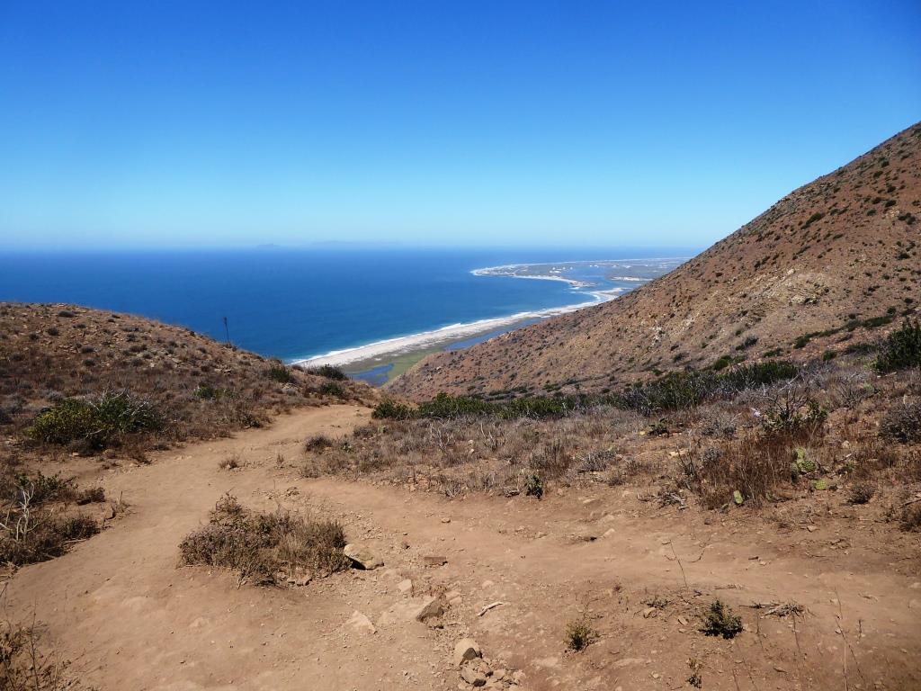
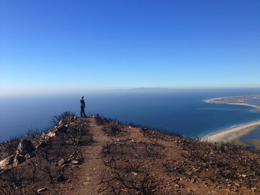
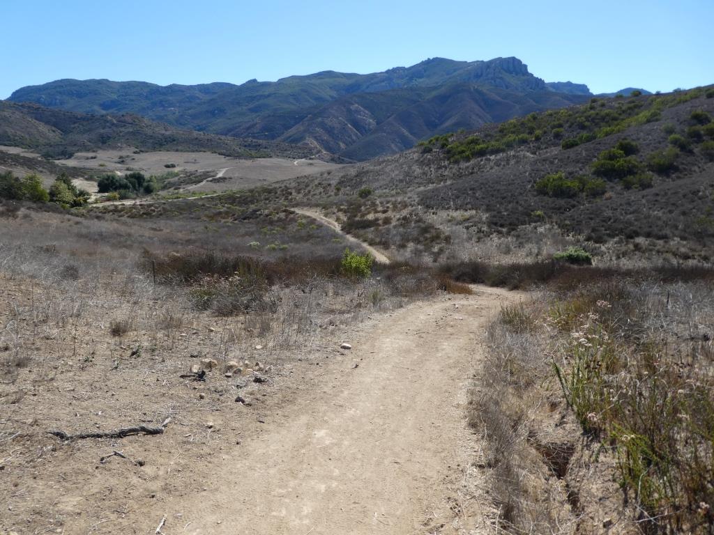
The Elliot Mountain Trail is a short (maybe .3 mile) spur trail off of the Outlaw Loop Trail in the Conejo Canyons Open Space in Thousand Oaks. This short, single-track trail leads you to the peak of Elliot Mountain, where you can enjoy panoramic views of the area.

This is about a 4 1/2 to 5 mile hike from the Conejo Canyons Bridge. Elliot Peak is about 975 feet, making it a fairly moderate hike, though indeed half the hike is fairly hilly. Reaching the top of Elliot Peak is slightly rocky, so you want to make sure to wear shoes made for hiking and consider a hiking stick.

Let’s do it:

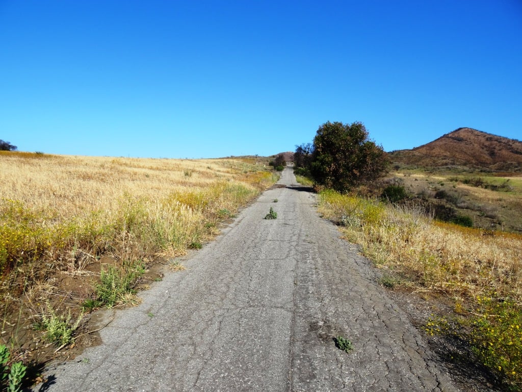
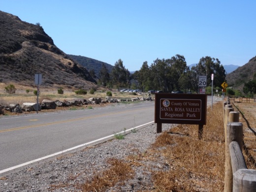
Access the Conejo Canyons bridge via Santa Rosa Road. Coming from Thousand Oaks, take Moorpark Road north down the Norwegian Grade, where it intersects with Santa Rosa Road. Continue about 3.7 miles on Santa Rosa Road and make a left on Hill Canyon Road. Drive down Hill Canyon Road and you will see a large, flat dirt parking area on the right, adjacent to Santa Rosa Valley Regional Park. There’s also parking in a dirt lot directly across from the Conejo Canyons Bridge on the left.

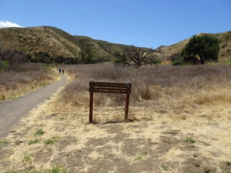
Take the flat Hill Canyon Trail about a mile until you get to a juncture with a sign. The sign says go straight to the Hawk Canyon Trail or a take a right on the Western Plateau Trail. Take the right.

This is the steepest part of the hike. You’ll go up the Western Plateau Trail about 1/2 mile until you see the first juncture. One the left you’ll see a sign that says “Vista Point,” where you see a bench with nice views. Directly across from there is a post with a “Bell Box” (a box where cyclists can borrow a bell to alert others to their presence). Next to the that is the single track “Outlaw Trail.” That’s where you’re going.

The Outlaw Trail is a mile and a half mostly single track loop trail with fantastic views of the area. Lots of switchbacks on this trail makes it popular with cyclists. I usually see one or two of them up here, and usually zero hikers (excluding yours truly). Shortly after entering the Outlaw Trail, you’ll reach a fork where you decide whether to go clockwise or counter-clockwise. If like me you tend to go clockwise, you’ll eventually will pass a trail to the left (west) called the Lichen Trail. Continue east a few yards to a sign that says Elliot Mountain Trail.

As mentioned above, the Elliot Mountain Trail is a short spur trail to the peak. The final couple dozen steps involve very minor rock climbing as an fyi. Nothing excessive. But it can get slippery. I’ve managed to get up there and back down perfectly fine in regular running shoes and no hiking pole, but just be careful.

Then after enjoying the views, you come back down to the Outlaw Trail and continue your way around the loop back down to the Western Plateau Trail. Enjoy your hike!

Conejo Canyons Bridge is the entry point to the trail.

Conejo Canyons Bridge is the entry point to the trail.

The Hill Canyon Trail is one of the flattest trails in the Conejo Valley. Take it a about a mile to the Hawk Canyon/Western Plateau sign juncture.(For continued flat trail, continue straight on the Hawk Canyon Trail.)

The Hill Canyon Trail is one of the flattest trails in the Conejo Valley. Take it a about a mile to the Hawk Canyon/Western Plateau sign juncture.(For continued flat trail, continue straight on the Hawk Canyon Trail.)

The Hawk Canyon Trail/Western Plateau Trail juncture. Exit stage right.

The Hawk Canyon Trail/Western Plateau Trail juncture. Exit stage right.

This section of the Western Plateau Trail is the steepest and widest section of the hike. There’s a bench off to the left about halfway up the hill if you need a break.

This section of the Western Plateau Trail is the steepest and widest section of the hike. There’s a bench off to the left about halfway up the hill if you need a break.

At the top of the hill, the first juncture is the Outlaw Loop Trail on the right. To the left (not picture here), you’ll see a sign that says “Vista Point.” There’s another bench here.

At the top of the hill, the first juncture is the Outlaw Loop Trail on the right. To the left (not picture here), you’ll see a sign that says “Vista Point.” There’s another bench here.

A few step into the Outlaw Loop, you’ll see this sign. Either direction gets you to the Elliot Mountain Trail.

A few step into the Outlaw Loop, you’ll see this sign. Either direction gets you to the Elliot Mountain Trail.

Eventually you will see this sign. You’re on your way up to Burt Elliot’s peak.

Eventually you will see this sign. You’re on your way up to Burt Elliot’s peak.

But before you reach the peak, there’s yet another bench placed by the Conejo Open Space Conservation Agency to enjoy the views.

But before you reach the peak, there’s yet another bench placed by the Conejo Open Space Conservation Agency to enjoy the views.

The trail to the peak, like the Outlaw Trail, is quite narrow, though nicely maintained.

The trail to the peak, like the Outlaw Trail, is quite narrow, though nicely maintained.

Chumash Trail in Pt. Mugu State Park

ChumashTrail1.jpg

The Chumash Trail trailhead is accessible off of PCH at this link. It is at the western tip of Point Mugu State Park, about 2 1/2 miles from where Las Posas Road connects to PCH in Camarillo, and about 10 miles from the intersection of Las Posas Road and Highway 101.  It is across the street (PCH) from a Naval Base Ventura County training range. Look for the left turn into a small dirt parking area that has space for perhaps 15 or so cars.

The first .7 mile of the Chumash Trail is quite rocky and steep. Make sure to wear good hiking shoes and possibly carry a hiking stick, especially if you have bad knees. Dogs are not allowed. My kids did not enjoy this particular hike (ages 8 and 11 at the time). Definitely not stroller friendly. Awesome views and nice ocean breezes, but there is no protection from the sun, so wear sunscreen if it is sunny out.

You finally reach a flat area after the first .7 mile, where you can veer left (north) to continue on the Chumash Trail for another .5 mile (option 1) or turn right (east), which leads you to the Mugu Peak Trail (option 2).

After the additional .5 mile (option 1) on the Chumash Trail, you reach the La Jolla Valley Loop Trail that circles the La Jolla Valley Natural Preserve. There is a walk-in campground a little over a mile into the hike that technically you are required to reserve and pay for at the nearby Ray Miller Trailhead, which has a lot more parking, etc. The La Jolla Valley Loop Trail is roughly three miles in total if you do the entire loop.

The Mugu Peak Trail (option 2) is a couple miles covering the south ridgeline of Mugu Peak, offering more majestic views stretching across the Pacific Ocean to Anacapa/Santa Cruz Islands and beyond. It connects to the La Jolla Valley Loop trail.

Map of Point Mugu State Park at www.nps.gov/samo/planyourvisit/upload/PointMuguSP_Map_LAMountains_1.jpg.

This sign was here at one point but was gone for some reason as of July 2016.

This sign was here at one point but was gone for some reason as of July 2016.

ChumashTrail2.jpg
Great perspective on the gigantic sand dune below to the south.

Great perspective on the gigantic sand dune below to the south.

Santa Rosa Valley Regional Park in Camarillo

Located at 10241 Hill Canyon Road in Camarillo, Santa Rosa Valley Regional Park is a 50 acre county park with hiking, trails and equestrian riding areas. Open 7:30 am - 5:00 pm - (January, February, November, December), until 6:00 pm (March, October), 7:30 pm (April, May, September) and 8:00 pm - (June, July, August). There is no playground area here...this park is mostly geared towards hiking, exploring and horseback riding. Parking is $2 on weekdays and $4 weekends.

SantaRosaValleyRegPark.JPG

This park is located at the entry point to the Conejo Canyons bridge, where you can access trails in the Western Plateau area of Thousand Oaks, maintained by the Conejo Open Space Foundation.

From Thousand Oaks, take Moorpark Road down the Norwegian Grade through Santa Rosa Valley until you see the sign shown below.

More information at www.ventura.org/parks-department/inland-parks/santa-rosa-valley-park-camarillo.

SantaRosaCountyPark_sign.JPG

Sandstone Peak Hike in Malibu

Views from Sandstone Peak trail towards Lake Sherwood.

Views from Sandstone Peak trail towards Lake Sherwood.

Sandstone Peak is the highest point in the Santa Monica Mountains at an elevation of 3,111 feet. Views from the trail stretch from the Pacific Ocean and Channel Islands and inland to the Conejo/Simi Valleys.

From the Conejo Valley, take Westlake Boulevard south until it becomes Decker Canyon, make a right on Mulholland, then right on Little Sycamore Road, which becomes Yerba Buena Road, with an endpoint of Sandstone Peak Trailhead. Before you see this sign on the right, you will be passing a parking lot at the Mishe Mokwa Trailhead. Another .6 miles and you'll see the sign below.

The hike is only about 3 miles round trip. Depending on how fast you go, the 1.5 mile climb to the top can take anywhere from 25 minutes to an hour. The trail is well maintained but has quite a bit of loose stones, so be sure to wear good shoes so you don't twist an ankle. The starting elevation at the Sandstone Peak trailhead is 2,030 feet, so you'll be climbing over 1,000 vertical feet over 1.5 miles.

Visit the National Park Service website at www.nps.gov/samo/planyourvisit/circlexranch.htm for more information about the Circle X Ranch area and a printable pdf map of the trails that will get you to Sandstone Peak, including the Mishe Mokwa Trail, Grotto Trail and the Backbone Trail.

To extend the hike, check out Sandstone Peak to Inspiration Point and Tri Peaks.

There are several ways of getting to Sandstone Peak. The most direct way is the trailhead directly up to Sandstone Peak (takes about an hour) and the other is via the Mishe Mokwa Trail, which takes you to Split Rock, through a loop that connects you to the Backbone Trail to Sandstone Peak. This trail will give you views of "Balanced Rock" that you'll see pictured below. Once you reach Sandstone, you'll find a steep staircase that will take you to the peak.

Sandstone0.1.jpg
Balanced Rock

Balanced Rock

Balanced Rock from another angle.

Balanced Rock from another angle.

Sandstone7.jpg
Sandstone10.jpg
Prior to the Woolsey Fire of November 2018, this sign and staircase marked the final ascent to the peak. They were destroyed in the fire, however, and a new path was constructed . See photo below.

Prior to the Woolsey Fire of November 2018, this sign and staircase marked the final ascent to the peak. They were destroyed in the fire, however, and a new path was constructed . See photo below.

New path leading to final ascent to the top after Woolsey Fire.

New path leading to final ascent to the top after Woolsey Fire.

The unofficial name bestowed on Sandstone Peak by the Boy Scouts is "Mt Allen," named in honor of W. Herbert Allen to commemorate his gift of this mountain to the Boys Scouts of America in 1965.

The unofficial name bestowed on Sandstone Peak by the Boy Scouts is "Mt Allen," named in honor of W. Herbert Allen to commemorate his gift of this mountain to the Boys Scouts of America in 1965.

Sandstone2.jpg

Lynnmere Trail in Thousand Oaks

The Lynnmere Open Space contains 4 to 5 miles of ridgeline trails in 114 acres in the area south of Wildwood Park and west of Lynn Road in Thousand Oaks.  Awesome views of Wildwood Park, Mount Clef Ridge and the Conejo Canyons Open Space.

Views from Lynnmere Trail looking north towards Wildwood Park and Mount Clef Ridge.

Views from Lynnmere Trail looking north towards Wildwood Park and Mount Clef Ridge.

As you can see in the map below (provide courtesy of the Conejo Open Space Foundation), you can actually hike a nice loop on the Lynnmere Trail and connect to other trails in the area.

ArroyoLynnmereLoop_cosf.gif

There are a number of places where you can enter the Lynnmere Trail, including:

The hike outlined in the image above is the fairly strenuous, seven mile Arroyo Conejo/Lynnmere Loop hike described at www.cosf.org/website/html/arroyo-conejo-lynnmere.html. Park at the Rancho Conejo Playfield at 950 N. Ventu Park Road and the Arroyo Conejo trailhead is on the right.

RanchoConejoPlayfield_sign.JPG

After about a mile and a half of rolling hills, there's a descent into the canyon. You'll come across the creek at the bottom, where you'll find a foot path. Soon after crossing the path, you'll find a sharp right (unmarked to my knowledge) turn up the barranca to the Lynnmere Trail, and you're on your way.

ArroyoConejo_stream1.JPG
You may come across this bench at the peak of the southern section of Lynnmere Trail.

You may come across this bench at the peak of the southern section of Lynnmere Trail.

After the winter rains it greens up nicely here and other Conejo Valley trails.

After the winter rains it greens up nicely here and other Conejo Valley trails.

Backbone Trail Hike From Kanan Road Trailhead to Zuma Ridge Motorway in Malibu

NOTE: Closed due to damage from the Woolsey Fire as of December 2018. Updates at www.nps.gov/samo/planyourvisit/backbonetrail.htm.

You've driven Kanan Road from Agoura Hills towards PCH for decades and have passed by the Backbone Trail trailhead on Kanan and Newton Canyon Road just before Tunnel "T-1" hundreds of times. But you never stopped there to check it out. Well, it's about time to give it a try!

The Backbone Trail stretches 67 miles through the Santa Monica Mountains, from Will Rogers State Park on the east to the Ray Miller Trailhead on the west. There are 12 "official" Backbone Trail trailheads and the Kanan Road Trailhead is one of them. More information on the National Park Service website at www.nps.gov/samo/planyourvisit/backbonetrail.htm.

There are two trailheads to catch here at what is also referred to as the Newton Canyon Trailhead. The Backbone Trail to the Latigo Canyon Trailhead is 2.5 miles one way headed east. The Backbone Trail to the Zuma Ridge Motorway - the one covered here - is also 2.5 miles one way headed west. 

The Backbone Trail to Zuma Ridge Motorway is a nice, moderate, winding, mostly single track, well-maintained trail. You'll encounter a creek, a view of the Upper Zuma Falls, a short bridge, some tree-lined canopied sections, wildflowers and moderately rocky sections.

KananBackboneTrail1.JPG

Once you reach Zuma Ridge Motorway, you can continue on the Backbone Trail or turn back for a five mile round trip hike.

Ranch Overlook Trail in Rancho Sierra Vista/Satwiwa in Newbury Park

Trailhead to the Ranch Overlook Trail starts at the juncture of Sycamore Canyon Fire Road (paved road that runs through Point Mugu State Park) and the access bridge to the Satwiwa Native American Culture Center.

Trailhead to the Ranch Overlook Trail starts at the juncture of Sycamore Canyon Fire Road (paved road that runs through Point Mugu State Park) and the access bridge to the Satwiwa Native American Culture Center.

This is the bridge heading the other direction from the Ranch Overlook Trail sign leading to the Satwiwa Native American Indian Culture Center.

This is the bridge heading the other direction from the Ranch Overlook Trail sign leading to the Satwiwa Native American Indian Culture Center.

The one mile Ranch Overlook Trail is located in Rancho Sierra Vista/Satwiwa in Newbury Park.

The trail extends from just west of the Satwiwa Native American Indian Culture Center to the Palomino Trail in the Rancho Potrero Open Space.

The trail is about two wide and you’ll find hikers, runners, cyclists and equestrians all sharing it. The east portion is moderately flat, leading to a moderate hill. At the peak, you’ll have nice views toward the Rancho Sierra Vista main parking area and adjacent ranch structures as well as towards Boney Mountain.

Continue west down the trail to a juncture where you can either veer right towards the parking area and road into Rancho Sierra Vista, or you can continue straight until the next juncture. At the next juncture, if you take a left, you’ll soon be transitioning from Federal land (Rancho Sierra Vista) to Conejo Open Space land (Rancho Potrero). Though you won’t find a trail sign that indicates this, the trail that continues westward is the Palomino Trail.

Do be mindful of rattlesnakes back here. They want nothing to do with you, so if you come across one crossing the trail, let them make their way across.

The “peak” of the Ranch Overlook Trail, looking southeast towards Satwiwa and Boney.

The “peak” of the Ranch Overlook Trail, looking southeast towards Satwiwa and Boney.

Peak of Ranch Overlook Trail, looking down towards main Rancho Sierra Vista/Satwiwa parking area and restrooms.

Peak of Ranch Overlook Trail, looking down towards main Rancho Sierra Vista/Satwiwa parking area and restrooms.

This is west of the peak of the Ranch Overlook Trail, a downhill section that takes you towards Rancho Potrero.

This is west of the peak of the Ranch Overlook Trail, a downhill section that takes you towards Rancho Potrero.

This sign is at the bottom of the west side of the Ranch Overlook Trail, facing east, if you opt to take the trail counter-clockwise from the parking area.

This sign is at the bottom of the west side of the Ranch Overlook Trail, facing east, if you opt to take the trail counter-clockwise from the parking area.

This ancient oak tree is adjacent to the Ranch Overlook Trail sign near the parking lot access. This was taken in September 2018. The large branch broke off earlier that summer. In the background is the parking area.

This ancient oak tree is adjacent to the Ranch Overlook Trail sign near the parking lot access. This was taken in September 2018. The large branch broke off earlier that summer. In the background is the parking area.

This is the Palomino Trail in the adjacent Rancho Potrero Open Space, looking east towards Rancho Sierra Vista, in June 2018. These areas do green up after the winter rains in the April/May time frame….but dry up fast.

This is the Palomino Trail in the adjacent Rancho Potrero Open Space, looking east towards Rancho Sierra Vista, in June 2018. These areas do green up after the winter rains in the April/May time frame….but dry up fast.

Channel Islands National Park

Channel Islands National Park consists of 5 of the 8 Channel Islands off the Santa Barbara coast. Although the islands are close to the shore, their isolation has left them relatively undeveloped.

The northern Channel Islands are Anacapa (1.1 sq mi), San Miguel (14.6 sq mi), Santa Cruz (96.5 sq mi) and Santa Rosa (83 sq mi) and the southern islands are San Clemente (57 sq mi), San Nicolas (23 sq mi), Santa Barbara (1 sq mi) and Santa Catalina (75 sq mi).

Channel Islands National Park includes the islands of San Miguel, Santa Rosa, Santa Cruz, Anacapa and Santa Barbara. Anacapa is located in Ventura County while the other four are in Santa Barbara County. San Clemente Island, the southernmost Channel Island, is owned and operated by the U.S. Navy. Catalina Island as we know with its population of 3,700 is a popular tourist destination. San Nicolas Island in Ventura County is also controlled by the U.S. Navy. On a clear day you can see two of the five islands, Anacapa and Santa Cruz.

ChannelIslandsMap.jpg

Visitors to the islands may swim, snorkel, hike, camp, watch wildlife, sail and explore tidepools, beaches and canyons. There is no food service on the islands, so bring what you need. Take a commercial service to the islands like Island Packers, which has been servicing the islands since 1968. Landings at Anacapa and Santa Cruz islands are year-round while the more remote outer islands, Santa Barbara, Santa Rosa and San Miguel are scheduled late spring through early fall.

Visit the National Park Service website at www.nps.gov/chis to learn more about visiting Channel Islands National Park. The park is open year-round.

The Robert J. Lagomarsino Visitor Center at Channel Islands National Park is located in the Ventura Harbor at 1901 Spinnaker Drive (805.658.5730) and the Outdoors Santa Barbara Visitor Center is located at the Santa Barbara Harbor at 113 Harbor Way, 4th Floor.

On a clear day you can see two of the Channel Islands from Newbury Park and other Ventura County spots. Here's a view from the Rancho Potrero Open Space in Newbury Park.

On a clear day you can see two of the Channel Islands from Newbury Park and other Ventura County spots. Here's a view from the Rancho Potrero Open Space in Newbury Park.

Anacapa Island seen from a whale watching boat.

Anacapa Island seen from a whale watching boat.