California ScienCenter - Exposition Park

CalScienceCenterFront.JPG

My kids and I visit California ScienCenter in Exposition Park from time to time, roughly a 1 hour drive from Thousand Oaks. It is worth the drive. The ScienCenter is built in the location where the first State Exposition Building that opened in 1912.  The redeveloped building is modern and beautiful, with several floors of scientific exhibits of interest to all ages, including Ecosystems, Creative World, World of Life, Air and Space and Science Court. Entrance to the museum is FREE, although donations are greatly appreciated.  Parking is $12 (as of December 2017).

The "World of Life" exhibit on the third floor is a perennial favorite in our family, where we get to see everything from brains and lungs to live cockroaches, termites and animals. There's also a kids' "Discovery Room" with additional fun activities for the younger one.

CalScienceCenter_Aircraft.JPG

If you have more time and energy on your trip to Exposition Park, visit the adjacent Natural History Museum of Los Angeles County and the California African American Museum as well as the Exposition Park Rose Garden (where they have 16,000 or so rose plants).

California ScienCenter is located at 700 State Drive at the corner of S. Figueroa and 39th Street in Exposition Park.  Visit www.californiasciencenter.org or call 323.SCIENCE (724.3623) for more information.

NOTE: AS OF APRIL 2021, TIMED-ENTRY RESERVATIONS ARE REQUIRED. THERE IS A $3 SERVICE FEE. SEE californiasciencecenter.org/visit/get-reservations-tickets.

The Space Shuttle Endeavor went on a flyover trip to the West Coast atop a Boeing 747 on Friday, September 21, 2012. The Endeavor completed 25 successful space missions between its first mission on May 7, 1992 and its final mission in May 2012 to the International Space Station, now resides at the ScienCenter in the Samuel Oschin Pavilion.

SpaceShuttleEndeavor.jpg

NASA named California ScienCenter one of only three museums in the U.S. to permanently exhibit a retired space shuttle.  We have visited the Endeavor and the exhibit is extraordinarily impressive. Learn more about the Endeavor at californiasciencecenter.org/exhibits/endeavour-experience/space-shuttle-endeavour.

EndeavorCSC.JPG

Los Robles Trail West "Space Mountain"

"Space Mountain" is not the "official" name of the Los Robles Trail heading west from the South Moorpark Road and Greenmeadow Avenue in Thousand Oaks trail access point but this mostly single track trail was affectionately named after the Disneyland ride due to its switchbacks and twists and turns to the top, where you will be rewarded with outstanding views of the Conejo Valley and beyond. These trails are particularly popular with mountain bikers who enjoy the rocky, single track trails, as well as hikers and runners.

From the main trailhead, go west just under 1/2 mile and you'll see the fork in the road where you can go east or west. Go west, young man (or woman).

LosRoblesTrail_EastWestSign.JPG

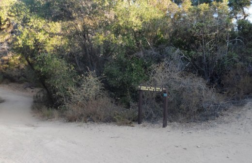
After making your way up the hill to the right, you'll go down a hill to another fork in the road, where you can either veer slightly right to to the Spring Canyon Trail, which takes you about a mile to the Ventu Park area of Newbury Park. Veer to the left to continue on the Los Robles Trail West.

LosRobles_SpringCynSign.JPG

Only 4.7 miles from this juncture is the Rancho Sierra Vista/Satwiwa National Park area in Newbury Park. Some challenging miles for sure, but fun!

LosRoblesTrail_JunctureSign.JPG

This section of the Los Robles Trail is mostly single track although some sections you can walk two-wide (though you'd best not do so, as there are many mountain bikes on these trails). Good to be aware of others on the trail.

I've attempted from time to time to count the number of switchbacks on my way up to the top of Space Mountain and back down and come up with something in the neighborhood of 8 to 10 of them. This is not a stroller friendly trail as it is steep, with plenty or rocks jutting out. An easy trail to twist your ankle if you're not careful.

A photo of a section of the Los Robles Trail West up Space Mountain.

A photo of a section of the Los Robles Trail West up Space Mountain.

It is roughly 3 miles to the top, where you will find one bench directly on the trail, facing a very short path to a viewing area with another bench.

Bench on the trail at the top of "Space Mountain" on the Los Robles Trail.

Bench on the trail at the top of "Space Mountain" on the Los Robles Trail.

The viewing bench at the very top of Space Mountain.

The viewing bench at the very top of Space Mountain.

All told, this is roughly about 3.5 miles each way, or 7 miles round trip.

Los Robles Trail sign at the top of Space Mountain.

Los Robles Trail sign at the top of Space Mountain.

Views from the top of Space Mountain looking west toward the Conejo Grade.

And as mentioned above, you can continue west on the Los Robles Trail west into Newbury Park. Portions of the trail go through privately owned land, which the owner has generously made available for public trail access...so be sure to treat the trail with respect!

LosRoblesWest_PrivPropSign.JPG

And last but not least, a view of the single track trail heading towards Newbury Park, where you will eventually connect with the Angel Vista Peak trail.

Single track with awesome, continuous views as you continue west into Newbury Park.

Single track with awesome, continuous views as you continue west into Newbury Park.

Rocky Oaks Nature Reserve in the Malibu Hills

RockyOaks_sign.JPG

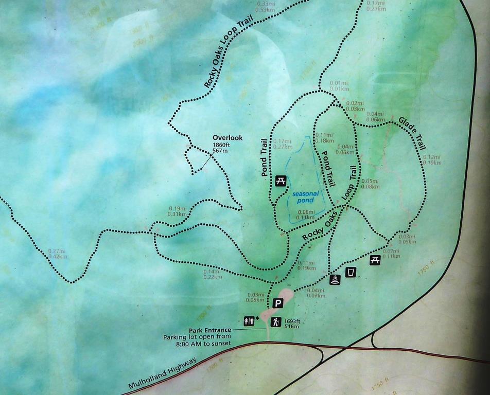
Rocky Oaks is a 250 acre nature reserve that is part of the Santa Monica Mountains Recreation Area, located at the 31500 block of Mulholland Highway in Malibu, west of Kanan Road. The entrance is on the north side of Mulholland Highway. The park is managed by the National Park Service.

RockyOaksLoopTrail.JPG

Rocky Oaks has various species of oak trees, some centuries old. The Overlook Trail takes you to a peak with gorgeous panoramic views while the Pond Trail (less than a mile round trip) takes you to a seasonal pond area which used to be part of a cattle ranch.

The Rocky Oaks Loop Trail is a 2.2 mile easy trail that is lined with sage. This is one of the more low key, easy to hike areas around town. It can get hot but at only 6 miles from PCH you can also feel some nice ocean breezes in these trails.

Learn more about Rocky Oaks and download a trail map at www.nps.gov/samo/planyourvisit/rockyoaks.htm.

Pond is looking quite nice in late spring of 2017.

Pond is looking quite nice in late spring of 2017.

RockyOaks_2.JPG

Los Robles Trail East in Thousand Oaks

The Los Robles Trail East in Thousand Oaks is accessible from the Los Robles Trail trailhead heading west from the corner of South Moorpark Road and Greenmeadow Avenue in Thousand Oaks.

LosRoblesTrail_SignMain.JPG

From the main trailhead, go west just under 1/2 mile and you'll see the fork in the road where you can go east or west. Head south (click here if you prefer going west) where you'll go towards the Los Robles Trail East.

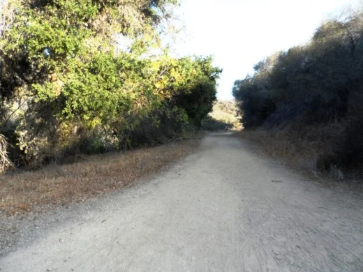
A gradual uphill of about 1/2 mile on a wide fire road trail takes you to a picnic bench and then a more winding, partially shaded, narrower, eastbound section of trail.

Fire road that takes you to picnic bench.

Fire road that takes you to picnic bench.

Picnic bench at juncture of fire road and narrower, steeper Los Robles Trail East.

Picnic bench at juncture of fire road and narrower, steeper Los Robles Trail East.

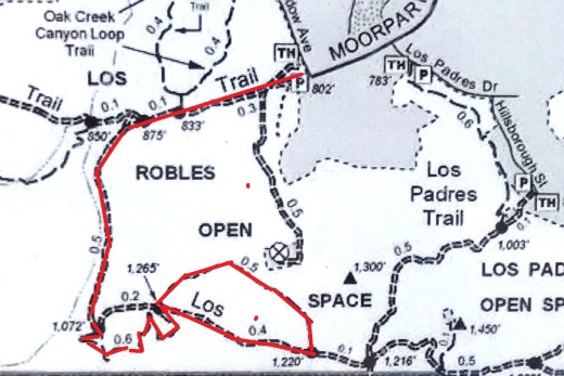
LosRoblesTrail_MapEast.jpg

Another .6 mile gets you to a hill where you'll soon be treated to a reward for your hiking effort...a bench with a view of the Conejo Valley.

Los Robles Trail East near hilltop viewpoint with bench.

Los Robles Trail East near hilltop viewpoint with bench.

And the bench at the top. Nice view of the Conejo Valley, eh?

And the bench at the top. Nice view of the Conejo Valley, eh?

And the trail loops around with another bench on the other side of the trail looking south towards Hidden Valley.

Bench facing south.

Bench facing south.

The trail loops back around towards the main Los Robles Trail, where you can head back west again from where you came from, or head east towards the northern tip of the Los Padres Trail or stretch further east towards the Triunfo Canyon Trail and White Horse Canyon Trail.

Now go on, take a hike!

Los Padres Trail in Thousand Oaks

LosPadresTrail_trailhead.JPG

The Los Padres Trail is a short, 1 mile, neat little trail accessed on Los Padres Drive, near the corner of Fox Hills Drive in Thousand Oaks. Take Moorpark Road south of the 101 freeway and turn left on Los Padres Drive. The trailhead is clearly marked on the right hand side, The trail is maintained by the Conejo Open Space Foundation.

Surrounded by trees in the first section of the Los Padres Trail.

Surrounded by trees in the first section of the Los Padres Trail.

Short but sweet, the trail is.canopied by trees, several bridges, mostly single track trail and a bit of a climb (750 feet) as you make your way up to the Los Robles Trail junction. That's about a mile, so you can turn around there for a 2 mile round trip hike.

Where the Los Padres Trail meets the Los Robles Trail.

Where the Los Padres Trail meets the Los Robles Trail.

Or...you can turn right (west) and head your way up the wide, fire road sized section of the Los Robles Trail east. This is a bit of a climb, but pretty moderate and gradual. Crest the hill and you'll see a gate.

The Los Padres Trail is winding, uphill and wide in this section.

The Los Padres Trail is winding, uphill and wide in this section.

Before the gate, you can turn left (east) and in 3 miles you're at Triunfo Park in the Los Padres Open Space via the Triunfo Canyon Trail. Or turn right (west) and you're off into the Los Robles Open Space. If you go straight ahead, you’ll reach a gate to Hidden Valley private property.

LosRoblesTrail_Triunfo.JPG
Gate at top of trail. Private property in Hidden Valley ahead.

Gate at top of trail. Private property in Hidden Valley ahead.

Marview Drive Trail in Thousand Oaks

Marview Drive Trail Trailhead in Thousand Oaks

Marview Drive Trail Trailhead in Thousand Oaks

If you're looking for a short, steep and sweet trail to hike up and down in Thousand Oaks, check out the trail on Marview Drive, just east of the entrance to Old Meadows Park at 1600 Marview Drive. Take Erbes Road and go west on Marview. After passing the residential section of the road, up ahead is Old Meadows Park and on the right is plenty of street parking across from the trailhead.

MarviewTrail_steep.jpg

Short it definitely is. Only about a quarter of a mile to the top of the hill, but it will take you a bit longer than your typical hike because it is so steep, at least the first section.

MarviewTrail.JPG

Then toward the top it starts to flatten out, where you will discover panoramic views of the Conejo Valley. There's also quite a clear view of the 23 Freeway from up here!

Marview_23fwy.JPG

At the top of the trail is a large, enclosed square fenced in with No Trespassing signs all over the place. This is a water tank. But you can walk around the area to the other side, where there's actually a trail and walkway that goes down to the St. Patrick’s Episcopal Church.

So there you have it! A short, steep, but sweet little trail in the heart of Thousand Oaks!

The Promenade at Westlake

thepromenade_logo.gif

Located at the southeast corner of Westlake Boulevard and Thousand Oaks Boulevard, The Promenade at Westlake is an architecturally appealing outdoor mall that has an assortment of things to do, including two large fountains, a koi pond and the Cinepolis movie theater.
One of two fountains at The Promenade at Westlake.
One of two fountains at The Promenade at Westlake.

Eateries include The Grill on the Alley, Marmalade Cafe, Farfalla Trattoria, Kreation Organic, Fresh Brothers, Lemonade, Paul Martin's American Grill and Soom Soom Fresh Mediterranean (opened in September 2018) and Shake Shack (opened in October 2018).

Other stores include Cost Plus World Market, See's Candies, Sprinkles Cupcakes and Ice Cream and a variety of clothing and specialty stores, including Restoration Hardware, Brandy Glanville, Intermix, Lululemon Athletica, Sephora, Sharon Segal / Nina Segal the closet, Chico's and more.

Lots of outdoor seating around the fountain area outside of Barnes and Noble.  There is usually live music on Friday/Saturday nights during the summer months.

ThePromenadeWLV_FrontFountain.jpg

The Promenade at Westlake is the sister mall of the similarly appointed The Commons at Calabasas

The Promenade is located at 100 Promenade Way, Westlake Village (southeast corner of Westlake and Thousand Oaks Boulevards).  Visit www.ShopPromenade.com or call 805.497.9861 for more information.

Previously at The Promenade:

Ranch Center Road, Wood Canyon Fire Road and Other Trails in Northern Point Mugu State Park

Northern Point Mugu State Park map image courtesy National Park Service

Northern Point Mugu State Park map image courtesy National Park Service

Point Mugu State Park in the Santa Monica Mountains stretches from Newbury Park to the ocean, over 14,000 acres of land and 70 miles of trails. Visit this link for more information.

If you ever get the time and energy, consider exploring the trails in the northernmost section of Point Mugu State Park. To access these trails, you can start at Rancho Sierra Vista/Satwiwa in Newbury Park and make your way up Big Sycamore Canyon Road, then, down, down, down the big paved hill into the canyons of Point Mugu State Park.

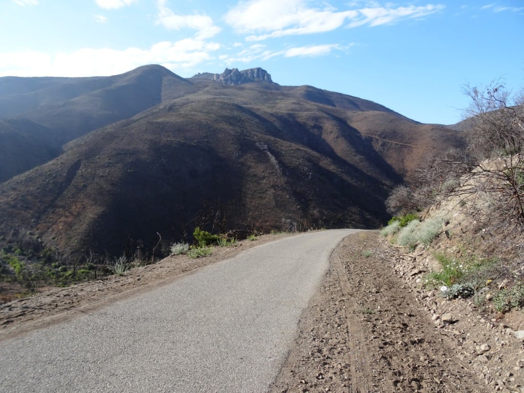
The descent down into the canyon on Big Sycamore Canyon Road is pretty steep. Watch for cyclists. Boney Mountain is seen in the distance.

The descent down into the canyon on Big Sycamore Canyon Road is pretty steep. Watch for cyclists. Boney Mountain is seen in the distance.

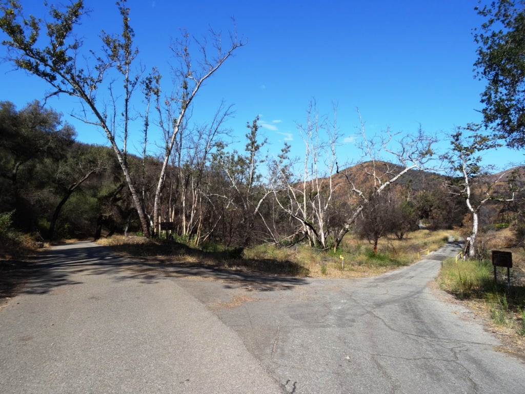
The descent into the canyon is about 3/4 mile. From there, you'll go another mile or so until you see a fork in the road. If you go straight (veering slightly left), you'll continue down Big Sycamore Canyon Road towards PCH. But if you turn right, you're on Ranch Center Road, a gradual, steady climb up an old, paved hill.

Juncture of Big Sycamore Canyon Road (left) and Ranch Center Road (right).

Juncture of Big Sycamore Canyon Road (left) and Ranch Center Road (right).

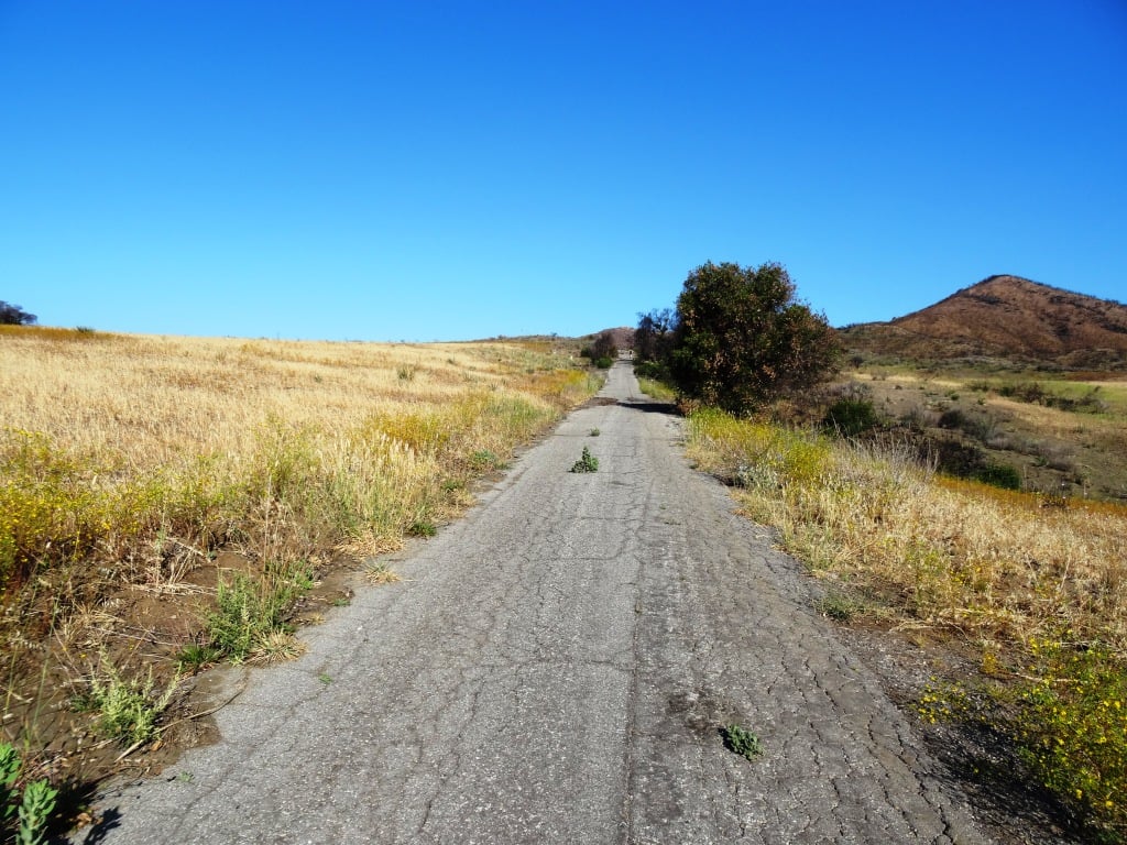
This is one section of Ranch Center Road. As you can see, this is a pretty old road that was used by the ranchers who lived here before the land was acquired by California State Parks.

This is one section of Ranch Center Road. As you can see, this is a pretty old road that was used by the ranchers who lived here before the land was acquired by California State Parks.

You are highly unlikely to see a lot of people down here. You might see a couple cyclists from time to time, but hikers/runners in these quiet areas are, from my experience, pretty rare in appearance. It feels like you're going to the middle of nowhere.

You will also notice that there are several trails that connect with the road, including, from east to west, the Sin Nombre Trail, Sage Trail, Ranch Center Fire Trail, Coyote Trail and, finally, the Wood Canyon Fire Road trail. All of these trails will either take you back to Big Sycamore Canyon Road or other trails that will allow you to do a loop back up to Rancho Sierra Vista. You can add another 4 miles to your adventure by checking out the Guadalasca Trail that connects to the Wood Canyon Fire Road. See detailed map here.

Old water tank seen at the juncture of Ranch Center Road (paved) and Ranch Center Fire Road (trail).

Old water tank seen at the juncture of Ranch Center Road (paved) and Ranch Center Fire Road (trail).

After you pass the water tank seen above, you continue downhill towards the remains of some old ranch houses. Pretty much everything has been demolished but you'll see some vintage items still on hand, along with signs warning you to stay outta there.

You've reached what used to be the Ranch Center.

You've reached what used to be the Ranch Center.

Not sure if this would sell on Craigslist.

Not sure if this would sell on Craigslist.

The old ranch house area is at the juncture of Ranch Center Road and Wood Canyon Fire Road. I particularly enjoying running down Wood Canyon Fire Road as it is so quiet and there is nice tree coverage.

More Wood Canyon Fire Road

More Wood Canyon Fire Road

Wood Canyon Fire Road runs south until it connects with the "Loop Trail" (west) or continues east back towards the Two Foxes Trail (parallels Big Sycamore Canyon Road) and then Big Sycamore Canyon Road, where you can veer back up north towards Newbury Park. 

DOZENS AND DOZENS OF TRAILS IN AND AROUND VENTURA COUNTY

Heritage Park Native Plant Demonstration Garden in Thousand Oaks

The Heritage Park Native Plant Demonstration Garden is located at the corner of Thousand Oaks Boulevard and Long Court in Thousand Oaks (next to the still vacant Corrigan's Steak House and across from Pacific Breeze Salon). The garden was designed by the Conejo Valley Audubon Society in collaboration with the City of Thousand Oaks. The drought-resistant California native plants seen in the garden attract birds, butterflies, pollinators by providing food and shelter while eliminating the need for fertilizer and pesticides.

More information at wp.conejovalleyaudubon.org/wp-content/uploads/2020/07/HeritagePark_Palette_FINAL-amended11-24-16.pdf.

San Buenaventura State Beach in Ventura

San Buenaventura State Beach is a two-mile stretch of beach from the Ventura Pier on the north down south past the homes of the Ventura Keys to just north of Marina Park on the south.

This beach features swimming, surfing and picnicking. There are two miles of sandy beach, sand dunes, picnic sites, a parking lot, restrooms and the Jolly Oyster. San Buenaventura State Beach features the largest day-use picnic area at a state beach in Southern California.

Looking to ride a bike but didn’t bring one? Rent one near the pier at Wheel Fun Rentals.

There’s a nice mile-long hike and bike trail along the beach stretching from the park entrance at San Pedro Street and Pierpoint Blvd to the Ventura Pier. This trail continues northward up the boardwalk past Surfers’ Point and beyond. CLICK HERE for more details on the Omer Rains Trail.

The 1,700-foot pier has a snack bar, Beach House Fish restaurant and bait shop. Wheel Fun Rentals is right near the pier if you need a bike. Visit www.parks.ca.gov/?page_id=600 or call 805.585.1850. Campfires not allowed at this beach.

Plenty of parking available for a fee, accessible at San Pedro Street and Pierpont Boulevard in Ventura, as well as additional parking with direct access to the Ventura Pier at 1156 E. Harbor Boulevard.

Malibu Lagoon Field Trips Hosted by Santa Monica Bay Audubon Society

The Santa Monica Bay Audubon Society (SMBAS) hosts Malibu Lagoon Field Trips the 4th Sunday of every month.

Adult Walk starts at 8:30 a.m. for 2-3 hrs. The group meets at the metal-shaded viewing area next to parking lot. SMBAS makes a special effort to make these monthly Malibu Lagoon walks attractive to first-time and beginner birdwatchers. Brings binoculars and cameras.

Metal shaded viewing area next to parking lot.

Metal shaded viewing area next to parking lot.

Children & Parents Walk starts at 10:00 a.m. for a 1 hr session. Meet at metal-shaded viewing area next to parking lot. SMBAS leaders are experienced with kids so by all means bring them down to the beach to enjoy nature. Binoculars will be provided.

Upcoming dates: 9/27/20. (SUBJECT TO CHANGE DUE TO COVID - PRIOR MONTHS HAVE BEEN CANCELLED)

If you have a Scout troop or other group 7 or larger, please call Lu at 310.395.6235 to make sure SMBAS has enough binoculars and docents on hand.

Visit smbasblog.com to learn more.

Directions: Malibu Lagoon is located at the intersection of Pacific Coast Highway and Cross Creek Road in Malibu. Bring water and sun protection; look around for people wearing binoculars and hats.

Parking: Self-serve parking machine in lot, $3/hr, $12 day ($11 seniors); credit cards accepted. Annual passes accepted. You may also park (read all signs carefully) on PCH west of Cross Creek Road, on Cross Creek Road, or on Civic Center.Way north (inland) of the shopping center. Lagoon parking in shopping center lots is not permitted.

Albertson Motorway Fire Road Trail in Thousand Oaks

The Albertson Motorway is a fire road and public trail that is accessible in the Lang Ranch Open Space in Thousand Oaks. The trailhead is at the east end of Lang Ranch Parkway. Street parking is available on Lang Ranch Parkway. This is a residential area, so be mindful of the neighbors.

The Albertson Motorway trailhead at the east end of Lang Ranch Parkway in Thousand Oaks.

The Albertson Motorway trailhead at the east end of Lang Ranch Parkway in Thousand Oaks.

Given this is a fire road, it is mostly wide, flat and hilly, taking you upwards and eastbound towards the Palo Comado/Cheeseboro Canyons, Las Virgenes Canyons and Ahmanson Ranch. The views are outstanding and get better the higher you go up. You'll see Simi Valley, Bard Reservoir, Thousand Oaks and beyond.

As you meander on the trail, stay towards the right to stick with the fire road. In the first mile and half, there will be several opportunities to veer left onto trails that take you up north towards the Autumn Ridge Trail in the Lang Ranch Open Space, which can be done as a loop (more details at cosf.org/trails/lang-ranch/lang-ranch-woodridge-strenuous-hike-autumn-ridge-to-albertson-motorway-loop). The Albertson fire road is more of an "out and back" trail where you can reach a particular destination, then turn back.

You will go towards a fairly short section of the trail that is not a fire road, but more of a single track area, for perhaps .2 mile. A fun little section for hikers, quite different than the rest of the trail. 

This is the section of Albertson Motorway not accessible to the public.

This is the section of Albertson Motorway not accessible to the public.

You'll eventually pass through a gate and about a mile and a half from there you will reach a point where you can take a right-hand turn (south) towards China Flat and Simi Peak. Along the way, there are two benches for taking in the view towards the Simi Hills.

You will eventually pass through this gate.

You will eventually pass through this gate.

Bench #1 on Albertson Motorway trail.

Bench #1 on Albertson Motorway trail.

Bench #2 on Albertson Motorway trail.

Bench #2 on Albertson Motorway trail.

The turnoff for Palo Comado/China Flat/Simi Peak is about 2 1/2 miles into the hike. There's a trail on the right. Hard to miss., then you'll see this sign.

Transition to Palo Comado Canyon Trail

Transition to Palo Comado Canyon Trail

If you continue past the transition to Palo Comado Canyon Trail, Albertson Fire Road continues on for awhile as you can see in the map below.

Albertson Fire Road Trail from China Flat turnoff area. (Courtesy National Park Service)

View of Bard Reservoir from Albertson Motorway Fire Road.

View of Bard Reservoir from Albertson Motorway Fire Road.

Elliot Mountain Trail and Outlaw Loop Trail in the Conejo Canyons Open Space, Thousand Oaks

Views from Elliot Mountain Peak in the Conejo Canyons Open Space

Views from Elliot Mountain Peak in the Conejo Canyons Open Space

Burt Elliot was a long-time trail volunteer in the Conejo Open Space and the Santa Monica Mountains National Recreation Area. He passed away in 2014, but his name lives on forever in the Conejo Open Space.

The Elliot Mountain Trail is a short (maybe .3 mile) spur trail off of the Outlaw Loop Trail in the Conejo Canyons Open Space in Thousand Oaks. This short, single-track trail leads you to the peak of Elliot Mountain, where you can enjoy panoramic views of the area.

This is about a 4 1/2 to 5 mile hike from the Conejo Canyons Bridge. Elliot Peak is about 975 feet, making it a fairly moderate hike, though indeed half the hike is fairly hilly. Reaching the top of Elliot Peak is slightly rocky, so you want to make sure to wear shoes made for hiking and consider a hiking stick.

Let’s do it:

Access the Conejo Canyons bridge via Santa Rosa Road. Coming from Thousand Oaks, take Moorpark Road north down the Norwegian Grade, where it intersects with Santa Rosa Road. Continue about 3.7 miles on Santa Rosa Road and make a left on Hill Canyon Road. Drive down Hill Canyon Road and you will see a large, flat dirt parking area on the right, adjacent to Santa Rosa Valley Regional Park. There’s also parking in a dirt lot directly across from the Conejo Canyons Bridge on the left.

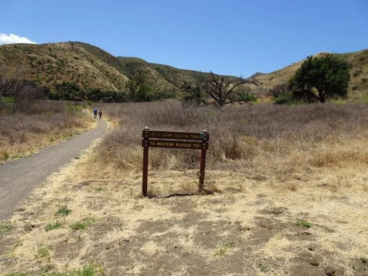
Take the flat Hill Canyon Trail about a mile until you get to a juncture with a sign. The sign says go straight to the Hawk Canyon Trail or a take a right on the Western Plateau Trail. Take the right.

This is the steepest part of the hike. You’ll go up the Western Plateau Trail about 1/2 mile until you see the first juncture. One the left you’ll see a sign that says “Vista Point,” where you see a bench with nice views. Directly across from there is a post with a “Bell Box” (a box where cyclists can borrow a bell to alert others to their presence). Next to the that is the single track “Outlaw Trail.” That’s where you’re going.

The Outlaw Trail is a mile and a half mostly single track loop trail with fantastic views of the area. Lots of switchbacks on this trail makes it popular with cyclists. I usually see one or two of them up here, and usually zero hikers (excluding yours truly). Shortly after entering the Outlaw Trail, you’ll reach a fork where you decide whether to go clockwise or counter-clockwise. If like me you tend to go clockwise, you’ll eventually will pass a trail to the left (west) called the Lichen Trail. Continue east a few yards to a sign that says Elliot Mountain Trail.

As mentioned above, the Elliot Mountain Trail is a short spur trail to the peak. The final couple dozen steps involve very minor rock climbing as an fyi. Nothing excessive. But it can get slippery. I’ve managed to get up there and back down perfectly fine in regular running shoes and no hiking pole, but just be careful.

Then after enjoying the views, you come back down to the Outlaw Trail and continue your way around the loop back down to the Western Plateau Trail. Enjoy your hike!

Conejo Canyons Bridge is the entry point to the trail.

Conejo Canyons Bridge is the entry point to the trail.

The Hill Canyon Trail is one of the flattest trails in the Conejo Valley. Take it a about a mile to the Hawk Canyon/Western Plateau sign juncture.(For continued flat trail, continue straight on the Hawk Canyon Trail.)

The Hill Canyon Trail is one of the flattest trails in the Conejo Valley. Take it a about a mile to the Hawk Canyon/Western Plateau sign juncture.(For continued flat trail, continue straight on the Hawk Canyon Trail.)

The Hawk Canyon Trail/Western Plateau Trail juncture. Exit stage right.

The Hawk Canyon Trail/Western Plateau Trail juncture. Exit stage right.

This section of the Western Plateau Trail is the steepest and widest section of the hike. There’s a bench off to the left about halfway up the hill if you need a break.

This section of the Western Plateau Trail is the steepest and widest section of the hike. There’s a bench off to the left about halfway up the hill if you need a break.

At the top of the hill, the first juncture is the Outlaw Loop Trail on the right. To the left (not picture here), you’ll see a sign that says “Vista Point.” There’s another bench here.

At the top of the hill, the first juncture is the Outlaw Loop Trail on the right. To the left (not picture here), you’ll see a sign that says “Vista Point.” There’s another bench here.

A few step into the Outlaw Loop, you’ll see this sign. Either direction gets you to the Elliot Mountain Trail.

A few step into the Outlaw Loop, you’ll see this sign. Either direction gets you to the Elliot Mountain Trail.

Eventually you will see this sign. You’re on your way up to Burt Elliot’s peak.

Eventually you will see this sign. You’re on your way up to Burt Elliot’s peak.

But before you reach the peak, there’s yet another bench placed by the Conejo Open Space Conservation Agency to enjoy the views.

But before you reach the peak, there’s yet another bench placed by the Conejo Open Space Conservation Agency to enjoy the views.

The trail to the peak, like the Outlaw Trail, is quite narrow, though nicely maintained.

The trail to the peak, like the Outlaw Trail, is quite narrow, though nicely maintained.