The Ojai Valley Sign and Rotary Club of Ojai Plaque on State Route 150
/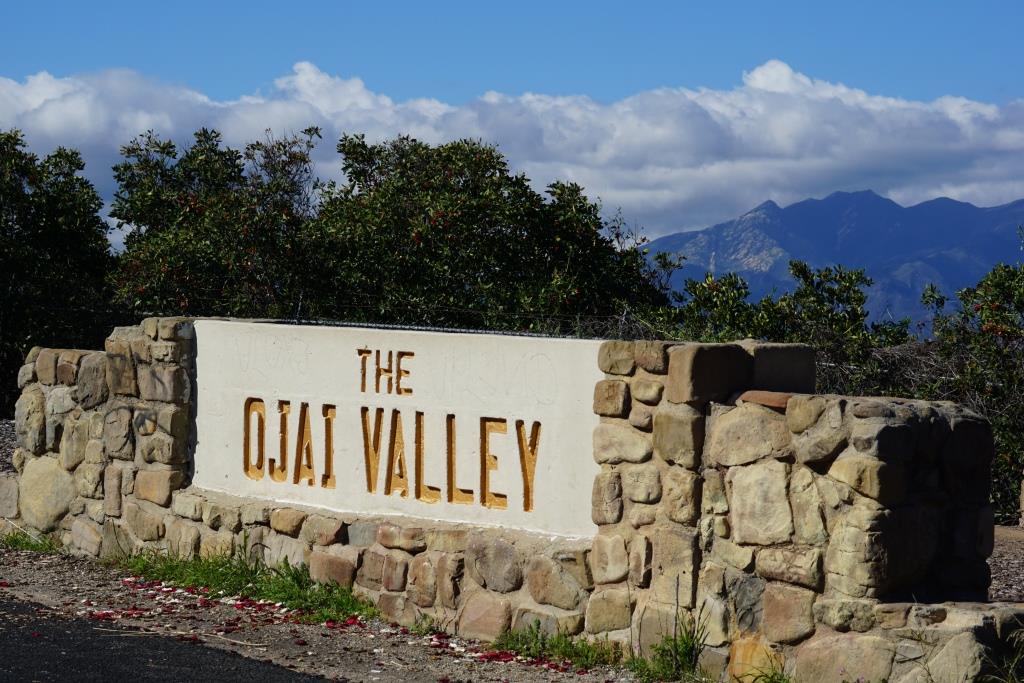
The Ojai Valley sign on California State Route 150 at 6462 Santa Paula Ojai Road.
California State Route 150 runs 36.4 miles, from State Route 126 in Santa Paula at 10th Street (where it is called Ojai-Santa Paula Road), through Ojai (where it is called Ojai Avenue), then co-signed with State Route 33 (Maricopa Highway) until unincorporated community Meiners Oaks, then Baldwin Road between Ojai and Lake Casitas, then finally, Casitas Pass Road until it ends at U.S. Route 101 in Carpinteria.
If you are driving the section between Ojai and Santa Paula (which you WILL have to do sometime to experience the beauty back there), at roughly 6462 N. Ojai Road you will see a large "The Ojai Valley" monument.
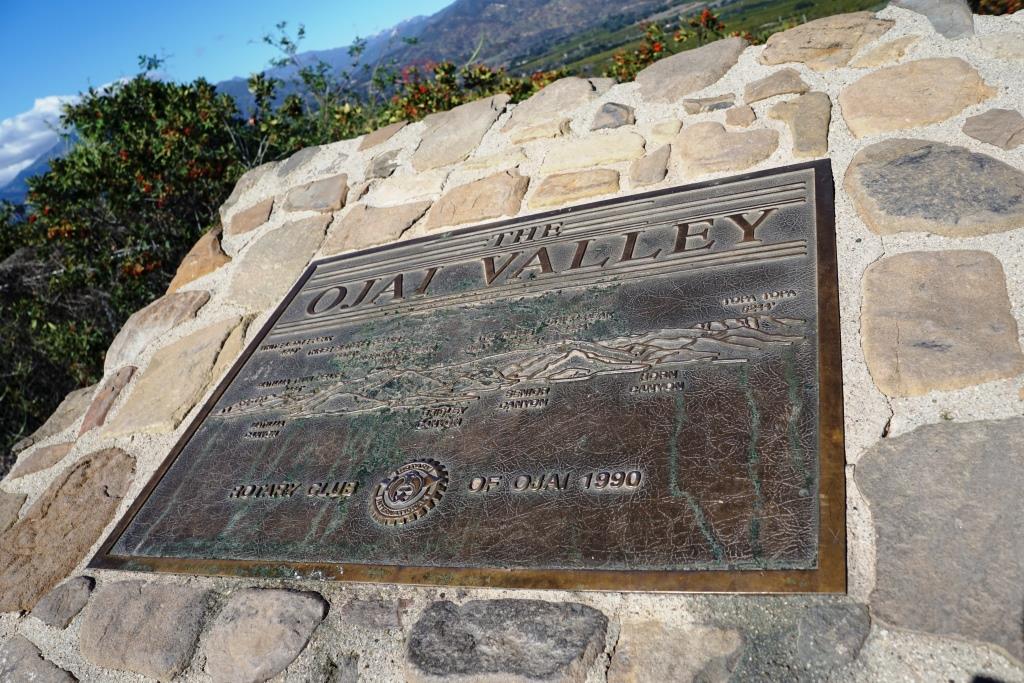
Park the car, check out the views of the Ojai Valley and take a look at the Rotary Club of Ojai plaque dated 1990. The plaque shows various prominent mountain peaks in the Ojai Valley, including:
- White Ledge Peak (4,640')
- Matilija Twin Peaks (4,485')
- Three Sisters Peaks (5,378')
- Nordhoff Peak (4,485')
- Chief Peak (5,334')
- Topatopa Peak (6,244')
The plaque also highlights the canyons in view - Matilija Canyon, Gridley Canyon, Senior Canyon and Horn Canyon.

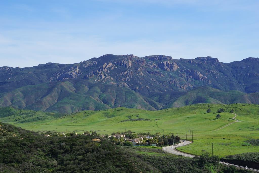
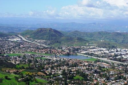
As you can see, the view is awesome. The tallest point ahead is Chief Peak.
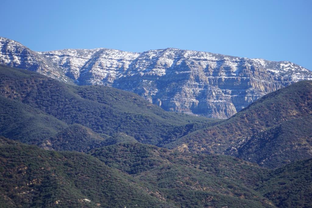
This photo was taken in January 2017 after storms dusted snow on the Topa Topa Mountains. We can see this snow from the Conejo Valley but it is fun to see it closer up from Ojai.