Tell Me About the History of the Street Names in Casa Conejo in Newbury Park

Casa Conejo is an unincorporated Ventura County community of about 1,000 homes located in Newbury Park. Casa Conejo is a rectangular shaped island within Thousand Oaks city limits, but is not part of the city. Although Casa Conejo is considered part of Newbury Park, it is not part of the majority of Newbury Park within the boundaries of the City of Thousand Oaks.

Casa Conejo Map.jpg

Premiering in 1960, Casa Conejo was the first planned community in Newbury Park. Several folks have asked about the origin of the street names in Casa Conejo. Here goes (with the help of a relative of the original developers):

Louis Lesser Enterprises developed Casa Conejo. Members of the Lesser and Malat families created the street names; hence Lesser and Malat Drives, Rudman Drive came from Louis Rudman, also related through marriage to the Lessers, and who managed home sales.
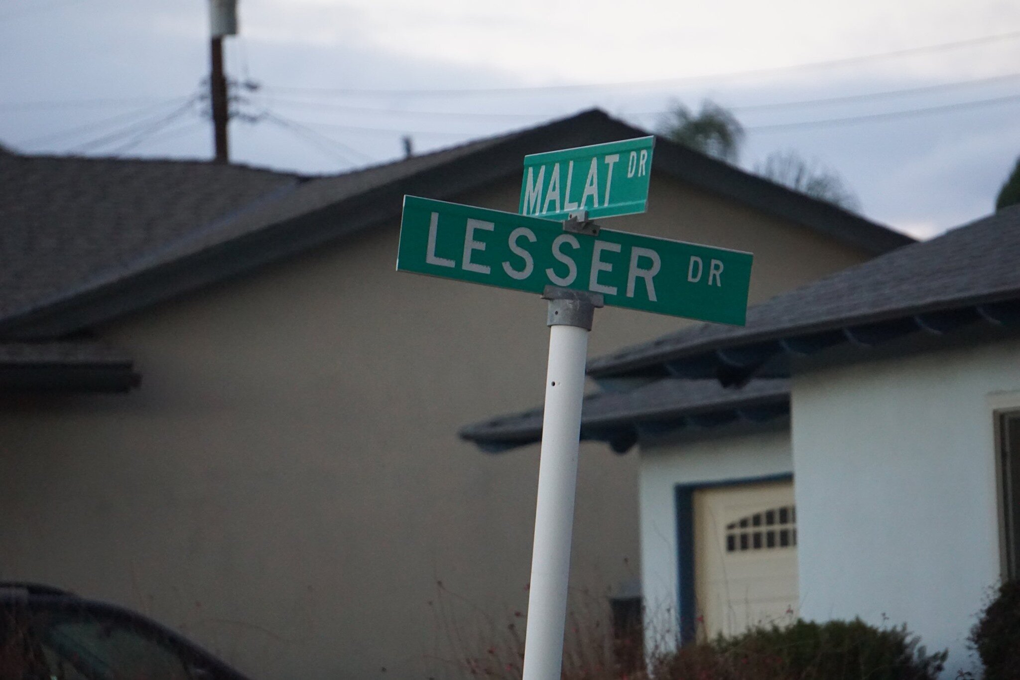
malat and lesser.jpg
rudman and lesser.jpg

William Malat (William Drive) had twin sons, Melvin (Melvin Ct) and Gerald (Gerald Drive). William's wife was Ethel (Ethel Ct). Louis Lesser's wife was Jeanne (Jeanne Ct). Louis Lesser's brother, Alvin "Sonny" was married to Martha (Martha Dr). Louis Rudman's wife was Shirley (Shirley Dr), who was also Ethel’s sister. One of Sonny's daughters is Dena (Dena Dr).

dena and gerald.jpg

Ben (Ben Ct) and Lily (Lily Ct) were Louis and Alvin Lesser's parents. Michael (Michael Drive) is a cousin (by marriage) of the Lessers and Malats. Cathy (Cathy Dr) and Francine (Frankie Dr) were two of Louis and Jeanne’s four children. Lisa Rudman (Lisa Ct) is related to the Rudmans (I suspect their daughter).

The jackpot winner was WENDY, who has by far the longest street, not to mention a freeway on/offramp and overpass, named after her! Wendy, who lives in AZ, is a granddaughter of William Malat and daughter of Melvyn. Before it became Wendy Drive in mid-1961, it was called Avenida de la Felicidad.

There are a couple dozen other streets in Casa Conejo that I don’t have the source for at this time, but perhaps I’ll do some more digging:

North/South Streets: Jenny Drive, Gerst Drive, Ruth Drive, Lois Ave, Dorena Drive, Kitty St, Bella Dr, Randy Dr, Debbie St, Cay Ct, Henry Dr, Devia Dr, Virginia Dr, Nellie Ct, Bob Ct, Elinor Ct.

East/West Streets: Gloria Dr, Carl Ct, Alice Dr, Lynn Ct, Lois Ct, Verna Ave.

wendy drive.jpg

Historical and Cultural Landmark Grandma Prisbrey's Bottle Village in Simi Valley

BottleVillage1.JPG

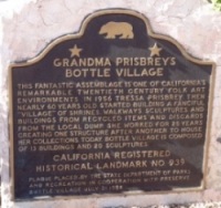
Grandma Prisbrey's Bottle Village in Simi Valley is a California Historical Landmark, Ventura County Cultural Landmark and is listed on the National Register of Historic Places.

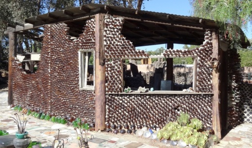
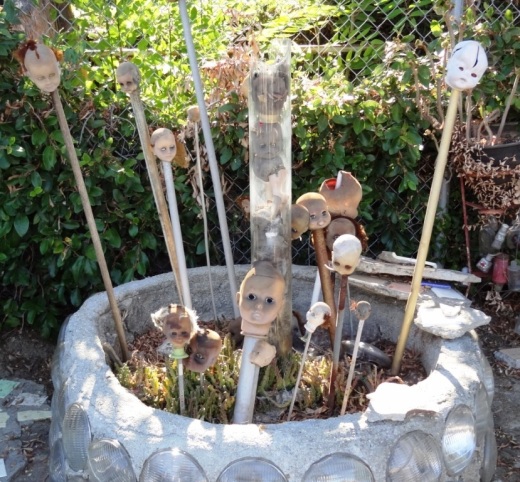
Bottle Village is a .3 acre lot located at 4595 Cochran Street that contains shrines, walkways, sculptures and buildings made from recycled items and discards from local landfills. All of these structures were built by hand over a 25 year old period by Tressa "Grandma" Prisbrey, beginning at age 60 in 1956 until 1972. Thirteen buildings and 22 sculptures in total.

BottleVillage8.JPG

A non-profit organization, Preserve Bottle Village (PBV), was formed in 1979. The 1994 Northridge Earthquake caused extensive damage to the Bottle Village site. PBV has embarked on a campaign to develop a master plan for the restoration of significant site components. Learn how you can help at bottlevillage.weebly.com. There’s also a more recent website, with link to social media and periodic tours, at www.bottlevillage.org.

Grandma Prisbrey sold the property in 1972 to care for an ailing son, but came back several years later to continue building and to give tours.  She died in 1988 at the age of 92.

BottleVillage9.JPG
BottleVillage11.JPG
BottleVillage7.JPG
BottleVillage5.JPG

Hillside Letters in the Conejo Valley and Greater Ventura County

There are over 500 hillside letters, or “mountain monograms,” in the United States, including 81 in California. What are hillside letters, you ask. They are simply large single letters, abbreviations and sometimes even messages erected on a hillside, usually by a school or town.

The Big “C” overlooking UC Berkeley (From Wikipedia; public domain)

The Big “C” overlooking UC Berkeley (From Wikipedia; public domain)

One well known hillside letter is a giant concrete block letter “C” built in the hills overlooking UC Berkeley that was constructed on March 23, 1905.

We have our share of hillside letters here in the Conejo Valley and Greater Ventura County, some of which you may be aware of…others, perhaps not.

The mountain monograms visible in our neck of the woods include:

The letters CLU on Mt. Clef Ridge above Cal Lutheran University are maintained by students.

Hilltop A overlooking Agoura High School up a steep hill. Made out of wood, I believe.

Here is a view of the letter VC north of Ventura College in late April 2019.

Here is a view of the letter VC north of Ventura College in late April 2019.

If you drive north up Catalina Street, west of Ventura High School, you will be able to see this letter V on the hillside.

The letter F is located in the hills west of Fillmore and is quite easy to see.

This letters SP letters in the hills south of Santa Paula is cleared brush. They originated in 1922. More information on THIS PAGE.

Happy Face Hill in Simi Valley is not a mountain monogram but is perhaps the visible hillside attraction throughout Ventura County.

Cheeseboro Canyon vs Chesebro Road in Agoura Hills

CheeseboroApr18.jpg

Cheeseboro and Palo Comado Canyons cover over 4,000 acres in the northernmost section of the Santa Monica Mountains National Recreation Area, in the Simi Hills. The Chumash occupied these canyons for thousands of years, until ranchers came into the area in the 1800s. The natural landscape changed as a result to accommodate the needs of grazing cattle.

The National Park Service (NPS) acquired Cheeseboro Canyon in the early to mid 1980s and subsequently acquired Palo Comado Canyon (formerly known as the Jordan Ranch), in 1994.

Nearly every time we post an image from Cheeseboro Canyon to a social media site, someone points out, "it's not Cheeseboro, it's Chesebro."

Why is it called Cheeseboro when the road that gets you to the trailhead is called Chesebro?

According to one NPS Ranger I've spoken with, the original owner of the land in the late 1800s was Oscar Cheesebrough (yet a different spelling). The NPS adopted the U.S. Geological Survey spelling of Cheeseboro, while Caltrans adopted the name Chesebro.

Why the difference? That's not so clear. But what IS clear is that the actual canyon is called Cheeseboro Canyon and it is a beautiful place to hike and bike!

CheeseboroPic1.jpeg
ChesebroSign.jpg

The Carpinteria Tar Pits are One of Five Natural Asphalt Lake Areas in the World

The Carpinteria Tar Pits at Carpinteria State Beach are located in a designated area called Tar Pits Park. The Carpinteria Tar Pits are one of five natural asphalt lake areas in the world, 2nd in size to and older than the La Brea Tar Pits in Los Angeles.

These tar pits date back to the Pleistocene Age (Ice Epoch), which 2.6 million to 11,700 years ago. Evidence of imperial elephants, the giant sloth, bison, wolf, tusked mastodons and camels have been discovered in t

Read More

M*A*S*H Site at Malibu Creek State Park

Malibu Creek State Park is a wilderness wonderland, stretching over 8,000 acres in Calabasas, Agoura and Malibu. The park is a great place for hiking, biking, camping, picnicking and exploring. If you do plan to explore the park, be sure to check out the old M*A*S*H (or "MASH" television series set!

MalibuCreek_Mash1.jpg

Produced by 20th Century Fox, M*A*S*H was filmed from September 1972 to February 1983 over 11 seasons and 256 episodes on CBS. Exterior scenes were filmed at what is now Malibu Creek State Park. Over the years, the ambulance and other props left at the old site became less and less visible as the surrounding brush became overgrown.

In 2007, the set was restored with a shaded picnic area, military vehicles, ambulance, helipad and signpost. Check out the photos below, but, better yet, visit it in person! For more pictures and extensive information about the M*A*S*H set and Malibu Creek State Park, visit www.malibucreekstatepark.org.

MASH_sign.jpg

The M*A*S*H site is easily accessible from the main parking lot at Malibu Creek State Park, mostly on wide fire roads, with one significant hill, a bridge crossing and one somewhat rocky trail section. The path is about 2 1/2 miles each way, so it would be a good idea to bring drinks and snacks.

MalibuCreek_Mash2.JPG
MASH_3.JPG
MASH_4.JPG
MashSite4.JPG
MashSite6.JPG

Erbes Road in Thousand Oaks Named After Early Settlers in the Conejo Valley

Courtesy of Thousand Oaks Library calisphere.org/item/ark:/13030/c8w093ww

Courtesy of Thousand Oaks Library

calisphere.org/item/ark:/13030/c8w093ww

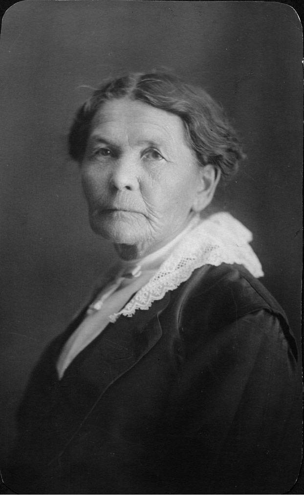
This is Elizabeth Opper Erbes. She is the mother of Ernest and Otto Erbes, who were early settlers in the Conejo Valley.

Otto (born in 1885, passed in 1959) owned a walnut orchard on what is now Erbes Road.

Estella Park on Erbes Road just south of Hillcrest is located on land donated to the city by Otto Erbes and his wife.

Erbes Road is a major north/south artery in the City of Thousand Oaks, stretching just over 5 miles, from Calle Zocolo, north of Olsen Road, on the north, to Thousand Oaks Boulevard on the south.

Olsen Road is also named after early Conejo Valley pioneer Nils Olsen. Olsen and four Norwegian compatriots purchased 650 acres of land from George Edwards in 1890.