Over 40 Things to Do in Malibu

This "27 Miles of Scenic Beauty" sign was swapped out for "21 Miles of Scenic Beauty" sign in April 2017 in order to correct the actual length of City of Malibu coastline.

This "27 Miles of Scenic Beauty" sign was swapped out for "21 Miles of Scenic Beauty" sign in April 2017 in order to correct the actual length of City of Malibu coastline.

The new sign updated in 2017.

The new sign updated in 2017.

Malibu was incorporated as a separate city in Los Angeles County on March 28, 1991, with 84% of Malibu voters supporting incorporation in a 1990 election.

The Conejo Valley lies just 8 to 10 miles away from the Malibu beachfront, making Malibu a natural choice to beat the heat and enjoy to its south-facing beaches. Here's a compilation of over 40 things to do in and around Malibu.

Beaches (East to West)

Surfrider Beach from the Malibu Pier

Surfrider Beach from the Malibu Pier

Adamson House

Adamson House

Several Dozen Things to See and Do in the City of Oxnard

OxnardSign.JPG

The City of Oxnard was incorporated on June 30, 1903. Covering an area of just over 39 miles, of which 70% is land, Oxnard is the most populous city in Ventura County, with nearly 208,000 residents in 2016.

Oxnard's namesake is Harry T. Oxnard, who opened a beet factory in 1899 and taught local farmers the ins and outs of growing sugar beets. The land for the factory was purchased from Thomas S. Rice (of Rice Avenue fame) and the first plant manager was Major J. A. Driffill, who later became mayor.

There's plenty to see and do in Oxnard, and we've summed up some of our favorite activities below.

Great beaches in Oxnard include Mandalay Shores, Hollywood Beach and Silver Strand Beach, which are highlighted at THIS LINK.

Speaking of beaches, ‘ololkoy Beach Park (formerly Oxnard Beach Park) is a nice park with a pirate-themed, accessible playground area, large grassy area, restrooms and quick access to the beach.

The Channel Islands Maritime Museum located at the Channel Islands Harbor is home to world class maritime art, ship models and other maritime items. Open Thursday through Monday from noon to 4pm.

Channel Islands Harbor is a great place to beat the heat with the family, offering a variety of activities, such as fishing trips, boat cruises, eateries, water sports, shopping and special events year-round.

Oxnard Beach Park

Oxnard Beach Park

There's a nice bike path in Oxnard that takes you from Oxnard Beach Park to Channel Islands Harbor that we enjoy from time to time.

The Henry T. Oxnard Historic District is located on F and G Streets, between Palm and 5th Streets. The area was added to the National Register of Historic Places in 1999. Most of the 144 historic homes and buildings in the area were built before 1925 and includes Mission/Spanish revival, bungalow/craftsman and Colonial Revival architecture.

A great time to check out the Historic Oxnard District is during the two weeks preceding Christmas each year, when dozens and dozens of residents decorate their homes in lights and holiday decor for Christmas Tree Lane.

The Oxnard Performing Arts Center hosts concerts, musicals, speakers and other performances year-round. At over 1,600 seats, it is one of the largest venues in Ventura County.

The Collection at RiverPark is an outdoor shopping center located on the northeast side of the 101 between the Oxnard and Vineyard exits. The 650,000 sq ft center includes a combination of entertainment, retail, restaurants, open space with fountains, parks and playgrounds and quality art. Activities at The Collection include Color Me Mine Ceramics Studio, Century RiverPark Movie Theater and Levity Live Comedy Club, Jump ‘n Jammin Children’s Entertainment Center, Red Door Escape Room and Bowlero.

Swing for the fences at Who's on First Batting Cages in Oxnard. What's on second? I don't know's on third. Who? First base.

Hollywood Beach

Hollywood Beach

River Ridge Golf Course is a public golf course offering two 18-hole courses as well as footgolf!

Skateboarders and in-line skaters are on a roll at the City of Oxnard Bedford Pinkard Skate Park near Channel Islands High School. Pinkard is a former City Council member who was a supporter of many youth and community programs.

The Elite Theatre Company, located at Fisherman's Wharf at Channel Islands Harbor, Fisherman's Wharf, is host to musicals, plays, comedies and more.

The Dallas Cowboys have held Summer Training Camp for a number of years at River Ridge Fields at Oxnard's Marriott Residence Inn. Practices and scrimmages taking place in August are open to the public and free of charge. Check for updates at www.dallascowboys.com/trainingcamp.

Halloween Events and Activities In and Around Ventura County

Halloween season is upon us again! Halloween 2025 looks to be a fun time with this compilation of Halloween events taking place in Ventura County and surrounding areas.

Dates/times subject to change; contact event organizers to confirm. This list will be updated regularly. For calendar view, click here.

Pumpkin Patches in Ventura County and Surrounding Areas

Cool Residential Displays (Click links for footage and more info)

10 Carob Drive, south of Borchard in Newbury Park

Residential display synchronized to music at 1455 Valley High, Thousand Oaks

Golden Crest Avenue in Newbury Park (Cross Street Antelope Place) - Two homes

Lakota Loop Family-Friendly Walkthrough Halloween Experience at 1881 Lakota Street, Simi Valley on October 26, 30 and 31 from 6:30-9PM.

“Blackwood Cemetery” annual display at home on Blackwood Street in Newbury Park

Mapleleaf Ave west of Madrid Ave in Newbury Park

Camino Dos Rios west of Lynn Road in Thousand Oaks

Flaming Star and Shenandoah in Thousand Oaks

Donald Avenue, just east of Wendy Drive in Newbury Park

Annual awesome display at this home on Yew Drive in Newbury Park

Bernadine St and Wauneta St in Newbury Park

Orangewood and Felton in Newbury Park

Backwoods Massacre Haunted House at 2360 Bryson Place in Simi Valley (quite scary - not for all ages).

PAST EVENTS

Sun, Oct 5: Trunk or Treat at Iceoplex Simi Valley (2:15-6PM)

Sat/Sun Oct 11-12: Mizel Family Foundation Harvest Festival in Thousand Oaks (10AM-2PM)

Sat, Oct 12: California Joe Halloween Magic Show at Camarillo Library (11AM-Noon)

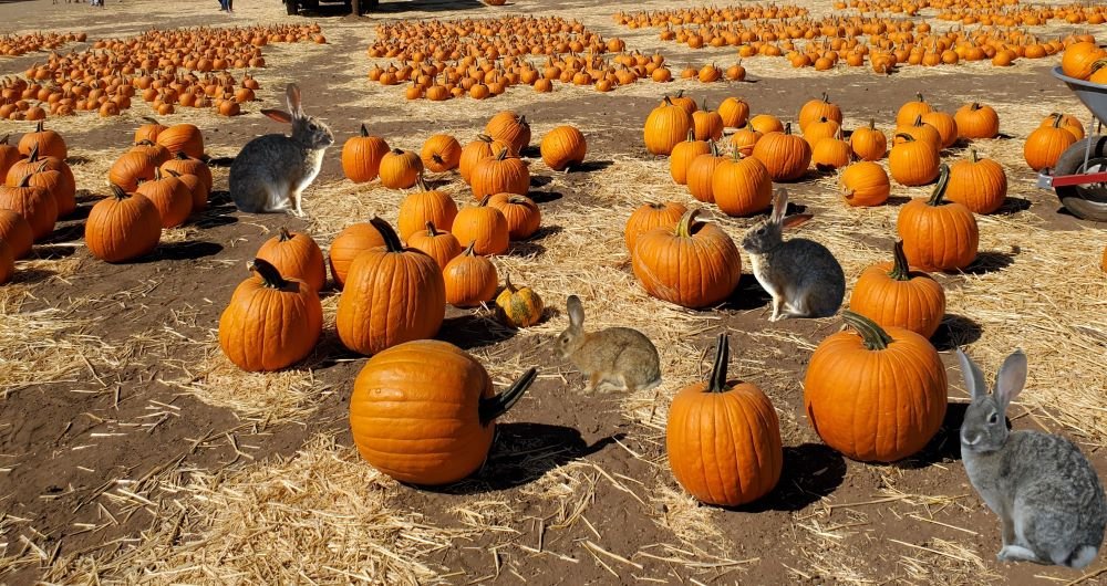
Sat, Oct 18: Free Pumpkin Patch at Simi Valley Town Center (10AM)

Sat, Oct 18: Simi Valley YMCA Fall Festival and Trunk or Treat (3-6PM) (RSVP)

Sat, Oct 18: Trail or Treat at Camarillo Grove Park (10AM-1PM; $10 hike requires RSVP)

Sat, Oct 18: Halloween Haunted Trail, Costume Contest and Trick or Treat Street in Thousand Oaks (6-9PM)

Oct 17-19: Boo at the Zoo at the Santa Barbara Zoo (5-8PM)

Oct 18-19: Boo at the Zoo at The Teaching Zoo in Moorpark

Sun, Oct 19: Calabasas Pumpkin Festival (10AM-5PM)

Wed, Oct 22: VC Dept of CSS 4th Annual Trunk or Treat in Camarillo (4-6PM)

Wed, Oct 22: Trick-or-Treat at The Collection at RiverPark in Oxnard (5PM) (RSVP)

Wed, Oct 22: 4th Annual Spook-Tacular Celebration in Port Hueneme (5-8PM)

Thu, Oct 23: Oxnard Police Department Trunk or Treat Spooktacular (5-7PM)

Fri, Oct 24: Ventura Harbor Witches Paddle (4-5:30PM)

Fri, Oct 24: Spooky Swim at Pleasant Valley Aquatic Center in Camarillo (5:30PM) (RSVP)

Fri, Oct 24: City of Malibu Bu Bash Halloween Carnival (Ages 2-10) (3-6PM)

Fri, Oct 24: Spooktacular Bash at Camarillo Community Center (5-7PM Age 50+)

Fri, Oct 24: Spooky Town at the Simi Valley Town Center (5-9PM)

Fri, Oct 24: Terrifying True Stories in a Haunted Church at Heritage Square Oxnard (6-10:30PM)

Sat, Oct 25: Inaugural Pumpkin Paddle at Channel Islands Harbor (10AM)

Sat, Oct 25: Halloween “BooFest” Event in Old Town Camarillo (Noon-4PM)

Sat, Oct 25: Harvest Festival at Stagecoach Inn Museum (1-4PM)

Oct 25-26: Boo at the Zoo at The Teaching Zoo in Moorpark

Sat, Oct 25: Howl-O-Ween Dog Costume Contest in Camarillo (10AM-1PM)

Sat, Oct 25: Peace Pumpkin Fest in Camarillo (10AM-3PM)

Sat, Oct 25: Trick or Treat Event at Mae Boyar Park in Oak Park (10AM-1PM)

Sat, Oct 25: Howl-O-Ween Dog Costume Contest at Ventura Harbor Village (Noon)

Sat, Oct 25: Pumpkin Party at the Leonis Adobe Museum in Calabasas (1-4PM)

Sat, Oct 25: Eastside Little League Trunk or Treat in Oxnard (2-7PM)

Sat, Oct 25: Pumpkin Festival at Christ the King Newbury Park (3-6PM)

Sat, Oct 25: Downtown Ventura Costume Contest and Trick-or-Treating (3-7PM)

Sat, Oct 25: Halloween Haunt in the Park at Plaza Park in Oxnard (4-7PM)

Sat, Oct 25: Parade of Frights Marketplace at Channel Islands Harbor (2-8PM; Parade at 7PM)

Sat, Oct 25: Ventura Family YMCA Trunk-or-Treat in Ventura (5-7PM)

Sat, Oct 25: Fall Festival at Conejo Valley Church of Christ (4-6PM)

Sat Oct 25: Terrifying True Stories in a Haunted Church at Heritage Square Oxnard (6-10:30PM)

Oct 24-26: Boo at the Zoo at the Santa Barbara Zoo (5-8PM)

Sun, Oct 26: Dia de los Muertos Celebration at Strathearn Historical Park (11AM-5PM)

Sun, Oct 26: Seaside Trick or Treat at Ventura Harbor Village (1-3PM)

Sun, Oct 26: Thriller Zombie Dance at Ventura Harbor Village (2:45-3:15PM)

Sun, Oct 26: Trunk or Treat at Inside Car Guys Newbury Park (4-6PM)

Wed, Oct 29: Trunk or Treat at Thousand Oaks Post Acute (5-7PM)

Wed, Oct 29: Halloween in the Park in Camarillo (5:30-8PM)

Pumpkin Patches in Ventura County and Adjacent Areas

The star of the Halloween show is the pumpkin. According to my favorite resource Wikipedia, the name pumpkin originated from the ancient Greek word pepon ("large melon"). The French called it pompom. The British changed it to pumpion. Then American colonists changed it to pumpkin.

Pumpkins are gourd-like squashes and technically are a fruit. They can range in size from 1 lb to 1,000 lbs.

But who cares about all that...what we REALLY want to know is, where are the pumpkin patches in Ventura County and surrounding areas for the 2025 fall season!? Well, here are some choices...but make sure to call before you go for hours, etc.

OTHER HALLOWEEN EVENTS AND ACTIVITIES AROUND VENTURA COUNTY

Big Wave Dave's Pumpkin Patch will be operating its pumpkin patch again this year at the Pacific View Mall under the big tent in the Trader Joe's/Target parking lot from September 26th through October 31st, 2025. Free admission to the pumpkin patch, with kids’ activities, photo opps and more. BBQ tri tip sandwiches available on weekends. Open Wednesday to Sunday. Hours 2:30pm-7:30pm Wed/Thu, 2:30pm-8:30pm Fri, 11am-8pm Sat and 11am-6pm Sun. Visit bigwavedaveschristmastrees.com/pumpkin-patch.html

Conejo Family Farms is a new local pumpkin patch in 2025 located at 5937 Ridge View Street in Camarillo. There is a pumpkin patch, 5 acre corn maze, hay rides, bounce house, weekend music, and more. Opens Wednesday, September 17th. Entry fee $10 for ages 5 and up. Visit www.conejofamilyfarms.com for more information. From Thousand Oaks, take the 101 north to Camarillo Springs Road, go south to Ridge View Street and take a right. The patch will be on the right.

Mizel Family Foundation You Pick Pumpkin Days in Hidden Valley on Tuesdays, Wednesdays, and Thursdays from 4-5:30PM, October 14-30. Visit Mizel Estate Wines on a fall afternoon where you can select and harvest your own pumpkins. Mizel’s Pumpkin Patch features a wide variety of pumpkins in all sizes, shapes and colors. Located at 1050 W. Potrero Road. www.mizelestate.com

Pumpkins_moreof.jpg

Boccali Ranch Pumpkin Patch at 3277 E. Ojai Avenue in Ojai will be open 7 days a week from 10am to 7pm from October 4-31, 2025. They offer tiny to extra-large “Big Mac” pumpkins, squash, gourds, Indian corn and seasonal produce. More details at boccalipumpkins.com.

Prancer's Pumpkin Patch Santa Paula is located at 18540 East Telegraph Road and their Fall Fest will take place September 27 to October 31, 2025. Pumpkin patch events on weekends from 9am to 6pm with the following themes:

  • 9/27-9/28: Animals of the Farm

  • 10/4-10/5: Heroes on the Farm

  • 10/11-10/12: Wild West on the Farm

  • 10/18-10/19: Fiesta at the Farm

  • 10/25-10/26: Harvest Fest on the Farm

Fall fest includes 10 acres of pumpkin patch, wagon hay ride, animal center, corn field expedition, farm games, live entertainment and more. Admission $26 ages 3 and up. Ages 2 and under free. Check for details at prancersfarm.com.

Stu Miller's Pumpkin Patch just east of the Simi Valley Town Center.

Stu Miller's Pumpkin Patch just east of the Simi Valley Town Center.

The 2025 Underwood Family Farms Fall Harvest Festival in Moorpark is back from September 27 to October 31 at 3370 Sunset Valley Road. Admission includes huge pumpkin patch, tractor-drawn wagon rides, corn maze, giant tractor display, hay pyramids, animal center, and many other family-friendly activities. Themed weekend events include animal shows, pig races, live performers, roaming entertainment and more. Weekday admission is $16 at the gate only. Weekend admission varies from $25 to $34 per person purchased online. Children 2 and under and parking are free. More details at www.underwoodfamilyfarms.com/fall-harvest.

The Underwood Farm Center in Somis at 5696 Los Angeles Avenue also has a pumpkin patch along with its year-round animal center. Open 9am to 6pm.

McGrath Brothers Great Pacific Pumpkins is located at 5100 Olivas Park Drive in Ventura. Call 805.644.1235. They are open the entire month of October from 9am to 6pm. Admission is $3. Tractor ride is $2. Hay Maze is $2. Check their Instagram page at www.instagram.com/mcgrathgreatpacificpumpkins for updates.

Bennett's Best Pumpkin Patch has locations next to the Whizin Market Square at 28900 Roadside Drive and at the corner of Kanan and Agoura Roads.

The Four Seasons of Fun Adventureland pumpkin patch at the Simi Valley Town Center in the parking lot open daily through November 2nd. Hours vary. Bounce house activities available. www.facebook.com/profile.php?id=61581115013603

There will not be a Seasonal Adventures Pumpkin Patch this year in Thousand Oaks and Simi Valley as in years past. However, they will be hosting a Pumpkin Patch at the Pierce College Farm Center, 7100 El Rancho Drive, Woodland Hills. The patch will be open daily from October 1st to 31st, 2025. Hours 4-9pm Mon-Thu, 4-10pm Fri, 11am-10pm Sat and 11am-9pm Sun. Free admission and parking. Attractions require tickets. www.seasonaladventures.com/pierce-college

Great Pacific Pumpkins Ventura1.JPG

Indoor Play Places In and Around Ventura County

There are hundreds of parks with play areas throughout the Conejo Valley and Greater Ventura County compiled at THIS LINK, but if you are looking for an indoor playtime experience with your little ones, from toddlers to teens, here are a number of options to check out.

This is just a small sampling of kids' activities highlighted here on Conejo Valley Guide.

FUN FOR THE KIDS AT LOCAL VENTURA COUNTY AREA SHOPPING MALLS

The three story foam ball projectile and climbing area at Kids World in Oak Park.

The three story foam ball projectile and climbing area at Kids World in Oak Park.

Compilation of Public Beaches Spanning From Oxnard to Hueneme to Malibu

In a separate post, we highlighted beaches ranging from Carpinteria down south to the beaches at the Ventura Harbor. This is the 2nd installment of local area beaches that stretch from McGrath State Beach on down to the beaches gracing Malibu. We hope these compilations prove useful in guiding you to all the oceanfront fun Ventura County and adjacent areas have to offer!

Additionally, here's a compilation of beaches in the Santa Barbara area (excluding Carpinteria).

McGrath State Beach has been closed due to flooding issues since 2019. Visit parks.ca.gov/?page_id=607 or call 805.968.1033 for more information.  McGrath has 2 1/2 miles of beach available. Swimming, surfing, and water sports are discouraged because of rip currents. McGrath is 5 miles south of Ventura off the 101 freeway via Harbor Boulevard.

Mandalay State Beach is 94 acres of undeveloped beachfront land located south of Reliant Energy's Mandalay Generating Station. The natural sand dunes and the wetlands ecosystem are recognized for their important natural value and houses several threatened bird species. This is a passive, natural open space park with no support facilities. The sandy ocean beach and adjacent coastal dunes are available for public day use only. The beach is managed by the County of Ventura on behalf of the California State Parks Department. Located at the corner of Harbor Boulevard and 5th Street in Oxnard. Visit www.parks.ca.gov/?page_id=609. No dogs allowed.

‘ololkoy Beach Park (formerly Oxnard Beach Park) has one of the best kids play areas around town, restrooms, lots of grass, and easy access to miles and miles of beach. The park is located at 1601 S. Harbor Boulevard. visitoxnard.com/directory/oxnard-beach-park

Oxnard Beach Park looking towards the beach.

Oxnard Beach Park looking towards the beach.

Hollywood Beach is a great spot for swimming, sunning and viewing the Channel Islands. Free public beach volleyball courts, public restrooms on the north end of the beach, on-street parking and lifeguards on duty between Memorial Day and Labor Day. Located right next to Channel Islands Harbor off of Harbor Boulevard. Dogs are allowed at Hollywood Beach on leash before 9am and after 5pm. West-facing beach means it’s great for catching the sunset!

Hollywood Beach

Hollywood Beach

Silver Strand Beach is a 1 mile long beach near Channel Islands Harbor, about 150 yards in width. It is capped by north and south jetties, both of which have small parking lots; one next to San Nicholas Avenue (at Ocean Drive), the other next to Sawtelle Avenue. Free parking from sunrise to sunset with limited restroom facilities. This is a sandy bottom beach break which may have rip tides and an undertow, so be careful. Dogs on leash allowed before 9am and after 5pm. Lifeguards on duty daily during summer months. Accessed via S. Victoria Avenue. Visit visitoxnard.com/things-to-do/beaches/silver-strand-beach for more information.

There's a Kiddie Beach Park off of S. Victoria Avenue at Sunset Drive with available parking, restrooms and benches. It is a small sliver of sand that fronts the south end of Channel Islands Harbor and thus does not face ocean waves.

Hueneme Beach Park is a 50 acre area with picnic tables, barbecue pits, walking paths, a fishing pier, sand volleyball courts, Surfside Seafood snack bar, lifeguards and restrooms. Beach parking lots and Surfside Drive parking available for a fee. No dogs allowed. Visit www.ci.port-hueneme.ca.us/index.aspx?NID=926 for more information. Located at 550 E. Surfside Drive, Port Hueneme

Ormond Beach is a 1,500 acre area composed of agriculture, industry and wetlands. A two mile long beach extends from Port Hueneme on the north to Naval Base Ventura County on the south. This is one of the few areas in southern California with an intact dune transition zone marsh system, hosting over 200 migratory bird species. The California Coastal Conservancy is restoring these wetlands. A bit off the beaten path, it is probably more geared towards bird watchers and hikers. Get there via Hueneme Road, going south on either Perkins Road on the north and Arnold Road on the south.

Naval Base Ventura County occupies roughly 6 miles of oceanfront space between Ormond Beach on the north and Point Mugu State Park on the south. This space is not accessible by the general public. However, there are periodic opportunities for civilians to catch a glimpse of the Pacific Ocean from NBVC during organized events open to the public.

Mugu Beach is the first publicly accessible beach area south of Naval Base Ventura County off of PCH, located adjacent to the prominent Mugu Rock. For the most part this is the most quickly accessible beach to Camarillo and Conejo Valley residents. There is paid parking ($12 last time I was there) as well as parking available on PCH. Popular with fisherman. One thing to be aware of here is that there is a significant undertow. If you bring the little ones, best to stay out of the water or just be extra careful.

South of Mugu Rock there is also some beach that is accessible with plenty of parking on PCH. No facilities and not a lot of beach, but beautiful views and a quick place to explore.

ThornhillBroome.JPG

Thornhill Broome Campground and Beach is also part of Point Mugu State Park, located a mile or two south of Mugu Beach. This is a campground right on the beach with a capacity for about 60 or so RVs. But of course you can visit for the day for a parking fee. Plenty of parking also available on PCH. Porta-potties available. Dogs are allowed around here as long as they are on a leash (and paleeeze...pick up after them).

Across the street on PCH is a gigantic, steep sand dune that I've always found to be interesting. Learn more about that sand dune here.

Unusually large sand dune on the east side of PCH across from Thornhill Broome Campground

Unusually large sand dune on the east side of PCH across from Thornhill Broome Campground

Sycamore Cove is at the southernmost beachfront portion of Point Mugu State Park. Point Mugu State Park features 3.6 miles of ocean shoreline (Sycamore Cove to Mugu Beach), with rocky bluffs, beaches, sand dunes, rugged hills and uplands, two major river canyons and wide grassy valleys dotted native trees.

Sycamore Canyon Campground across PCH from Sycamore Cove has 58 campsites. For a challenge, ride or hike down through Sycamore Canyon from Rancho Sierra Vista/Satwiwa in Newbury Park. You'll most likely have to pay to park here (most recently $12 for day use) as there are not many spots on PCH available on the south side...watch out...there are no parking signs all over the place.

SycamoreCove_sign.JPG

Sycamore Cove Beach has a number of picnic benches shaded by trees and is thus a popular spot on summer weekends for the BBQ crowd as well as with the campers from the campground on the other side of PCH. Located at 9000 Pacific Coast Highway. Visit www.parks.ca.gov/?page_id=630.

Trees shade the picnic tables at Sycamore Cove Beach

Trees shade the picnic tables at Sycamore Cove Beach

In the 3.3 mile stretch of PCH between Sycamore Cove Beach and County Line Beach (below) there are three or four places where you can park on PCH and access the beach.

One of these beaches I refer to as Call Box 1-35 Beach, about a mile southeast of Sycamore Cove Beach. This is not the official name of this beach in the unincorporated section of Ventura County northwest of Malibu city limits. But since the dilapidated staircase leading down to the beach is next to this call box, it seems appropriate. The address is approximately 9649 Pacific Coast Highway, Malibu (yes, technically not Malibu, yet in Google maps the address says Malibu).

About half a mile southeast of Call Box 1-35 is Call Box 1-27 Beach, which I also refer to as 26 Steps Beach. 26 Steps Beach is approximately 1.9 miles northeast of County Line Beach (see below) and 1.5 miles southwest of Sycamore Cove Beach (see above), at approximately 9999 PCH, just west of Deer Creek Road. I made up the name 26 Steps Beach because there is a well-worn, tagged up staircase that leads you from your parked car on PCH near the 1-27 Call Box sign to the beach. This is not a bad little section of beach that rarely has many people. No restrooms. Parking is free on PCH.

County Line Beach is located across the street from the iconic Neptune's Net, 3 miles south of Sycamore Cove at 42505 Pacific Coast Highway, Malibu. Lots of surfers and places to explore. Park on PCH. Watch out for bikers...there can be hundreds of them hanging out here on many a weekend. There are outer reefs for scuba diving that have an abundance of sea life. Activities include diving, surfing, and tide pools. No lifeguards on duty. There are a few porta-johns here. Technically, County Line Beach is located in Solromar, an unincorporated community in Ventura County - but they use the Malibu zip code so hey, it’s ok to say it is in Malibu.

NeptunesNet.JPG

Before the main Leo Carrillo State Beach area while heading south on PCH is the Leo Carrillo State Park Staircase Beach area. There’s a California State Parks parking lot at 40000 Pacific Coast Highway, Malibu. Parking is available for approximately 50 cars. There’s a moderately narrow trail that takes you down to the beach, which is also a fairly narrow beach with lots of rocks. You can also walk to this beach from the main Leo Carrillo Beach. Dogs allowed on leash.

Leo Carrillo State Park Staircase Beach parking lot.

Leo Carrillo State Park Staircase Beach parking lot.

Leo Carrillo State Park consists of 1 1/2 miles of beach for swimming, surfing, windsurfing, surf fishing and beach combing; one of our favorites for exploring sea caves, rocks and tidepools. Located at 35000 West Pacific Coast Highway, Malibu, Leo Carrillo is about 1 1/2 miles south of County Line Beach. On the north side of PCH, there are 135 campsites in over 2,500 acres. Visit www.parks.ca.gov/?page_id=616 or call 805.488.1827. Dogs on a leash are allowed in day use areas, campground and north beach (north of lifeguard tower 3). Dogs are not allowed on back country trails or south beach (south of lifeguard tower 3). Park on PCH or in the state lot ($12) and take the tunnel under PCH to the beach. More details on how to get to Leo Carrillo from the 101 freeway at this link.

NicholasCanyon.JPG

Nicholas Canyon County Beach is one mile east of Leo Carrillo at 33850 Pacific Coast Highway. Great beach where you can hang out, fish, picnic, surf and more. About 150 parking spaces available. Generally $10 to park on summer weekends, or park on PCH. More info at beaches.lacounty.gov/nicholas-canyon-beach. Restrooms available.

A view of Nicholas Canyon County Beach, just a mile east of Leo Carrillo.

A view of Nicholas Canyon County Beach, just a mile east of Leo Carrillo.

Located between Leo Carrillo and Point Dume State Beaches, Robert H. Meyer Memorial State Beach is made up of a number of cove or cliff-foot strands known as "pocket beaches" along the west end of Malibu, including El Pescador, La Piedra and El Matadorwww.parks.ca.gov/?page_id=633 Dogs are not allowed on state beaches.

El Pescador State Beach is 1.4 miles east of Nicholas Canyon at 32900 Pacific Coast Highway, Malibu. Steep, uneven stairs lead to about 10 acres of narrow, sandy beach. It is just east of Decker Canyon, the curvy, steep road that takes you up to Hidden Valley/Westlake Village. Dogs are not allowed on state beaches. Limited parking is available (fees vary) or park on PCH. Small, secluded beach. When the tide is not too high, you can trek you way east towards La Piedra Beach and back.

Porta-potty available. www.parks.ca.gov/?page_id=633.

Sign on PCH east of Decker Canyon Road, prior to El Pescador State Beach to the west of it.

Sign on PCH east of Decker Canyon Road, prior to El Pescador State Beach to the west of it.

La Piedra State Beach is .3 miles east of El Pescador at 32700 Pacific Coast Highway. A fairly long hiking path (may be a bit challenging for those lugging a lot of stuff) leads to 9 acres of narrow, sandy beach. Dogs are not allowed on state beaches. Limited parking available for a fee (which vary) or park on PCH. Porta potty available. www.parks.ca.gov/?page_id=633.

El Matador State Beach is .3 miles east of La Piedra at 32350 Pacific Coast Highway, just east of where Encinal Canyon Road intersects with PCH. A dirt path, then dozens of stairs, leads to 18 acres of narrow, sandy beach with stunning, rock formations and caves.

Dogs are not allowed on state beaches.  There is a parking lot with room for 25 or so cars where you can pay $3/hour or $10 for all day (as of June 2025).  You can also park on PCH, but on the north side...for whatever reason parking is prohibited on the south side of PCH. This means you have to cross PCH, which can be a challenge. There are porta-potties available. www.parks.ca.gov/?page_id=633

Stunning rock formations at El Matador State Beach.

Stunning rock formations at El Matador State Beach.

Lechuza Beach in Malibu, a mile east of El Matador State Beach, is maintained by the Mountains Recreation and Conservation Authority. It is a small, sandy beach with beautiful rock formations and views up the coast. Accessible via the northeast end of Broad Beach Road.  More information and specific access points at mrca.ca.gov/parks/park-listing/lechuza-beach. Dogs not allowed on the beach.

Zuma Beach is located at 30000 Pacific Coast Highway about 3.5 miles east of El Matador. With 1.8 miles of beach, Zuma is one of the largest and most popular beaches in Los Angeles County, Zuma is known for its long, wide sands and excellent surf. Plenty of facilities, including several food stands, restrooms, showers, volleyball, etc. Plenty of street parking on PCH and over 2,000 parking spaces (currently $8 weekdays and $15 weekends). Visit beaches.lacounty.gov/zuma-beach for more information. Zuma is known for riptides, so do be careful out there.

NOTE: Fires, including BBQs, are not allowed on any beach in Malibu; the exception is that fires may be allowed in designated spots at some state beaches. Dogs not allowed on the beach also.

Zuma Beach

Zuma Beach

Point Dume State Beach is a 63 acre promontory that juts out into the Pacific and features headlands, cliffs, rocky coves and vast beach access for swimming, surfing, scuba diving and fishing. Westward Beach borders Zuma Beach at Zuma's south side. There is plenty of parking on Westward Beach Road, which parallels Westward Beach. To the southeast of Westward Beach is a small 300 foot or so beachfront area called Pirate's Cove Beach (which due to its seclusion was once used as a nude beach).

PointDumeSign.jpg

At the end of Westward Beach Road (WBR), access to the protected 34-acre Point Dume Natural Preserve begins from the cul-de-sac. A gradual ascending trail leads to an ancient coastal bluff sand dune with spectacular views...we've seen whales, seals and dolphins over here. A stairway from the east side of the bluff-top preserve allows access to a more isolated beach and tidepools (look but don't touch). Location/Directions: Take Kanan south to PCH and turn right. WBR is over the rise, at the foot of the hill. Park free on WBR or pay a fee at Westward Beach lot. No restrooms at the Preserve but some can be found on WBR. Call 310.457.8143 or visit www.parks.ca.gov/?page_id=623 for more information.

NOTE: Dogs are not allowed on trails in the Point Dume Natural Preserve or on the beach.

Looking down on the beach at Point Dume

Looking down on the beach at Point Dume

Paradise Cove Beach is located at 28128 Pacific Coast Highway, accessed via Paradise Cove Road. Parking (as of August 2025) is $10 weekdays ($15 weekends/holidays) for if you spend up to 4 hours at the Paradise Cove Beach Cafe (and spend at least $30 there) or $45/$65/day (weekdays/weekends) if you park there just for the beach. Or, you can park on PCH and walk there. There are restrooms, cabanas, lounge chairs and chairs for rent, and a small pier. Visit www.paradisecovemalibu.com.

Escondido Beach is a short, narrow strip of beach accessible just west of Geoffrey's Malibu via a long stairway at 27420 PCH or near the corner of Escondido Beach Road and Malibu Cove Colony Drive. Look for access signs. No dogs allowed. No facilities.

Dan Blocker Beach is located at 26000 Pacific Coast Highway (between Solstice Canyon and Corral Canyon Roads. A sandy, narrow beach that draws surfers and scuba divers. Limited free roadside parking. Restrooms are available. Corral Canyon (trail map HERE) is located across the street at 25623 PCH. The trailhead is on the north side of PCH next to Malibu Seafood restaurant. The beach can be accessed from via a seasonal trail under PCH. 310.305.9546

On June 14, 2016, a new beach stairway access was completed at 24038 Malibu Road. Very little parking available there and no facilities at the beach. Read more at THIS LINK.

Malibu Beach is a 167 acre beach at 23050 and 23200 Pacific Coast Highway that includes Malibu Lagoon, Malibu Lagoon Museum and the Malibu Pier. Malibu Surfrider Beach next to the pier is quite popular with local surfers. Parking available for a fee, or park on streets surrounding Malibu Country Mart and walk across PCH at the signaled crosswalk at Cross Creek Road.

Malibu Surfrider Beach viewed from the Malibu Sportfishing Pier

Malibu Surfrider Beach viewed from the Malibu Sportfishing Pier

Perhaps the most expensive strip of beach in the world is Carbon Beach, which stretches about a mile and a half between the Malibu Pier and just east of Carbon Canyon Road. This wide beach is a beautiful strip of sand, but public access points can be challenging to find and parking can be a challenge. Learn specifics at THIS LINK but specifically, the public accessway points are at 22670 PCH, 22466 PCH and 22126 PCH. No restrooms and no dogs allowed at this beach.

Las Tunas Beach is located at 19444 Pacific Coast Highway, about 4 1/2 miles east of the Malibu Pier. It is a narrow beach beneath the bluffs that holds a special attraction to surf casters. Free parking lot. Located between Tuna Canyon and Las Flores Canyon Roads.

CoastalAccess2.JPG

And there's more...the California Coastal Commission Shoreline Public Access Program helps maximize public access to the beach along the California coast. When you see one of those "Coastal Access" signs, that means you can get to the beach. More on the program at www.coastal.ca.gov/access/accndx.html. The L.A. County Dept of Beaches and Harbors has published Malibu beach accessways at file.lacounty.gov/dbh/cms1_151453.jpg, including 11 accessways on PCH, Malibu Road and Broad Beach Road. But if you do check them out, be mindful of those who live there!

Aviation Museum of Santa Paula is Open to the Public the First Sunday of Each Month

The Santa Paula Airport was dedicated in August 1930. Today it is a non-towered facility with nearly 300 aircraft, handling approximately 97,000 arrivals/departures a year. Much of the original 1930’s-era facilities still exist and are used today, giving the airport a very authentic representation of the Golden Age of Aviation.

Located at the Santa Paula Airport, the Aviation Museum of Santa Paula is open the first Sunday of each month, with an array of hangars open to the public from 10 a.m. to 2 p.m.

Upcoming dates: September 7, October 5, November 2, December 7

SPAirport_Dedication.JPG

Each of the privately owned hangars houses a variety of vintage aircraft and collections of various types, as well as other memorabilia, such as antique radios, model aircraft and race cars. Some hangars celebrate highlights of fascinating aviation careers, while others contain antique aircraft undergoing the process of restoration. Hangar owners or docents are available to answer questions. 

SPAviationMuseum.JPG

You've got to take the time to stop by. It is fun, low key and quite interesting. The hangars are directly adjacent to the airfield, so you are guaranteed to see aircraft taking off and landing up close.

Obviously an aviation aficionado in this hangar!

Obviously an aviation aficionado in this hangar!

The participating hangars are fairly well spread out at the 51 acre airport but if you're not up for walking, there's a complimentary tram that will take you around. These are some very nice people who have obvious passion for what they do and enjoy sharing it with the general public. I struck up conversations with several hangar owners and they were full of great stories and information.

AviationMuseumTram.JPG

There is no charge for visiting the Aviation Museum, though donations are welcomed. Visit www.aviationmuseumofsantapaula.org or call 805.525.1109 for more information.

The Museum is not open on rainy days.

Directions: Arriving by car from the east, exit the Santa Paula Freeway (SR 126) at 10th street, turn right off the ramp, and then a quick left onto Harvard Boulevard. Turn left at the next signal at Eighth Street, under the freeway, left onto Santa Maria Street and park in the lot. Arriving from the west, exit the freeway at Palm Avenue, turn right and then a quick left onto Santa Maria Street, about a half mile to the end at the parking lot.

Lots to see, both inside and outside of the hangars.

Lots to see, both inside and outside of the hangars.