Another Look at the Conejo Valley Before and After the Rainstorms of 2017

Last week's highlights of scenes around the Conejo Valley before and after the winter rains of 2017 were so popular that I went back to the photo archives to find more photo duos to share. The temperatures are starting to heat up, so we have to enjoy this green while we can!

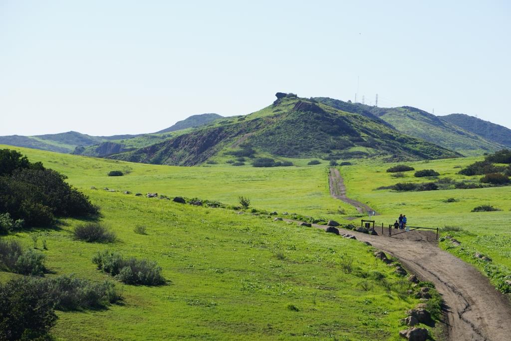
Rancho Sierra Vista, behind the Satwiwa Native American Culture Center.

Rancho Sierra Vista, behind the Satwiwa Native American Culture Center.

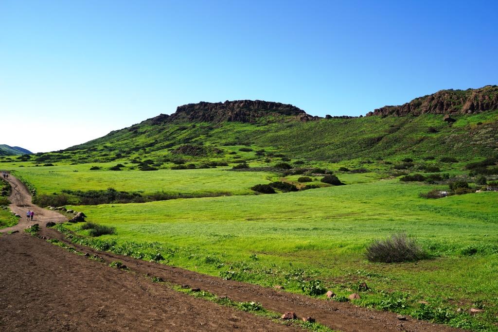
Rancho Sierra Vista after the rainstorms of 2017.

Rancho Sierra Vista after the rainstorms of 2017.

A view towards Newbury Park from the Rosewood Trail / Angel Vista Peak.

A view towards Newbury Park from the Rosewood Trail / Angel Vista Peak.

Rosewood Trail./ Angel Vista Peak views after the rainstorms.

Rosewood Trail./ Angel Vista Peak views after the rainstorms.

View of Mountclef Ridge from Tarantula Hill.

View of Mountclef Ridge from Tarantula Hill.

A greener view of Mountclef Ridge after the rains.

A greener view of Mountclef Ridge after the rains.

The former Olympia Farms property in the Rancho Potrero Open Space in Newbury Park.

The former Olympia Farms property in the Rancho Potrero Open Space in Newbury Park.

Greener times in the Olympia Farms area.

Greener times in the Olympia Farms area.

Los Robles Trail looking east from "Space Mountain."

Los Robles Trail looking east from "Space Mountain."

Fueled by months of steady rain, it is looking green here in the Los Robles Trail System.
Fueled by months of steady rain, it is looking green here in the Los Robles Trail System.

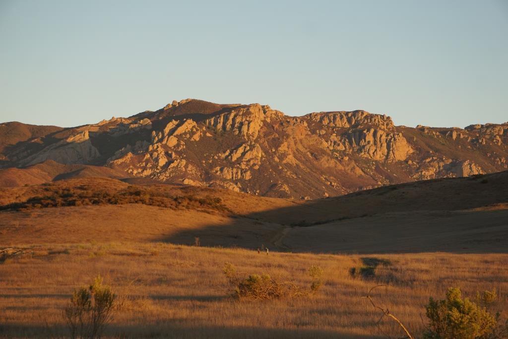
View of Boney Mountain Range from Rancho Potrero Open Space last fall.

View of Boney Mountain Range from Rancho Potrero Open Space last fall.

Green foreground after the rains in Rancho Potrero looking at Boney Mountain.

Green foreground after the rains in Rancho Potrero looking at Boney Mountain.
Wildflowers in Bloom in the Conejo Open Space

We are already seeing these beautiful orange poppies blooming throughout the open space surrounding the Conejo Valley after two months of steady rains. Here is a patch of them in the North Ranch Open Space, west of Lindero Canyon Road up in the hills. 

These yellow wildflowers appear off of the Westlake Vista Trail adjacent to the Las Virgenes Reservoir each year in the March time frame.

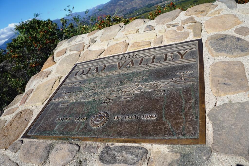
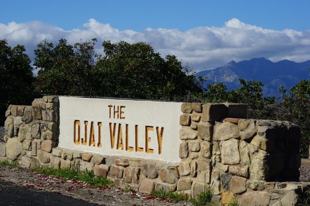
The Ojai Valley Sign and Rotary Club of Ojai Plaque on State Route 150

The Ojai Valley sign on California State Route 150 at 6462 Santa Paula Ojai Road.

The Ojai Valley sign on California State Route 150 at 6462 Santa Paula Ojai Road.

California State Route 150 runs 36.4 miles, from State Route 126 in Santa Paula at 10th Street (where it is called Ojai-Santa Paula Road), through Ojai (where it is called Ojai Avenue), then co-signed with State Route 33 (Maricopa Highway) until unincorporated community Meiners Oaks, then Baldwin Road between Ojai and Lake Casitas, then finally, Casitas Pass Road until it ends at U.S. Route 101 in Carpinteria.

If you are driving the section between Ojai and Santa Paula (which you WILL have to do sometime to experience the beauty back there), at roughly 6462 N. Ojai Road you will see a large "The Ojai Valley" monument.

Park the car, check out the views of the Ojai Valley and take a look at the Rotary Club of Ojai plaque dated 1990. The plaque shows various prominent mountain peaks in the Ojai Valley, including:

  • White Ledge Peak (4,640')
  • Matilija Twin Peaks (4,485')
  • Three Sisters Peaks (5,378')
  • Nordhoff Peak (4,485')
  • Chief Peak (5,334')
  • Topatopa Peak (6,244')

The plaque also highlights the canyons in view - Matilija Canyon, Gridley Canyon, Senior Canyon and Horn Canyon.

VISIT THIS PAGE FOR A BUNCH OF FUN THINGS TO DO IN OJAI

OjaiRotaryPlaque1990.JPG
As you can see, the view is awesome. The tallest point ahead is Chief Peak.

As you can see, the view is awesome. The tallest point ahead is Chief Peak.

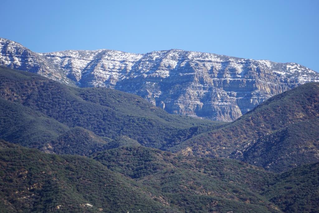
This photo was taken in January 2017 after storms dusted snow on the Topa Topa Mountains. We can see this snow from the Conejo Valley but it is fun to see it closer up from Ojai.

This photo was taken in January 2017 after storms dusted snow on the Topa Topa Mountains. We can see this snow from the Conejo Valley but it is fun to see it closer up from Ojai.

A Look at the Conejo Valley Before and After the Recent Rainstorms

As Tom Jones said, "It's good to touch the green, green grass of home." We're seeing green hills throughout the Conejo Valley after several months of rain. We're enjoying it now, but we know it will only last so long, as evidenced in the "before and after" photos below.

OVER 50 LOCAL AREA TRAILS AND HIKES

Autumn Ridge Trail in the Lang Ranch Open Space last May.

Autumn Ridge Trail in the Lang Ranch Open Space last May.

Autumn Ranch Trail in Lang Ranch in late February 2017.

Autumn Ranch Trail in Lang Ranch in late February 2017.

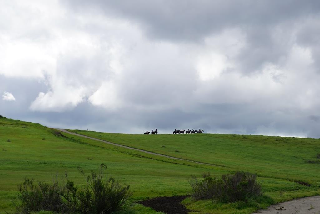
Horsing around in the Rancho Potrero Open Space, Newbury Park, last December.

Horsing around in the Rancho Potrero Open Space, Newbury Park, last December.

Horsing around again in Rancho Potrero; this time in late February 2017.

Horsing around again in Rancho Potrero; this time in late February 2017.

Hidden Valley Overlook in Rancho Sierra Vista/Satwiwa last July.

Hidden Valley Overlook in Rancho Sierra Vista/Satwiwa last July.

Hidden Valley Overlook two days ago.

Hidden Valley Overlook two days ago.

Boney Mountain Range in the Santa Monica Mountains from Dos Vientos early last November

Boney Mountain Range in the Santa Monica Mountains from Dos Vientos early last November

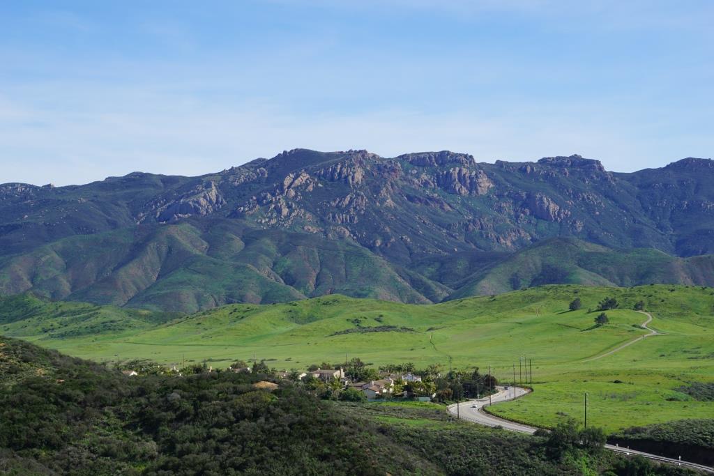
The same view of the Boney Mountain Range, with the Rancho Potrero area in the foreground, on Friday, March 3, 2017.

The same view of the Boney Mountain Range, with the Rancho Potrero area in the foreground, on Friday, March 3, 2017.

A view of Lizard Rock in Wildwood Park from the Mesa Trail in late September 2016.

A view of Lizard Rock in Wildwood Park from the Mesa Trail in late September 2016.

The same view towards Lizard Rock in Wildwood Park on February 24, 2017.  

The same view towards Lizard Rock in Wildwood Park on February 24, 2017.  

My, oh my, do we love the green, green grass of home or what!? Enjoy it while you can!

Green As We've Ever Seen After Recent Rainstorms in the Conejo Valley

The hills are alive with green throughout the Conejo Valley after all of the recent rainstorms. The photos below are just one small glimpse at one can be seen out there. For a compilation of local area trails, visit THIS LINK.

Mountclef Ridge at Wildwood Park

Mountclef Ridge at Wildwood Park

Rancho Potrero overlooking the old Olympia Farms property in Newbury Park

Rancho Potrero overlooking the old Olympia Farms property in Newbury Park

Trail off of Lindero Road in Westlake Village

Trail off of Lindero Road in Westlake Village

Cheeseboro Canyon in Agoura Hills

Cheeseboro Canyon in Agoura Hills

Rancho Sierra Vista / Satwiwa in Newbury Park

Rancho Sierra Vista / Satwiwa in Newbury Park

Hillcrest Open Space in Thousand Oaks

Hillcrest Open Space in Thousand Oaks

Views of Newbury Park from Angel Vista Peak

Views of Newbury Park from Angel Vista Peak

Los Robles Trail East in Thousand Oaks

Los Robles Trail East in Thousand Oaks

Deer enjoying the green in Hidden Valley

Deer enjoying the green in Hidden Valley

Water Flows at Rancho Sierra Vista/Satwiwa in Newbury Park After 6-8 Inches of Rain

The river is back again near the Wendy and Potrero trailhead to the Wendy Trail in Rancho Sierra Vista/Satwiwa. It was here a month ago, dried up quickly, and of course now is back. This and other water flows near the Satwiwa Center, "Lake Satwiwa" near the parking lot and more captured here. Best to stay off the trails until they dry up a bit though I did tiptoe down the side of the Wendy Trail to capture the water flow. 

More on local hikes and trails around Ventura County at THIS LINK.

Seasonal pond next to main parking lot at Rancho Sierra Vista/Satwiwa. I like to call this "Lake Satwiwa" though there is no official name for it to my knowledge.

Seasonal pond next to main parking lot at Rancho Sierra Vista/Satwiwa. I like to call this "Lake Satwiwa" though there is no official name for it to my knowledge.

Pacific Coast Highway Was Originally Called the Roosevelt Highway

The 1400 mile stretch of road called the Roosevelt Highway (U.S. 101) in the 1920s was re-named Pacific Coast Highway in 1941.

This postcard, from back in the days when it cost only a penny to mail a postcard (the 1930s) indicates "the varying scenery, such as oil being drilled out of the ocean, makes motoring an interesting pastime in California." It shows an image of the Roosevelt Highway between Ventura and Santa Barbara.

Bob then indicates to his dear friend Jane, "Just dropping a line to say all is well in Calif. There's lots of strange things to see in this state. You should be taking your Sunday rides out here."

Now what does Bob mean by that? Well, never mind. Speaking of Ventura and Santa Barbara beaches, visit THIS LINK for public beaches spanning from the Ventura Harbor through Carpinteria and THIS LINK for Santa Barbara area beaches.