Cycling Clubs and Groups In and Around Ventura County

CyclistsCam.JPG

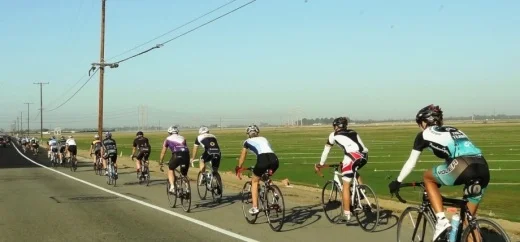
Any given Sunday morning I come across hundreds of bicyclists on my morning runs in the Thousand Oaks area and throughout Ventura County.

Here are some local cycling groups:

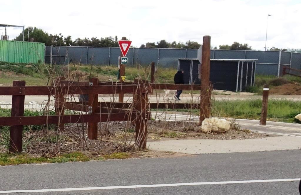
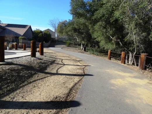
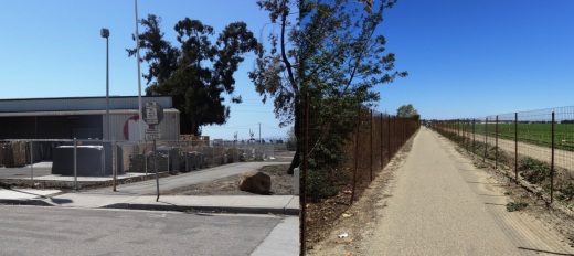
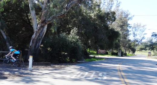
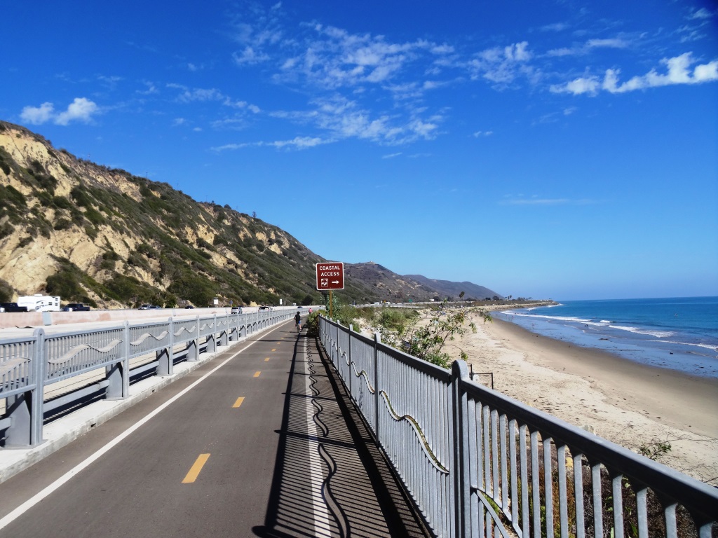
CLICK HERE for some family-friendly friendly bike path options around Ventura County.

And for some local BMX track options, Freedom Park BMX Raceway in Camarillo

Bike shops in the local area:

EBike shops:

Guide to Finding Family Friendly Bike Paths In and Around Ventura County

As a casual cyclist with young kids I usually steer clear of riding on busy streets, particularly those that don't have any type of bike lane on them. Thankfully there are nearly 80 miles of bikeways in Thousand Oaks, including 3 miles of bike paths, 20 miles of bike lanes and 54 miles of marked bike routes.  

Bike routes are shared with vehicles

Bike routes are shared with vehicles

Class I Bike Paths are separate from auto traffic and thus are great for family friendly cycling. Class II Bike Lanes are striped, painted and shared lanes adjacent to automobile lanes. Class III Bike Routes are marked by green signs that signify sharing with autos.

We also love taking our bikes to other places in and around Ventura County to enjoy other sights and surroundings. So how about if we highlight Class I Bike Paths throughout Ventura County, stretching from Thousand Oaks to Ventura.

Conejo Valley

The Conejo Creek Bike Path is a 1.2 mile path in the heart of Thousand Oaks that connects Gainsborough Road on the south to Conejo Creek Park and the Thousand Oaks Library. This is a nice, flat path, good for kids.

Another access point to the Conejo Creek Bike Path on La Granada Drive.

Another access point to the Conejo Creek Bike Path on La Granada Drive.

There is another Thousand Oaks bike path, the .5 mile Greenmeadow Drive connector bike path accessible on the west at Greenmeadow and Yellowstone, on the south side of Los Robles Greens. This is not a particularly interesting path but it does enable cyclists and walkers a path around the golf course to the Los Robles trailhead and Moorpark Road from Newbury Park. A bit hilly, too.

Entrance to Greenmeadow Avenue connector bike path in Thousand Oaks

Entrance to Greenmeadow Avenue connector bike path in Thousand Oaks

There is also the .8 mile bike path on the north side of The Oaks mall as well as the .5 mile Read Road Connector path accessible off of Olsen Road just east of the 23 freeway.

Sign at the Read Road connector path on Olsen Road east of 23 Freeway.

Sign at the Read Road connector path on Olsen Road east of 23 Freeway.

Medea Creek Natural Park has hiking, biking and fitness trails that stretch from Calle Rio Vista and Oaks Hills Drive in Oak Park on the north, then south past Medea Creek Lane and Conifer Street to a cul de sac entrance to the park at the west terminus of Tamarind Street. About a mile to mile and a half of paths, including paved and dirt paths.

Nicely paved path at Medea Creek Natural Park in Oak Park

Nicely paved path at Medea Creek Natural Park in Oak Park

Ventura

My personal favorite bike path in Ventura County is the Omer Rains Trail that runs the entire length of San Buenaventura State Beach.

Senator Omer Rains Ventura Oceanfront Bikeway Sign on Main Street next to Ventura Beach RV Resort

Senator Omer Rains Ventura Oceanfront Bikeway Sign on Main Street next to Ventura Beach RV Resort

We park the car at Marina Park in Ventura and ride a short distance north on Pierpont Blvd to the bike path entrance. This oceanfront path takes you past the Ventura Pier, through the Promenade area, adjacent to the Ventura County Fairgrounds, Emma Wood State Beach and beyond. Or you can get to the path from anywhere along the Ventura Promenade area.

Bike path along San Buenaventura State Beach.

Bike path along San Buenaventura State Beach.

Omer Rains Bike Path near Ventura Beach RV Resort on Main St.

Omer Rains Bike Path near Ventura Beach RV Resort on Main St.

Nice, newer paved section of Ventura beachfront bike path near Surfers Point.

Nice, newer paved section of Ventura beachfront bike path near Surfers Point.

The Ventura River Trail is a 6.3 mile asphalt pedestrian and bike path that follows the old Southern Pacific Railroad right-of-way from Main Street in Ventura to Foster Park inland towards Ojai. You can easily connect from the Omer Rains Trail to the Ventura River Trail up to the Ojai Valley Trail for quite a long, nearly automobile-free ride.

The Ventura Harbor Bike Path takes you 1.2 miles from Market St and Arundell Ave in midtown Ventura southwest through farmland to E. Harbor Boulevard and Schooner Drive, near Four Points by Sheraton.

Bike path from midtown Ventura to the Harbor is not the most exciting path but it is a convenient way to ride to Ventura Harbor, Marina Park and adjacent areas.

Bike path from midtown Ventura to the Harbor is not the most exciting path but it is a convenient way to ride to Ventura Harbor, Marina Park and adjacent areas.

The La Conchita Bike Path between Rincon Point at the Ventura/Santa Barbara County Line adjacent to Highway 101 past La Conchita to Mobil Pier Road in Ventura was completed in September 2014. This path has leapfrogged into my own personal favorite in Ventura County because of its spectacular beach views. This is about 4 miles of bike path in the Oil Piers Beach to Mussel Shoals to La Conchita Beach to Rincon Point beach areas.

Bike paths rarely get better than this stretch along the southbound 101 and the Pacific Ocean in Ventura.

Bike paths rarely get better than this stretch along the southbound 101 and the Pacific Ocean in Ventura.

There's another short stretch of bike path at the east end of Navigator Drive that goes west, then south, around the Ventura West Marina.

Entrance to short bike path adjacent to Ventura West Marina.

Entrance to short bike path adjacent to Ventura West Marina.

There is a two mile biking and hiking on the east side of the lake at the Lake Casitas Recreation Area, 11311 Santa Ana Road, Ventura. The path starts at picnic area #1 and follows the east shoreline of the lake for a four mile round trip ride. The path is paved in the recreational area and becomes a dirt road outside of that. More information at www.casitaswater.org/recreation/amenities/bike-trail.

Ojai

The Ojai Valley Trail is a 9 to 10 mile trail that parallels Highway 33 from Foster Park on the outskirts of west Ventura, to Soule Park in Ojai. It connects to the Ventura River Trail.

The Ojai Trail runs parallel to Ventura Ave/Ojai Ave.

The Ojai Trail runs parallel to Ventura Ave/Ojai Ave.

Simi Valley

The Arroyo Simi Bike Path is a two lane bike path in Simi Valley that runs from Madera Road, just south of Easy Street on the west, ending at Tapo Street on the east. Over seven miles.

Arroyo Simi Bike Path/Trail in Simi Valley.

Arroyo Simi Bike Path/Trail in Simi Valley.

Camarillo

We enjoy the newer, flat roughly 2 mile Calleguas Creek bike path from Pleasant Valley Fields up to the corner of Flynn and Upland Roads in Camarillo. Quick access from the Conejo Valley and a nice, relatively easy path good for all ages.

Look at how nice and flat this bike path adjacent to Calleguas Creek is!

Look at how nice and flat this bike path adjacent to Calleguas Creek is!

Other Areas

There's an online bike map available on the Ventura County Transportation Commission website at www.goventura.org where you can find other Class I, II and II bike paths around the county. Here are some of them.

The Santa Paula Bike Trail takes you roughly 3 miles on the east near W. Main St and Peck Rd to (roughly) Dike Road on the west

The Fillmore Bike Path runs from south of Highway 126 (Telegraph Road) up past Shiell Park.

In Moorpark there's a .5 mile path at Country Trail Park, around the neighborhood to the west, back to Mountain Trail Street.

There's a bike path that starts at the ocean side of Oxnard Beach Park and takes you south all the way to Hollywood Beach and Channel Islands Harbor. Cross Harbor Boulevard and make your way into Channel Islands Harbor, where you can ride all the way to the south end of the harbor.

Bike path near Oxnard Beach Park and Channel Islands Harbor.

Bike path near Oxnard Beach Park and Channel Islands Harbor.

In Port Hueneme there's a bike path that starts off of Bard Rd, west of South J St, through Richard Bard Running Springs Park and takes you southwest all the way to Hueneme Beach.

If you're willing to venture a bit further away from Ventura County, the Marvin Braude Coastal Bike Path stretches over 20 miles, from Will Rogers State Park in Pacific Palisades to Torrance. Flat, adjacent to the ocean, and so many things to do along the way!

Marvin Braude Coastal Bike Path in Pacific Palisades

Marvin Braude Coastal Bike Path in Pacific Palisades

That should be enough to get you started! Looking for local cycling clubs? Find some of them at this link.

La Conchita Bike Path Between Mobil Pier Road in Ventura to Rincon Point

My choice for most awesome Class I Bike Path in Ventura County is the La Conchita Bike Path that runs from Mobil Pier Road in Ventura (southwest of Mussel Shoals) to Rincon Point. The path is directly adjacent to the southbound Highway 101.

Entry point to La Conchita Bike Path at Rincon Point Rd/Bates Rd (directly adjacent to the 101 onramp).

Entry point to La Conchita Bike Path at Rincon Point Rd/Bates Rd (directly adjacent to the 101 onramp).

This distinct path premiered in September 2014 and provides for roughly 4 miles of unimpeded views of the Pacific Ocean on the west and is directly adjacent to the hustle and bustle of Highway 101 on the other side.

Do views from a bike path ever get any better than this!!??

Do views from a bike path ever get any better than this!!??

Class I bike paths are great to bring the entire family on as they are completely separate from street traffic. My kids love this path because it is flat, in great condition and is just so beautiful that its hard not to ride this path without a smile.

This separates the path from southbound 101 traffic. Pretty amazing riding carefree adjacent to the 101.

This separates the path from southbound 101 traffic. Pretty amazing riding carefree adjacent to the 101.

We brought the bikes to Rincon Beach Park to start our journey on the north end of the path. (Alternatively, park at Rincon Point or on Rincon Pt Road.) You first get to see surfers at the world famous Rincon Point, then on to the La Conchita Beach area.

One of several beach access points to the La Conchita Beach area.

One of several beach access points to the La Conchita Beach area.

There are several beach access points along the path.  As part of this project, Caltrans built an undercrossing to enable folks to walk to the beach from La Conchita

After La Conchita you reach a stopping point at the small community of Mussel Shoals, where you can stop at the Cliff House Inn for a drink and check out the man-made Rincon Island.

A quick stop to view the man-made an inaccessible Rincon Island

A quick stop to view the man-made an inaccessible Rincon Island

Walk your bikes across the offramp to the next bike path entry point, on to the next section of path that half circles southeast to its endpoint at Mobil Pier Road.

You cross here (signs indicate you must walk bikes across) to the next access point.

You cross here (signs indicate you must walk bikes across) to the next access point.

You will see beach area here referred to as Oil Piers Beach. There used to be piers here but they were taken down in 1998.  There is parking on Mobil Pier Road for beach/bike path access; you can park here and ride the path the opposite direction.

The beauty continues (except for the graffiti) as you ride towards Mobil Pier Road.

The beauty continues (except for the graffiti) as you ride towards Mobil Pier Road.

Mobil Pier Road is the endpoint of this Class I path, but, you can continue south if you'd like by taking the Mobil Pier Road underpass below the 101 to Pacific Coast Highway going south, past Hobson Beach Park, Rincon Parkway, Faria Beach Park and so on. This section is not Class I path but I've taken my kids here and we enjoy it.

Great stuff! A Ventura County "Bucket List" item that all of you have to try!

Bicycle Safety Tips From the Ventura County Sheriff's Office

bike sign.JPG

Each year, hundreds of bicyclists in California are involved in a collision with a motor vehicle. Here are some important facts bicyclists and motorists should know.

California vehicle code section 21202(a): Any person operating a bicycle upon a roadway at a speed less than the normal speed of traffic moving in the same direction at the same time shall ride as close as practicable to the right-hand curb or edge of the roadway.

A bicycle ridden at night must be equipped with a lamp emitting a white light. There must also be a red reflector on the rear of the bicycle that must be visible from 500 feet when directly in front of a motor vehicle whose headlights are on.

Riders under the age of 18 must wear a helmet at all times. All riders, regardless of age, should wear a helmet at all times to reduce injuries.

No person shall drive a motor vehicle in a bicycle lane established on a roadway except to park where parking is permitted, to enter or leave the roadway, or to prepare for a turn within a distance of 200 feet from the intersection.

Bicyclists must travel on the right side of the roadway in the direction of traffic, except when passing, making a legal left turn, riding on a one-way street, riding on a road that is too narrow, or when the right side of the road is closed due to road construction. (CVC 21650.)

Handlebars must not be higher than the rider's shoulders. (CVC 21201(b))

A driver of a motor vehicle shall not overtake or pass a bicycle proceeding in the same direction on a highway at a distance of less than three feet between any part of the motor vehicle and any part of the bicycle or its operator. (CVC 21760(c))

Bicyclists must obey the rules of the road because they travel along the roadway with other motorists. It is important to note drivers and bicyclists must share the road. When making turning movements in a car or on a bike, use caution, be seen (appropriate lighting after dark) and be predictable.

The Thousand Oaks Traffic Bureau urges citizens to drive their cars and ride their bicycles responsibly. Wear equipment to protect you and make you more visible to others, like a bike helmet, bright clothing (during the day), reflective gear, and a white front light and red rear light and reflectors on your bike (at night, or when visibility is poor). Plan your route if driving as a vehicle on the road; choose routes with less traffic and slower speeds. Your safest route may be away from traffic altogether, in a bike lane or on a bike path.

For more information on bicycle safety, visit:

www.safekids.org/bike

www.ots.ca.gov/grants/pedestrian-and-bicycle-safety

www.calbike.org/go_for_a_ride/california_bicycle_laws

You also avert motorists when you ride on some of these class I (protected) bike paths around Ventura County.

Thousand Oaks Ranks #49 on 2016 BICYCLING Magazine List of Top 50 Bike-Friendly Cities

The Amgen Tour came by so fast in 2016 that it was just a blur!

The Amgen Tour came by so fast in 2016 that it was just a blur!

Today, BICYCLING Magazine published its biennial list of the top 50 bike-friendly cities in the United States. The list is updated every other year based on data from over 100 cities and factors in miles of bike lanes and other information.

The City of Thousand Oaks made the cut at #49 this time, down from #33 on the 2014 list. The article mentions that the City gave bicycle safety education to 5,500 K-8 students over the last year, upgraded paths by providing separate facilities for bicyclists and equestrians and added green paint to bike lane intersections. However, the write-up notes that "much of Thousand Oaks' bike lanes remain far too narrow" and that only 3 out of the city's 157 miles of bike lanes contain a striped buffer to allow extra space between cars and cyclists.

Other Southern California cities on the list include Los Angeles (#24, up from #28 in 2014) and Long Beach (#28, down from #23 in 2014). The top 3 cities on this biennial list are Chicago, San Francisco and Portland.

For Class I Bike Paths in and around Ventura County, click THIS LINK.

Other local cycling clubs/groups in and around Ventura County at THIS LINK.

Thousand Oaks Ranked #33 on 2014 BICYCLING Magazine List of Top 50 Bike-Friendly Cities

Amgen Tour of California 2016

Amgen Tour of California 2016

In August 2014, BICYCLING Magazine published its biennial list of the top 50 bike-friendly cities in the United States. The list was completed based on cities with populations of 95,000 or more (roughly 300 U.S. cities are in this category) based on input from various sources, including the League of American Bicyclists.

Congratulations goes out once again to the City of Thousand Oaks for placing 33rd on this list, up from 38th on the 2012 list. Thousand Oaks was one of three Southern California cities to make the list, which included Los Angeles (28th) and Long Beach (23rd).

Keep in mind that this list was based on cities with populations of about 100,000+, which represents about 300 of the 20,000 or so cities in the U.S.

For Class I Bike Paths in and around Ventura County, click THIS LINK.

Other local cycling clubs/groups in and around Ventura County at THIS LINK.

California's New "Three Feet for Safety" Bike Passing Law Takes Effect September 16th

IGive3Feet.png

Beginning September 16, 2014, a new law takes effect that requires motorists that are passing a bicycle on a highway to have at least 3 feet of clearance from the bicycle. Violations of this new Three Feet for Safety Act (AB 1371) can result in a $35 fine. The fine increases to $220 if the driver collides with the bicyclist while in violation of the law (which if you think about it how would they not be violating the law if they collided...hmm).

This law basically clarifies the existing law, which says cars must pass bicyclists at a "safe distance."

Now let's say you're driving on a two-lane highway like Potrero Road in Thousand Oaks where there's no bike lane and cars are coming the opposite direction as you approach a group of cyclists. What should you do? Obviously slow down so that you can pass with at least 3 feet of clearance after cars coming the other way have passed. Just make sure you're not crossing a double yellow line.

Two lane Potrero Road in Hidden Valley

Two lane Potrero Road in Hidden Valley

According to the California Bicycle Coalition, this law does not prohibit a bicyclist from passing a car by less than 3 feet. But that's because bicyclists present much less risk to car drivers than vice versa.

One may think, how in the world will anyone know if it is 3 feet vs 2 1/2 feet, etc. Short of attaching a yardstick to the side of your car, I guess we'll have to use our best judgment.

Speaking of bicycles...click here for some fun bike paths in and around Ventura County.