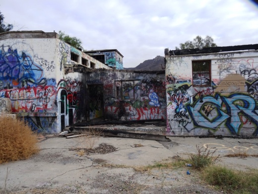
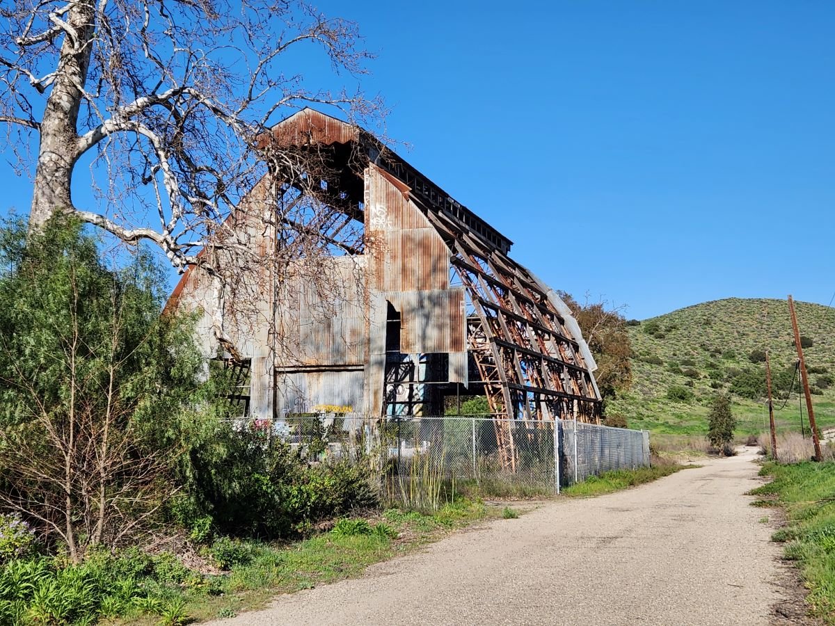
The "Scary Dairy" at CSU Channel Islands University Park in Camarillo
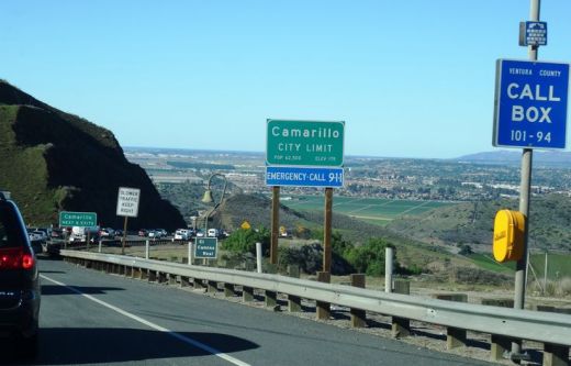
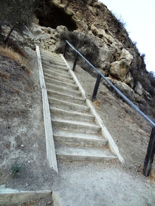
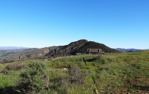
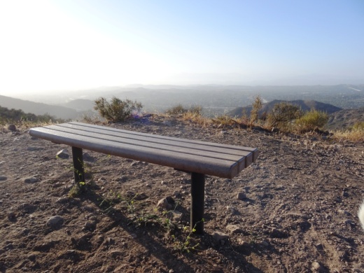
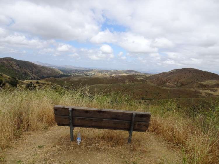
CSU Channel Islands University Park is a 367 acre parcel located adjacent to CSU Channel Islands off of S. Lewis Road in Camarillo. It is a regional educational and recreation area owned and operated by California State University Channel Islands.

In 1932, the State of California purchased 1,760 acres of the Lewis Ranch and built the Camarillo State Mental Hospital, which operated from 1936 to 1997 and at one point treated as many as 7,000 patients in the mid 1950s.

Located on the parcel was a dairy farm that produced crops and housed livestock that fed the hospital community. The farm was disbanded in the 1960s and has been left in a state of disrepair, falling prey over the decades to vandals and coined "Scary Dairy."

After closure of the hospital, the land was conveyed to the County of Ventura, which had considered developing a golf course and amphitheater there but later abandoned its plans. The land was acquired by the University in 2009.

Fences and "No Trespassing" signs now surround what's left of the structures. but you can still get pretty close to check out Scary Dairy.

ScaryDairy1.JPG

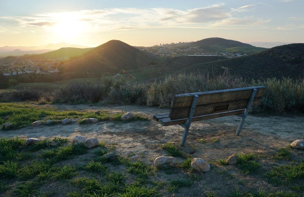
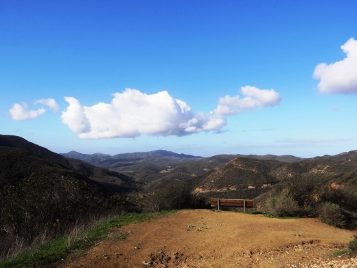
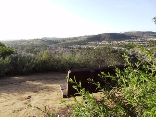
CSU Channel Islands University Park is open to the public daily from sunrise to sunset. From Camarillo, take Lewis Road south to Camarillo Street and turn left (east).  Cross the bridge over Calleguas Creek and the entrance is on the left. Parking is $6 per vehicle (as of 2022). Do note that there are no facilities at this park, like restrooms and drinking fountains.

Visit www.csuci.edu/cipark for more information.

ScaryDairy4.JPG
ScaryDairy5.JPG
ScaryDairy7.jpg
ScaryDairy3.JPG

The Carpinteria Tar Pits are One of Five Natural Asphalt Lake Areas in the World

The Carpinteria Tar Pits at Carpinteria State Beach are located in a designated area called Tar Pits Park. The Carpinteria Tar Pits are one of five natural asphalt lake areas in the world, 2nd in size to and older than the La Brea Tar Pits in Los Angeles.

These tar pits date back to the Pleistocene Age (Ice Epoch), which 2.6 million to 11,700 years ago. Evidence of imperial elephants, the giant sloth, bison, wolf, tusked mastodons and camels have been discovered in t

Read More

Hillside Letters in the Conejo Valley and Greater Ventura County

There are over 500 hillside letters, or “mountain monograms,” in the United States, including 81 in California. What are hillside letters, you ask. They are simply large single letters, abbreviations and sometimes even messages erected on a hillside, usually by a school or town.

The Big “C” overlooking UC Berkeley (From Wikipedia; public domain)

The Big “C” overlooking UC Berkeley (From Wikipedia; public domain)

One well known hillside letter is a giant concrete block letter “C” built in the hills overlooking UC Berkeley that was constructed on March 23, 1905.

We have our share of hillside letters here in the Conejo Valley and Greater Ventura County, some of which you may be aware of…others, perhaps not.

The mountain monograms visible in our neck of the woods include:

The letters CLU on Mt. Clef Ridge above Cal Lutheran University are maintained by students.

Hilltop A overlooking Agoura High School up a steep hill. Made out of wood, I believe.

Here is a view of the letter VC north of Ventura College in late April 2019.

Here is a view of the letter VC north of Ventura College in late April 2019.

If you drive north up Catalina Street, west of Ventura High School, you will be able to see this letter V on the hillside.

The letter F is located in the hills west of Fillmore and is quite easy to see.

This letters SP letters in the hills south of Santa Paula is cleared brush. They originated originated in 1922. More information on THIS PAGE.

Happy Face Hill in Simi Valley is not a mountain monogram but is perhaps the visible hillside attraction throughout Ventura County.

Evolution of the Conejo Grade in Ventura County Over the Last 100 Years

Horseshoe shaped section of the Conejo Grade in the 1920s.

Horseshoe shaped section of the Conejo Grade in the 1920s.

The Conejo Grade is the section of Highway 101 that connects the Conejo Valley with Camarillo. It is a four mile stretch of freeway with a significant 7% grade.

Going down the Conejo Grade from Newbury Park to Camarillo today.

Going down the Conejo Grade from Newbury Park to Camarillo today.

At 3:30 p.m. on the afternoon of May 1, 1937, a newly upgraded and realigned Conejo Grade premiered after a day of celebration commencing at the ranch of Adolfo Camarillo. Camarillo, the namesake of what in 1964 became the City of Camarillo, donated the right of way to enable the grade to be realigned. Actor Leo Carrillo entertained guests at Camarillo's ranch at the bottom of the grade.

Grand opening of the newly realigned Conejo Grade on May 1, 1937.

Grand opening of the newly realigned Conejo Grade on May 1, 1937.

The old Conejo Grade was constructed by the California Highway Commission in 1914-1915. The previous route had 49 twists and turns, making it somewhat hazardous to drive (albeit somewhat less steep than the current grade). The newly aligned Conejo Grade cut the number of curves by 75%.

Another view of the Conejo Grade before it was realigned in 1937.

Another view of the Conejo Grade before it was realigned in 1937.

The new 1937 Conejo Grade cost a total of $570,000, which is less than the average cost of a house in the Conejo Valley today! Over a year and a half, the project employed about 100 workers who put in over 272,000 hours, excavating over 800,000 cubic yards of mostly hard rock. Talk about rock stars!

In the 1950s and 1960s, Caltrans further widened and improved Highway 101 over the Conejo Grade.

In the 1950s and 1960s, Caltrans further widened and improved Highway 101 over the Conejo Grade.

Several decades later, as Ventura County grew and the cities of Camarillo and Thousand Oaks incorporated in 1964, Caltrans continued to widen and improve the highway to what it is today.

ConejoGrade2014_2.jpg

Source for historical information: "California Highways and Public Works" (May 1937) - official journal of the State of California Division of Highways, Department of Public Works.

Special thanks to the Pleasant Valley Historical Society for providing historic photos.

Hike to the Teepee, Paradise Falls and Little Cave at Wildwood Park in Thousand Oaks

One hiking experience that everyone in the Conejo Valley and neighboring areas has to experience is Wildwood Park. With 14 trails covering 17 miles in the nearly 1,800 acre park managed by the Conejo Open Space Conservation Agency, there is plenty to see and do in Wildwood Park.

One particularly fun and fairly easy family hike at Wildwood takes you from the main parking lot at the west end of Avenida de los Arboles to the Teepee, Paradise Falls and Little Cave (formerly Indian Cave**). Take the Mesa Trail about a 3rd of a mile until you see the sign below, then take a left.

Another third of a mile and you're at the teepee, where you'll find another clearly marked sign pointing you in the direction of Paradise Falls.

Another third of a mile and you're at the teepee, where you'll find another clearly marked sign pointing you in the direction of Paradise Falls.

WildwoodTeepee3.JPG

Hike down some switchbacks and stairs and you'll see be at the beautiful Paradise Falls. Always a fun place to take the kids, though we're warned not to go into the water, which is largely urban runoff.

ParadiseFalls2.JPG
ParadiseFalls4.jpg

But it is sure popular and enjoyable to sit back and enjoy this year-round waterfall that is so nicely hidden yet so close to hustle and bustle of suburban Thousand Oaks.

ParadiseFalls11.3.13.JPG

The Little Cave is roughly half a mile east of Paradise Falls and can be accessed from the trail directly above the falls or by hiking back up to the teepee and going the other direction.

Trail adjacent to Paradise Falls that takes you towards the Indian Cave.

Trail adjacent to Paradise Falls that takes you towards little Cave.

A quarter of a mile or so and you'll see the sign below.

Little Cave (Formerly Indian Cave) sign

Here's the sign indicating you are near the Indian Cave in Wildwood Park.

Formerly called indian cave

Another 100 yards or so and you've reached the staircase that will take you up to the Cave.

Large enough to actually hang out in, though the last time we walked in there were signs of rodents.

Large enough to actually hang out in, though the last time we walked in there were signs of rodents.

IndianCave5.JPG

You can literally climb through the cave to an exit at the top and hike your way up to a connector trail that will lead you back towards the parking lot. My kids love this and so do I!

** The change in name was approved by the Conejo Open Space Conservation Agency (COSCA) in May 2022. COSCA received a request to change the Indian Creek Trail name earlier that year. On its own, the work "Indian" refers to individuals from India, rather than Native Americans, and thus did not accurately reflect the origin of the people to whom it refers.

The Indian Cave and Indian Cave Trail were renamed Little Cave as it was unclear if the cave was naturally formed and/or historically used by Native Americans.

The Indian Creek Trail in Wildwood Park was renamed Two Springs Trail as two natural springs contribute to the stream flow in this portion of the channel.

Bench Yourself in the Conejo Valley

There are over 150 miles of public multi-use trails surrounding the Conejo Valley managed by the Conejo Open Space Conservation Agency and hundreds of miles more in the neighboring Santa Monica Mountains National Recreation Area. Learn more about these great trails here on Conejo Valley Guide.

All of this hiking, biking and running can make one tired. Not to worry...there are benches in strategic spots all throughout the area, all with great views! Here we highlight some of them. Click the images for more information about the trails that lead to these benches.

Views from Angel Vista Peak bench in Newbury Park.

Views from Angel Vista Peak bench in Newbury Park.

Bench at top of peak just east of Angel Vista Peak.

Bench at top of peak just east of Angel Vista Peak.

Bench at the top of "Space Mountain" on the Los Robles Trail West.

Bench at the top of "Space Mountain" on the Los Robles Trail West.

Bench with perfect sunset view off of the Autumn Ridge Trail in the Lang Ranch Open Space.

Bench with perfect sunset view off of the Autumn Ridge Trail in the Lang Ranch Open Space.

A bench on a hilltop overlooking the Conejo Valley on Los Robles Trail East Scenic Loop.

A bench on a hilltop overlooking the Conejo Valley on Los Robles Trail East Scenic Loop.

Bench on Los Robles Loop East Scenic Loop looking towards the south.

Bench on Los Robles Loop East Scenic Loop looking towards the south.

Benches at the top of Big Sycamore Canyon Road in Point Mugu State Park (adjacent to Rancho Sierra Vista/Satwiwa in Newbury Park).

Benches at the top of Big Sycamore Canyon Road in Point Mugu State Park (adjacent to Rancho Sierra Vista/Satwiwa in Newbury Park).

Another bench that overlooks Sycamore Canyon from the Boney Mountain Trail.

Another bench that overlooks Sycamore Canyon from the Boney Mountain Trail.

Image of the Upper Sycamore Canyon bench after the Rancho Sierra Vista area in Newbury Park was ravaged by the Springs Fire of 2013.

Image of the Upper Sycamore Canyon bench after the Rancho Sierra Vista area in Newbury Park was ravaged by the Springs Fire of 2013.

Upper Sycamore Canyon bench was subsequently replaced. Here it is in April 2014.

Upper Sycamore Canyon bench was subsequently replaced. Here it is in April 2014.

Bench on the west side of Tarantula Hill in Thousand Oaks.

Bench on the west side of Tarantula Hill in Thousand Oaks.

Another view of the Tarantula Hill bench before sundown in June 2022.

This bench is located at the juncture of the Sunrise and Meadow Vista Trails in the Lang Ranch Open Space and the Long Canyon Trail in Simi Valley. Nice view towards Simi Valley.

This bench is located at the juncture of the Sunrise and Meadow Vista Trails in the Lang Ranch Open Space and the Long Canyon Trail in Simi Valley. Nice view towards Simi Valley.

Bench on Indian Creek Trail in Wildwood Park.

Bench on Indian Creek Trail in Wildwood Park.

Bench overlooking Bard Reservoir on the Sunset Hills Loop.

Bench overlooking Bard Reservoir on the Sunset Hills Loop.

Sunset Hills Trail bench in early spring 2023.

One of two benches in the hills above CLU overlooking Thousand Oaks.

One of two benches in the hills above CLU overlooking Thousand Oaks.

Oakbrook Vista Trail bench off of Lang Ranch Parkway in Thousand Oaks

Oakbrook Vista Trail bench off of Lang Ranch Parkway in Thousand Oaks

This bench on a hill connected to the Rancho Potrero trail in Newbury Park faces the west and gets you some nice views of several of the Channel Islands on clear days.

This bench on a hill connected to the Rancho Potrero trail in Newbury Park faces the west and gets you some nice views of several of the Channel Islands on clear days.

<
Bench off the Lizard Rock Loop trail on the west side of Wildwood Park.

Bench off the Lizard Rock Loop trail on the west side of Wildwood Park.

Bench with a view of Boney Peak from the Potrero Ridge Trail in Newbury Park.

Bench with a view of Boney Peak from the Potrero Ridge Trail in Newbury Park.

There are dozens of benches facing all directions in the beautiful hilltop Conejo Valley Botanic Garden in the heart of Thousand Oaks

There are dozens of benches facing all directions in the beautiful hilltop Conejo Valley Botanic Garden in the heart of Thousand Oaks

Another bench on the west side of top of the Conejo Valley Botanic Garden.

Another bench on the west side of top of the Conejo Valley Botanic Garden.

Bench overlooking the Potrero Grade from the Vista Del Mar Trail in Newbury Park.

Bench overlooking the Potrero Grade from the Vista Del Mar Trail in Newbury Park.

This is a new bench on the Vista Del Mar Trail in Newbury Park that made its premiere in 2023.

Bench on the El Encanto Trail in the Dos Vientos section of Newbury Park. Panaromic view towards Boney Mountain while catching the sunset.

Bench on the El Encanto Trail in the Dos Vientos section of Newbury Park. Panaromic view towards Boney Mountain while catching the sunset.

Bench with panoramic views at the top of the Triunfo Canyon Trail (part of the Los Robles trail system) in Westlake Village.

Bench with panoramic views at the top of the Triunfo Canyon Trail (part of the Los Robles trail system) in Westlake Village.

Enjoy views towards Newbury Park, Wildwood Park and so on from this bench on the Lynnmere Trail in Thousand Oaks.

Enjoy views towards Newbury Park, Wildwood Park and so on from this bench on the Lynnmere Trail in Thousand Oaks.

Bench at Box Canyon Overlook in Wildwood Park.

Bench at Box Canyon Overlook in Wildwood Park.

Bench #1 on the Albertson Motorway Fire Road Trail in Thousand Oaks.

Bench #1 on the Albertson Motorway Fire Road Trail in Thousand Oaks.

Bench #2 on the Albertson Motorway Fire Road Trail in Thousand Oaks.

Bench #2 on the Albertson Motorway Fire Road Trail in Thousand Oaks.

Bench off the Western Plateau Trail in the Conejo Canyons Open Space near the Hill Canyon Trail.

Bench off the Western Plateau Trail in the Conejo Canyons Open Space near the Hill Canyon Trail.

Another bench off the Western Plateau Trail. This one is marked by a “Vista Point” sign and is across from the Outlaw Trail juncture in the Conejo Canyons Open Space.

Another bench off the Western Plateau Trail. This one is marked by a “Vista Point” sign and is across from the Outlaw Trail juncture in the Conejo Canyons Open Space.

This bench is near Elliot Peak in the Conejo Canyons Open Space.

This bench is near Elliot Peak in the Conejo Canyons Open Space.

This bench is off the Outlaw Trail in the Conejo Canyons Open Space, not far from Elliot Peak.

This bench is off the Outlaw Trail in the Conejo Canyons Open Space, not far from Elliot Peak.

Another view from the bench atop Tarantula Hill….at sunset.

Another view from the bench atop Tarantula Hill….at sunset.

Koi Ponds In and Around Ventura County and Surrounding Areas

On a recent visit to The Commons at Calabasas we were treated to a beautiful pond full of koi and turtles cohabitating. Koi comes from the Japanese word nishikigoi, which means "brocaded carp." Koi is basically domesticated, ornamental carp. In Japanese, the word koi sounds like another word that mean affection or love.

Where to find koi in Ventura County and surrounding areas? Here's what we know:

There is a koi pond at The Promenade at Westlake, next to Marmalade Cafe.

Friendly looking koi looking for handouts at The Lakes at Thousand Oaks.

Friendly looking koi looking for handouts at The Lakes at Thousand Oaks.

The bottom level pond at The Lakes at Thousand Oaks has lots of koi, frolicking around with the ducks, even during the winter when the Holiday Ice Rink is in use.

Green Thumb Nursery on Victoria Avenue in Ventura has a small koi pond container in the back that is fun to observe with the kids.

The pristine Gardens of the World on Thousand Oaks Boulevard has a Japanese Garden that contains a beautiful koi pond.

Koi pond at The Gardens of the World in Thousand Oaks

Koi pond at The Gardens of the World in Thousand Oaks

The Santa Barbara Zoo has a large koi pond area with some very healthy looking koi, swimming among the lily pads.

Last I checked there were a lot of koi amongst the hundreds of ducks at Conejo Creek Park in Thousand Oaks.

The Simi Valley Town Center has a koi pond on the west side of the mall where you can get up close and personal with them.

Koi pond at west end near Studio Movie Grill.

Koi pond at west end near Studio Movie Grill.

As noted at the beginning of the article The Commons at Calabasas has quite a lovely koi and turtle pond.

The turtles are quite prominent at The Commons at Calabasas. Don't touch them!

The turtles are quite prominent at The Commons at Calabasas. Don't touch them!

When in Santa Barbara, be sure to stop by Alice Keck Park Memorial Gardens, a beautiful botanic garden with over 75 tree and plant species, a large koi pond also home to ducks and turtles, picnic areas and more. Quite a serene place.

Only 25 miles from the Conejo Valley is the Lake Shrine Meditation Gardens in Pacific Palisades. This 10 acre spiritual sanctuary hosts a spring-fed lake lined with gardens and home to koi, ducks and beautiful swans.