M*A*S*H Site at Malibu Creek State Park
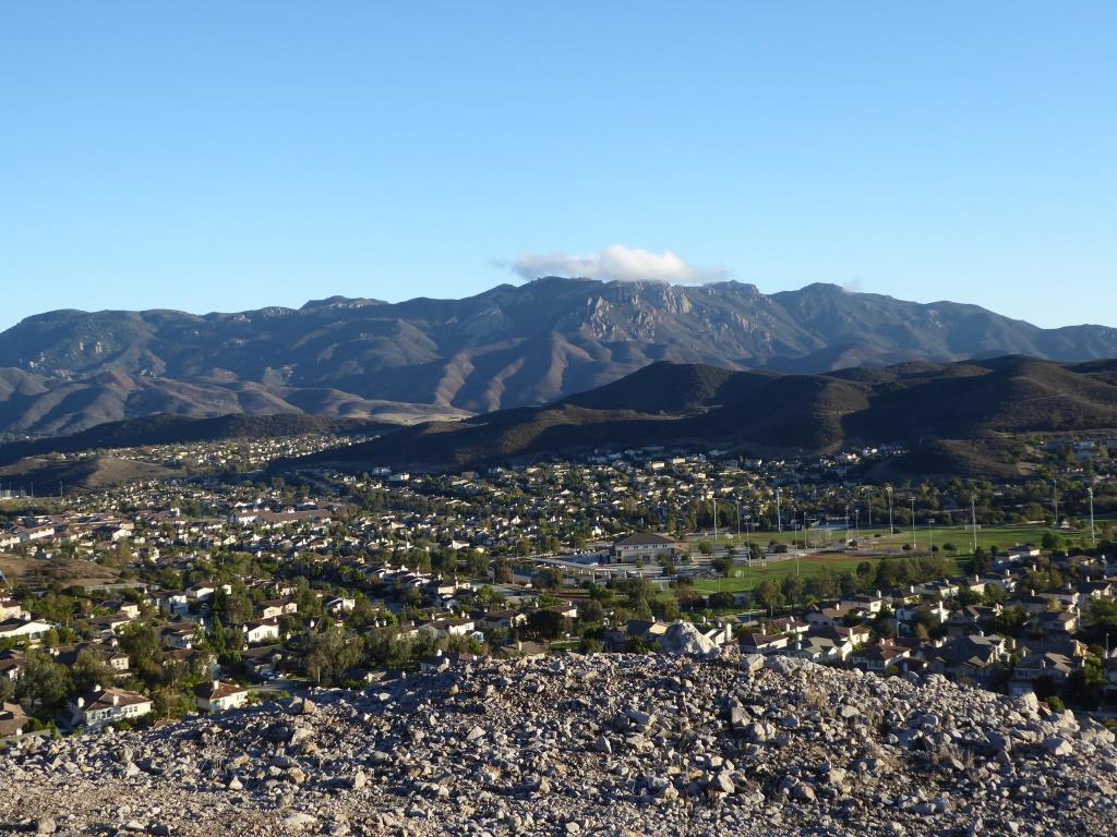
Malibu Creek State Park is a wilderness wonderland, stretching over 8,000 acres in Calabasas, Agoura and Malibu. The park is a great place for hiking, biking, camping, picnicking and exploring. If you do plan to explore the park, be sure to check out the old M*A*S*H (or "MASH" television series set!

MalibuCreek_Mash1.jpg

Produced by 20th Century Fox, M*A*S*H was filmed from September 1972 to February 1983 over 11 seasons and 256 episodes on CBS. Exterior scenes were filmed at what is now Malibu Creek State Park. Over the years, the ambulance and other props left at the old site became less and less visible as the surrounding brush became overgrown.

In 2007, the set was restored with a shaded picnic area, military vehicles, ambulance, helipad and signpost. Check out the photos below, but, better yet, visit it in person! For more pictures and extensive information about the M*A*S*H set and Malibu Creek State Park, visit www.malibucreekstatepark.org.

MASH_sign.jpg

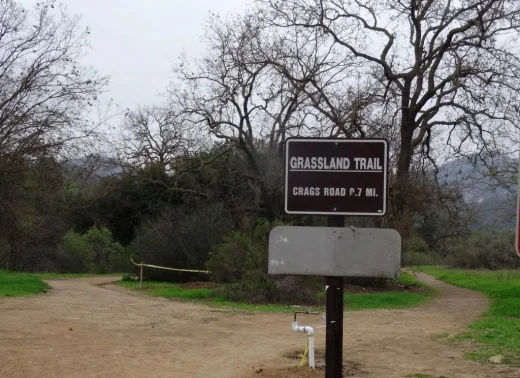
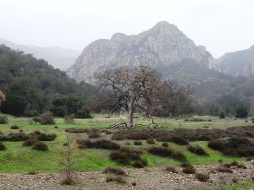
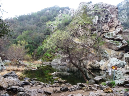
The M*A*S*H site is easily accessible from the main parking lot at Malibu Creek State Park, mostly on wide fire roads, with one significant hill, a bridge crossing and one somewhat rocky trail section. The path is about 2 1/2 miles each way, so it would be a good idea to bring drinks and snacks.

MalibuCreek_Mash2.JPG
MASH_3.JPG
MASH_4.JPG
MashSite4.JPG
MashSite6.JPG

1983 Was the Last Year You Could Watch Drive-In Movies in the Conejo Valley

The Thousand Oaks Drive-In, located behind the current site of the Kohl's Department Store in Newbury Park at 1960 Newbury Road, was closed in 1983. This picture, courtesy of the Thousand Oaks Library Special Collections, was taken by local photographer Scott Harrison on October 11, 1983, shortly after the Drive-In was closed that year.

Thousand Oaks Library Special Collections, News Chronicle Collection. Photo by Scott Harrison.

Thousand Oaks Library Special Collections, News Chronicle Collection. Photo by Scott Harrison.

As you can tell from the sign in the picture, the last two films shown at the Drive-In were "Risky Business" and "Private School." The theater was torn down and eventually Kohl's opened in March 2004.

According to an August 4, 1997 Ventura County Star article, the Thousand Oaks Drive-In opened the first week of August 1967.  Seeing this picture certainly brings back childhood memories for me. There are over 150 other movie screens in the Conejo Valley and Ventura County today, but nothing compares to watching a movie while sitting in the comfort (arguably) of your own car!

Grand opening of the Thousand Oaks Drive-In Theatre in August 1967

Powerline Trail to Edison Road to Conejo Mountain Peak in Newbury Park

View of Boney Mountain range from midway up the Powerline Trail in Newbury Park.

View of Boney Mountain range from midway up the Powerline Trail in Newbury Park.

While you're driving down the Conejo Grade from the Conejo Valley towards Camarillo, you may wonder what that mountain is south of the 101.  This would be the 1,814 foot tall Conejo Mountain.

So how do you get up there? 

There are no "official" marked trails to the peak of Conejo Mountain, but there are unofficial ways to get up there. One way that I'm aware of us via the Powerline Trail to Edison Road Trail in the Dos Vientos section of Newbury Park. 

Get to the Powerline Trail trailhead located on Via Ricardo, west of Via Pisa. Park on the street. Or for added trail mileage, park at Dos Vientos Community Park and take the short (1/2 mile) Park View Trail until it ends at Via Ricardo, where you'll see a crosswalk to the Powerline Trail on the other side.

Follow the Powerline Trail on a single to double tract trail until it reaches the much wider Edison Conejo Mountain Road, marked by sets of power line transmission towers.

It is amazing how quiet it can get back here. This trail is a bit on the long, steep side and the mountain can get quite brown and barren. But the rock formations are pretty cool, and get more interesting the higher you climb. And the views are outstanding, from Boney Mountain to the south to the Channel Islands and Oxnard Plain to the west and Thousand Oaks to the east.

You will be passing by this anxiety-causing sign on the way up. Not to worry. Just a warning.

You will be passing by this anxiety-causing sign on the way up. Not to worry. Just a warning.

Now, pay attention, To find the path to the top of Conejo Mountain, count the pairs of transmission towers that you pass. The unmarked path is just above the 4th set of transmission towers, which is roughly two miles from the trailhead.

When I went, there was fairly large arrow formed with rocks that pointed in the direction of the path. Although it is not an official trail, you can kind of make out the path that has been cleared by hikers over the years. And there are some sections where it appears the path has been aligned by rocks.

In any case, although it looks difficult, it actually isn't that bad, as long as you take your time and watch your step. When you reach the top, you will have a clear birds eye view of the 101 on the other side.of the mountain.

When it greens up after the winter storms, it sure looks a lot prettier up here.

When it greens up after the winter storms, it sure looks a lot prettier up here.

A clear view of Highway 101 from the peak of Conejo Mountain.

A clear view of Highway 101 from the peak of Conejo Mountain.

Clear, unimpeded views of Anacapa and Santa Cruz Islands from up here.

Clear, unimpeded views of Anacapa and Santa Cruz Islands from up here.

Building of the Norwegian Grade from Conejo Valley to Camarillo 1909 to 1911

This historic photo and information was generously provided by Gerry Olsen, grandson of Nils Olsen, one of the original settlers in the Conejo Valley in the 1890s.

Back at the turn of the century, farmers in the Conejo Valley grew dry crops like barley and wheat and had to take their harvest to Port Hueneme/Oxnard via horse-drawn wagons. Their only routes were the treacherous (at the time) Potrero Road or down the unpaved Norwegian Grade to Santa Rosa Road.

So in 1909, with a $60 donation from the county to purchase dynamite, Norwegian families Olsen, Pedersen, other volunteers and paid helpers blasted into the hillside from Nils Olsen's property, 1 1/2 miles down to Santa Rosa Road.

It took two to three years to finish the project using the dynamite, manual labor and horse-drawn earth moving machines called Fresno Scrapers (named after a Scottish chap in 1883 who formed the Fresno Agricultural Works to manufacture it).  Here is a historic photo of these early Conejo Valley roadbuilders.

I used to run up the grade from time to time and that was a pretty tight squeeze, with its steep descent and cactus on the side of the road. While most of us take the 23/101 freeways to get to/from Thousand Oaks/Moorpark/Camarillo these days, the Norwegian Grade provides an alternate 2-lane route with a direct linkage to the gritty Norwegian settlers who had the guts and determination to build it.

Over 40 Things to Do in Malibu

This "27 Miles of Scenic Beauty" sign was swapped out for "21 Miles of Scenic Beauty" sign in April 2017 in order to correct the actual length of City of Malibu coastline.

This "27 Miles of Scenic Beauty" sign was swapped out for "21 Miles of Scenic Beauty" sign in April 2017 in order to correct the actual length of City of Malibu coastline.

The new sign updated in 2017.

The new sign updated in 2017.

Malibu was incorporated as a separate city in Los Angeles County on March 28, 1991, with 84% of Malibu voters supporting incorporation in a 1990 election.

The Conejo Valley lies just 8 to 10 miles away from the Malibu beachfront, making Malibu a natural choice to beat the heat and enjoy to its south-facing beaches. Here's a compilation of over 40 things to do in and around Malibu.

Beaches (East to West)

Surfrider Beach from the Malibu Pier

Surfrider Beach from the Malibu Pier

Adamson House

Adamson House

Hike to the Rock Pool at Malibu Creek State Park in Agoura Hills

One of the most popular destinations in Malibu Creek State Park is the Rock Pool, a picturesque place that is easily accessible for all ages.

MalibuCreek_RockPool1.JPG

As seen in the photo above, it can be stunning to see after solid rains but can also dry up. One fun way to get to the Rock Pool is via the Grassland Trail, accessible on Mulholland Highway just west of Las Virgenes Road, where street parking is available.

GrasslandTrail_sign.JPG

Take the Grassland trail, with moderate hills, .7 miles to the Crags Road main fire road/trail in Malibu Creek State Park, and turn right. Alternatively, you can park in the Park's lower parking lot, pay $12 for a bit more secure parking, and take the main trail into the park.

The scenery along the Grassland Trail can be quite beautiful, particularly after the rainy season.

The scenery along the Grassland Trail can be quite beautiful, particularly after the rainy season.

MalibuCreekSP_020815.JPG
MalibuCreek_CragsRoadSign.JPG

Soon you'll see the sign where you can see the Visitor Center is on the left. That's the direction you'll be taking to get to the Rock Pool. Veering to the right gets you to another popular site at the Park, the old M*A*S*H television series set.

You'll see a bridge over the creek (seen below after the winter rains) that takes you to the Visitor Center (open weekends noon to 4pm). The Rock Pool is the trail on the right (west) before reaching the bridge. Look carefully and you may see the little sign that says "Rock Pool."

Malibu Creek free flowing after some decent winter rainstorms

Malibu Creek free flowing after some decent winter rainstorms

Well known Rock Wall used by rock climbers seen in the original Planet of the Apes (1968)

Well known Rock Wall used by rock climbers seen in the original Planet of the Apes (1968)

You'll walk through a shaded area with picnic benches through to a Rock Wall that is popular with local rock climbers. The video above shows scenes from the movie Planet of the Apes (1968) shot in Malibu Creek State Park. From there, the Rock Pool is a short walk further.

MalibuCreek_RockPool.JPG

California State Parks, which manages the Park, warns visitors not to jump or dive into the Rock Pool as it is dangerous. But it is certainly fun to explore and is quite a beautiful area.

RockPool_MalibuCreek.JPG

All told, getting to the Rock Pool is only about 3 miles round trip and worth it. I would put this hike on par with hiking to Paradise Falls in Thousand Oaks' Wildwood Park in terms of ease of access and family enjoyment. Learn more about Malibu Creek State Park at this link.

Five Notable Historical Sites and Places to See in and Around Ventura County

In the mid 1850s, the area that we call Ventura County was the southern part of Santa Barbara County.  By 1873, Ventura County officially split off from Santa Barbara County and by the turn of the century the cities of San Buenaventura (or Ventura as we know it), Port Hueneme, Santa Paula, Nordhoff (now Ojai), Simi, Somis, Moorpark and Oxnard came on board. Camarillo and Thousand Oaks were late bloomers, incorporating in 1964.

There are hundreds of historical things to see around Ventura County, dozens of which are covered here on Conejo Valley Guide. Let's take a look at five neat places to see Ventura County history to additional information.

Strathearn Historical Park and Museum in Simi Valley has a notable collection of structures and artifacts from Simi's early days. The park is jointly operated by the Rancho Simi Recreation and Park District and Simi Valley Historical Society.

Strathearn3.JPG
AgricultureMuseum.jpg

The Museum of Ventura County opened its Agriculture Museum in Santa Paula in September 2011. The museum is housed in the historic 1888 restored mill building. In its 12,000 sq ft, you'll find an extensive collection of vintage farm equipment, tools, machines, clothing, photos and artifacts.

Probably my personal favorite local historical venue, just outside the Ventura County border, is the Leonis Adobe Museum in Calabasas, adjacent to Sagebrush Cantina. If you've never been there, do stop by and bring the kids, as you'll be amazed at how much there is to see in this somewhat hidden location. The kids will love visiting with the collection of farmyard animals, there are lots of historical artifacts, including quite an impressive collection of vintages wagons/carriages and much more.

Bull-ying can be a good thing...at the Leonis Adobe in Calabasas.

Bull-ying can be a good thing...at the Leonis Adobe in Calabasas.

Bull-ying can be a good thing...at the Leonis Adobe in Calabasas. Fun to watch.

ranchhouse.jpg

The Camarillo Ranch House is a 6,000 sq ft Victorian home built by Adolfo Camarillo, son of city namesake Juan Camarillo, in 1892. The house is owned by the City of Camarillo and the nonprofit Camarillo Ranch Foundation maintains the property, which has been restored to look how it looked in the 1904 to 1930 time frame. Take a docent-led tour of the house and enjoy one of the most beautiful venues for outdoor weddings and events in Ventura County...immaculate grounds and stunning, mature trees at this peaceful location that is right off the 101.

Stagecoach Inn front web.jpg

Last but not least is the Stagecoach Inn Museum in Newbury Park, home to a replica of the 1876 Grand Union Hotel. Take a docent-led tour, check out the quaint gift shop and tour the grounds, which includes a Chumash Indian village, rose garden, nature trails and more. The site is home to a historic Sycamore Tree that is over 250 years old. Adjacent to the museum is a park with some uniquely designed playground equipment.

For hundreds and hundreds of things to do, check out the Do Something section of CVG.