
Point Dume State Beach
/On November 24, 1793, English explorer George Vancouver named the rocky promontory Point Dume after his friend, Father Francisco Dumetz. Point Dume is the western terminus of Santa Monica Bay and was named California Registered Historical Landmark No. 965.

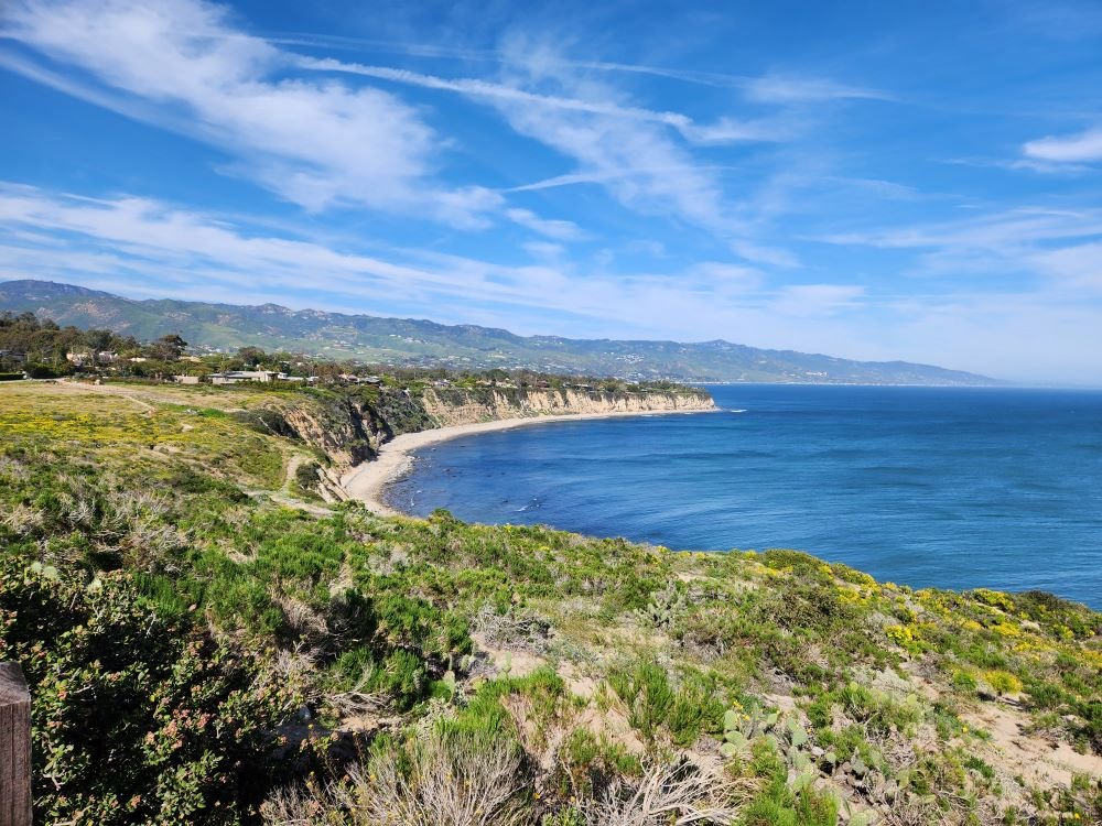
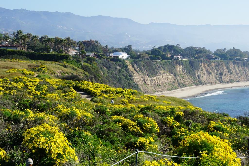
View in the spring of 2023
Point Dume State Beach is a 63 acre promontory that juts out into the Pacific and features headlands, cliffs, rocky coves and vast beach access for swimming, surfing and scuba diving.
To get to Point Dume State Beach, take Westward Beach Road southeast from PCH near Zuma Beach's south side to the paid parking area, or park on Westward Beach Road, which parallels Westward Beach.
To the southeast of Westward Beach is a small 300 foot or so beachfront area called Pirate's Cove Beach (which due to its seclusion was once used as a nude beach).
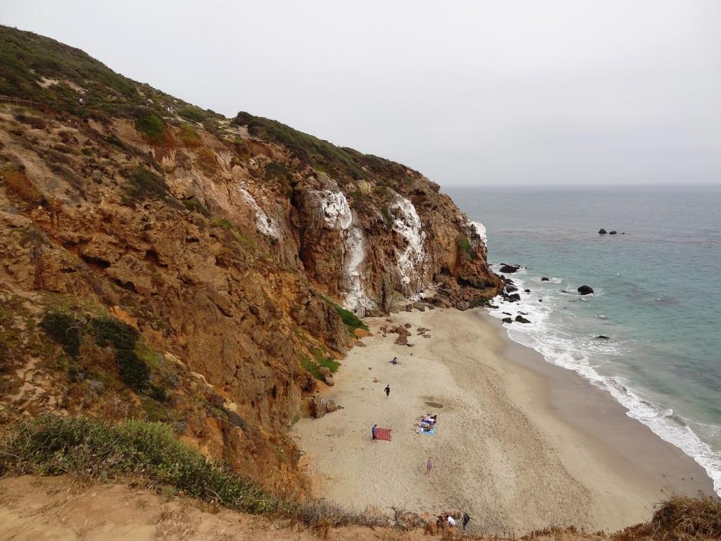
Pirate's Cove beach seen from the top of the promontory. You can climb down there and when the tide is moderate to low, walk around to it.
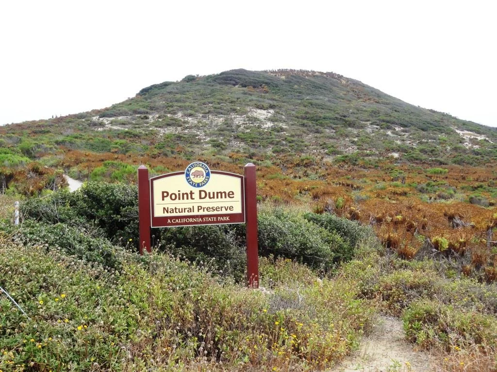
The 34-acre Point Dume Natural Preserve also begins from the cul-de-sac. A gradual ascending trail leads to an ancient coastal bluff sand dune with spectacular views...we've seen whales, seals and dolphins over here. A stairway from the east side of the bluff-top preserve allows access to a more isolated beach and tidepools (look but don't touch). You'll have fun exploring up here.

In the spring of 2023
This is a snippet of the pilot episode, "The Lady in the Bottle," of I Dream of Jeannie that originally aired September 18, 1965. If you skip to 1:39 in this clip, you will see the prominent rock formations on the east side of the Point Dume promontory. Below is a more recent shot of that area.

This is where Captain Anthony Nelson (Larry Hagman) made a giant S.O.S. in the sand with sticks and other items, including an old bottle that moved itself. He picks it up, dusts it off, and out pops Barbara Eden. Lucky guy!
Location/Directions: Take Kanan south to PCH and turn right. Westward Beach Road is over the rise, at the foot of the hill. Park free on WBR or pay a fee at Westward Beach lot. No restrooms at the Preserve but some can be found on WBR. Call 310.457.8143 or visit www.parks.ca.gov/?page_id=623 for more information. Also see beaches.lacounty.gov/point-dume-beach.
Dogs are not allowed on trails in the Point Dume Natural Preserve or on the beach.
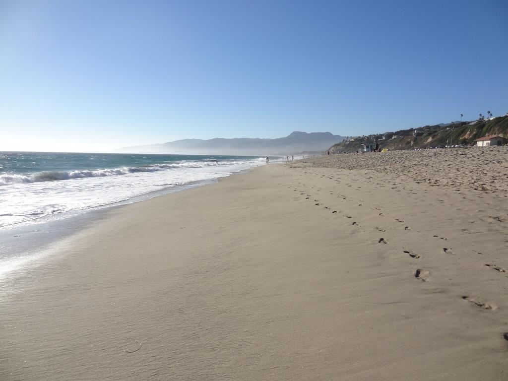
Westward Beach
Springtime at the Point Dume Natural Preserve


