The Adamson House in Malibu is Listed on the National Register of Historic Places

AdamsonHouse_front.JPG

The Adamson House at 23200 Pacific Coast Highway in Malibu is a National Historic Site and a registered California landmark. The house and grounds share one of the most beautiful beach locations in Southern California, with a view of the Malibu Lagoon, Malibu Beach and the Malibu Pier. In addition to its world-famous Malibu Tile, the house contains hand-carved teak wood doors, hand-painted murals, molded ceilings, hand-wrought ironwork and lead-framed bottle glass windows.

AdamsonHouse_sign.JPG

The house was built in 1930 for Rhoda Rindge Adamson and Merritt Huntley Adamson, originally as a summer cottage and in 1936 as the family's primary residence. It is located on the 13,315 acre Malibu Rancho that was purchased by Rhoda's parents, Frederick and May K. Rindge, in 1892.  Mr. Rindge passed away in 1905 and left the ranch to his wife, who later gave the parcel to the Adamsons.

USC graduate Merritt Adamson met Rhoda Rindge while he was employed as foreman of the Rindge Ranch. The couple married in 1915 and in 1916 Merritt founded Adohr Farms in the San Fernando Valley, named after his wife's first name spelled backwards.

AdamsonHouse_historic.jpg

Rhoda inherited the property after Merritt's death in 1949 and she lived there until her passing in 1962. The land was later purchased by the State of California under eminent domain laws to create beach parking, but local groups and preservationists fought to preserve the property and succeeded. The house was restored and the garage was converted into the Malibu Lagoon Museum and they opened to the public in 1983.

Flooring in the backside of the house

Flooring in the backside of the house

The Adamson House Tour is a guided tour through the house which contains its original furnishings and is decorated with the renowned Malibu Potteries tile. Trained volunteer docents relate the history of the house, details of its architecture and furnishings, and the history of the family that lived in and created this distinctive home. Admission (as of July 2018) is $7 for ages 17 and up, $2 ages 6 to 16 and free for under 6. Cash only. Open for guided tours 11am to 2pm Wed to Sat. More information at www.adamsonhouse.org or call 310.456.8432.

Historic Carousel at Chase Palm Park in Santa Barbara Closed First Week of December 2017

ChasePalm3.jpg

The historic 1916 Allan Herschell Carousel has operated at Chase Palm Park in Santa Barbara since 1999. Nearing the end of its 20 year lease with the City of Santa Barbara, the owner of the Carousel opted to relocate it Hood River, Oregon, for installation in a dedicated museum of historically significant carousels.

The Carousel is one of three machines produced by the Allan Herschell Factory in the 1915-1917 time frame. It was listed in the National Register of Historic Places on April 13, 2000. It is 40 feet in diameter, with a 19 foot wooden pole in its center, supporting 35 jumping, hand-carved wooden horses plus two hand carved art deco style wooden chariots.

This carousel originally operated outdoors on the east coast, where it was used for decades without adequate maintenance. It was purchased in 1970 by Seaport Village in San Diego, where after 10 years in storage it was sold again to its current owners. 

While this is sad news for local residents, the good news is that this historical carousel will be preserved in its new location in Hood River. 

herschell.jpg

Photos From Janss Conejo Ranch in 1960-1961 in What is Now Wildwood Park

6274WildwoodMovieRanch7-30-1961WaltDibblee.jpg

In the 1930s to 1960s, a number of TV shows and movies were filmed in what is now Wildwood Park, like Gunsmoke, The Rifleman, Spartacus and Wuthering Heights. Steve Dibblee of Ventura Views has provided these shots taken by his father, Walt Dibblee, of a western ranch town in Wildwood Park in 1960-1961.

You can see the same, familiar Mountclef Ridge in Wildwood Park today

You can see the same, familiar Mountclef Ridge in Wildwood Park today

Steve indicated the above photo shows The Rifleman's house and barn. It may also have been used in "The Man Who Shot Liberty Valance."

Steve indicated the above photo shows The Rifleman's house and barn. It may also have been used in "The Man Who Shot Liberty Valance."

And here is a bit of a depressing scene at the ranch on September 28, 1960.

And here is a bit of a depressing scene at the ranch on September 28, 1960.

View more of Walt's Ventura County area photography, including an extensive collection of aerials from the mid 1950s to the late 1960s, at VenturaViews.com.

10th Annual Waves of Flags Display at Pepperdine University Will Be Open September 9 to 25, 2017

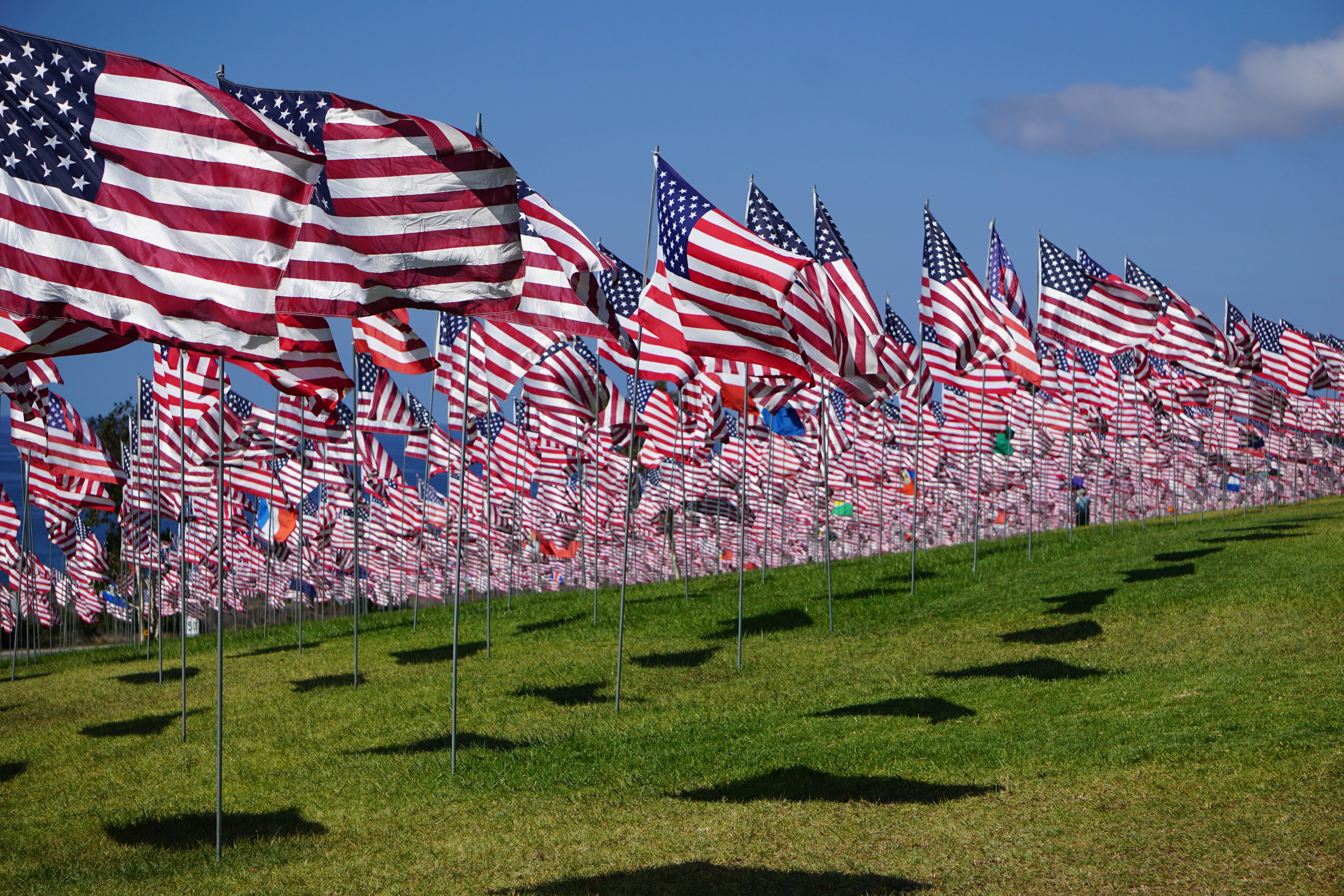
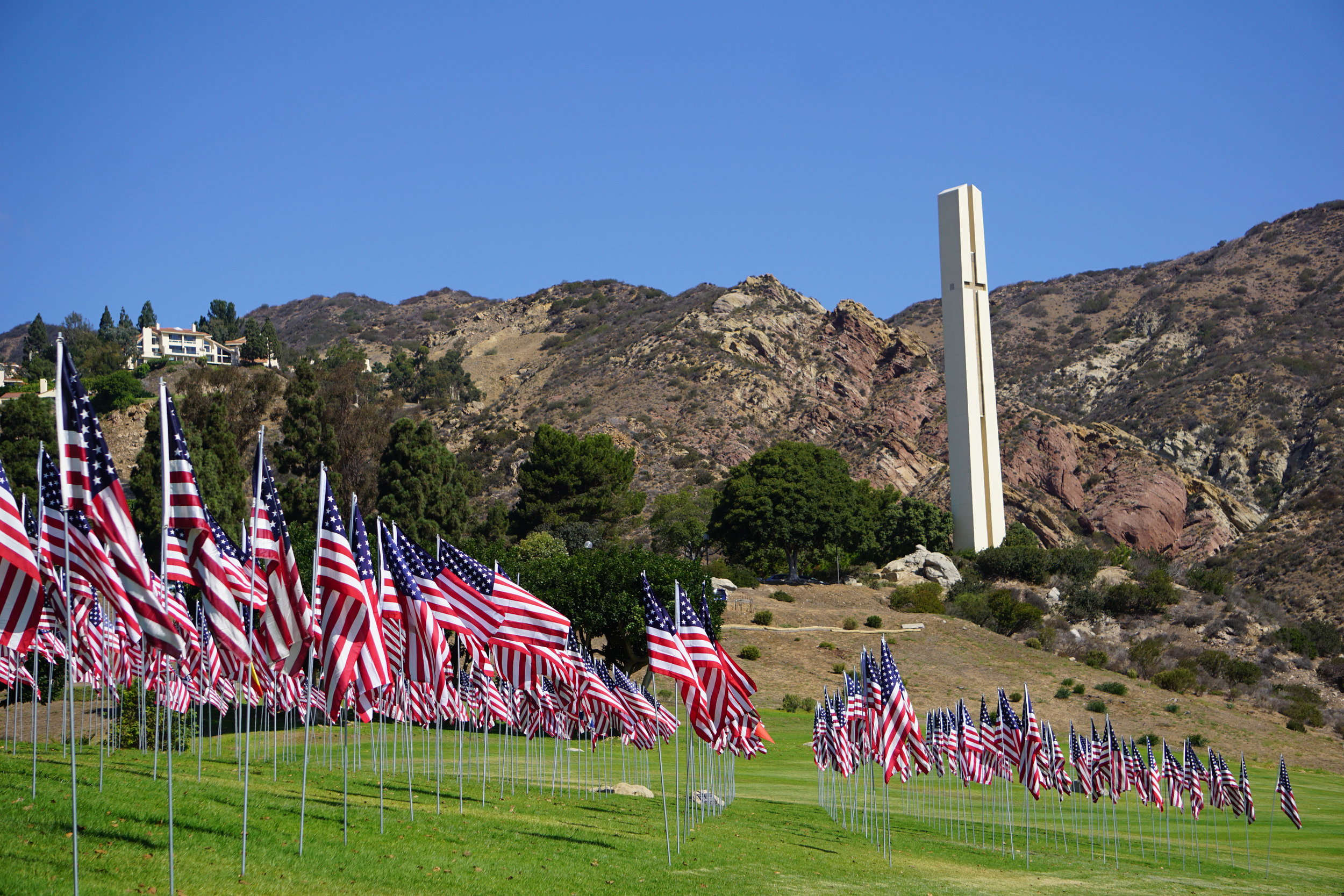
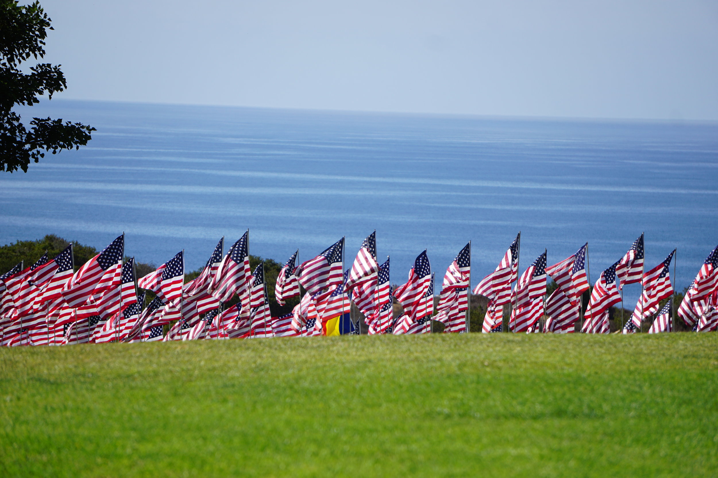
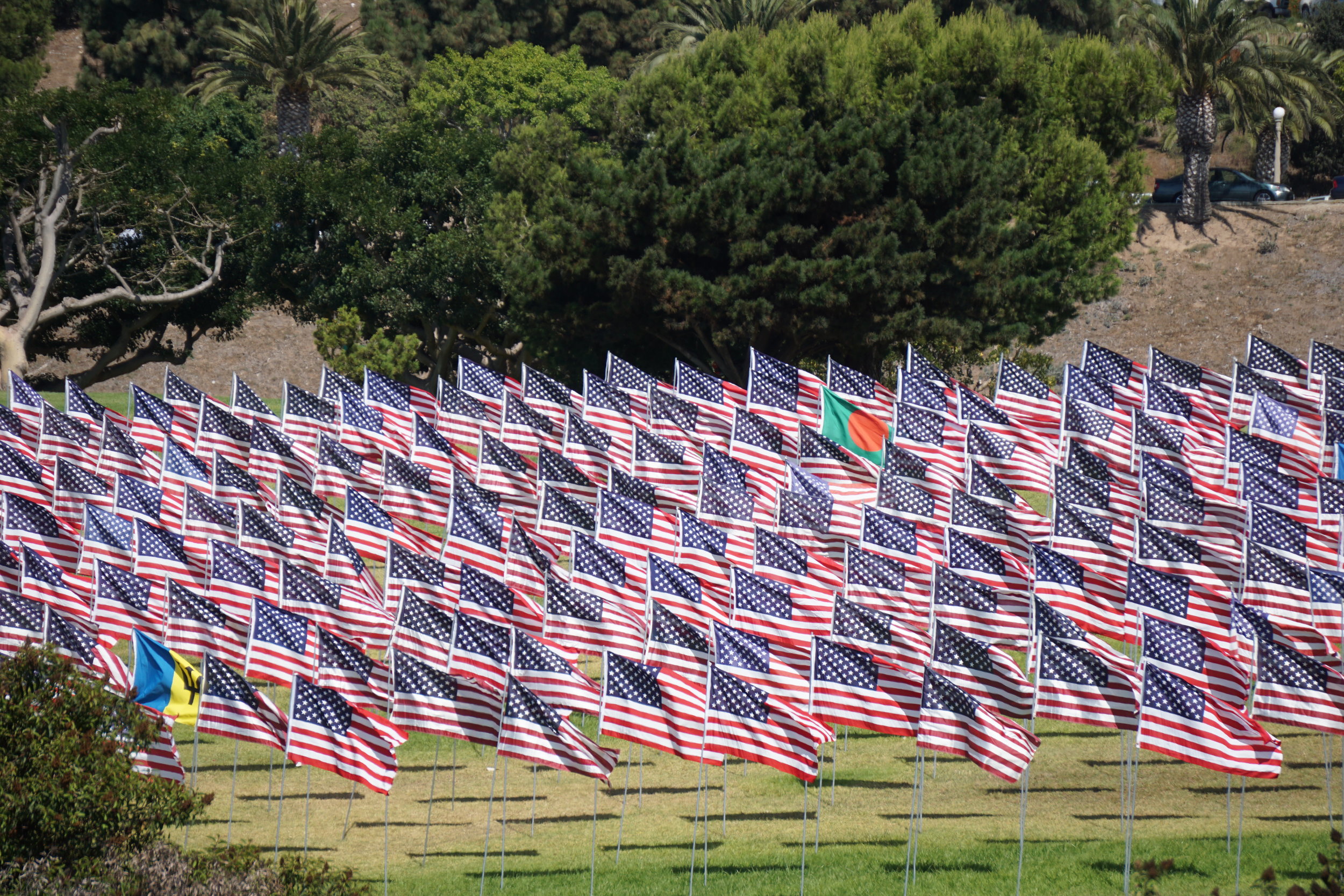
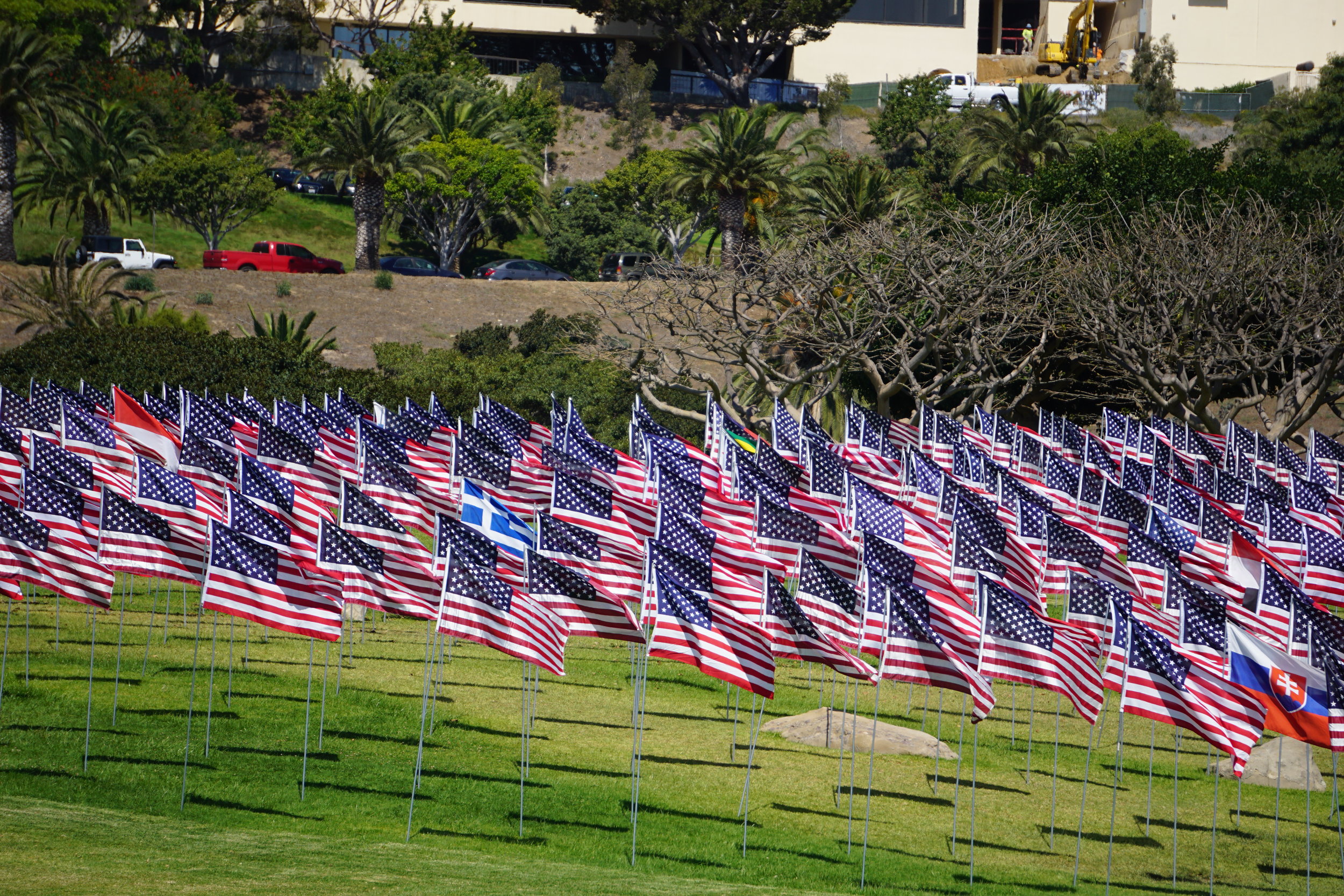
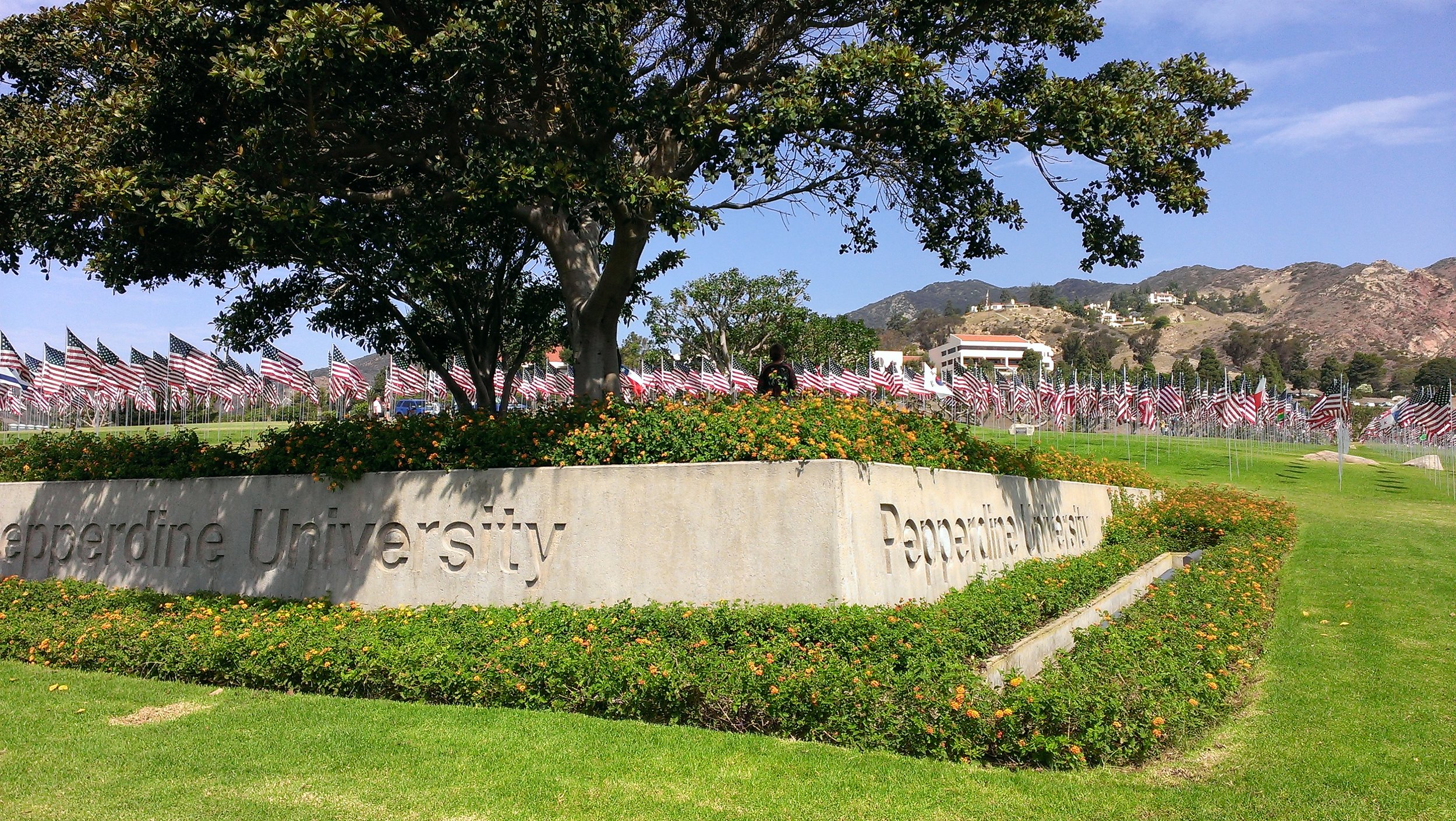
From September 9 through September 25, Pepperdine’s Alumni Park at the corner of Pacific Coast Highway and Malibu Canyon Road will have on display the 10th Annual Waves of Flags installation to commemorate the lives lost in the terror attacks of September 11, 2001.

Each year, Waves of Flags features 2,977 full-size flags—2,887 American flags for each American life lost and 90 international flags representing the home countries of individuals from abroad who died in the 9/11 attacks.

The installation became a Pepperdine tradition in 2008 when the school’s College Republicans group organized to bring the tribute to the campus.

In addition to the Waves of Flags installation, Pepperdine is the permanent home of the Thomas E. Burnett, Jr., Heroes Garden, a public space for visitors to reflect and honor all those who live heroic lives, including namesake and Pepperdine alumnus Thomas Burnett (MBA ’95), a passenger on United Flight 93 who lost his life in the 9/11 attacks.

How Are Tropical Storms Named?

cyclone.jpg

With all of the terrible news stemming from tropical storm Harvey in Texas and now Irma in Florida, there's been banter in my household regarding where these names came from, who names them, why we name storms, and so on.

The World Meteorological Organization (WMO) maintains lists of names used for each of ten different tropical cyclone basins around the world. There is an international committee that maintains lists of names in each basin. Each region has its own set of naming rules. 

When are names assigned to storms? Once the storm produces sustained wind speeds of over 33 knots, or 38 miles per hour.

The storms impacting Texas and Florida are in the Caribbean Sea, Gulf of Mexico and North Atlantic basin. The naming convention in this basin has six lists of names that are used in rotation. As such, the 2017 list of names, which started with Arlene and ends with Whitney, will be used again in 2023.

When a storm is particularly deadly or costly, the name is retired. In addition to Katrina in 2005, Sandy in 2012 and Harvey in 2017, a whole host of other names have been "retired" since 1954. Carol, Janet, Audrey, Donna, Agnes, Gloria, Hugo, Keith, Wilma, Felix, Ingrid, Matthew and dozens more names will no longer be used to name a tropical storm. See www.nhc.noaa.gov/aboutnames_history.shtml for more retired names.

The names are alphabetized in the Atlantic basin but do not include names beginning with Q, U, X, Y and Z. Xavier, you're off the hook.

Atlantic tropical storms were originated by the National Hurricane Center starting in 1953. This was subsequently transitioned to the WMO.

From 1953 to 1978, only women's names were used. Men's names were introduced in 1979 and are alternated with women's names (but what about gender-neutral names like Pat - I dunno).

Why are names used? Because it makes it easier to get the word out to the public when a name is used.

How do they come up with the names? It is up to each committee but names are selected that are familiar to those who live in each region.

The 2018 list of cyclone names in the Atlantic region are: Alberto, Beryl, Chris, Debby, Ernesto, Florence, Gordon, Helene, Isaac, Joyce, Kirk, Leslie, Michael, Nadine, Oscar, Patty, Rafael, Sara, Tony, Valerie and William. Visit public.wmo.int/en/About-us/FAQs/faqs-tropical-cyclones/tropical-cyclone-naming to see the other names currently on deck.

Let's look at the Western North Pacific and South China Sea basin naming convention. There, each country contributes names, like Damrey (Cambodia), Fenshen (China), Meari (DPR Korea), Usagi (Japan) and so on.

Vintage Sign From The Lang Ranch on Display at Chumash Indian Museum in Thousand Oaks

Lang Ranch gate photo by Herb Noseworthy, 1967. (From the Thousand Oaks Library Special Collections "Conejo Through the Lens" collection.)

Lang Ranch gate photo by Herb Noseworthy, 1967. (From the Thousand Oaks Library Special Collections "Conejo Through the Lens" collection.)

The nearly 2,600 acre Lang Ranch in the northeast section of Thousand Oaks was annexed into the city in 1968.  It is now home to open space, plenty of homes and the Chumash Indian Museum.

The Lang Ranch sign seen in the photo from approximately 1967 shown above is on display at the museum. 

The museum is open Saturdays from 10am to 4pm. Admission price as of August 2017 is $5.00 for adults, $3.00 for seniors 65+ and children under 12. There is no charge to walk the trails in the park.

Ventura County Courthouse (now San Buenaventura City Hall) on National Register of Historic Places

Ventura City Hall (aka San Buenaventura City Hall) was originally built as the Ventura County Courthouse in 1912. Located at 501 Poli Street on a hill overlooking the City of Ventura and the Pacific Ocean, it has a terra cotta exterior, copper sheathed dome and Italian marble foyer.

The Courthouse was in use until 1969, when it was deemed to be an earthquake risk. However, the City of Ventura purchased the building from the county and renovated and made structural improvements to it. The building has functioned as Ventura City Hall since 1974.

It was designated State of California Landmark No. 847 in December 1970 and named to the National Register of Historic Places in August 1971.

Ventura County Court House photo dated February 1971 (Photo Credit: City of Ventura).

Ventura County Court House photo dated February 1971 (Photo Credit: City of Ventura).

The original architect of the Courthouse was Albert C. Martin, who also designed Grauman's Chinese Theater (now TLC Chinese Theatre) in Hollywood.

According to the City's website, the 200-foot frontage by 135 foot depth annex was completed in 1932, after five years of work supervised by architect Harold Burkett. Between the first and second floor windows of City Hall are 24 faces, each depicting whimsical friars' faces which serve as a historical reminder that the City of San Buenaventura was one of the nine original Mission towns founded by Father Junipero Serra and Franciscan friars in 1782.

According to the City's website, significant restoration to the building's terra cotta exterior took place in 1987-88 and 2004-5. In 1987-88, it took 16 months of steam cleaning to restore 3,600 terra cotta tiles on City Hall West, including replacing 959 damaged tiles. In 2005, the complex's entire façade was restored, repairing 10,000 blocks by sanding and repainting, replacing 100 damaged blocks and installing a water repellant over the walls and joints.

The end result is that this is one beautiful, can't miss, historic building in Ventura County. More on Ventura City Hall at www.cityofventura.ca.gov/1098/Ventura-City-Hall.

One of the 24 friars' faces on the building taken February 1971 (Photo Credit: City of Ventura).

One of the 24 friars' faces on the building taken February 1971 (Photo Credit: City of Ventura).