Lake Piru Recreation Area

Lake Piru Recreation Area

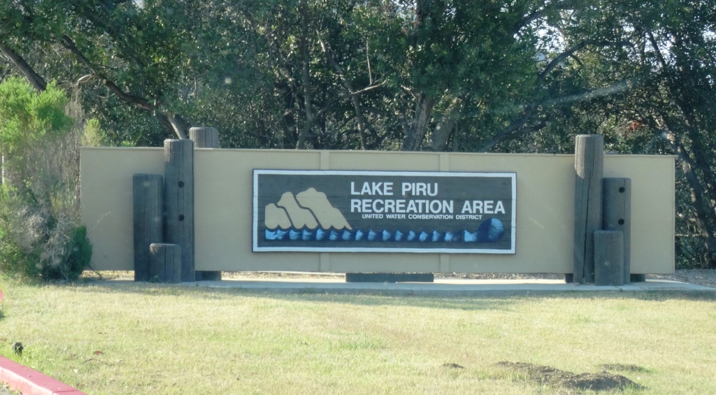
The 60 acre Lake Piru Recreation Area is located on the western shore of Lake Piru, an artificial lake in the Los Padres National Forest. Lake Piru offers 238 tree-shaded campsites, coin-operated hot showers and a store. Each site has a picnic table, fire ring and grill top.

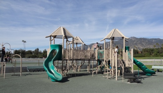
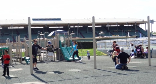
The dam is owned and operated by the United Water Conservation District of Santa Paula and a third party operates the campsite; visit campone.com/campsites/lake-piru for more information. Boat rentals and fishing available as well as a newer children's playground area.  Make camping reservations by calling 805.521.1500.

Lake Piru in Summer 2015

Ventura Raceway

VenturaRaceway.jpg

Ventura Raceway is a world-famous dirt track located at the Ventura County Fairgrounds.  Ventura Raceway became world famous in the early 1990s when it hosted several years of the ESPN Thunder Series on television. 

With weekly racing events held on most Saturday nights from March through October, Ventura Raceway has a worldwide following of short track racing fans.  Most Saturday nights you can find the powerful VRA 360 Sprint Cars racing at the 1/5 mile oval.  These 600+ horsepower, open wheel racers hit speeds in excess of 80 mph on the track that is smaller than a high school oval track. 

Beyond the sprint cars, there are classes for seniors (age 45 and up) down to kids as young as 5 years old in a family friendly environment. 

Located at 10 West Harbor Blvd, Ventura. Admission (as of January 2019) is $15 for adults, $11 for 60+, military and students with ID and free to 12 and under (with adult). Visit www.venturaraceway.com or call 805.648.RACE for more information.

Long Canyon Trail in Simi Valley

Long Canyon Trail is an easy to hike trail in the Wood Ranch section of Simi Valley, located at the corner of Wood Ranch Parkway and Long Canyon Road (take Wood Ranch Parkway south until it ends, and turn right into the parking lot). It is quite a peaceful place to do some light hiking with the family. And the views as you can see are beautiful.

About a .7 mile hike to the top of the canyon connects you with the Lang Ranch / Woodridge Open Space in Thousand Oaks. Great views from the top towards Simi Valley,  Thousand Oaks and beyond, towards the Channel Islands on clear days.

LongCanyon0.jpg
Technically I believe this bench is in the Lang Ranch/Woodridge Open Space in Thousand Oaks, which connects with the Long Canyon Trail. Nice view here towards Simi Valley.

Technically I believe this bench is in the Lang Ranch/Woodridge Open Space in Thousand Oaks, which connects with the Long Canyon Trail. Nice view here towards Simi Valley.

Backbone Trail Hike From Kanan Road Trailhead to Zuma Ridge Motorway in Malibu

NOTE: Closed due to damage from the Woolsey Fire as of December 2018. Updates at www.nps.gov/samo/planyourvisit/backbonetrail.htm.

You've driven Kanan Road from Agoura Hills towards PCH for decades and have passed by the Backbone Trail trailhead on Kanan and Newton Canyon Road just before Tunnel "T-1" hundreds of times. But you never stopped there to check it out. Well, it's about time to give it a try!

The Backbone Trail stretches 67 miles through the Santa Monica Mountains, from Will Rogers State Park on the east to the Ray Miller Trailhead on the west. There are 12 "official" Backbone Trail trailheads and the Kanan Road Trailhead is one of them. More information on the National Park Service website at www.nps.gov/samo/planyourvisit/backbonetrail.htm.

There are two trailheads to catch here at what is also referred to as the Newton Canyon Trailhead. The Backbone Trail to the Latigo Canyon Trailhead is 2.5 miles one way headed east. The Backbone Trail to the Zuma Ridge Motorway - the one covered here - is also 2.5 miles one way headed west. 

The Backbone Trail to Zuma Ridge Motorway is a nice, moderate, winding, mostly single track, well-maintained trail. You'll encounter a creek, a view of the Upper Zuma Falls, a short bridge, some tree-lined canopied sections, wildflowers and moderately rocky sections.

KananBackboneTrail1.JPG

Once you reach Zuma Ridge Motorway, you can continue on the Backbone Trail or turn back for a five mile round trip hike.

Ranch Overlook Trail in Rancho Sierra Vista/Satwiwa in Newbury Park

Trailhead to the Ranch Overlook Trail starts at the juncture of Sycamore Canyon Fire Road (paved road that runs through Point Mugu State Park) and the access bridge to the Satwiwa Native American Culture Center.

Trailhead to the Ranch Overlook Trail starts at the juncture of Sycamore Canyon Fire Road (paved road that runs through Point Mugu State Park) and the access bridge to the Satwiwa Native American Culture Center.

This is the bridge heading the other direction from the Ranch Overlook Trail sign leading to the Satwiwa Native American Indian Culture Center.

This is the bridge heading the other direction from the Ranch Overlook Trail sign leading to the Satwiwa Native American Indian Culture Center.

The one mile Ranch Overlook Trail is located in Rancho Sierra Vista/Satwiwa in Newbury Park.

The trail extends from just west of the Satwiwa Native American Indian Culture Center to the Palomino Trail in the Rancho Potrero Open Space.

The trail is about two wide and you’ll find hikers, runners, cyclists and equestrians all sharing it. The east portion is moderately flat, leading to a moderate hill. At the peak, you’ll have nice views toward the Rancho Sierra Vista main parking area and adjacent ranch structures as well as towards Boney Mountain.

Continue west down the trail to a juncture where you can either veer right towards the parking area and road into Rancho Sierra Vista, or you can continue straight until the next juncture. At the next juncture, if you take a left, you’ll soon be transitioning from Federal land (Rancho Sierra Vista) to Conejo Open Space land (Rancho Potrero). Though you won’t find a trail sign that indicates this, the trail that continues westward is the Palomino Trail.

Do be mindful of rattlesnakes back here. They want nothing to do with you, so if you come across one crossing the trail, let them make their way across.

The “peak” of the Ranch Overlook Trail, looking southeast towards Satwiwa and Boney.

The “peak” of the Ranch Overlook Trail, looking southeast towards Satwiwa and Boney.

Peak of Ranch Overlook Trail, looking down towards main Rancho Sierra Vista/Satwiwa parking area and restrooms.

Peak of Ranch Overlook Trail, looking down towards main Rancho Sierra Vista/Satwiwa parking area and restrooms.

This is west of the peak of the Ranch Overlook Trail, a downhill section that takes you towards Rancho Potrero.

This is west of the peak of the Ranch Overlook Trail, a downhill section that takes you towards Rancho Potrero.

This sign is at the bottom of the west side of the Ranch Overlook Trail, facing east, if you opt to take the trail counter-clockwise from the parking area.

This sign is at the bottom of the west side of the Ranch Overlook Trail, facing east, if you opt to take the trail counter-clockwise from the parking area.

This ancient oak tree is adjacent to the Ranch Overlook Trail sign near the parking lot access. This was taken in September 2018. The large branch broke off earlier that summer. In the background is the parking area.

This ancient oak tree is adjacent to the Ranch Overlook Trail sign near the parking lot access. This was taken in September 2018. The large branch broke off earlier that summer. In the background is the parking area.

This is the Palomino Trail in the adjacent Rancho Potrero Open Space, looking east towards Rancho Sierra Vista, in June 2018. These areas do green up after the winter rains in the April/May time frame….but dry up fast.

This is the Palomino Trail in the adjacent Rancho Potrero Open Space, looking east towards Rancho Sierra Vista, in June 2018. These areas do green up after the winter rains in the April/May time frame….but dry up fast.

Channel Islands National Park

Channel Islands National Park consists of 5 of the 8 Channel Islands off the Santa Barbara coast. Although the islands are close to the shore, their isolation has left them relatively undeveloped.

The northern Channel Islands are Anacapa (1.1 sq mi), San Miguel (14.6 sq mi), Santa Cruz (96.5 sq mi) and Santa Rosa (83 sq mi) and the southern islands are San Clemente (57 sq mi), San Nicolas (23 sq mi), Santa Barbara (1 sq mi) and Santa Catalina (75 sq mi).

Channel Islands National Park includes the islands of San Miguel, Santa Rosa, Santa Cruz, Anacapa and Santa Barbara. Anacapa is located in Ventura County while the other four are in Santa Barbara County. San Clemente Island, the southernmost Channel Island, is owned and operated by the U.S. Navy. Catalina Island as we know with its population of 3,700 is a popular tourist destination. San Nicolas Island in Ventura County is also controlled by the U.S. Navy. On a clear day you can see two of the five islands, Anacapa and Santa Cruz.

ChannelIslandsMap.jpg

Visitors to the islands may swim, snorkel, hike, camp, watch wildlife, sail and explore tidepools, beaches and canyons. There is no food service on the islands, so bring what you need. Take a commercial service to the islands like Island Packers, which has been servicing the islands since 1968. Landings at Anacapa and Santa Cruz islands are year-round while the more remote outer islands, Santa Barbara, Santa Rosa and San Miguel are scheduled late spring through early fall.

Visit the National Park Service website at www.nps.gov/chis to learn more about visiting Channel Islands National Park. The park is open year-round.

The Robert J. Lagomarsino Visitor Center at Channel Islands National Park is located in the Ventura Harbor at 1901 Spinnaker Drive (805.658.5730) and the Outdoors Santa Barbara Visitor Center is located at the Santa Barbara Harbor at 113 Harbor Way, 4th Floor.

On a clear day you can see two of the Channel Islands from Newbury Park and other Ventura County spots. Here's a view from the Rancho Potrero Open Space in Newbury Park.

On a clear day you can see two of the Channel Islands from Newbury Park and other Ventura County spots. Here's a view from the Rancho Potrero Open Space in Newbury Park.

Anacapa Island seen from a whale watching boat.

Anacapa Island seen from a whale watching boat.

Old Boney Trail Hike in Pt. Mugu State Park

If you're looking for a hike of about 10 miles in the Rancho Sierra Vista/Boney Mountain Wilderness area, consider the Old Boney Trail loop from Newbury Park. You can park either in the National Park Service parking lot or at Wendy Drive where it meets Potrero Road.

You can do the hike clockwise or counter-clockwise since it is a loop course. I prefer clockwise, which starts by trekking through Rancho Sierra Vista to Danielson Road. Details of this path are at THIS LINK. This path gets you to a juncture where you can continue another 3/10ths of a mile to the Danielson Monument (which you definitely should do if you've never been there) or veer a sharp right up the Old Boney Trail.

Sign at juncture of Danielson Road trail and Old Boney Trail in Pt. Mugu State Park

Sign at juncture of Danielson Road trail and Old Boney Trail in Pt. Mugu State Park

I love the Old Boney Trail. It is narrow and covered with growth on both sides. Kind of like running through a chaparral jungle. This makes the trail mostly shade covered for the first couple miles of this 3.5 mile stretch of trail. You'll be treated to some nice views of Boney Mountain along the way.

OldBoneyTrail1.JPG

Although the Old Boney Trail does not reach a peak for panoramic views, you'll still find several spots that reward you with views towards the Channel Islands and west Ventura County.

OldBoneyTrail2.jpg

About a mile or mile and a half into Old Boney Trail from Danielson Road, you'll see a turnoff sign to the right that takes you to the Fossil Trail, a mile or so drop back down to the bottom of Sycamore Canyon. The drop is about 1300 ft to 500 ft with plenty of rocky surfaces, so you'll have some fun going back down this way, for a shorter route. And of course, look closely and you'll be treated to surfaces covered with sea fossil imprints from millions of years ago.

OldBoneyFossilTrailSign.JPG

From the Old Boney Trail/Fossil Trail juncture, you have another 2.1 fun miles to the next juncture at Blue Canyon Trail at the bottom of the canyon. You'll get some more neat views of Boney Mountain during this stretch. At the juncture is the following sign on Blue Canyon Trail.

Sign on Blue Canyon Trail at the Old Boney Trail juncture in Pt. Mugu State Park.

Sign on Blue Canyon Trail at the Old Boney Trail juncture in Pt. Mugu State Park.

You will turn right on Blue Canyon Trail, which will take you to the Danielson Multi-Use area and the paved Sycamore Canyon Fire Road. A left-hand turn will get you lots of fun for another day, onward to Chamberlain Trail that gets you up to some might nice peaks, and Serrano Valley.

Sign at entrance to Blue Canyon Trail at the Danielson Multi-Use area (you of course will be looking at the back side of this sign if you're coming from the Old Boney Trail).

Sign at entrance to Blue Canyon Trail at the Danielson Multi-Use area (you of course will be looking at the back side of this sign if you're coming from the Old Boney Trail).

I've never actually seen anyone using the Danielson Multi-Use area but here's the picnic area.

I've never actually seen anyone using the Danielson Multi-Use area but here's the picnic area.

So you run through the Danielson area to the main paved road to the right (turning left of course will take you to PCH in about 4-5 miles). In another 3 miles you'll be back in civilization; these miles include the 800 foot, 3/4 mile ascent into Rancho Sierra Vista, which can be a bit brutal...perhaps my (and maybe your) least favorite section of this course. But once you're up the hill, you're home free! Time for breakfast, lunch, dinner or all of the above!

Sycamore Canyon Fire Road sign at the top of the hill in Rancho Sierra Vista/Satwiwa.

Sycamore Canyon Fire Road sign at the top of the hill in Rancho Sierra Vista/Satwiwa.

Of course, you can easily reverse this course and make your way DOWN Sycamore Canyon Fire Road, turn left onto Blue Canyon Trail, left on Old Boney Trail for 3.5 miles and then left on Danielson Road, back down into the canyon and up towards Satwiwa.

Oak Park Campground in Simi Valley

OakParkCampground.jpg

Located at 901 Quimisa Drive in Simi Valley, the Oak Park Campground is a rustic 100.5 acre open space park that is surrounded by gentle, rolling hills and an abundance of coastal sage scrub brush. This natural environment supports a multitude of California native wildlife species, such as a raptors, roadrunners, sagebrush lizards, and alligator lizards. The park is ideal for group RV camping in a secluded setting.

Day use is $2 per day ($4 on weekends) (as of July 2018). Camping is $32 per day.

Plenty of things to explore in this 100 acre space! Learn more or make reservations at www.ventura.org/inland-parks/oak-park-simi-valley or call 805.654.3951.

The video shot below was on a Sunday night around 7 p.m. in July 2010. There was for the most part nobody there! What a great opportunity to camp with your kids locally! I guess my only concerns about the location would be that the park is sandwiched between the 118 freeway and the railroad tracks...though I did not encounter any noise issues in my brief drive-by.

Marvin Braude Coastal Bike Path - Pacific Palisades to Torrance

We love driving down to Will Rogers State Beach from time to time, bring the bikes and enjoy the Marvin Braude Coastal Bicycle Path along the Pacific Ocean. 

This fun 22 mile path takes you from Pacific Palisades as far as Torrance.  Depending on how far you want to go and if you have kids with you, there are so many spots to stop along the way. 

To get to Will Rogers State Beach from the Conejo Valley, take the 101 to Las Virgenes/Malibu Canyon Road south to PCH, then about 9 miles down PCH to Will Rogers (17000 PCH), just east of Gladstones and Sunset Boulevard. Parking at Will Rogers varies based on when you go; I last recall paying $10.

The path doesn't actually start at Will Rogers Beach as it is a walking path only at this point. Ride the bike through the parking lot to the start of the bike path at Temescal Canyon Road. And, you're off!

From the start of the path, here are some approximate distances to destinations:

  • Santa Monica Pier - 3.2 miles
  • Venice Pier - 5.8 miles
  • Marina del Rey - 8.7 miles
  • Playa del Rey - 9.9 miles
  • Dockweiler Beach - 12.5 miles
  • Manhattan Beach Pier - 16.5 miles
  • Hermosa Beach Pier - 18.2 miles
  • Redondo Beach Pier - 20.4 miles
  • Torrance Beach - 22.3 miles (endpoint)

With younger kids, the Santa Monica Pier makes a perfect 6 1/2 mile round trip destination as you can stop, eat lunch and have some fun at Pacific Park, then ride back. Or kick it a few notches and ride to/through Venice Beach for all the action. 

Pacific Park up ahead

Pacific Park up ahead

There are plenty of restrooms water stops and of course non-stop BEACH to enjoy here, making this one of my favorite destination for bicycling with the family. And of course, you don't have to park at Will Rogers...you can park anywhere on PCH in and around the bike path to enjoy it.

Of course you do have to be careful of sand on the path, pedestrians/beach goers crossing and walking on the path, other cyclists, runners, roller bladers and crowds.  

Detailed map at file.lacounty.gov/SDSInter/dbh/docs/189949_2013-BIKEMAP85x11Web-Ready(highres).pdf

CLICK HERE FOR DOZENS OF FAMILY-FRIENDLY BIKE PATHS BACK UP IN THE VENTURA COUNTY AREA!

Paradise Falls Hike - Wildwood Park in Thousand Oaks

Perhaps the most popular destination in Wildwood Park in Thousand Oaks is Paradise Falls. There are a variety of trails and ways to get to Paradise Falls. Here's a quick and easy 1 mile route.

Park in the main trailhead at the west end of Avenida de los Arboles. Take the Mesa Trail about a 3rd of a mile until you see the sign below, where you'll turn left.

Another third of a mile and you're at the teepee, where you'll find another clearly marked sign pointing you in the direction of Paradise Falls.

Wildwood_Teepee1.JPG

You turn right down the hill and take a short walk to the following sign.

ParadiseFalls2.JPG

Hike down some switchbacks and stairs and you're almost there.

ParadiseFalls3.JPG

And wallah! You're at the following sign, where you'll be reminded that these year-round falls are partially fed by urban run-off, making them something you may not want to jump into.

ParadiseFalls4.jpg

But Paradise Falls is fun to get to and see. A full-on roughly 40 foot waterfall a mile away from civilization in Thousand Oaks.

ParadiseFalls5.JPG

You can walk back the way you came or hike back up the trail above the falls and loop back up to the teepee via the Wildwood Canyon Trail.

Santa Barbara Botanic Garden

SantaBarbaraBG.gif

Founded in 1926, the Santa Barbara Botanic Garden is the oldest botanic garden in California dedicated to the study, conservation and display of native flora.  The Garden is a place of beauty and serenity, of education, research and conservation, of history and stewardship.

The Garden's living collections, including more than 1,000 types of plants, are featured throughout 78 acres accessible by over 5.5 miles of public trails; many trails are accessible by stroller or wheelchair. Accredited by the American Association of Museums as a living museum, the collections are devoted to illustrating the remarkable diversity of California's native flora. Arranged in stunning displays and interpreted through signage and docent-led tours, the living collections capture California's natural beauty and provide endless opportunities for learning, appreciation, and enjoyment.

Garden sections and displays include the Arroyo Section, Campbell Trail, Canyon Section, Desert Section, Home Demonstration Section, Manzanita Section, Meadow Section, Porter Trail, Redwood Section, Tea House Garden and Woodland Trail.

Santa Barbara Botanic Garden

The Garden's library includes over 15,000 books and journals, representing an important resource for education and research. Special collections include rare books, photos, manuscripts, and horticultural catalogs. The strength of the collection lies in its diversity, representing important botanical and horticultural works on California flora, Mediterranean floras of the world, landscape history, and the disciplines of botany and horticulture.

Composed of over 140,000 specimens of plants, the herbarium represents the region's largest scientific collection of preserved central coast plants. Collectively, the specimens document the ecology and geography of the region's plant diversity.

Open 7 days a week, the Garden is closed on Thanksgiving, Christmas Eve, Christmas Day, New Years Day and during some special events. Current admission costs as of April 2018 are $12 for adults, $10 for 60+ seniors, $8 for ages 13-17, college students and active military, and $6 for ages 2 to 12. Current garden hours are 9 am to 6 pm March through October and 9 am to 5 pm November through February.

The Garden Shop has an extensive selection of crafts, nature-related books and gifts for all ages and is open daily. There's also a Garden Growers Nursery open year-round.

Located at 1212 Mission Canyon Road, Santa Barbara. Visit www.sbbg.org or call 805.682.4726 for more information.

Day at the Races - Santa Anita

Santa Anita Park

You don't have to be a gambler to enjoy a day at Santa Anita Park in Arcadia!  The winter/spring horse race season starts the day after Christmas and ends usually early April.

Santa Anita is a beautiful 320 acre park with a large grandstand that holds 26,000 people and a nice infield with plenty of open space.  I picked the horses for fun when I was a kid and loved it on the rare occasion when my father and I made a day of it at the race track.

SantaAnita1.jpg

The park is open Thursdays through Mondays, with 10 races on weekends/holidays and 8 races on most weekdays.  Gates open at 10:30 a.m. and first race is normally at 1 p.m. 

You don't have to put a lot of money down on a race to enjoy the excitement!  Heck, pluck down $2 and bet on a longshot and you'll be glued to the race.  It's really a lot of fun.

Admission is only $5 for adults and FREE for those under 17 accompanied by an adult.  Parking is $4 ($10 valet).  For kids there is a playground with slides, a jungle gym and swings.  There is a picnic facility for special events  Better yet, there are Family Fun Days from noon to 4 p.m. each Sunday in March through season's end in April.  Family Fun Days feature carnival games, giant inflatable slide and bounce house, face painting and pony rides.

SantaAnita4.JPG
SantaAnita5.JPG

If you're looking to take it up a notch, check out the fine dining at The Turf Club (dress code enforced...no jeans, sneakers and t-shirts here), Front Runner and Club House Terrace restaurants.

Santa Anita is located at 285 West Huntington Drive, Arcadia.  Visit www.santaanita.com or call 626.574.7223 for more information.

So I convinced the kids that that to drive with me to Santa Anita on Super Bowl Sunday 2013 with the goal of getting home in time for the Super Bowl. We left our house in the Conejo Valley around 9:40 a.m. and arrived about 20 minutes before the first race at 11 a.m., about 3 hours earlier than normal I guess because of the Super Bowl.

We parked in the northern lot that takes you directly to the infield area. Follow the green line in the parking lot to find it. The parking area is huge. I prefer the infield because it is outside and you don't have  to endure as much of massive plumes of cigarette smoke you have to endure in the grandstand area. That said, the food choices in the infield were limited to hot dogs and junk food, so if you don't bring your own lunch, you'll have to go under the tunnel into the grandstand area.

Speaking of the tunnels, they're cool. There's a tunnel to get from the parking lot to the infield and another one that gets you to the grandstand and paddock area. The tunnels are extremely good for echo sounds with the kids.

There's a humongous screen in the infield where you can view the horses and the race. We sat on the benches in front of the screen so we could stand up during the race and watch the horses down the stretch. I let the kids pick one horse each race. Having a little skin ($2) in the game makes it a lot more fun. Although the kids' choices were a little off the mark, I managed to win a couple exactas that brought me close to break even for the day.

The humongous screen in the infield area

The humongous screen in the infield area

So much excitement as the horses take it down the final stretch

So much excitement as the horses take it down the final stretch

We took a quick walk to the paddock area, where you can see the trainers prepping the horses before the race and walk into the track. We also met the trumpeter before the race. Such a nice guy who enjoyed interacting with the kids.

The park itself is just stunning. So huge and beautiful. Although the park was at very low capacity the day we went, but we still encountered some characters who were cursing and moaning about their lousy picks...so do be prepared for that.

The only drawback to the infield area is that it is mostly unshaded, so wear sunscreen and consider bringing an umbrella if you don't want too much sun. Or of course you can go to the grandstand. The playground area in the infield is pretty well maintained and comparable to what you'd find in most parks.

So we left after the 7th race around 2:15 p.m. and made it back home with 15 minutes to spare before the Super Bowl at 3:30 p.m. What a great day!

Las Virgenes View Park in Calabasas

Las Virgenes View Park is located at the northeast corner of Las Virgenes Road and Mulholland Highway in Calabasas. The park is a 696 acre project of the Santa Monica Mountains Conservancy, owned and managed by the Mountains Recreation and Conservation Authority in cooperation with the Las Virgenes Municipal Water District and City of Calabasas.

Enjoy a 2.4 mile trail through chaparral and woodlands to a scenic vista point at 1,100 feet. It is a single track trail of switchbacks that largely parallels Las Virgenes Road. You'll enjoy all sorts of views as you head up the trail, from Malibu Creek State Park, De Anza Park, King Gillette Ranch and beyond.

Off street dirt parking is at the trailhead and across the street. More information at www.lamountains.com/parks.asp?parkid=30.

Trailhead

Trailhead

LVViewPark2.JPG
LVViewPark3.JPG
View from the Las Virgenes View Park Trail towards Malibu Creek State Park.

View from the Las Virgenes View Park Trail towards Malibu Creek State Park.

LVViewPark5.JPG