Mount Pinos in the Los Padres National Forest is the Highest Point in Ventura County
/At 8,847 feet in elevation, Mount Pinos is the highest point in Ventura County. It is located in the northernmost tip of Ventura County in the Los Padres National Forest, near the Kern County border.
From Thousand Oaks, plan on about a 1 hour, 45 minute, 100 mile drive to get to the Mount Pinos parking area at the "Mt. Pinos Nordic Base," where you will find plenty of parking. The Base is at an elevation of 8,300 feet, which means you only have 547 feet of elevation gain to hike to the peak.
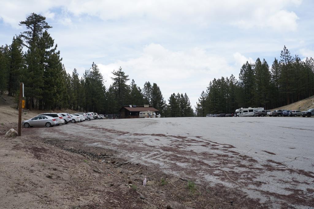
Plenty of parking available here at Mt. Pinos Nordic Base. The trail to the summit is to the left.
The hike to the top is about two miles along a wide access road shaded by pine trees much of the way. It is a fairly easy hike, with no significant challenges. Easy enough for kids and adults alike, though at this elevation your breathing may be a bit more labored than normal.
Take a deep breath of fresh air as you experience the 50th highest and 11th most topographically prominent summit in California.
Trail to the Mt. Pinos summit is largely tree-lined. You may trip on a pine cone or two!
You will notice a radio tower up ahead with about a 1/2 mile to go to the peak. You will come across a fork in the road. Turn right to get to the actual peak. Continue towards the left (west) for a Chumash interpretative area.
At this juncture of the trail, you will notice a radio tower up ahead at the summit of Mt. Pinos
The interpretative area has several benches and an interpretative sign. The Chumash name for Mount Pinos is Iwihinmu. The Chumash call the summit Liyikshup, the center of the world.
A view from Mount Pinos summit.
Of course, you'll find snow up here in the winter months. There are no ski lifts, but cross country skiing, tubing and snow play are available....right here in Ventura County.
You may also find stargazers situated in the parking lot with high powered telescopes.
There are campgrounds available on Mount Pinos, including the following:
Mt. Pinos Campground is available from May to November, with 15 reservable sites (must be made eight or more days in advance) and 4 first-come, first-serve sites. Picnic tables, fire rings, vault toilets, no water. www.fs.usda.gov/recarea/lpnf/recarea/?recid=10990
The McGill Campground is available May to November, with 54 reservable campsites and 18 first-come, first-serve campsites. Picnic table, BBQ, fire rings, vault toilet, no water. www.fs.usda.gov/recarea/lpnf/recarea/?recid=10989
The walk-in Chula Vista Campground is located adjacent to the Nordic Base area and is free of charge and open May to November. It is a first-come, first-serve walk-in campground. www.fs.usda.gov/recarea/lpnf/recreation/camping-cabins/recarea/?recid=10982&actid=29.
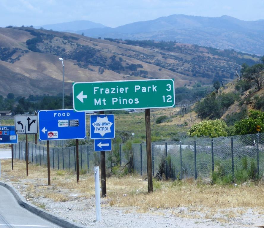
Directions to Mount Pinos: From I-5, take Frazier Park exit (Frazier Mountain Park Road). Go west approximately 6 miles. The road name changes to Cuddy Valley Road. Continue on it up Mt. Pinos. The road name changes to Mt. Pinos Highway.
Check traffic and weather conditions before you go, particularly during snow season. Good to have chains on hand.
Frazier Mountain Community Snow Play Visitor Page at www.facebook.com/groups/2579680555601233