
Mugu Peak in Point Mugu State Park
/
The 1,266 foot elevation Mugu Peak is at the western edge of the Santa Monica Mountains, in Point Mugu State Park. The peak provides views stretching from the Malibu Lagoon/Naval Base Ventura County and Channel Islands on the west, Thornhill Broome Beach on the east, La Jolla Valley on the north and more.
There are multiple ways of getting to the peak. The most direct (and albeit steepest) ascent is via the Chumash Trail, accessible across from the Naval Base shooting range (yes, sometimes you will hear rounds). The Chumash Trail is accessible off of PCH at this link. Look for the left turn into a small dirt parking area that has space for perhaps 15 or so cars.
The 7/10ths of a mile hike up the Chumash Trail is pretty brutal, but I've seen all shapes, sizes and ages making it up at varying paces.

Turn left after reaching the top of the Chumash Trail. Veering left continues the Chumash Trail towards La Jolla Valley. Veer right up the really steep hill for the most direct route to Mugu Peak.

The initial Mugu Peak Trail section is quite steep, then you plateau, then the remainder is more moderate, seen above.

The Mugu Lagoon within Naval Base Ventura County is a colorful sight from throughout the hike and at the top of Mugu Peak.

Looking northwest from Mugu Peak you will see the the 1,421 foot Laguna Peak, which contains a Naval satellite tracking station.

Views southeast with Thornhill Broome Beach in the background.
So you've reached the top of Mugu Peak, enjoyed the panoramic views, saluted the flag on display, checked out the toolbox under the flag with logbooks and other items, the next choice is, do you go back the way you came or do you take another route? If you head back the direction you came, the title mileage of the hike is about 2 1/2 miles of mostly steep up/downhills.
Well, if you continue in the direction of Thornhill Broome Beach (southeast), you can continue on the Mugu Peak Trail, which is several miles traversing around the southern, then western sections of Mugu Peak. This is my preferred approach as the footing is much easier and your total mileage is roughly 4 miles. Plus, you are treated to additional views that are just beautiful.
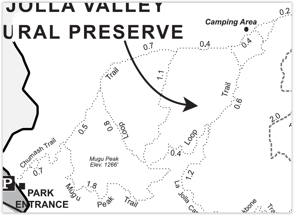
Map snippet courtesy of California State Parks.
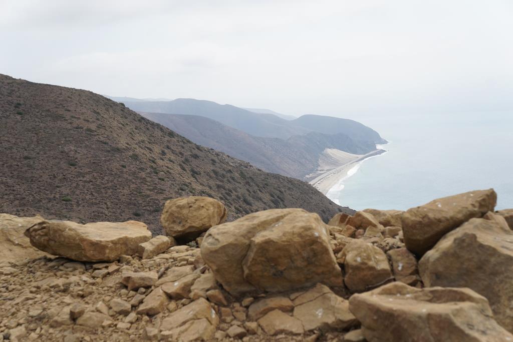
Another view of Thornhill Broome Beach and the large sand dune across PCH from the southeastern edge of the Mugu Peak Trail.
You can also get to Mugu Peak from the La Jolla Canyon Loop Trail.
